Good morning. This is Doug Chabot with the Gallatin National Forest Avalanche Forecast on Thursday, March 3rd, at 7:00 a.m. Today’s forecast is in memory of Ben Richards. Ben was killed in an avalanche on Yellow Mountain near Big Sky 15 years ago today. He will be forever missed and remembered. This forecast does not apply to operating ski areas.
There is no new snow to report, only warm temperatures and southwest wind blowing 10-30 mph. In the Bridger Range, Hyalite and Big Sky the temperatures at 5 a.m. are in the mid 30s F at 9,000 feet. These will rise into the high 40s F today under partly sunny skies. In the southern ranges the temperatures will rise into the high 30s F and drop to freezing tonight, but just barely. It might not freeze in the north. Wind is expected to remain southwest averaging 10-20 mph. No snow is expected.

Today is a serious day in the northern ranges. Snowpack stability is changing for the worse, and fast. It has been 72 hours without freezing temperatures between 8-9,000 feet in the Bridger Range, Hyalite and Big Sky area. Mountain temperatures are expected to rise into the high 40s with sun and minimal wind, a trifecta of ingredients for wet avalanches. Conditions will worsen throughout the day. Stay away from avalanche terrain and avalanche runout zones that are getting sun or are wet. Wet loose and wet slab avalanches are likely. Avoidance is the key to staying safe. Digging a snowpit is not required, just situational awareness.
If you can magically port yourself onto cooler, upper elevation, north facing (shaded) slopes, then you’ll need to contend with a few wind drifts that could break, but this concern is secondary (avalanche activity list). First you’ll have to navigate lower elevation, wet avalanche territory, our primary concern. Avalanche danger will rise from MODERATE to CONSIDERABLE on all slopes that are getting sunshine.

The southern mountains from Big Sky to West Yellowstone have temperatures that are below freezing by a couple degrees. Warm temperatures and some sunshine will create wet avalanches, but these will likely be loose slides on the surface instead of deeper slabs. Wet snowpacks are dynamic and can surprise us, so be extra cautious today. Faceted and weak snow are found in the top 6-18” of the snowpack. In a few areas wind drifts have added enough weight to create instability. Ian and I had a whumpf yesterday in a snowpack that had a thick wind slab over faceted snow, a recipe found throughout our southern ranges. If the snow is dry, dig to test the weak snow. If the surface is wet, stay out of avalanche terrain. For today avalanches are possible and the danger is rated MODERATE on all slopes, wet or dry.
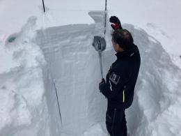
In the mountains around Cooke City there are two issues to be concerned with: a weak layer of faceted snow buried 2 feet deep, and wet loose avalanches on steep slopes that are getting sun. A skier triggered and was caught in an avalanche on Tuesday near Goose Creek on this weak layer. He was luckily unharmed (photos and details). This is the most recent slide in a list of avalanche activity (avalanche activity list, video). Yesterday a skier noted many wet, loose avalanches in steep terrain on Mt Abiathar in YNP (details). I expect to see similar wet avalanches around Cooke City today. Do not get into steep terrain if you see recent slides, or find instability. It remains possible to trigger avalanches and the danger is rated MODERATE.
If you get out, please send us your observations no matter how brief. You can submit them via our website, email (mtavalanche@gmail.com), phone (406-587-6984), or Instagram (#gnfacobs).
Upcoming Education Opportunities
See our education calendar for an up-to-date list of all local classes. Here are a few select upcoming events.
Tomorrow! Companion Rescue Clinic with the Bozeman Splitfest. Information and registration HERE.
Every Saturday near Cooke City, 10 a.m.-3 p.m. FREE snowpack update and transceiver/rescue training. Stop by for 20 minutes or more at the Round Lake Warming Hut.
Daves Zinn’s latest article, Understanding what digital slopes angle maps can (and can’t) tell you, is a great read for anyone using apps to identify avalanche terrain.