Snow Observations List
BZN Snow Rangers rode little bear to check boundary signs and see where closure encroachment issues had been occurring. Boy were we pleasantly surprised to see 10 new inches up high from the previous spring storm cycles which had set up nicely with minimal traffic. Snow was wind affected on high ridgetops but not on less exposed midslopes. Temperatures were below freezing in the morning but by 1400 higher temps and direct sunlight started to cause some roller balls and pinwheeling. We observed no new avalanche activity. There was one pair on a two-seater skandic, and another group of at least two mountain sledders who seemed far above our ability and eluded us despite our best efforts to find them.
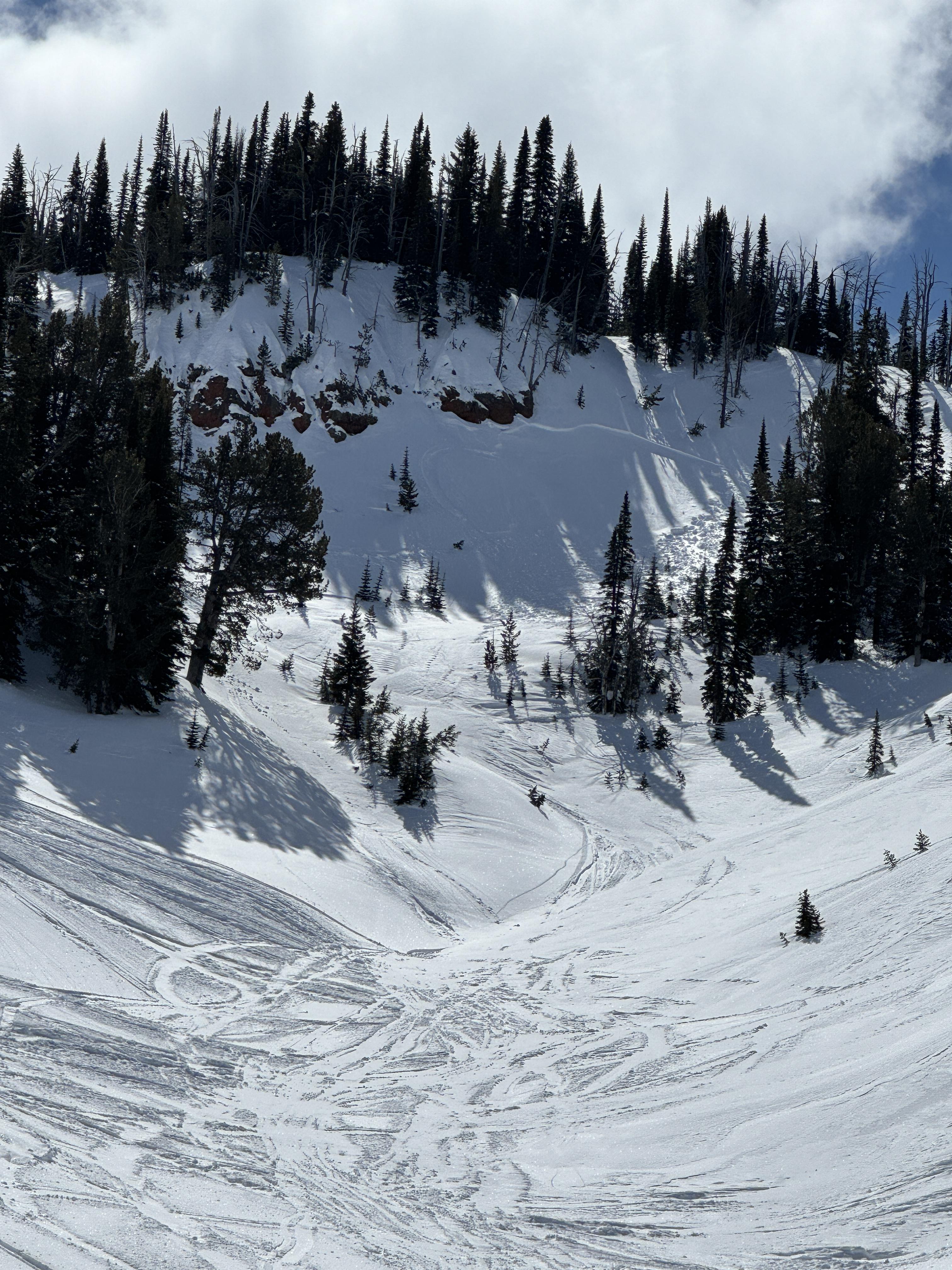
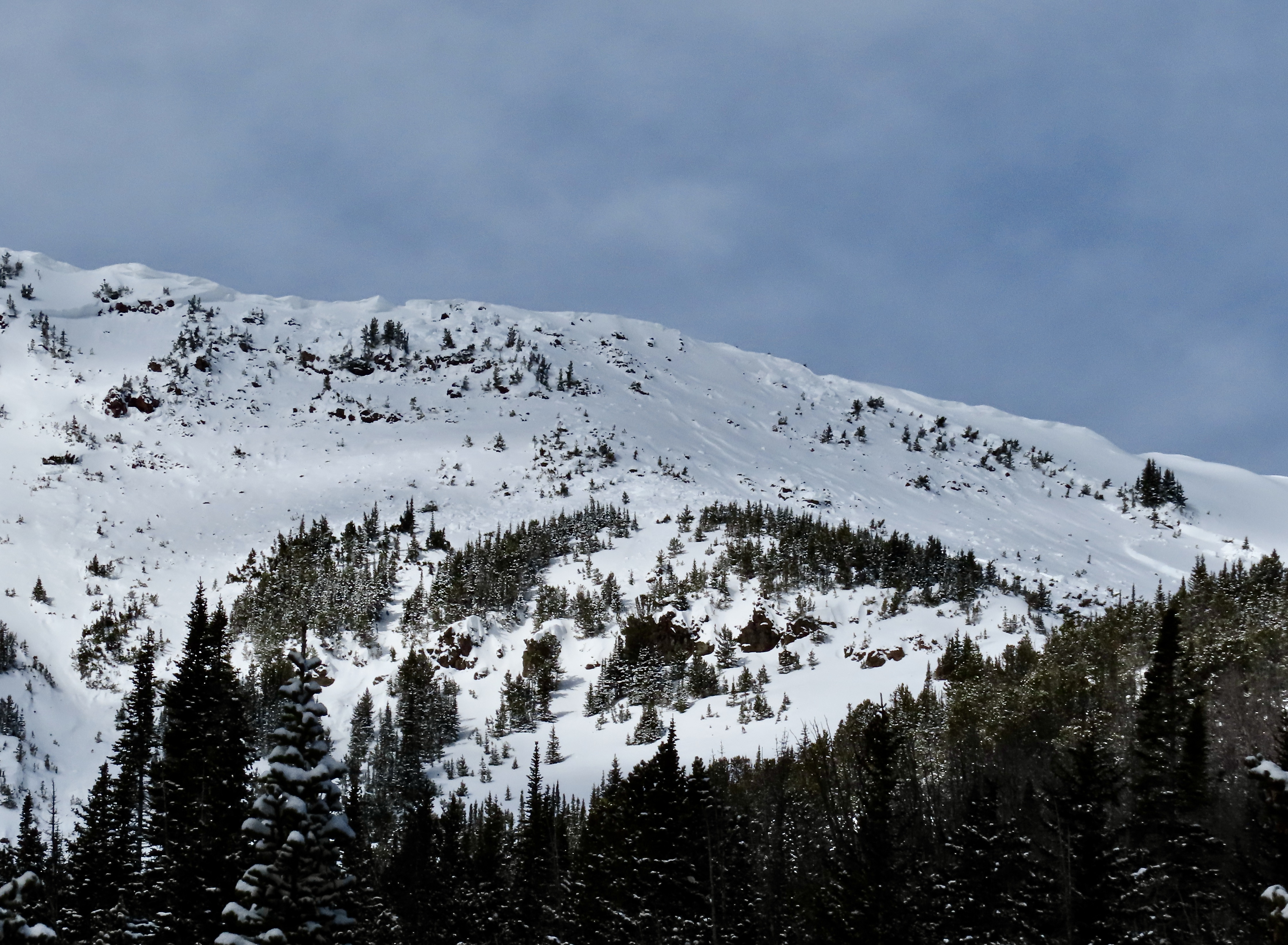
Full Snow Observation ReportRode up to maintenance shack then across to East Hotel creek and dug on the south slopes.
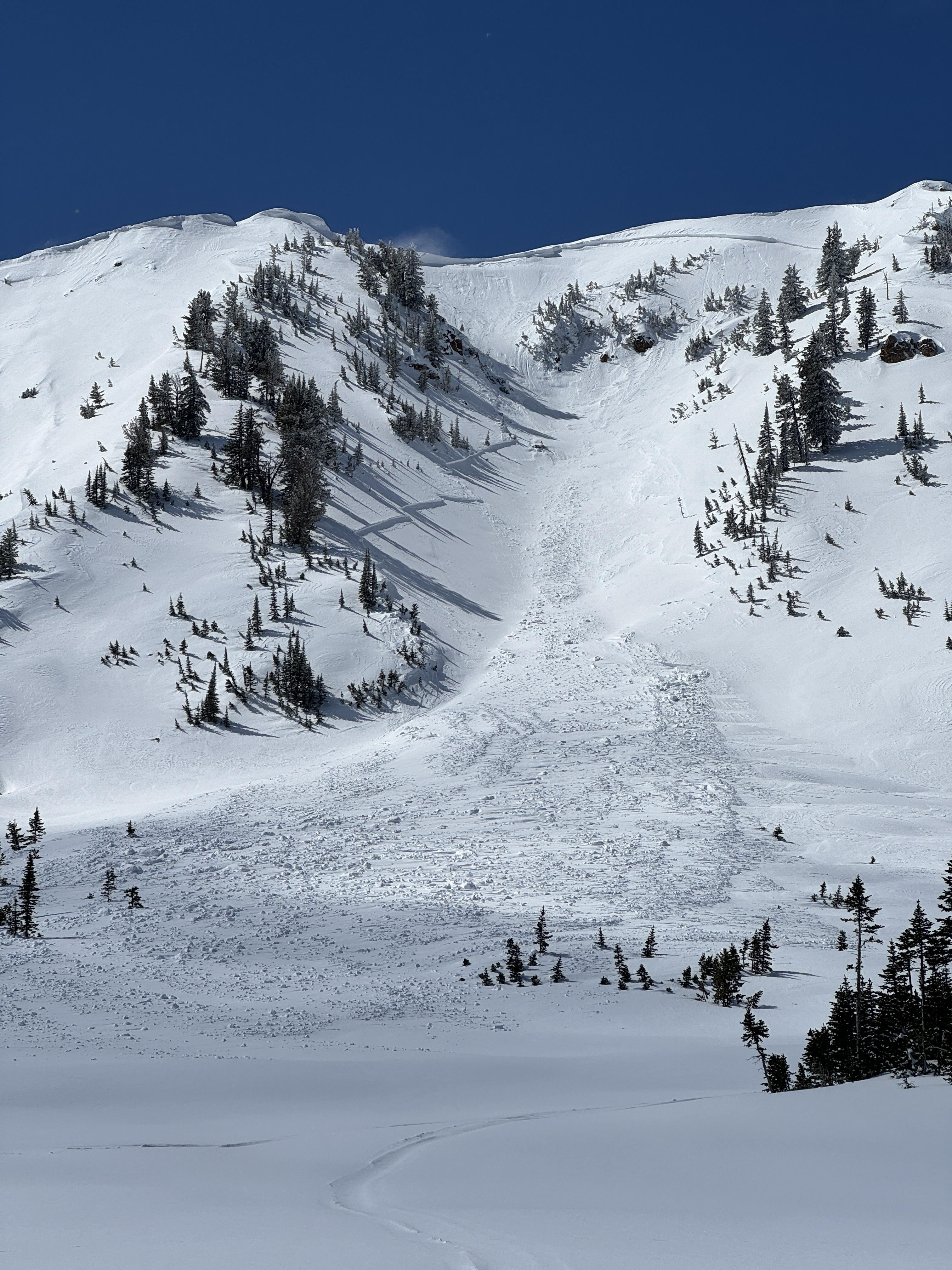
From there we rode to upper Hellroaring creek and to below Reas peak and dug another pit. Then we traveled up and around into Jefferson bowl before heading out.
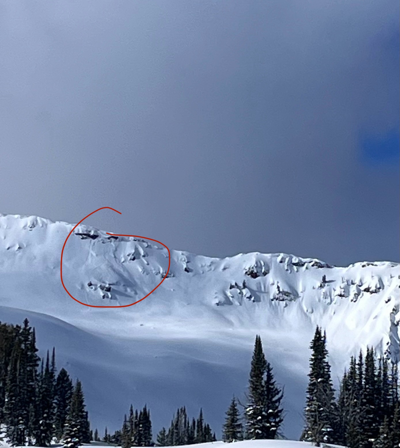
Avalanche activity seen: 5 total
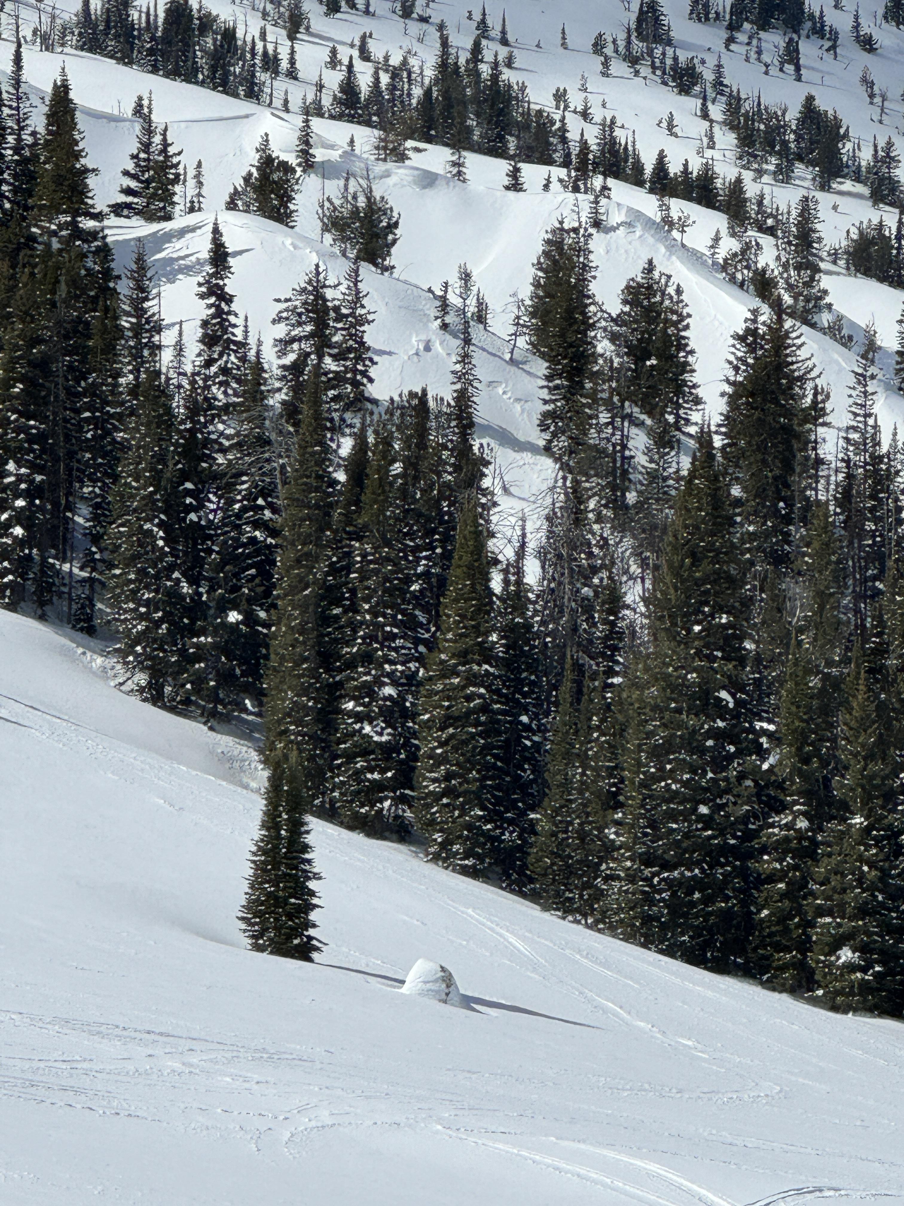
2 appeared to be rider triggered near Reas peak on North aspects that broke within or just below the new storm snow. (D1/D2)
We saw a natural avalanche that broke near Yale creek on a southern aspect, again broke below new snow. (D1)
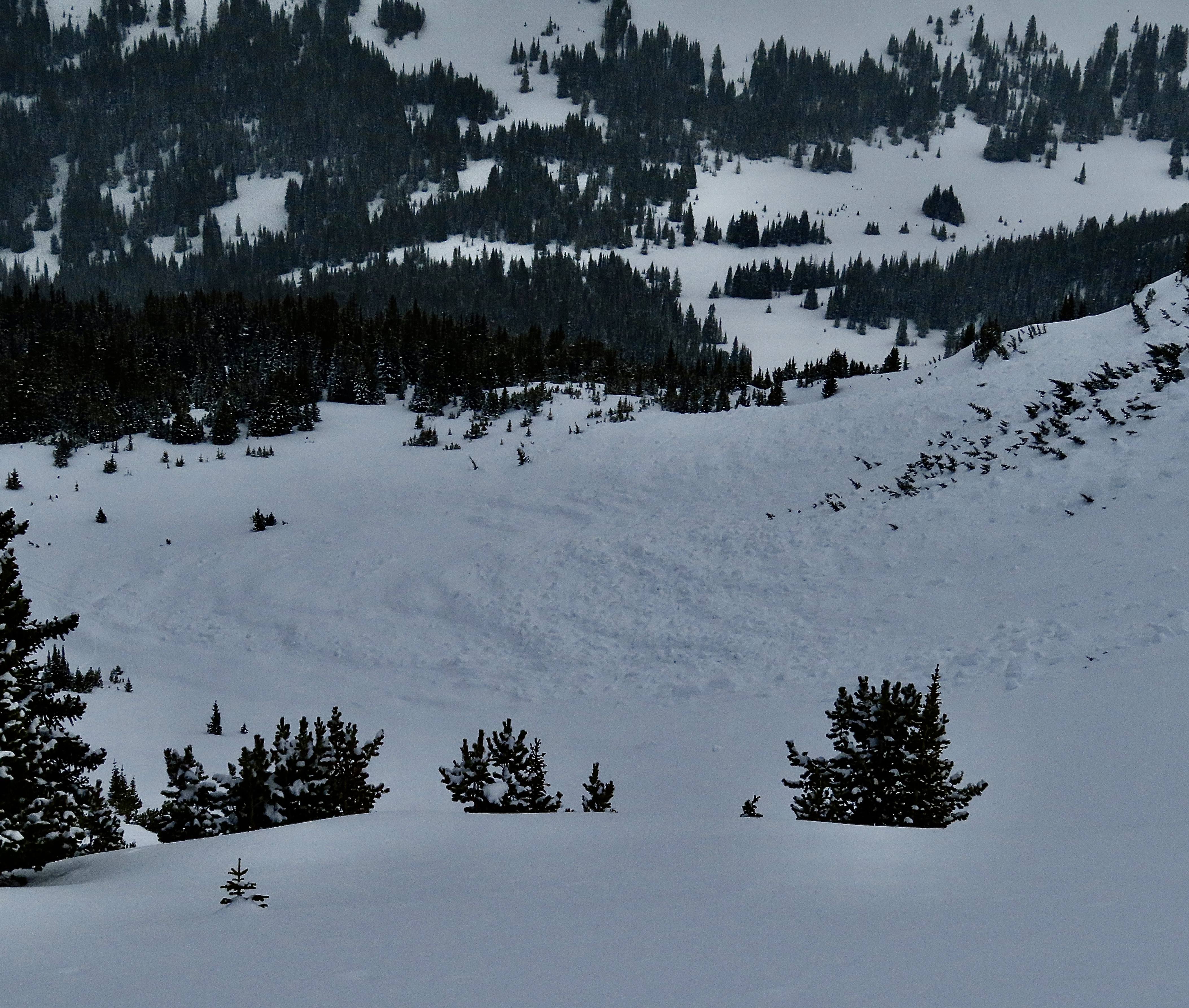
2 large natural avalanches that broke within the wind drifted snow in Jefferson Bowl.(D2/D2)
Snow depth ranged between 225-275cm in our test pits.
No signs of instability seen on our ride but temperatures were increasing and wet snow activity will likely follow. In our pit above East Hotel we observed the new snow to be bonding well with the old. (ECTN’s 15/17)
In Hellroaring below Reas we observed facets above and below the upper most crust under the new snow and got propagation.(ECTP15)
Travel Advice:
Human triggered avalanches are still possible but it is not unreasonable to explore into avalanche terrain.
However, we suggest digging down about 3’ below the new snow and asses how it is bonding before riding into steeper terrain. As always carry rescue equipment and reduce risks by only exposing one person at a time while others keep watch from non-avalanche terrain.
Moderate is good for now.
Similarly to other forecast regions I expect wet snow instabilities to increase throughout this week.

Saw no signs of instability. Skied east to southeast aspect slopes. The snow did get moist, but not sloppy, in the afternoon. Did not execute any snow pits and accompanying test. The snow pack felt solid. Would have been nice to do a little snow science, but it was a long tour.
Full Snow Observation ReportFrom email: We were out camping around the east side of Sphinx Mountain. We rode sleds over dirt for a while and came from Buck Ridge. We didn’t see any fresh avalanche crowns all weekend. We did get a big whoomph that collapsed the snowpack while skinning along a ridgeline on Sphinx that seemed freshly loaded. Cracks shot out maybe 25 feet around, but it didn’t move. We didn’t dig snow pits; we followed our plan of keeping our terrain selection on the mellow side.
Full Snow Observation ReportFrom text: A group of snowmobilers watched a pow surfer trigger an avalanche. The individual was buried to his chest and thankfully uninjured.
Full Snow Observation Report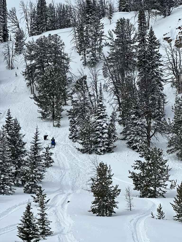
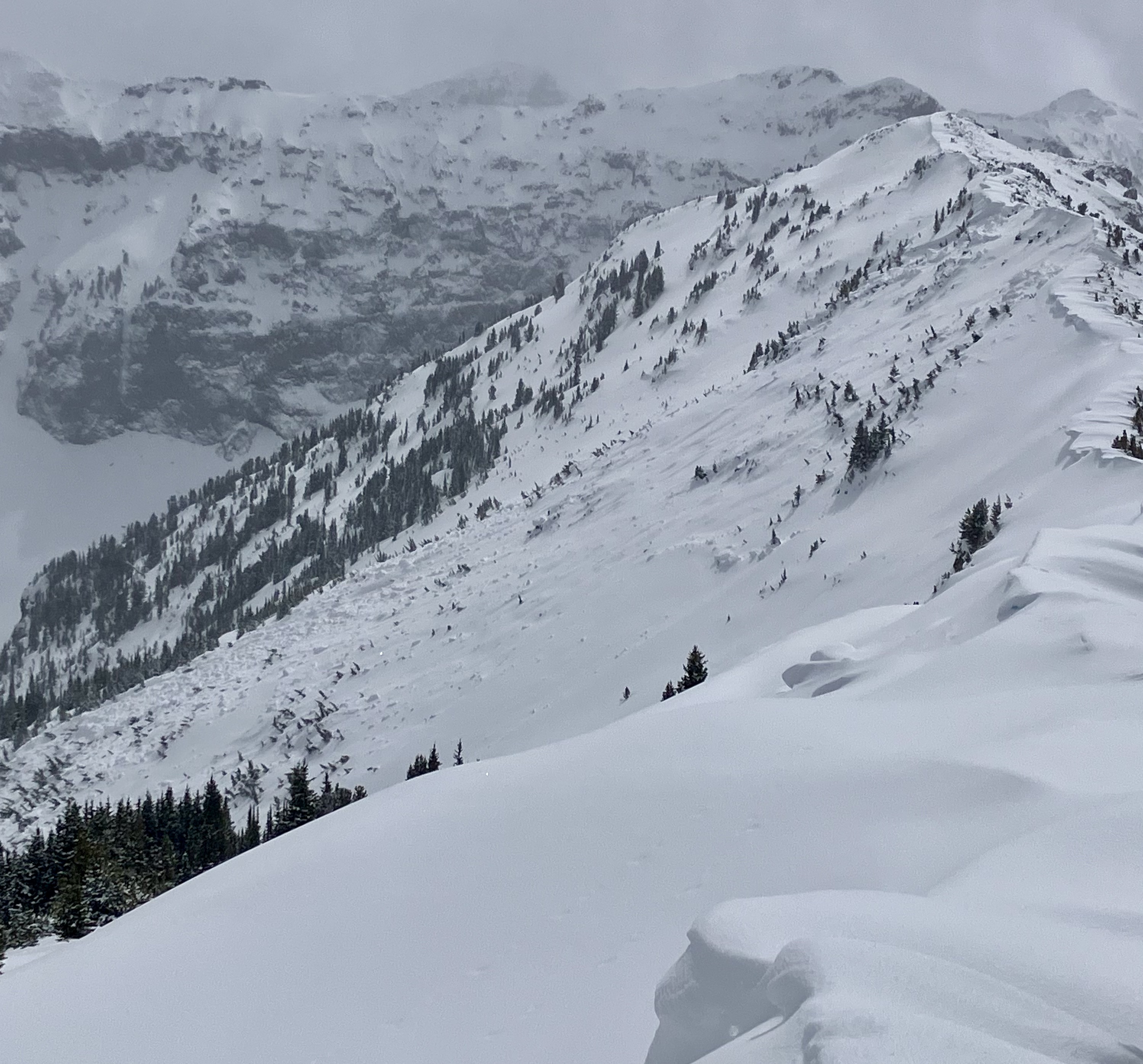
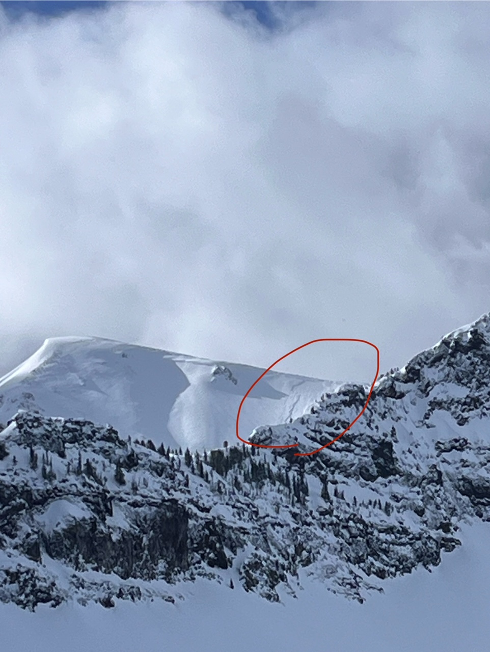
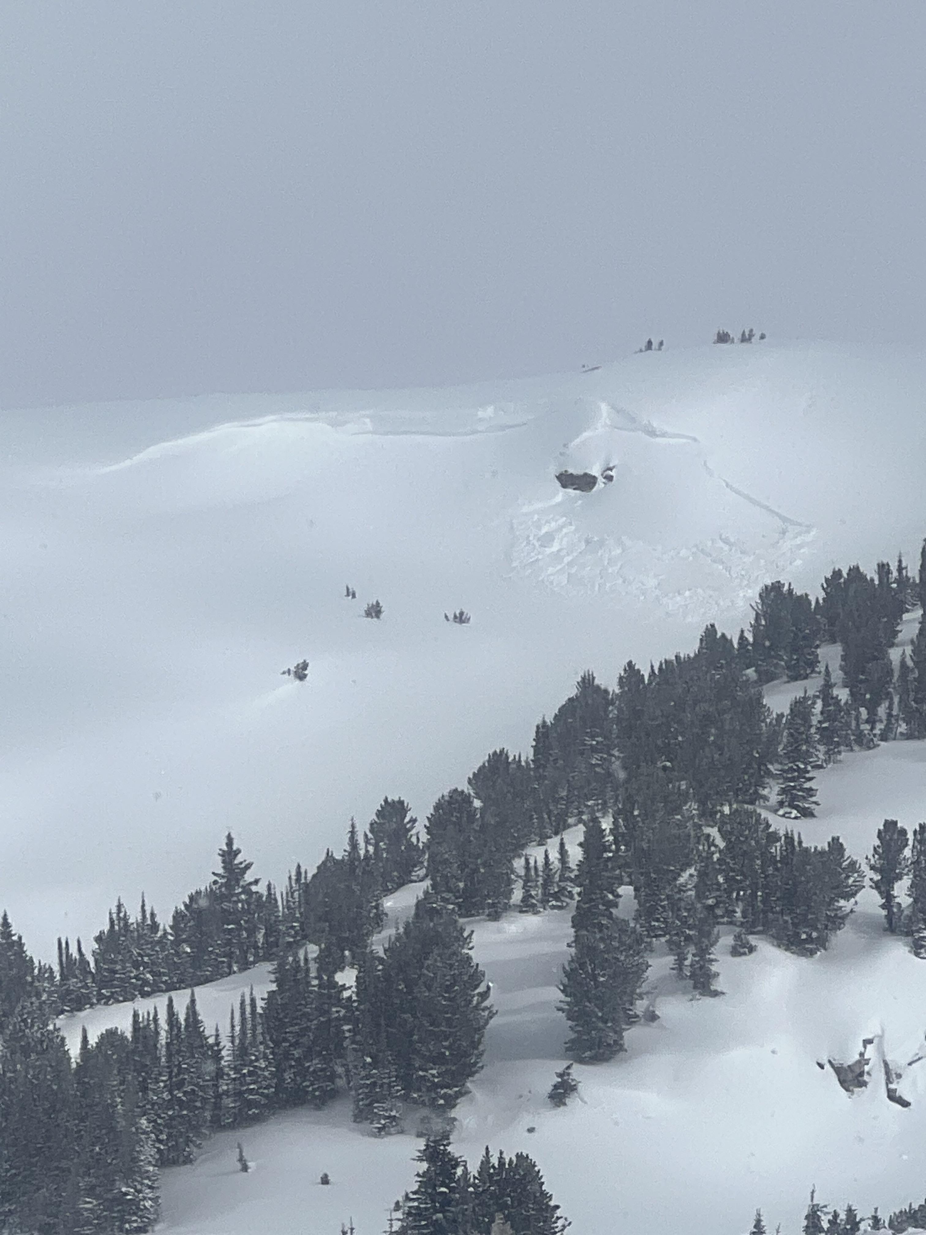
We toured up to Flanders Mtn. to take down the weather station for the season (before the road closes on Monday, Apr 1). The main observation is a big, deep 2-6' deep avalanche that broke 300-500' wide in weak snow at the bottom of the snowpack. Photos and video attached. It broke across two separate start zones and included a lower angle ridge (still around 30 degrees) in between that slid. E-NE aspect at 9,800'. HS-N-R3-D3-O.
Next to the avalanche debris there was 1-2" of new snow on a thin melt-freeze crust, and the debris seemed to have around 3" of new snow on it. Minimal evidence of recent wind.There was a trace of new snow in the parking lot, 3-6" on most of the trail, I think from the last couple days, and places up high had 10-12" of recent snow where the sun hadn't affected snow from earlier in the week. Today wind was calm with sunny skies becoming partially obscured with light snow showers. We also saw one small dry loose slide in the new snow on a steep north facing slope, and a variety of older crowns including wind slabs near the ridge and one 2-3' deep crown below some cliffs.
Full Snow Observation Report

Today, myself and 5 others toured up beehive basin for an avalanche 2 course. In the morning a pit was dug in the bonus wiggles on a south facing slope. The biggest takeaway from this was the melt freeze crust on the surface. This pit experienced an ECTP-22 and CT-15-Q1. Both tests failed on depth hoar 40 cm above the ground. Another pit was dug on an east facing slope on the west side of beehive basin in an opening between tree fields, about 30ft from the ridge line. The biggest takeaways from this pit where a PST 40/120-end at the surface hoar-melt freeze crust interface 40cm above the ground and ECTN on the upper crust. As for the surface, the surface crust softened for the afternoon decent. There was little to no wind today and no evidence of wind slab, no observed avalanches, and no observed cracking or collapsing.
Full Snow Observation Report200 cm snow depth. Soft on top moving to firm, cohesive layers through the pack. Some weak snow near ground.
Full Snow Observation ReportOur group conducted an East facing snow pit on the top of the East Beehive Ridge at around 9100’, at 1 pm. Sky was OVC, wind from W at 5 mph. Snow pit was on a 15° slope. The total snow depth was 135 cm. Our results were an ECTN 22 at 35 cm down, a PST 34/100 End and 85 cm down, and a DT 21 PC at 100 cm down. No observed wind slabs on ridge south of Prayer Flag Trees. No signs of wet loose such as rollerballs at 4 pm.
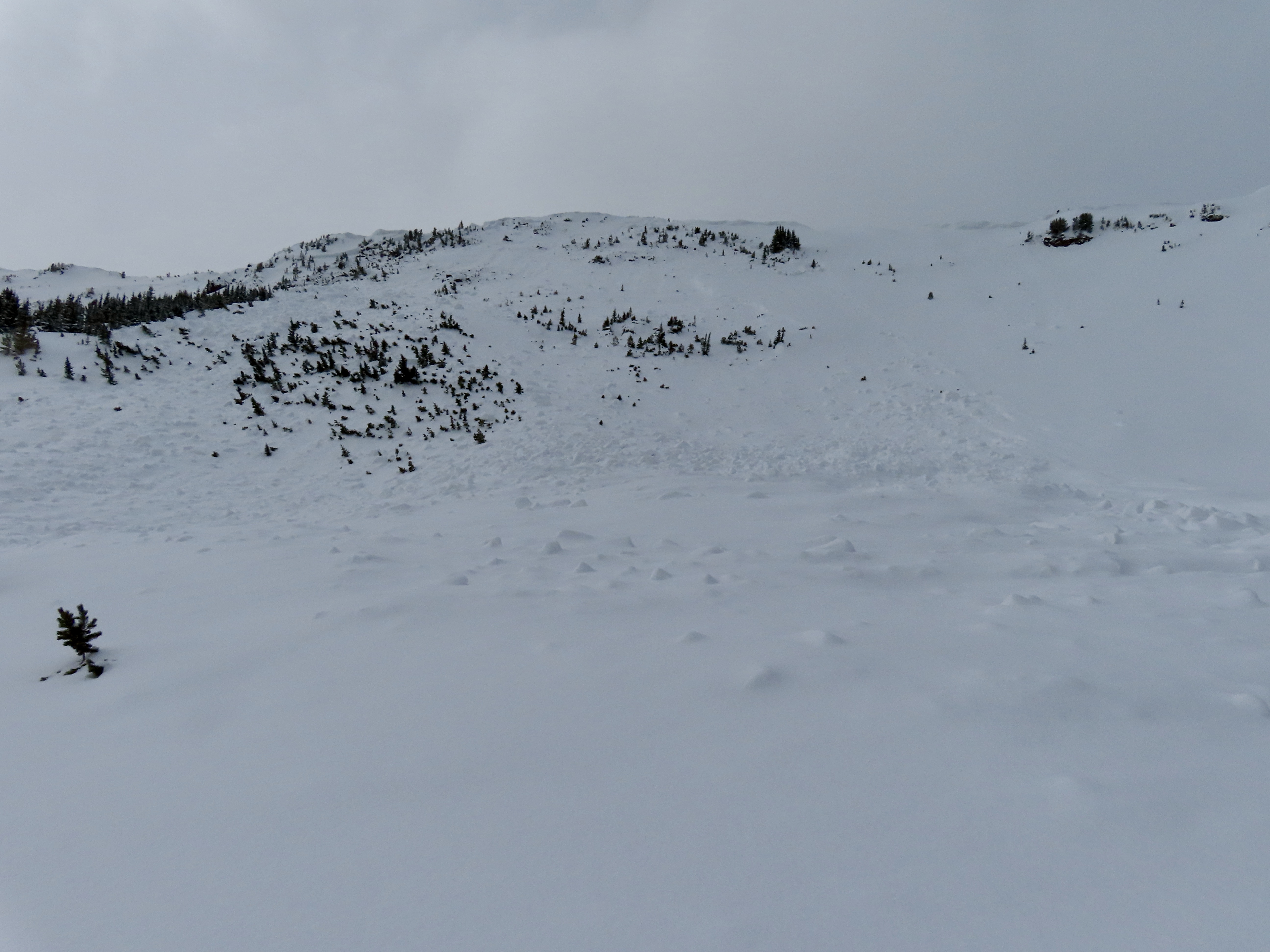
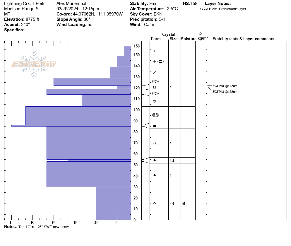
Full Snow Observation ReportWe rode into Taylor Fork, to the ridge at sunlight basin, through Carrot basin to the wilderness boundary, and back along the ridge to Beaver slide. There was 12" of new snow equal to 1.25" SWE.
Wind was calm, and skies were partly sunny with clouds obscuring Sage Peak, Skyline and areas to the south. The recent snow had not been affected by wind anywhere. The ridge near the weather station that is normally scoured still had 8"+ of light new snow on it. Sunny slopes got moist in the afternoon.
The only new avalanche I saw was one slope with small debris from a loose snow slide/ or new snow/wind slab on Kirkwood Ridge.
We dug a pit near the wilderness boundary where Ian and Dave dug earlier in the week. We had ECTP13 and ECTP18 on the recently buried layer of small facets below a 2" crust under the 12" of new snow.
Full Snow Observation ReportI mentioned to Ian on the phone I saw a deeper PWL avalanche near Woodward peak, but after looking at my photos I think it was actually a rock band... Not totally sure one way or the other, but I'm leaning towards not an avalanche.
My movie wont save in the new software I use for the vertical format, so that probably won't get published, but maybe in the morning.

Skied Hyalite and Divide peak today. Snow conditions were extremely variable, ranging from undisturbed powder, to wind slabs and sun crusts. No bullseye signs of instability outside of the new snow (i.e. on the deep slab layer).
In the recent snow there was some localized cracking in dispersed windslabs, rollerballs coming off steep solar aspects, and two old windslab releases in the summer trail bowl off Hyalite. These slides probably released either before or during the most recent wind/storm event, as the start zones were both partially refilled. The larger of the two was noticeably older than the other, with the start zone and debris deeply covered. Both were R1/D1, naturally triggers, with crowns no deeper than half a meter directly under the cornice. No cornice fall seemed evident near either crown.
New snow that was sheltered from the wind and sun showed no signs of instability, and the weather consisted of light winds with periods of interspersed graupel and sun. Weather and obvious wind affects looked similar across the range.
Full Snow Observation Report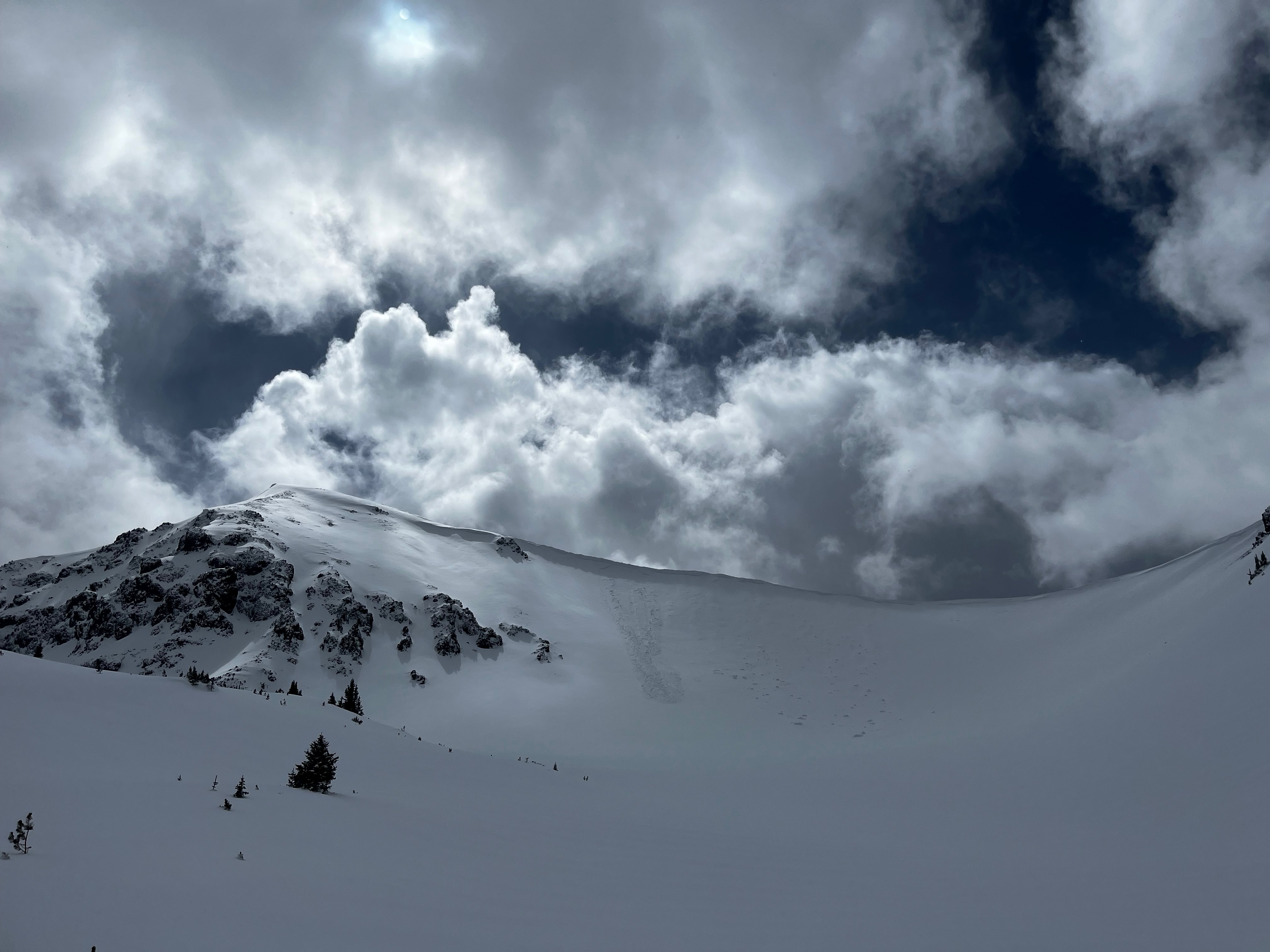
ECTP 11 30cm down on melt freeze layer.
PST 28/100 End
location: meadow below the ramp above Bradley’s meadow.
Full Snow Observation Report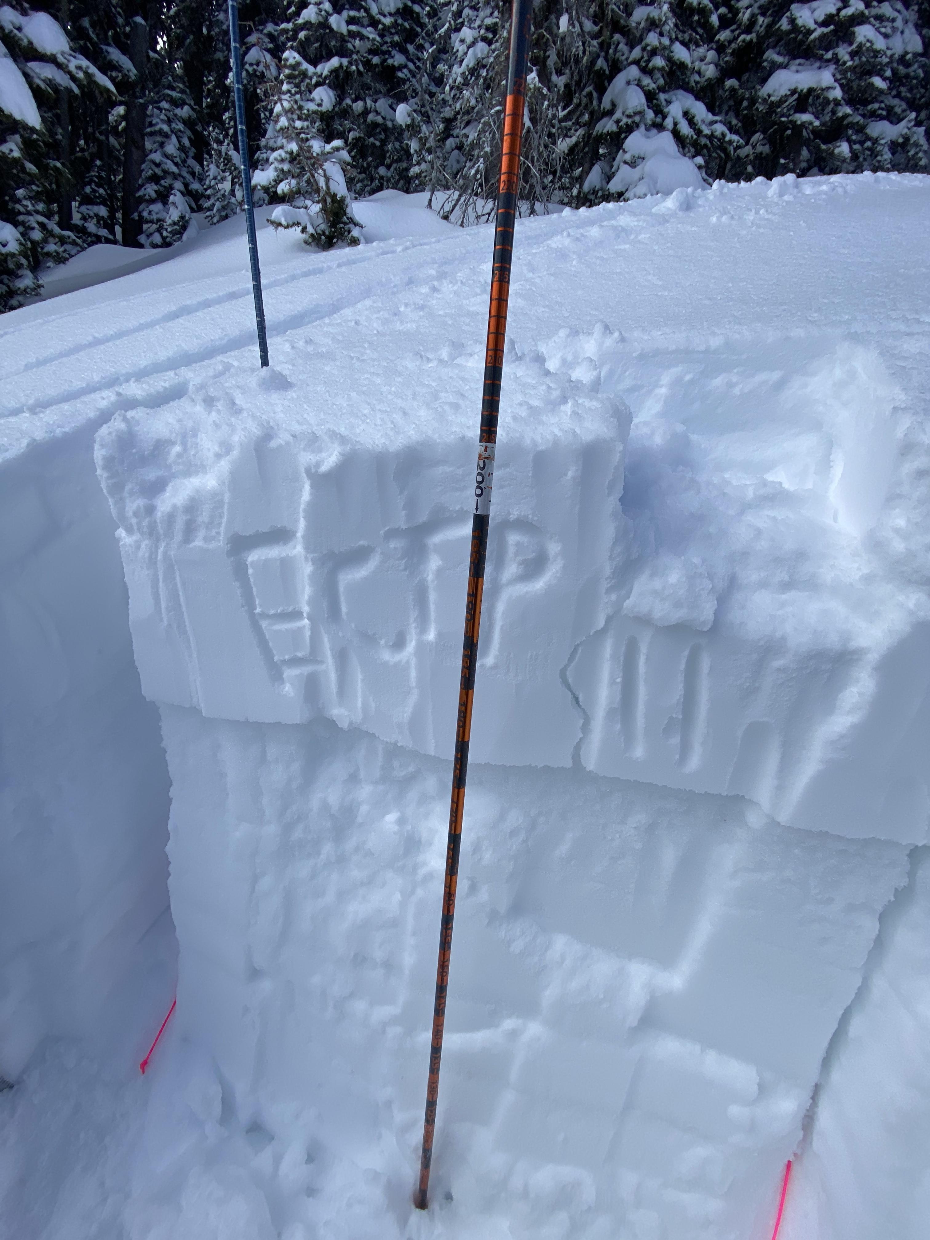
Dug a pit near the top of bacon rind on an east facing slope. ECT-P 14 on the new snow slab breaking 12” deep
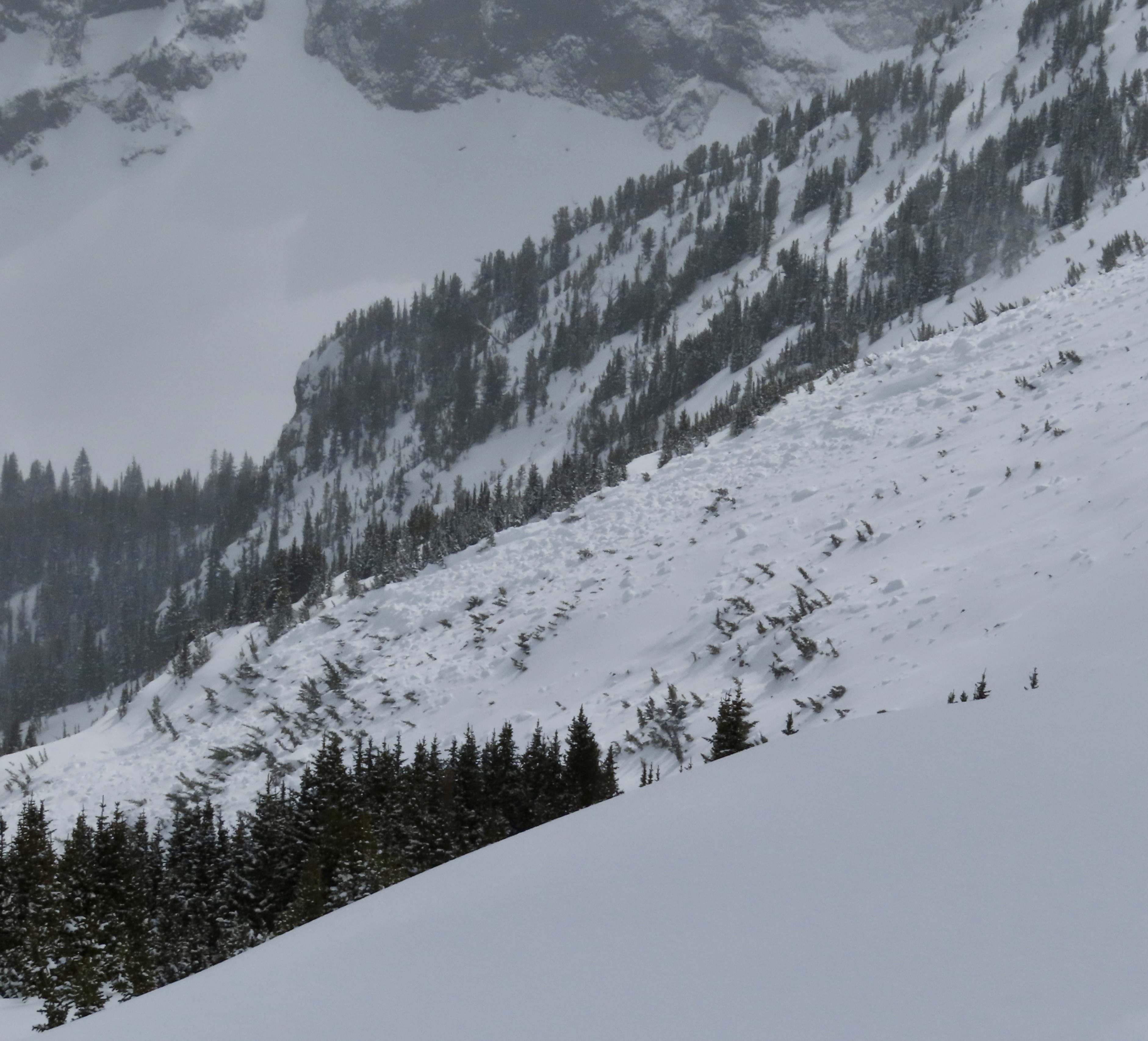
Full Snow Observation ReportSkied Divide Peak this morning. Snowfall totals in the main fork were around 3", while the Shower falls area experienced 6-8". Inconsistent snow depths within divide cirque highlight heavy snow transport yesterday and overnight. Varying levels of sun crust below the most recent snow were widespread.
One hand shear on a solar ESE aspect demonstrated cohesiveness, which seemed to be due to moist snow, on a thick crust. Sheer quality created a pretty smooth bed surface.
Today's tour provided many views of undulating wind effect- cornices on west-east ridges formed on south and north sides. Plenty of large cornices were present and could be quite destructive.
Spotted two fresh natural slides, one within Divide cirque on a NE aspect @ ~9,800 (D1, R1), and another on the N face of Hyalite @ ~10,200ft. that was mostly out of view, but could be estimated around similar size and destructiveness. These seem to have occurred within the last 24 hours, or after snowfall, likely windslabs on lee slopes.
We skied east of the central divide gully, avoiding wind issues to the west and solar issues to the east.
Full Snow Observation Report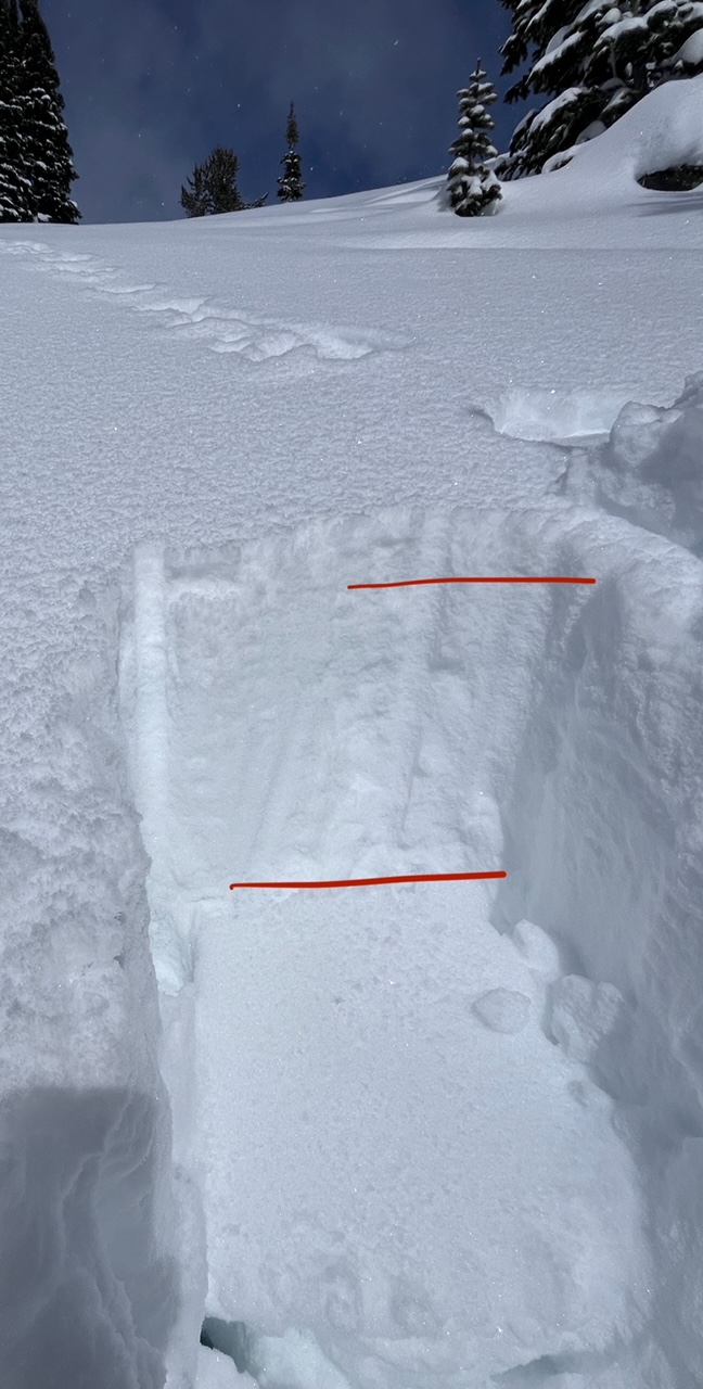
Spotted this big guy on the east face of Blackmore today. Seemingly natural and I believe it occurred in the last 36 hours or so. Debris had last nights snow on it. I’d estimate it at D2.
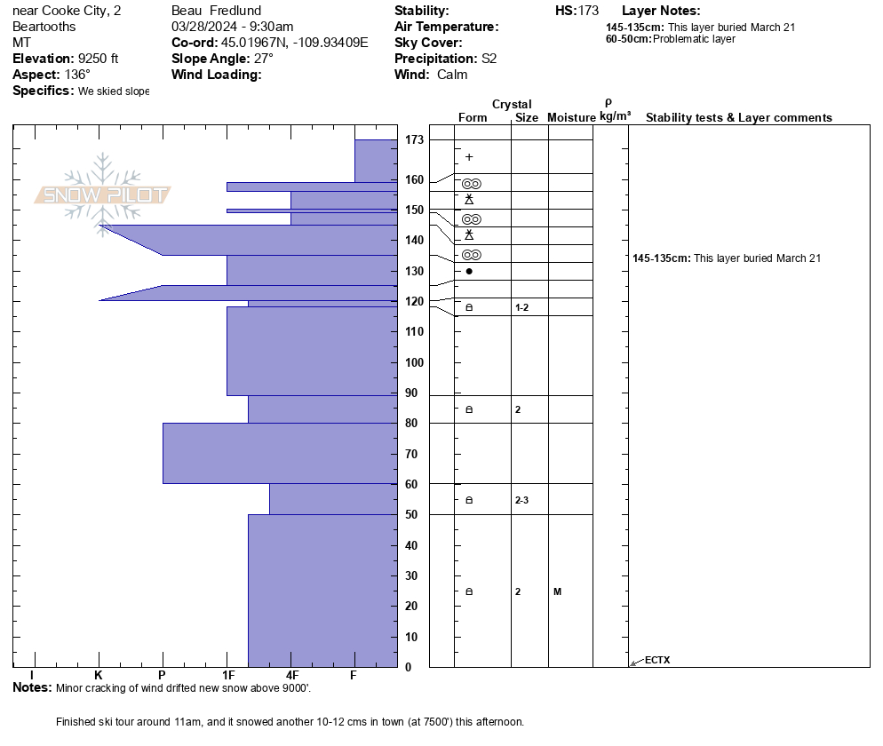
Full Snow Observation Report
From email: "Snowpit from this morning: SE aspect, 9250'.
It snowed all day in Cooke (S2), mild temps, light westerly winds."
Full Snow Observation Report
Today, we skied near the wilderness boundary north of Round Lake. On a wind-loaded test slope at the top of our second ski run, we were able to get recent drifts to crack, but not avalanche. Slightly further down on a steep roll the second skier in our group triggered a small wind slab avalanche. This avalanche was 15-20' wide, 8" deep, and ran for about 30-40 vertical feet. The skier easily skied away from the slide and was not caught.
Winds remained mostly calm but increased by the end of the day. Snowfall through the day was enough to partially cover our morning tracks and we found 2" of snow on our snowmobiles at the end of the day.
Full Snow Observation Report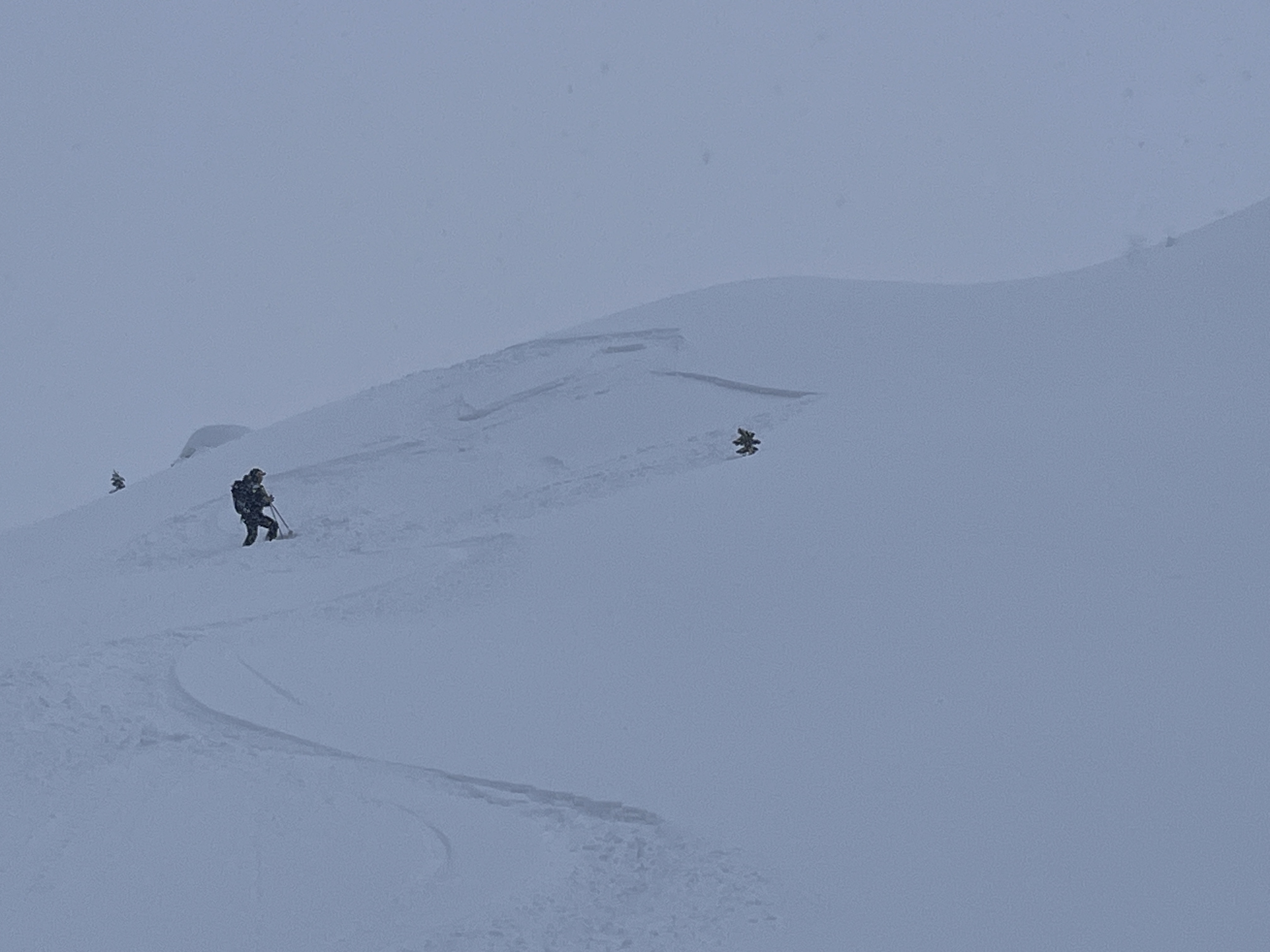

skiing north of cooke city today observed this Small windslab on a South facing slope ~9800 ft.
Full Snow Observation Report
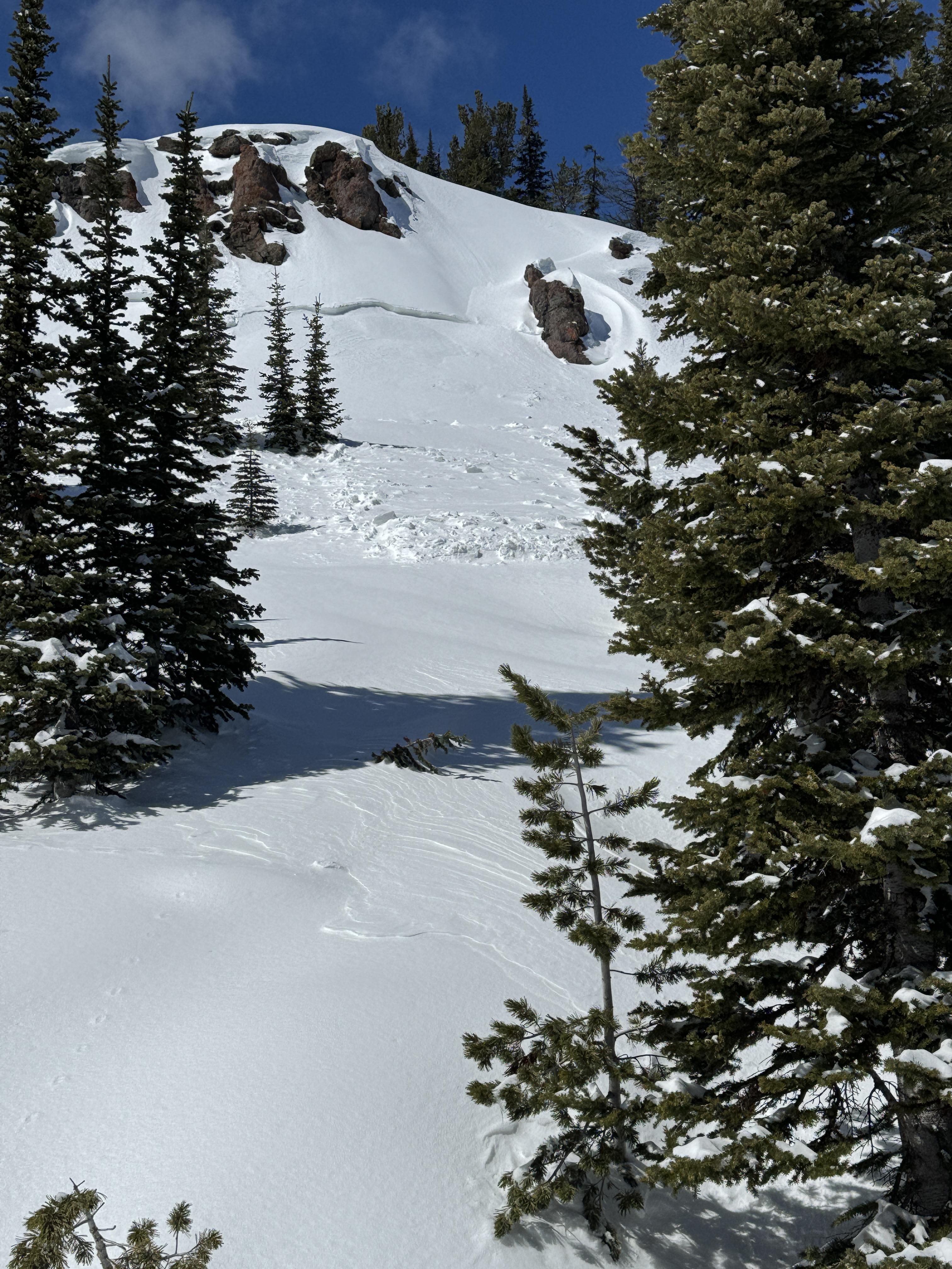
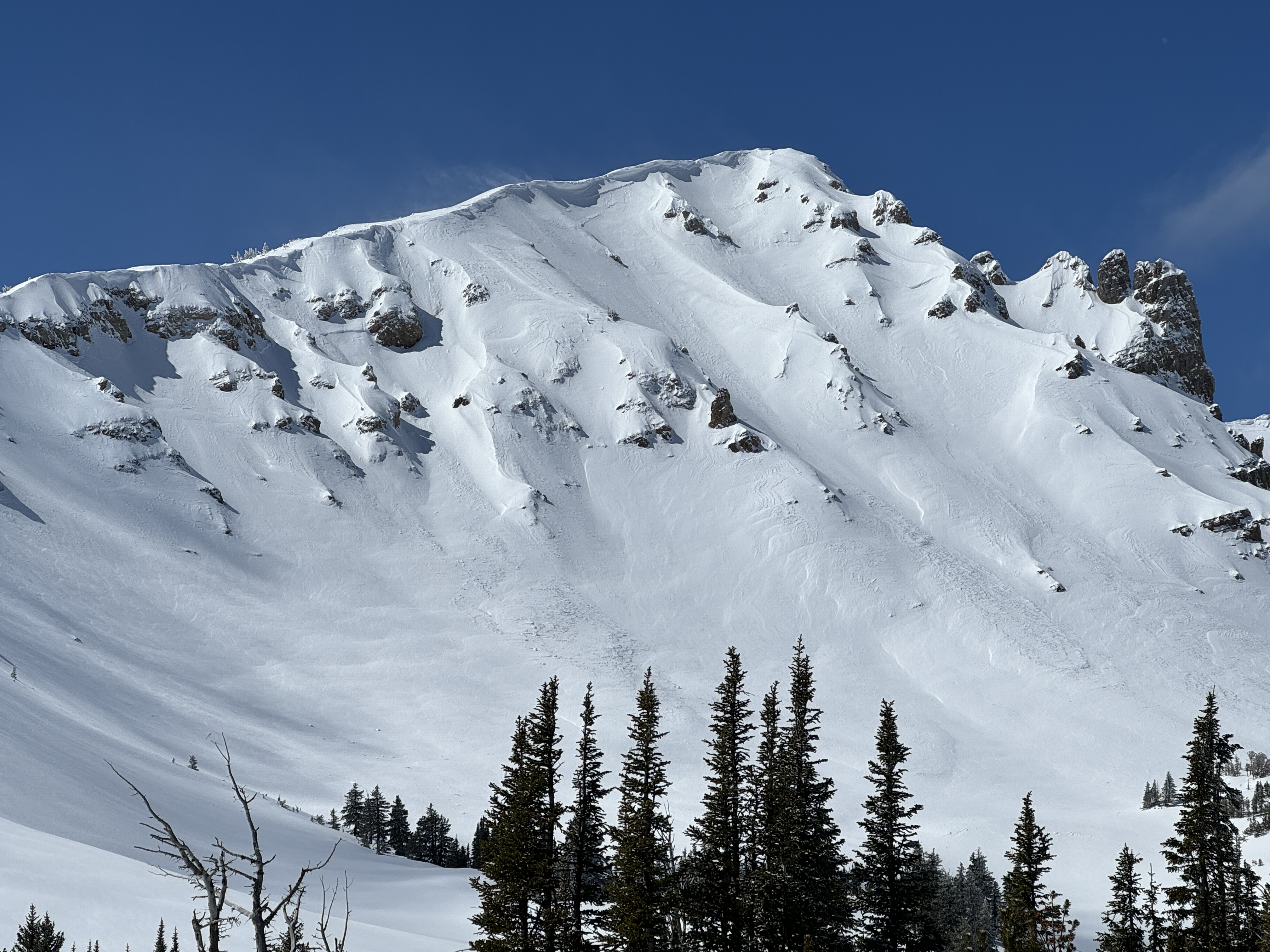
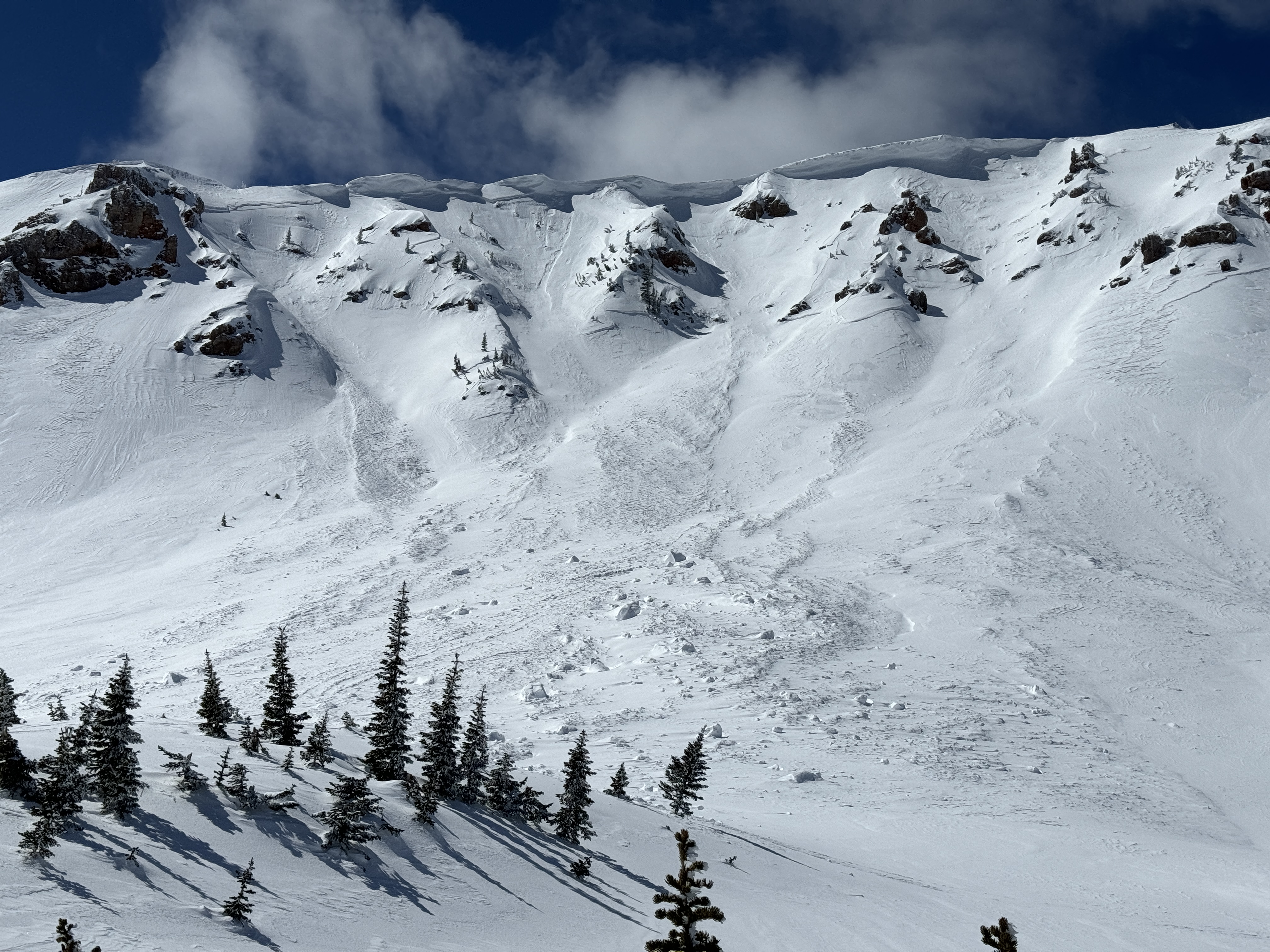
Today, we rode north of Cooke City through Abundance Basin around Scotch Bonnet ending at the East Henderson bench. We found anywhere from 4-12" of new snow that fell in the last 24-48 hours. Strong winds have transported this new snow into thick drifts even in more sheltered terrain. We did not see any recent notable avalanches but saw many crowns and debris piles from two weeks ago.
On the East Henderson bench, we dug a snowpit and found 235cm (almost 8') of snow. We found moist faceted snow 6' below the surface near the bottom of the snowpack. At the top of our snowpit was 12" of new snow above a stiff crust. Our stability test showed ECTN15 results on this interface.
Snow continued off and on through the day with little to no accumulation. Many slopes had signs of either wind-loading or had been scoured by recent wind resulting in thinner areas.
Full Snow Observation Report