Snow Observations List
Skied at Cinnamon Mountain today. The recent warm spell was not kind to the snowpack off 191. South facing slopes at all elevations had lost significant amounts of snow, with those below 7500 ft mostly bare and muddy.
Where there was still snow a thick yet loosely frozen crust capped weaker layers lower in the snowpack. Out of the wind this crust had barely refrozen, and I crashed through it many times, sometimes with the slab propagating further and shaking nearby saplings. Near treeline the crust became stout and supportable, and the 2-3 cms of new snow were bonding well (i.e. wet snow on wet crust).
Light winds with moderate gusts out of the WSW were lightly drifting the new snow, and precip was falling intermittently and as rain below ~7 kft. Certainly a funky day out there.
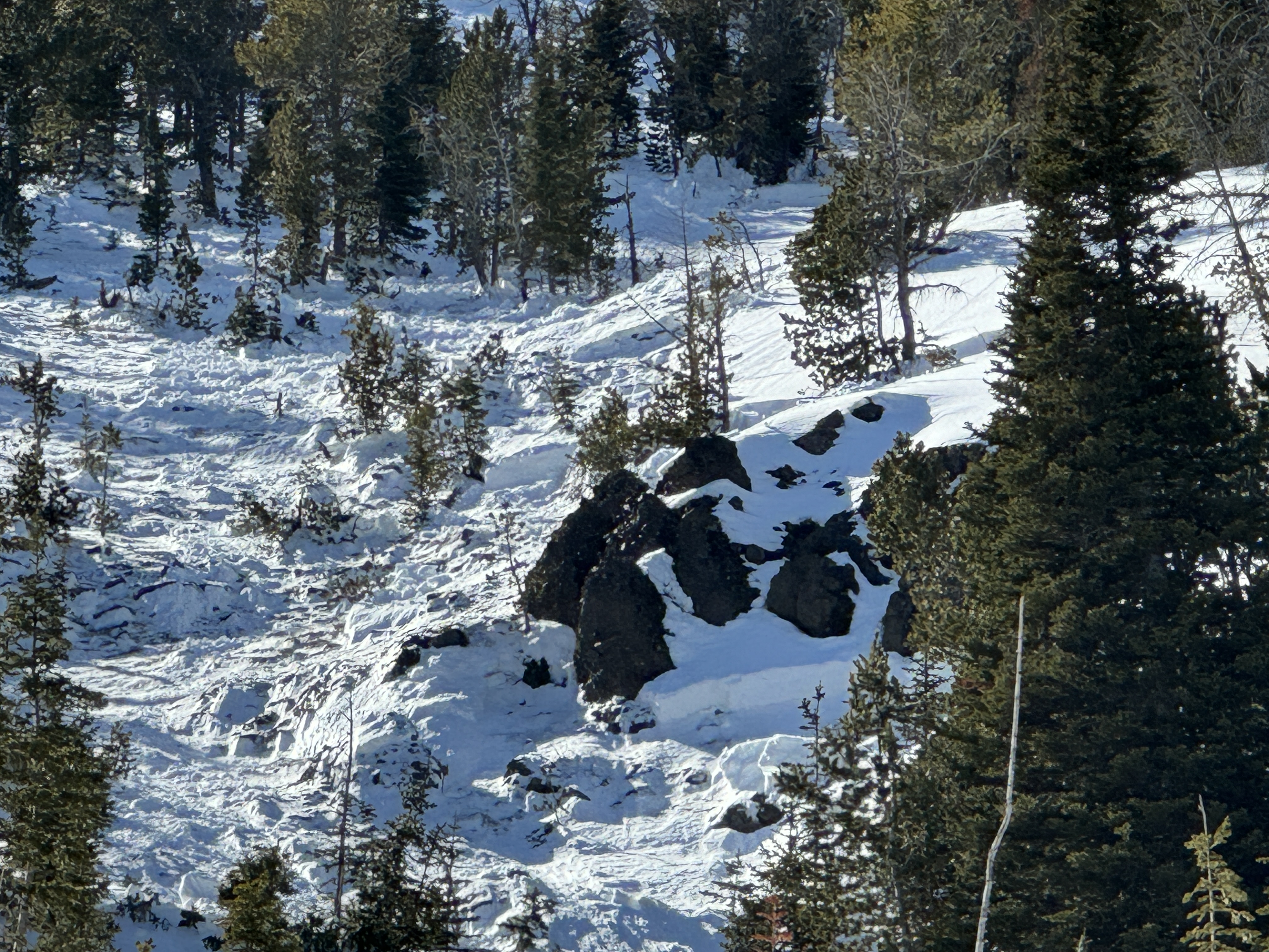
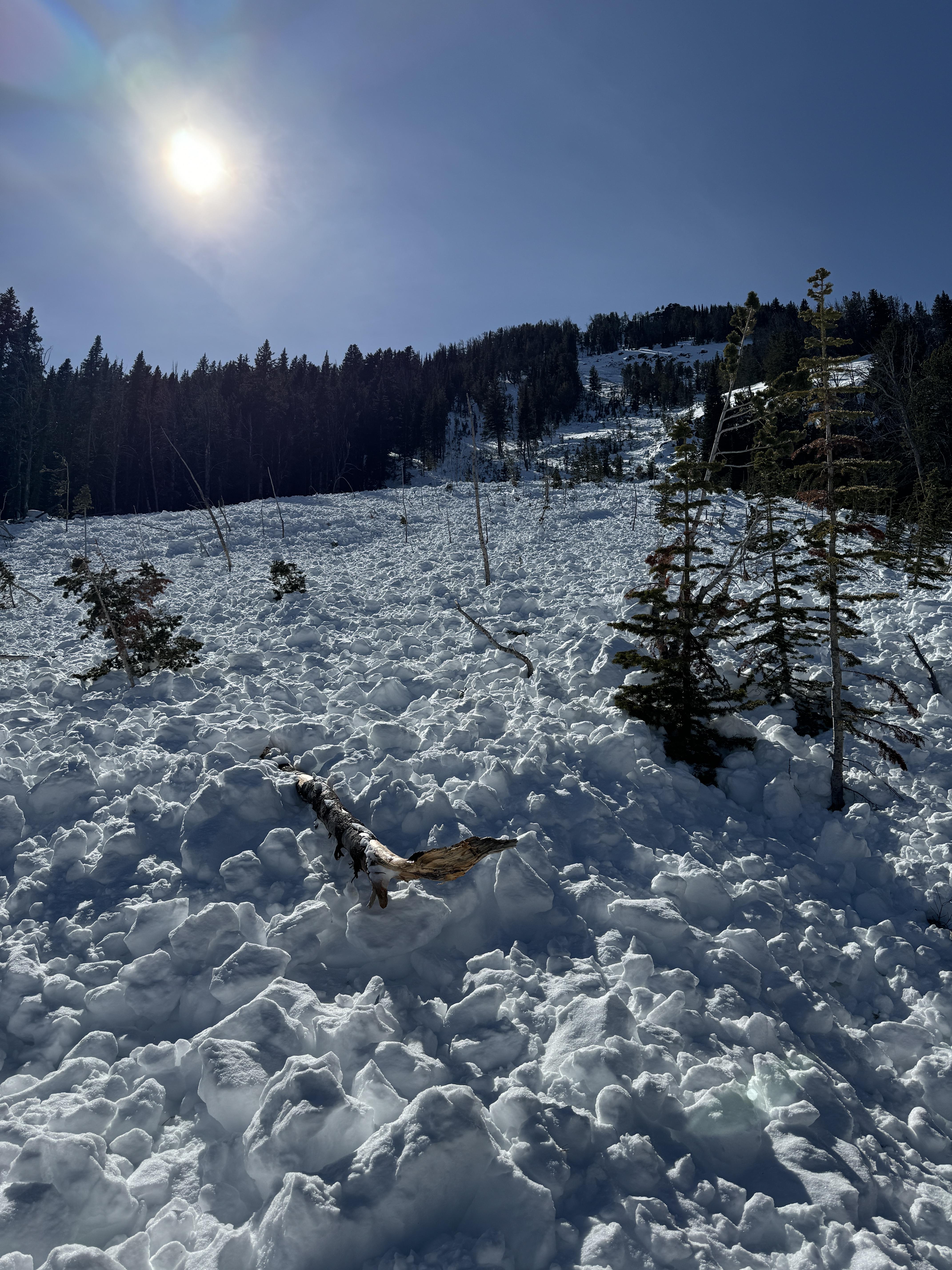
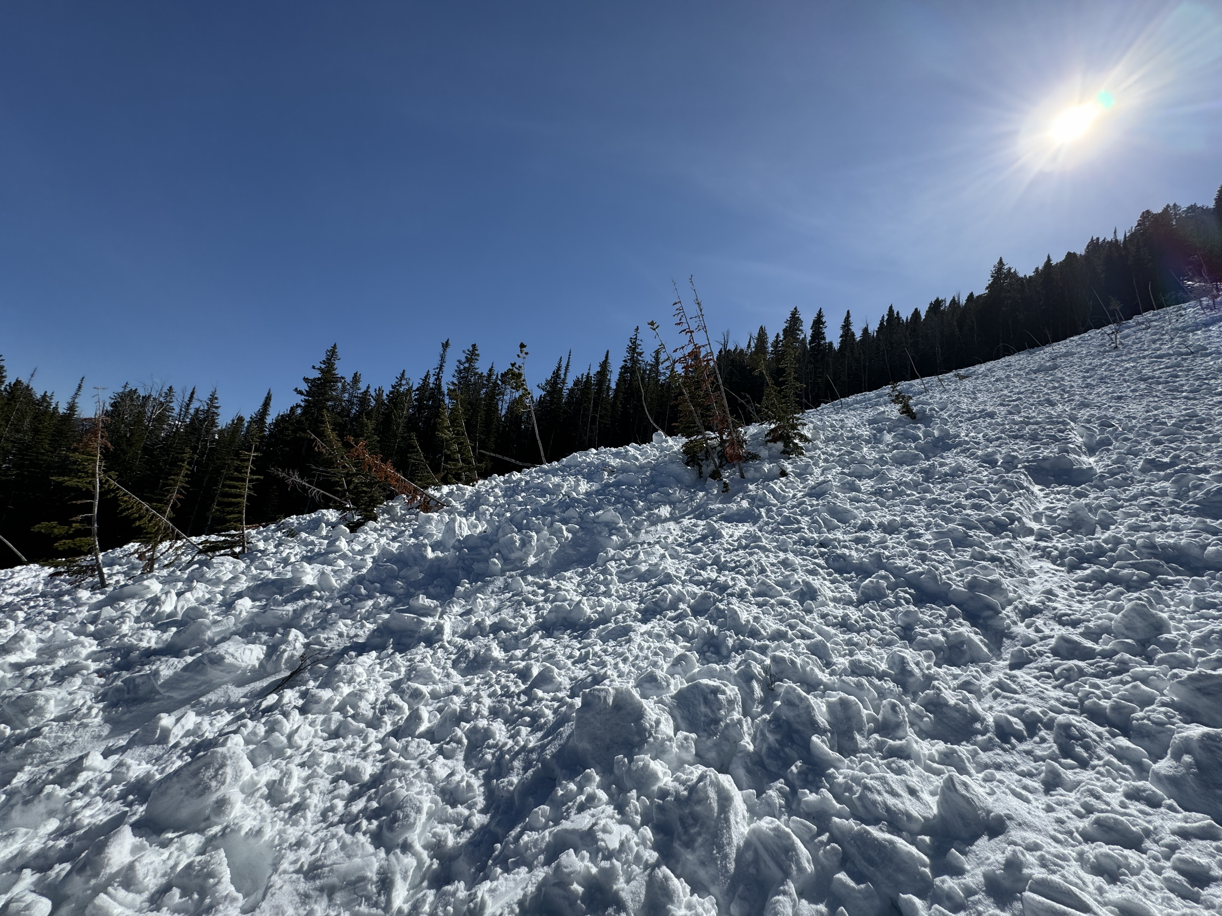
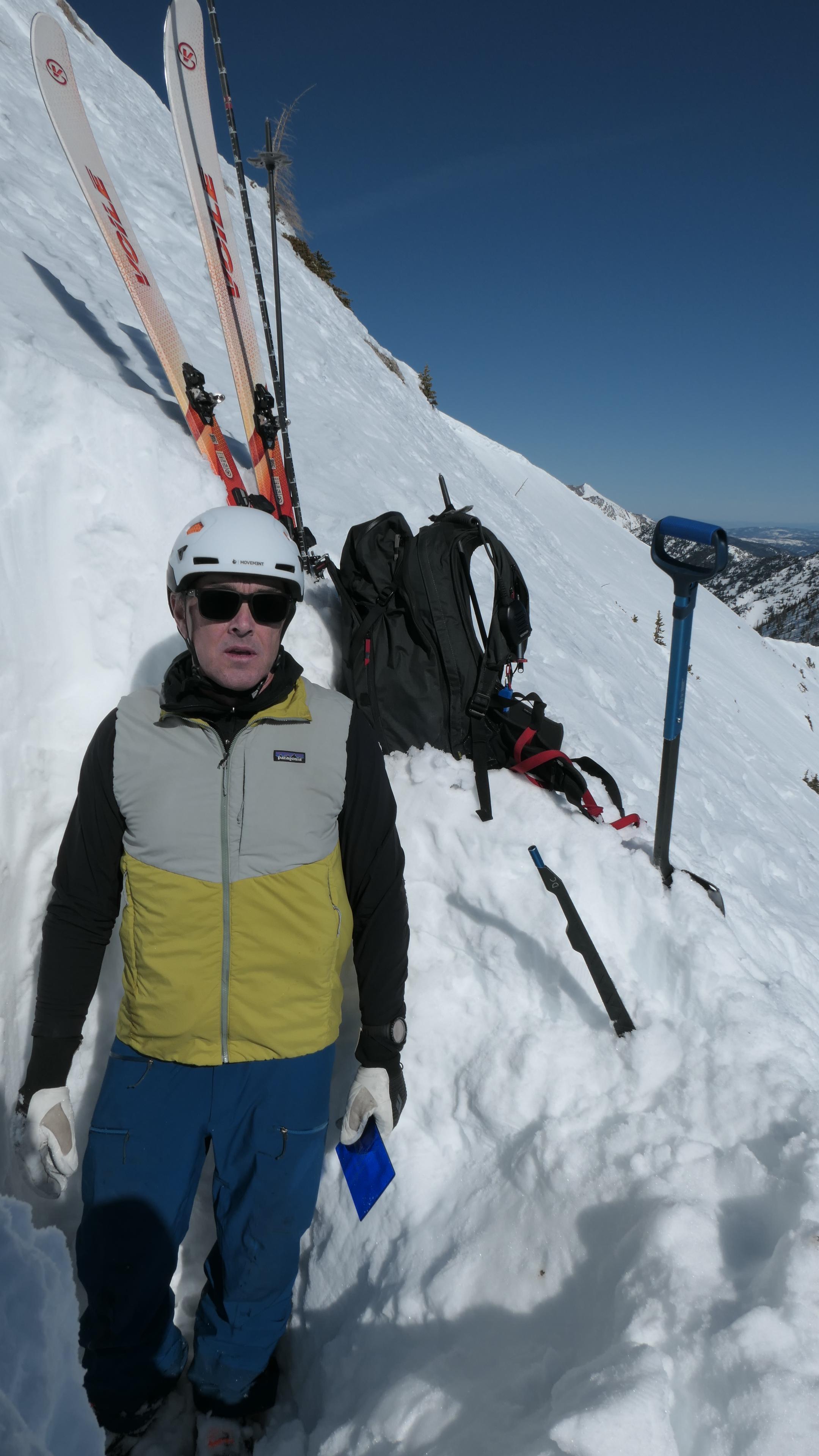
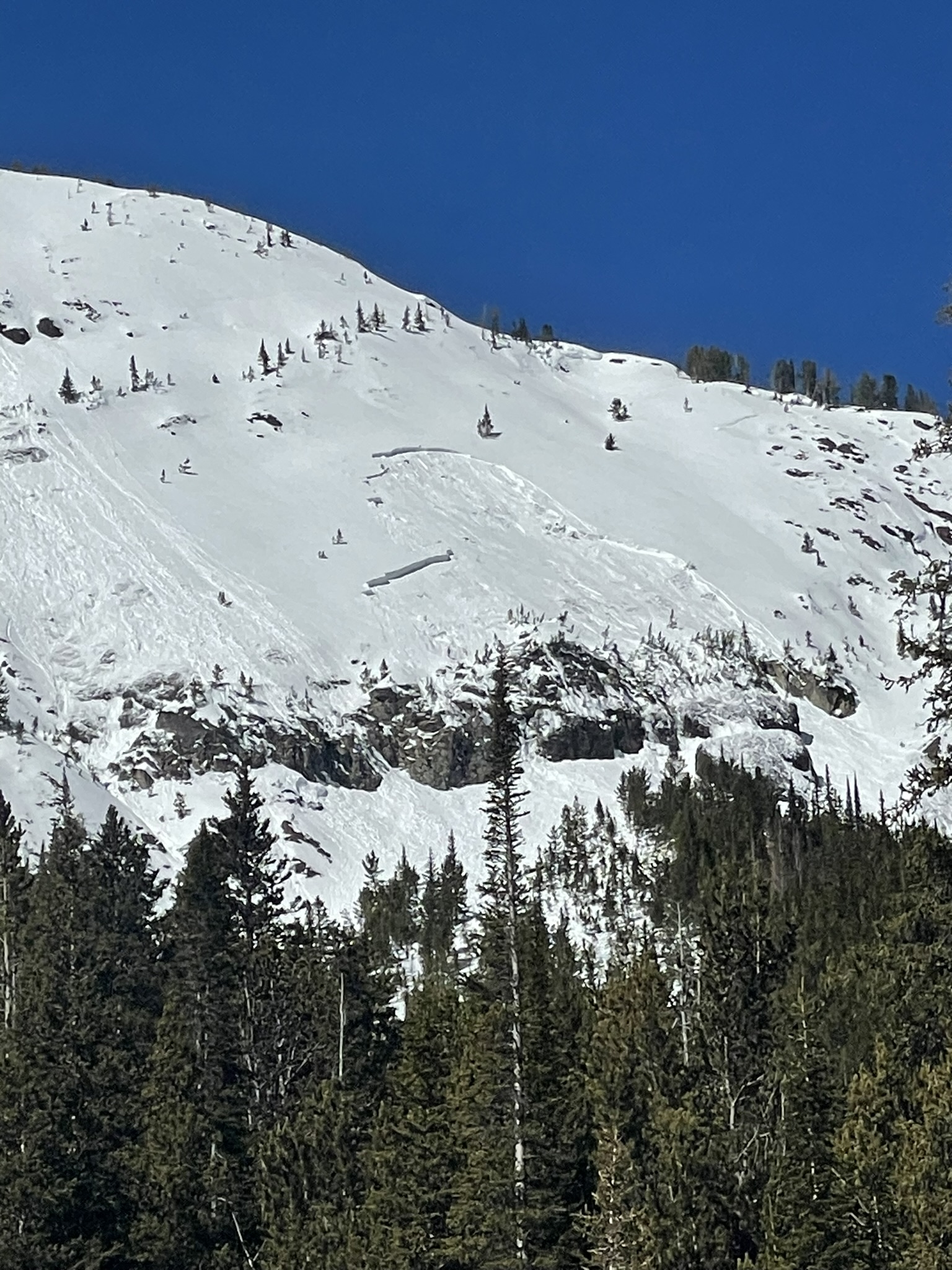
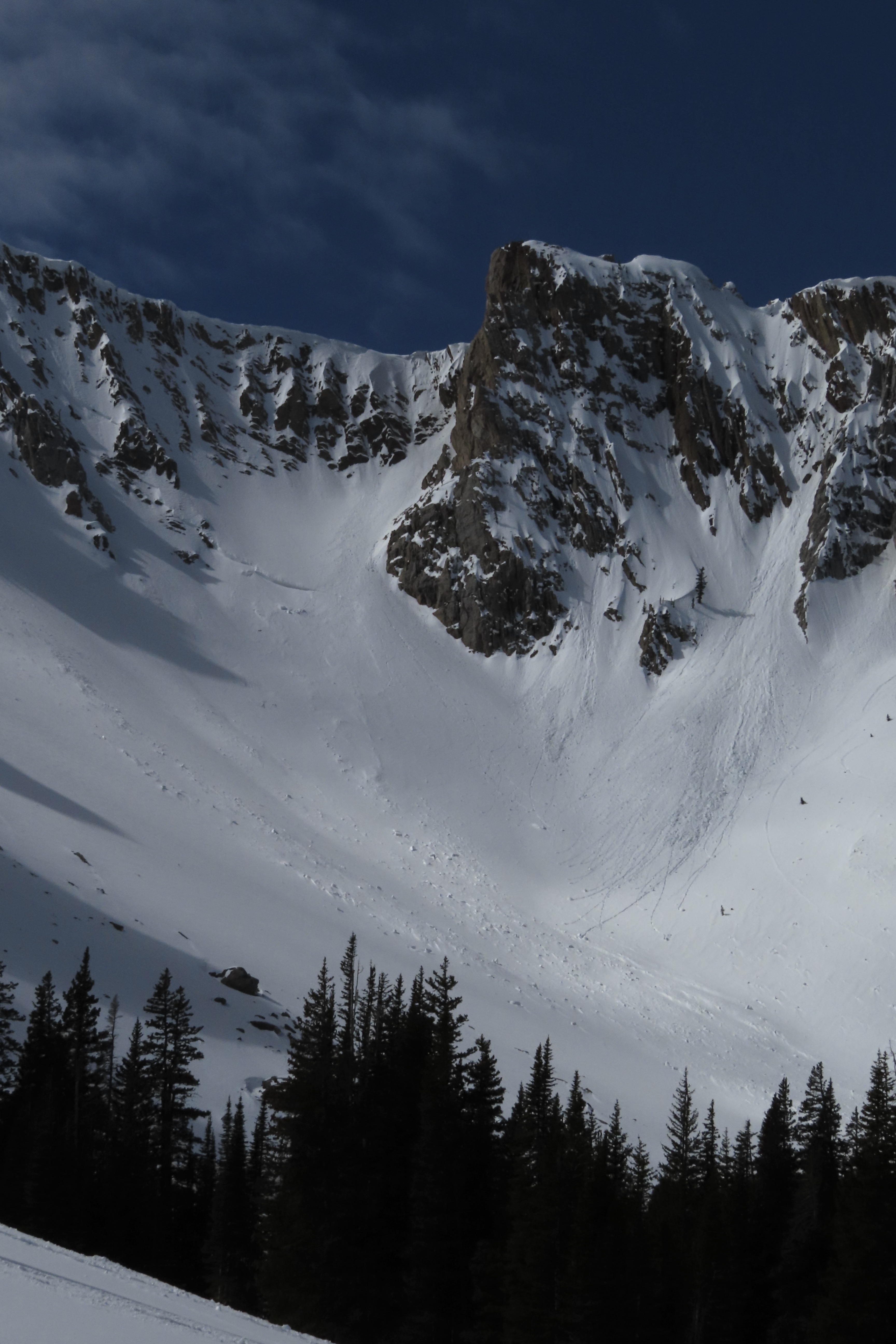
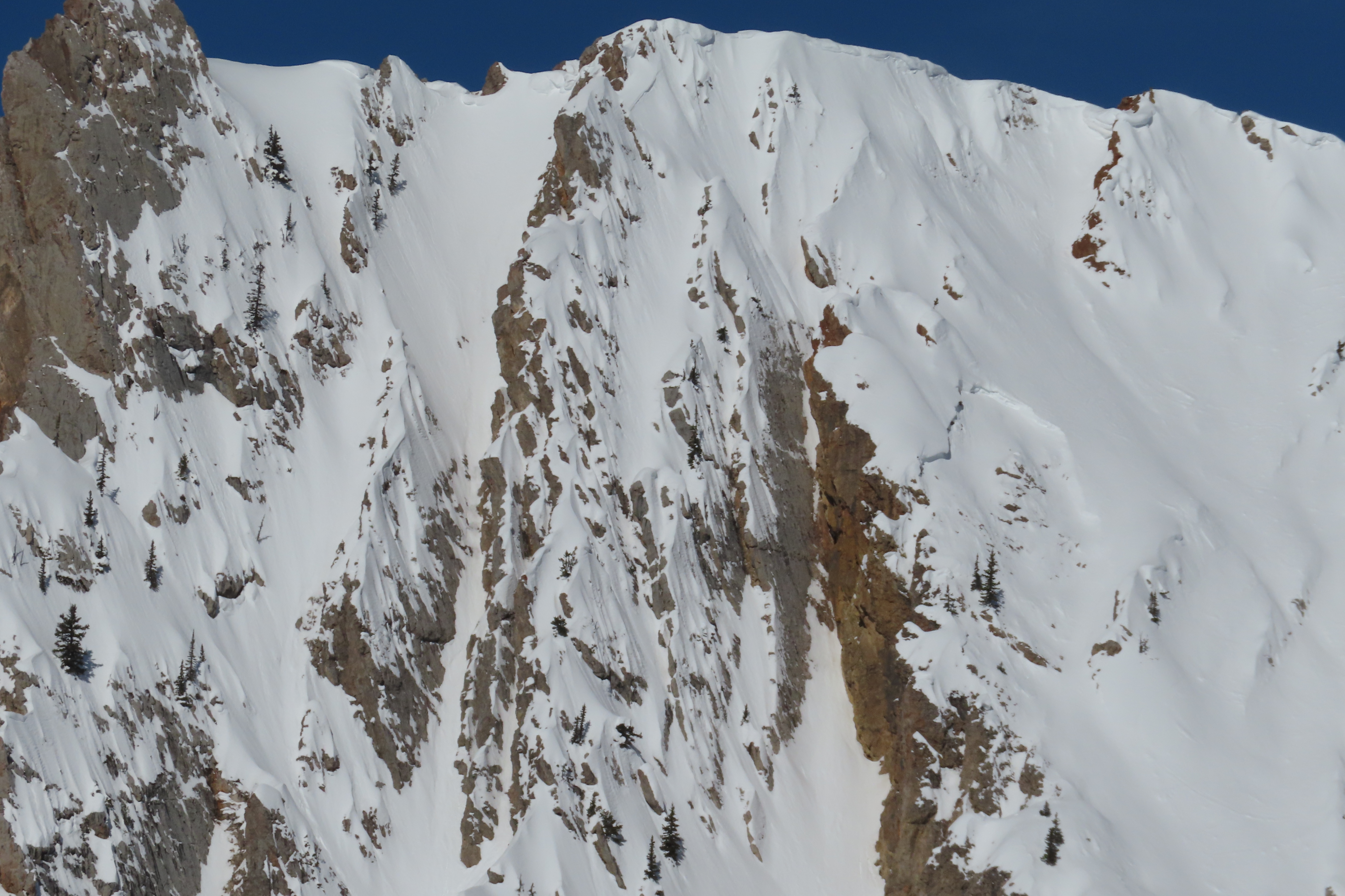
Full Snow Observation ReportOur party took a slow tour up and down the SE face of Blackmore today. New rollerballs were observed on E aspects, and we witnessed a natural D1 loose wet slide occur on the east face of Blackmore at around 1:00. Dug a quick pit on the way up (NE aspect, ~8700’) out of curiosity about snowpack structure and fracture initiation. HS 110 cm. A compression test yielded CTM (15 taps), with a Q2 resistant planar shear at 60 cm depth. Was surprised to not find faceted snow near the bottom of the pit, despite the avalanche incident that occurred the day prior on the northeast ridge of Blackmore on a similar aspect and elevation.
Full Snow Observation ReportI pulled the last sentence of his ob: This suggests significant uncertainty in the distribution of the persistent weak layer in the forecast area.
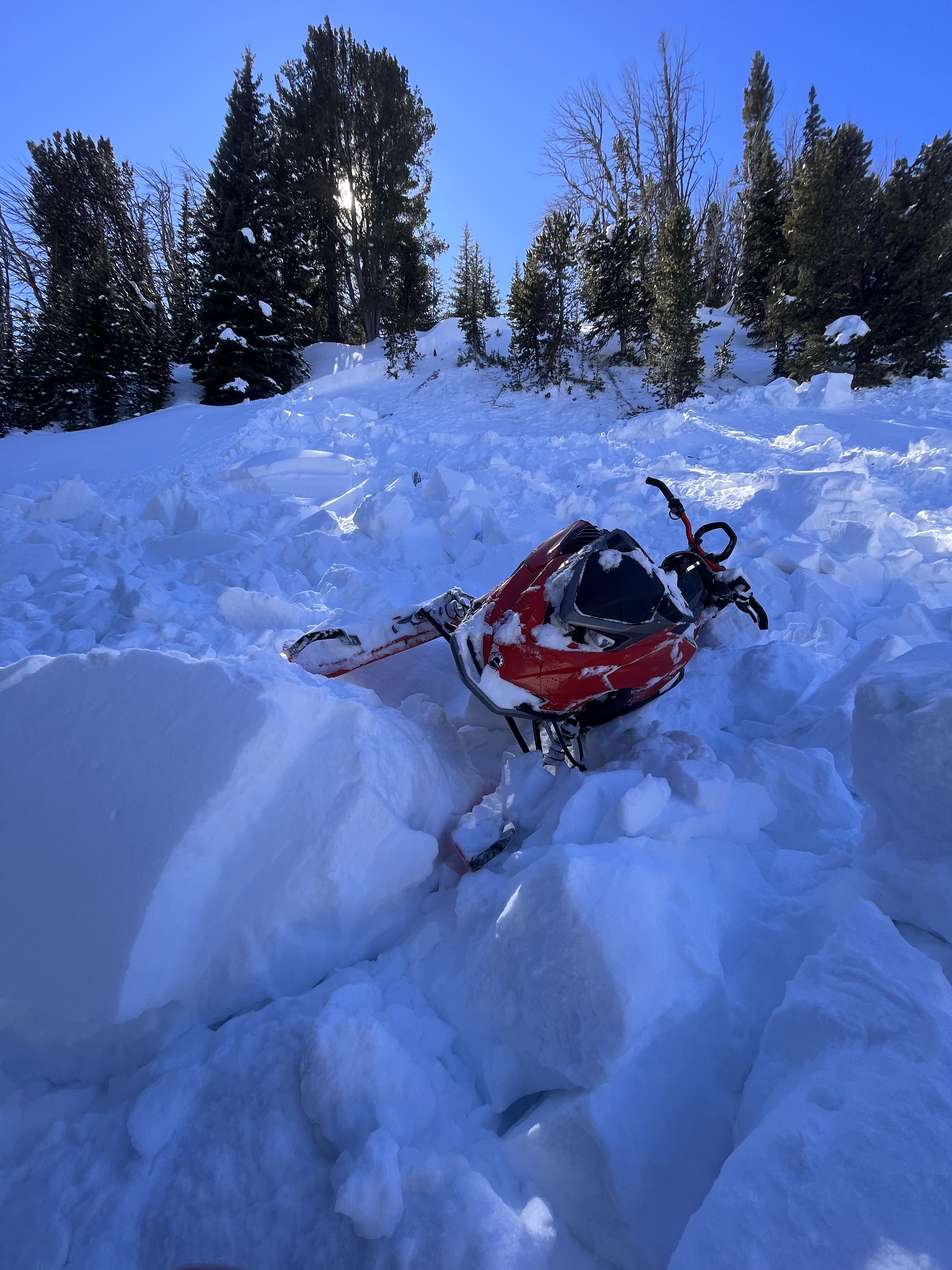
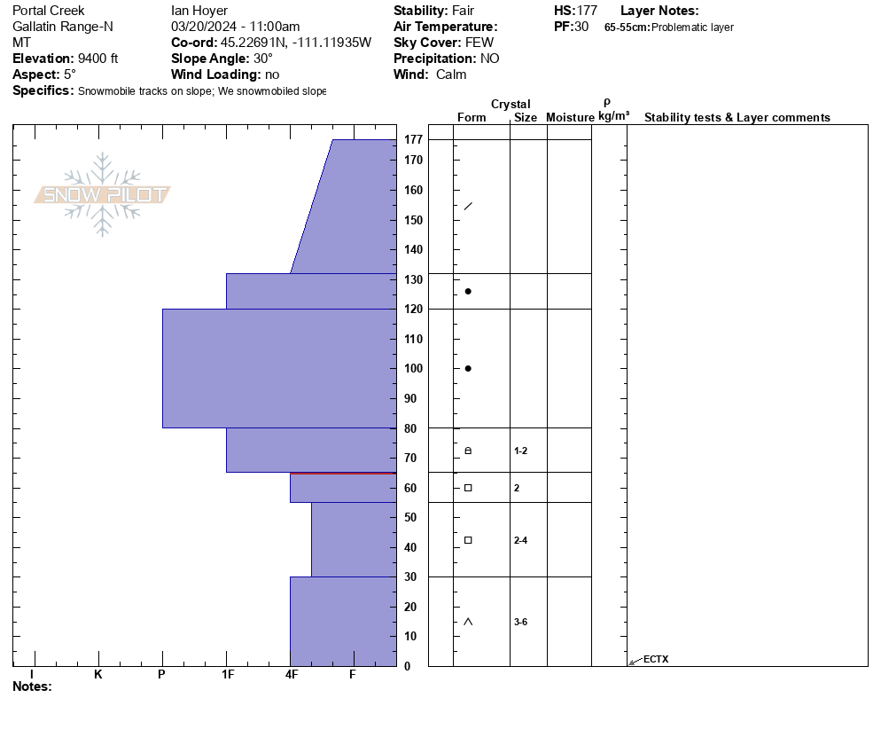
Rode up to the head of Portal Creek to area beneath Eaglehead Mtn and then around to the ridge overlooking Hidden Lakes. The trail is very low snow near the Portal Creek trailhead and the snow was wet to the ground beneath a stout crust. As we got higher up the coverage increased and even sunny slopes only had a couple inch thick surface crust over dry snow. On shady slopes there was still dry snow at the surface. We dug on a N aspect at 9400 ft just north of Eaglehead Mtn. The snowpack was 180 cm deep. We got an ECTX, but the facets near the ground were still soft and sheared off cleanly when pulling on the column.
We had no signs of instability today. The only avalanche we saw was a large slide on Eaglehead that had been previously reported over two weeks ago.
Full Snow Observation ReportGreat day out. Really good to see some more of the terrain up Portal. MODERATE seems like it was appropriate this morning, with the increasing cloud cover I'm not sure if it reached CONSIDERABLE this afternoon, but we were head down by 12:30 so it may well have.

Jordan texted this to me today 3/19. I assume it happened yesterday, or earlier.
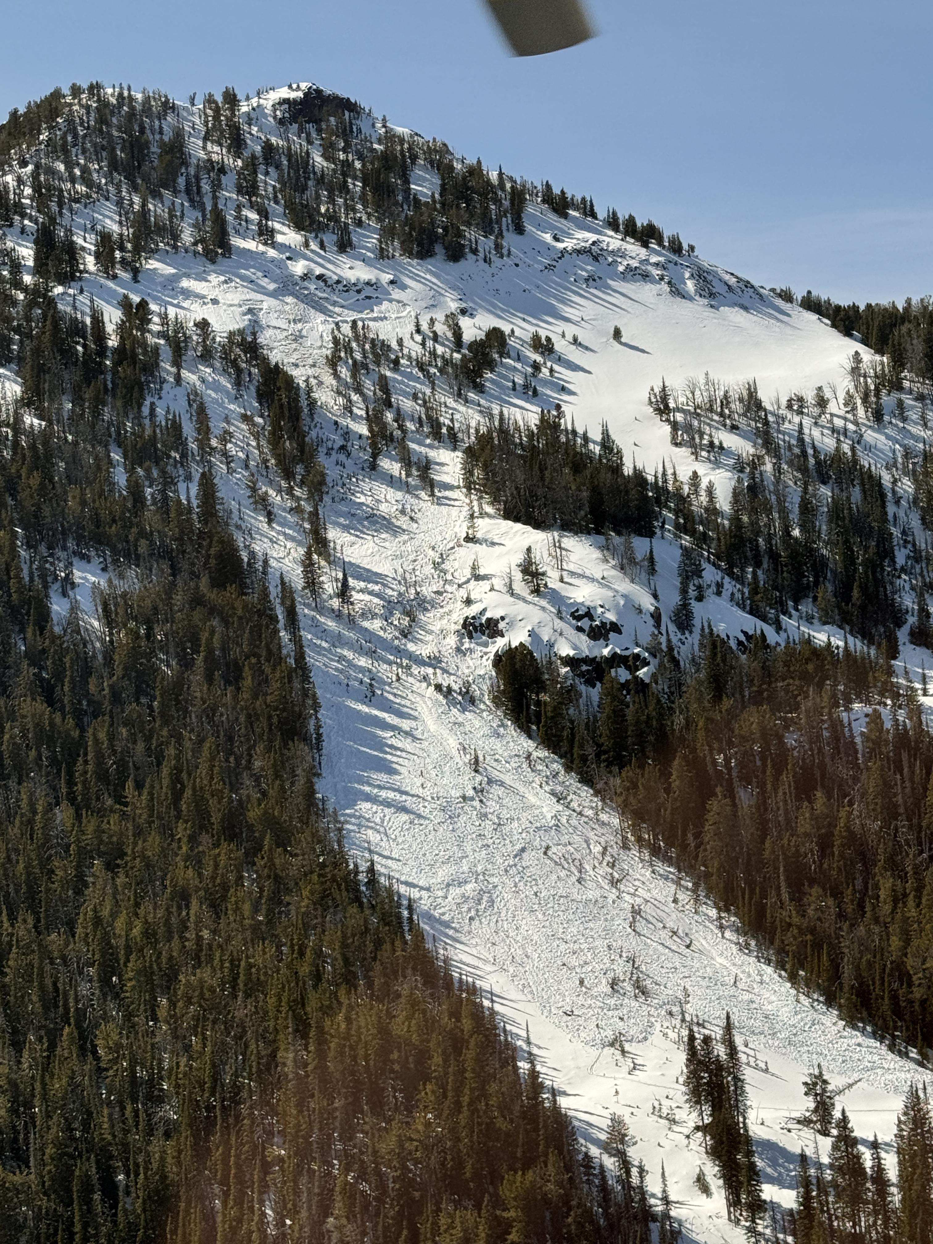
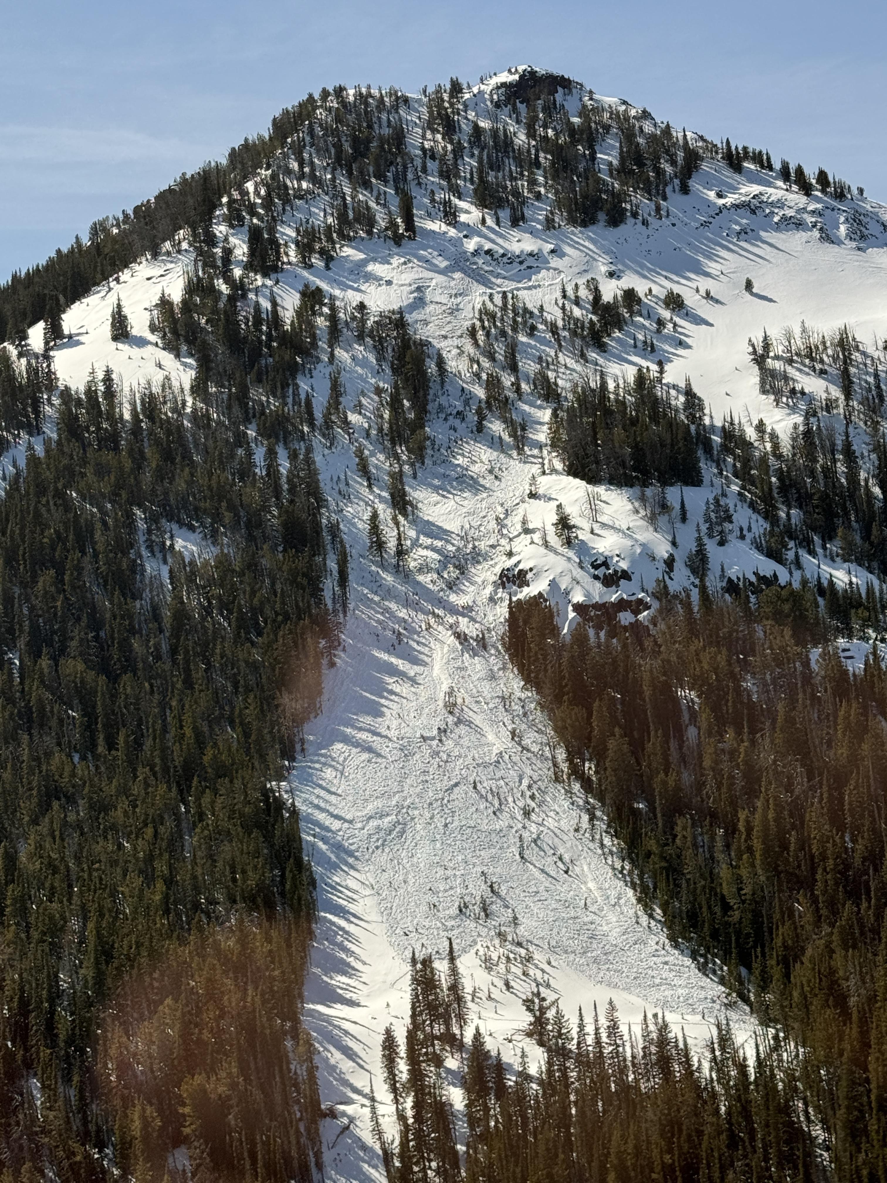
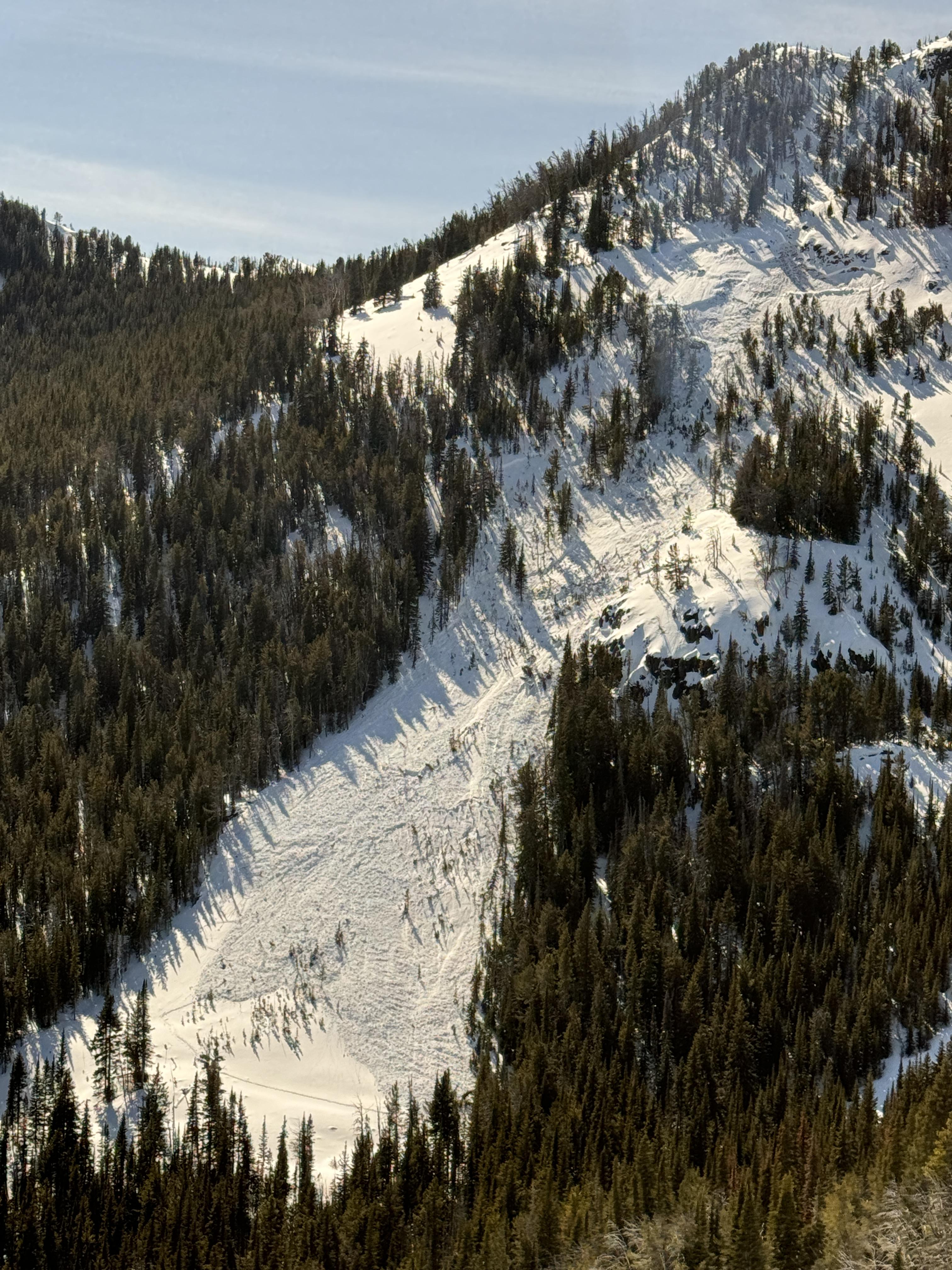
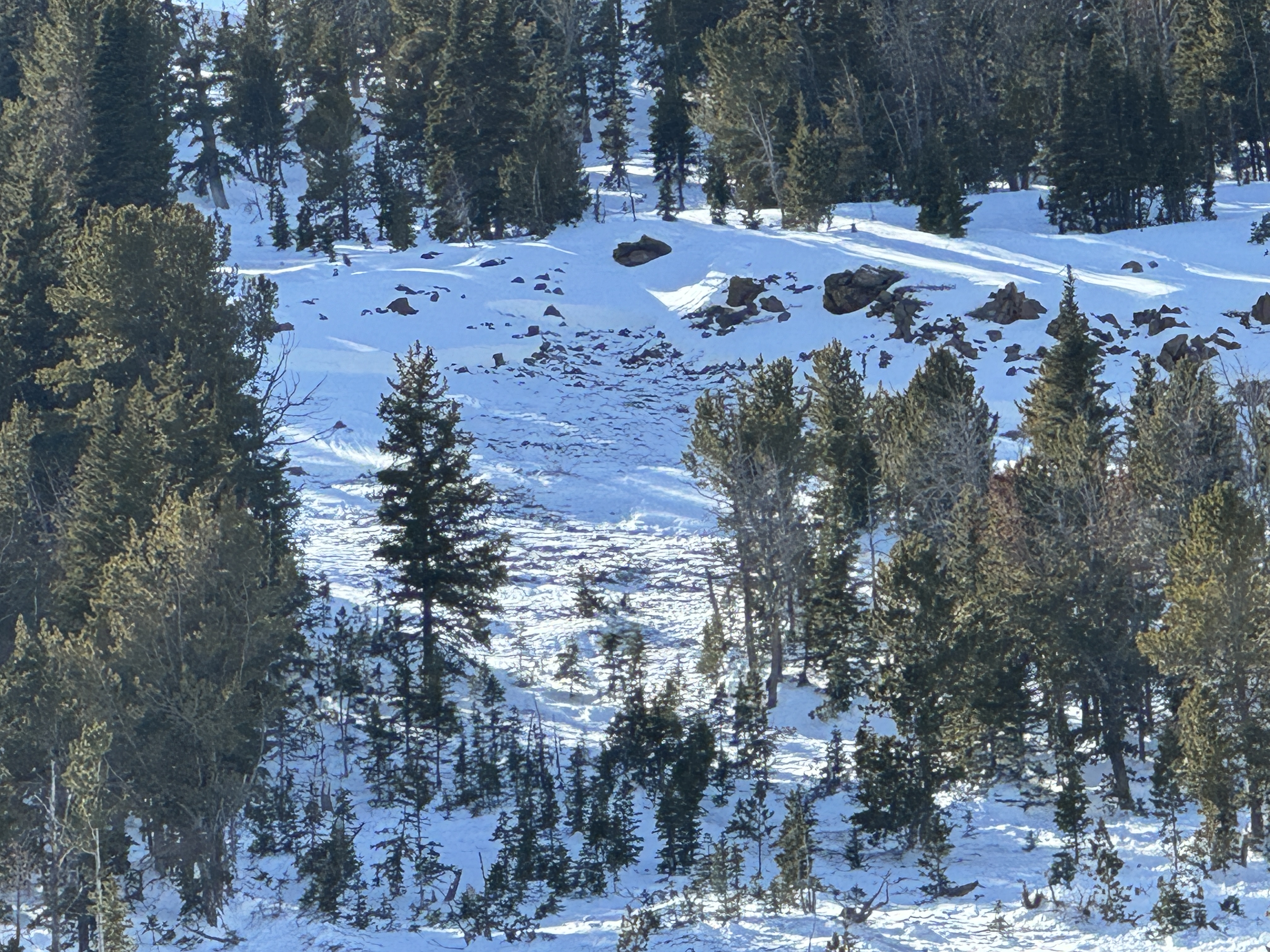
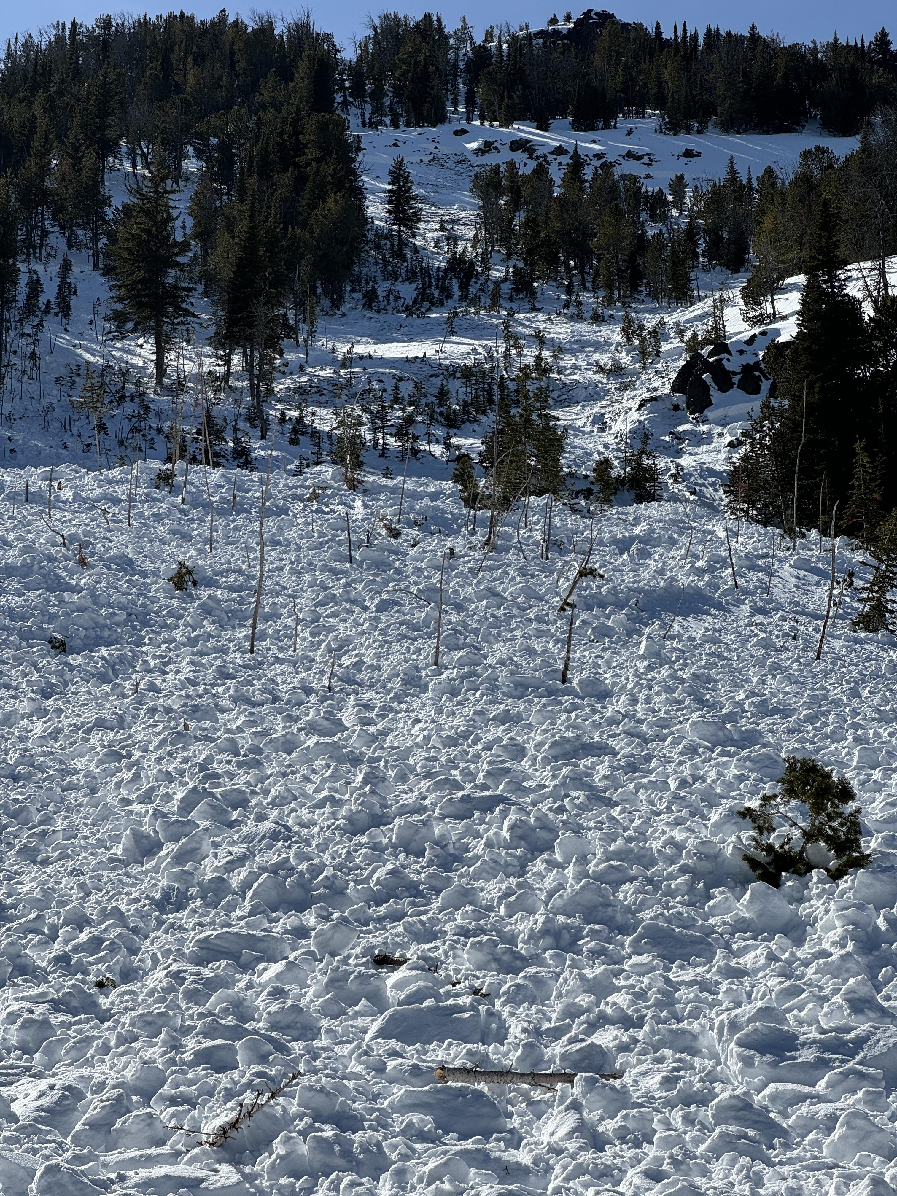
Two skiers were ascending a northeast-facing avalanche path on the northernmost ridgeline of Mount Blackmore around 1 PM when they triggered a large, dry slab avalanche that failed 3 feet deep, 150 feet wide, and ran 500 feet vertical. Debris piled up 4-8 feet deep. The avalanche failed on weak, faceted snow near the base of the snowpack.
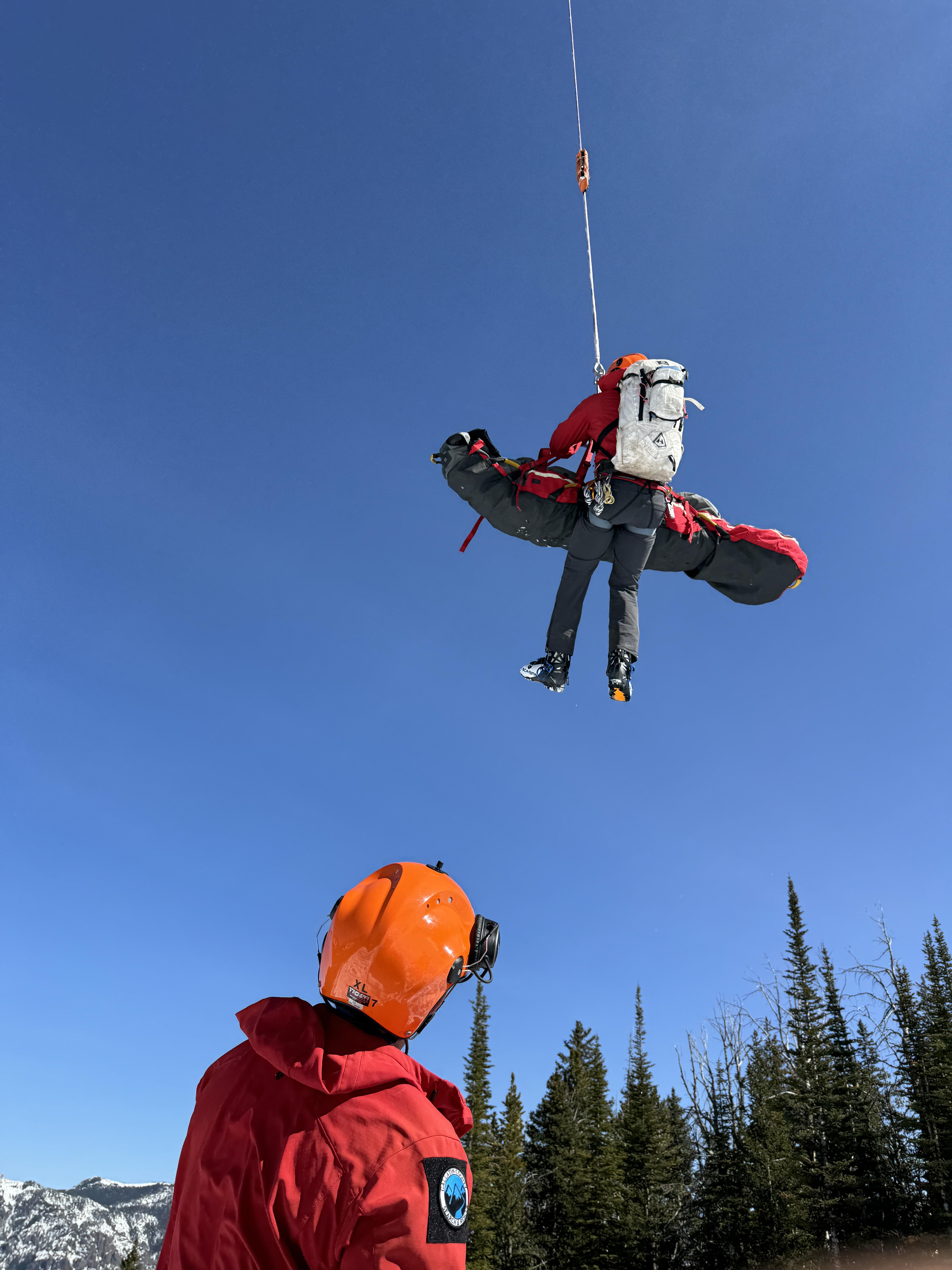
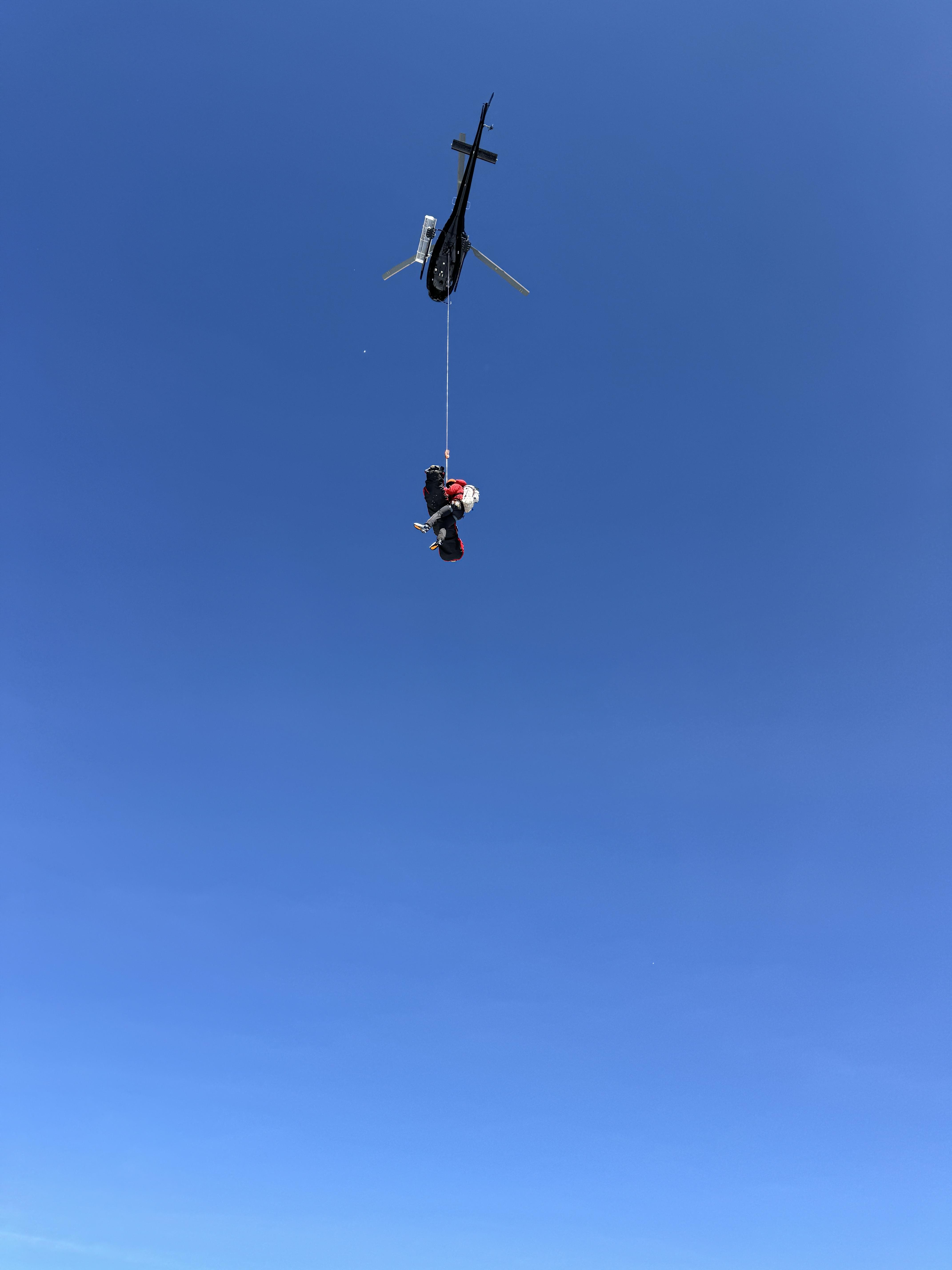
As the group was about halfway up the avalanche path, they saw a small slide initiate to their right and then they heard a loud boom as the rest of the slope collapsed 250 feet above them. The skier lower on the path sprinted to the left into the trees to avoid getting caught. The second skier was 30 higher on the slope. He attempted to run off the slope but was unable to avoid getting captured. He was carried to the bottom of the avalanche path, got submerged in the snow, but thankfully came to rest on the surface. His partner initiated a beacon search and called his name, quickly finding him on top of the avalanche debris. The skier sustained significant injuries. They called 911 and Gallatin Country Sheriff Search and Rescue initiated a response with the Helicopter team. The two skiers worked to address injuries while awaiting rescue. GCSAR inserted a team with a helicopter that provided medical treatment and transported both the injured and uninjured skiers. The GNFAC was on scene to evaluate the scene for hazards to the rescue team.
Full Snow Observation ReportThe skiers stated they were trying to ski Mt. Blackmore but got off track on the logging roads downhill of Blackmore Lake. At the time of the avalanche, they were trying to get back on course. Both skiers were carrying a beacon, shovel and probe. Neither skier was wearing an airbag. They both grew up in Bozeman. One had taken the ASMSU Avalanche Fundamentals course, which was their only formal avalanche training. They did not read the avalanche forecast this morning.
I was teaching a snow science program at crosscut today and our group got propagation (ECTP21) in our test pit on the facets at the ground, ~80cm down. The snow was 85cm deep at that location. We were on an eastern aspect around 6200' in a treed area. The students (bozeman 6th graders) were very psyched about getting to try what they'd seen on the mtavalanche youtube and seeing unstable results!
Full Snow Observation ReportOn the drive up we could see a wet slide from yesterday that occurred in Argentina bowl, human triggered. We also got a report of a wet slide in St Lawrence path in Truman Gulch (not big). We toured along the ridge to the summit of Saddle. By 1000 the snow was softening. We dug below the first cliff band and found 7' of snow, the bottom 2' consisting of weak facets. A Deep Tap Test showed a clean shear at this interface. An avalanche could be triggered by 3 ways: more load from snowfall or wet avalanche debris, melt-water percolating through the snowpack to the facets, or human triggering from a thin spot.
By 1100 the snow was getting wet and punchy at lower elevations. Loose wet slides could trigger dry slab avalanches, a proposition we did not want to hang around for.
Full Snow Observation Report
Moderate rising to Considerable was correct. Deep slabs are on the menu here. Saddle Peak sliding wall-to-wall is a real possibility. Hopefully it will be from a wet cycle after the ski area closes.
Temp at 30 cm under the surface was 0C; at 40 cm it was -1C.

From IG:
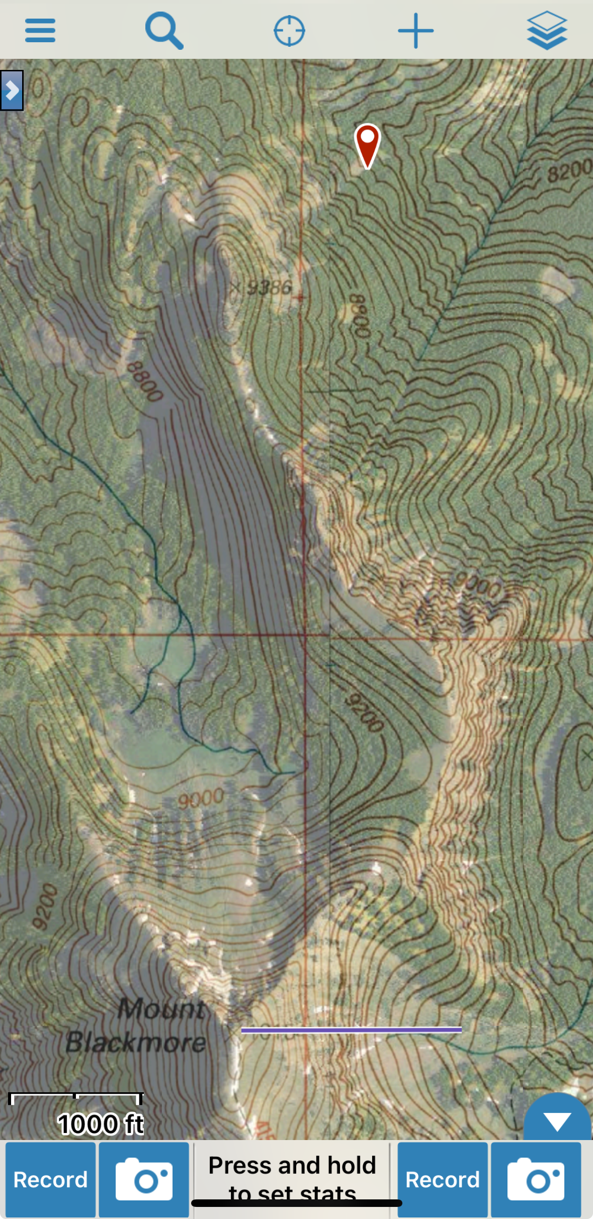
Southeast aspect on Mt Blackmore. Unknown time and date. Elevation 9700 to 9800’
Full Snow Observation Report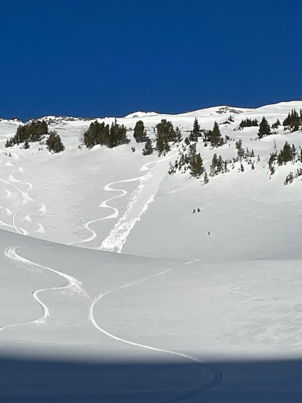
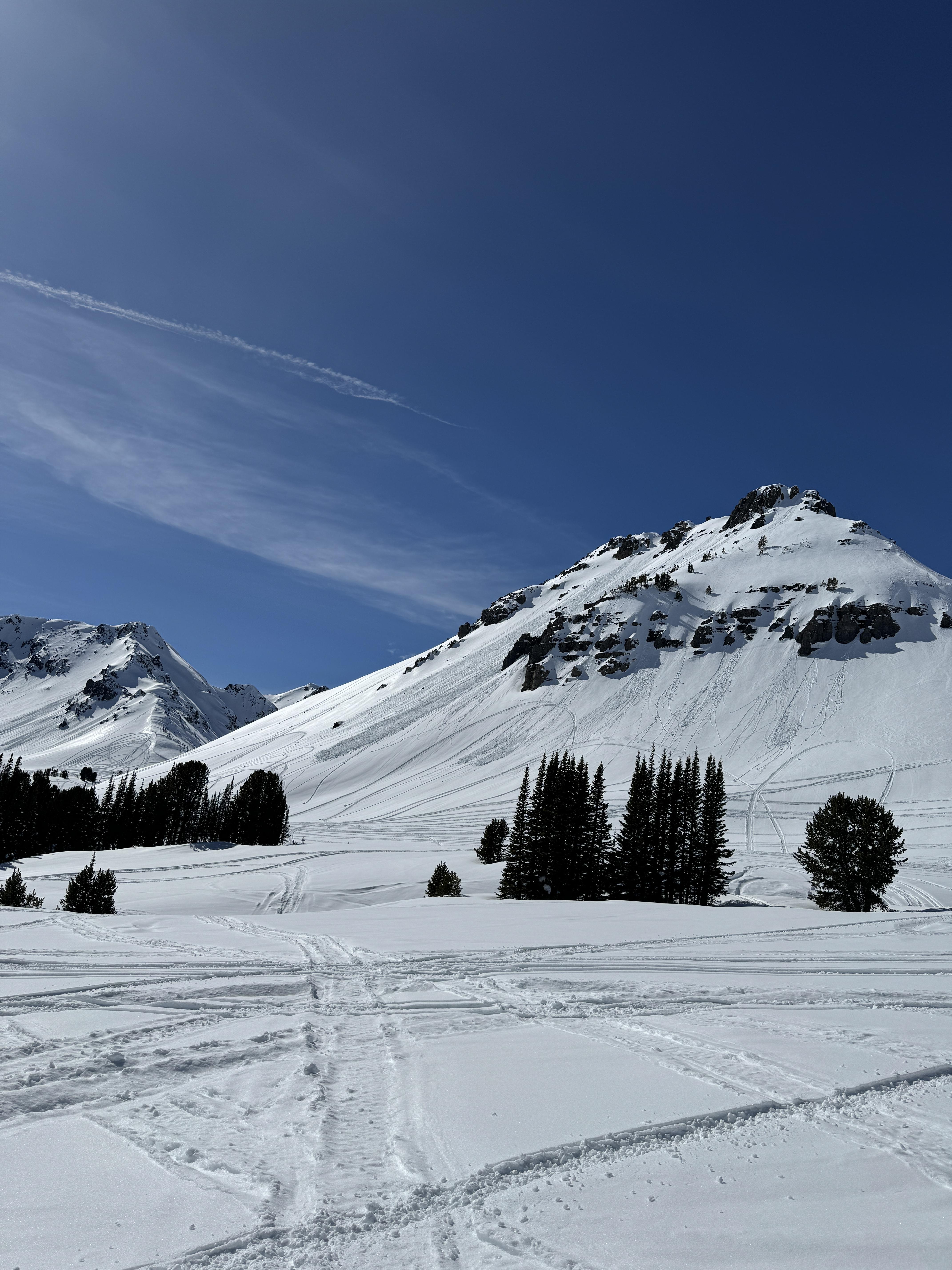
Toured up Mt. Rae in the boulder river drainage. Surprised to still find cold snow in spots and some still being blown around. Had some collapses and shooting cracks on the ascent. Shallow and suspicious snow for sure but a beautiful day out.
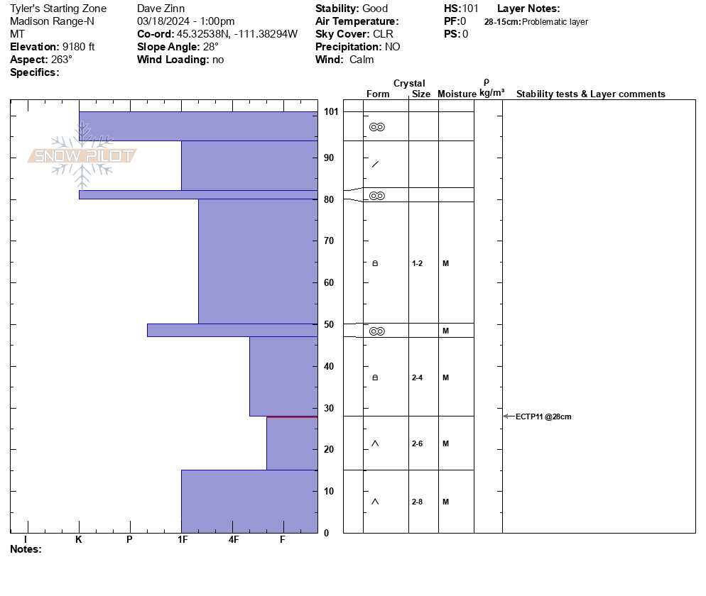
Full Snow Observation ReportWe went on a safari of different snow conditions at Beehive today. We toured up to the prayer flags, looked into the top of Bear Basin on southeast and northeast aspects, and then returned to Beehive through the north edge of Tyler's. We dug a pit in the starting zone of Tyler's and were a bit surprised by an ECTP11 on basal depth hoar. There were percolation columns through the upper half of the snowpack and the lower two thirds of the snowpack were moist. You could make a snowball. The depth hoar remains very weak and F+ hardness. The stout melt freeze crust was 3" thick on the southwest aspect.
Surface snow conditions varied wildly as is often the case in the spring. There was cold powder on the northern half of the compass. The crust had broken down by 11 AM on the southeast aspect and the top 3-5" were wet and rollerballs were easy to push downhill. The southwest aspect was just starting to soften as we left at 1 PM. If we continue to get good overnight freezes, we will only have to worry about wet, loose snow avalanches. Wet slab activity should be limited if there is any.
Full Snow Observation ReportSome of the nicest corn skiing I have had in Beehive back down Tyler's. The danger was MODERATE for wet snow and dry snow avalanches.

This is a steep gully and can avalanche from very high. Almost all debris ends up at the bottom of the climb.
We rode from Taylor Fork through Cabin Creek on March 17. We saw a few recent slab avalanches that happened after the last snowfall, and some recent natural wet loose avalanches, and a cornice fall. Both (all) of these types of slides are possible for someone to trigger the next 2-3 days.
Melt freeze crust on sunny slopes was 1-1.5" thick with dry snow below. Softened on south-southwest slopes by midday to early afternoon. Shady slopes seemed to be staying dry up high. Skies were mostly clear with calm wind.
Full Snow Observation Report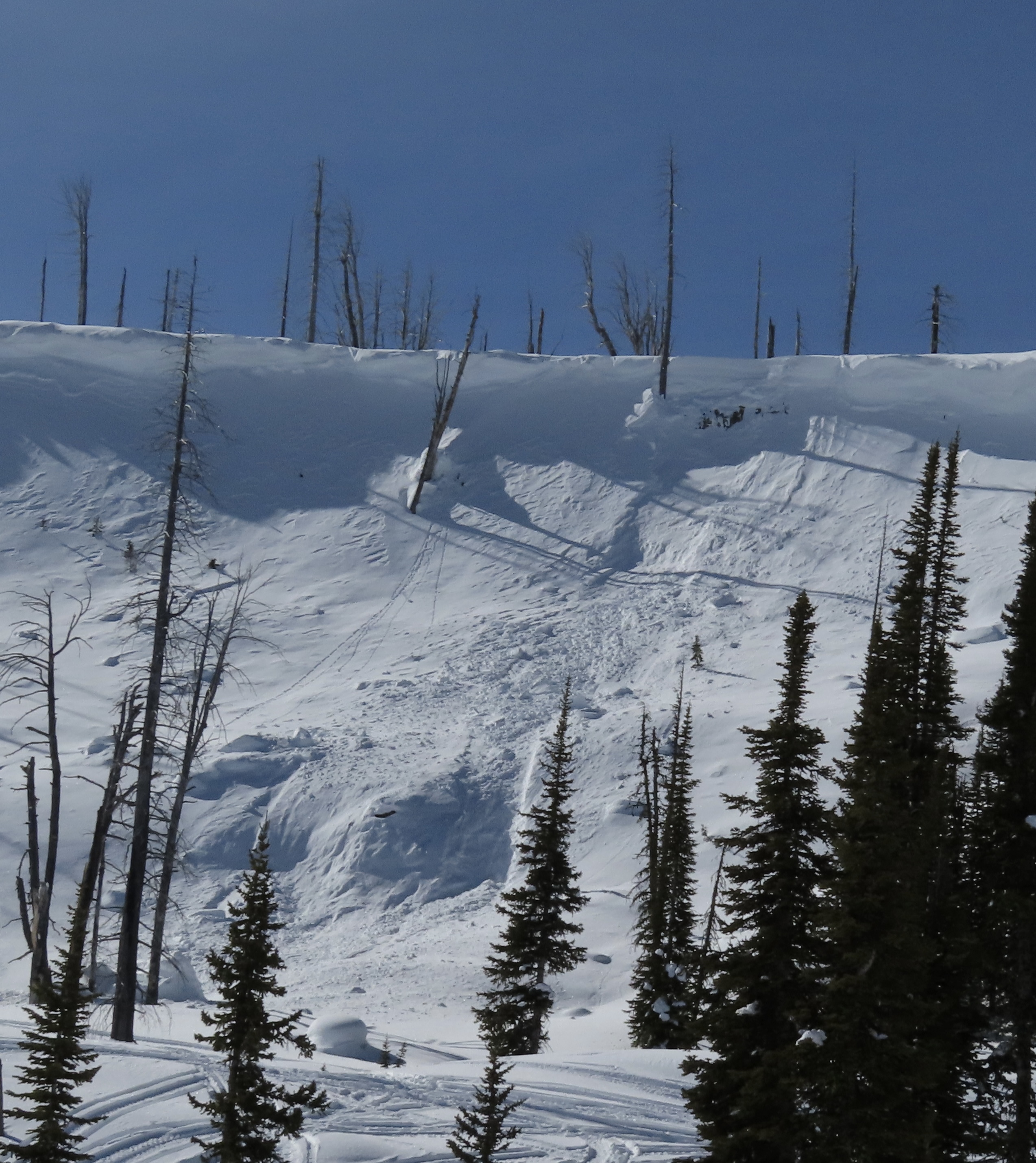

We rode to the Wilderness boundary near Astral Lake and skied a small loop through to Green Lake. We then rode across to Lulu and Daisy Passes to look for avalanches. We saw several wet loose slides on south faces. We saw no new deep slab avalanches since Alex was there last week. After a late start due to some sled issues, we dug one pit looking for new upper level weak layers. ECTNs on hardness changes. We did not note any new persistent weak layers.
While it remains possible to trigger very large avalanches on persistent weak layers near the base of the snow pack, it is clearly becoming less likely. Unfortunately, if you triggered one, it would be no less deadly.
Full Snow Observation ReportThe danger seems to have dropped to MODERATE. Very large avalanches remain possible but they are becoming less likely.

Had a pretty interesting collapse this afternoon while touring up the east ridge of Beehive. The slope I was on I measured at 30° at the highest, was below treeline but in a small meadow. The surface had melted and refroze. As I was touring across the small slope stomping to the to break the surface to set a better skin track the whole piece broke (150' wide by 50' down) together and moved down slope about 6". I quickly dug a little bit where it broke from the rest of the slope and it seamed to break near the ground, ~ 50cm and with the naked eye I could see large depth hore crystals and little to no rounding.
While I do think it was simply a collapse I was very surprised this happened and the way this whole piece moved on such a low angle slope. I hadn't seen something like this before. Guess it lines up with just how weird this season has been.
~8560' west facing
45.31868, -111.38395
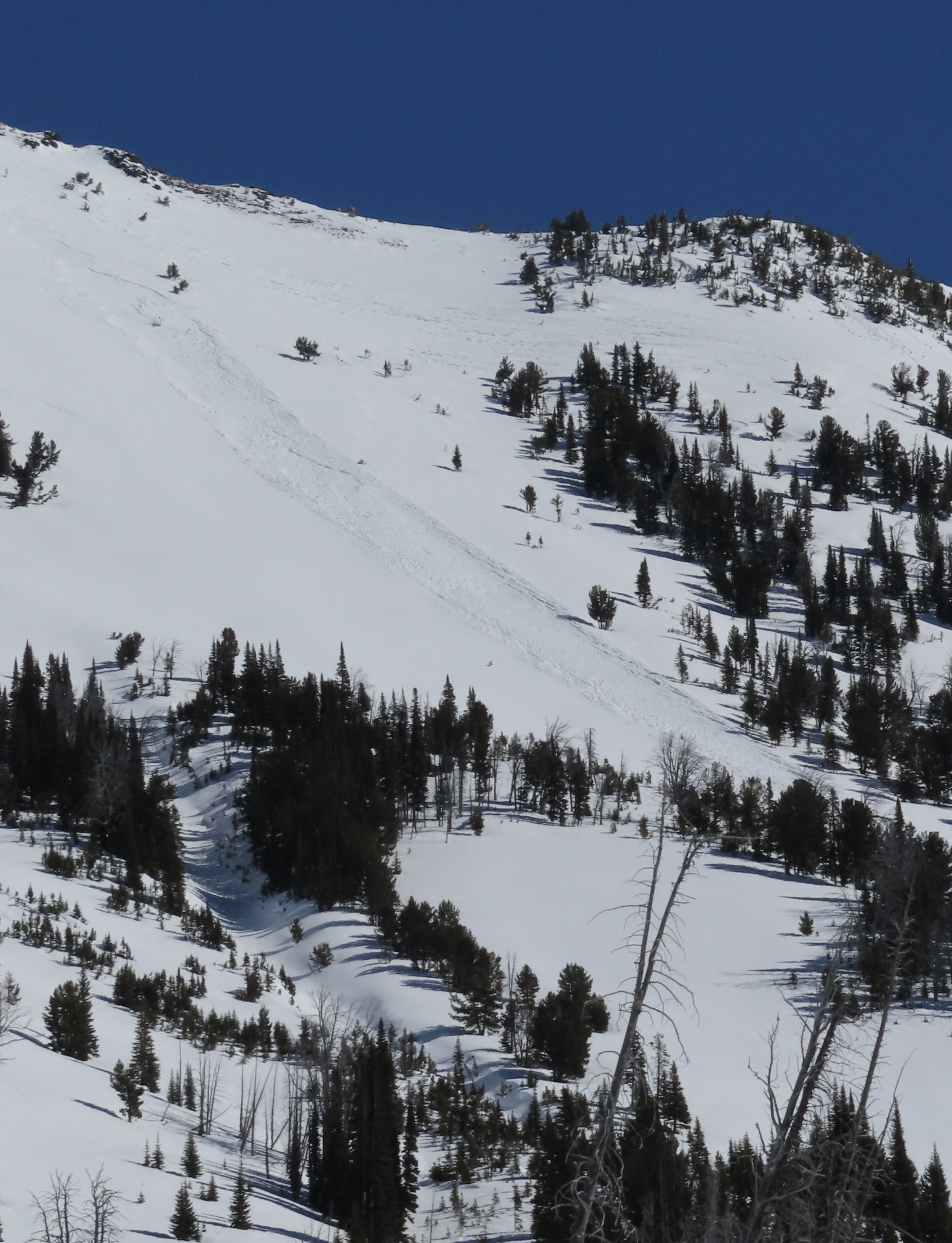
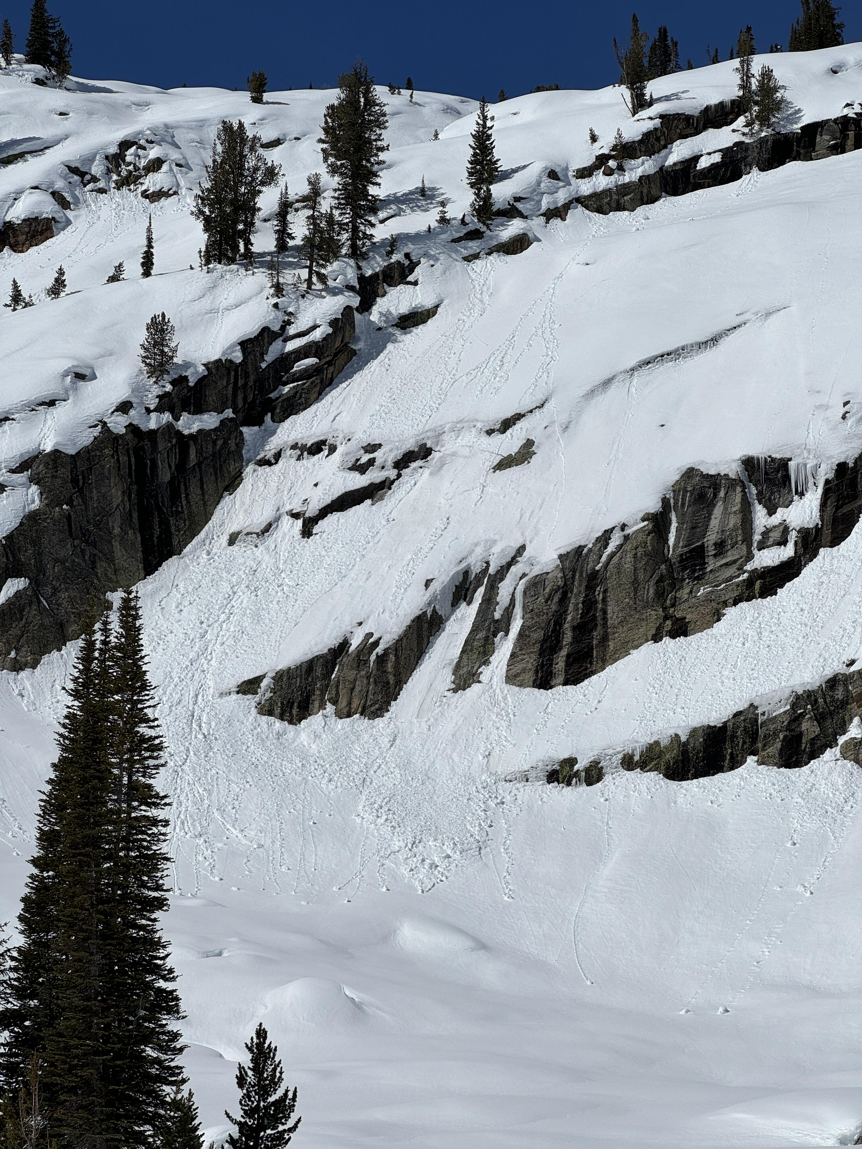
Full Snow Observation ReportWe were skinning in the valley to the East of Woody Ridge near the North end and observed a wet slide occur naturally due to a point release, moving about 500 ft downslope. While that was occurring it remotely triggered a dry slab avalanche approx. 50-100 ft adjacent on the same slope and elevation. The crown appeared to be 3 ft deep, possibly thicker, but we were viewing from afar so hard to tell. 9500 ft elevation, East aspect. 12:02 PM March 17, 2024. Air temp approx. 30F clear skies all day.
Full Snow Observation Report
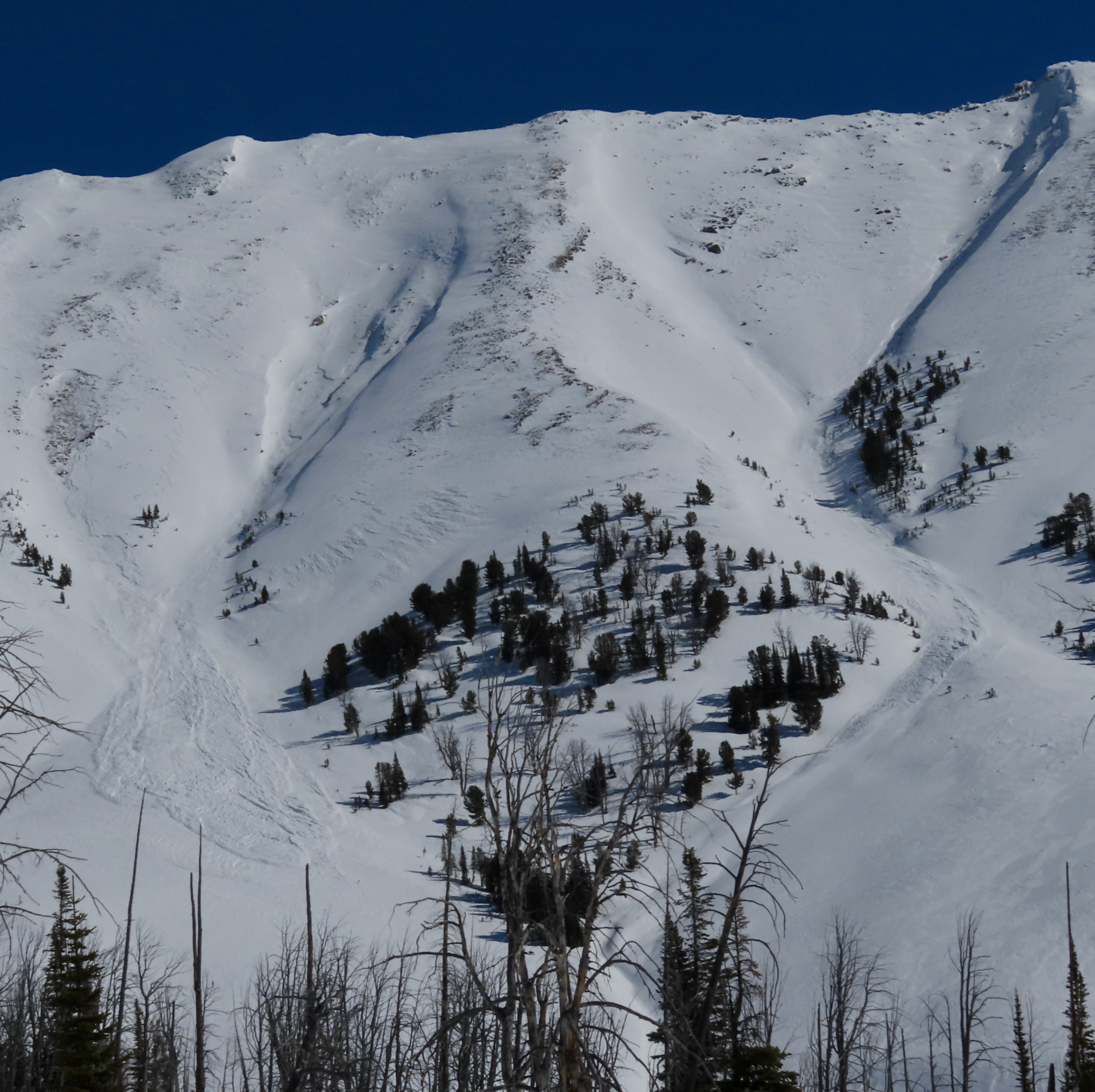
Just got out from a hot few days at the Woody Creek Cabin. A highlight of the trip was watching a natural avalanche come off the unsupported northly end of the Climax slide path on Sunday the 17th. We believe it was remotely triggered by a wet loose point release which occurred a second before and ran immediately adjacent to the slab avalanche (see photo). Our best estimate for size is R2-D2, approximately 1.5m deep, and based on Google Earth measurements 75-100m wide, running about 200m. This occurred just before noon as the path received direct sunlight.
We also saw numerous roller balls and D1-1.5 loose wet avalanches in the Climax Path. The largest of which ran about 250 m, likely a D1.5 as it didn't have the mass for a D2 despite the distance.
We travelled in the trees on the east side of the valley, and gave run-outs a large berth. We skied moist snow on south aspects in Olie's Woods.
Full Snow Observation Report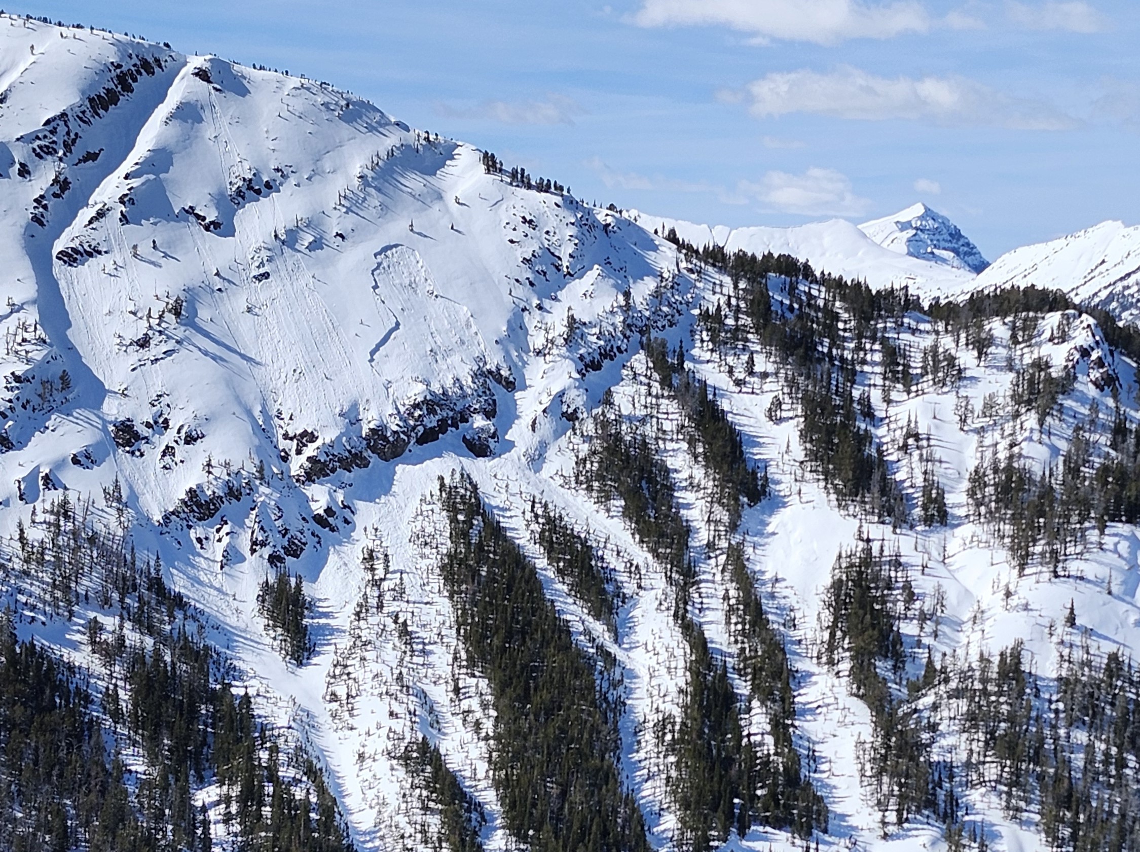
Rode into The Throne via Battle Ridge on Sun. Trail in is heavily bumped and dirt starting to show. Guessing it will be about finished by the end of the week with the higher temperatures. Skied a couple of laps on The Throne. Top layer was soft/slushy, or corn like, but the rest of the snowpack was one finger hardness until the bottom 10". Bottom of the snowpack remains rotten. We saw two small point releases that were maybe 15' wide, caused by warming. Otherwise the snowpack felt stable in our area.
Traveled N to a subridge of Naya Nuki and found similar results. No recent avalanche activity noted.
Full Snow Observation ReportWe skied into Frazier Basin from the Fairy Lake road. On north facing slopes the snow was dry. On south facing slopes there was a 1-2" melt freeze crust which was softening on southeast-south facing slopes around 11am-noon. Snow was generally dry below that crust, probably got a little more wet today than yesterday.
We saw a few natural wet loose avalanches run throughout the middle of the day in sunny, steep rocky terrain. There were at least 4 old, deeper avalanche crowns, most of which had been reported and occurred 1-2 weeks ago.
We dug a snowpit on a north facing slope at 8,300'. Snow depth was 140cm and there was weak depth hoar (4F hardness) 30-40cm above the ground, below a 2-3 foot deep hard slab. Compression tests broke on the depth hoar/facets at CT29 and CT(30+1), sudden collapse/Q1.
Skies were partly cloudy in the morning and cleared with scattered clouds through the day. Wind was calm.
Full Snow Observation Report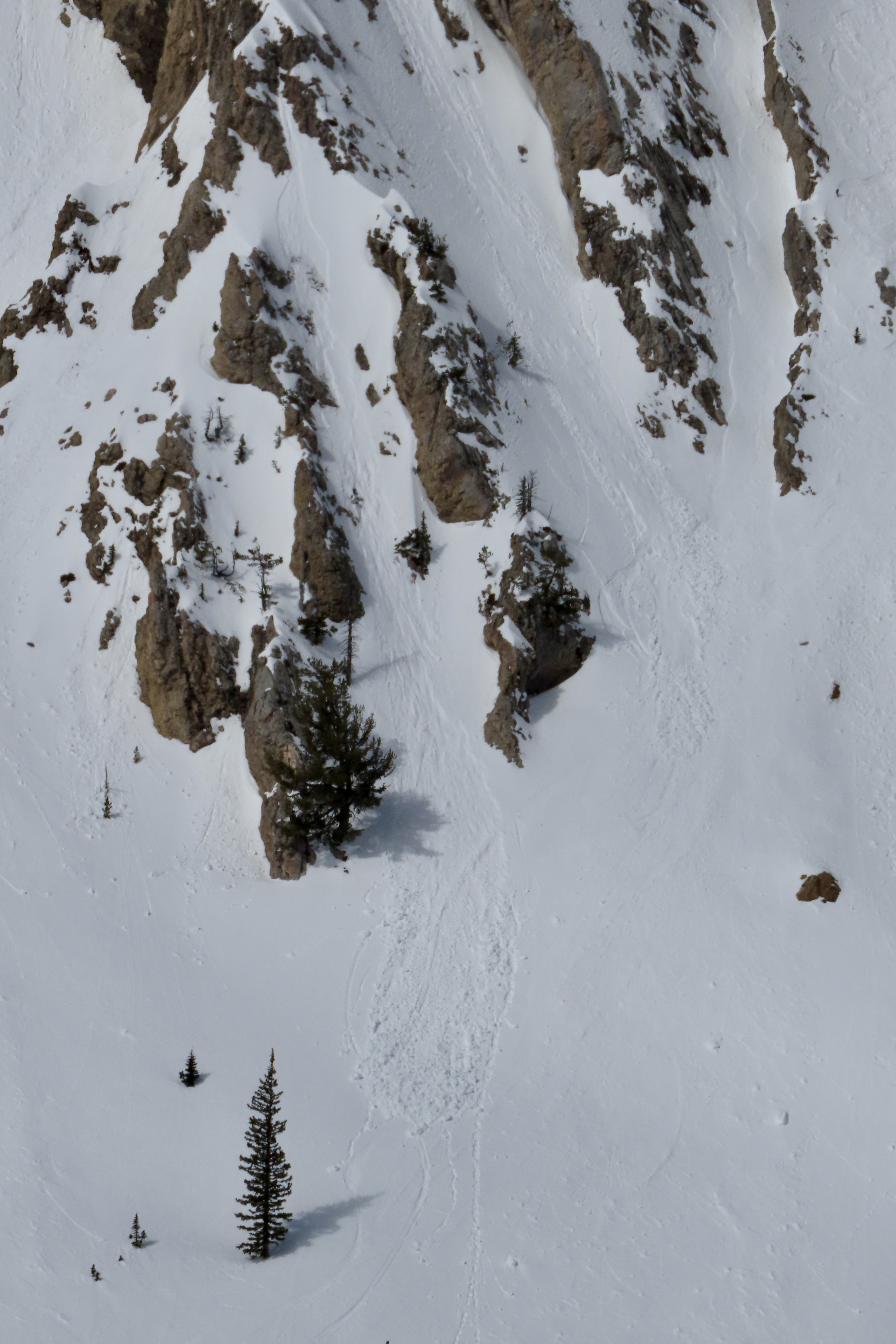


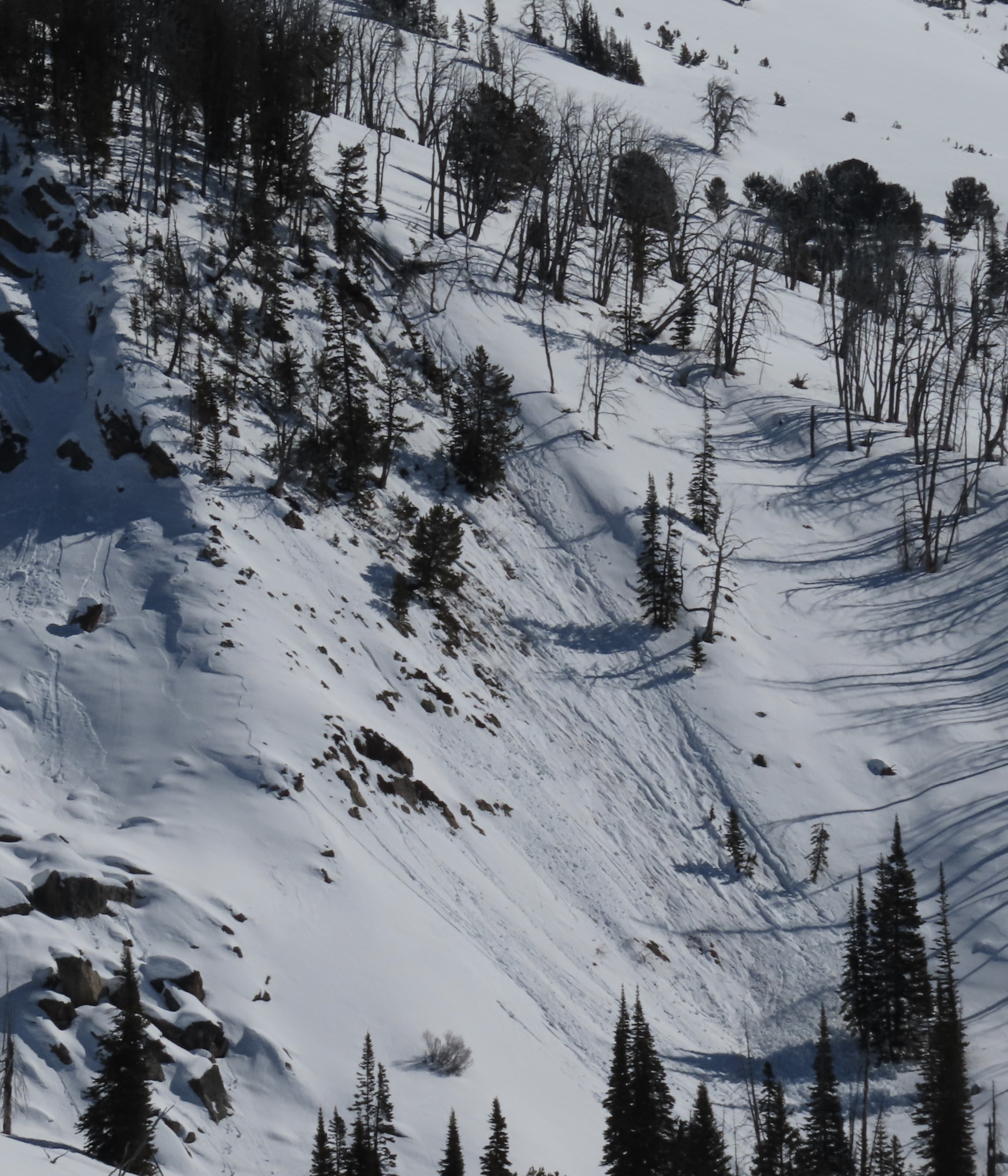
Avalanche broke about 400ft wide and slid for 250 ft. 4-2ft deep at the crown
Full Snow Observation Report