Photos
|
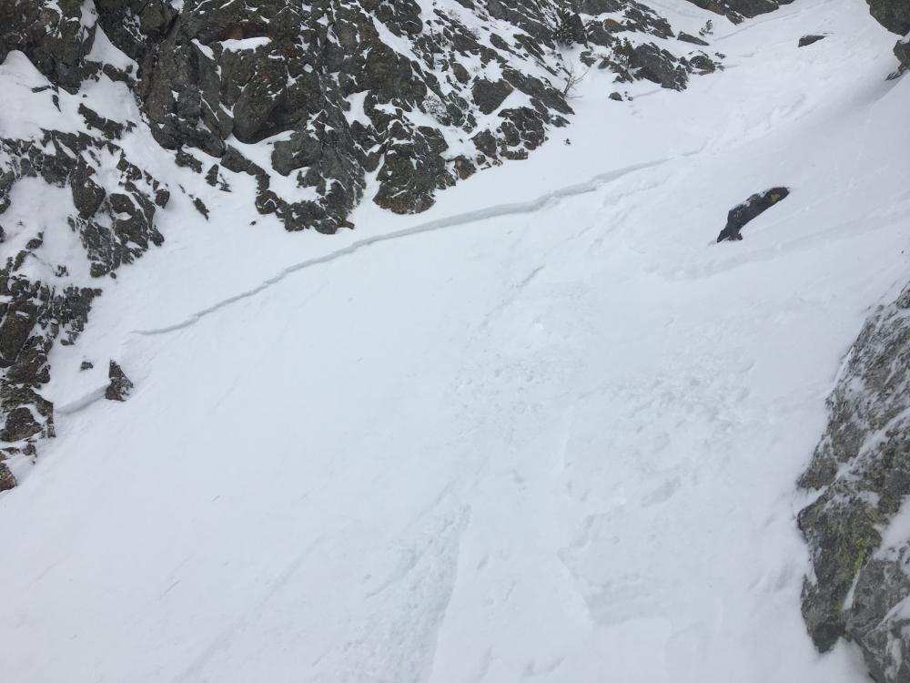
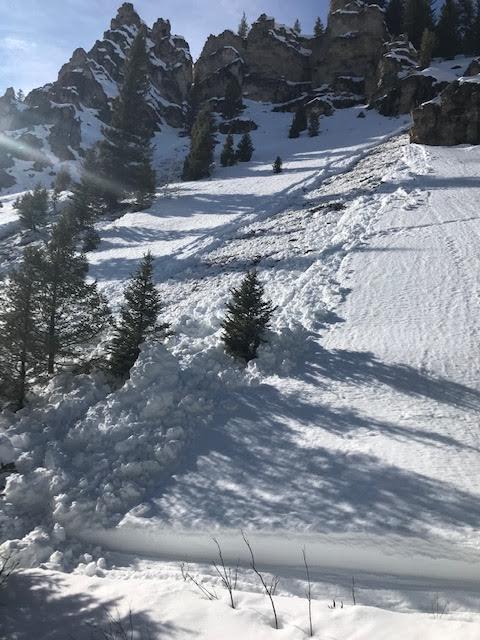
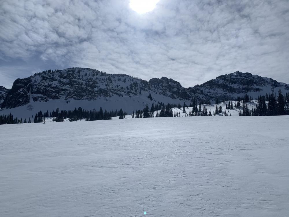
Northern Madison, 2020-03-09 After a jump turn into a ski cut to one of those protected spots, my partner triggered a storm slab about 4” thick that propagated from the edge of our boot pack on one wall of the chute to the other wall about 20/30’ across and then ran the rest of the chute onto the apron about 300’ below us. No one was caught or injured. We skied out of the chute on the crust bed surface and spent the rest of the day enjoying some low angle trees. The chute was around 40° at 9,000’-9,500’ and west facing. Photo: C. Oshiro-Leavitt Link to Avalanche Details |
|
Northern Gallatin, 2020-03-08 Dry loose avalanches on Blackmore. The snow stayed surprisingly cold and dry throughout the day. Photo: R Rustigian Link to Avalanche Details |
|
Northern Gallatin, 2020-03-08 A falling cornice triggered a large slide in the wet snow on an east facing slope up Hyalite. It was north of Mt. Blackmore and west of History Rock. Photo: R. Parsons Link to Avalanche Details |
|
Northern Gallatin, 2020-03-08 A falling cornice triggered a large slide in the wet snow on an east facing slope up Hyalite. It was north of Mt. Blackmore and west of History Rock. Photo: R. Parsons Link to Avalanche Details |
|
Northern Gallatin, 2020-03-08 A google earth view of the cornice triggered location, 45.4626N, -111,0219W 8766'Photo: R. Parsons Link to Avalanche Details |
|
Northern Madison, 2020-03-07 From obs.: "photo of “Avalanche Peak” just south of Lava Lake driving north on HWY 191, all likely from yesterday (3/6)." Photo: S. Jonas Link to Avalanche Details |
|
Out of Advisory Area, 2020-03-07 Obs from near Mill creek: "...We saw a natural wet slab that had released recently on a nw slope at around 7000’ (WS-N-R1-D1.5-G). Also got a big collapse on a sw aspect at about 7500’ on a moist layer of 4mm depth hoar. HS was only about 50cm where I got the collapse. Overall the snow was some wet hot garbage on all aspects,..." Photo: A. Schauer Link to Avalanche Details |
|
Cooke City, 2020-03-07 From e-mail: "...some wet loose avy activity observed today just west of Cooke City (south aspect, around 8200'). Overall though, minimal wet avalanche activity observed with this significant warm up..." Photo: B. Fredlund Link to Avalanche Details |
|
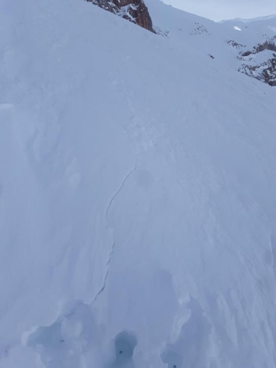
Southern Madison, 2020-03-07 From obs: "On Thursday my group skied a few lines off the Lee side of skyline. Generally, all stability observations but one were good except for 1. We were skinning cross slope along the top of the apron toward the bottom of a couloir on the north aspect of White Peak to recon the couloir for possible ascent and skiing. As we approached the opening of the couloir, a large collapse occurred on a firm wind slab and a crack shot out across the bottom of the couloir an unknown distance. (We deemed it unwise to further investigate given the slope angle was nearly 40 degrees. It was quite puzzling the slope did not slide upon collapse and we were not about to further poke that bear.) Photo: Z. Ferry Link to Avalanche Details |
|
Southern Madison, 2020-03-07 |
|
Southern Madison, 2020-03-07 |
|
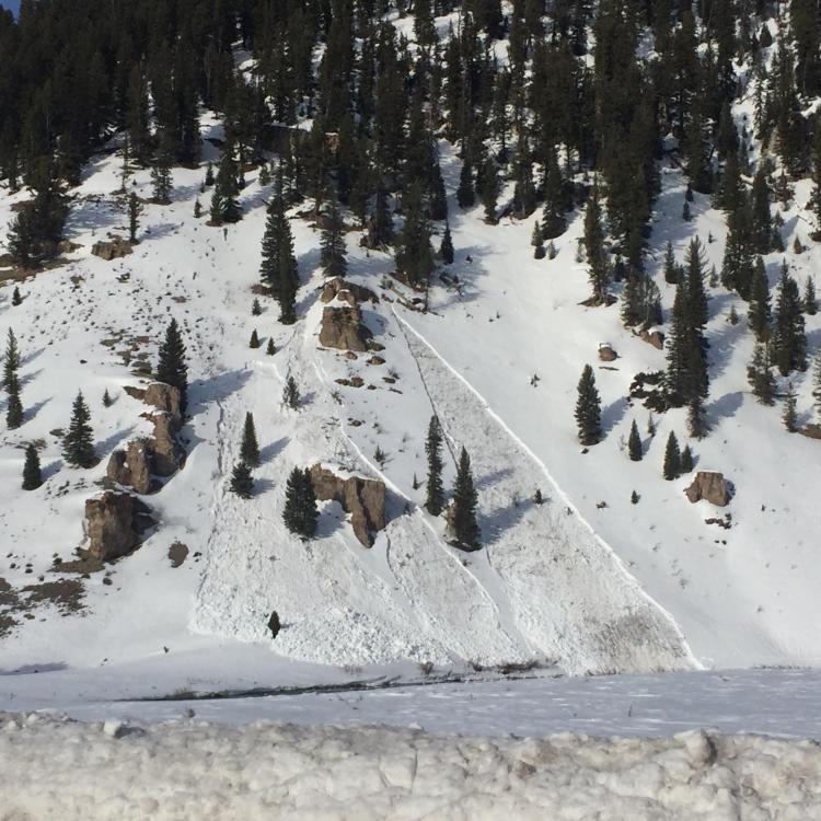
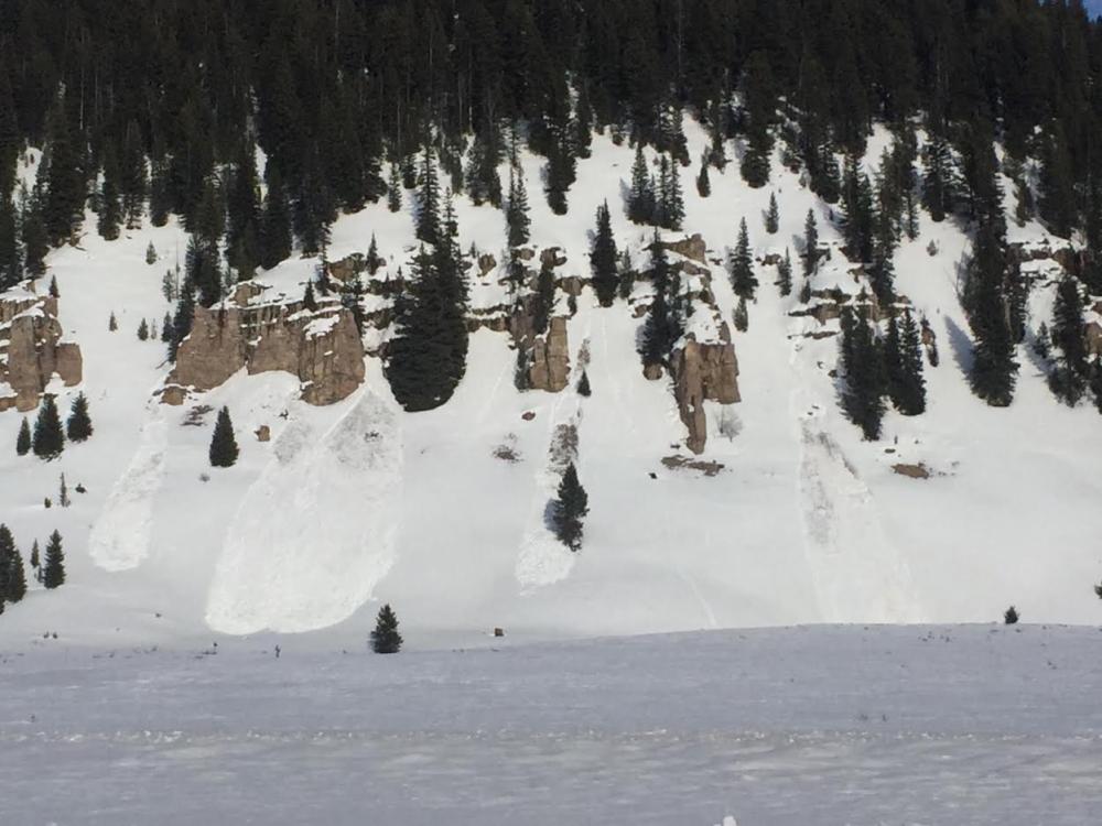
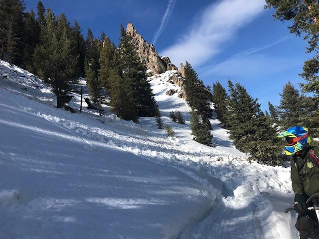
Southern Gallatin, 2020-03-07 |
|
Southern Gallatin, 2020-03-07 |
|
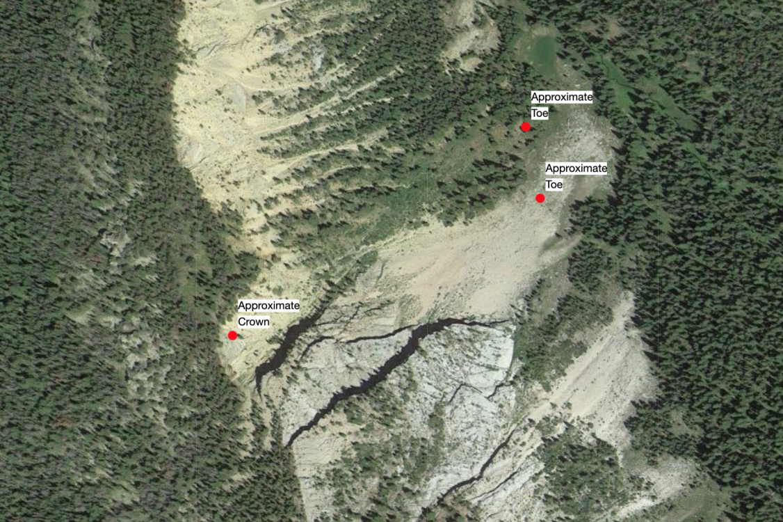
Southern Gallatin, 2020-03-05 From an email, "It did look like the east face of Ramshorn Peak slid pretty recently. The blowing snow and clouds weren't conducive to good pictures but you can see the crown line below and to the right of the summit. Looked like a cornice fall triggered it." Photo: B. Richards Link to Avalanche Details |
|
Northern Madison, 2020-03-02 New cornice drop in 2nd Yellowmule. Cornices are growing to enormous sizes, stay far back from the edge as they could break back farther than you expect and could trigger avalanches on slopes below. Photo: GNFAC Link to Avalanche Details |
|
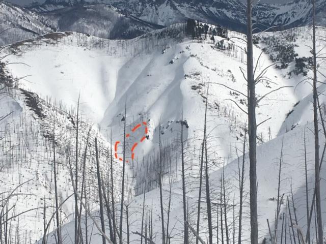
Northern Gallatin, 2020-02-29 "Saw this avalanche that broke on a NW facing slope around 9300’. Looks to have failed on the facets at the ground ... the crown was 4-5’." Photo: M. Murray Link to Avalanche Details |
|
Northern Gallatin, 2020-02-29 "Saw this avalanche that broke on a NW facing slope around 9300’. Looks to have failed on the facets at the ground ... the crown was 4-5’." Photo: M. Murray Link to Avalanche Details |
|
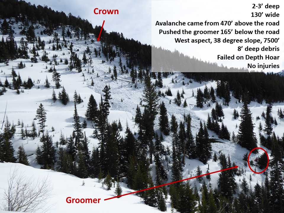
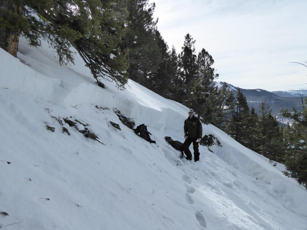
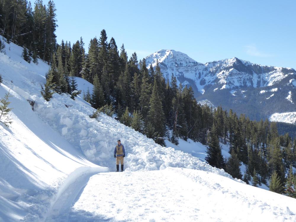
Northern Gallatin, 2020-02-28 Overview of an avalanche triggered on 2/27/2020 at 8:30 p.m. by a groomer between Storm Castle and Swan Creeks in the northern Gallatin Range. The driver was ok, but the machine did a full barrel roll and was very badly damaged. Photo: GNFAC Link to Avalanche Details |
|
Northern Gallatin, 2020-02-28 Crown of an avalanche triggered on 2/27/2020 at 8:30 p.m. by a groomer between Storm Castle and Swan Creeks in the northern Gallatin Range. The driver was ok, but the machine did a full barrel roll and was very badly damaged. It broke 2-3' deep on weak sugary snow near the ground. It was on a West aspect at 7,500' elev., 100' wide, 600' long. Photo: GNFAC Link to Avalanche Details |
|
Northern Gallatin, 2020-02-28 An avalanche triggered on 2/27/2020 at 8:30 p.m. by a groomer between Storm Castle and Swan Creeks in the northern Gallatin Range. The driver was ok, but the machine did a full barrel roll and was very badly damaged. The debris piled 8' deep on the road, which creates a terrain trap. Photo: GNFAC Link to Avalanche Details |