Photos
|
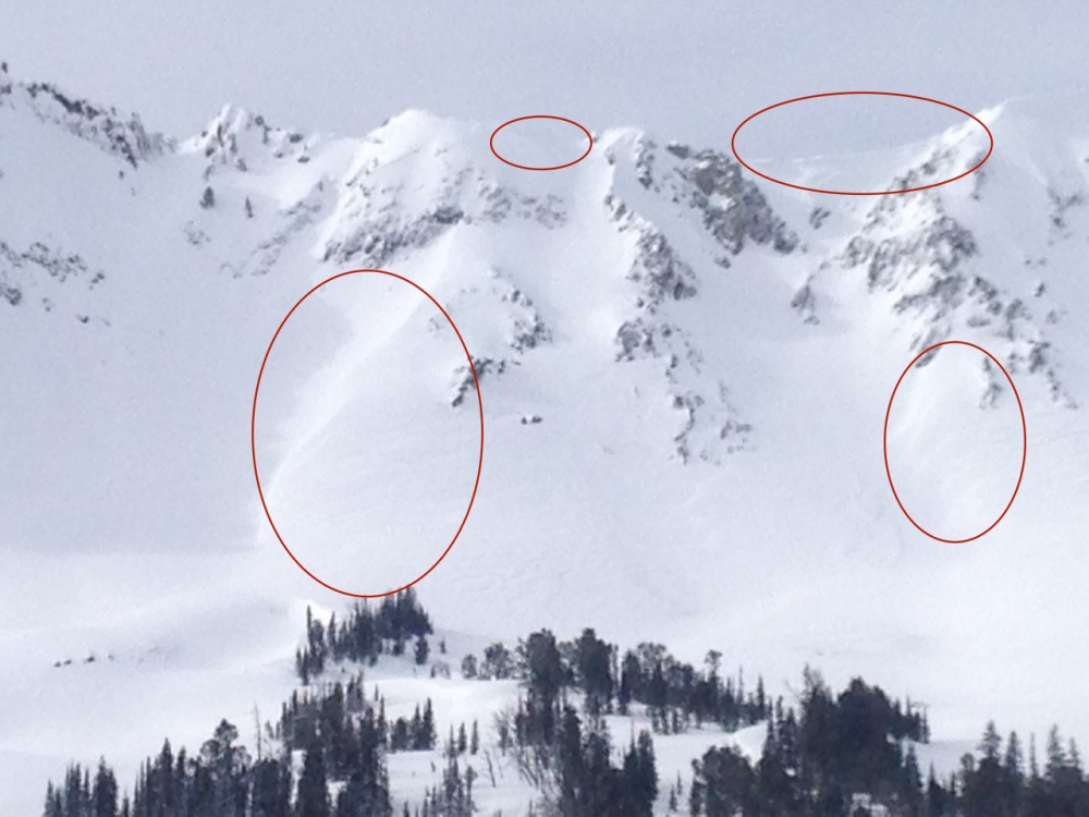
Cooke City, 2018-02-01 The areas circled in red show examples of cross-loaded slopes and commonly wind loaded areas near ridgelines (below large cornices). These types of terrain should be avoided after heavy loading from recent wind and snow. This is the east face of Miller Mtn. near Cooke City. Photo: G. Turnage |
|
Cooke City, 2018-02-01 Surface hoar buried 1-2' deep is showing signs of instability near Cooke City. This was an ECTP15. This layer is not unstable on a lot of slopes, but could produce large avalanche with heavy loading from more snow and wind. Photo: GNFAC |
|
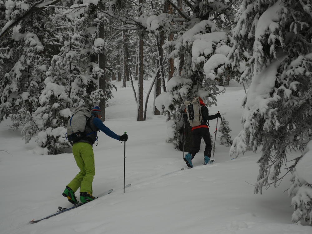
, 2018-01-31 Check out this blog post by Evelyn Lees at the Utah Avalanche Center on “Avalanche Fatalities During Uphill Travel.” One third of tourers die on the ascent, a surprisingly high statistic. Photo: C. Pruden |
|
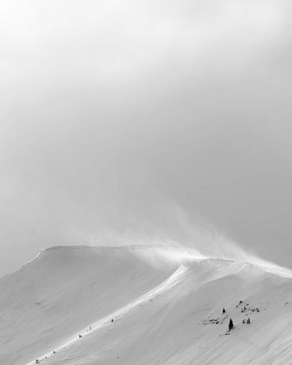
Bridger Range, 2018-01-31 Wind moving snow across the Bridger Range yesterday afternoon. Photo: C. Hagedorn |
|
Southern Madison, 2018-01-30 A layer of surface hoar propagated in our stability tests at Bacon Rind. This layer is not widespread, but does exist in localized areas. It's worth digging and looking for this layer before jumping into avalanche terrain. Photo: GNFAC |
|
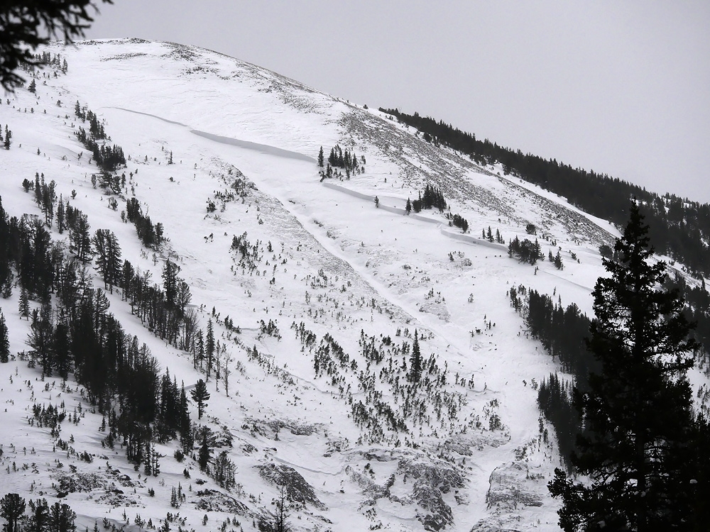
Cooke City, 2018-01-30 This avalanche released Monday night on a northwest facing slope (9,700') at the north end of Woody Ridge. Wind-loading clearly was a factor in pulling out this deep avalanche. A few hundred feet wide, with a crown to be estimated at 8-10' at it's deepest. Photo: B. Fredlund |
|
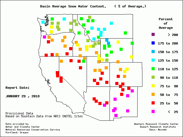
, 2018-01-30 It feels good to be living in the snowy "Haves" vs. "Have not" group. Look at the blue squares clustered in southwest Montana. We have over 125% of average snow water content and Cooke City has over 150%! Whoop, whoop. |
|
Cooke City, 2018-01-29 A skier triggered this 40' wide, 1-2' deep soft slab avalanche from lower angle terrain above. It is on an E aspect near 8,500' outside Cooke City. Photo: K. Miller |
|
Cooke City, 2018-01-29 A skier triggered this 30' wide, 2' deep soft slab avalanche from lower angle terrain nearby. It is on an E-SE aspect near 9,000' outside Cooke City. Photo: B. Fredlund |
|
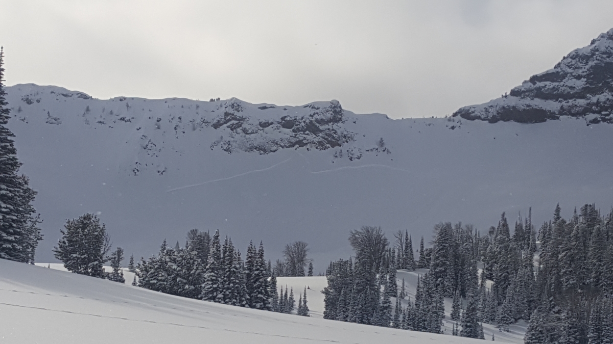
Bridger Range, 2018-01-27 Large natural avalanche was observed 1/26 and is at least a few days old. It is on a NE aspect in Mill Creek on the west side of the Bridgers. Photo: J. Castle |
|
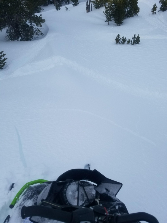
Northern Madison, 2018-01-25 Sledders triggered a small 12" x 12' wide wind slab and also some cracking in the 3rd Yellowmule on Buck Ridge. Small slides at low elevation are warnings that bigger slides are possible higher up. Photo: K&B Crisman |
|
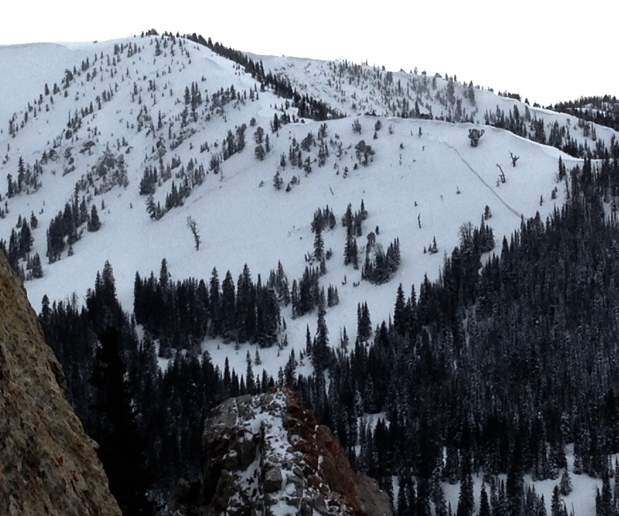
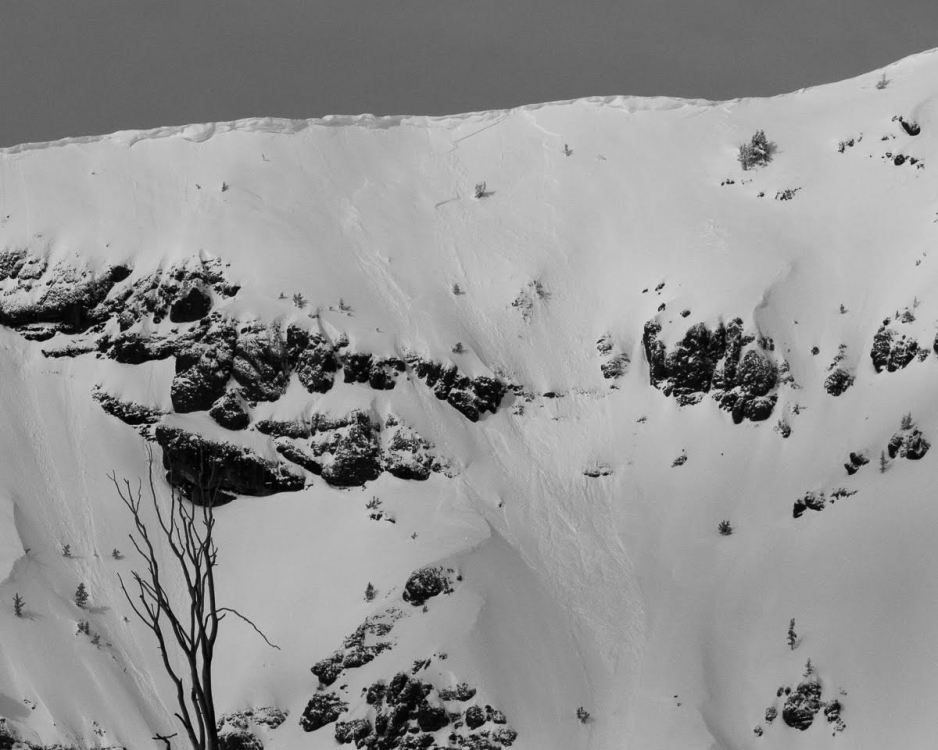
Cooke City, 2018-01-23 A couple of big avalanches observed on Mt. Hornaday (in Yellowstone Park). These avalanches occurred on S, SE aspects around 9,100', most likely last Friday (1/19). Photo: B. Fredlund |
|
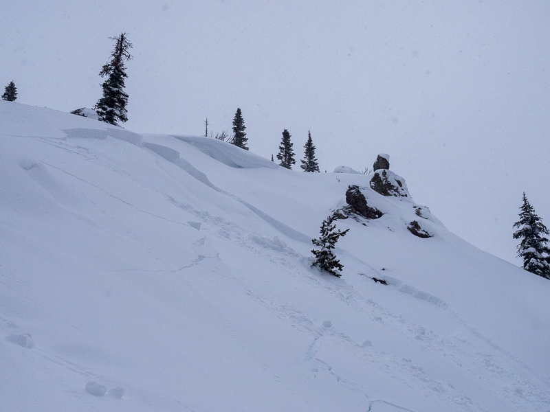
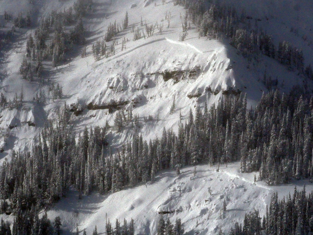
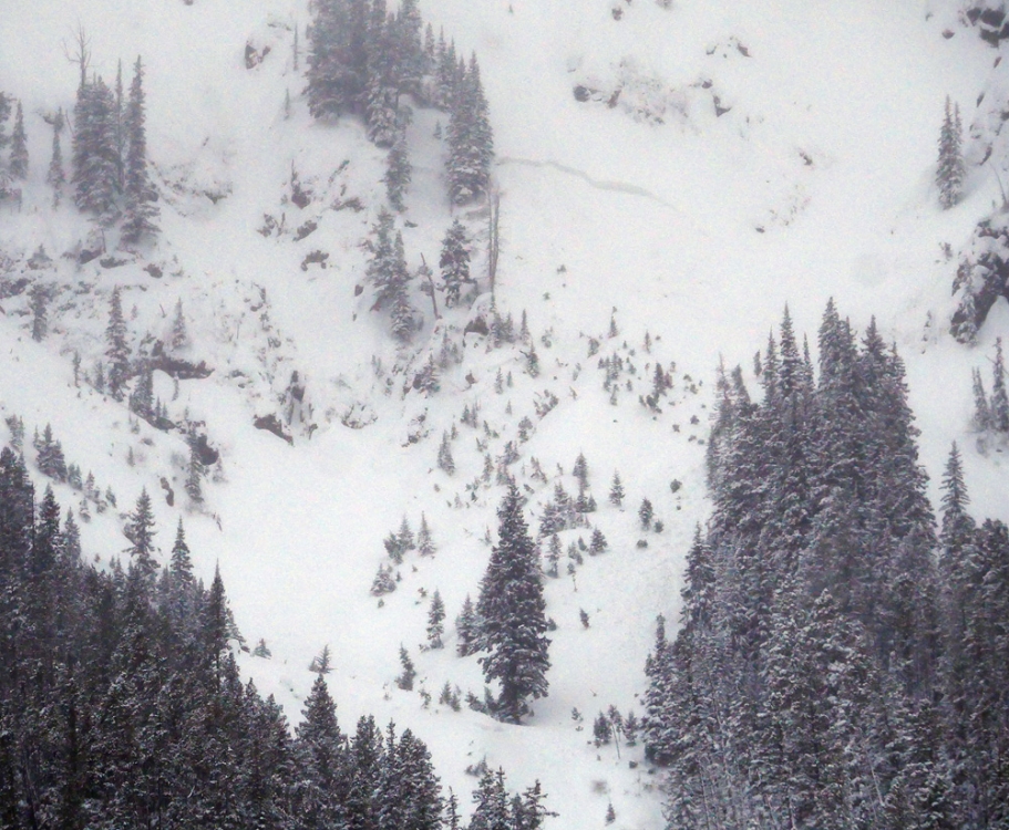
Cooke City, 2018-01-23 Southwest of Silver Gate (between Amphitheater Mtn. and Abiathar Peak), a natural avalanche broke from this last storm, likely on Saturday. It's a northerly aspect around 8,200' with a crown depth of approx. 3-5'. Photo: B. Fredlund
|
|
Cooke City, 2018-01-23 This avalanche was seen on Saturday (1/20) after the storm cleared. The new/old snow interface is where instabilities were most prevalent. Photo: Kt Miller |
|
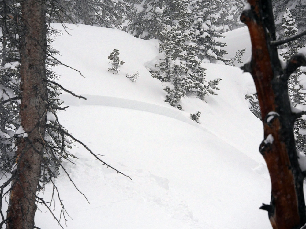
Cooke City, 2018-01-22 This avalanche was observed on 1/21 and looks to be natural. It is on a wind loaded, east facing slope. Photo: S. Strenge |
|
Bridger Range, 2018-01-22 A skier triggered and was carried in this wind slab on The Throne in the northern Bridgers on Sunday (1/21). P. Cronin |
|
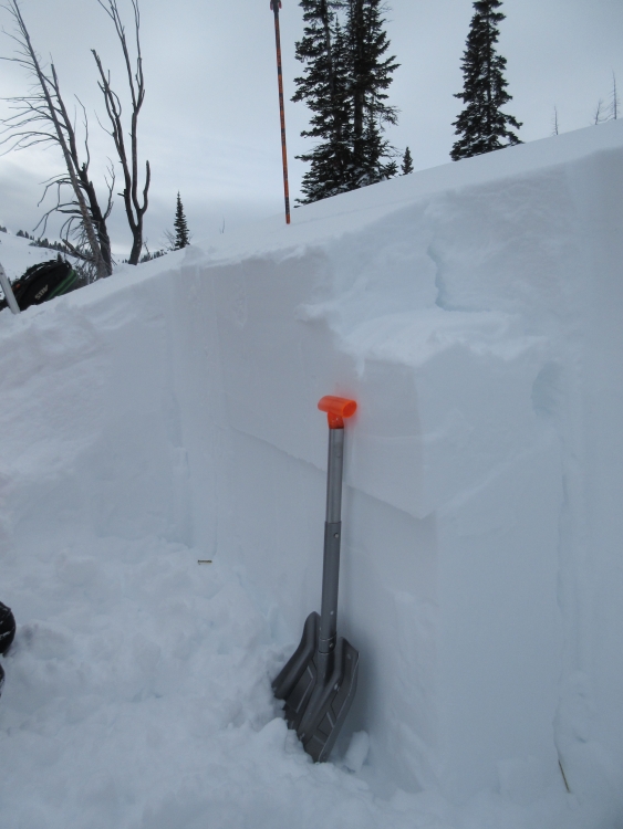
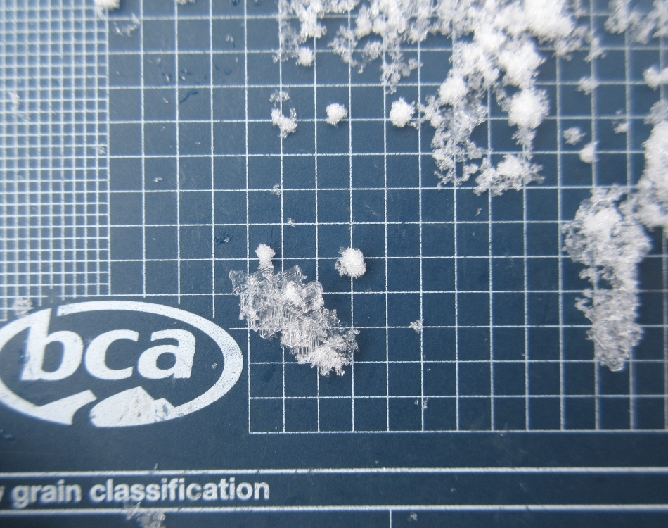
Southern Madison, 2018-01-21 A layer of surface hoar was buried with this last storm. It is easy to find it and test; just shovel down 1-2 feet and cut a column. I could see the grains in my pit wall, but it did not break in Compression Tests or Extended Column Tests. This is good news, but it's distribution and stability is not definitively known yet. We will continue to look for it and test it. Photo: GNFAC |
|
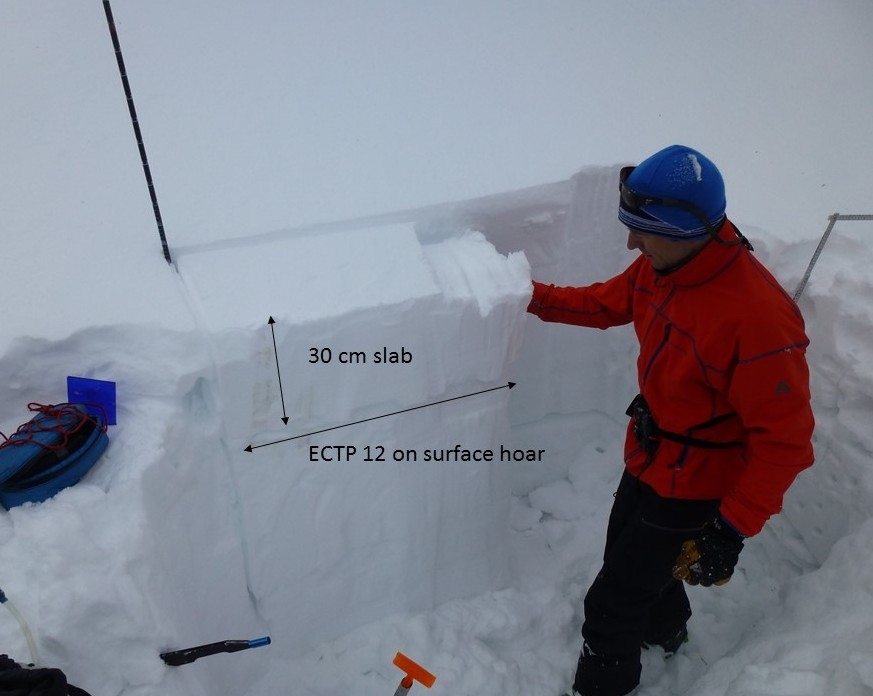
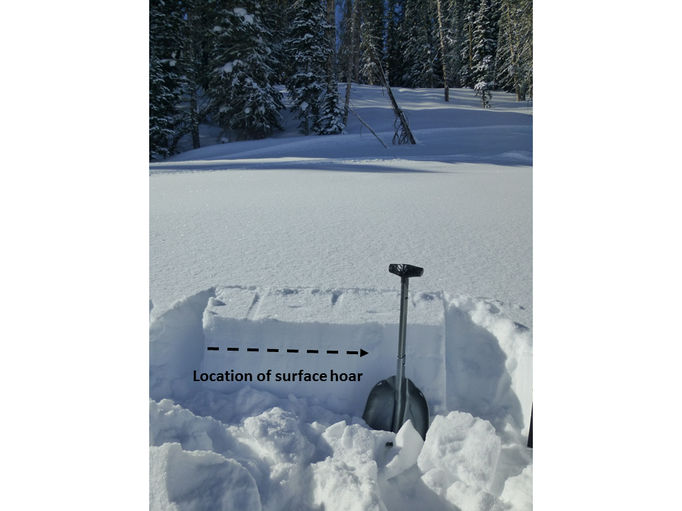
Lionhead Range, 2018-01-21 A layer of surface hoar was buried by the recent snowfall (1/19) at Lionhead. This layer was observed through most of our advisory area prior to this storm, and should be searched for by digging 1-2' deep before riding in avalanche terrain. Photo: GNFAC |
|
Northern Gallatin, 2018-01-20 Large natural avalanche on NE aspect of Divide Peak in Hyalite. The slope is likely wind-loaded and the slide appears to have been triggered by snow falling off the rocks. Photo: G. Antonioli |
|
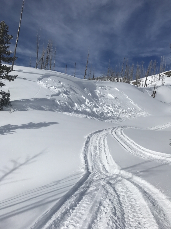
Southern Madison, 2018-01-20 This small slide is in the burned area of Taylor's Fork. Riders were traveling below a wind-loaded slope when they remotely triggered it. Photo: M. Gagne |