Photos
|
Northern Madison, 2019-02-17
Snowmobile - triggered avalanche in the McAtee Basin area near Buck Ridge. The avalanche was triggered unintentionally from the runout zone and propagated all the way up to the ridge above the riders. Luckily, nobody was caught or buried. Photo: J. Stoner Link to Avalanche Details |
|
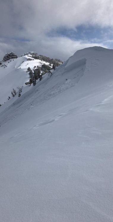
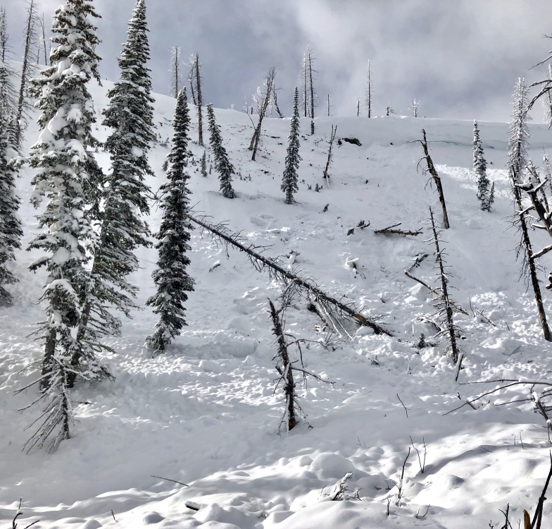
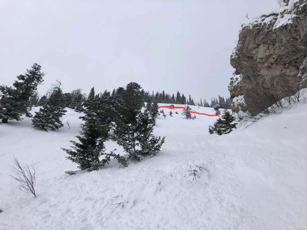
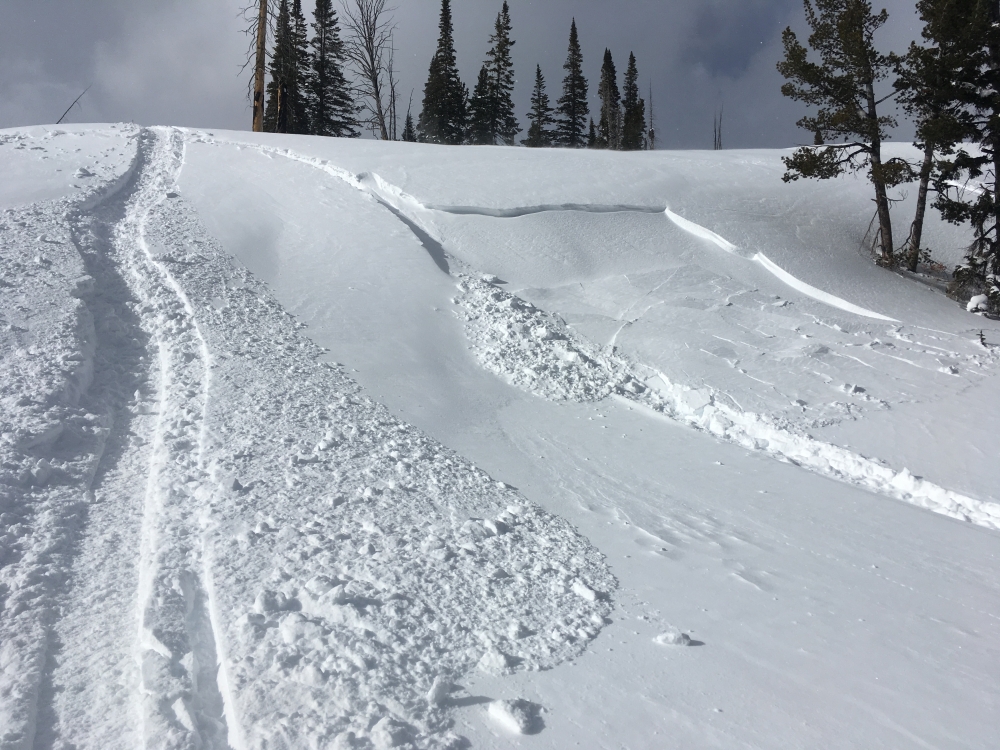
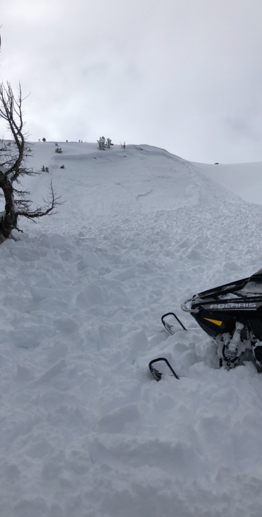
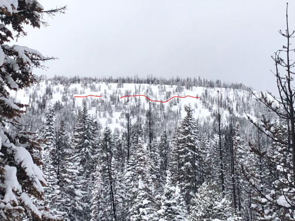
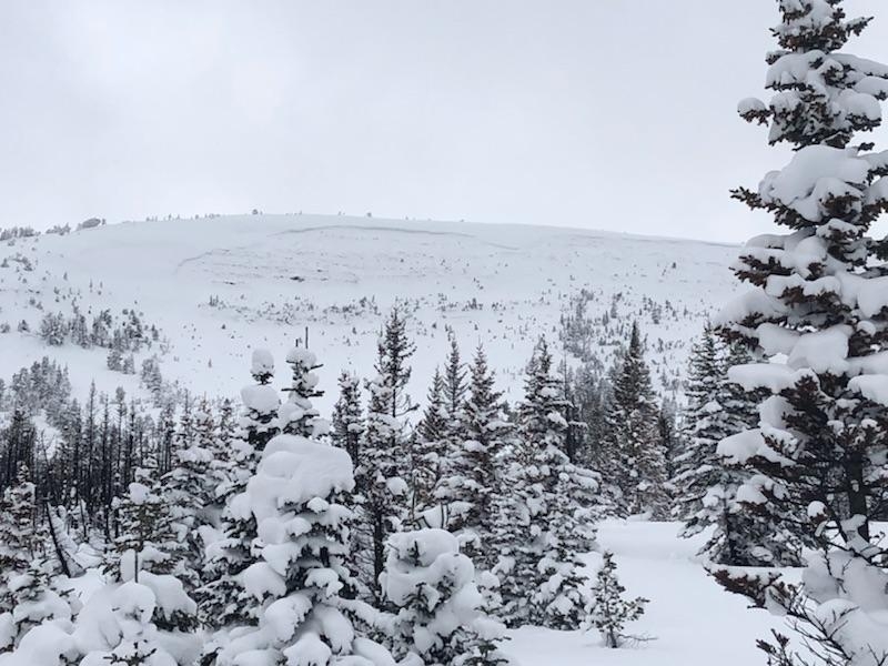
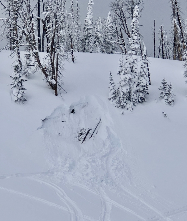
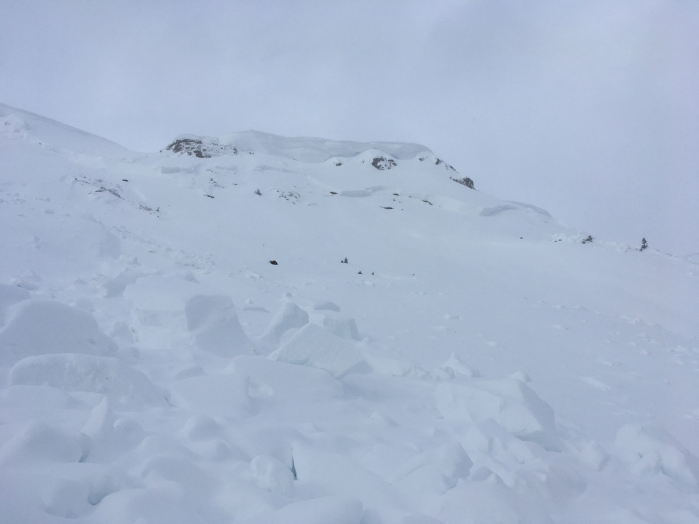
Southern Madison, 2019-02-17 This avalanche occurred in the trees on Ernie Miller ridge. Photo: F. Madsen Link to Avalanche Details |
|
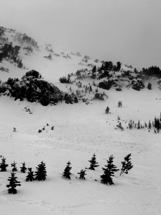
Southern Madison, 2019-02-17 Large avalanche that failed deep in the snowpack at Ernie Miller. This is the second photo we've recieved of this bowl sliding this season (last one was on Dec. 15th). Photo: F. Madsen Link to Avalanche Details |
|
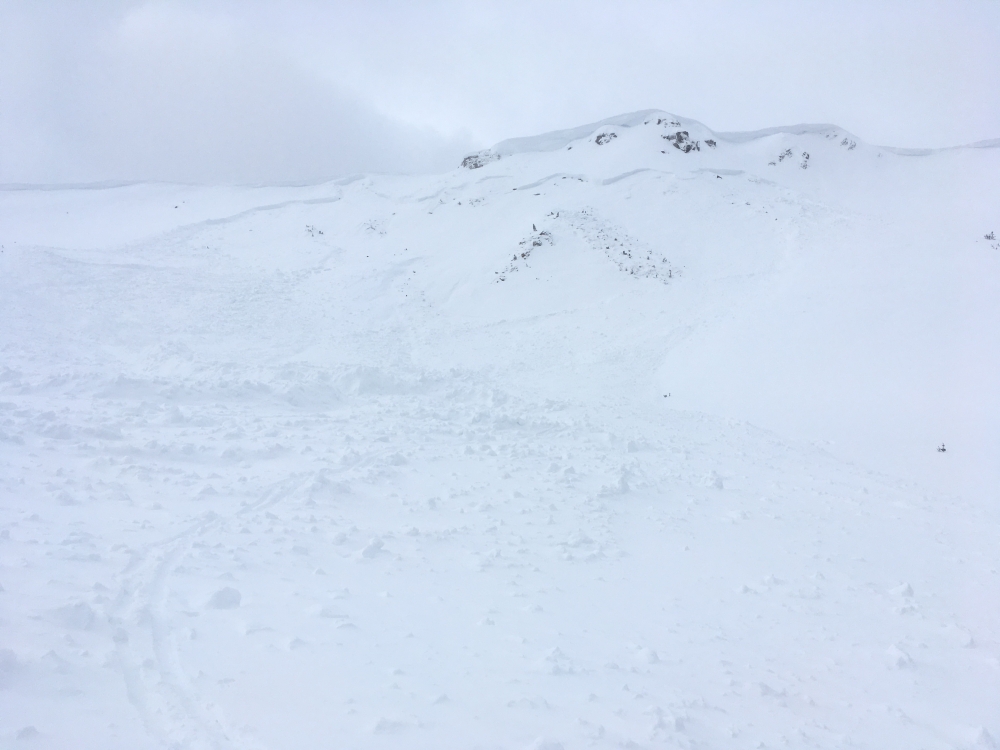
Southern Madison, 2019-02-16 This slide appeared to be triggered by a falling cornice. It broke near the ground and propagated two hundred feet wide. It snapped trees and left a debris pile up to ten feet deep. This avalanche illustrates that large and dangerous avalanches remain possible in the southern Madison Range and mountains near West Yellowstone. Photo: GNFAC Link to Avalanche Details |
|
Southern Madison, 2019-02-16 This small slide was triggered by a snowmobiler in the southern Madison Range. Although small, this slide is bull's eye information that larger slides are possible on similar slopes. Photo: GNFAC Link to Avalanche Details |
|
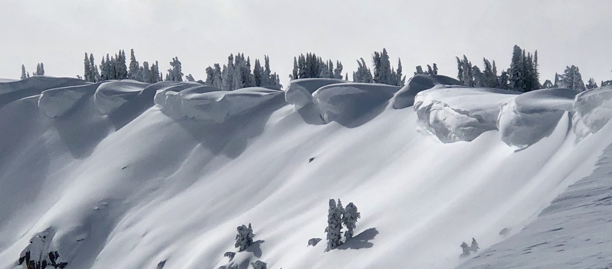
Southern Madison, 2019-02-16 Cornices are growing large after a series of storms in the southern Mountains. These cornices make up the rim of Sunlight Basin in the southern Madison Range. Cornices are good indicators of which slopes are wind loaded. It's often best to avoid riding on or underneath slopes attached to large cornices. Photo: GNFAC |
|
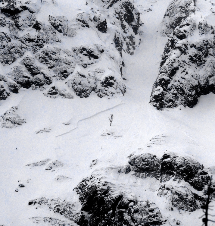
Cooke City, 2019-02-16 This avalanche failed naturally sometime between Feb 13-15 after recent wind and storm loading. SE aspect, 9400 ft elevation, 2-4' deep. Photo: B. Fredlund Link to Avalanche Details |

|
Bridger Range, 2019-02-16 Skiers reported intentionally triggering multiple avalanches failing up to a foot deep at the Throne. From the email: "We dug a pit above the top of the throne (ENE aspect, 8400’, 28°) and got an ECTP17. The pit broke below 55cm of new snow, on top of an old wind slab. Bailed on our objective (the ruler) and skied the main ESE chutes on the throne. Ski cut the top of all 3 chutes and got them all to break out 8-12” deep, 100-200’ wide and they all ran 500-700’ into the trees at the bottom of the gullies. The runout hit the trees at the bottom with enough force to snap 3” trees and piled up debris up to 5’ deep." Photo: M. Cohen Link to Avalanche Details |
|
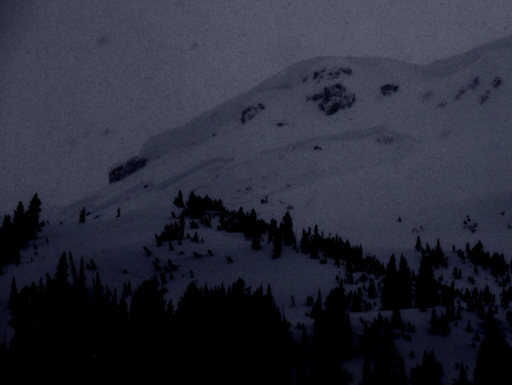
Cooke City, 2019-02-15 We saw this crown at 1545 on 2/15/19 after viewing this slope at least twice earlier in the day. We went to the avalanche on 2/16. It appeared to be triggered by a cornice fall and broke 4-8' deep. Photo: GNFAC Link to Avalanche Details |
|
Cooke City, 2019-02-15 We saw this crown at 1545 on 2/15/19 after viewing this slope at least twice earlier in the day. We went to the avalanche on 2/16. It appeared to be triggered by a cornice fall and broke 4-8' deep. Photo: GNFAC Link to Avalanche Details |
|
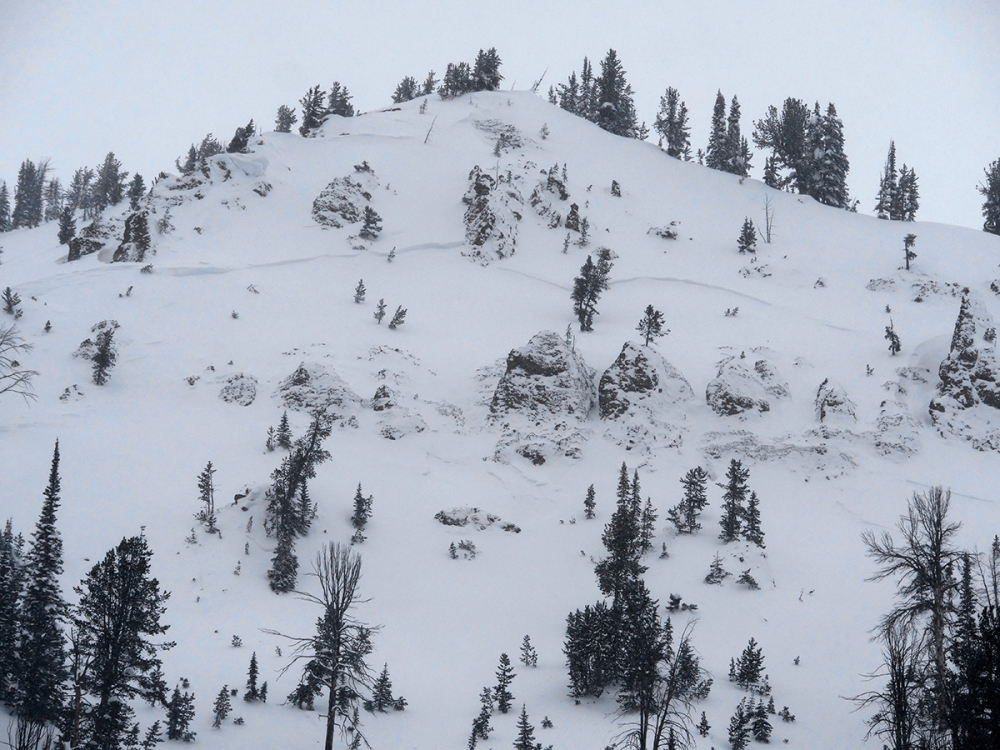
Cooke City, 2019-02-15 This large deep slab avalanche broke on Mt. Henderson on the afternoon of 2/15/19 during strong winds. New snow and strong wind this past week has formed fresh drifts that are easy to trigger. This heavy, steady wind loading pushed deep weak layers to break. With more heavy loading from new snow and wind we will see more large avalanches like this. Photo: GNFAC Link to Avalanche Details |
|
Cooke City, 2019-02-15 New snow and strong wind this week created fresh drifts that are easy to trigger. This small slide we triggered is a sign that drifts on larger, dangerous slopes are ready to avalanche. Photo: GNFAC Link to Avalanche Details |
|
Northern Gallatin, 2019-02-13 From an email, "Lots of wind slab activity... tough to tell exactly what happened here with everything filling back in so fast. A few quickly-disappearing crowns on ridge line and throughout E face, good debris pile." Photo: Cody C. Link to Avalanche Details |
|
Cooke City, 2019-02-12 "Observed a couple of small, natural avalanches out there today (wind loaded SE aspects on Mineral Mountain, about 8,800', just outside of Cooke City)." Photo: B. Fredlund Link to Avalanche Details |
|
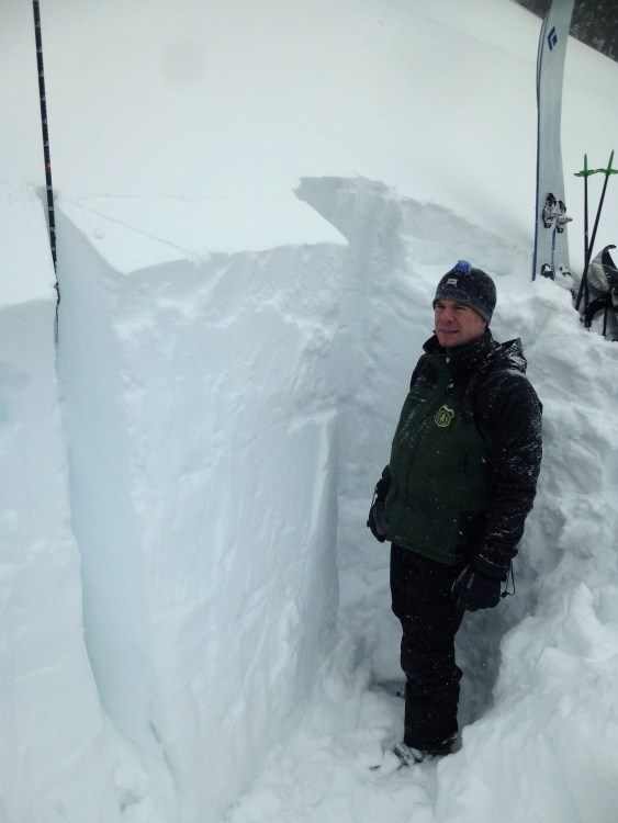
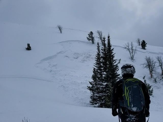
Cooke City, 2019-02-11 We found 6 feet of snow in a non-wind drifted slope near Lulu Pass (Rasta Chutes) outside Cooke City. This south facing slope at 9600' was stable, but 2 days ago a snowmobiler triggered the entire south face of Abundance, which caused me to pause and still be conservative since these slopes are very similar. Photo: GNFAC |
|
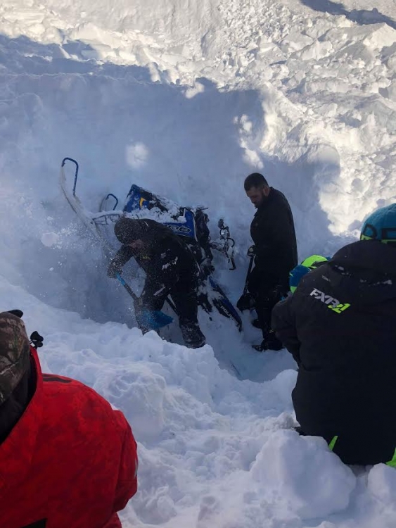
Island Park, 2019-02-11 This snowmobile was fully buried, along with its rider on February 7th, 2019, in the Centennial Range. Link to Avalanche Details |
|
Island Park, 2019-02-11 Photo of the snowmobile triggered slide that fully buried a rider on February 7th, 2019. Link to Avalanche Details |
|
Out of Advisory Area, 2019-02-11 A large snowmobile triggered avalanche in the Gravelly Range (Outside of advisory area) on February 10th, 2019. From email: "One rider was involved in the incident and was fortunate to be on the upper left side of the bowl when he saw the slide start. ... the crown was about 325 wide and varied in depth from 1 to 4 or 5 feet. The ridge line was wind loaded and this was an issue we had discussed as a group and wanted to avoid. We had read the reports for the day and knew that wind loading as well as a persistent week layer were both concerns. .... The rider involved entered the area from around where the road switchbacked and did not realize what was above him due to reduced visibility." Link to Avalanche Details |