Photos
|
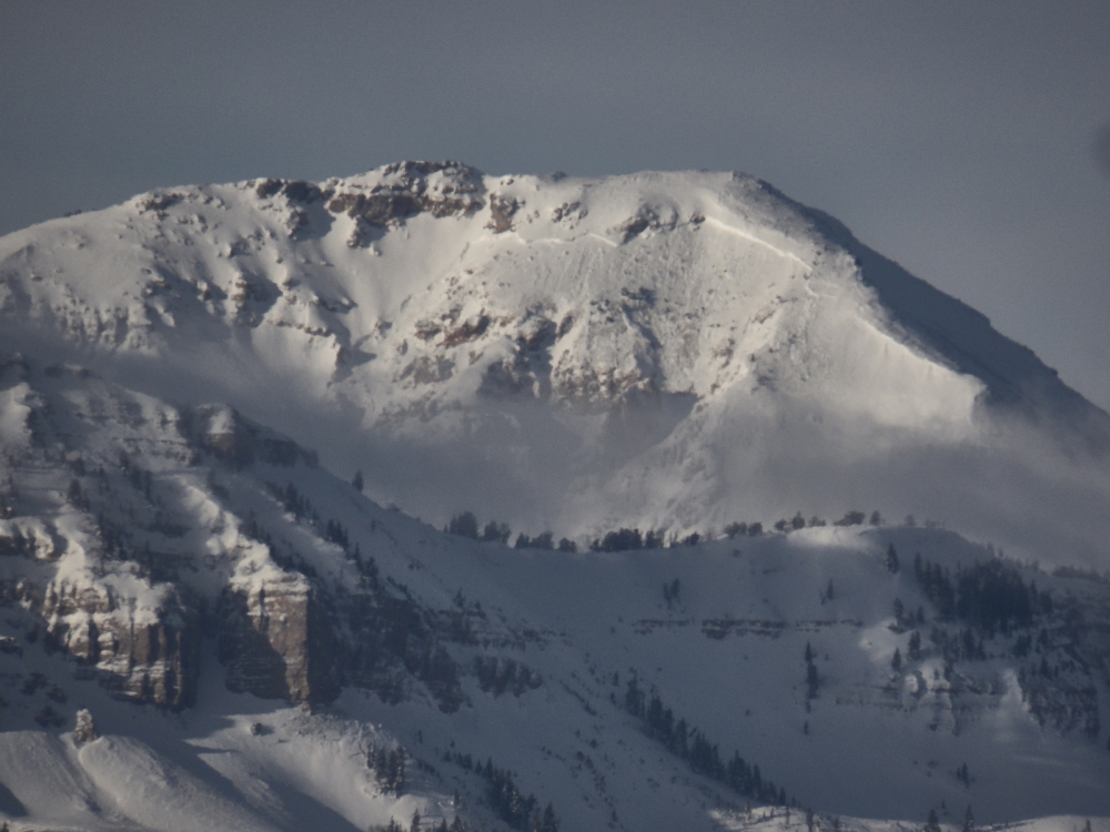
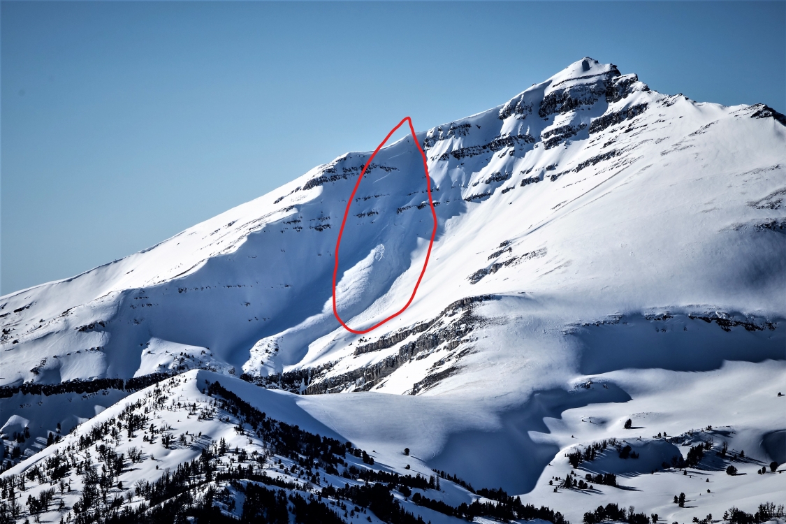
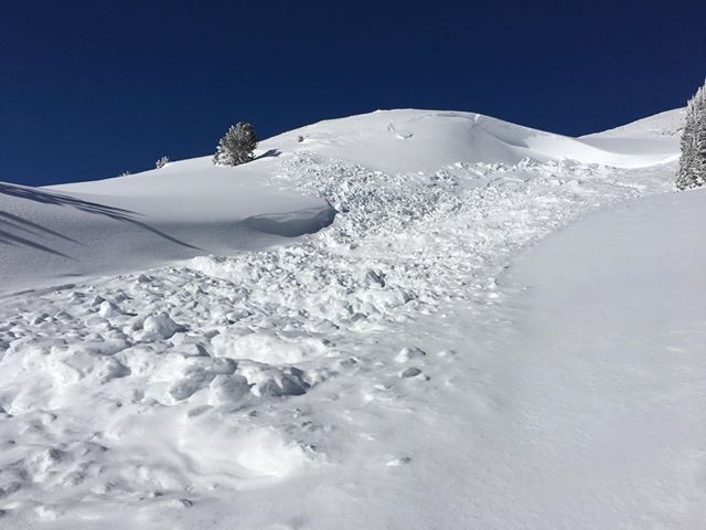
Lionhead Range, 2019-02-03 Large avalanche on Bald Peak in the Lionhead area near West Yellowstone. Photo: B. VandenBos Link to Avalanche Details |
|
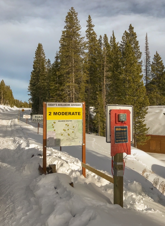
Cooke City, 2019-02-02 There's a new avalanche sign next to the beacon checker on the road out of Cooke City. Snowmobilers and skiers will pass it on their way to Lulu and Daisy Pass. It has the daily avalanche danger and a map showing the location of all the avalanche fatalities. This sign was a team effort between the GNFAC, the Friends of the Avalanche Center, and Montana State Parks (FWP). A big thanks goes out to Seth McArthur of FWP who made the sign. Photo: L. DeMarcus |
|
Bridger Range, 2019-01-30 Natural avalanche on the west side of the Bridger Range. Occurred on or before 1/27. Photo: GNFAC Link to Avalanche Details |
|
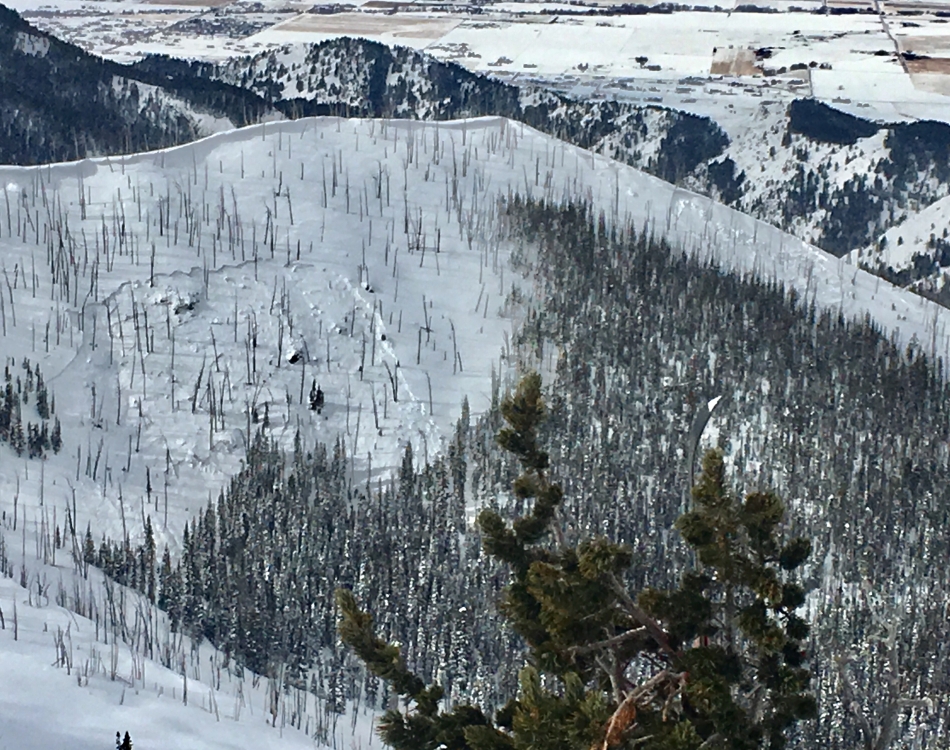
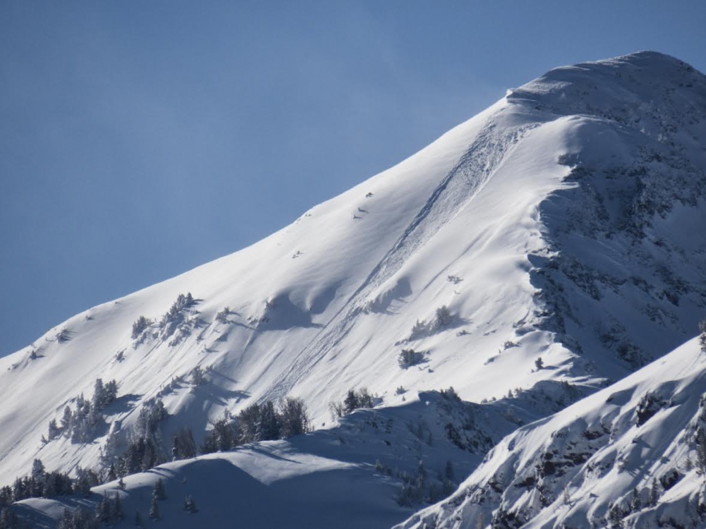
Northern Gallatin, 2019-01-30 A skier wrote, "Large natural avalanche on the south face of peak 10,201. Looked to be a day or two old and the crown looked to be 3-4 feet deep in places." Photo: S. Wilson Link to Avalanche Details |

|
Northern Gallatin, 2019-01-30 A skier noted, "Newish slide with a fresh looking debris pile. Between Alex Lowe and Peak 9806. Appeared to step down into the old snow. Looked like a D2.5-R3, natural trigger." Photo: F. Madsen Link to Avalanche Details |
|
Northern Madison, 2019-01-29 A natural avalanche on Cedar Mountain. Photo: M. Delguidice Link to Avalanche Details |
|
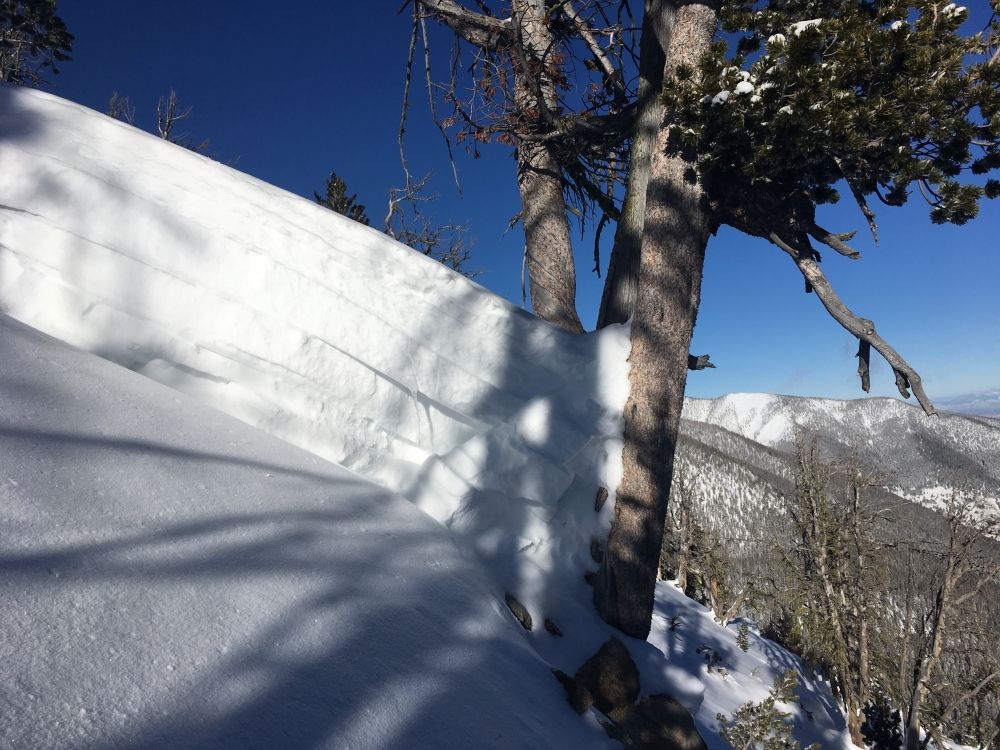
Out of Advisory Area, 2019-01-29 This is the crown at it's deepest. It failed on facets 70-90 cm deep before stepping down to the ground. Photo: S. Jonas Link to Avalanche Details |
|
Northern Gallatin, 2019-01-29 Natural avalanche observed on January 28th. From email: "Fresh natural on east face of Blackmore in gently wind-loaded terrain." Photo: B. VandenBos Link to Avalanche Details |
|
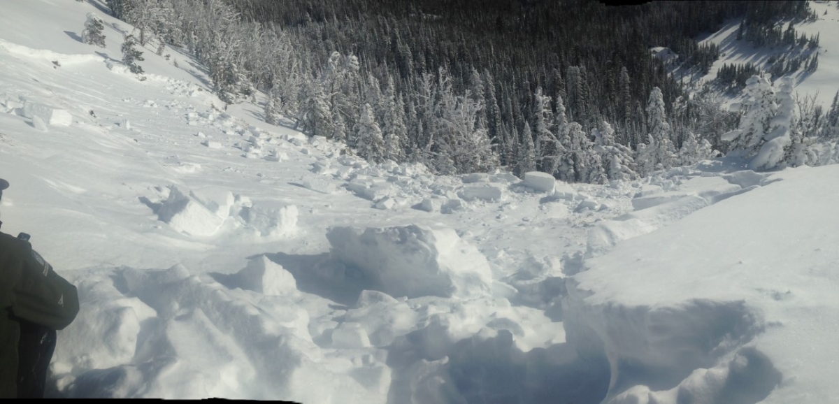
Out of Advisory Area, 2019-01-28 This was one of multiple avalanches triggered remotely from low-angle slopes connected to steep terrain in the Gravelly Range on Sunday. Photo: S. Olson Link to Avalanche Details |
|
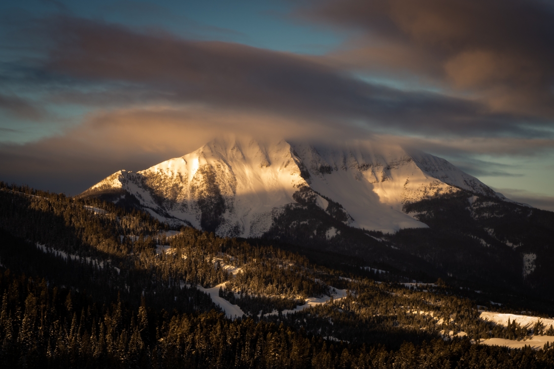
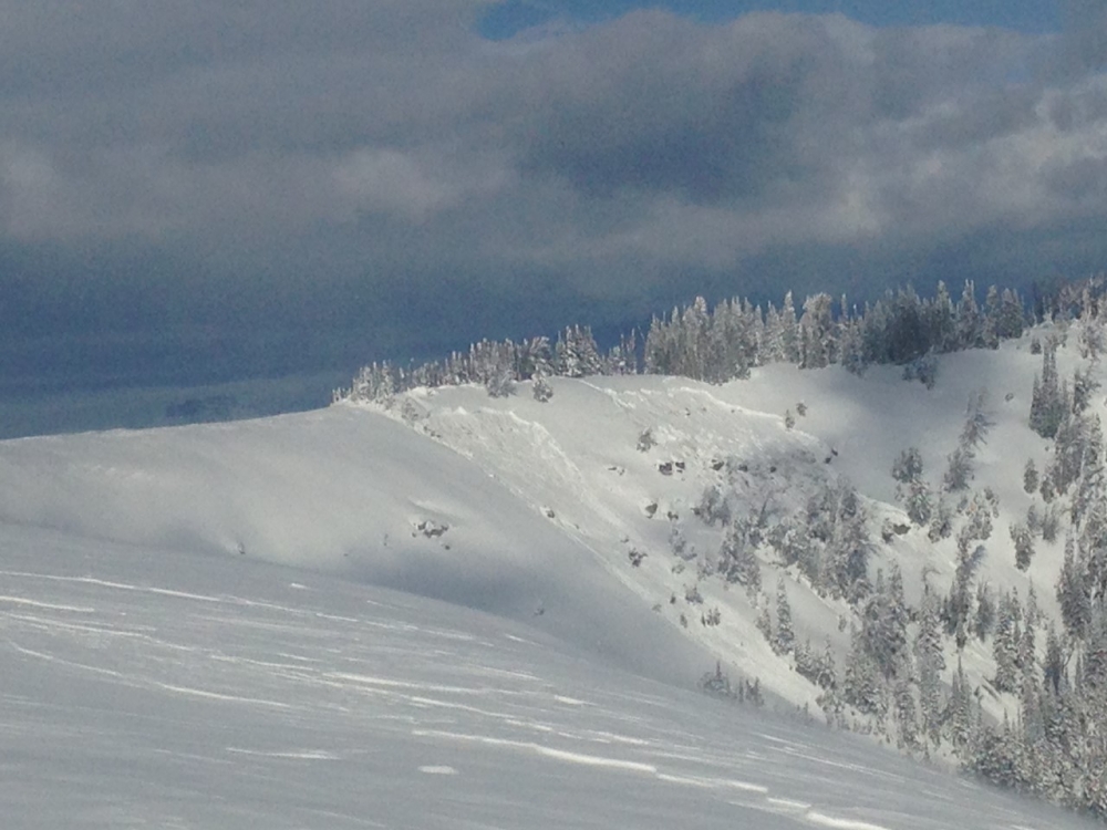
Lionhead Range, 2019-01-28 A very deep natural avalanche was observed on Sheep Mountain, on January 28th. From email: "This was southern facing slope of sheep mountain... Crown was at least 8’... very heavy wind loading." Photo: H. Menssen Link to Avalanche Details |
|
Northern Madison, 2019-01-28 Natural avalanche on Fan Mountain. Observed on the morning of January 28th, 2019. Photo: M. Delguidice Link to Avalanche Details |
|
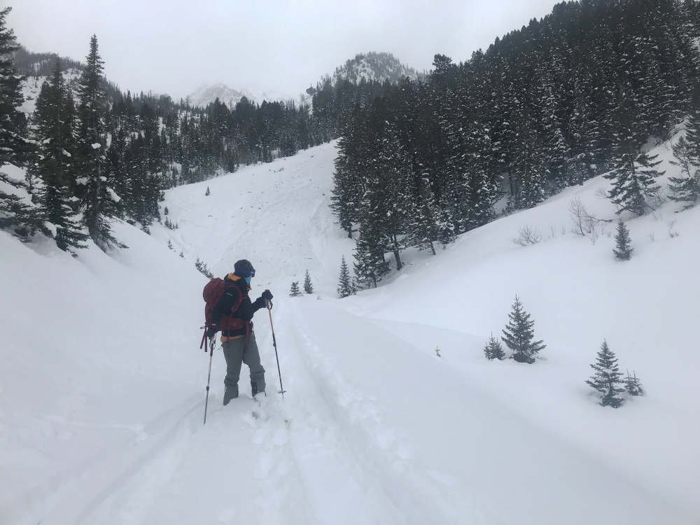
Out of Advisory Area, 2019-01-28 Behind the skier is the bottom of the debris from a large natural avalanche that skiers saw on Sunday 1/27. Photo: A. Whitmore Link to Avalanche Details |
|
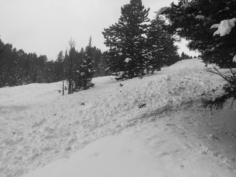
Out of Advisory Area, 2019-01-28 Debris from a natural avalanche that skiers watched happen on Sunday 1/27. Photo: A. Whitmore Link to Avalanche Details |
|
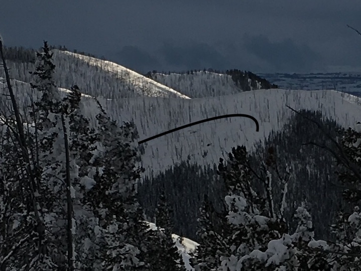
Out of Advisory Area, 2019-01-27 Skiers reported multiple large natural avalanches in the Arrastra drainage in the Absarokas. They estimated the recent storm cycle totals to be 3-5'. Photo: A. Whitmore Link to Avalanche Details |
|
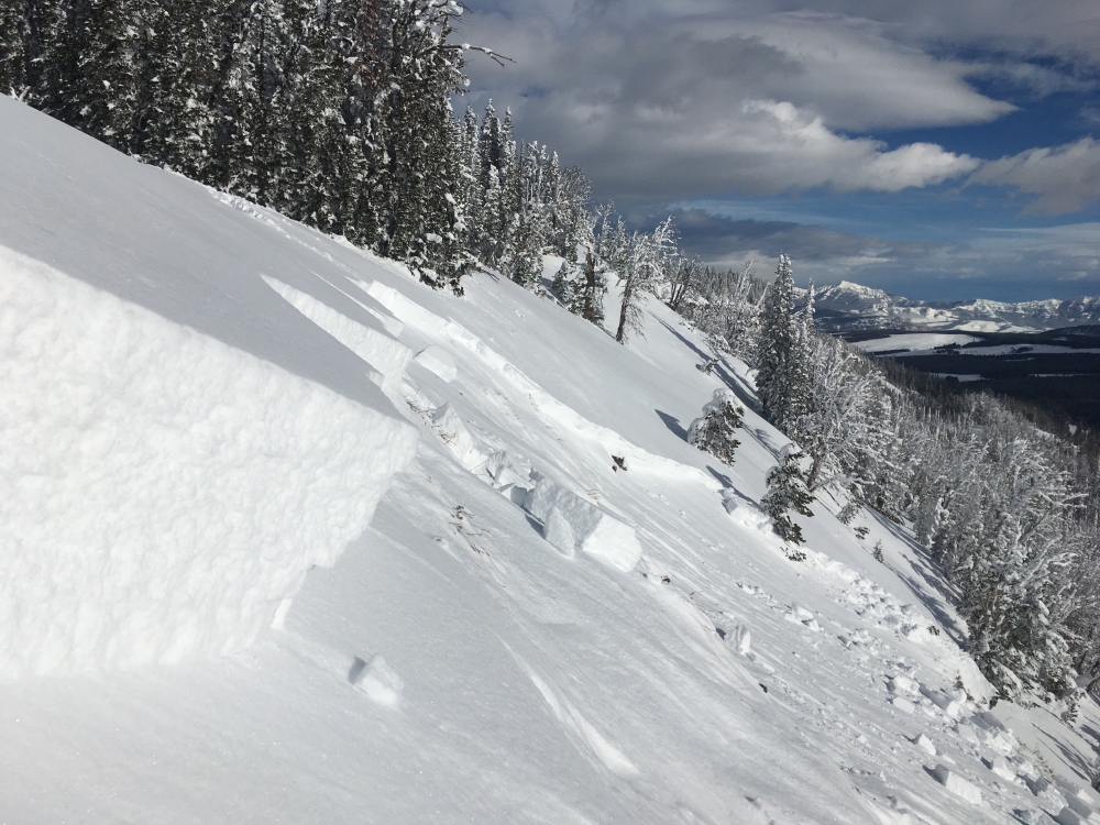
Southern Madison, 2019-01-27 We triggered this avalanche remotely from about 50 feet above the crown up on the ridge. The crown was 1-2' deep, 100' wide, and ran between 200 and 300 vertical feet through trees and cliffs. Another slide failed sympathetically at the same time, 100' down the ridgeline. The slides failed on a 40 cm thick layer of depth hoar, which composed half of the snowpack. Photo: GNFAC Link to Avalanche Details |
|
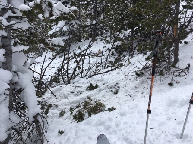
Out of Advisory Area, 2019-01-27 Skiers witnessed this avalanche slide on a low angle (30-32 degree) slope and break through very tight trees. Link to Avalanche Details |

|
Out of Advisory Area, 2019-01-27 Skiers witnessed this avalanche slide on a low angle (30-32 degree) slope and break through very tight trees. Link to Avalanche Details |
|
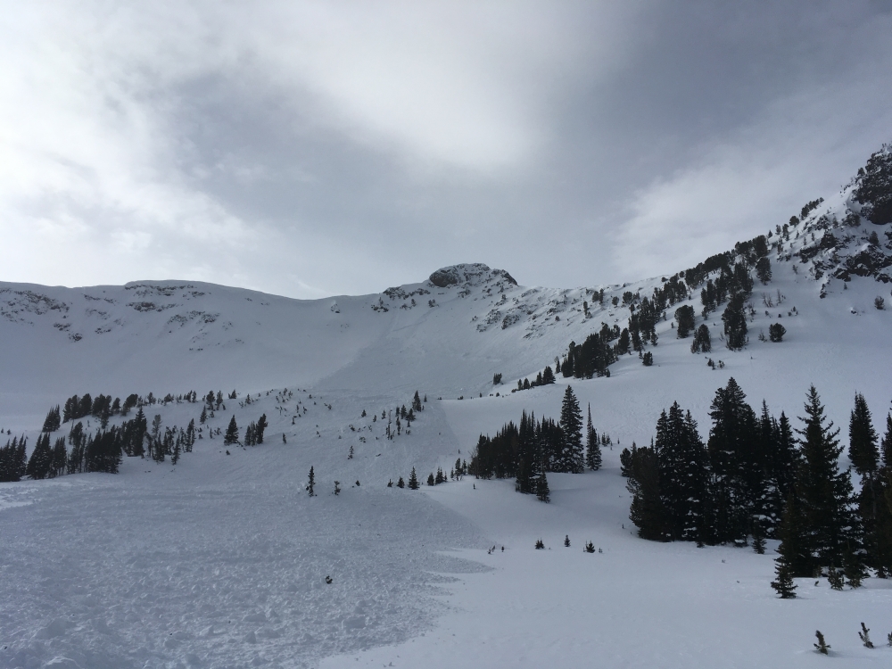
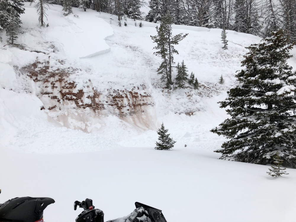
Bridger Range, 2019-01-27 Bridger Bowl Ski patrol snapped a photo of this natural slab avalanche on the west side of the Bridgers near Truman Gulch. Photo: BBSP Link to Avalanche Details |