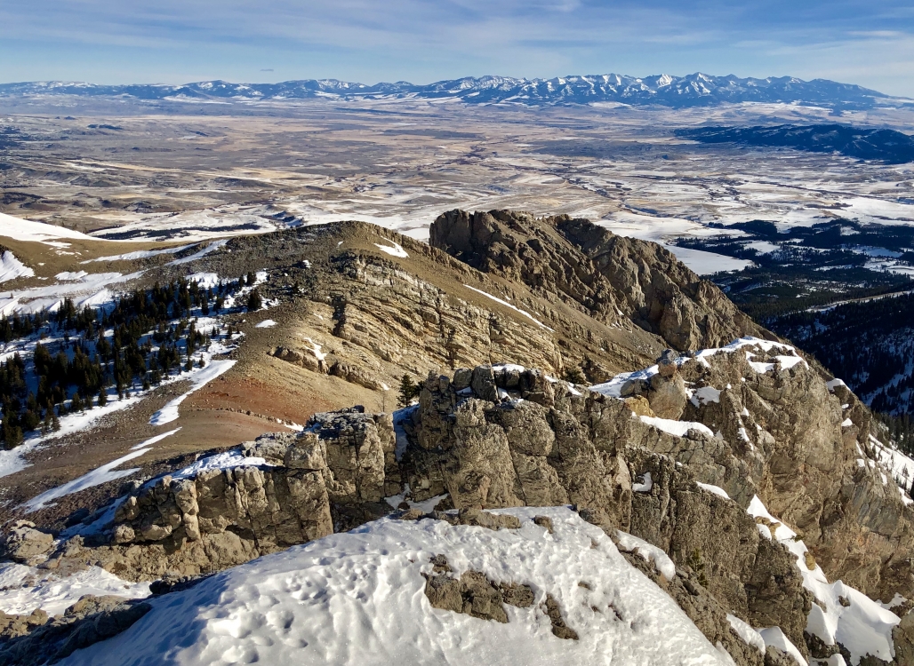
Photos
|
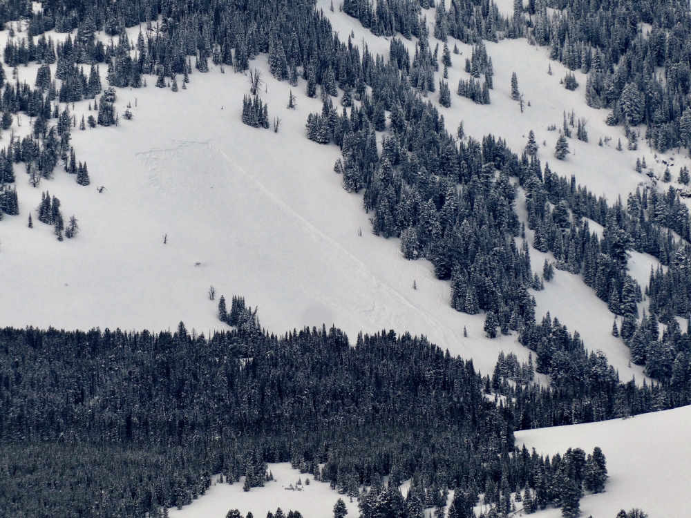
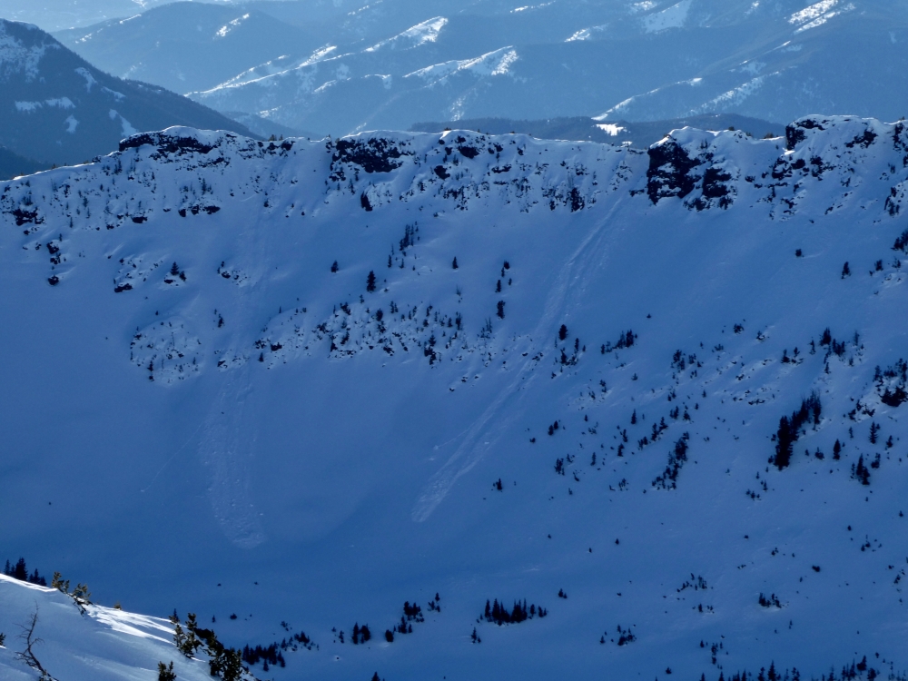
Northern Gallatin, 2019-01-22 Avalanche occurred on 21 January. From email: "As we entered the large open meadows on the east face ... we remotely triggered a sizable avalanche from 2-300 yards away. The crown was approximately 100 yards wide, running several hundred yards downhill ... the crown appeared to be about 2 feet deep." Photo: G. Antonioli Link to Avalanche Details |
|
Southern Madison, 2019-01-22 This avalanche propagated far in the new snow. A shallow snowpack of facets was especially thin and weak. We take note of these signs of instability because they can be windows into the poor stability in the backcountry. Photo: GNFAC |
|
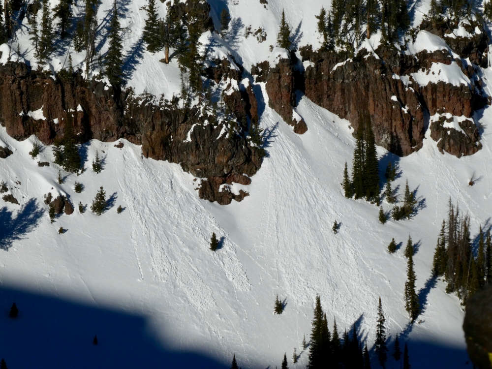
Cooke City, 2019-01-21 Natural avalanches seen January 21st. From email: "avalanche crowns on the shoulder of Mt. Republic from this morning. (saw the powder cloud at about 8:30am). I estimate the upper crown to be 1-3' deep and about 100' wide. Northerly facing terrain." Photo Credit: B. Fredlund Link to Avalanche Details |
|
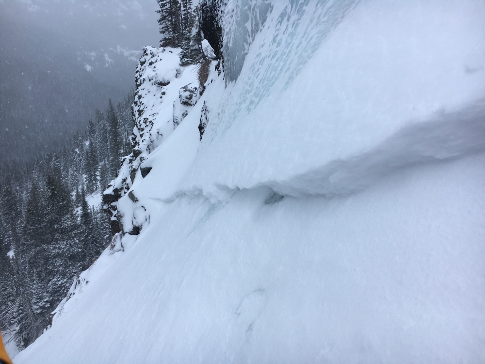
Northern Gallatin, 2019-01-21 Small avalanche 70m up "The Dribbles" ice climbing route in Hyalite. From email: "Some super heavy wind loading as the slope flattened out.... as he set up the anchor 70m up the climb a small slab came off just to his left." Photo Credit: K. McKinstry Link to Avalanche Details |
|
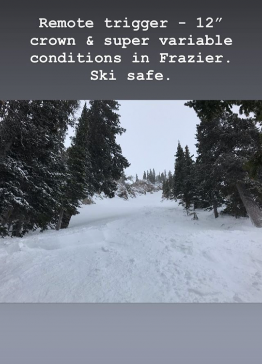
Bridger Range, 2019-01-21 Skiers sent this report from Instagram on Sunday 1/20. They also had stability test scores of ECTP14 underneath the new snow. Link to Avalanche Details |
|
Cooke City, 2019-01-20 Near Lulu Pass the winds were loading slopes with new snow. We got cracking as we skinned uphill. The new snow is not bonding well to the old snow surface. Photo: GNFAC Link to Avalanche Details |
|
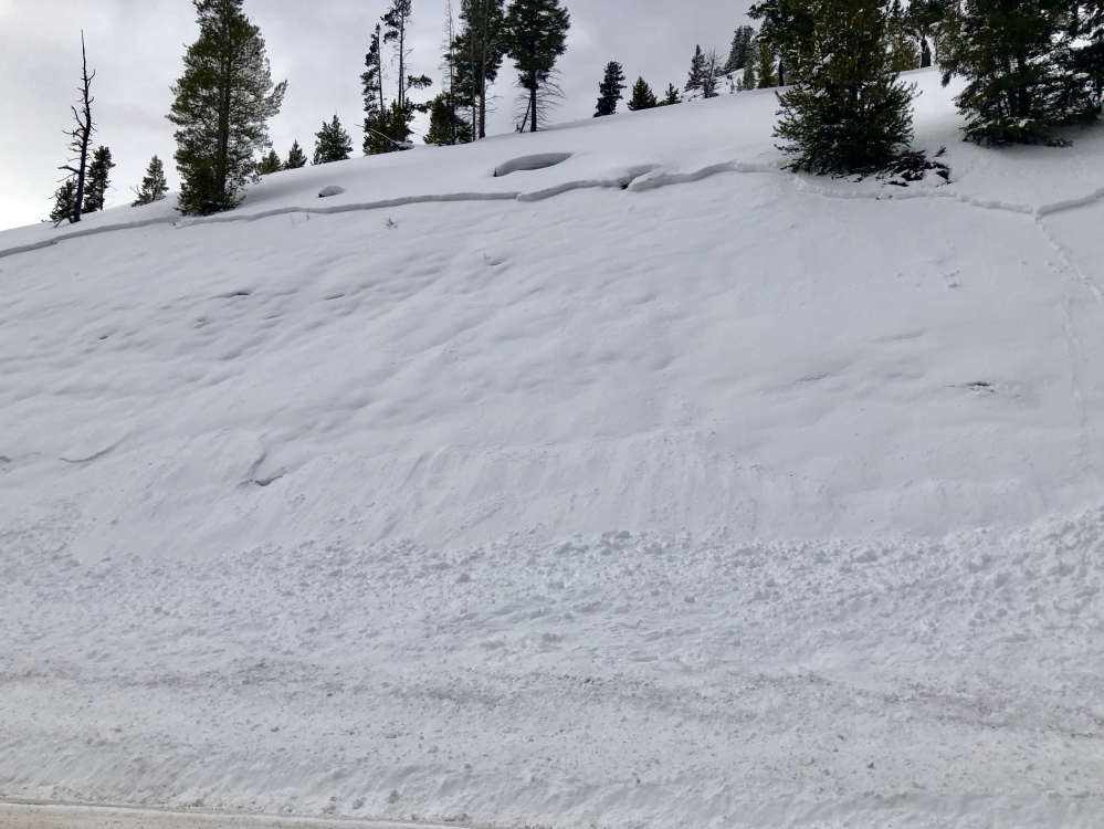
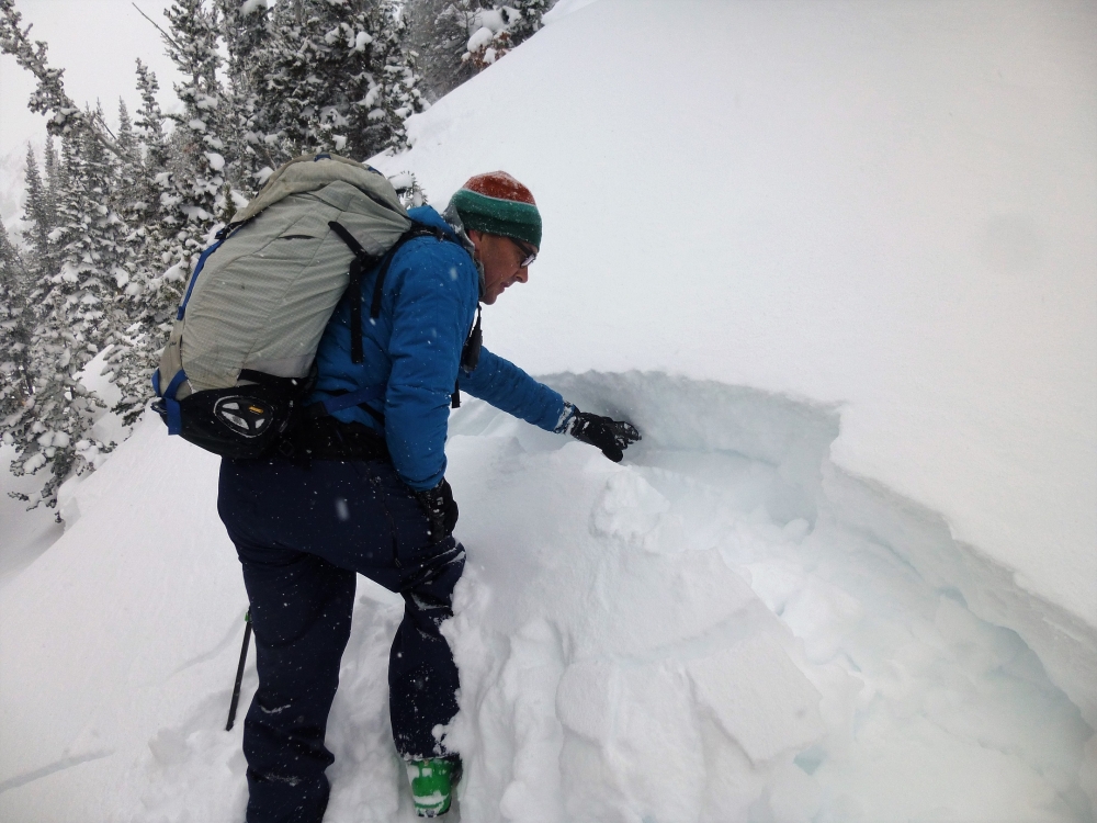
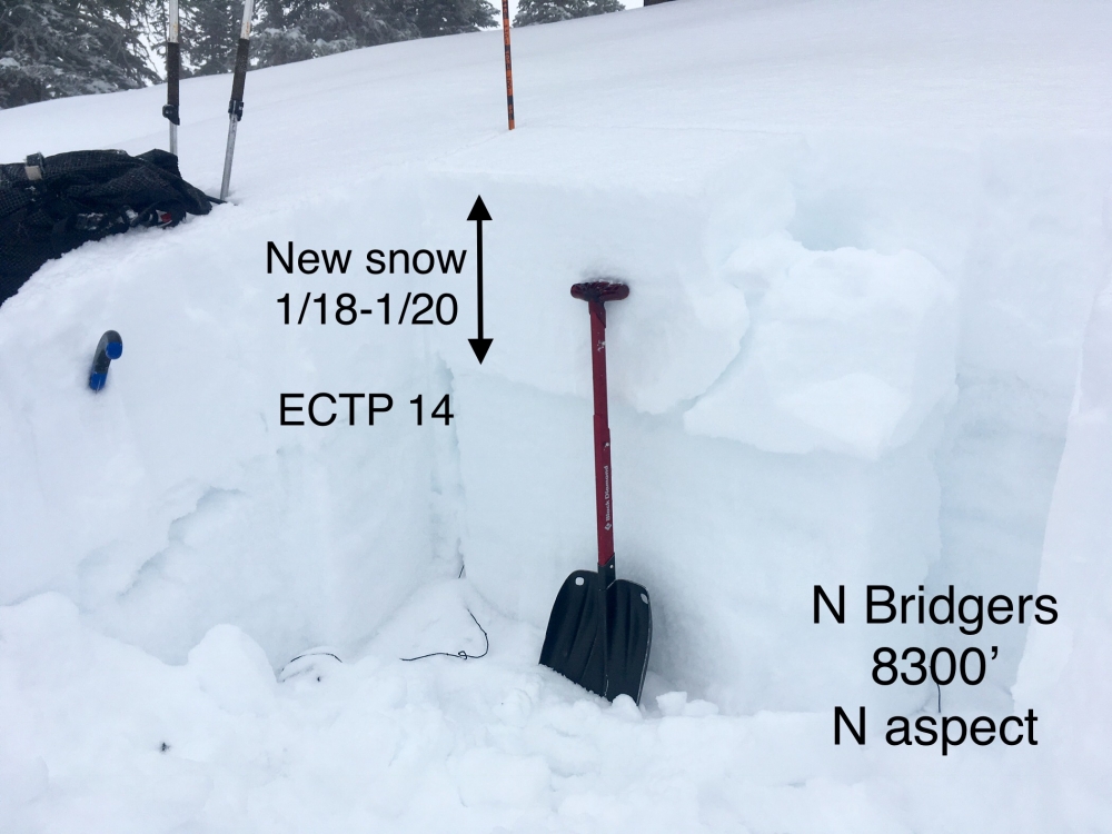
Bridger Range, 2019-01-20 The Bridger Range got 8-10" of new snow overnight (1/19-1/20) on top of 4-6" of snow from Friday (1/18). Last night's snow was equal to 1-1.5" of snow water equivalent. We got stable and unstable results in stability tests, but this heavy new load alone is enough to indicate large avalanches can break within or below this heavy snow. Photo: GNFAC Link to Avalanche Details |
|
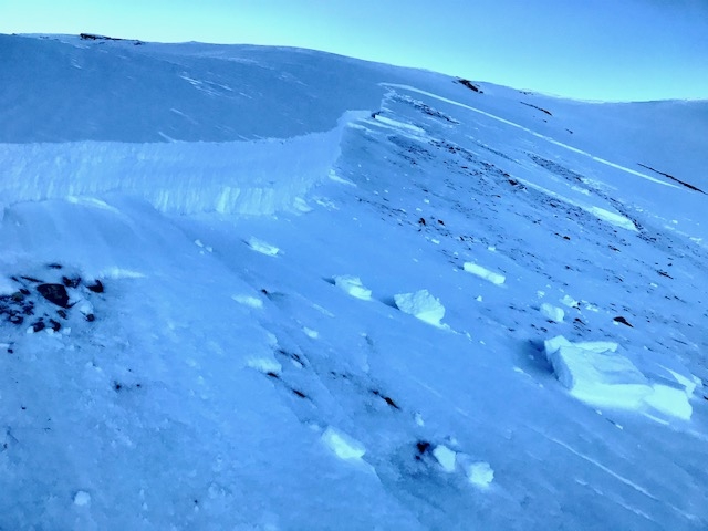
Bridger Range, 2019-01-19 This crown was part of a human triggered slide that caught and partially buried a skier near Fairy Lake in the northern Bridgers. The skier triggered the slide from low on the slope and was buried up to his chest. Fortunately, he was uninjured and able to dig himself out. Photo: GNFAC Link to Avalanche Details |
|
Bridger Range, 2019-01-19 Skiers near the south boundary of Bridger Bowl observed this natural slide on Saddle Peak below the Football Field. An intense shot of precipitation yesterday created unstable conditions, mainly on steep wind loaded slopes. This slide only involved the new snow and did not break into deeper layers. Fortunately, nobody was involved with this slide. Photo: N. Corwin Link to Avalanche Details |
|
Cooke City, 2019-01-18 The mountains near Cooke City got 8-10" of new snow since yesterday (1/17). We rode around Daisy and Lulu pass and saw small loose snow avalanches. With more wind and snow, avalanche danger will increase and we expect larger slides of new and wind-drifted snow, which may break deeper on buried weak layers. Photo: GNFAC |
|
Southern Madison, 2019-01-17 Sage Peak and Skyline Ridge have been wind scoured. The gullies are wind-loaded and the surface is blasted with nothing left to move. Photo: GNFAC |
|
Bridger Range, 2019-01-16 Conditions are firm and wind hammered in the northern Bridgers. Slide for life conditions are just as much of a hazard as avalanches. Although conditions are generally stable, all steep slopes should be assessed before dropping in. Photo: GNFAC |
|
Southern Madison, 2019-01-16 A rider found large crystals of feathery surface hoar in Teepee Basin on Tuesday, Jan 15. It was widespread and most crystals were 1/4-1/2" big, with this picture being the largest. It's now covered with 1-2" of snow. Photo: P. Smith |
|
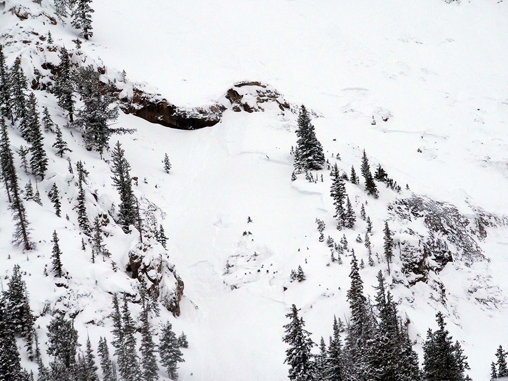
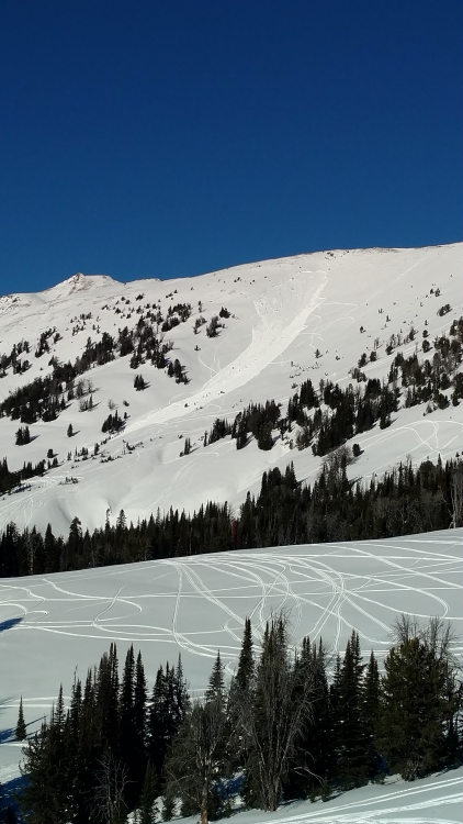
Southern Madison, 2019-01-16 Skiers triggered this large slide as they ascended (2-3 feet deep x 400 feet wide). It broke on a NE aspect at 10,000 feet on a 40 degree slope. It was recently wind-loaded and failed on facets at the ground. This occurred on Monday, January 14. Photo: Anon Link to Avalanche Details |
|
Southern Madison, 2019-01-16 Sledder's triggered this slide on Skyline Ridge while highmarking on Sunday, January 13. Photo: M. Bednar Link to Avalanche Details |

|
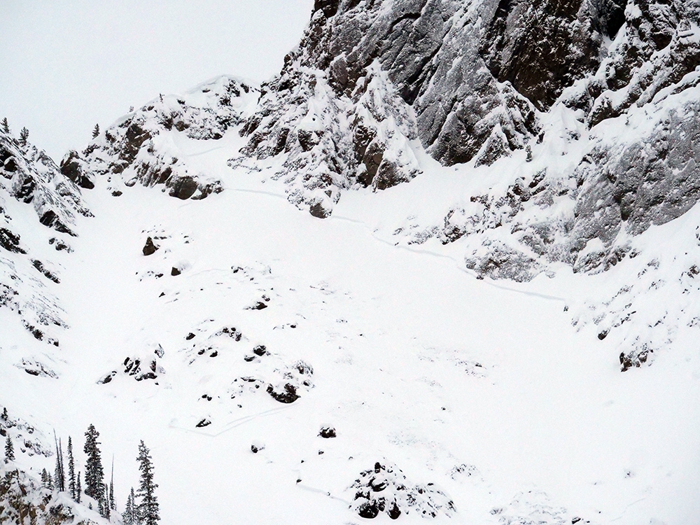
Lionhead Range, 2019-01-15 From facebook: "natural avalanche down near reynolds pass. West facing slope, it faces hwy 87 and is named mile Creek trail by usfs. No snowmobiling and haven't ever seen anyone ski it." Link to Avalanche Details |
|
Bridger Range, 2019-01-14 Skiers on the west side of the Bridgers found poor structure and signs of instability on Sunday. From the email: "We found a soft 4 finger layer about a foot thick over 6 to 12 inches of large grained facets that wouldn’t let us isolate a column. As we skinned up, we experienced whoomphing and cracking in the snow." Photo: P. Hinz Link to Avalanche Details |
|
Northern Gallatin, 2019-01-14 Photo: G. Antonioli Link to Avalanche Details |
|
Northern Gallatin, 2019-01-14 Above freezing temperatures at higher elevations created wet snow avalanches on slopes facing the sun. Photo: G. Antonioli Link to Avalanche Details |