Photos
|
Bridger Range, 2018-12-29 After receiving over a foot of snow in the past few days, skiers in the Bridgers were able to trigger a wind-loaded test slope near the Playground. With more snow in the forecast, storm slabs and wind slabs will remain sensitive over the next few days. Photo: G. Antonioli |
|
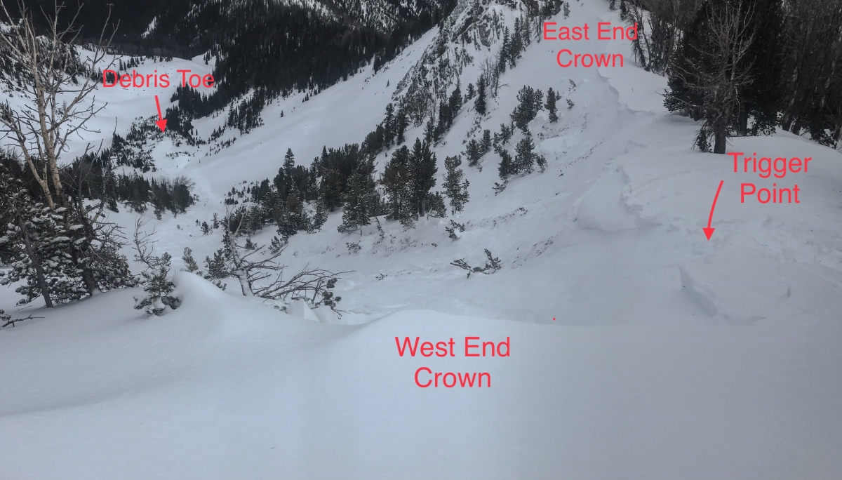
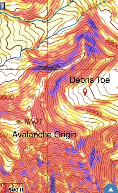
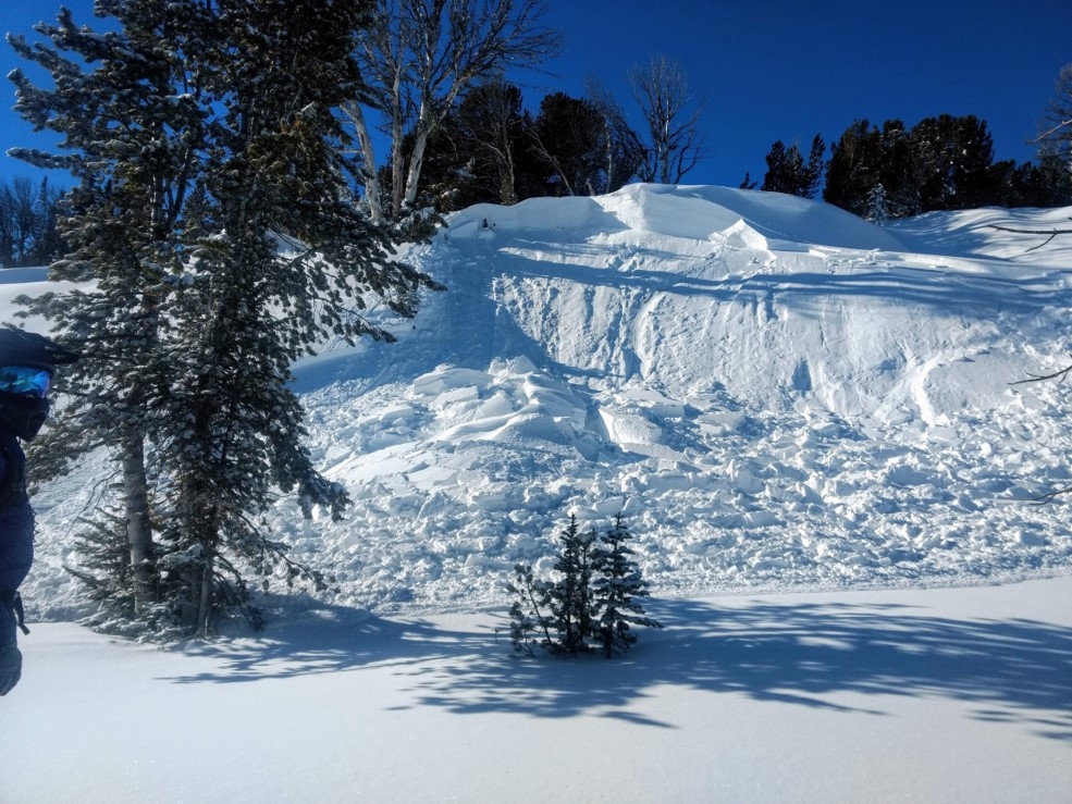
Cooke City, 2018-12-28 The avalanche on the south face of Mt Abundance was set off at about 2:00 pm on Thursday. Nobody was caught and it was triggered right behind a rider as he was climbing. It was estimated to be 1 foot deep, 100 feet wide, and ran a 100 feet slope distance. It was big enough to bury a person. Photo: J. Boyko Link to Avalanche Details |
|
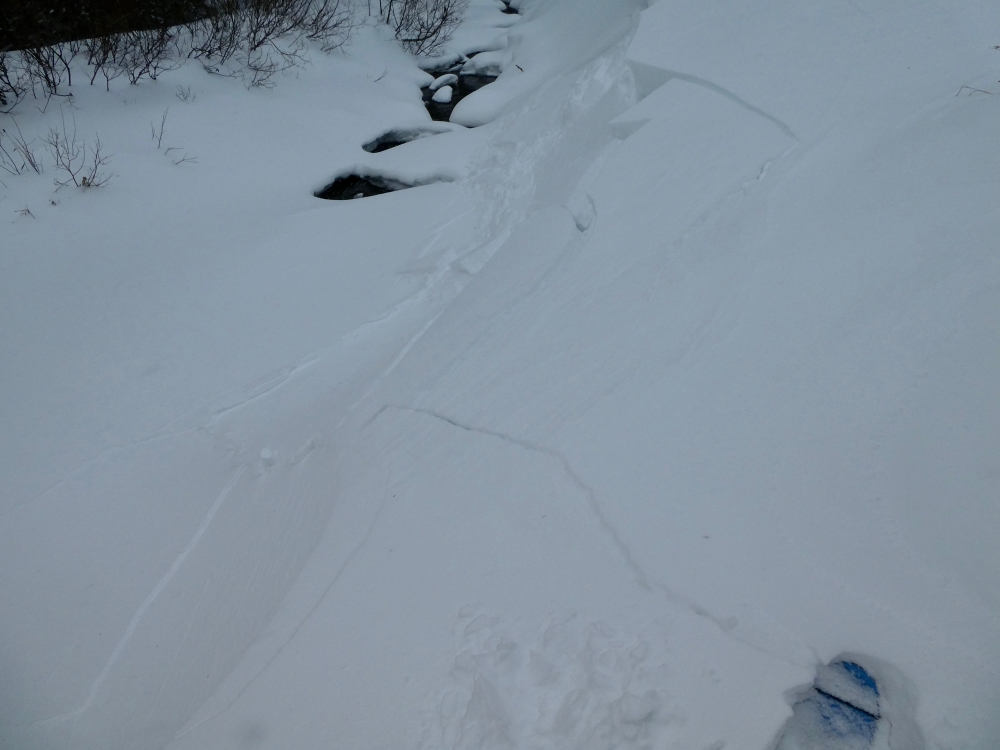
Lionhead Range, 2018-12-28 Collapsing and cracking in Watkins Creek in Lionhead. The snow is weak and collapses like this indicate instability. Photo: B. Rasmussen Link to Avalanche Details |
|
Lionhead Range, 2018-12-28 Collapsing and cracking in Watkins Creek in Lionhead. The snow is weak and collapses like this indicate instability. Photo: B. Rasmussen Link to Avalanche Details |
|
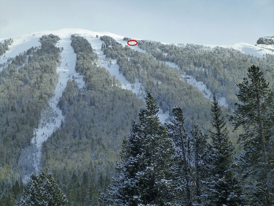
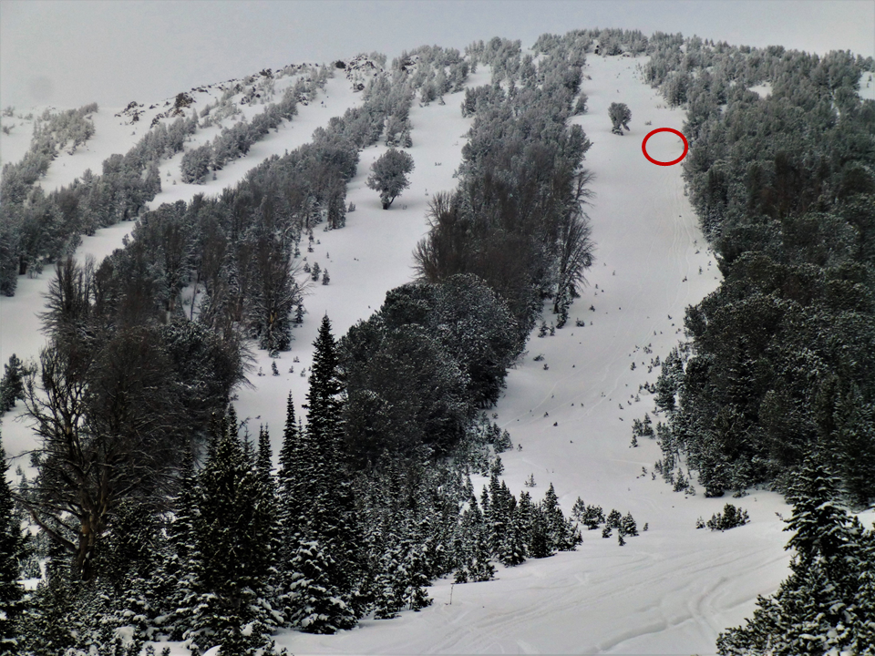
Cooke City, 2018-12-28 The red circle marks the location of my snowpit. There was 3 feet of faceted snow that was stable, but weak. Snowfall and wind will make these paths dangerous. Photo: GNFAC |
|
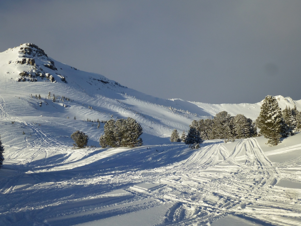
Cooke City, 2018-12-28 These wind ripples above Henderson Bench outside Cooke City are a sign that the wind blew hard across this face. Be on the lookout for areas where the wind drifted snow into hard slabs because these spots would be susceptible to sliding. Photo: GNFAC |
|
Lionhead Range, 2018-12-28 The snowpack at 9,000' above Hebgen Lake near West Yellowstone is 60-70cm (~2 feet) deep. It is mostly weak, sugary facets and will struggle to support the weight of future storms. Photo: GNFAC Link to Avalanche Details |
|
Bridger Range, 2018-12-28 Snow that fell in the Bridger Range on Thursday (12/27) was very lightweight and low density. This snow could easily sluff off steep slopes and wind will blow this snow into fresh wind slabs. Photo: GNFAC |
|
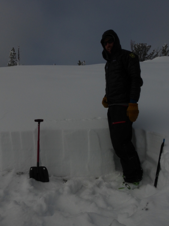
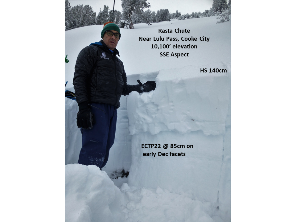
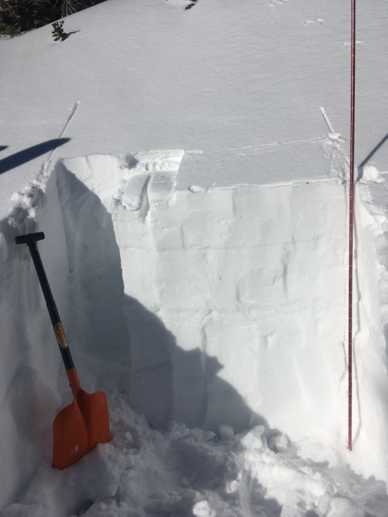
Cooke City, 2018-12-26 The red circle shows our snowpit location at 10,100' on a SSE facing slope near Lulu Pass. There was 140cm of snow and we got a layer of facets to break 55cm from the surface with 22 hits on an ECT. We opted to not ski the slope. Photo: GNFAC |
|
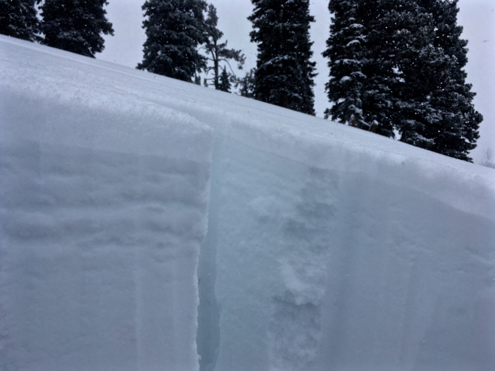
Cooke City, 2018-12-26 A layer of facets that formed in early December is breaking clean in stability tests (ECTP22) about 1.5 feet under the surface. Wind-loading or more snow will make this layer more reactive. Photo: GNFAC |
|
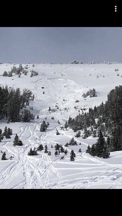
Out of Advisory Area, 2018-12-25 A skier triggered this avalanche near Emigrant Peak in Paradise Valley. He was not caught. From his email, " North Facing aspect at approx. 9800' on a west to east ridge. Slope angles are 35-40. Crown varied from 1-3'. Hard slab on the the cornice propagated to two other small starting zones and pulled the cornices and all the faceted snow near the ridgeline. Avalanche ran about 800'." Photo: A. Whitmore Link to Avalanche Details |
|
Out of Advisory Area, 2018-12-25 This map shows where a skier triggered a wind slab from the ridgetop near Emigrant Peak in Paradise Valley. Photo: A. Whitmore Link to Avalanche Details |
|
Island Park, 2018-12-24 From email: "7,500' West facing in the Hellroaring Drainage 12/22/18" Photo: S. Hansen Link to Avalanche Details |
|
Bridger Range, 2018-12-24 Saddle Peak is backcountry terrain located south of Bridger Bowl ski area's boundary. Hazards are not mitigated by patrol and there are no patrol rescue services. You should have the necessary skills and knowledge about snowpack and safe travel before entering this terrain. Photo: GNFAC |
|
Northern Madison, 2018-12-24 From e-mail on 12/23: "About an 8 inch slab triggered by snowmobilers. South facing slope in the 3rd yellowmule at buck ridge." Photo: Crisman Link to Avalanche Details |
|
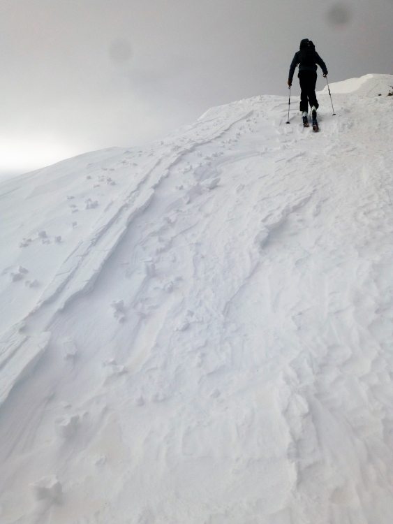
Cooke City, 2018-12-23 Riders in Cooke City observed wind loading near ridge tops and cross-loading at middle elevations today. They also reported multiple small wind slabs releasing near Lulu Pass during the day on Friday. P: L. Zuckiewicz Link to Avalanche Details |
|
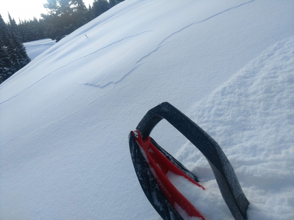
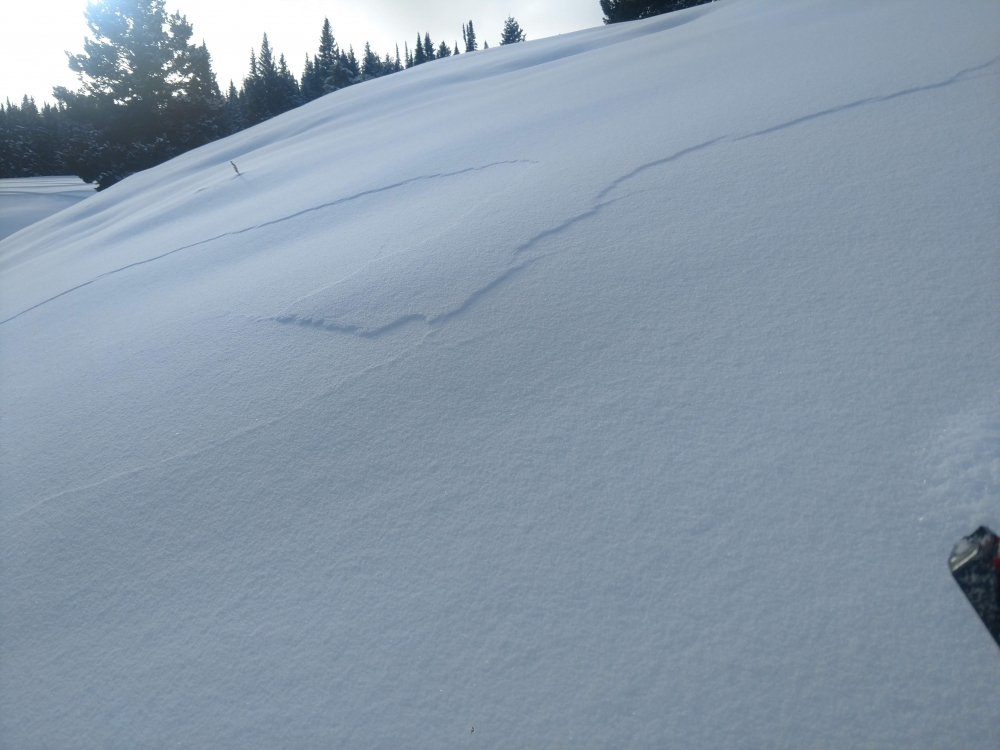
Bridger Range, 2018-12-23 On Saddle Peak, strong west wind (Friday) stripped the ridgetop of uncompacted snow that left elevated ski tracks and pole plants behind. Photo: GNFAC |
|
Northern Gallatin, 2018-12-23 This pit was dug near Maid of the Mist in Hyalite. It produced unstable test results on a thin weak layer 10" down from the surface. ECTP22 @22cm. SE slope at 9700'. HS 110cm. Photo: M. Zia |
|
Northern Madison, 2018-12-22 This wind-loaded pocket was triggered in the 2nd Yellowmule of Buck Ridge on 12/22. Photo: M. Alvarez Link to Avalanche Details |
|
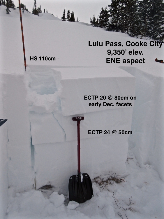
Cooke City, 2018-12-20 We found weak facets that formed in early December are buried 10" deep outside Cooke City. This layer produced unstable results in stability tests (ECTP 20) on a lightly wind loaded slope near Lulu Pass (12/20). This layer will be the likely place to see avalanches break in the snowpack on wind loaded slopes and when we get more snow. Photo: GNFAC |