Photos
|
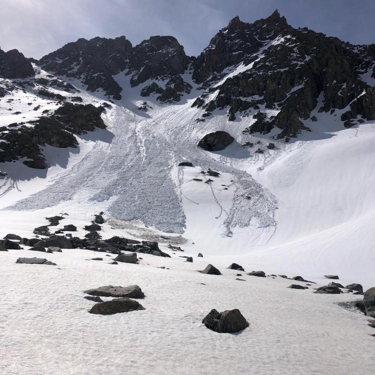
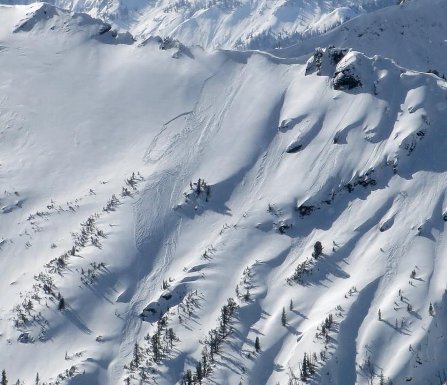
Cooke City, 2020-06-02 "...some wet slides from Tuesday/Wednesday (5/26-5/27) up W Fork Rock Creek." Photo: S. Magro |

|
Cooke City, 2020-05-04 From obs. (5/2/20): "Some recent wet slab avalanches were observed around Cooke City yesterday. North and south aspects to mid elevations... not sure of the exact timing, but attached is a photo of one, a southerly aspect around 9,000'." Photo: B. Fredlund Link to Avalanche Details |
|
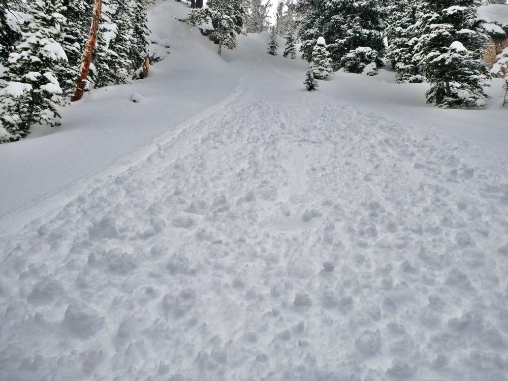
Cooke City, 2020-04-07 From obs on 4/6/20: "I got tagged by a small point release today. Skinning up the Republic Mountain ridgeline I had stopped to pull skins because it was apparent from hand-pit that the new snow was not bonding well with the old snow interface. I was looking down slope so didn’t actually see the release, but think it was a natural point release that I just happened to be standing in the way of, at least I didn’t feel any collapse so it didn’t seem like I had remotely triggered it. Restricted to new snow ~ 6” deep and ran for about 80 vertical feet. Point release in rock band at ~8,980 to toe at where I was standing at 8,900’ on ESE aspect on ~35° slope ( 45.004, -109.942). IWx: Overcast, warm (35°+), calm, snowing heavy at time (0.6 SWE at Fisher Creek SNOTEL in 10 hr.)." Link to Avalanche Details |
|
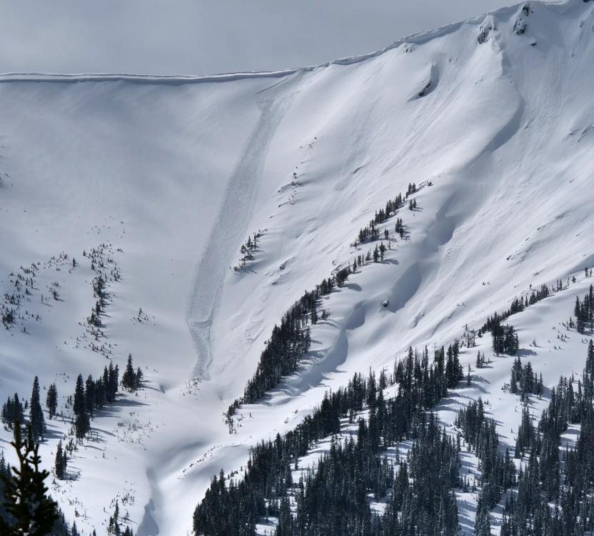
Cooke City, 2020-04-04 From email (4/4/20): "...east aspect, around 9700'. The crown looked to average about 2' deep, and it was about 400' wide. I'd estimate that this avalanche happened on April 1 or 2. (2-3 days ago)". Photo: B. Fredlund Link to Avalanche Details |
|
Cooke City, 2020-04-03 From email on 4/2/2020 "fresh, natural slab avalanche this morning. Estimated to be about 50' wide. A north facing aspect around 9700'. It looks to have been triggered by a sluff that came off the steep rocky terrain above." Photo: B. Fredlund
|
|
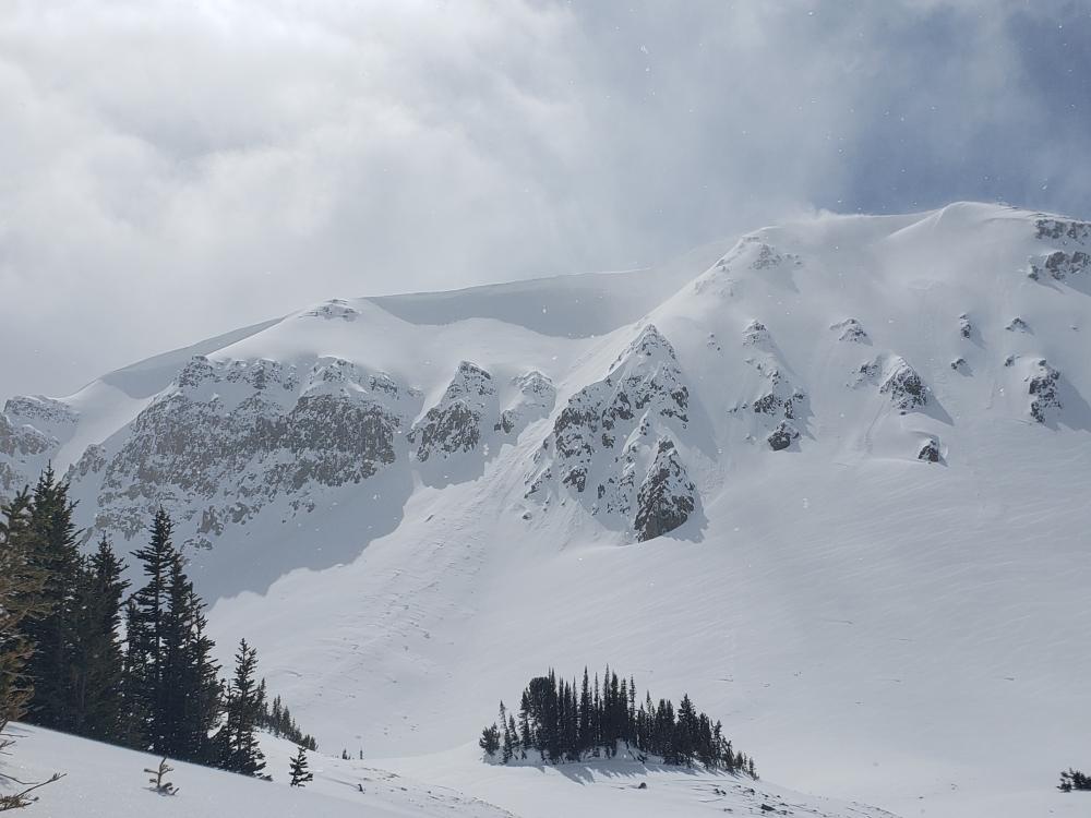
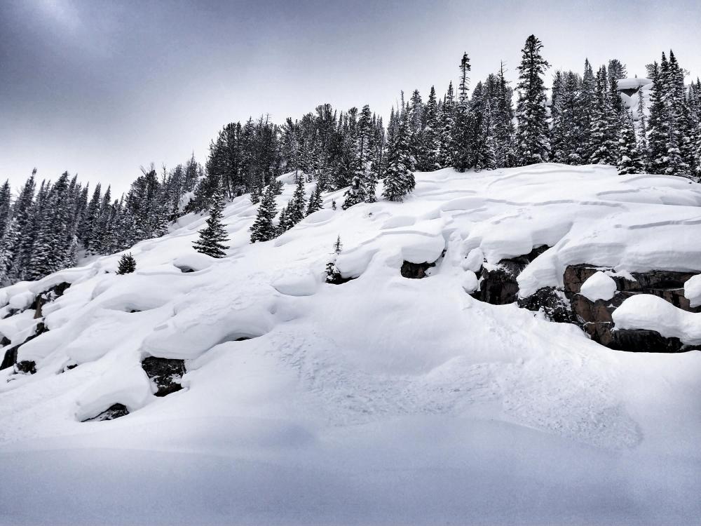
Cooke City, 2020-03-31 Cornices on the back side of Sheep mtn are getting huge. Guessing well over 25ft. They are right above a play area to the west of Ovis lake, and round Round lake. Photo: R. DeSilva |
|
Cooke City, 2020-03-28 From email on 3/27/2020 : "natural slab avalanche I observed today near Cooke City. An easterly aspect around 9,400'. I'd estimate the crown to be 2-3' deep and about 100' wide. Looks like it was triggered by a cornice fall (2-3 days ago?)." Photo: B. Fredlund Link to Avalanche Details |
|
Cooke City, 2020-03-27 From obs: "Wind Loaded slope. 2ft Crown. 100ft wide. firm, crusty bed surface. The avalanche was released by a ski cut." Photo: Anonymous Link to Avalanche Details |
|
Cooke City, 2020-03-16 Small slab avalanche in the upper Republic Valley, a northeast aspect around 10,000'. Photo: B Fredlund Link to Avalanche Details |
|
Cooke City, 2020-03-16 Snowmobile triggered avalanche near Lulu Pass. Photo: Anonymous Link to Avalanche Details |
|
Cooke City, 2020-03-16 Snowmobile triggered avalanche near Lulu Pass. Photo: Anonymous Link to Avalanche Details |
|
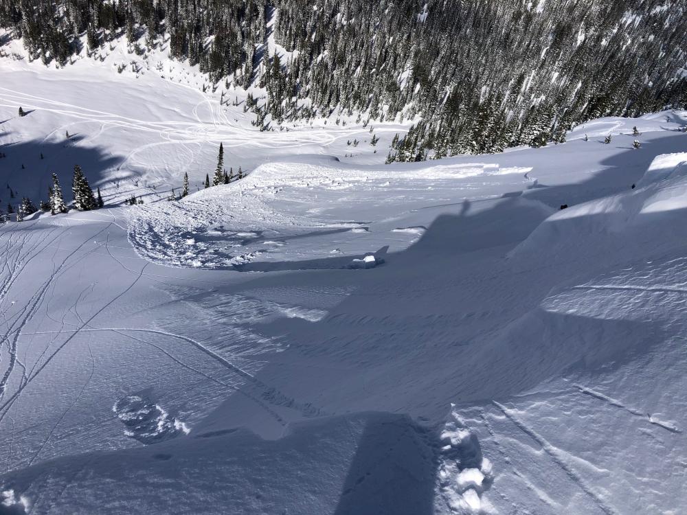
Cooke City, 2020-03-16 From e-mail on 3/15/20: "At around 1230pm today, everything that was steeper than 35 degrees in star Creek simultaneously slid on east, north, south aspects. Soft slab 6-12" in thickness. Prior to that, it had been snowing S5 for three hours." Photo: B. Zavora Link to Avalanche Details |
|
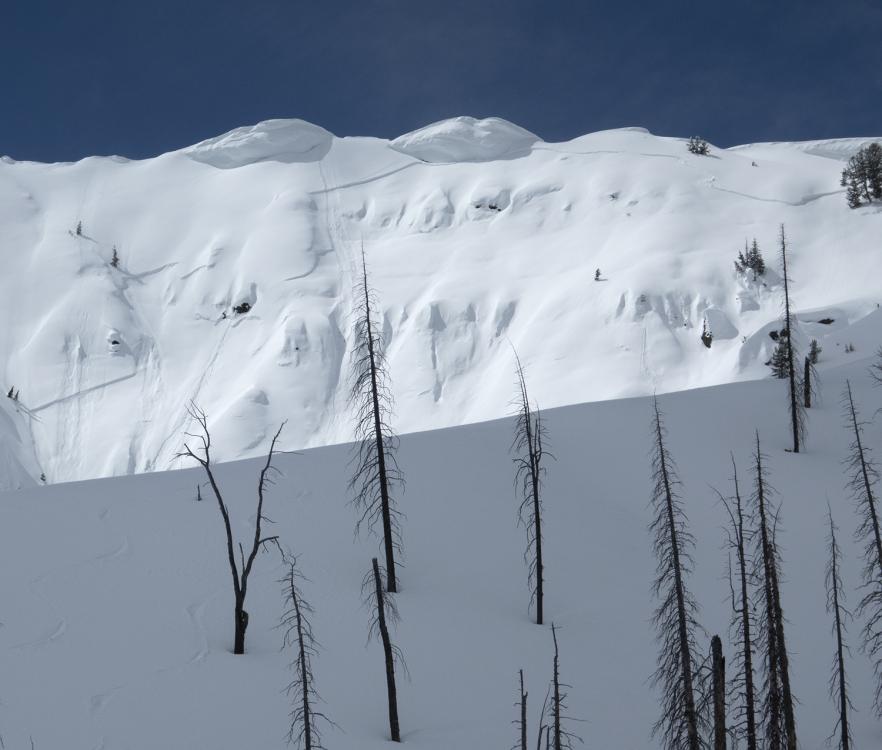
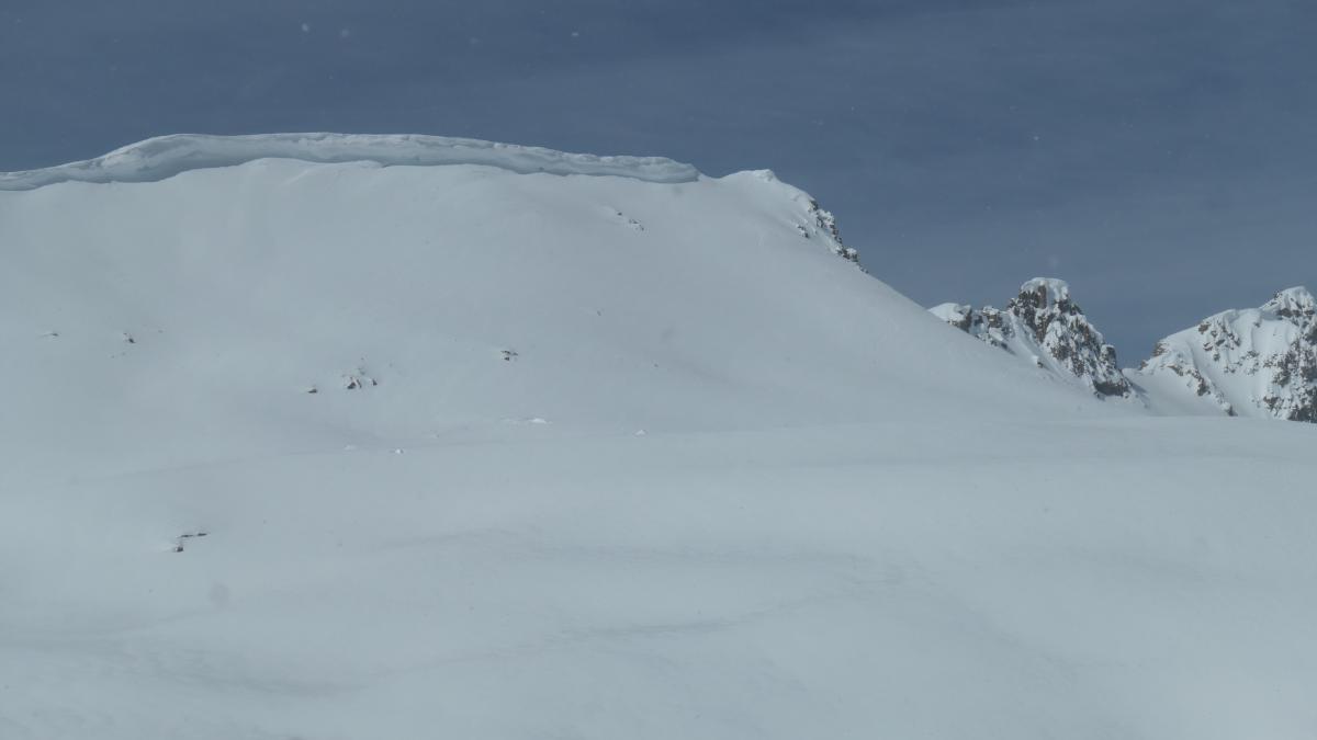
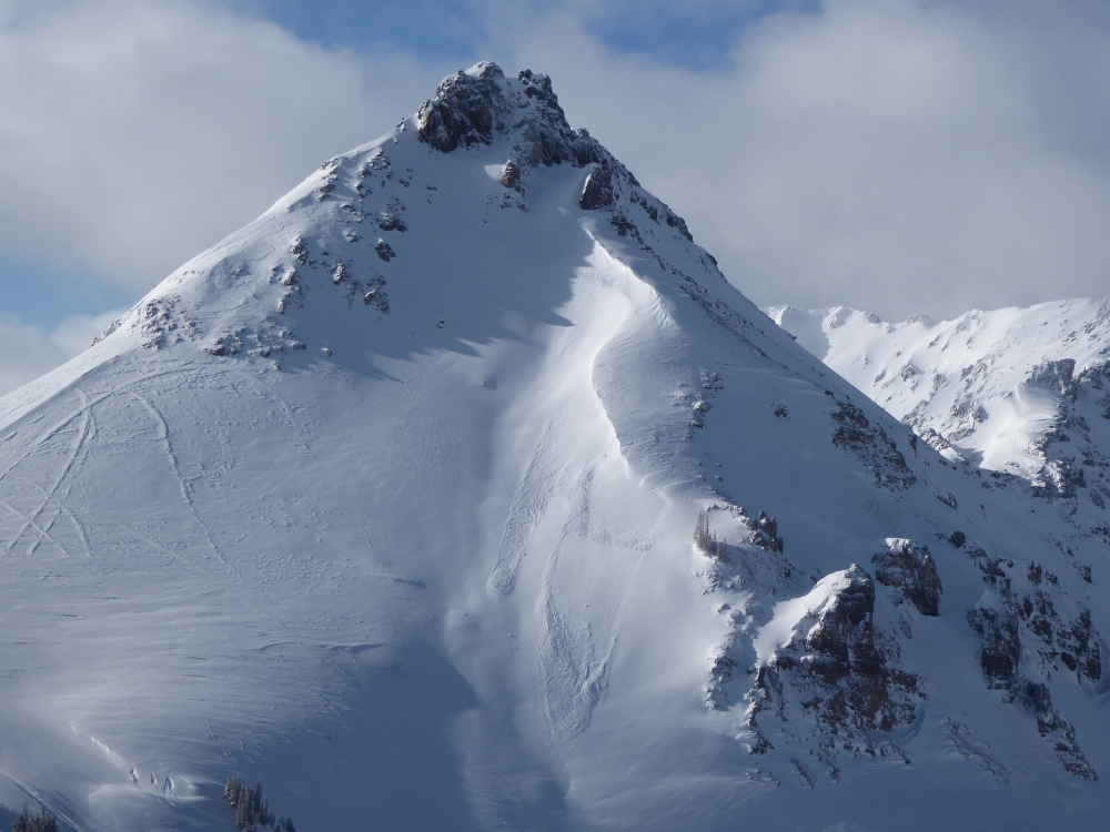
Cooke City, 2020-03-13 Cornices are growing to immense sizes in Cooke City. Try to minimize your time underneath these monsters and stay far away from the edge if you are on ridge tops. Photo: GNFAC |
|
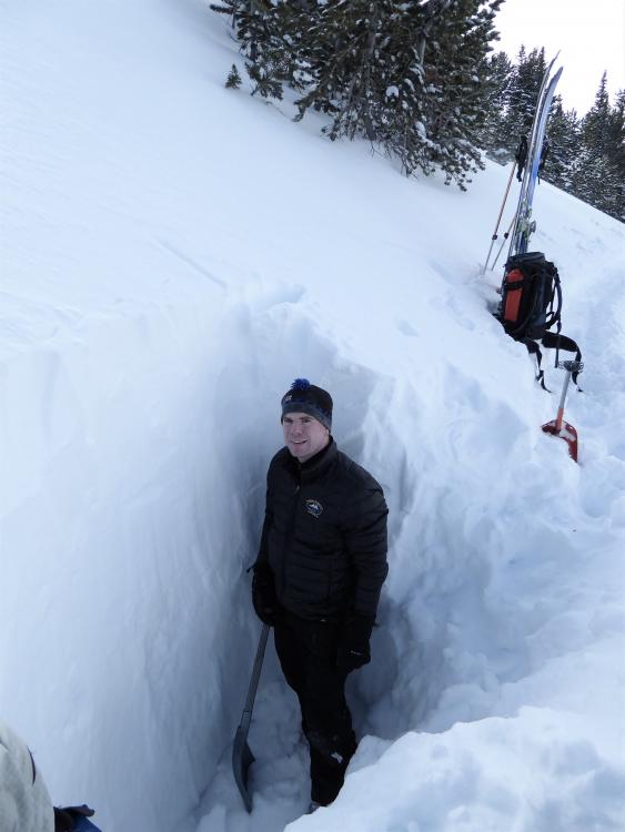
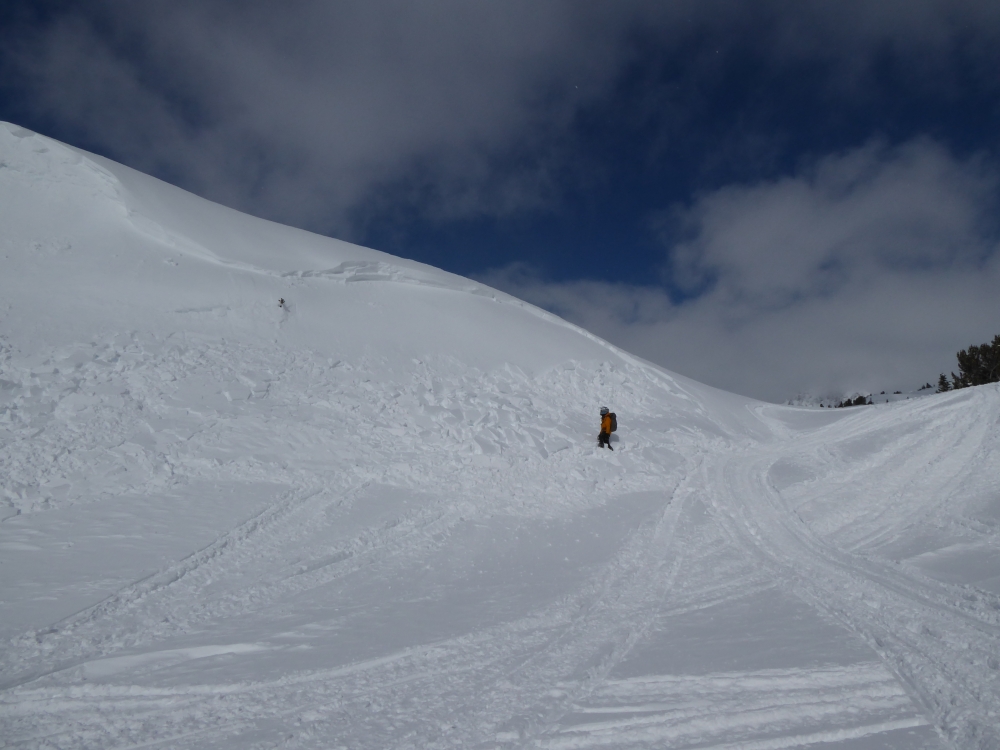
Cooke City, 2020-03-11 Mike Thom, Gardiner District Ranger, stands in a 7-foot deep snowpit at 9900' on Woody Ridge to the south of Cooke City. We found wind-loading to be our primary concern. Facets were still present at the base of the snowpack, but they are stable for now. Photo: GNFAC |
|
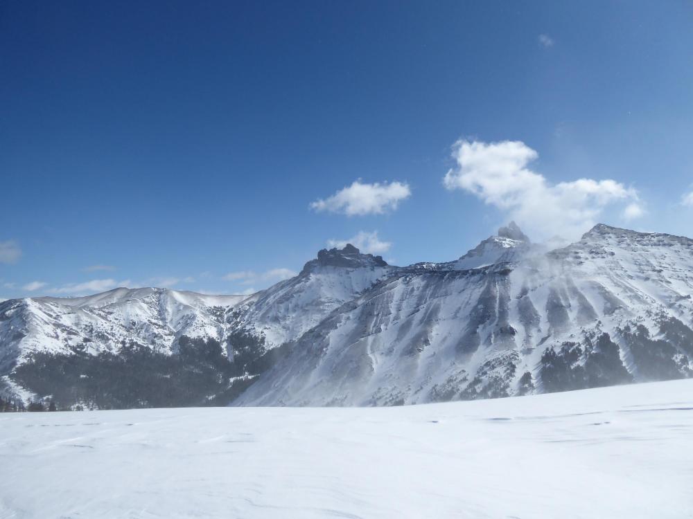
Cooke City, 2020-03-11 Strong wind stripped snow off many slopes above treeline. Photo: GNFAC |

|
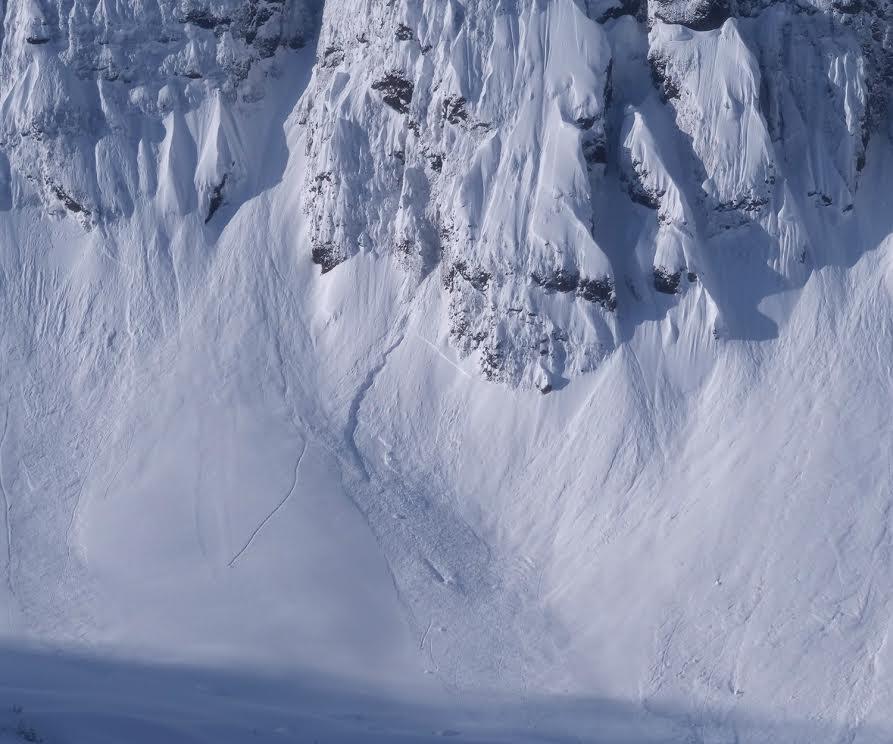
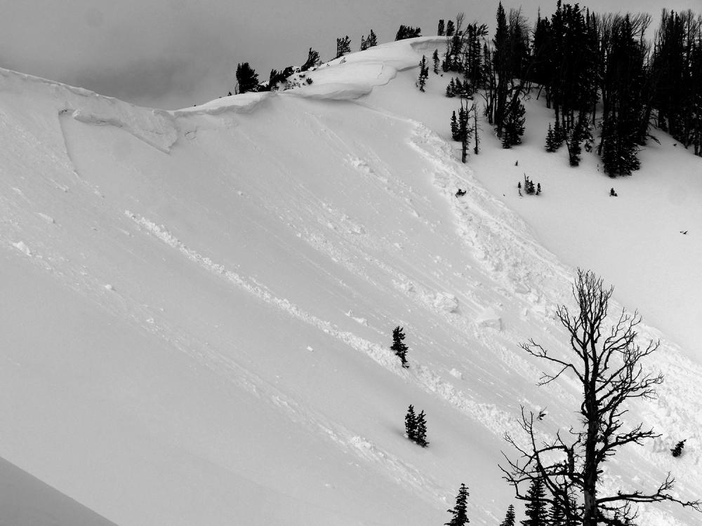
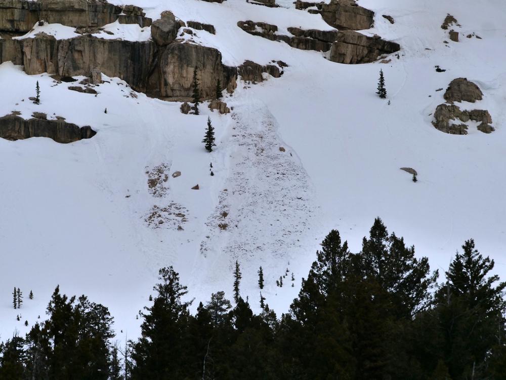
Cooke City, 2020-03-11 This naturally triggered avalanche likely happened Tuesday morning. Strong wind loaded slopes and made huge cornices. Photo: GNFAC Link to Avalanche Details |
|
Cooke City, 2020-03-07 From e-mail: "...some wet loose avy activity observed today just west of Cooke City (south aspect, around 8200'). Overall though, minimal wet avalanche activity observed with this significant warm up..." Photo: B. Fredlund Link to Avalanche Details |
|
Cooke City, 2020-02-28 From email: "Photo attached of a natural avalanche from yesterday, just south of Cooke City. It's on an E, NE aspect, with a crown around 9,300'. Looks like it occurred yesterday am, as a result of a cornice fall." B. Fredlund Link to Avalanche Details |
|
Cooke City, 2020-02-25 Small natural wind slabs on Crown Butte. Broke overnight, observed morning of 2/25/2020. Photo: GNFAC Link to Avalanche Details |
|
Cooke City, 2020-02-25 Snowmobile triggered wind slab near Goose Lake. Triggered morning of 2/25/2020. Broke 1-2' deep on a small slope. Photo: GNFAC Link to Avalanche Details |