Photos
|
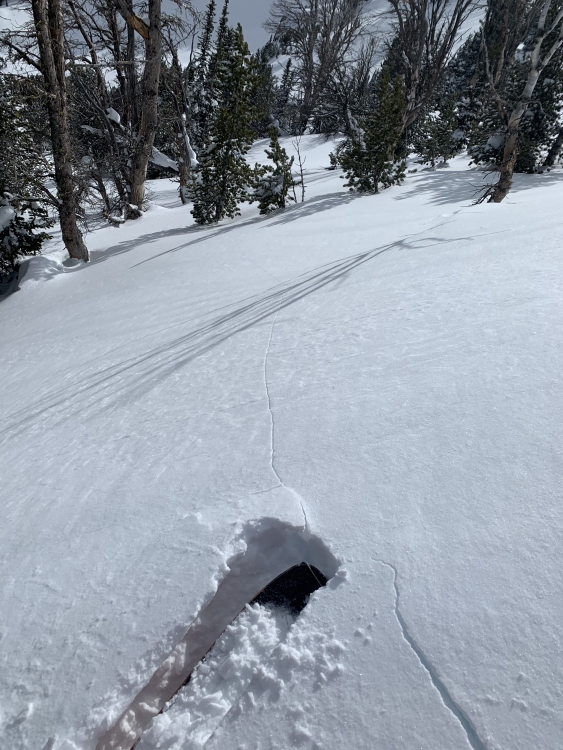
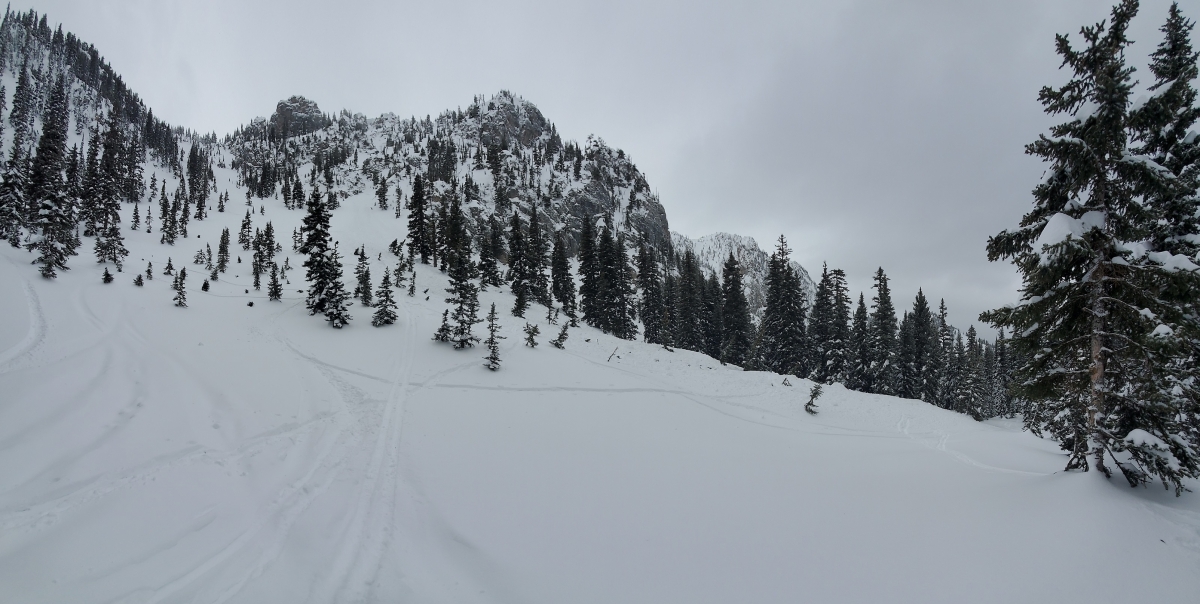
Northern Gallatin, 2020-02-17 "Toured up Blackmore today, we had shooting cracks under our feet along the north east ridge line." Photo: Mike Murray Link to Avalanche Details |
|
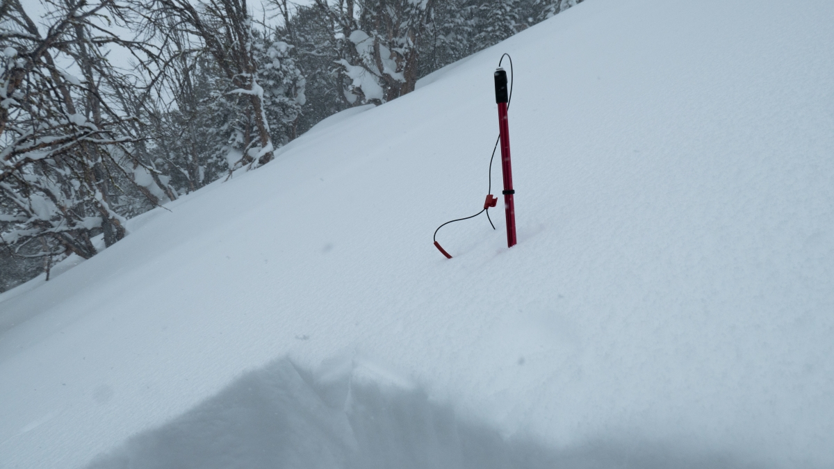
Cooke City, 2020-02-16 Cooke City is getting deep! The total snow height is 315 cm. Our pit results on Scotch Bonnet were a variety of ECTNs in the upper layers of the snowpack. When placing our probe for stability tests we could feel the weak snow near the ground as our probes just dropped through the lower 60 cm of the snowpack. I am still worried about the deep layers, but it has been a while since they performed and it seems like it will take a big trigger (i.e. a cornice drop), a big storm to add weight, or some really bad luck to trigger one of the monster avalanches on the basal facets. Photo: GNFAC |
|
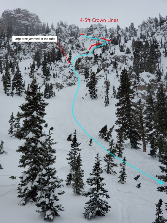
Bridger Range, 2020-02-16 "We came across the debris of a significant slide in one of the steeper lines just north of Wolverine bowl today. There was zero new fallen snow on the debris so it happened sometime this morning before 11:30 a.m. and after the snowfall stopped last night. The multiple crowns looked to be 3-5 feet tall and a large tree has been jammed into the tube ride chute. The toe of the debris is all the way down into the creek at the base of Wolverine. It's possible a large cornice broke off at the ridgeline but we couldn't get eyes on the actual start of the slide. We skinned up and down the debris pile twice while in search mode at around 12:30 but did not pick up a signal. We did not investigate above the pinch of the chute and into the upper part of the slide. The debris pile is quite deep with some damaged trees. We did 6 lines off the ramp over the weekend and did not see any other avalanche activity but obviously some significant wind loading." Photo: Ray K Link to Avalanche Details |
|
Bridger Range, 2020-02-16 We came across the debris of a significant slide in one of the steeper lines just north of Wolverine bowl today. There was zero new fallen snow on the debris so it happened sometime this morning before 11:30 a.m. and after the snowfall stopped last night. The multiple crowns looked to be 3-5 feet tall and a large tree has been jammed into the tube ride chute. The toe of the debris is all the way down into the creek at the base of Wolverine. It's possible a large cornice broke off at the ridgeline but we couldn't get eyes on the actual start of the slide. We skinned up and down the debris pile twice while in search mode at around 12:30 but did not pick up a signal. We did not investigate above the pinch of the chute and into the upper part of the slide. The debris pile is quite deep with some damaged trees. We did 6 lines off the ramp over the weekend and did not see any other avalanche activity but obviously some significant wind loading. Photo: Ray K Link to Avalanche Details |
|
Bridger Range, 2020-02-16 "We came across the debris of a significant slide in one of the steeper lines just north of Wolverine bowl today. There was zero new fallen snow on the debris so it happened sometime this morning before 11:30 a.m. and after the snowfall stopped last night. The multiple crowns looked to be 3-5 feet tall and a large tree has been jammed into the tube ride chute. The toe of the debris is all the way down into the creek at the base of Wolverine. It's possible a large cornice broke off at the ridgeline but we couldn't get eyes on the actual start of the slide. We skinned up and down the debris pile twice while in search mode at around 12:30 but did not pick up a signal. We did not investigate above the pinch of the chute and into the upper part of the slide. The debris pile is quite deep with some damaged trees. We did 6 lines off the ramp over the weekend and did not see any other avalanche activity but obviously some significant wind loading." Photo: Ray K Link to Avalanche Details |

|
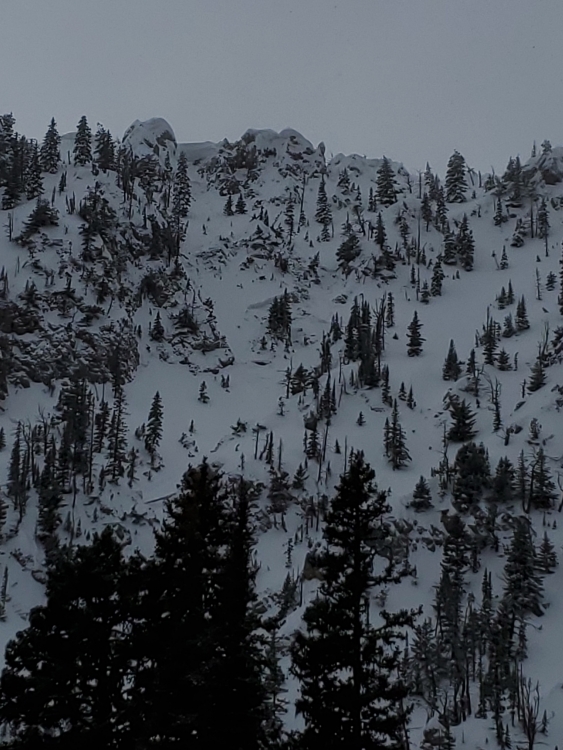
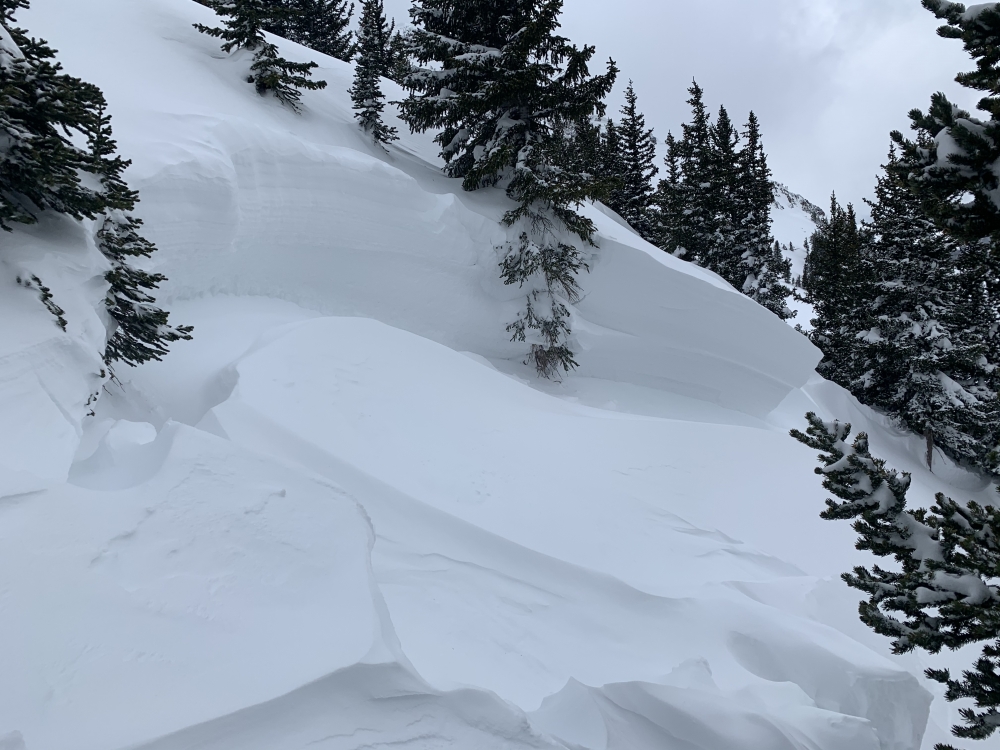
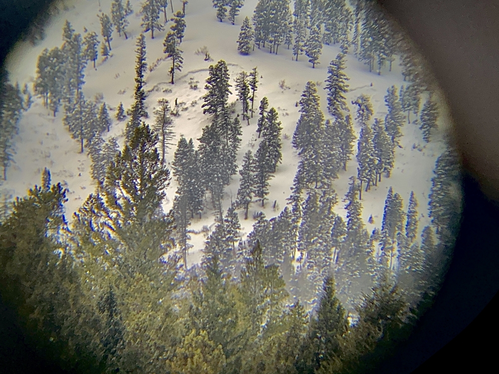
Northern Gallatin, 2020-02-16 "Slide occurred on north aspect of Mt Blackmore at 9200ft. Photo provides close-up view and width of crown." Photo: Laura Ippolito Link to Avalanche Details |

|
Northern Gallatin, 2020-02-16 "Slide occurred on north aspect of Mt Blackmore at 9200ft. Photo was taken at the end of the runout." Photo: Laura Ippolito Link to Avalanche Details |
|
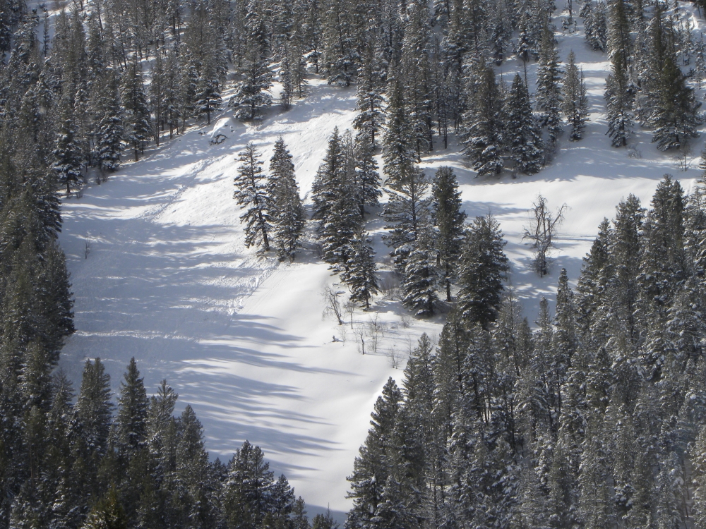
Northern Gallatin, 2020-02-16 "Slide occurred north northwest aspect of Mt Blackmore at 9400ft in a narrow meadow. This provides width of slide." Photo: Laura Ippolito Link to Avalanche Details |
|
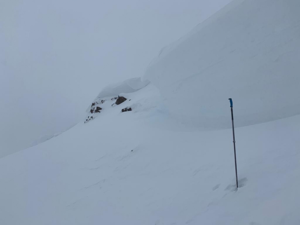
Northern Gallatin, 2020-02-16 "Slide occurred north northwest aspect of Mt Blackmore at 9400ft in a narrow meadow. Close-up view of an approximate 8" crown." Photo" L. Ippolito Link to Avalanche Details |
|
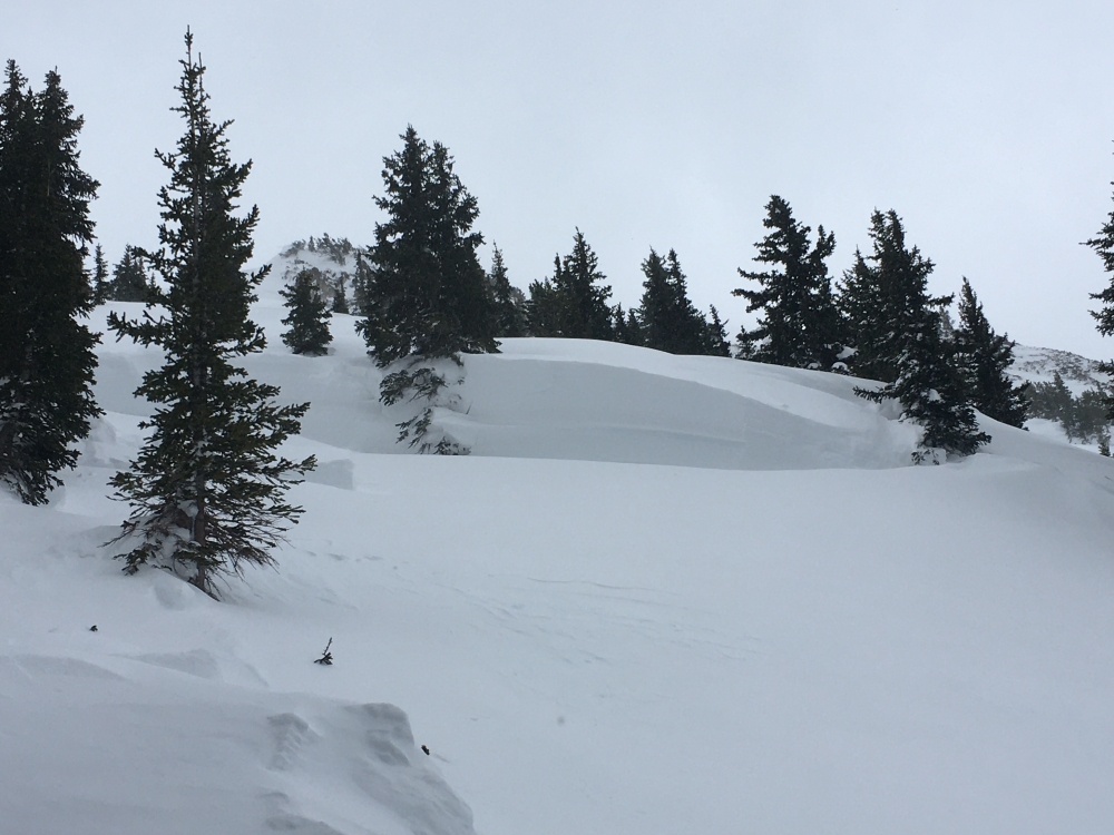
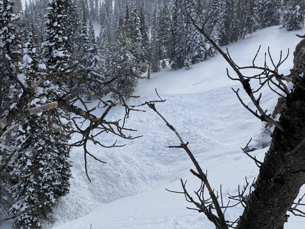
Northern Gallatin, 2020-02-16 Photo of the Divide Basin avalanche that was likely triggered by a cornice fall on Friday, Feb 14. Photo: Nick Truax Link to Avalanche Details |
|
Northern Gallatin, 2020-02-16 Photo of the Divide Basin avalanche that was likely triggered by a cornice fall on Friday, Feb 14. Photo: Nick Truax Link to Avalanche Details |
|
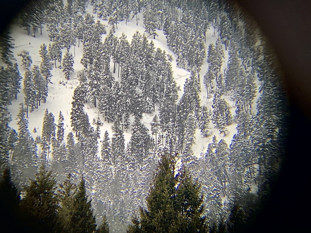
Northern Gallatin, 2020-02-16 From an observation, "R3-4 D2 avalanche that failed at the ground observed from the Trail Creek Rd. Looked to be several hundred feet wide, couldn’t see the debris, but crown went through lots of trees." Photo: Chris Cullaz Link to Avalanche Details |
|
Northern Gallatin, 2020-02-16 From an observation, "R3-4 D2 avalanche that failed at the ground observed from the Trail Creek Rd. Looked to be several hundred feet wide, couldn’t see the debris, but crown went through lots of trees." Photo: Chris Cullaz Link to Avalanche Details |

|
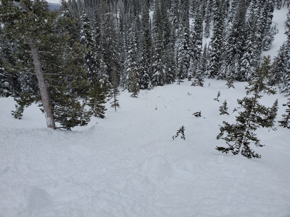
Northern Gallatin, 2020-02-16 We skied Wheeler via South Cottonwood and found that the two gullies on the East and South East aspects had recently run in their entirety. We could only see the crown on the South East gully but it appeared to have broke on the steepest part of the slope near the top approximate 3-4ft deep and was the width of the gully. Both avalanches ran the full length and width of their gullies, breaking several trees along the way. The East debris pile was about 25ft deep and the South East was 15ft deep. The East rounded the corner into the ravine at the bottom and also ran about 200ft into the forest. A couple larger trees in the path that were not broken had their branches stripped off the bottom 30ft. Interestingly, the narrow meadow between the South East gully and the South East meadow you recently reported slides on has not slid. Also, we had no propagation or collapsing in our pits. Photo: Alan Cleary Link to Avalanche Details |

|
Northern Gallatin, 2020-02-16 We skied Wheeler via South Cottonwood and found that the two gullies on the East and South East aspects had recently run in their entirety. We could only see the crown on the South East gully but it appeared to have broke on the steepest part of the slope near the top approximate 3-4ft deep and was the width of the gully. Both avalanches ran the full length and width of their gullies, breaking several trees along the way. The East debris pile was about 25ft deep and the South East was 15ft deep. The East rounded the corner into the ravine at the bottom and also ran about 200ft into the forest. A couple larger trees in the path that were not broken had their branches stripped off the bottom 30ft. Interestingly, the narrow meadow between the South East gully and the South East meadow you recently reported slides on has not slid. Also, we had no propagation or collapsing in our pits. Photo: Alan Cleary Link to Avalanche Details |
|
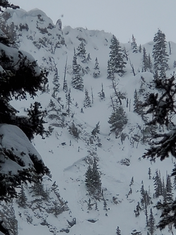
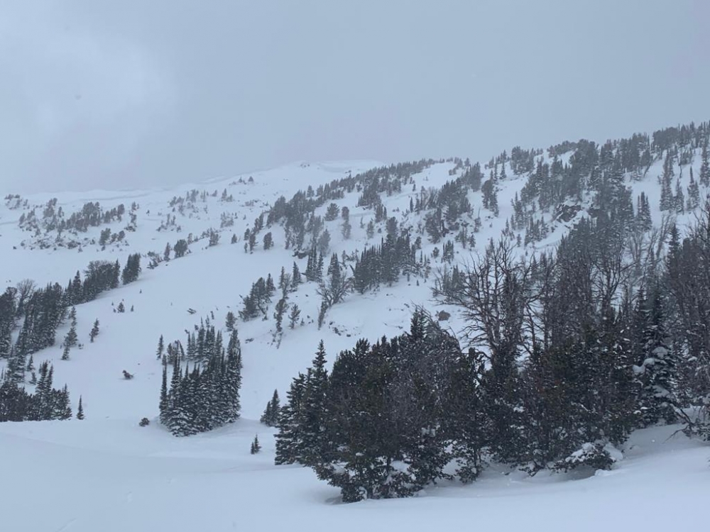
Out of Advisory Area, 2020-02-16 This picture was taken February 12. On Feb 15 skiers wrote about another avalanche, a large natural on the north face. 3' deep, 300' wide and ran 1,000 feet. Photo: L. Watson Link to Avalanche Details |
|
Southern Madison, 2020-02-16 Debris pile from the slide in Taylor’s Fork, crown of about 5-6’ and about 100' wide. Human triggered. Photo: Matt Seifert Link to Avalanche Details |