Photos
|
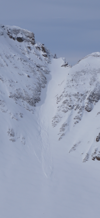
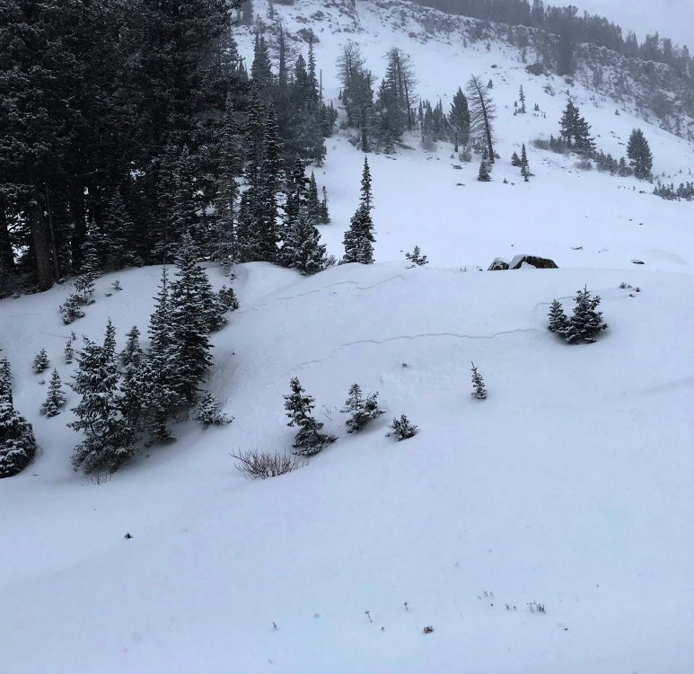
Cooke City, 2019-12-01 From an email: "Chris and I toured up the East Ridge of Mineral today and dug a pit on a NE aspect around 9000'. HS 75 cm, mostly facets with the exception of the new snow. ECTX. We found more of a windslab on some more exposed features although it wasn't reactive for us and we saw no natural avalanches with the exception of a small slide in the couloir skier's left of the summit of Meridian. We were still a ways away but it appeared to have run on the old/new snow interface." Photo: Henry Coppolillo Link to Avalanche Details |
|
Bridger Range, 2019-12-01 This natural avalanche released on Saddle Peak. wind loading from west winds created sensitive wind slabs this morning. Photo: S. Jonas Link to Avalanche Details |
|
Bridger Range, 2019-12-01 Skiers found reactive wind slabs near the ridge line that easily avalanched. Photo: S. Jonas Link to Avalanche Details |
|
Northern Madison, 2019-12-01 From obs.: "New snow from 24 hours ago blew around the ridge tops from 11pm last night until 7am this morning ~30mph. This soft 4 finger slab was about 6”-7” deep and broke on a convex roll.... We were assessing the terrain carefully and expected this result." Photo: R. Christian-Frederick Link to Avalanche Details |
|
Northern Madison, 2019-12-01 We triggered this dry loose avalanche on a west facing slope in Beehive Basin on 11/30. 3-5" of recent snow easily slid on top of a crust. Photo: GNFAC Link to Avalanche Details |
|
Northern Madison, 2019-12-01 Dry loose snow avalanches were easy to trigger on Saturday 11/30 in Beehive Basin. Photo: GNFAC Link to Avalanche Details |
|
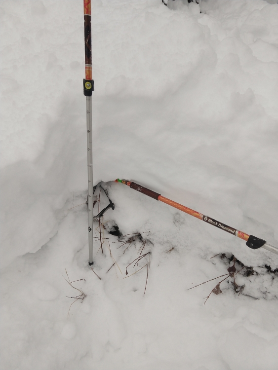
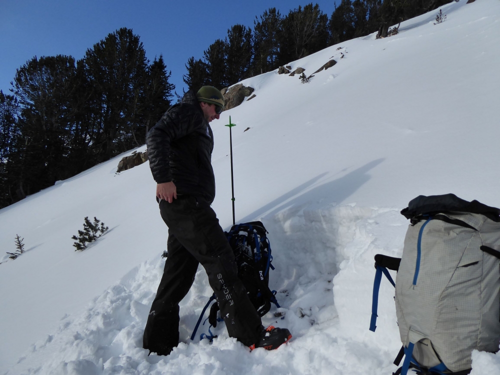
Lionhead Range, 2019-12-01 From obs.: "We found 12" to 16" of new snow sitting on top of 6"-8" of sugary snow that extended to the ground. We skied an east-facing slope of approx. 30º and found no signs of instability. We avoided steeper, north facing slopes... accessed by West Denny Cr. trailhead after seeing 12" - 16" of sugary snow there earlier in the week preceding the storm. Was concerned about new snow overloading the old snow and about ascending below the wind-loaded Lionshead Ridge." Photo: K. Peters (horizontal pole represents line of old snow with new snow above) |
|
Northern Gallatin, 2019-11-30 Obs from skiers in Hyalite: "A pit on a SE aspect at 9600' [near Flanders] was 75cm deep and looked pretty good, except for the crust near the surface that's sitting on top of some facets, which failed as I isolated the column. I did not notice any cracking, collapsing, or recent activity on this layer, but it will likely be something to keep in mind as we get more snow. We noticed the same crust atop near-surface facets on a N aspect in Maid of the Mist last weekend, although its crustiness varies, depending on aspect." Photo: S. Reinsel |
|
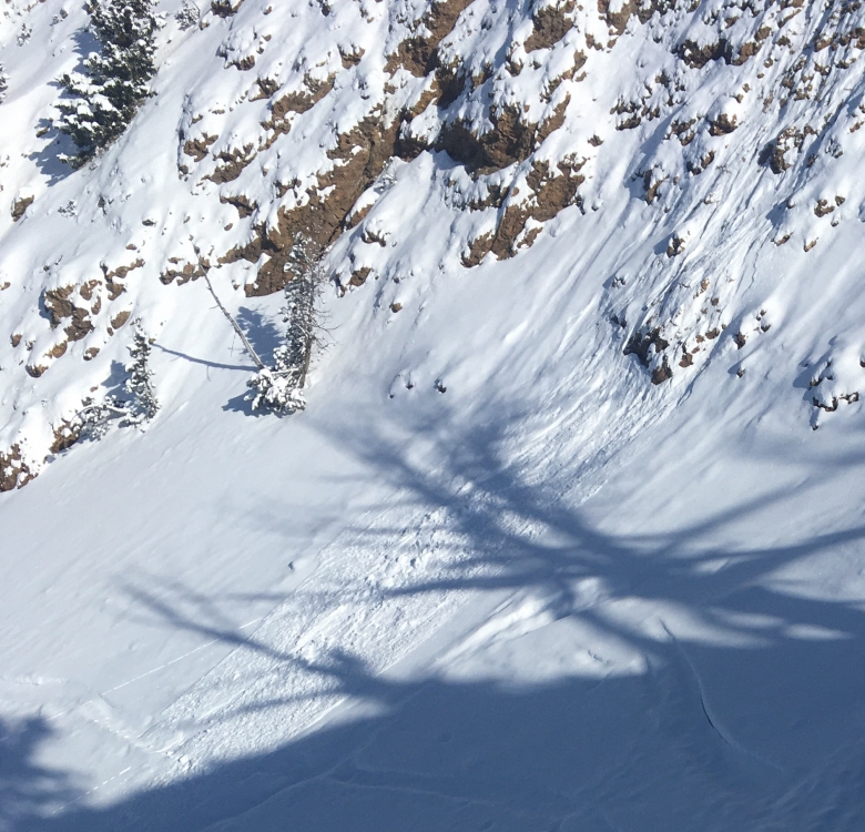
Cooke City, 2019-11-29 These small crowns indicate that new snow may not bond well to the old snow surface. Photo: B. Fredlund |
|
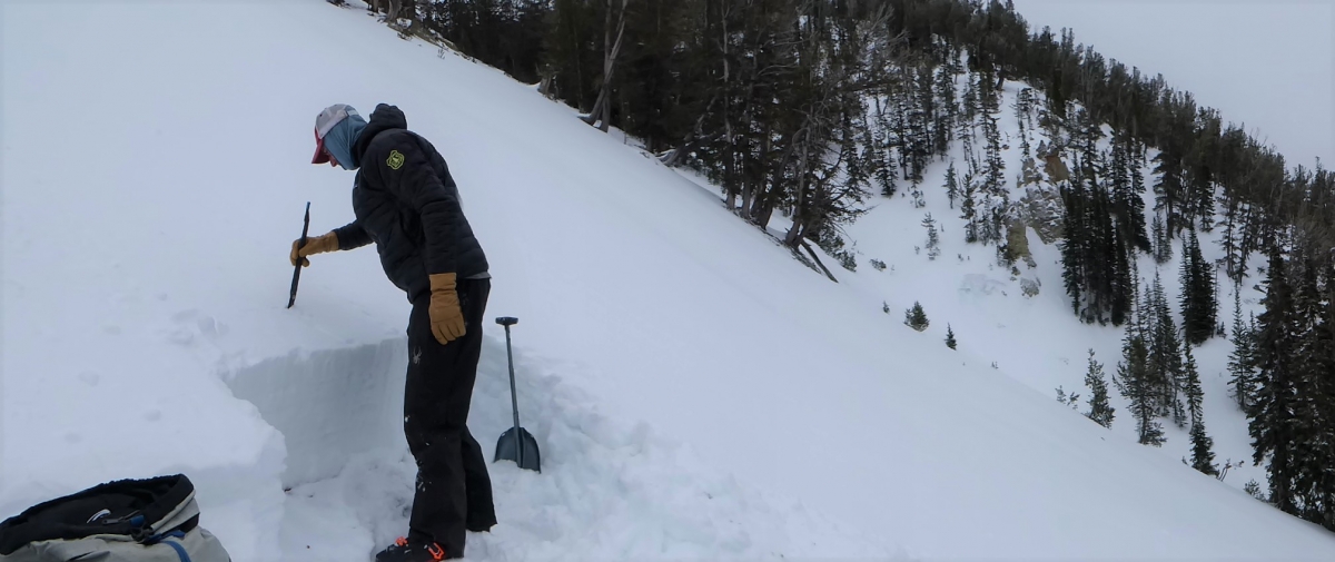
Cooke City, 2019-11-27 This snowpit was on a NE aspect at 10,000' on Henderson Bench. It was 3 feet deep and stable. Facets (weaker snow) are getting stronger. We will keep an eye on these to make sure the positive trend continues. Our snowpit profile is here. Photo: GNFAC |
|
Cooke City, 2019-11-27 This 2-foot deep snowpit consisted of layers of crusts and facets. It was dug on a SW aspect at 9800' in Miller Drainage. Nothing broke clean in our stability tests and we are optimistic about it handling a load of new snow. Photo: GNFAC |
|
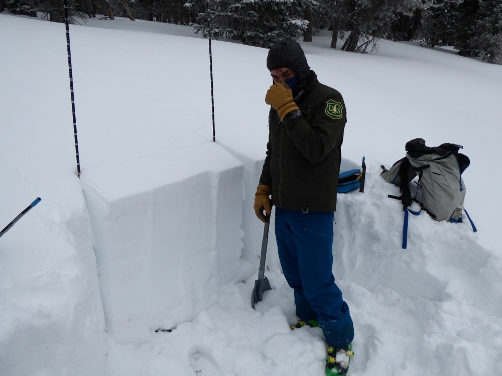
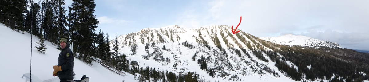
Cooke City, 2019-11-26 We dug two pits, one on a SW aspect in the Rasta Chute off Scotch Bonnet Peak (marked with arrow) and another low on Fisher Peak at a spot called Wade's World (where Dave is standing). Photo: GNFAC |
|
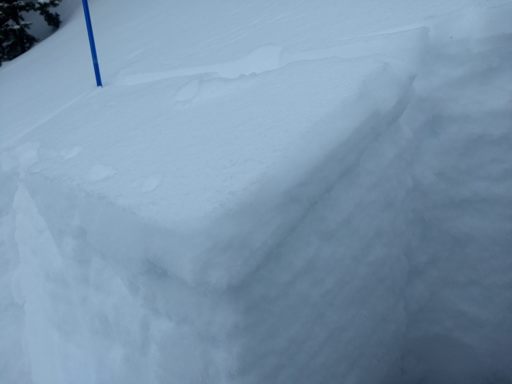
Cooke City, 2019-11-26 Dave Zinn dug a pit near the top of Rasta Chute (SW aspect) near Lulu Pass and found 65 cm of snow. The layers were crusts and some facets and we determined the slope to be stable. You can look at the snowpit profile here. Photo: GNFAC |
|
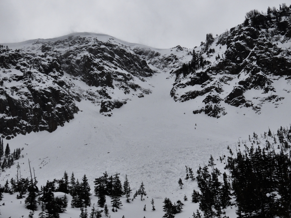
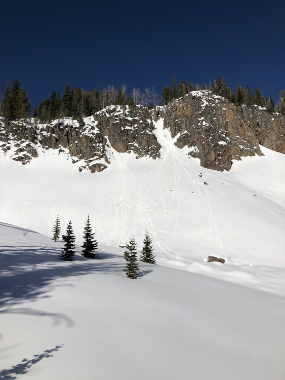
Out of Advisory Area, 2019-11-25 Sometime last week (11/20-11/22) these large avalanches occurred on heavily wind loaded northeast facing slopes in the Absaroka. The snowpack there is thin and faceted, similar to the southern ranges and mountains near West Yellowstone. Photo: B. VandenBos Link to Avalanche Details |
|
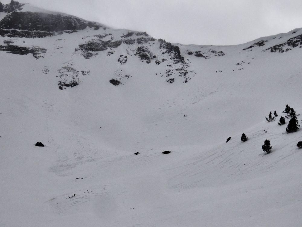
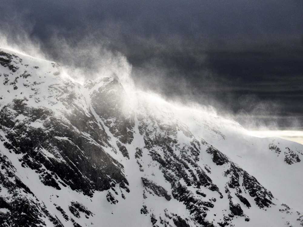
Out of Advisory Area, 2019-11-25 Strong winds found snow to transport on Saturday 11/23. Photo: B. VandenBos |

|
Northern Gallatin, 2019-11-23 Large surface hoar in Hyalite on 11/23. Photo: C. Kussmaul Link to Avalanche Details |
|
Northern Gallatin, 2019-11-23 Shooting cracks in Hyalite at ~9500 ft on a N aspect on 11/23. From obs "We got some large shooting cracks while skinning and ended up turning around." Photo: C. Kussmaul Link to Avalanche Details |
|
Northern Gallatin, 2019-11-23 From obs: "We took a tour up into the Maid today. A generally stable snowpack in the area, new snow seemed to bond well with the underneath crust layer. We did observe small pinwheels/rollers on steep pitches on southeast aspects, mostly due to the rocks heating up during the day. We also observed sluff buildup on aprons below the shadier and steep northern aspects." Photo: Tommy S. |
|
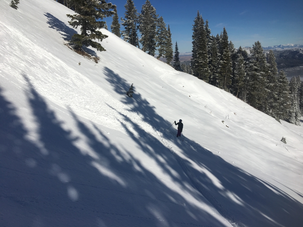
Bridger Range, 2019-11-22 Toured up to the ridge at Bridger today and traversed into Bridger Gully. At around 8,000' in the trees above the most prominent snowfield, my partner and I observed very small dry sluffs confined to the new snow. Bellow Bridger Gully, my partner was able to release a slide while traversing through rocks above his intended line. This was on an east-southeast aspect at 7,500'. Photo: Cole Oshiro-Leavitt Link to Avalanche Details |