Snow Observations List
No avalanches observed. A foot of new snow in 24hrs, 3-4 inches throughout the day. Strong wind gusts in the morning into early afternoon, drifting in open areas and higher elevations. Experienced multiple whoomphing in an open flat area.
Full Snow Observation ReportGabe Gassman and I rode buck ridge to the wilderness boundary at Macatee basin on a LE patrol mission. 6-8 inches of new snow fell since yesterday. Snow depth was variable as it had been affected by wind, but wind during the day was calm to 10mph. No avalanching of the new snow was observed.
Full Snow Observation ReportSkied conservatively terrain below 30 degrees today. Widespread whomping. Along the steeper part of the uptrack, we experienced settling and shooting cracks.
We agreed that in steeper terrain this would have led to an avalanche.
Full Snow Observation Report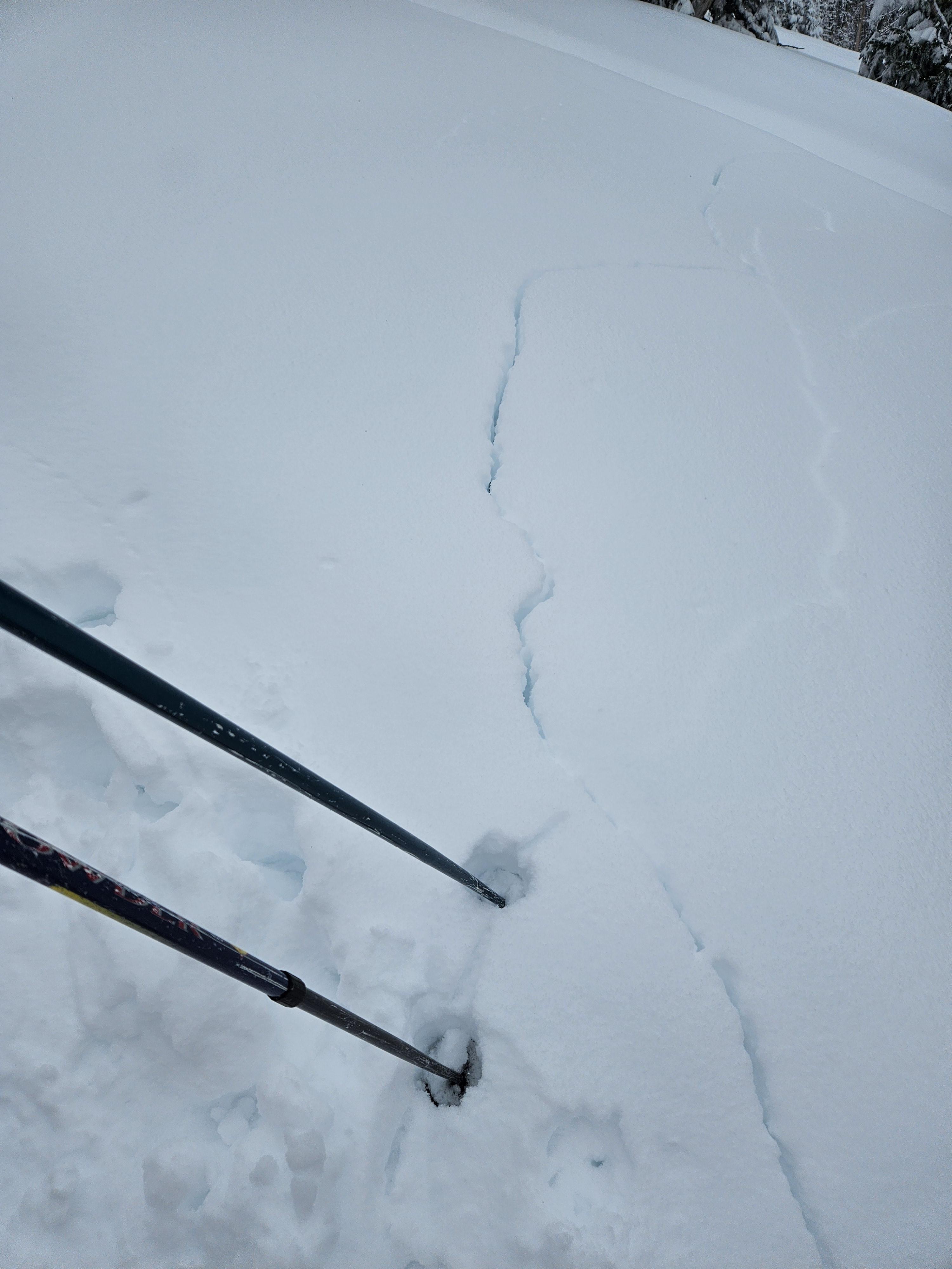
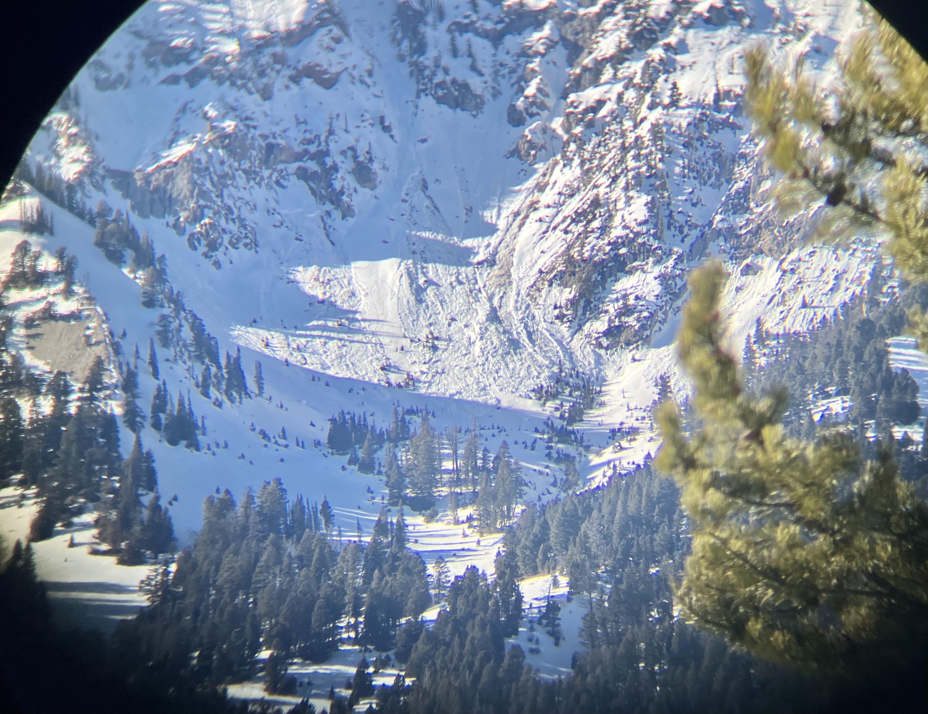
Four of us (all with 20-40 years backcountry experience) skied the lower angle slopes just south of the skillet at Bacon Rind. There was a well worn skin track from past weeks and lots of old down-tracks buried beneath ~8-10" of new snow. We heard numerous large-scale collapses and witnessed the development of propagating tensile fractures on a 20°-25° slope along the skin track (see photo/video). No need to dig a pit on days like this. We did not venture onto or view any steeper terrain, so we saw no natural avalanches. The new snow seems well-adhered to the older snowpack. All instability is tied to the lowest 20-30cm faceted sequence at the bottom.
We skied this location 4 times this week. Each time, we experienced collapsing and fracturing within the snowpack and stuck to skiing conservative, low-angle lines. The takeaway? Previous skier traffic may not indicate safety or diminish avalanche danger. If conditions are even somewhat questionable, stick to low-angle slopes or go nordic skiing (on groomed trails).
Full Snow Observation Report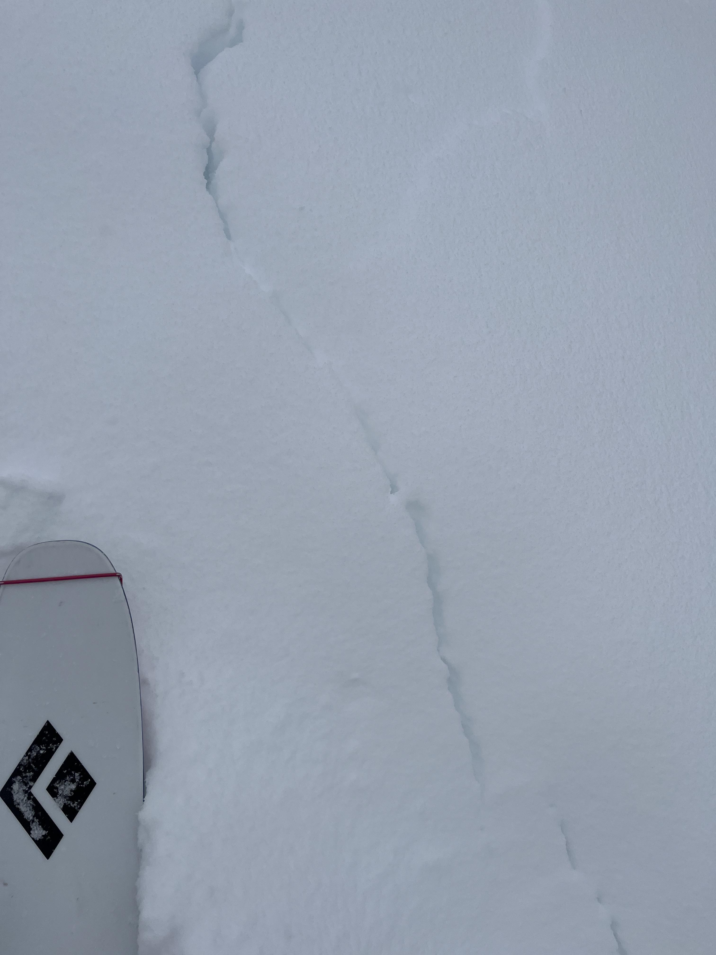
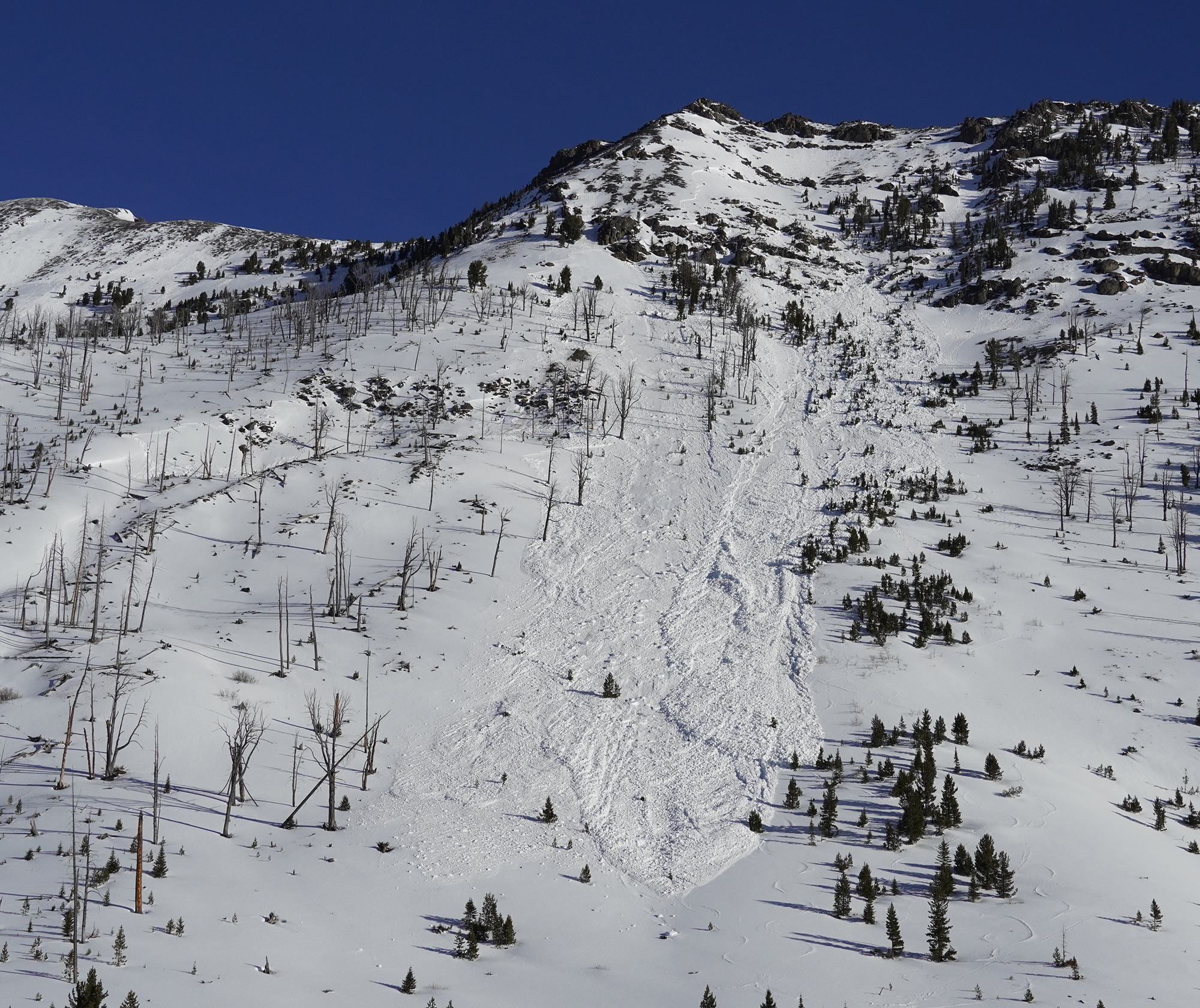
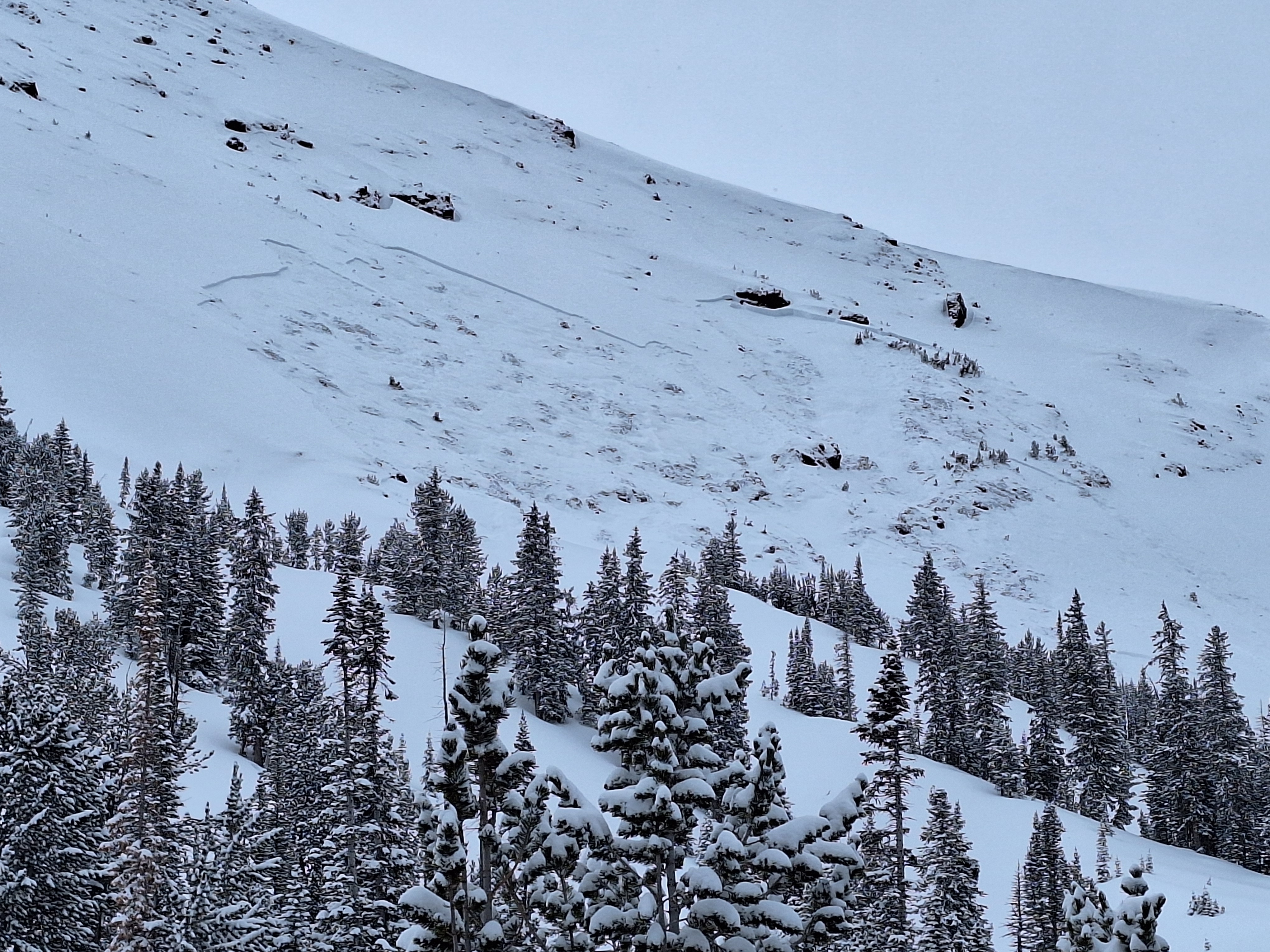
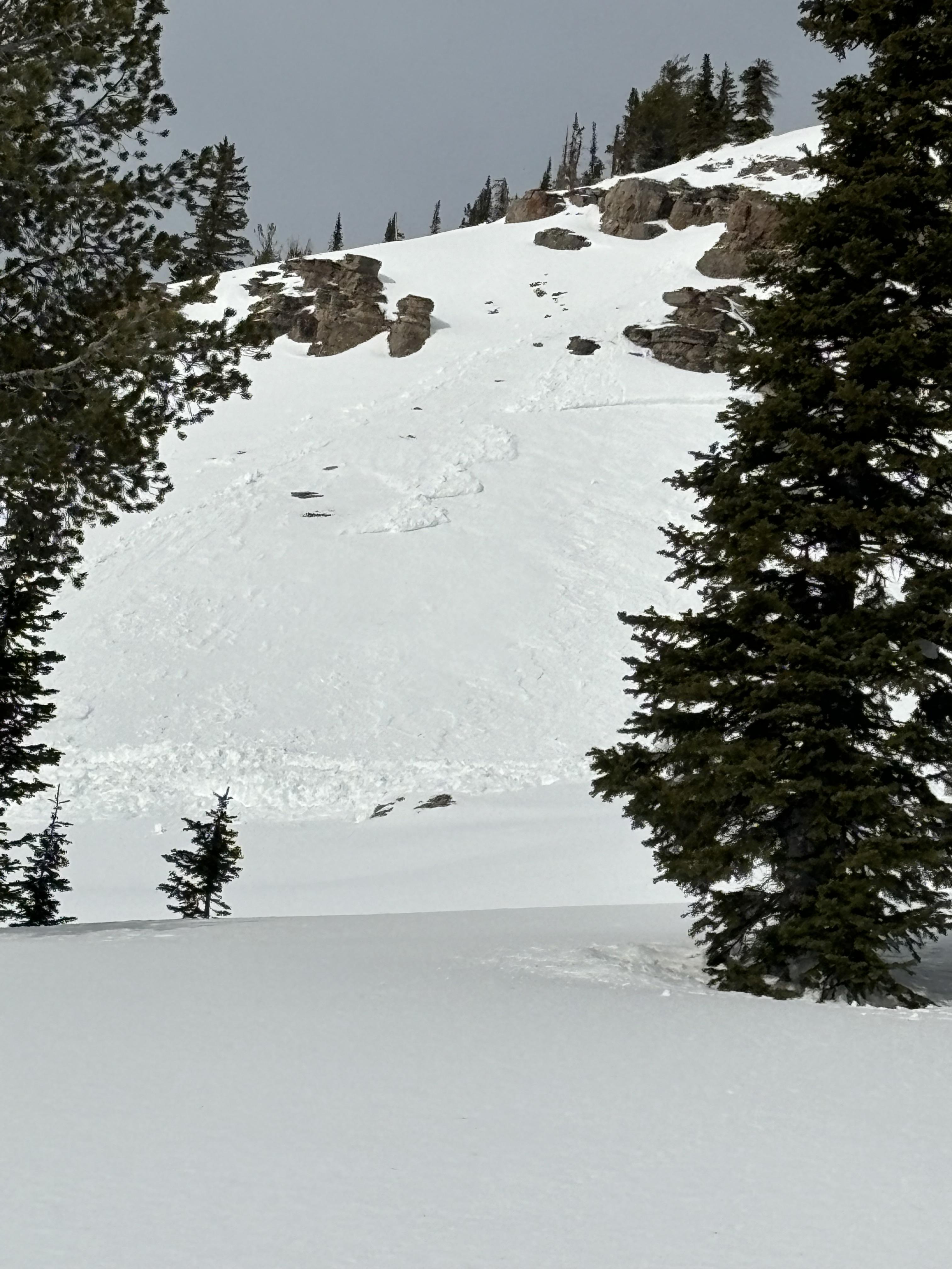
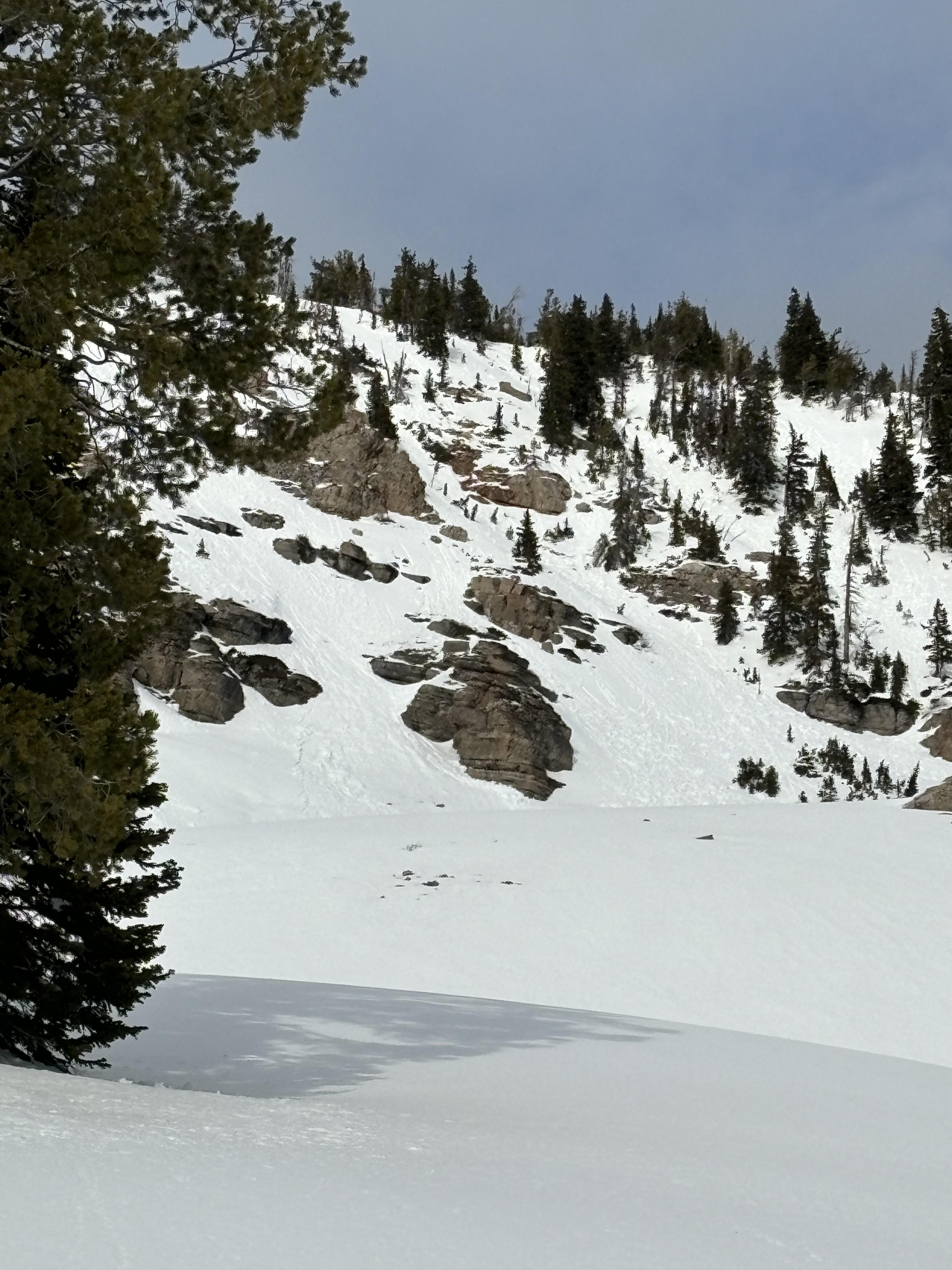
Observed a fresh avalanche this afternoon on Woody Ridge, South of the Submarine. Northwest facing slope, Approximately 10,150'. Appeared to be from today, 2/4.
Full Snow Observation Report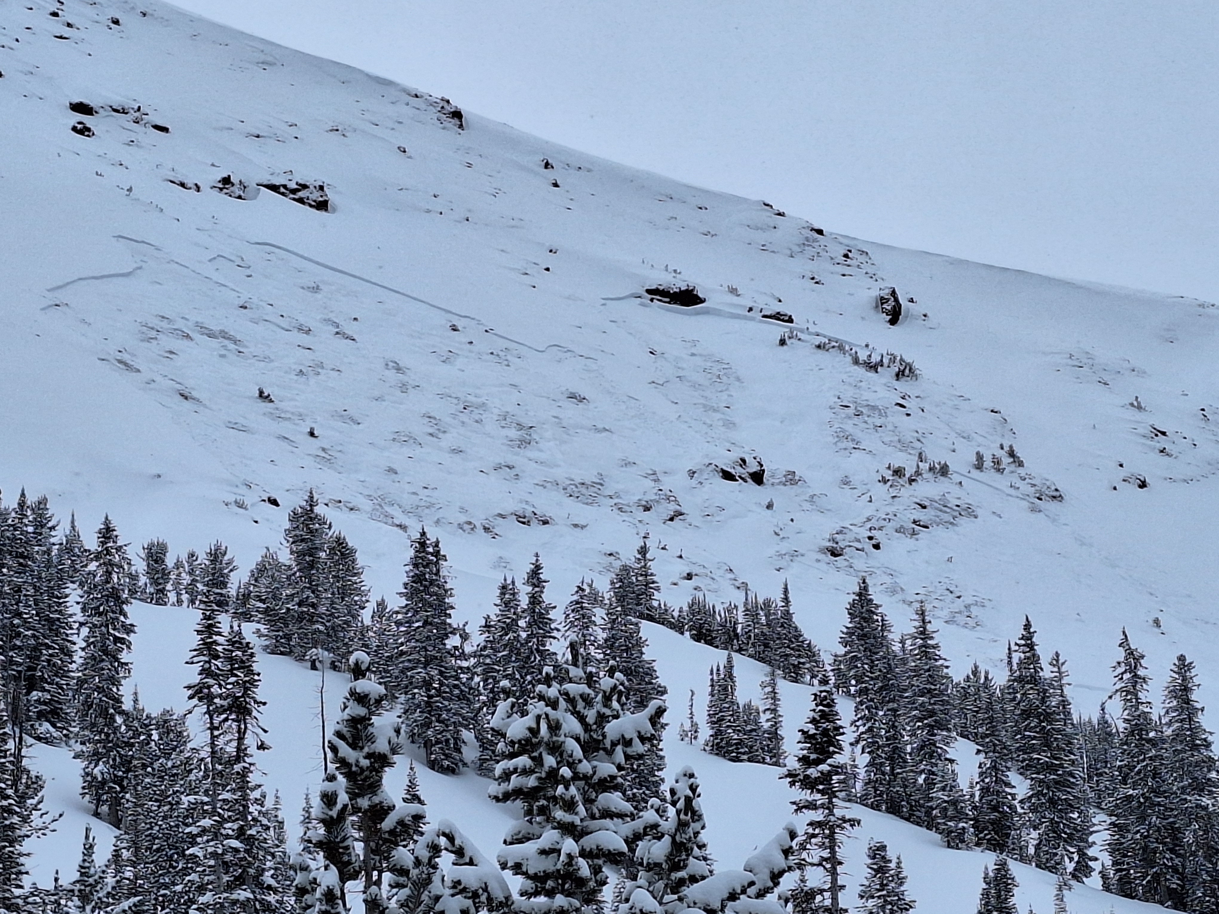
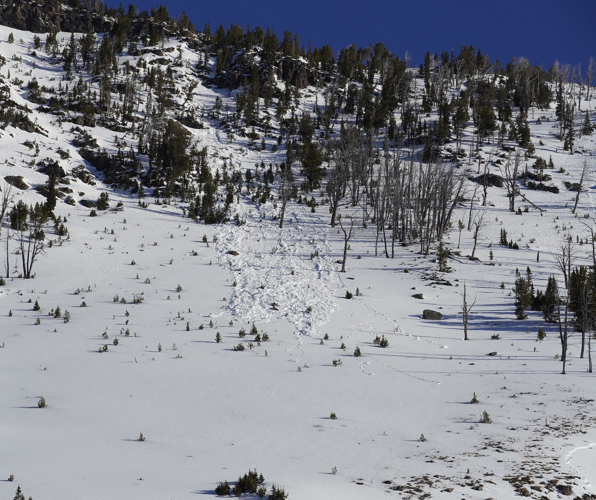
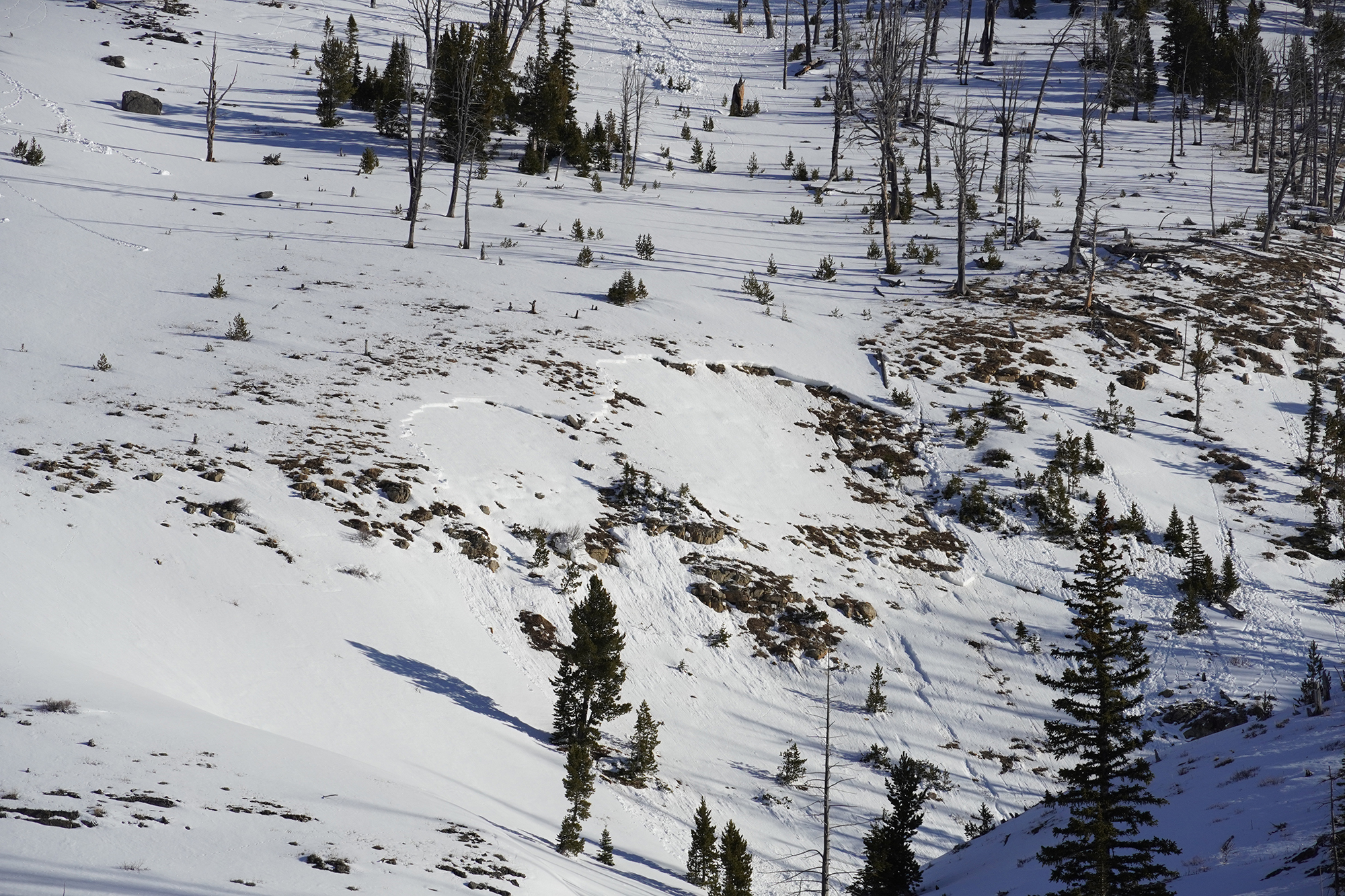
Multiple natural avalanches and at least one suspected human triggered dry loose in Beehive Basin. Most naturals appeared to have run either last night or yesterday (2/3/24), with a couple potentially older slides. New snow and rapidly changing cloud cover/depth perception made it a bit hard to be sure. Suspect one skier trigged dry loose in W facing trees. One of the W-facing chutes further up valley was also observed to have a crown line at approximately 9000' (no photo)
Full Snow Observation Report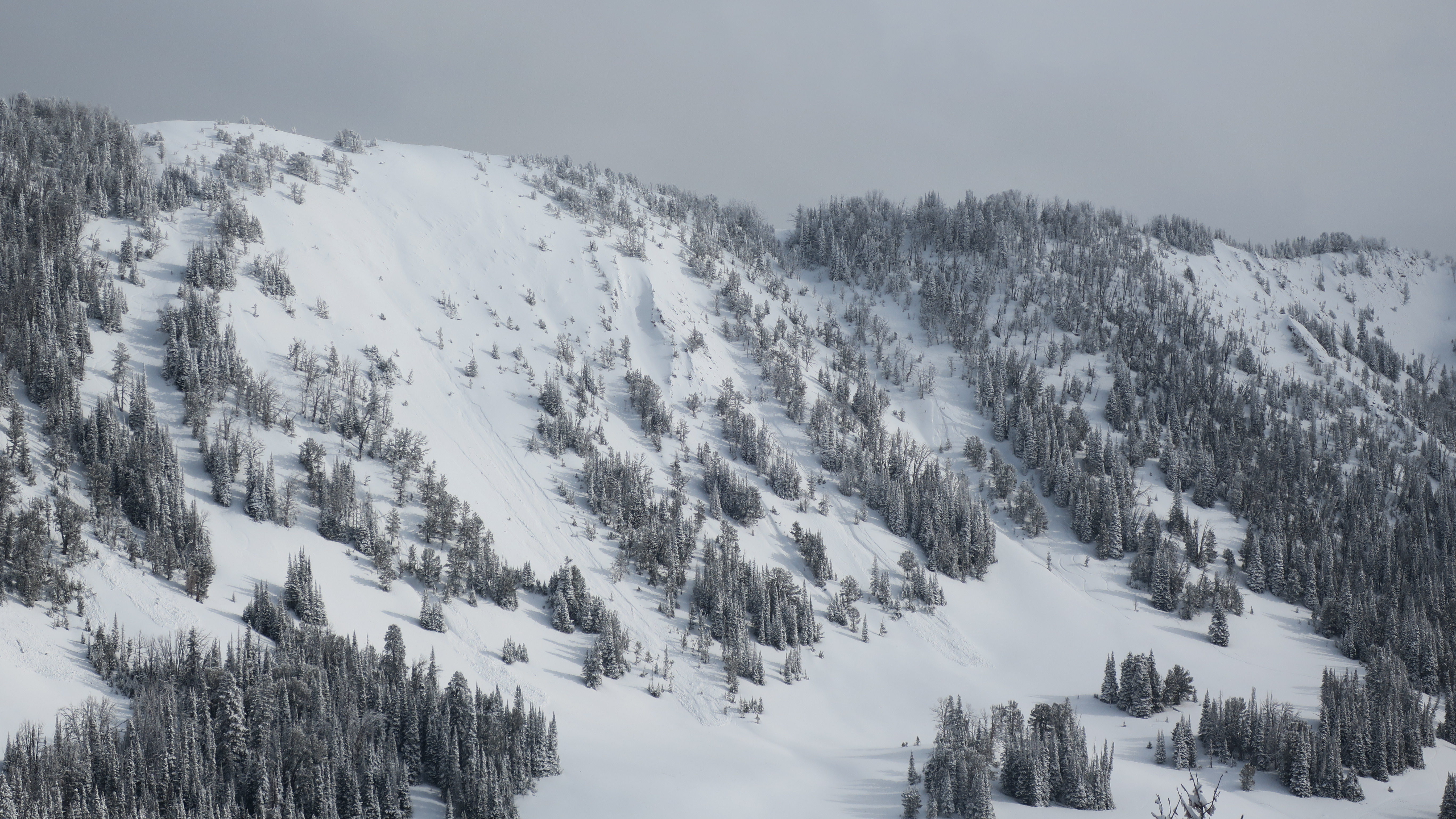
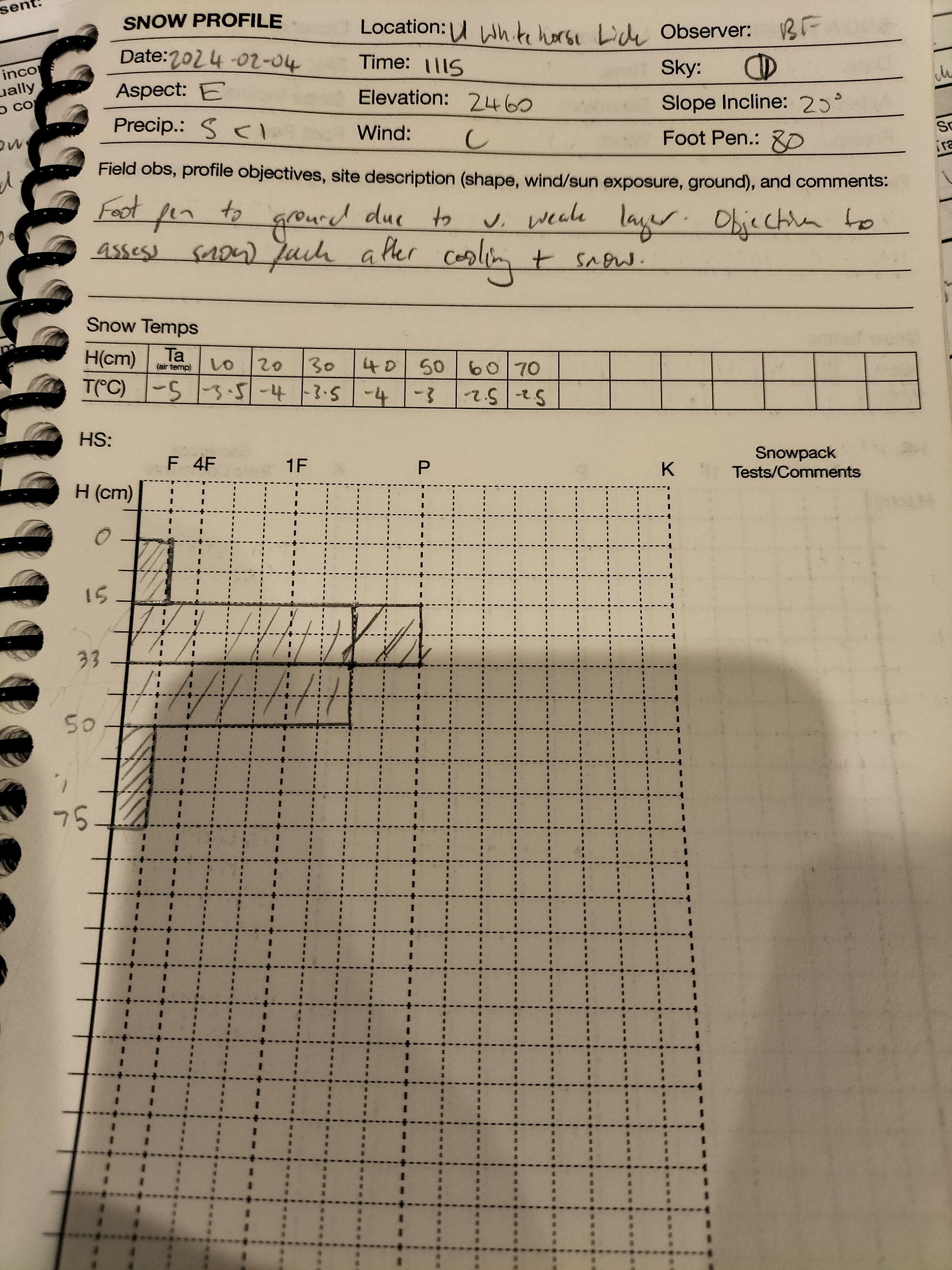
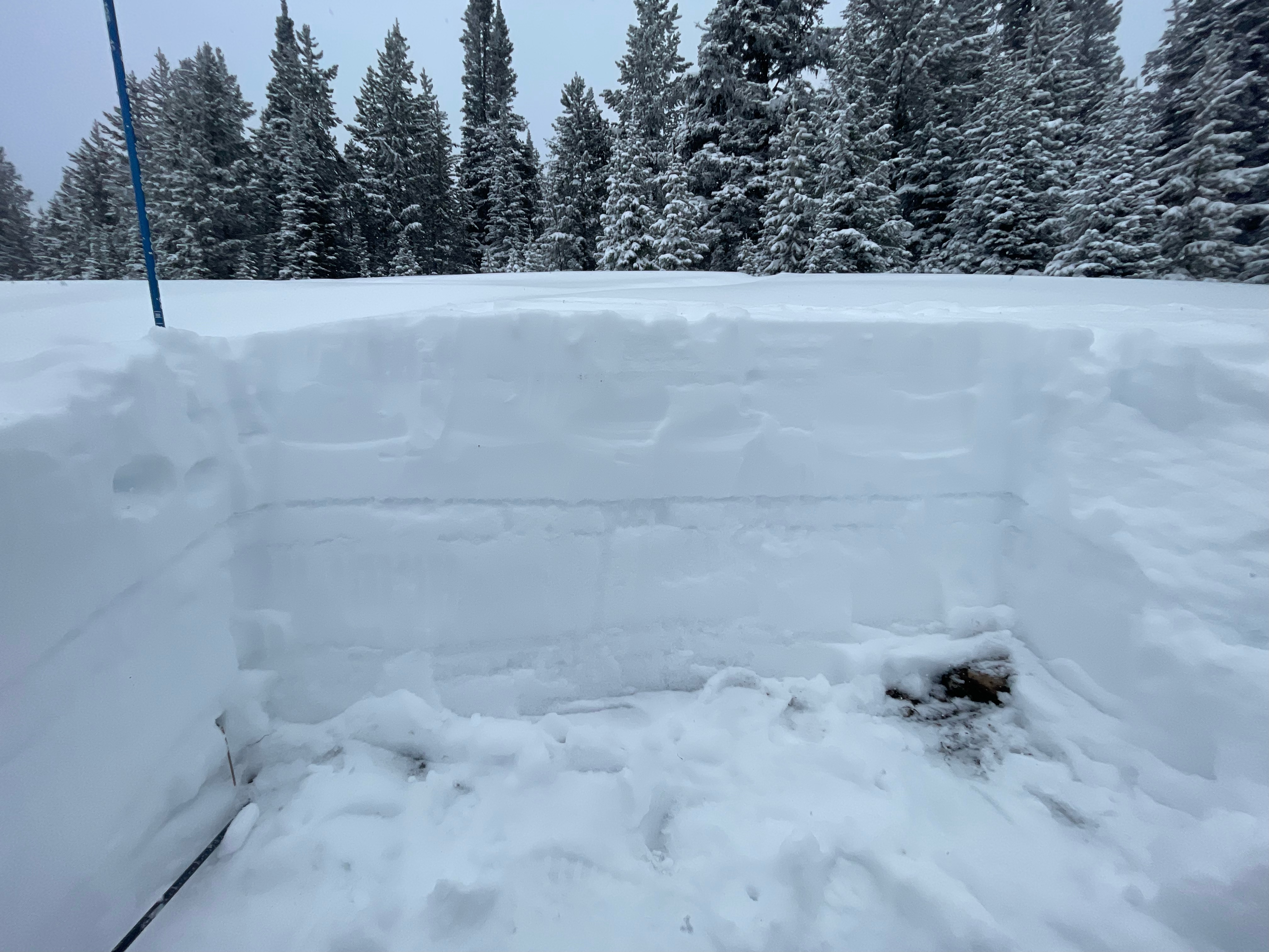
Main points of test profile to ground at N45°31.5026' W110°57.3867'
- Foot pen all the way to ground with very weak layer at base.
- Some rounding at the mid snowpack (15cm down to 50cm) with ~P resistance.
- MFcr interface layer @ 20cms
- CT Result
- CTM 14(SP) down 50cm
- ECT Result
- ECTN7 down 15cm
- ECTP27 down 50cm
On the terrain travelled, NE - SE slopes have ~70-80cm coverage. W slopes have very thin cover and presented minimal avalanche risk.
Full Snow Observation Report
We rode north of Cooke City today, 02/04/2024. We stopped below Fisher Bench and dug on an NE-facing slope at 9600'. What we found were unstable test scores, ECTP25, and a poor structure of weak snow. This pit had a well-defined strip of surface hoar that stability tests were failing on.
We moved on from here over Lulu Pass and towards the wilderness boundary. Along the way, we saw multiple old avalanches and a few more recent ones from last week's warm-up. While climbing a small test slope I saw shooting cracks coming from my skis, and could feel my track breaking through the slab to the weak snow below. Overall the snowpack is in poor shape and just putting a foot down in some places it was easy to break through the slab and fall to your waist in facets.
Light snow fell through the day will little daytime accumulation. The storm was well distributed with 3-4" in all the areas we rode today. Winds were calm and the sun tried to break through the clouds but it remained mostly cloudy.
Full Snow Observation Report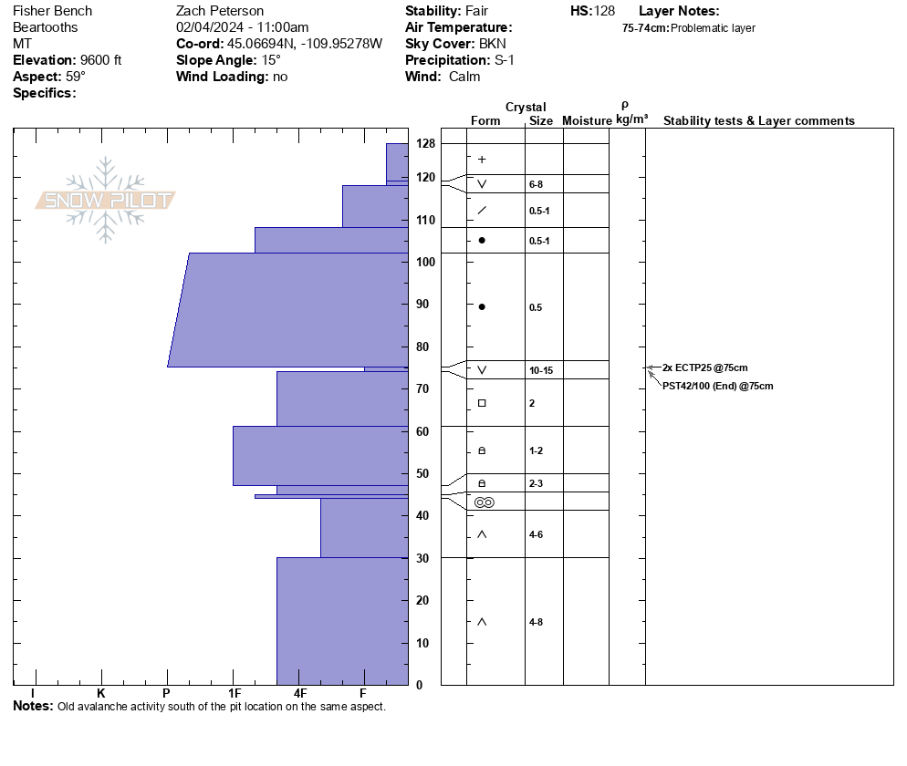

We dug a pit near the top of the skin track, and when approaching the location we experienced a big wumph. After digging our pit, we got a ECT3 on the more recently buried weak layer.
Full Snow Observation Report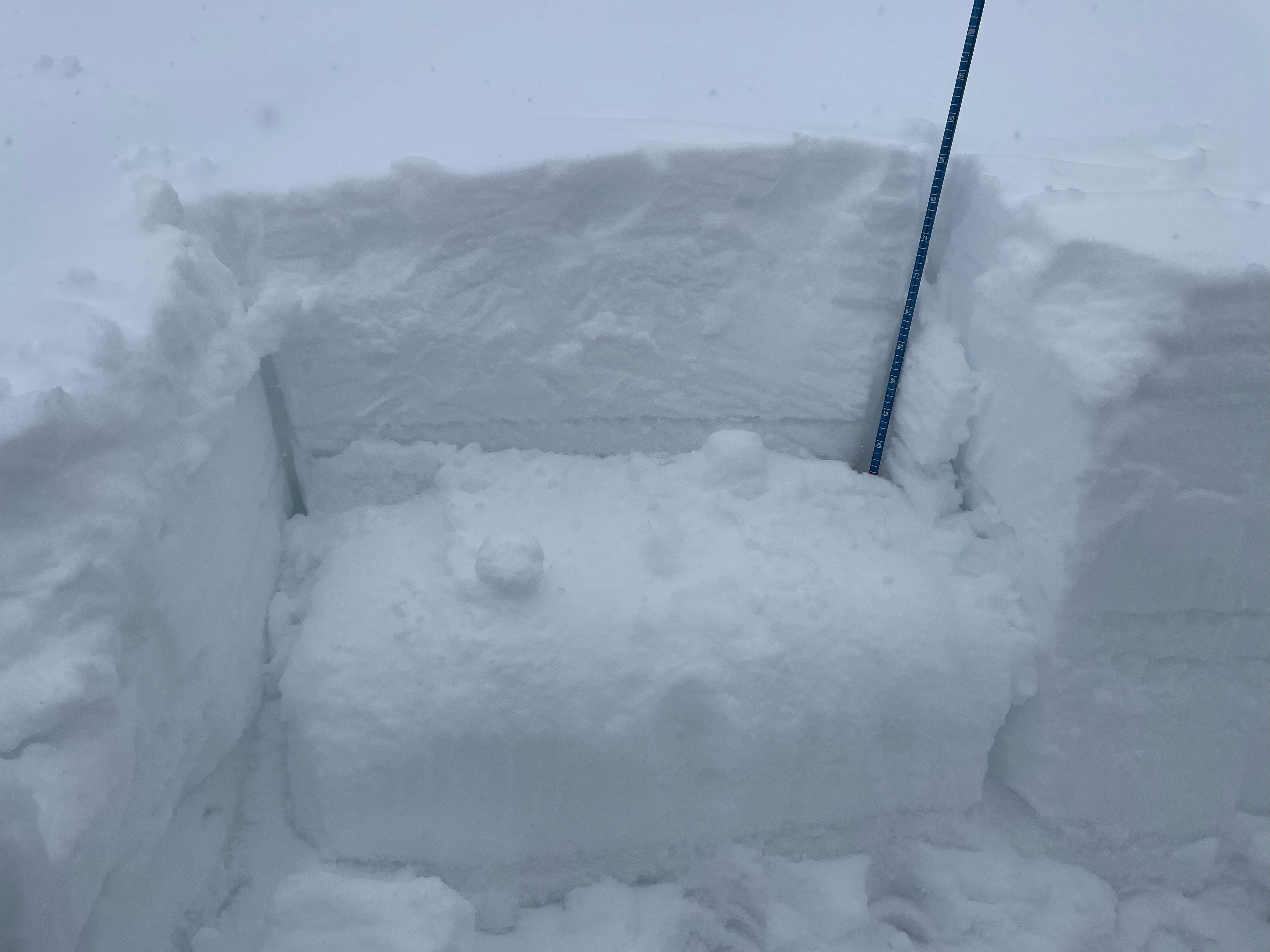
Went snowmobiling/skiing below White Peak. We saw older crowns down low in the meadows. While skinning up a mellow south facing nose off white peak, we dug down and got a ECTP15 2.5 feet below the surface. About 8-10 inches of snow fell throughout the day up high. As we continued to skin up higher, we observed numerous collapses before we decided to call it a day. We observed that aspects without a crust layer from this week were more reactive, although we saw propagation on solar aspects with a defined crust as well.
Full Snow Observation Report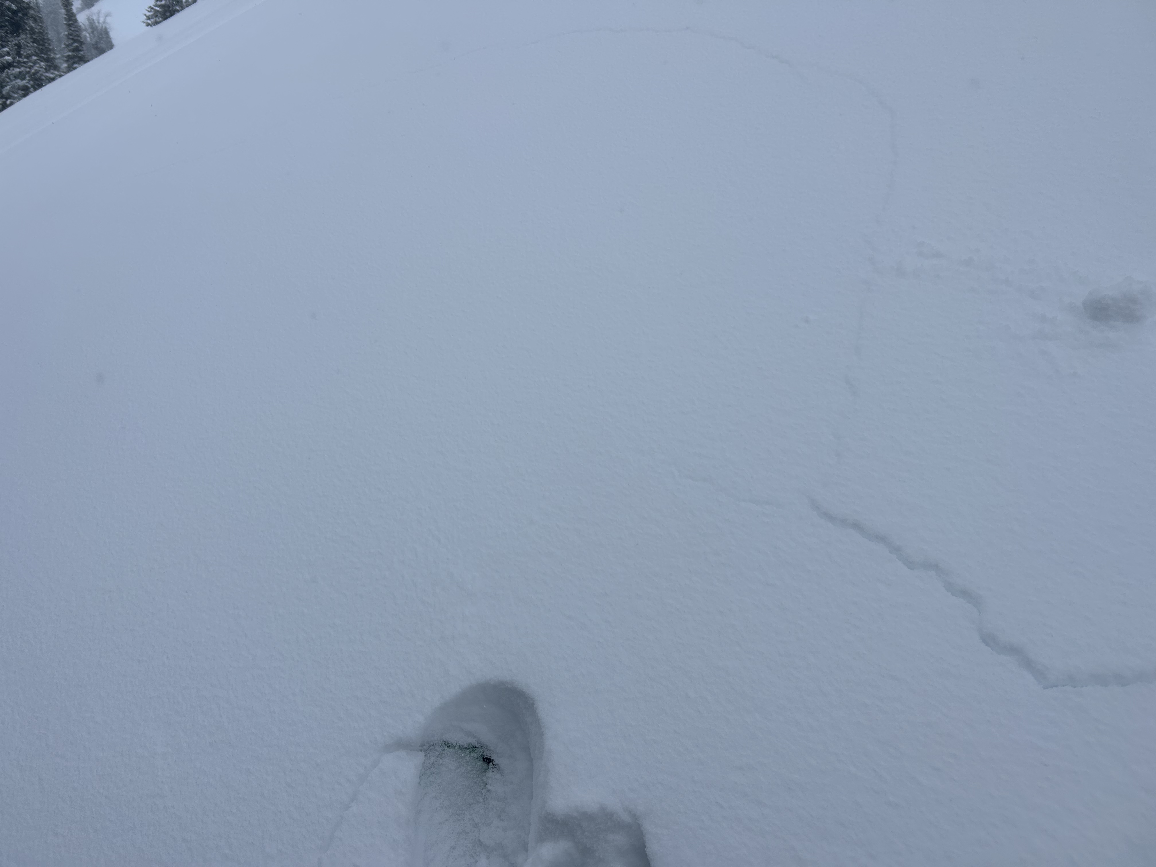
From email: "Temp 27. 4'' new snow, Rate S1, Sky OVC. NE aspect, SE winds, L observed localized drifting. Elevation 7790’. conducted several CT tests scored CTM and CTH (SC) ECTP 21, NE of Two Top on a layer of SH 35cm from surface. New snow on a melt freeze crust very reactive CTE 15cm from surface. Possible new layer of concern as new snow accumulates. No recent avalanches observed."
Full Snow Observation Report120 cm HS, OVC, E aspect, 6" new snow, -4c air temp, 14 deg. incline, blowing snow: none. ECTP 22 at 101 cm
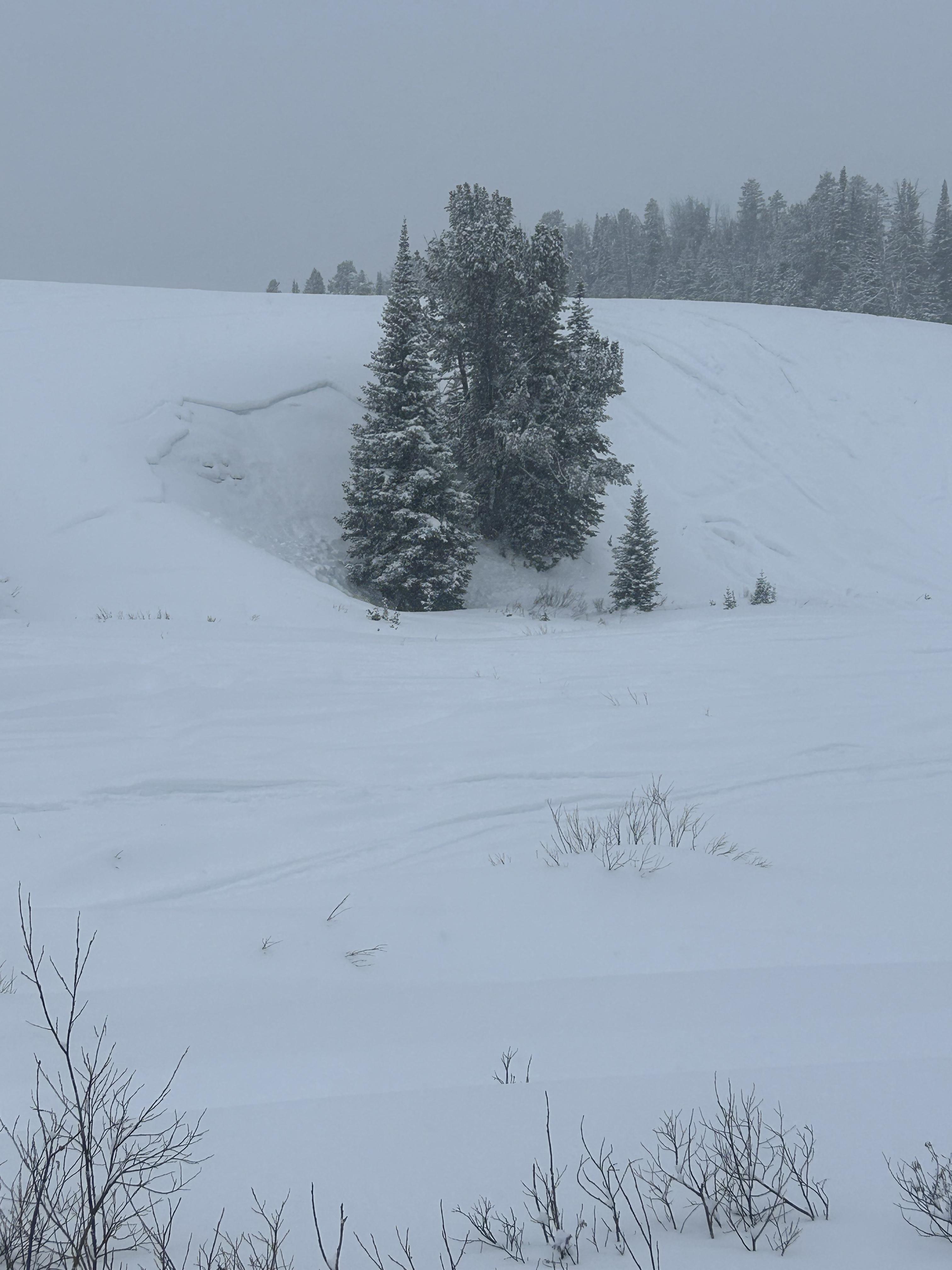
Full Snow Observation ReportWent up Lick Creek today with the intention of getting out in the new snow and doing some digging. We dug a couple pits on a north aspect at the top of the meadow at 8064' in an area of wind drifted snow. We observed propagation in both pits up 25cm on a faceted layer. HS 64cm, ECTP21, CT17 Q2. Skiing on the SE aspect was very thin but decent on a firm supportable crust formed during last week's warmer temps.
Full Snow Observation Report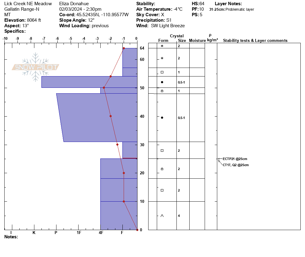
North of sawtelle peak between sawtelle and Bootjack. General observations of surprisingly low snowpack. Traveled from red rock parking lot to flats to Bootjack then south toward sawtelle then east to the flats and back north to red rock parking. The northern area had on average 6-10 inches, the southern area had 12-15 inches. Elevations were between 6300 and 7200 feet. Aspects were mostly NW to N to NE to E.
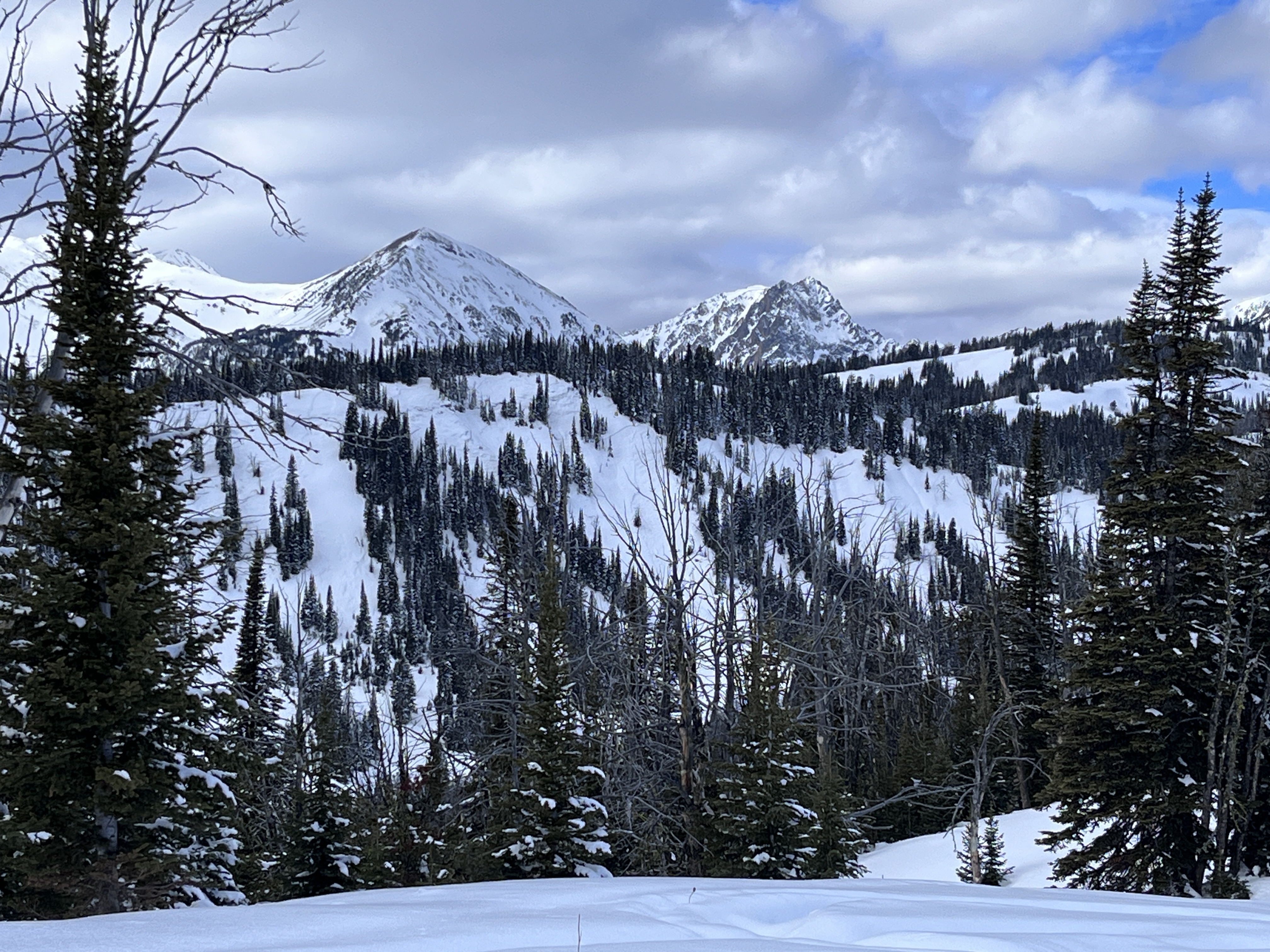
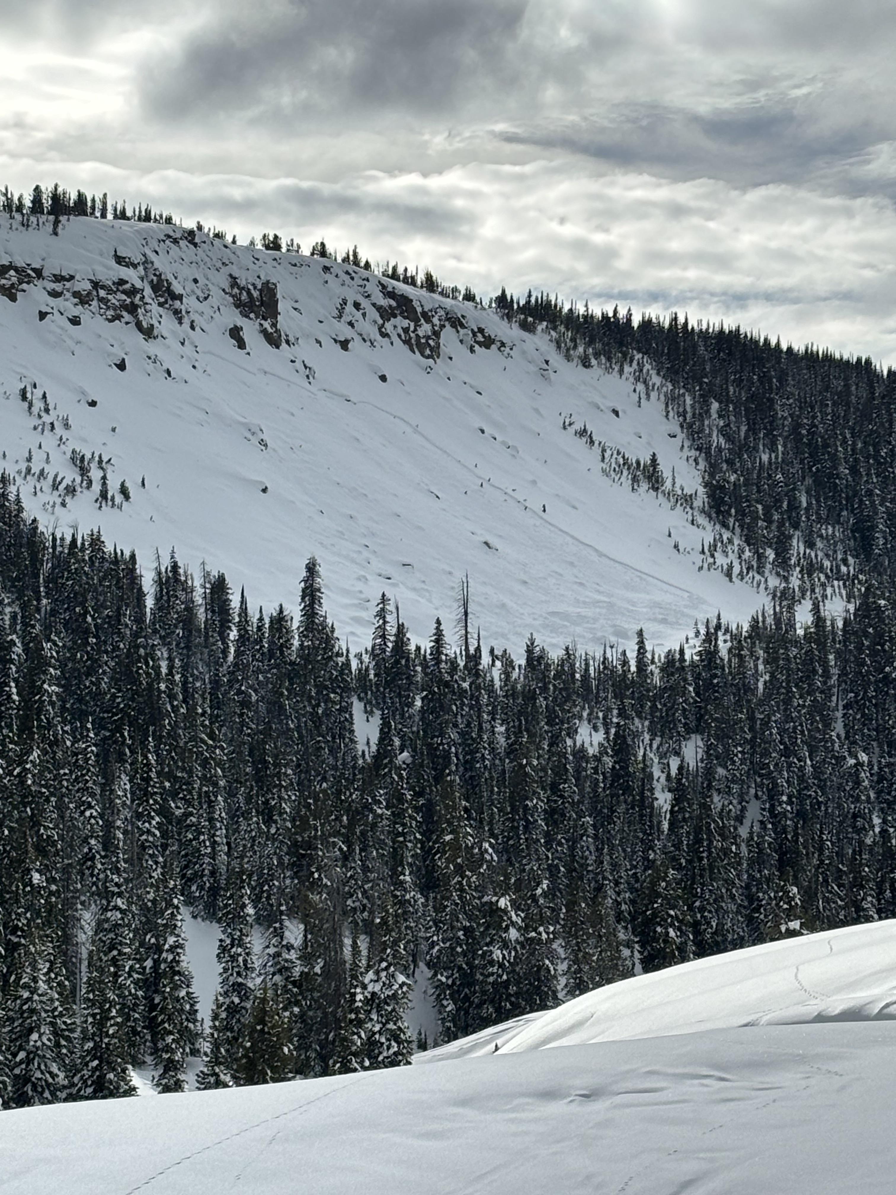
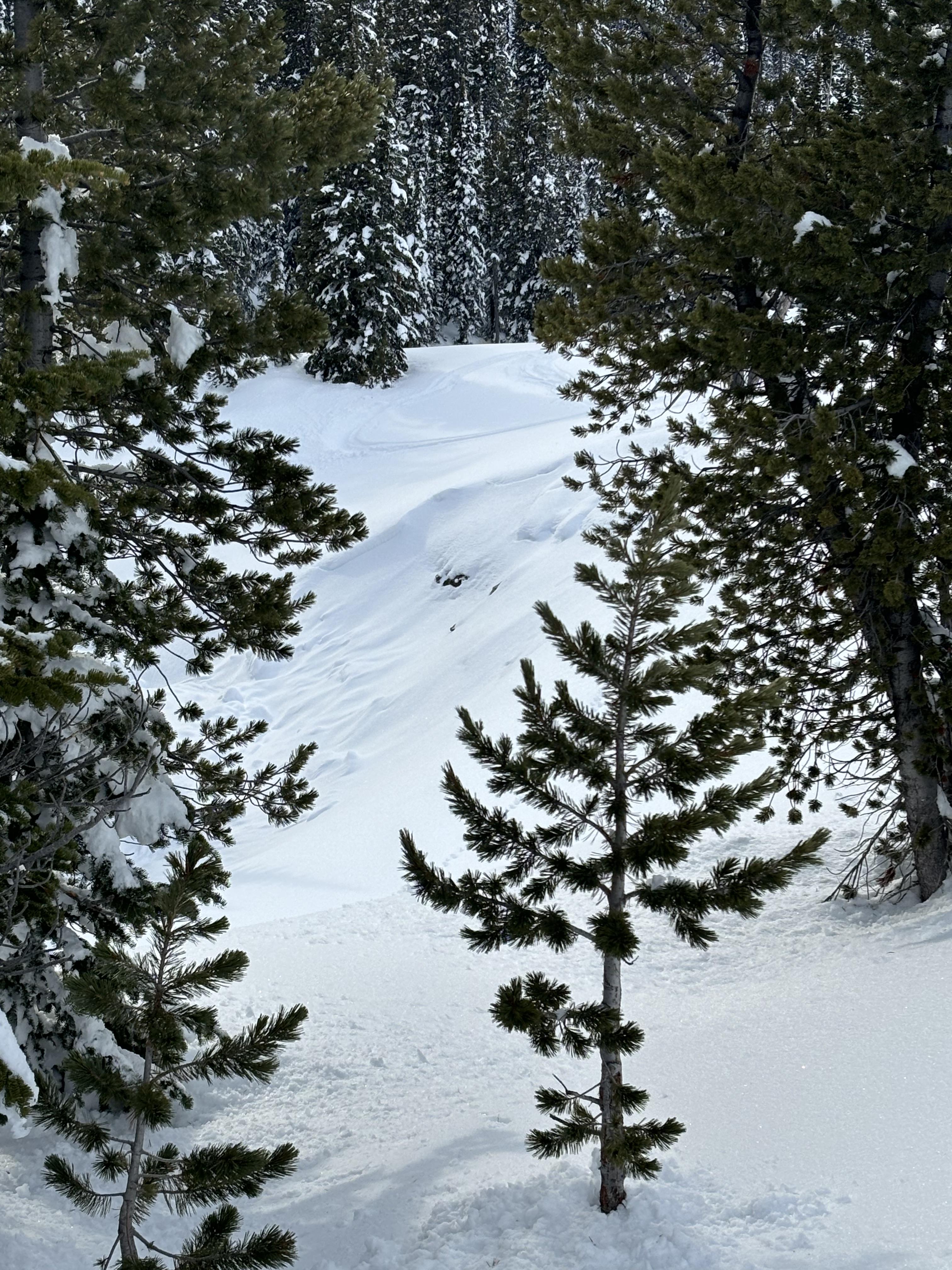
Full Snow Observation ReportAfter riding around in Miller zone rode up towards the east Crown Butte avalanche from this week to take a look!
Dug near the old cabin structure HS 100cm -140cm in area
210 deg aspect, @ 9380 ' on a 10deg slope
HS 110cm, ECTP28 on 3-4mm facets 20 cm up from ground.
Notes: solars and low elevation slopes formed a thin breakable crust over the last three days, under the crust in many places is a thin layer of faceting snow on top of a hard slab.
Full Snow Observation ReportFrom email on 2/2/24: "We received a call of a missing snowmobile in the Keg Springs area of Island Park at 1642. The missing snowmobiler arrived at 1800 hours at the rental property his party is staying at and said he had self-extricated from an avalanche."
Full Snow Observation Report
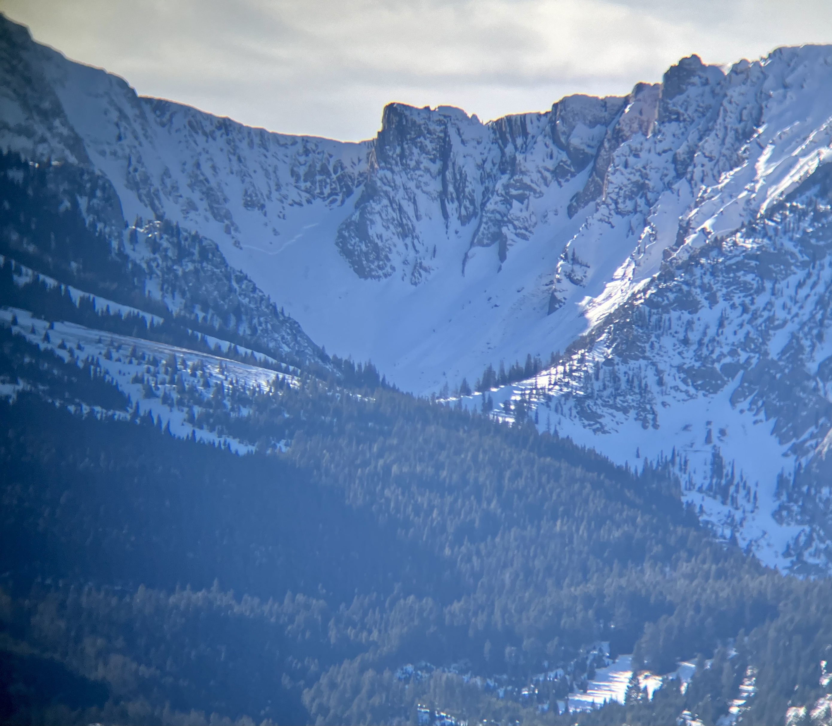
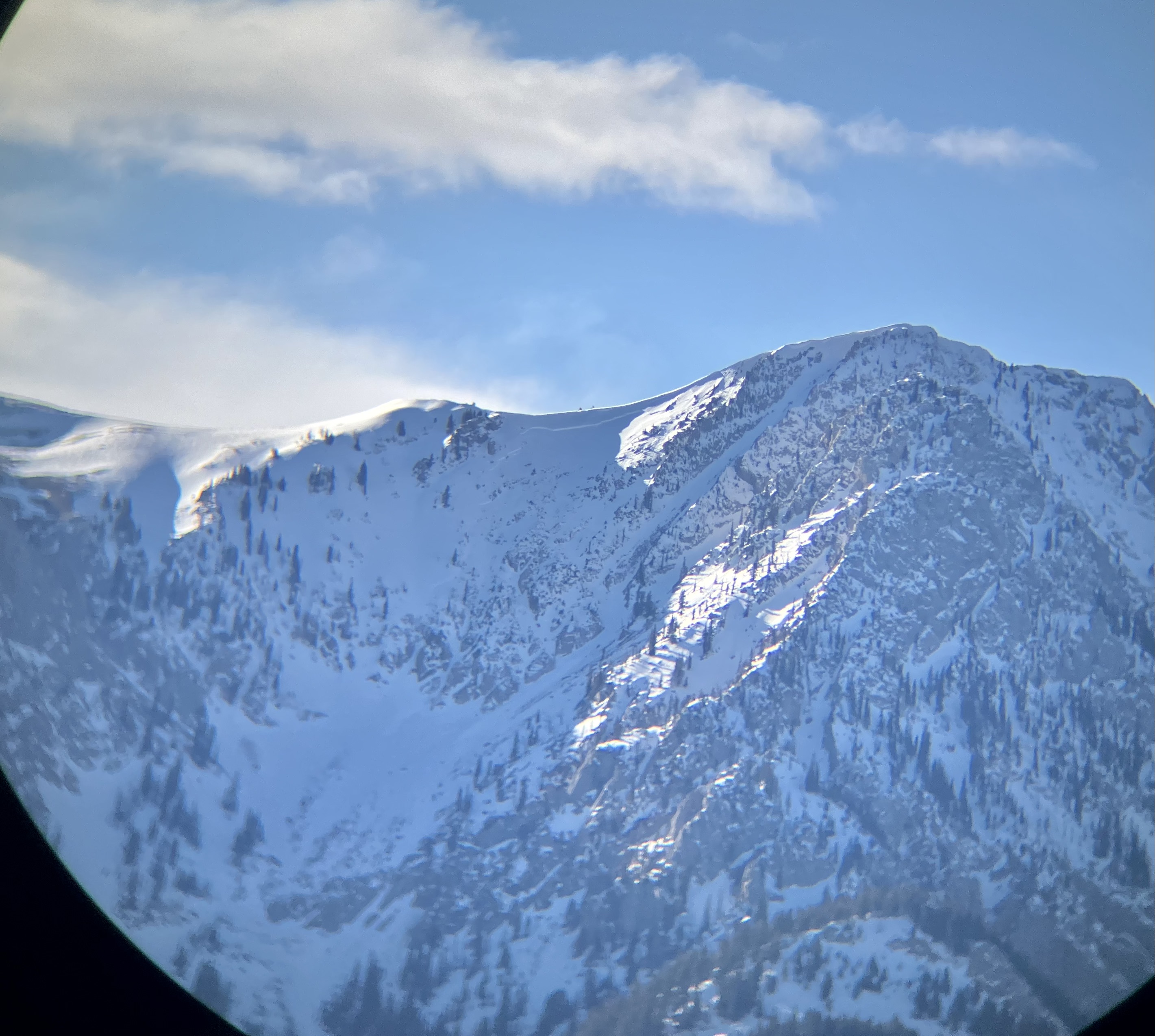
I drove up Bridger canyon this afternoon and stopped in a few spots to glass the range for recent avalanches. There were many recent wet avalanches, both wet loose that gouged through the snowpack and wet slabs about one foot deep and 50-100' wide. Many size D2, some smaller. Happened sometime between Monday and today (1-3 days old, maybe some this morning). The main spots for recent wet avalanches were on Bridger Peak and south of the Throne. Mainly on sustained steep terrain with rocky outcrops and east-south facing. There was one wet slab on a northeast facing, mid-elevation slope near the Throne. South facing terrain near Fairy Lake had some wet loose activity. I attached a photo of the wet slab activity on Bridger Peak and south of the Throne.
I also saw a wide crown in Frazier Basin and a similarly wide crown in another bowl to the north (300-400' wide). Photos attached. I am not sure if these occurred recently with the above freezing temperatures or if they are older. they do not appear wet like the others, but I could not see the debris and was generally far away. Also they are in higher terrain favored for cooling effects. But, they easily could have occurred over the recent hot days, potentially triggered by cornice fall?
Full Snow Observation Report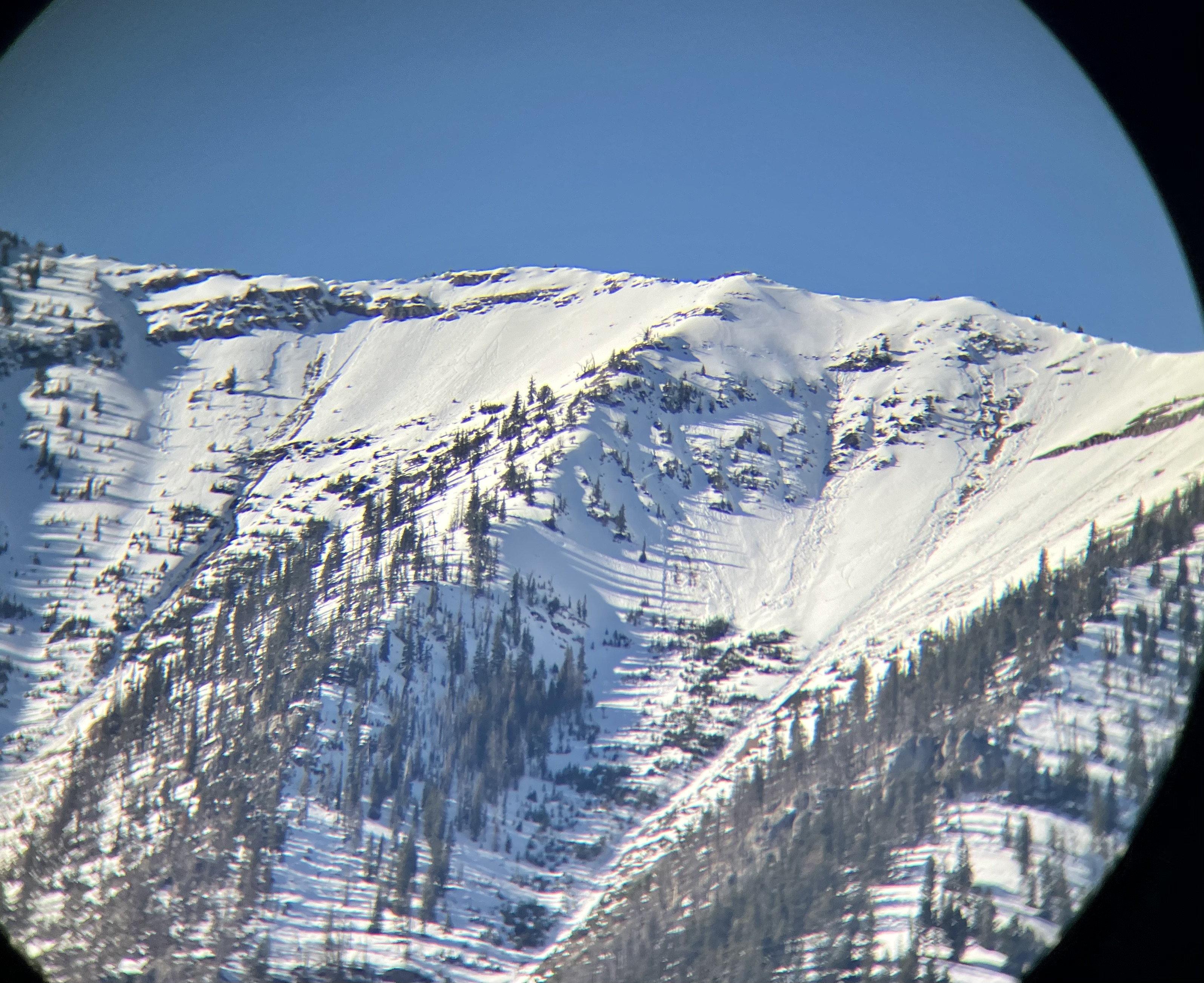
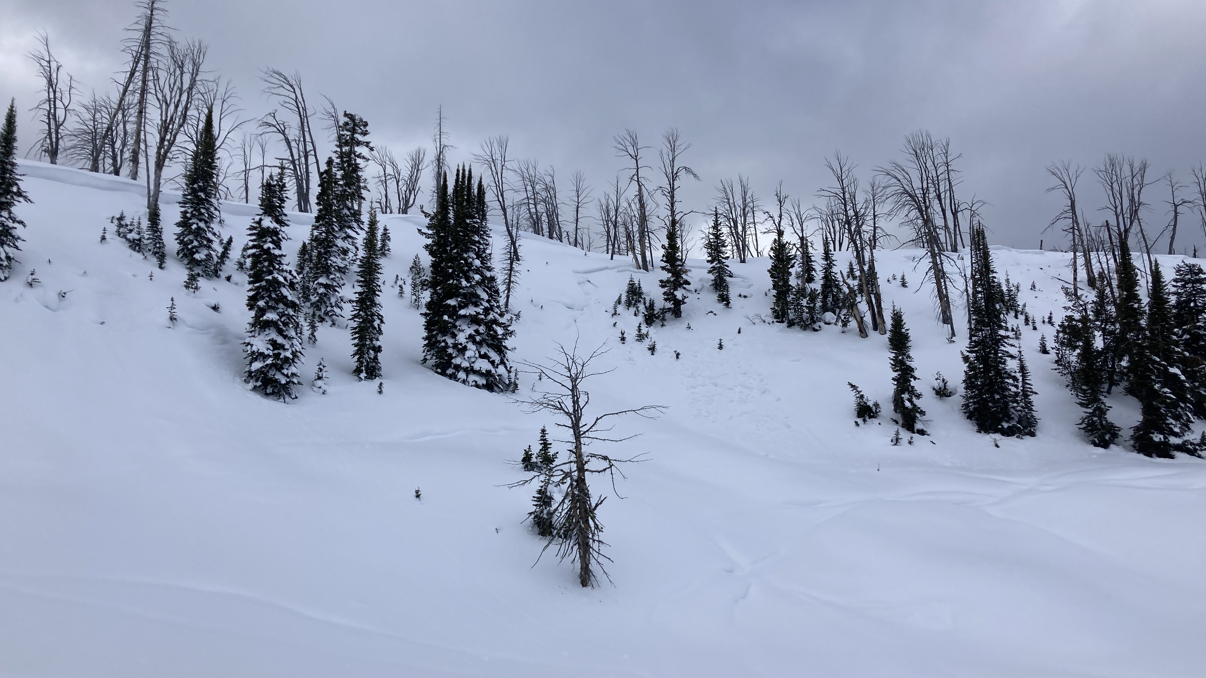
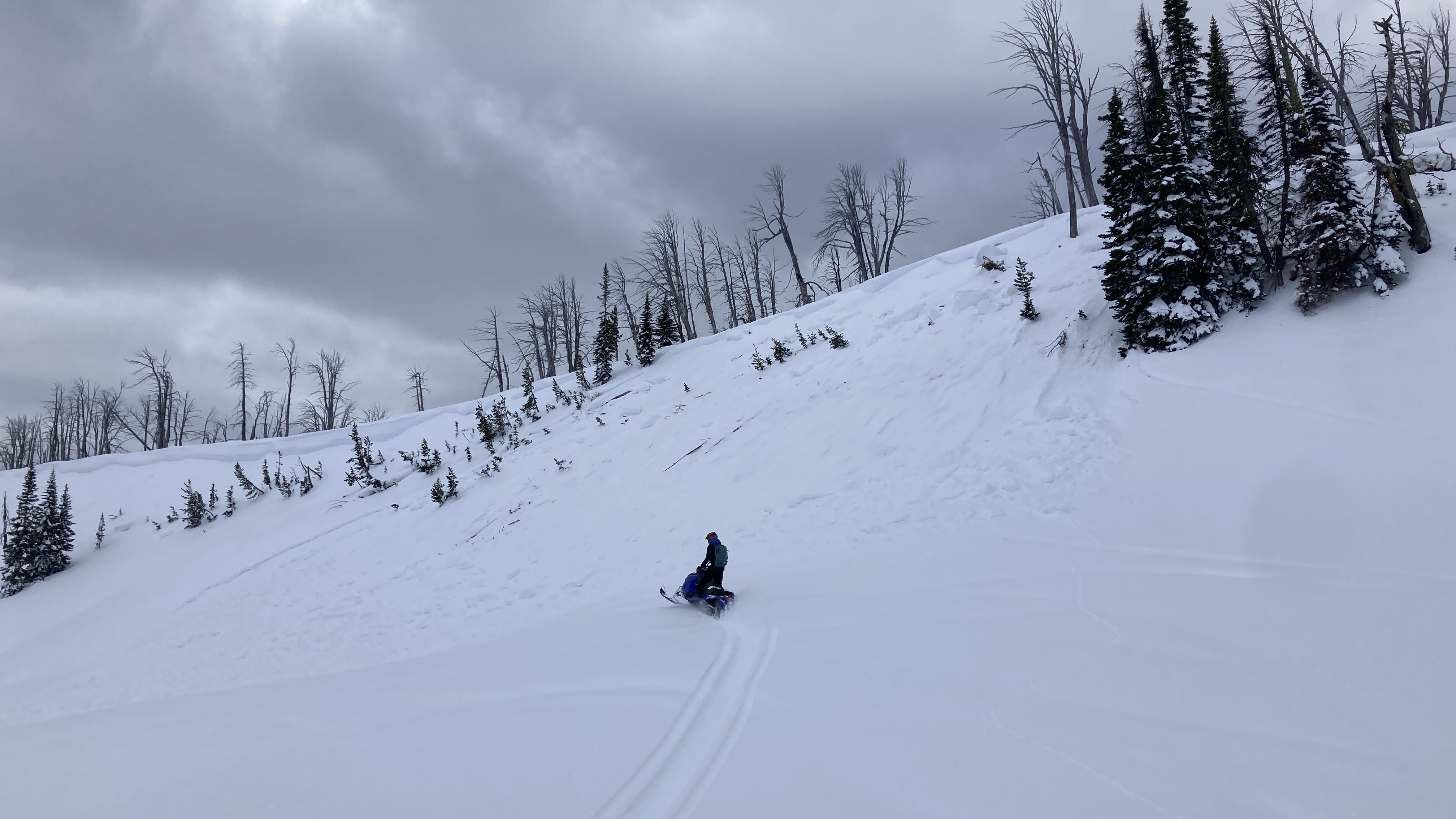
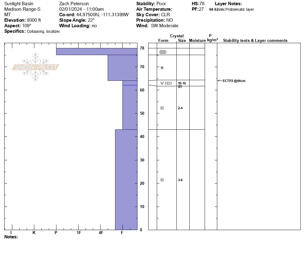
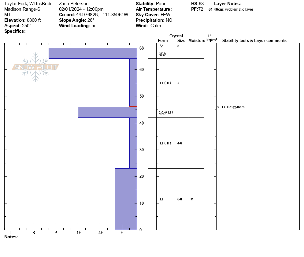
We rode into Taylor Fork today towards the Beaver Creek wilderness boundary. We saw multiple natural avalanches that happened during the last week, some newer than others and ranging in size (some in gullies others 50-75' wide). Many of these avalanches were old enough to be unrelated to the recent warming. However, at the wilderness boundary on an east-facing slope, we saw one natural wet slab avalanche and several smaller wet loose avalanches that likely happened yesterday during the warm sunny weather.
We felt a large collapse while approaching our snowpit location on an east-facing slope at 9300'. The pit was mostly faceted snow capped by a small cohesive slab and crust. We got an ECTP2, which is a very unstable result. We continued riding and after parking felt another collapse just 20' from our snowmobiles. We dug on a southwest-facing slope at 8800' and again had poor stability test results of ECTP6. Facets near the ground were moist but our stability tests were failing on dry facets above.
Clouds began rolling in around 11 AM, and a strong southwest wind remained throughout the day. Almost all slopes had a crust on them and temperatures remained cold enough that they did not soften.
Full Snow Observation ReportThe road is rideable but just barely. New snow will solve some access issues but the main problem is the whoops are very big.

Lots of collapsing and whomping in the snow, 3 avalanches seen in hell roaring creek and performed a few snow pit tests with an ECTP21 with 2 failures at 25 cm and 70 cm.
Full Snow Observation Report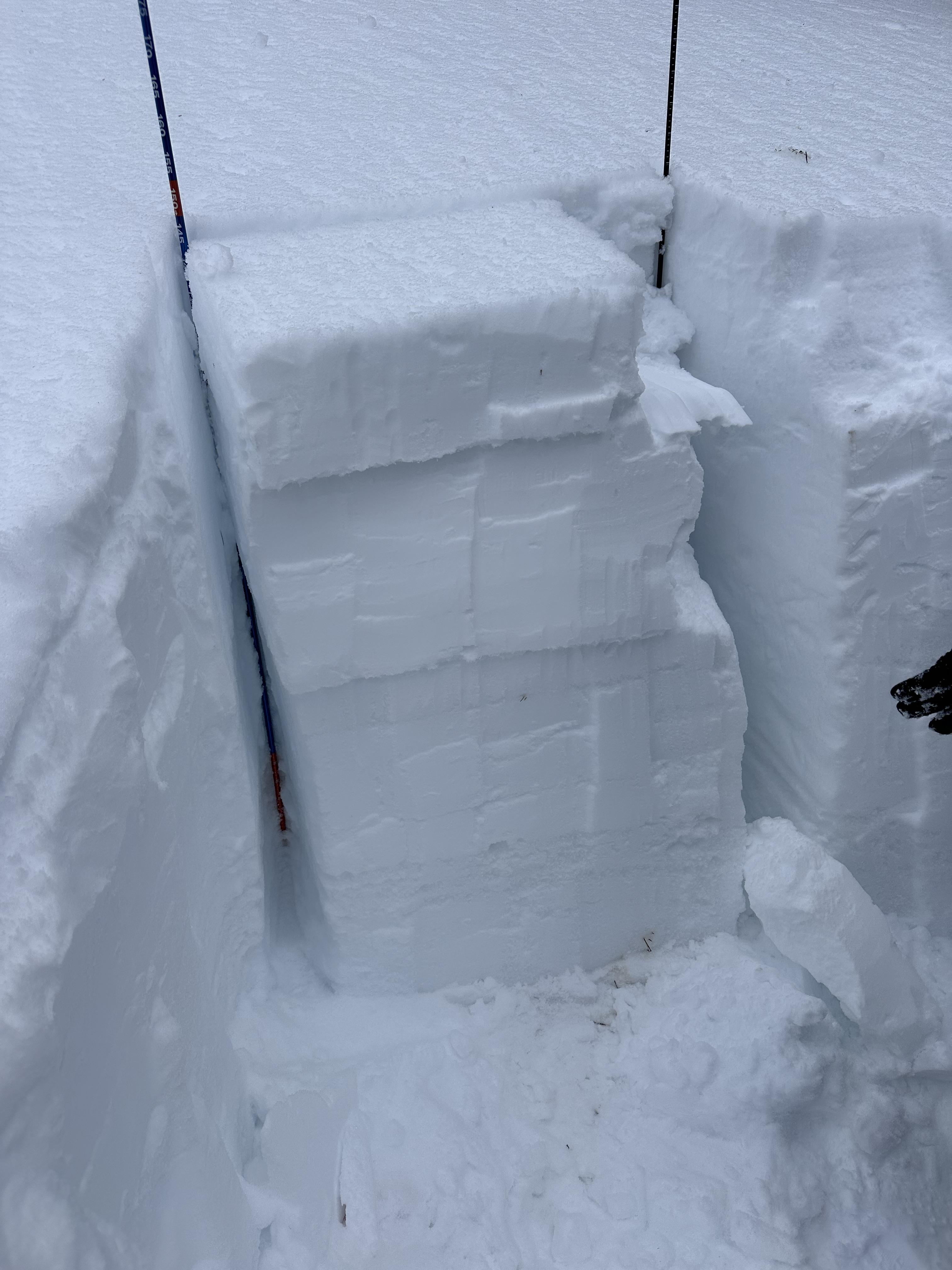
From email: "Some natural wet loose and PWL avalanches that happened yesterday, 01/30/2024, in Sheep Creek (observed today). Less collapsing today also."
Full Snow Observation Report