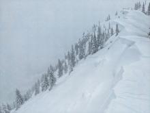

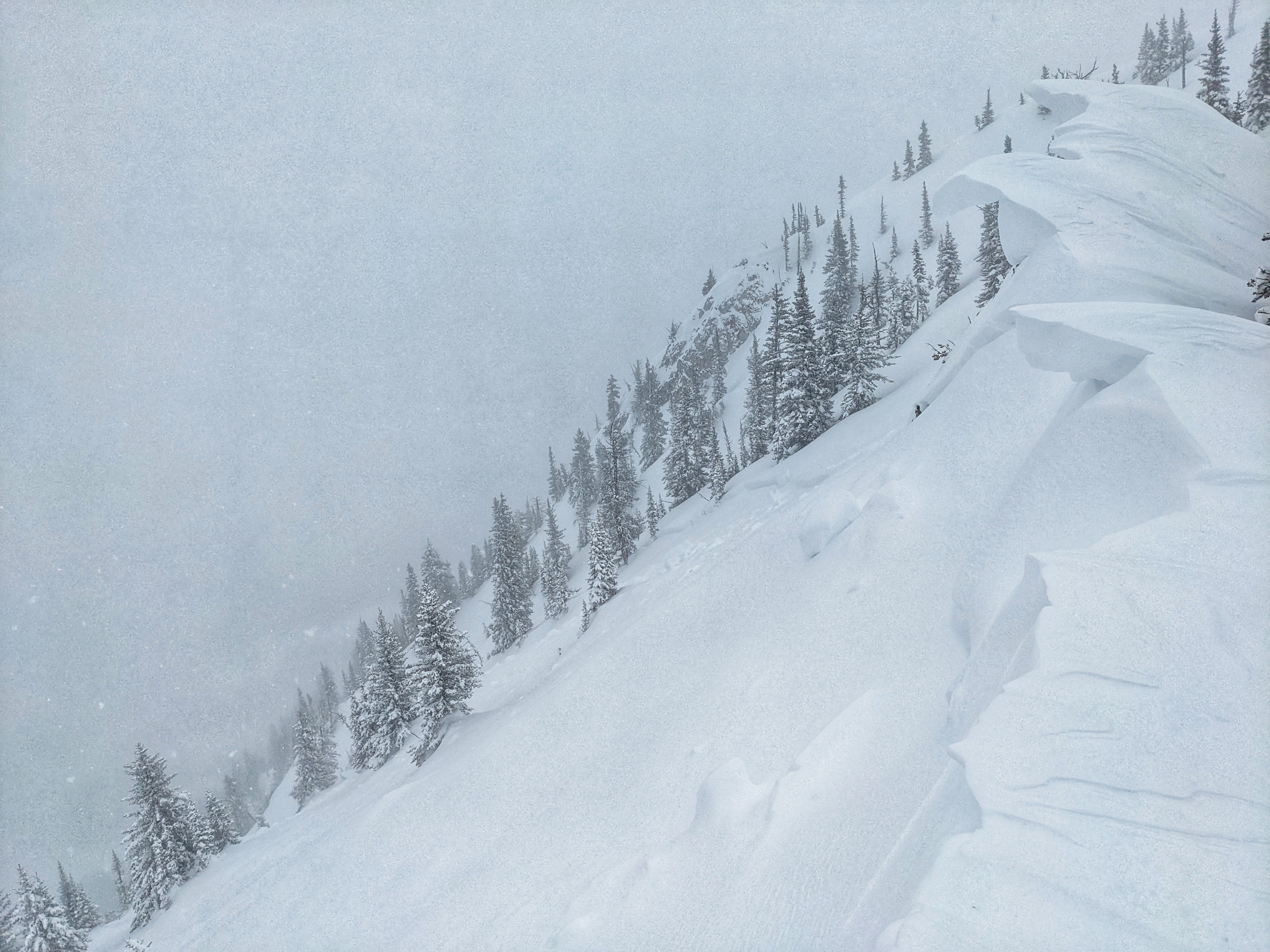
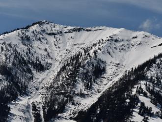
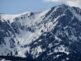
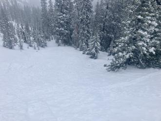
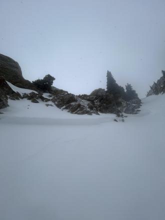
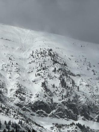
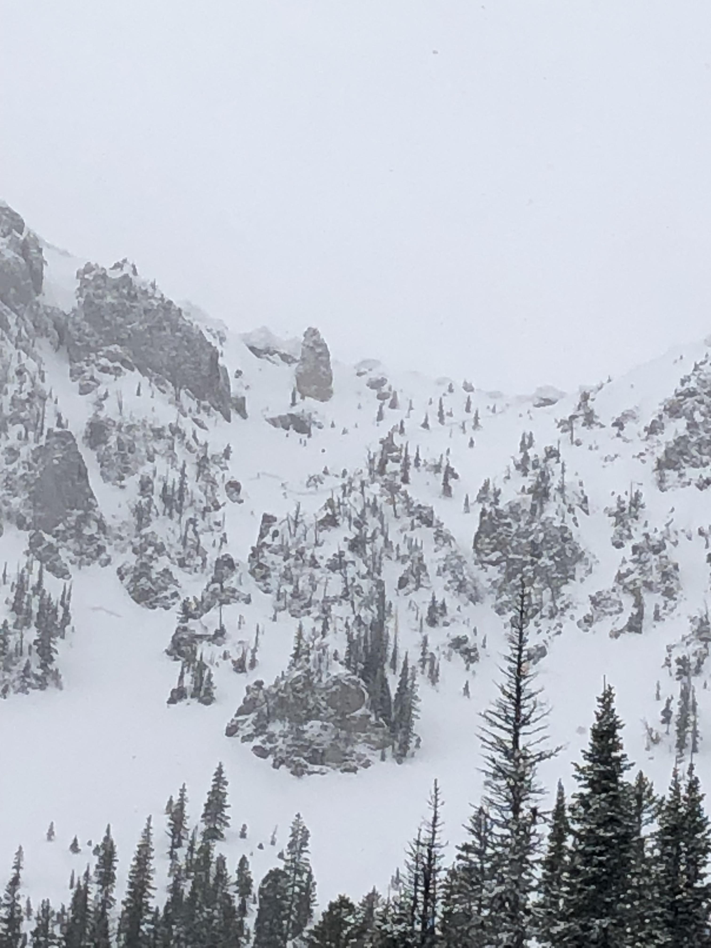
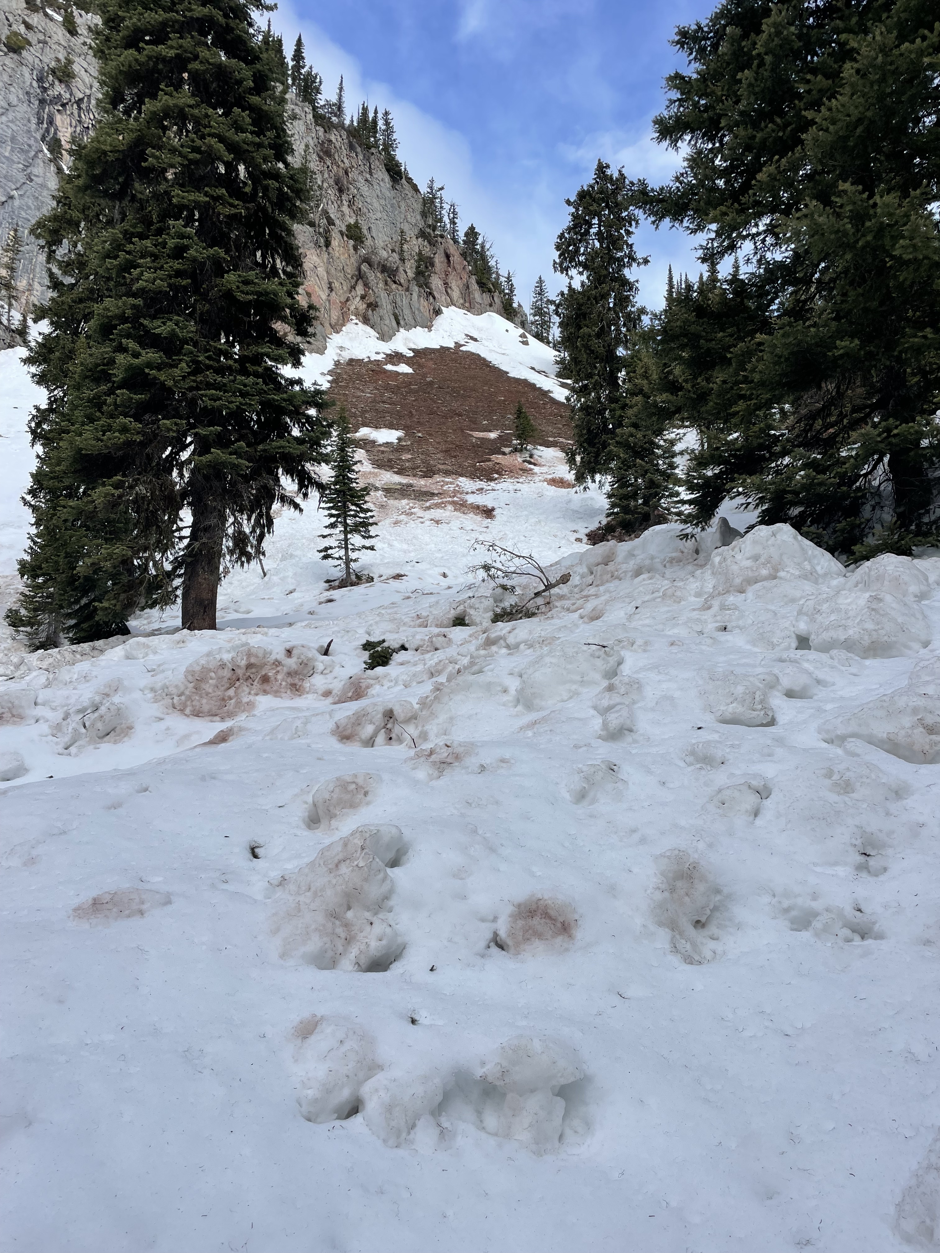
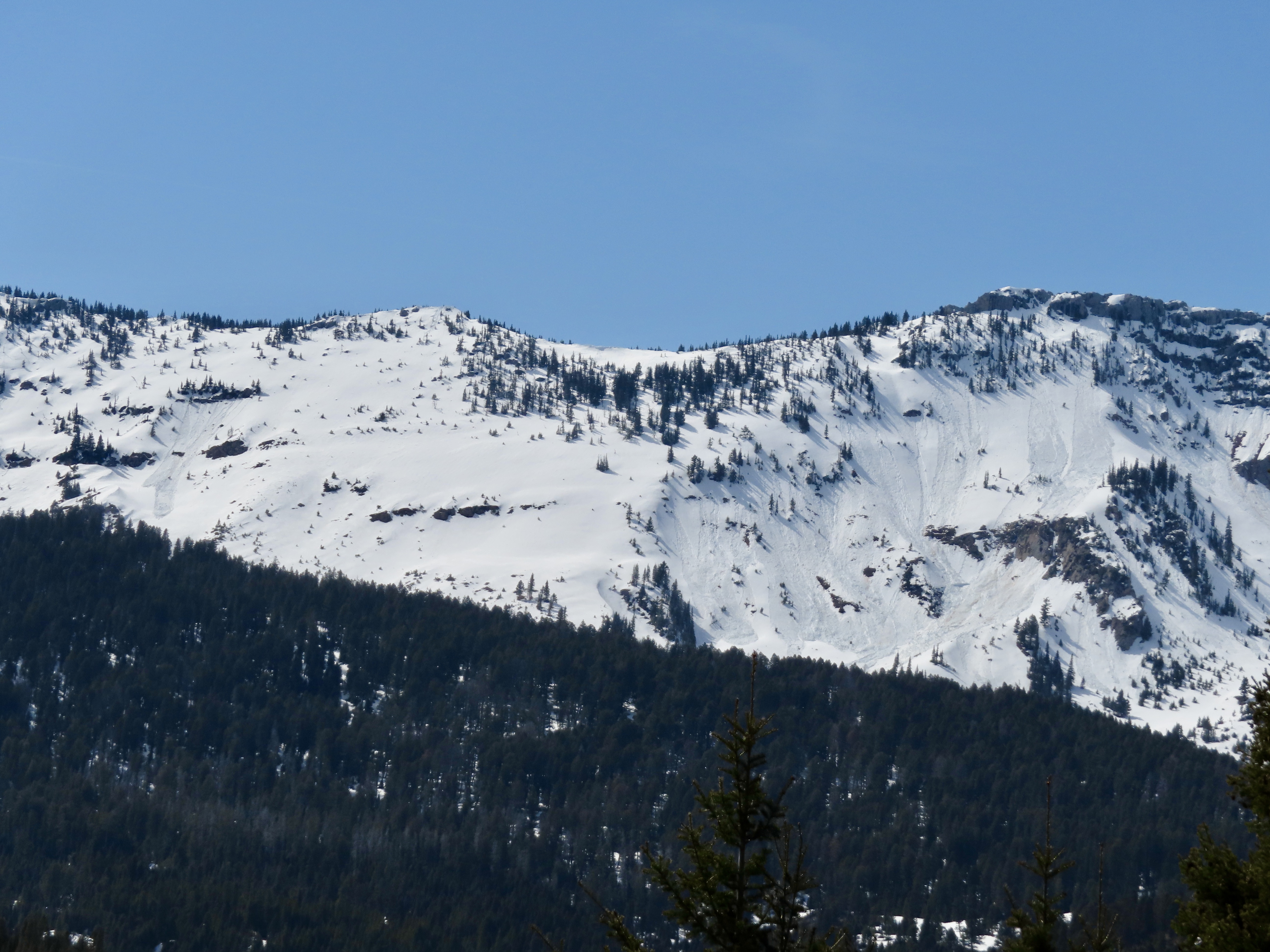
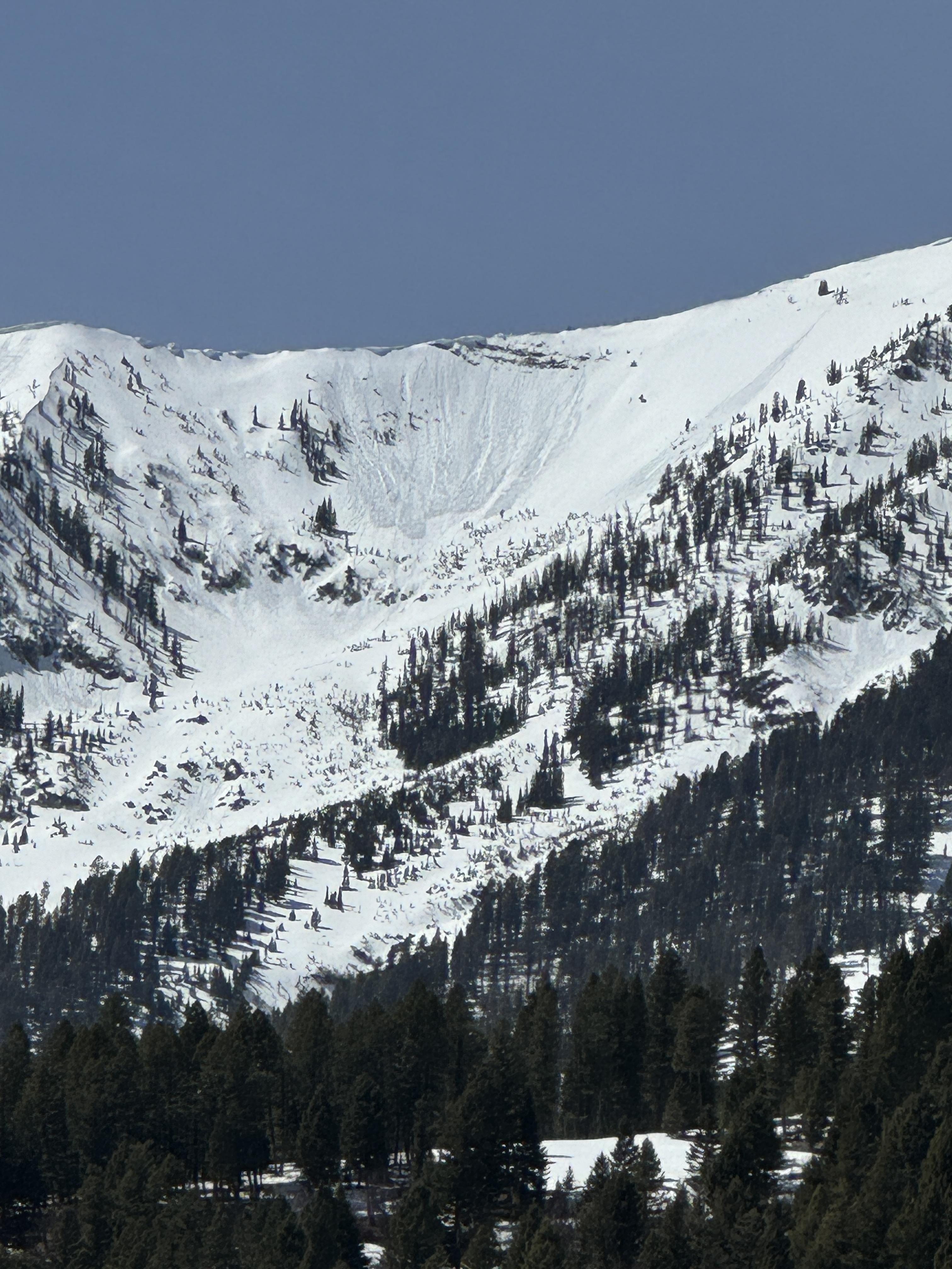
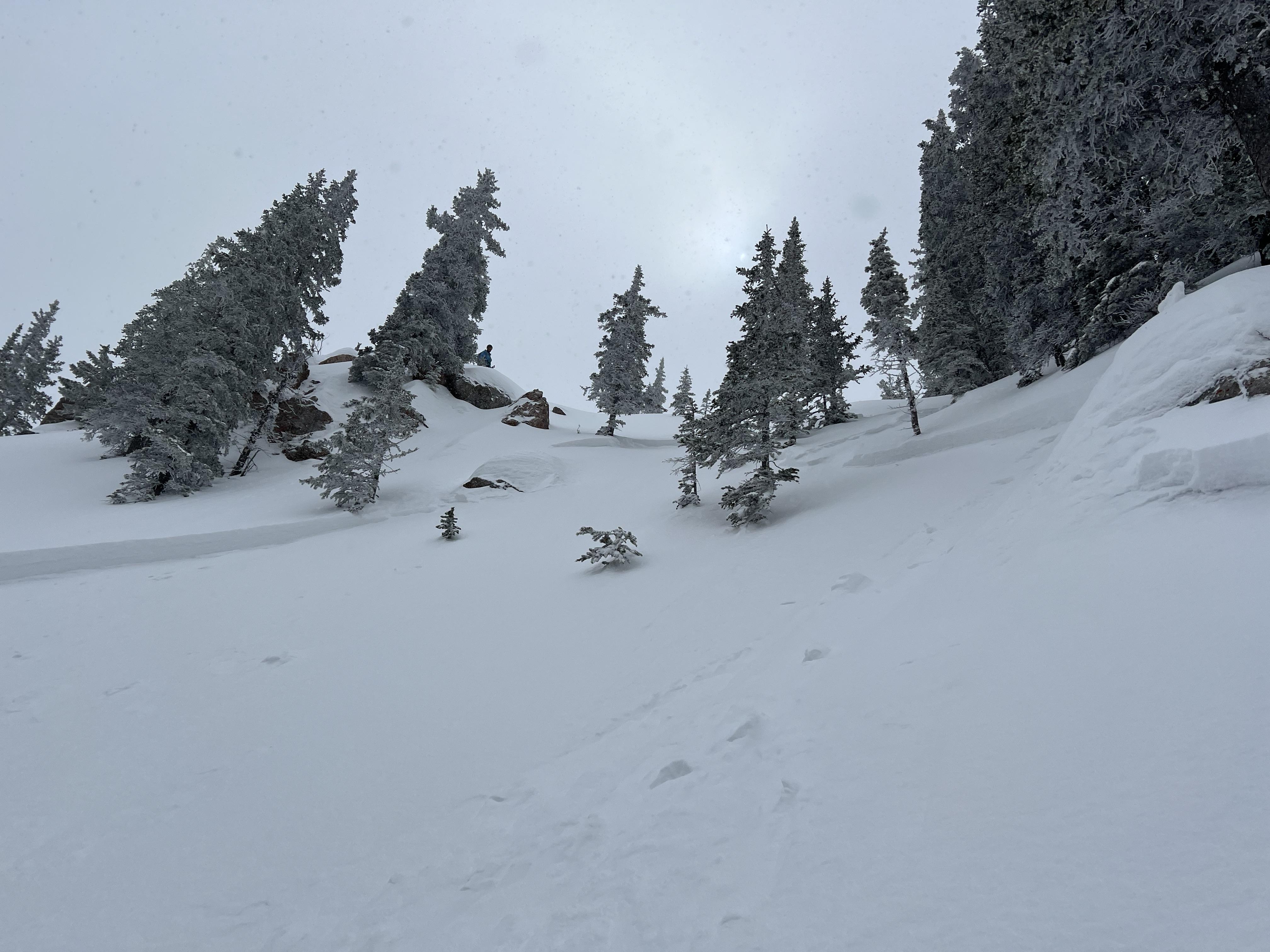
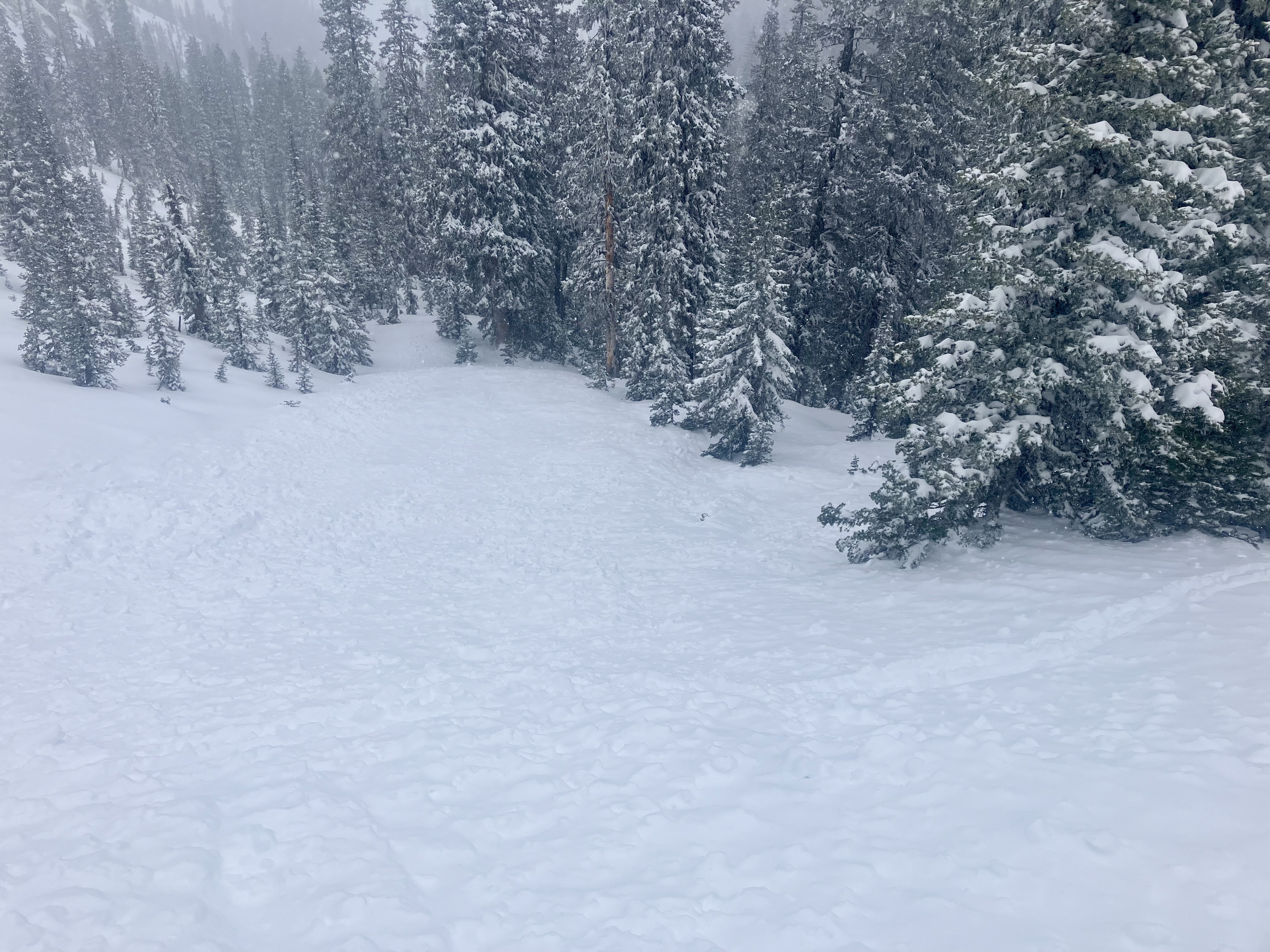
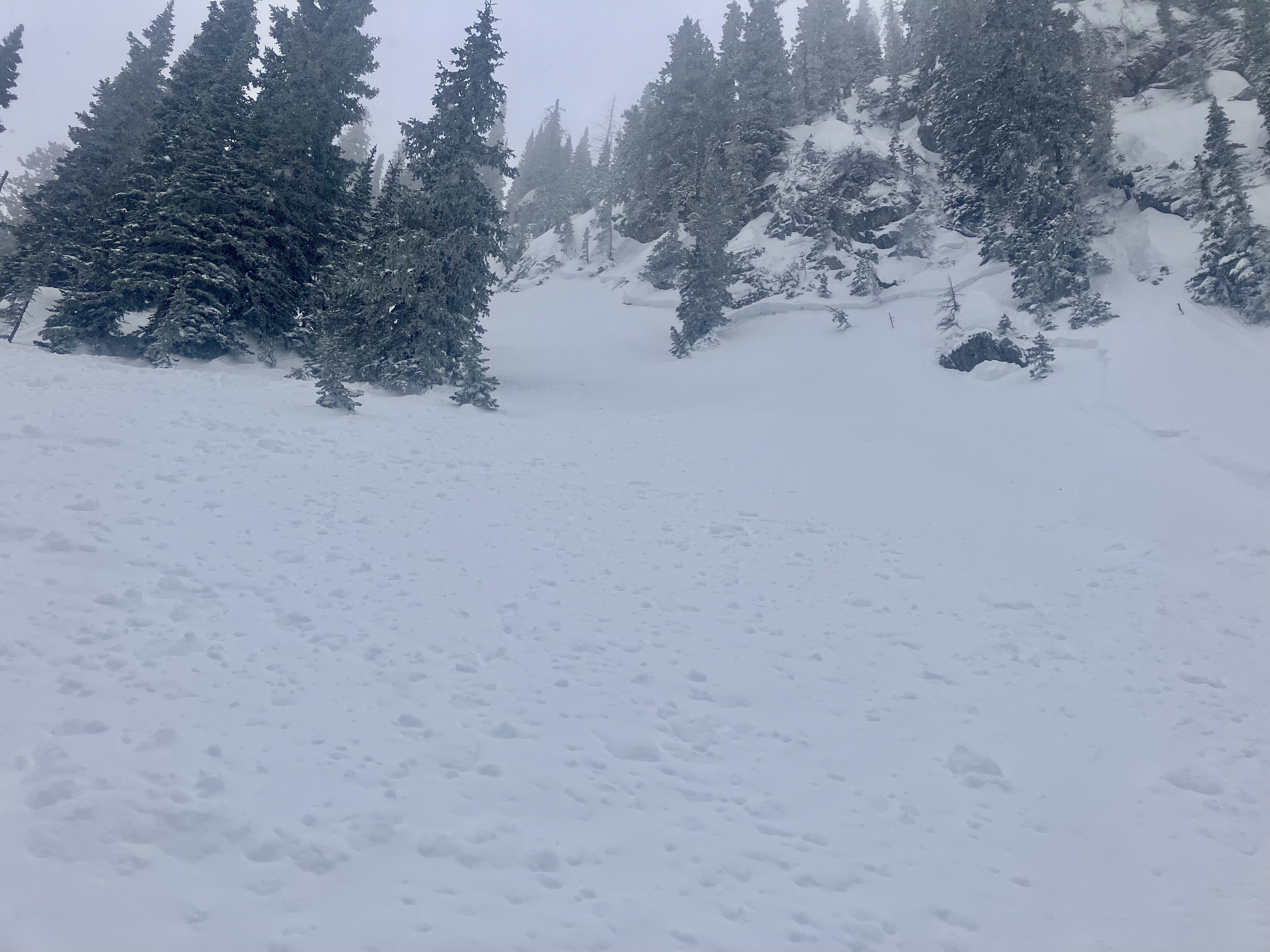
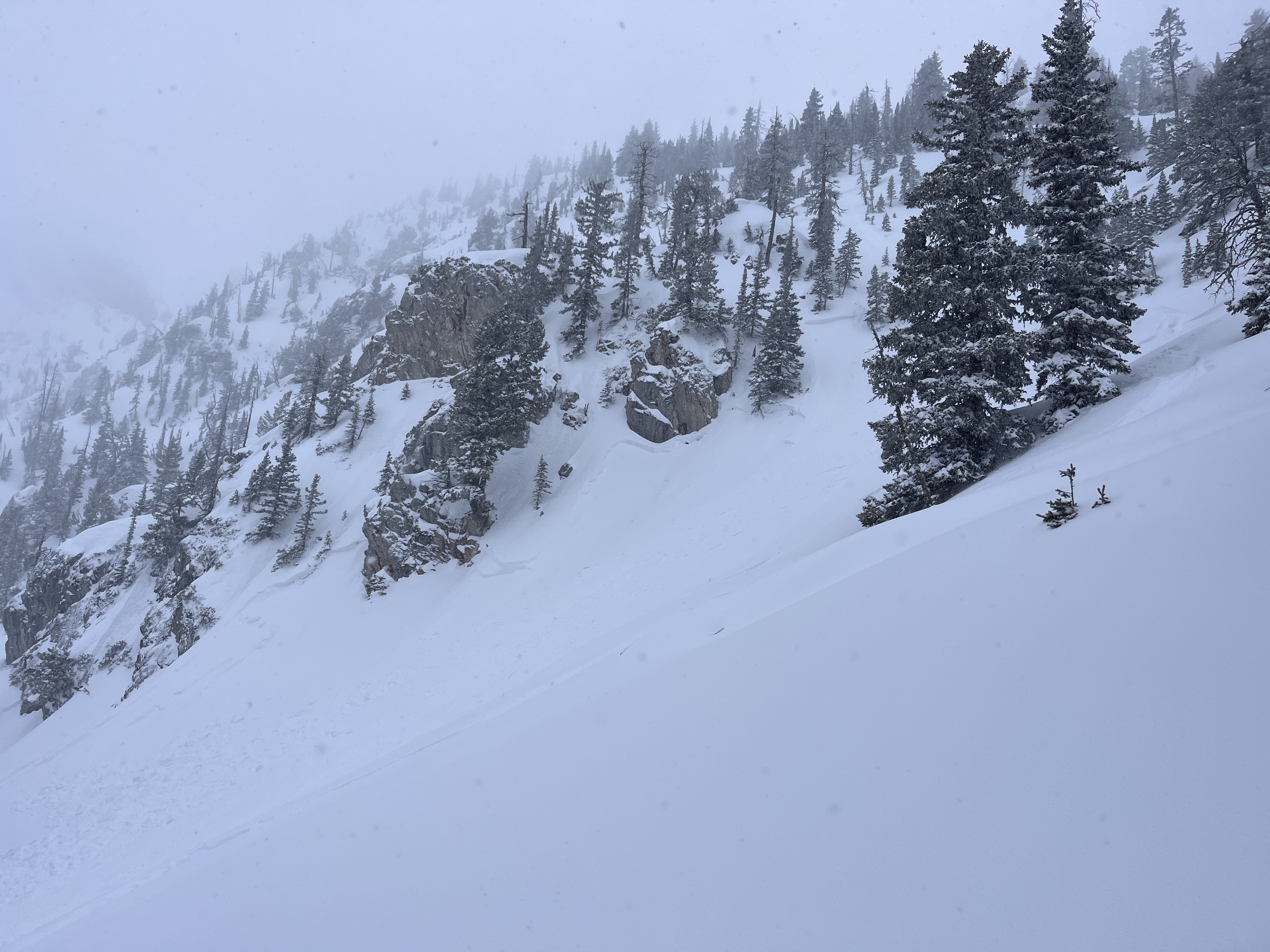
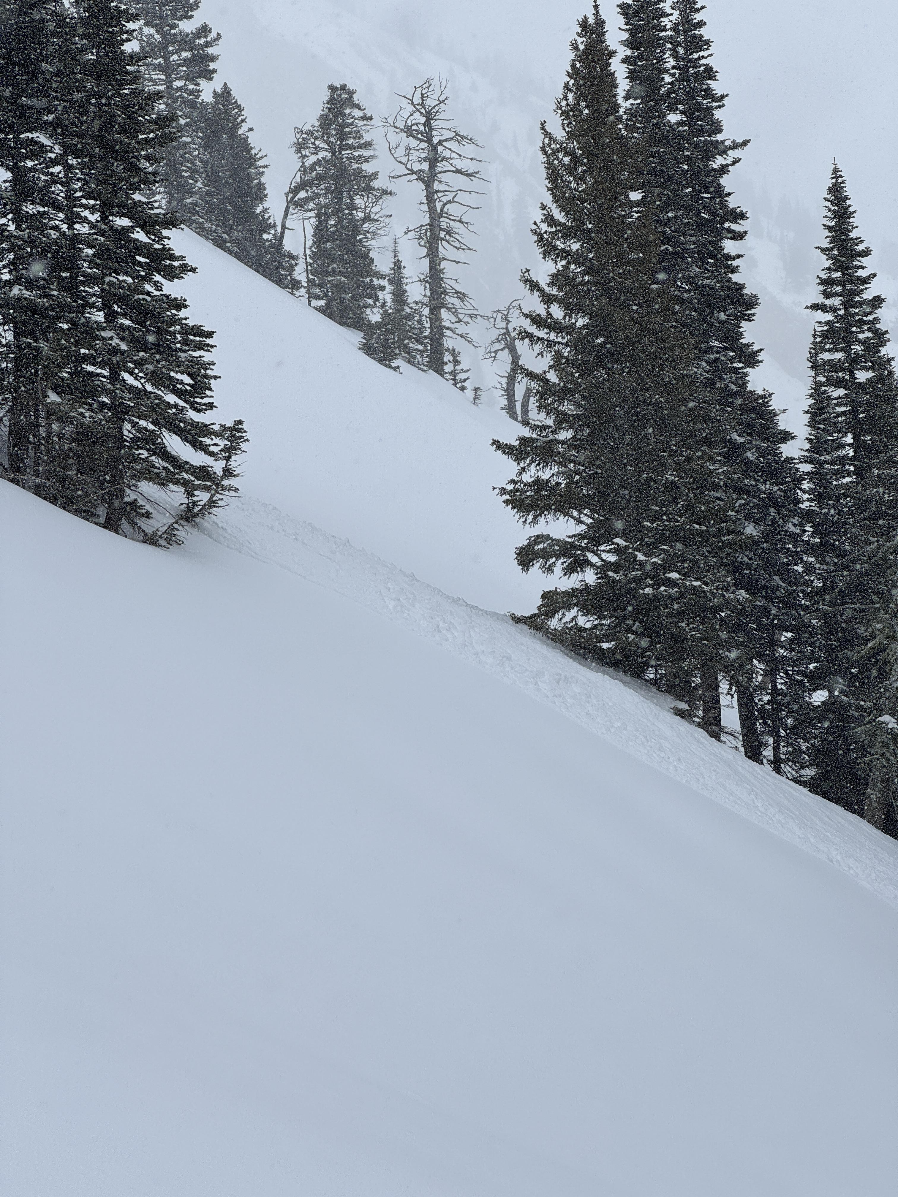
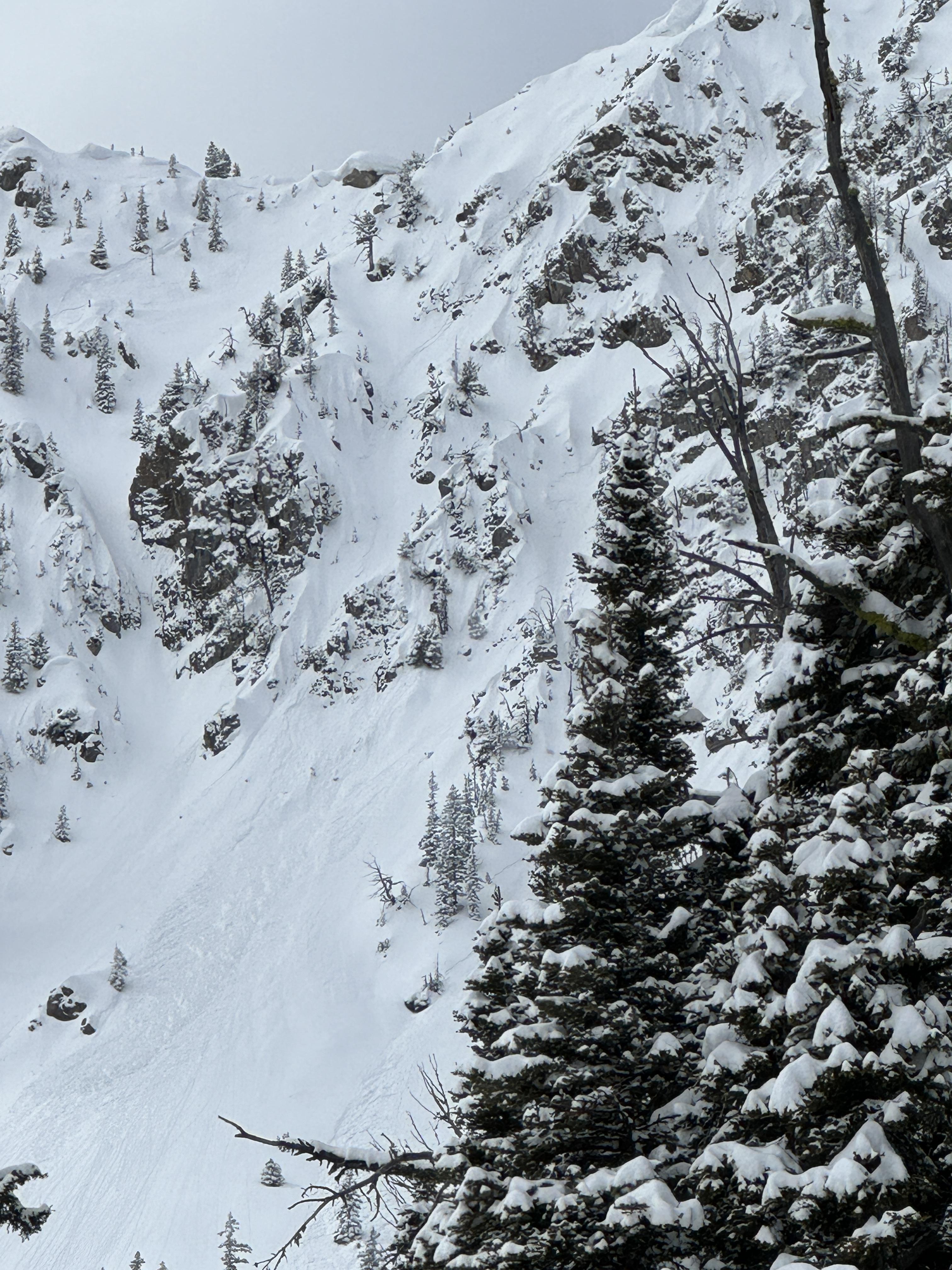
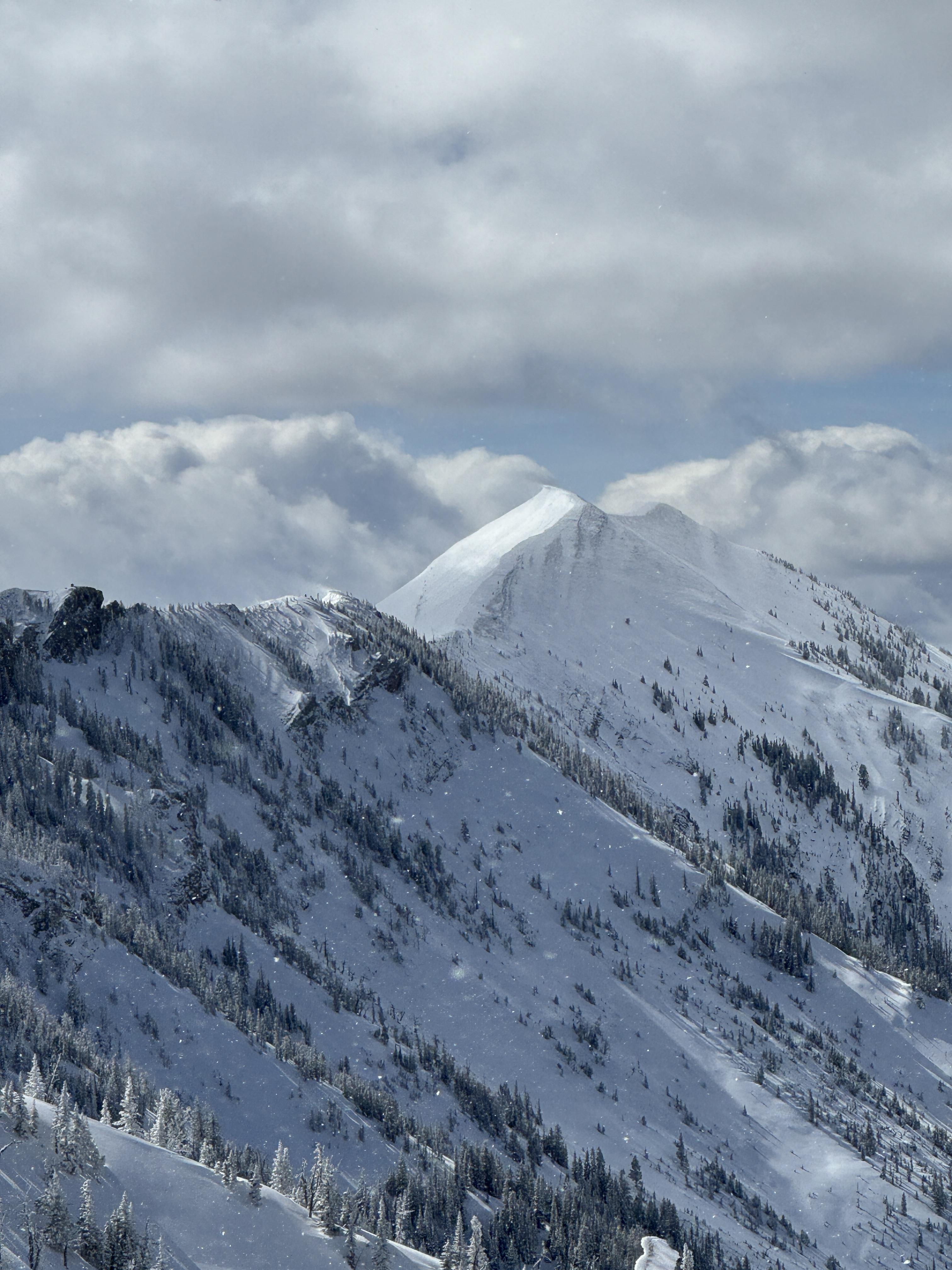
From email 5/8/24: "A few snaps from today. Observed several D2 slides between sluice box and the nose. I didn't see the toe of these slides, but it looked like there were running with some speed into mid elevation terrain. Slabs were most common in winded terrain, but slides flanked out on new/old interface and 4/26 crust (these layers are not very far apart) even in sheltered middle elevation terrain. Visibility was poor, but I'd expect to see similar large slides in steep, winded terrain" Photo: B. VandenBos
Trip Planning for Bridgers

Primary Problem: None
Bottom Line: Spring weather can be highly variable and create a mix of avalanche problems to watch out for. Snow conditions and snow stability can change drastically from day to day or hour to hour. Anticipate rapid change and plan accordingly. Plenty of snowfall over the winter with more spring snow to come makes avalanches possible into summer.Past 5 Days
Fri Apr 19

None
None
Mon Apr 22
None
None
Fri Apr 26
None
None
Mon Apr 29
None
None
Thu May 2
None
None
Relevant Avalanche Activity
Bridger Range
Bridger Bowl
large avalanches at Bridger
Bridger Bowl
SS-N-R3-D2-I
Elevation: 8,400
Aspect: E
Coordinates: 45.8156, -110.9230
Caught: 0 ; Buried: 0
More Avalanche Details
SS-N-R3-D2-I
Elevation: 8,400
Aspect: E
Coordinates: 45.8156, -110.9230
Caught: 0 ; Buried: 0
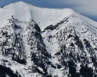
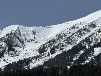
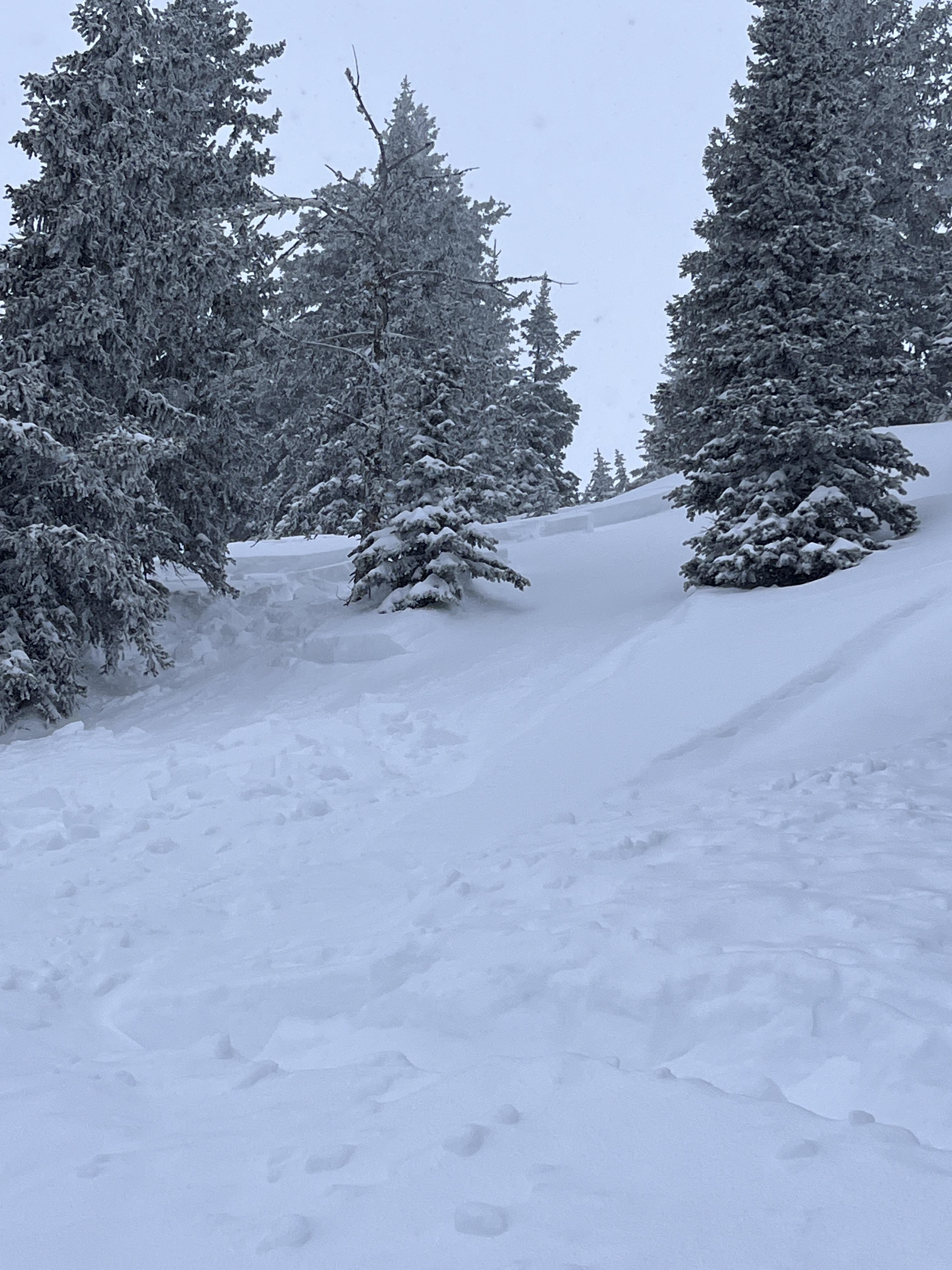
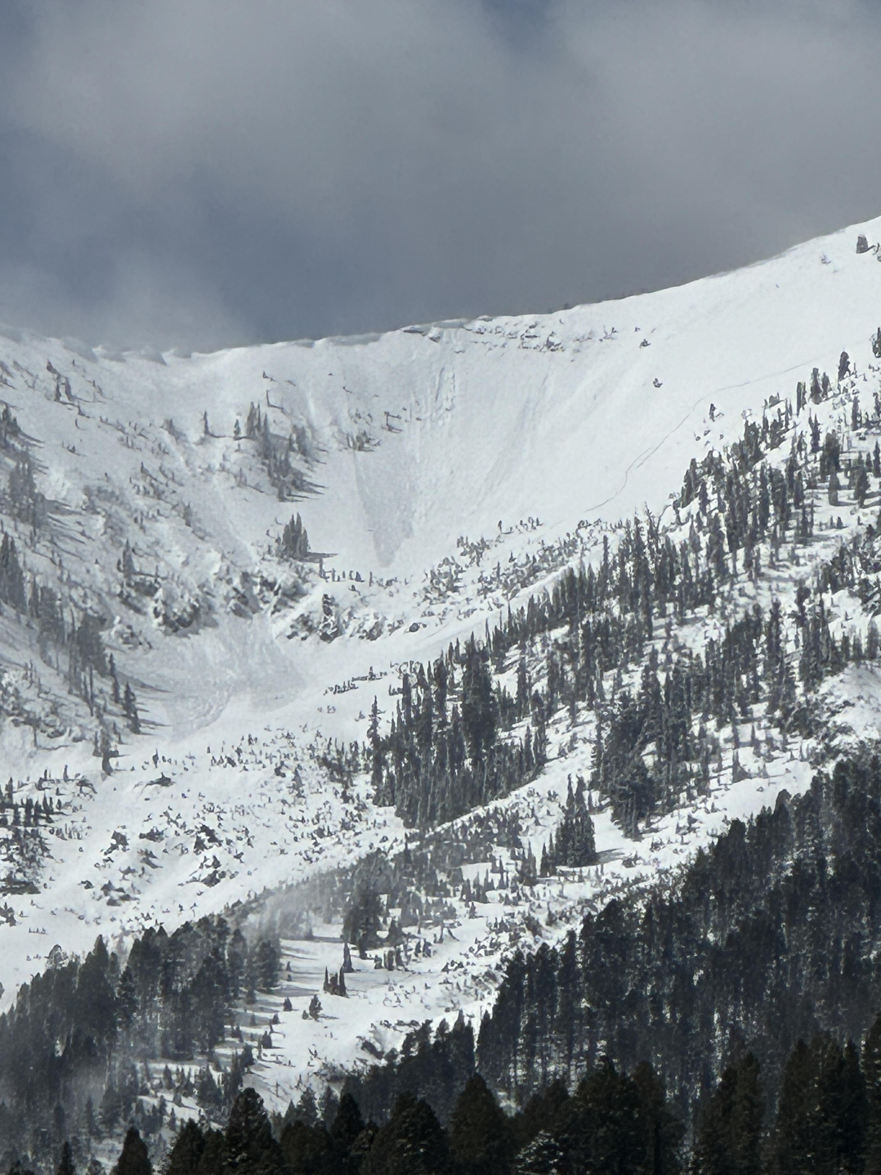
From email 5/8/24: "A few snaps from today. Observed several D2 slides between sluice box and the nose. I didn't see the toe of these slides, but it looked like there were running with some speed into mid elevation terrain. Slabs were most common in winded terrain, but slides flanked out on new/old interface and 4/26 crust (these layers are not very far apart) even in sheltered middle elevation terrain. Visibility was poor, but I'd expect to see similar large slides in steep, winded terrain
4/26 crust down:
55-60cm at 6500
65-70cm at bridger mid
75+cm at ridgeline"
More Avalanche Details
Bridger Range
Bridger Bowl
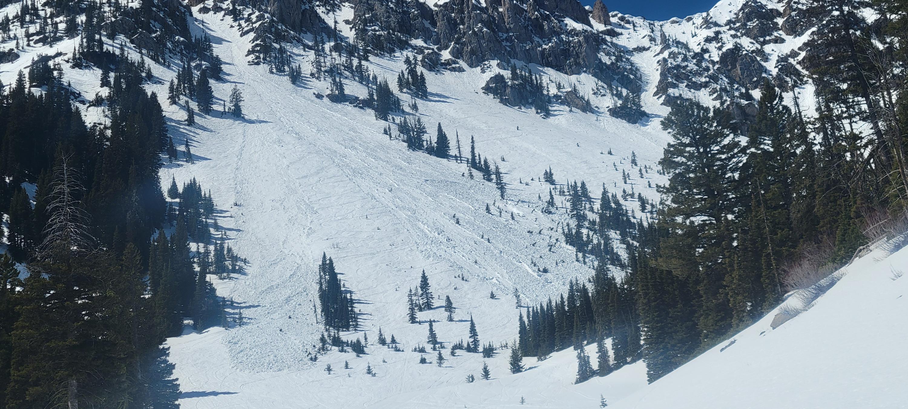
Multiple Avalanches around Peter’s Point
Bridger Bowl
SS-R2-D2-S
Elevation: 8,500
Aspect: NE
Coordinates: 45.8156, -110.9230
Caught: 0 ; Buried: 0
More Avalanche Details
SS-R2-D2-S
Elevation: 8,500
Aspect: NE
Coordinates: 45.8156, -110.9230
Caught: 0 ; Buried: 0
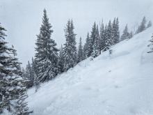
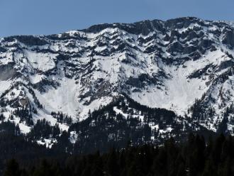
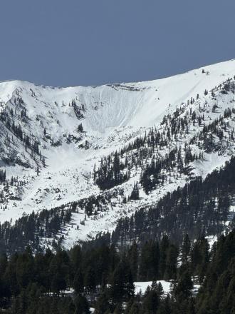
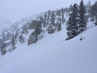
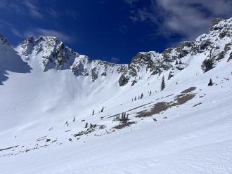
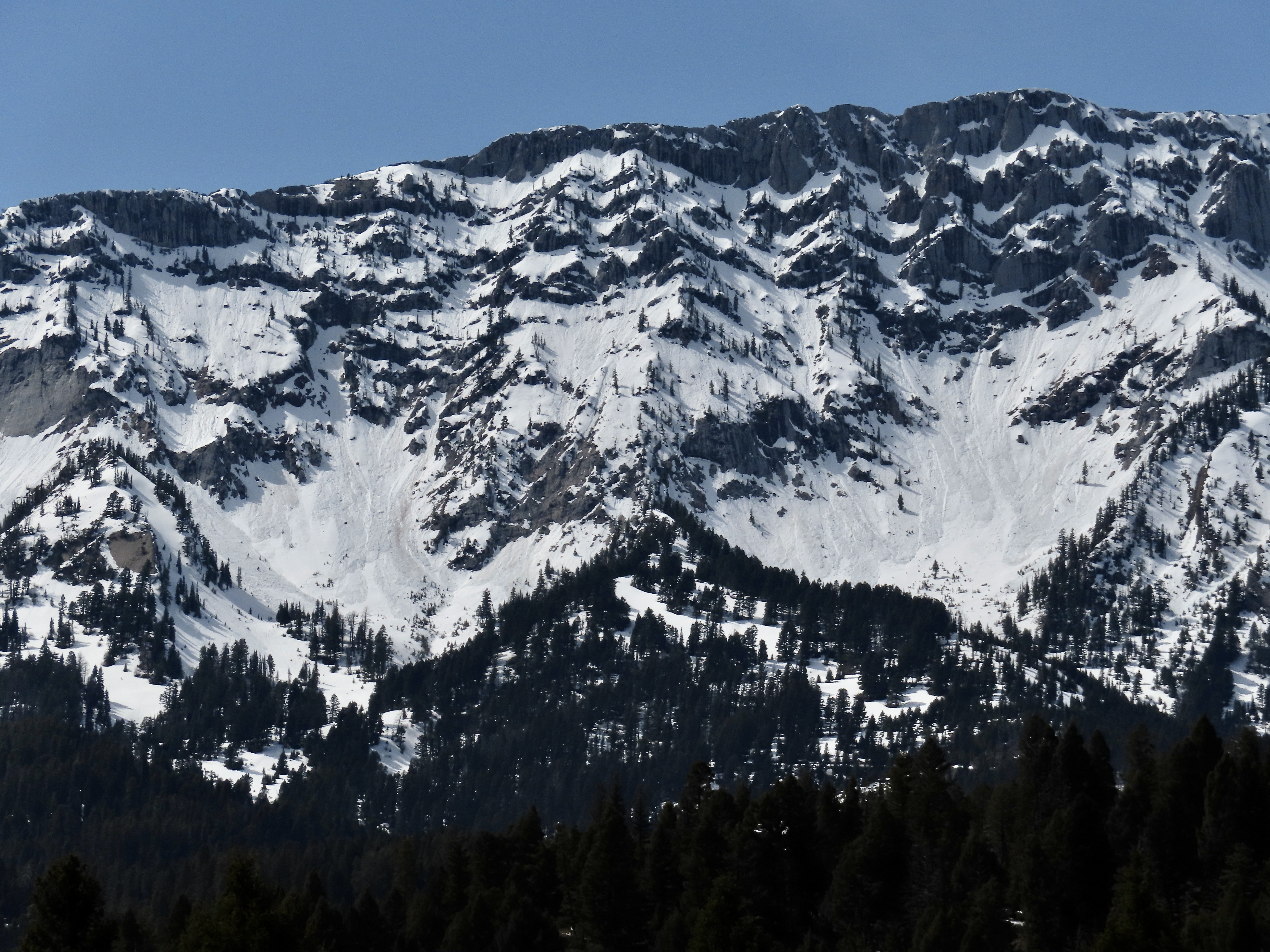
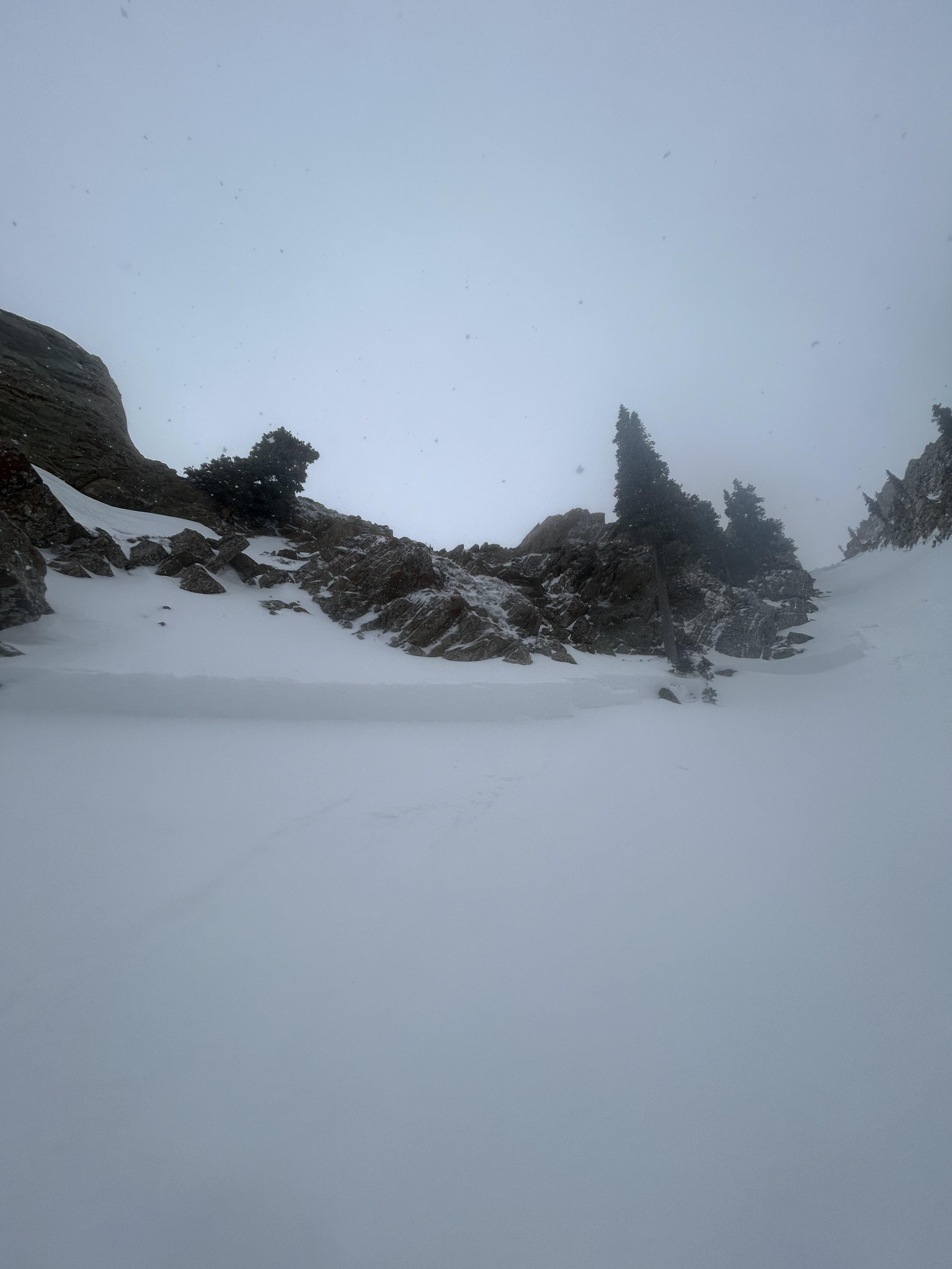
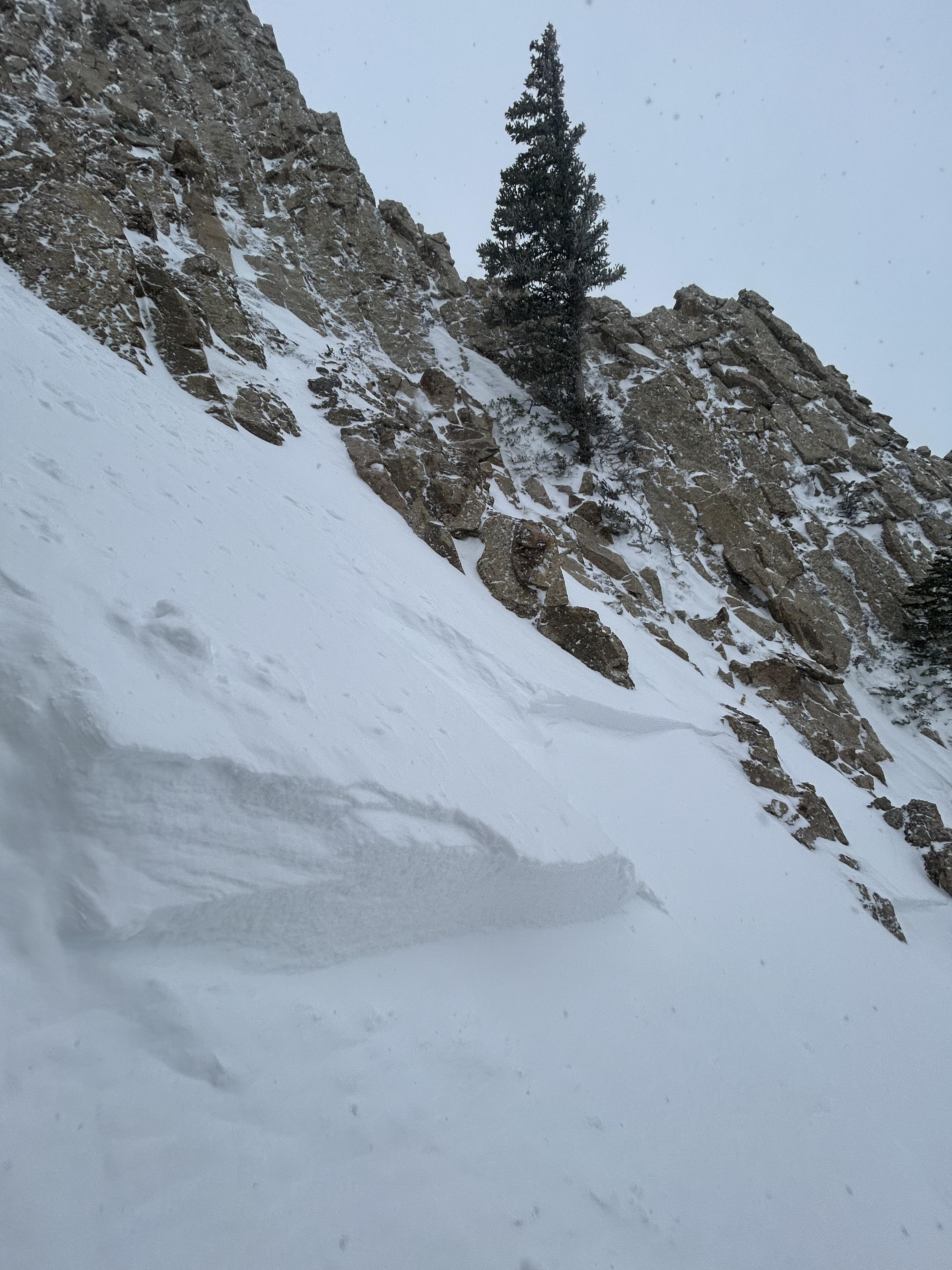
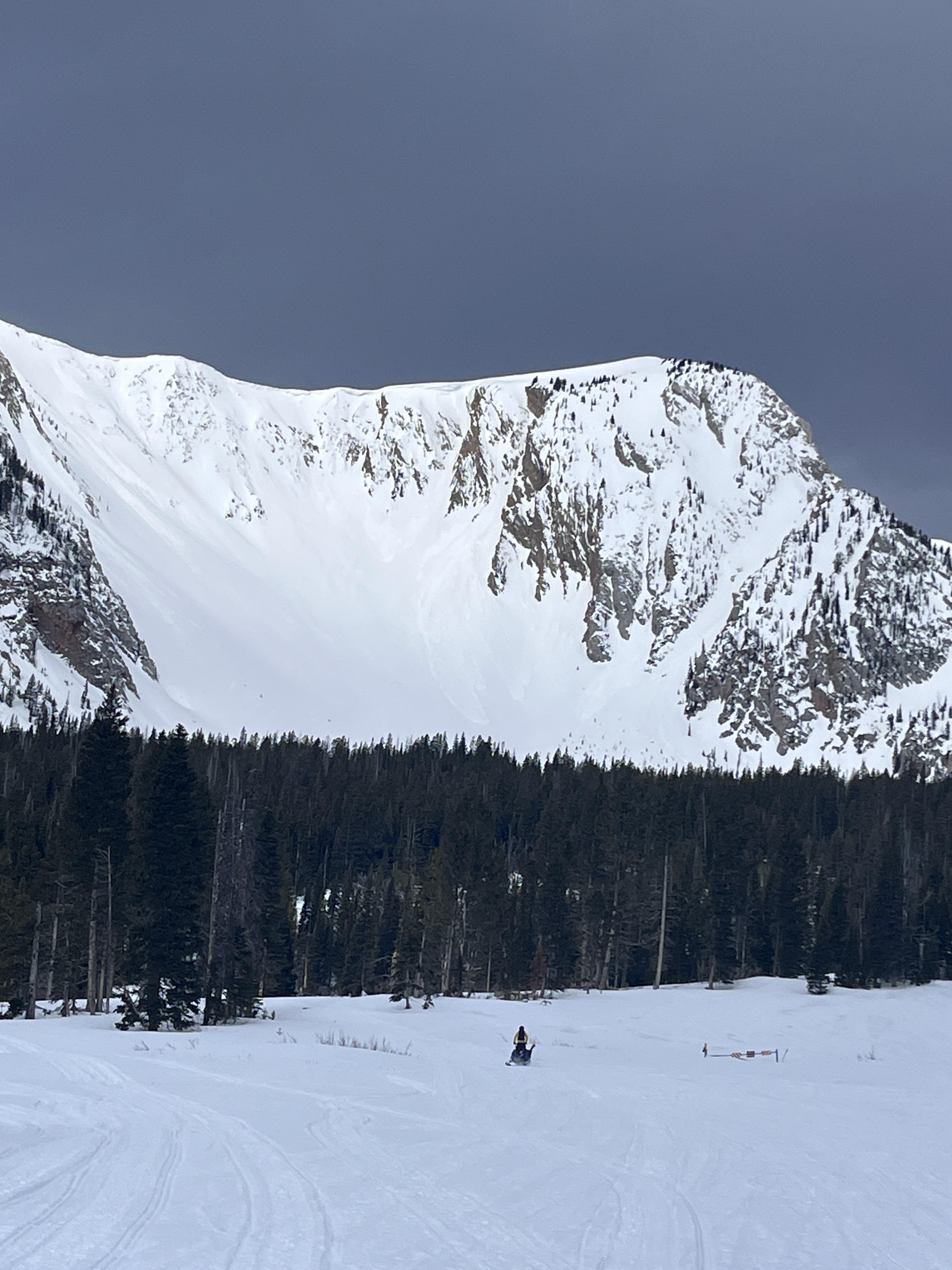
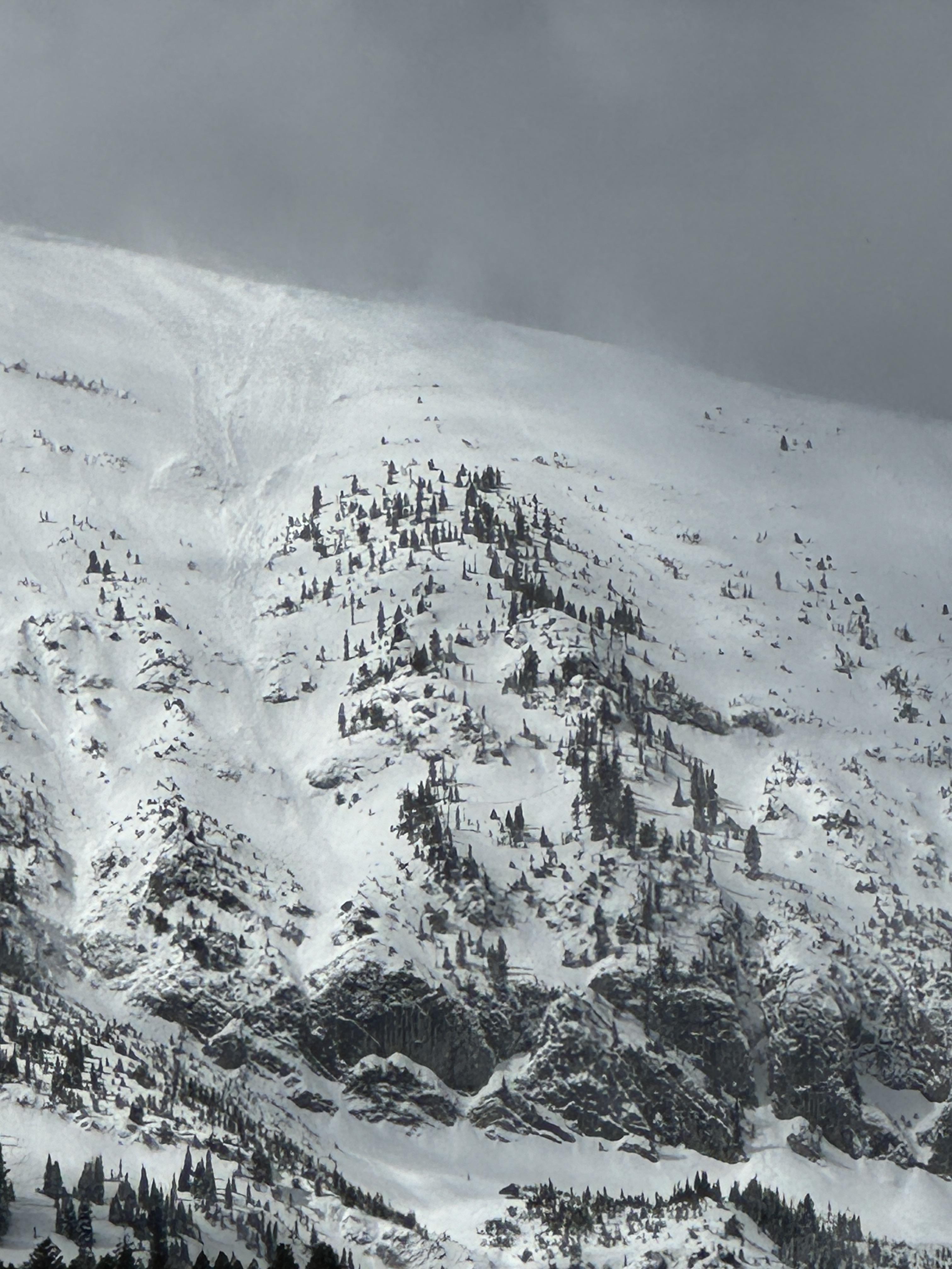
A skier near the top of the Alpine Lift at Bridger Bowl ski area took a photo of three avalanche crowns near Peter’s Point.
More Avalanche Details
Bridger Range
Wolverine Bowl
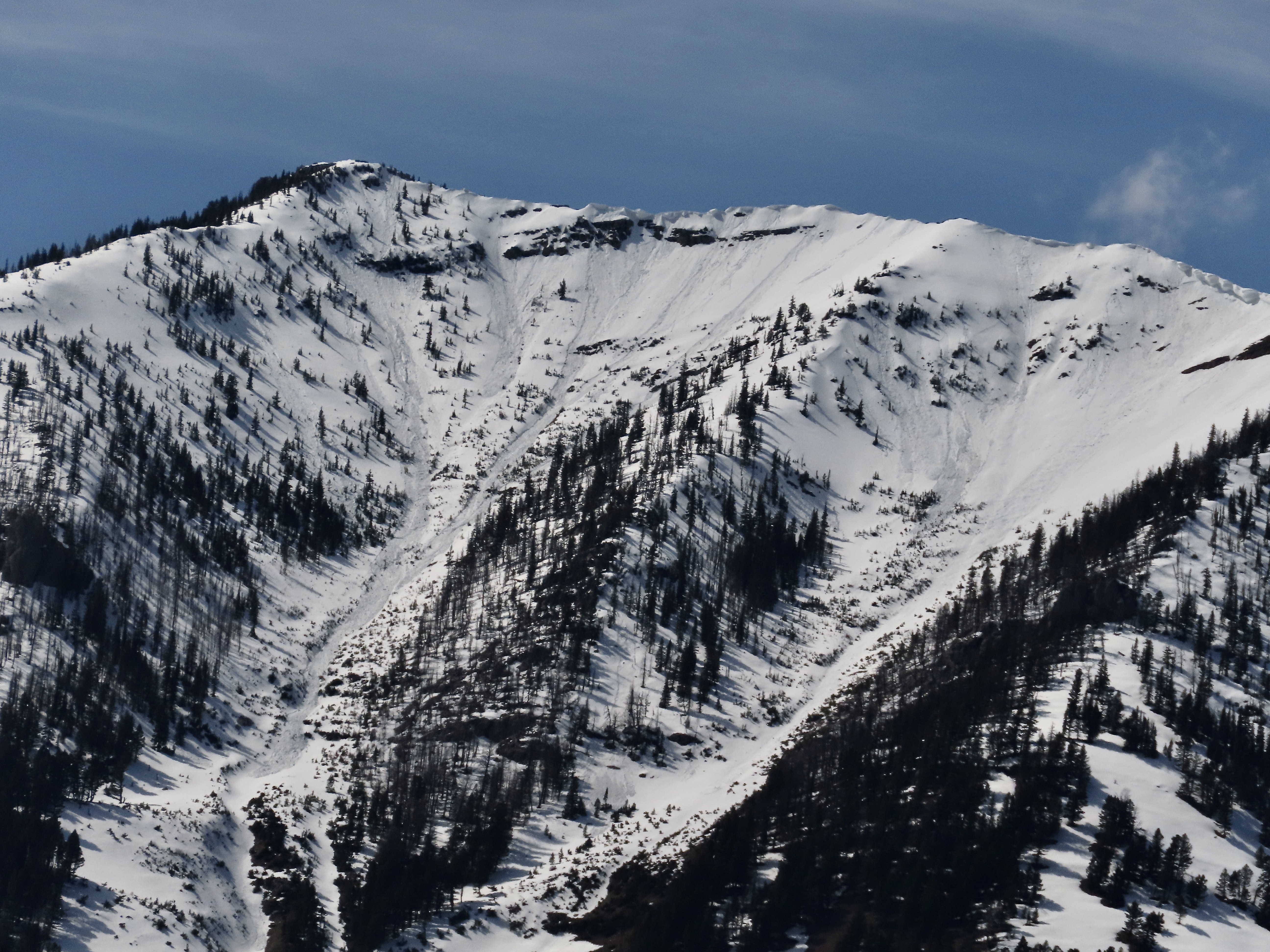
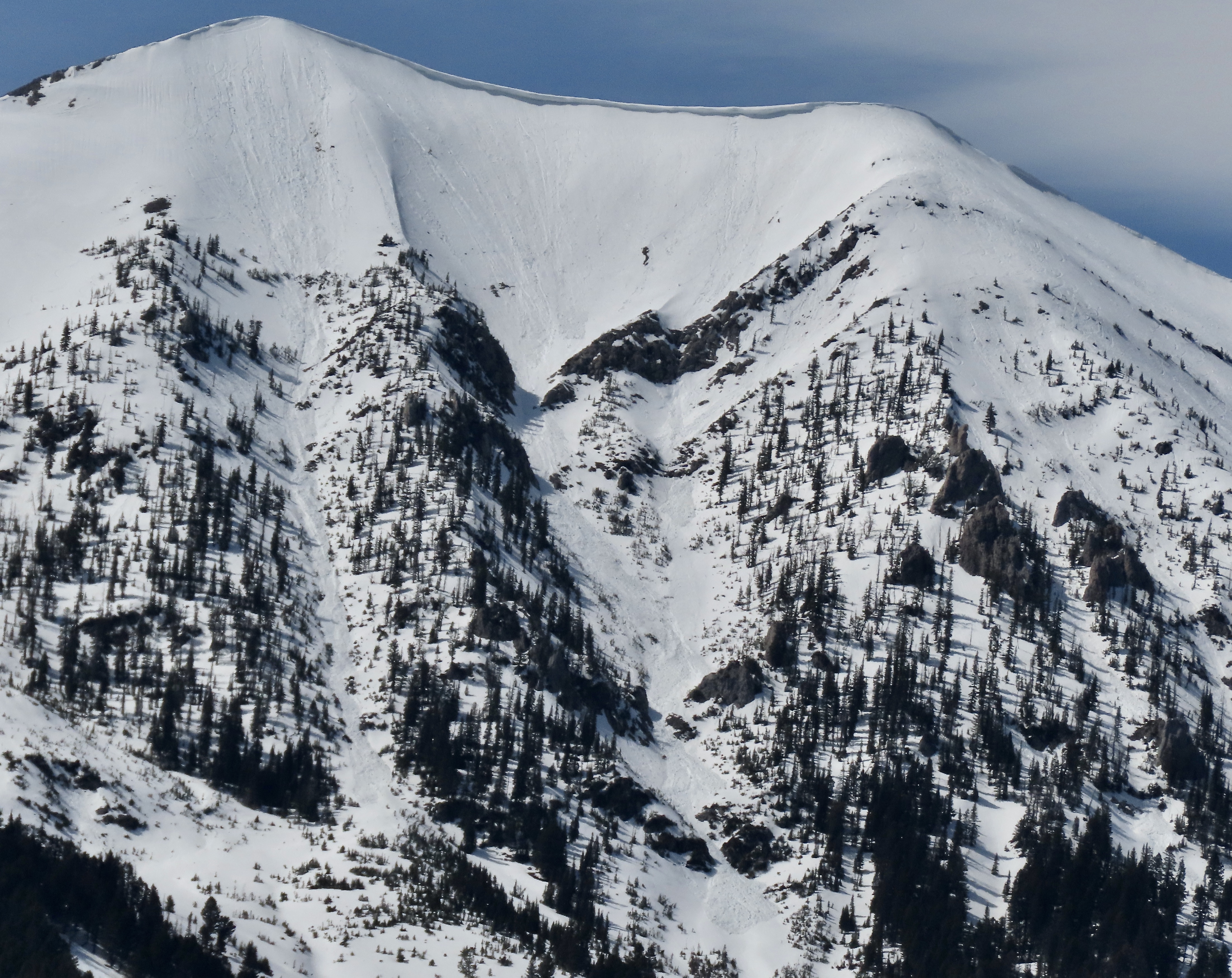
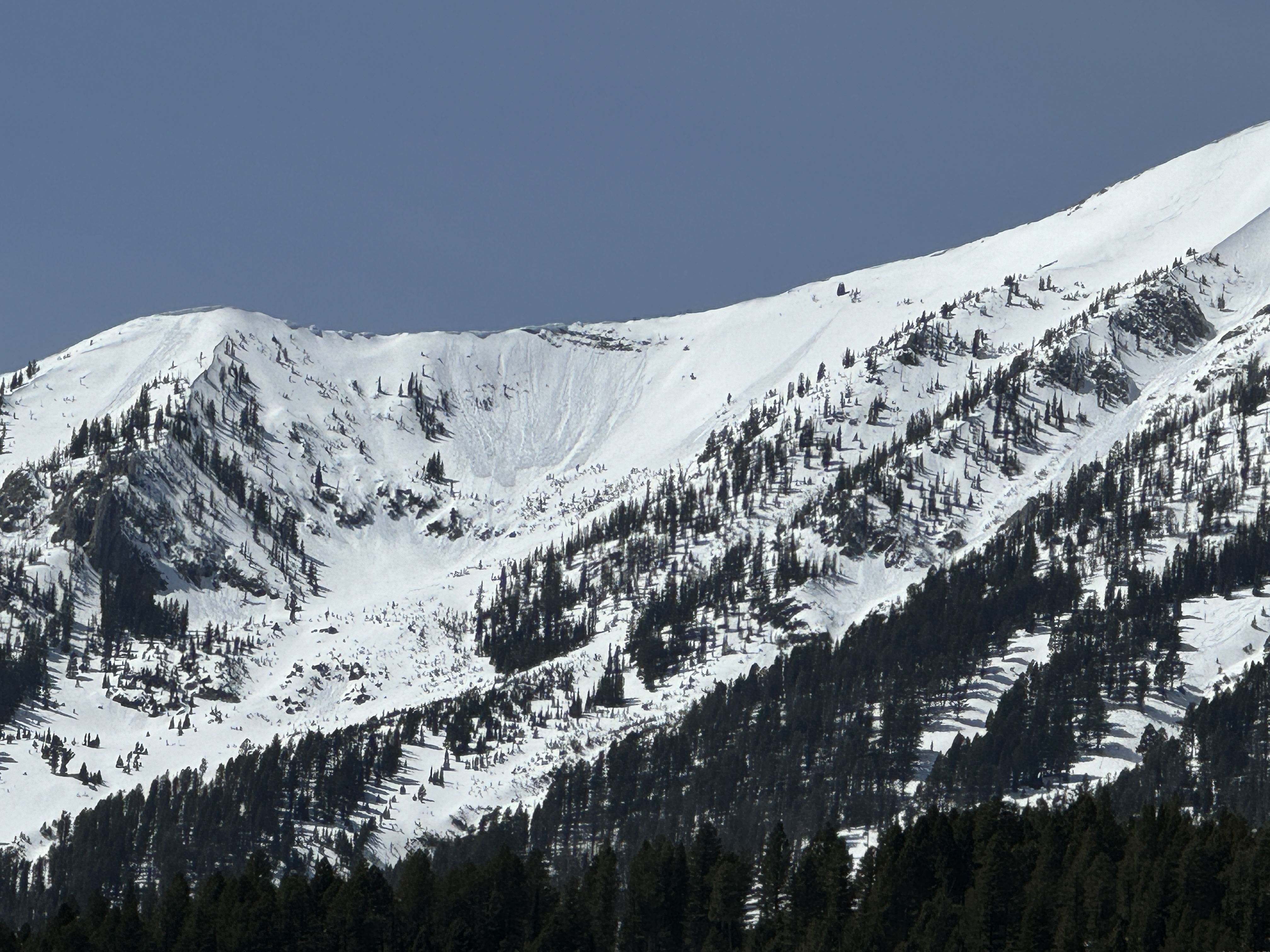
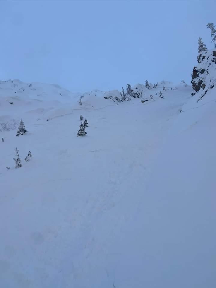
Large avalanche near Wolverine cirque
Wolverine Bowl
N
Coordinates: 45.8301, -110.9340
Caught: 0 ; Buried: 0
More Avalanche Details
N
Coordinates: 45.8301, -110.9340
Caught: 0 ; Buried: 0
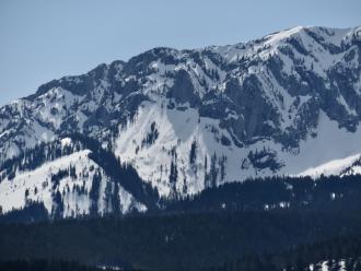
On 5/4/24 “…. a friend toured around Wolverine today. On his way out he heard a slide breaking trees (just before noon). Unknown location but he said it sounded like it was around/ above Texas Meadows. The action continues!”
More Avalanche Details
Relevant Photos
Displaying 1 - 40
-

-

From email 5/8/24: "A few snaps from today. Observed several D2 slides between sluice box and the nose. I didn't see the toe of these slides, but it looked like there were running with some speed into mid elevation terrain. Slabs were most common in winded terrain, but slides flanked out on new/old interface and 4/26 crust (these layers are not very far apart) even in sheltered middle elevation terrain. Visibility was poor, but I'd expect to see similar large slides in steep, winded terrain" Photo: B. VandenBos
-

A skier near the top of the Alpine Lift at Bridger Bowl ski area took a photo of three avalanche crowns near Peter’s Point. Photo: P Hinz
-

On 5/4/24 Skiers triggered large wet loose slides on the Fin near Cooke City
-

From email 5/2/24: "Triggered in the virtues this evening. 40' wide, 4-12" deep, failed as a dense, wind-packed slab on the rain/sun/heat crust underneath the most recent snow. I had marginal visibility but it looked like there were similar small-ish wind pockets that had failed in a few spots. Good skiing up high, fun first day up there."
-

From obs 4/25/24: "Came across a relatively large wet avalanche when approaching Texas meadows from Bradley’s meadows. Elevation around 7600ft, aspect, SSE. Depth: to ground. Considering the new snow on top of the debris, I’m guessing this slid prior to the storm last week. The slide path was melted out to dirt. Out of curiosity, we dug just to the lookers right of the slide and found soft snow near the ground - still evidence of crystal structure but could make a snowball if squeezed. Best guess is that a point release wet slide entrained enough snow to step down and release the whole face." Photo: A. Kautzer
-

On sunday 4/14 a large wet loose avalanche ran naturally in closed terrain at Bridger. The larger of the two in the photo, on the right, is from 4/14 at 1230pm. The other slide, on the left, happened yesterday (4/13) or late in the day Friday. Photo: BBSP
-
On 4/13/24 There were many loose wet avalanches that ran over the last 1-3 days. They appeared to involved the upper 6-12" of the snowpack. Photo: GNFAC
-
On 4/13/24 There were many loose wet avalanches that ran over the last 1-3 days. They appeared to involved the upper 6-12" of the snowpack. Photo: GNFAC
-

On 4/13/24 There were many loose wet avalanches that ran over the last 1-3 days. They appeared to involved the upper 6-12" of the snowpack. Photo: GNFAC
-
On 4/13/24 There were many loose wet avalanches that ran over the last 1-3 days. They appeared to involved the upper 6-12" of the snowpack. Photo: GNFAC
-
On 4/13/24 There were many loose wet avalanches that ran over the last 1-3 days. They appeared to involved the upper 6-12" of the snowpack. Photo: GNFAC
-
On 4/13/24 There were many loose wet avalanches that ran over the last 1-3 days. They appeared to involved the upper 6-12" of the snowpack. Photo: GNFAC
-
Driving home from Bridger Bowl, I spotted a number of wet, loose avalanches in Argentina Bowl. It was 1:30 PM when I saw them, and the sun was still blazing. I would expect there was more activity as the afternoon progressed. Photo: GNFAC
-
Driving home from Bridger Bowl, I spotted a number of wet, loose avalanches in Argentina Bowl. It was 1:30 PM when I saw them, and the sun was still blazing. I would expect there was more activity as the afternoon progressed. Photo: GNFAC
-

From IG message: “Rode the banana today.. lots of fast moving sluff. Had a mid elevation pocket pop. New snow seemed to have bonded well, the spot that did pop had formed into 12” slab below rock face.”
-

From IG message: “Rode the banana today.. lots of fast moving sluff. Had a mid elevation pocket pop. New snow seemed to have bonded well, the spot that did pop had formed into 12” slab below rock face.”
-

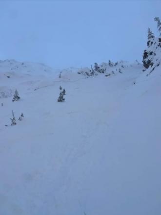
Skiers triggered this avalanche on a north-facing slope near the Anger Lake basin. The crown was 4-18 inches deep and propagated the entire width of the gully ~40 feet and ran the entire length of the gully ~500 vertical feet. The skier was able to ski out of the avalanche right as it broke and was not carried. Photo: Anonymous
-
The largest skier-triggered avalanche that we saw today. The crown extended out of frame below steep rocks. This avalanche broke ~1' deep within the recent storm snow. R2/D2. Photo: GNFAC
-

The largest skier-triggered avalanche that we saw today. The crown extended out of frame below steep rocks. This avalanche broke ~1' deep within the recent storm snow. R2/D2. Photo: GNFAC
-

The largest skier-triggered avalanche that we saw today. The crown extended out of frame below steep rocks. This avalanche broke ~1' deep within the recent storm snow. R2/D2. Photo: GNFAC
-
One of several skier-triggered avalanches that broke within the recent storm snow, ~1' deep. R2/D1.5. Photo: GNFAC
-
One of several skier-triggered avalanches that broke within the recent storm snow, ~1' deep. R2/D1.5. Photo: GNFAC
-
Riders saw this recent storm slab avalanche while riding near Fairy Lake. This avalanche was triggered by riders not in their group. Photo: Anonymous
-
Skiers in the Love Chutes triggered this avalanche after a ski cut produced no results. Further down the chute, the first skier triggered an 18" wind slab avalanche. They were carried 200' before self-arresting and were uninjured. Photo: Anonymous
-

Skiers in the Love Chutes triggered this avalanche after a ski cut produced no results. Further down the chute, the first skier triggered an 18" wind slab avalanche. They were carried 200' before self-arresting and were uninjured. Photo: Anonymous
-

A skier triggered a small avalanche on a steep north-facing pitch at the Throne, but it did not run far. Photo: GNFAC
-
While ski touring in Frazier Basin we saw at least 12 recent loose wet avalanches on east and south aspects. Most of them started near exposed rocks and entrained the upper 6" of wet snow. Photo: GNFAC
-

Loose wet avalanches on the east face of the October Bowl from 04/02/2024. Photo: GNFAC
-
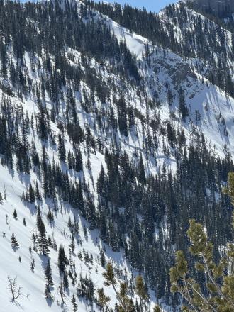
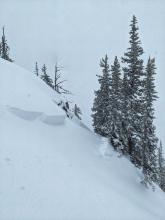
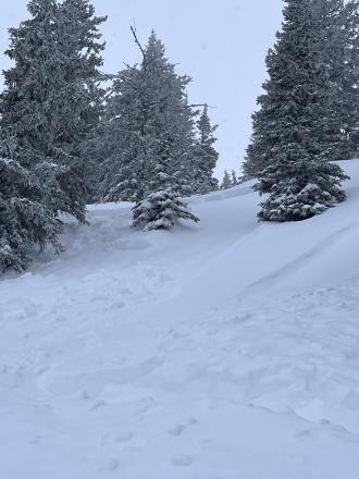
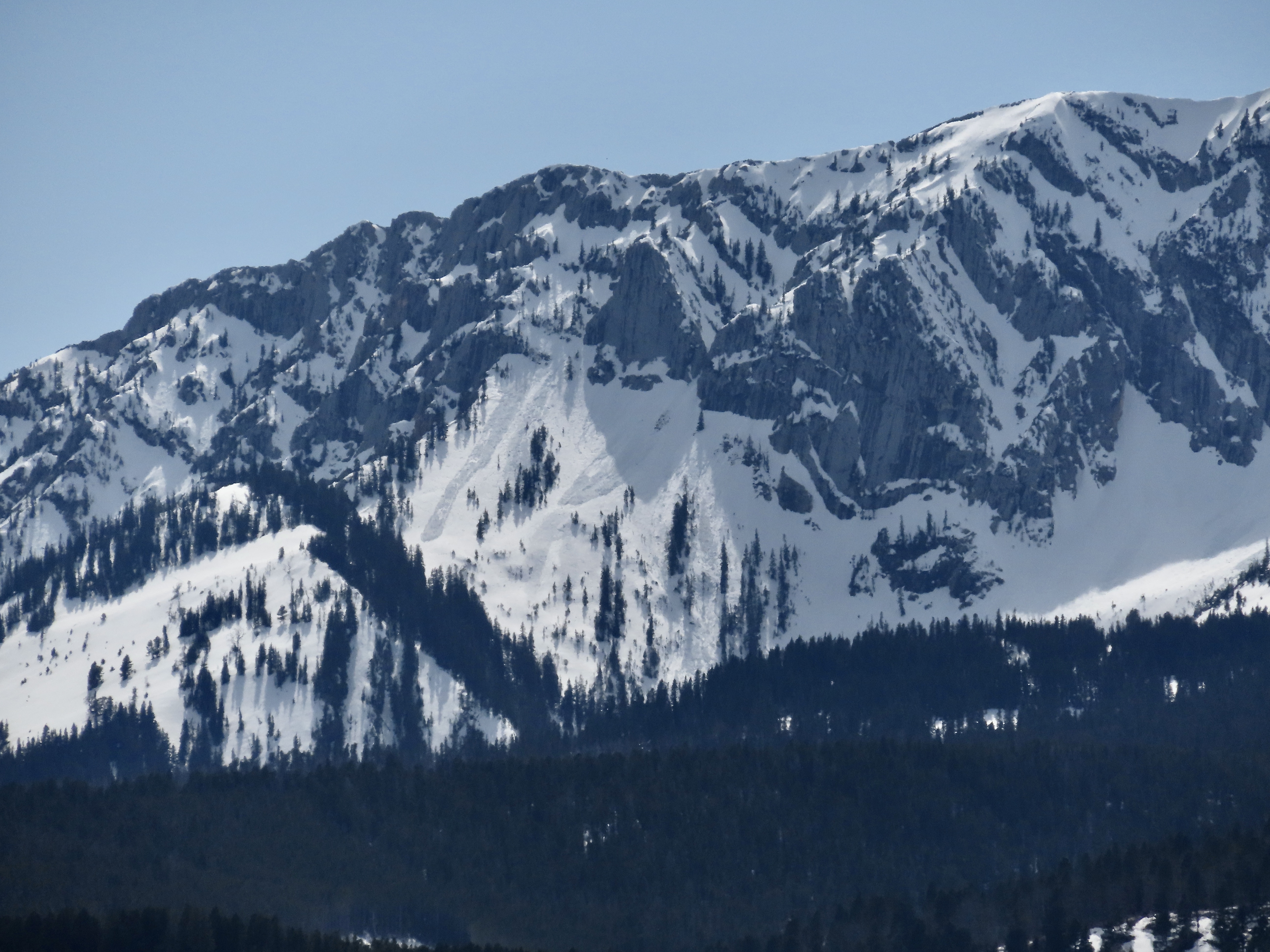
A large slab avalanche behind the Nose. Photo: GNFAC
-
From IG: Very touchy on Hollywood wall this morning. All slopes easily propagated 4-6” deep on a firm bed surface. Most were less than 50’ wide with the exception of the slide in the couloir which propagated down the entire couloir, maybe 500’ wide, and ran through the exits into the main bowl.
-

From IG: Very touchy on Hollywood wall this morning. All slopes easily propagated 4-6” deep on a firm bed surface. Most were less than 50’ wide with the exception of the slide in the couloir which propagated down the entire couloir, maybe 500’ wide, and ran through the exits into the main bowl.
-

There was a small wind-slab release out of Gibbs (I think), I suspect skier triggered, but I could make out a track. Photo: GNFAC
-

On our drive home we saw, what I assume were, natural wind-slab avalanches on Quarter Saddle (looked like a cornice collapse) and in Argentina Bowl. Bridger Peak was obscured by heavy wind-loading. Photo: GNFAC
-
On our drive home we saw, what I assume were, natural wind-slab avalanches on Quarter Saddle (looked like a cornice collapse) and in Argentina Bowl. Bridger Peak was obscured by heavy wind-loading. Photo: GNFAC
-
The wind was transporting significant amounts of the recent snow at high elevations. This is Naya Nuki loading as seen from the Ramp. Photo: GNFAC
-
The wind was transporting significant amounts of the recent snow at high elevations. This is Saddle Peak loading as seen from the Ramp. Photo: GNFAC


Videos- Bridgers
WebCams
Bridger Base Area
Ridge, Looking North
Alpine Apron

Weather Forecast Bridgers
Extended Forecast for10 Miles NNE Bozeman MT
Today

High: 55 °F
Sunny
Tonight
Low: 33 °F
Mostly Cloudy
then Slight
Chance Snow
ShowersSunday

High: 46 °F
Snow Showers
Sunday Night

Low: 31 °F
Chance Snow
ShowersMonday
High: 48 °F
Chance Snow
then
Rain/Snow
LikelyMonday Night

Low: 30 °F
Chance Snow
Tuesday
High: 51 °F
Slight Chance
Snow then
Chance
ShowersTuesday Night

Low: 33 °F
Slight Chance
Rain/SnowWednesday
High: 51 °F
Slight Chance
Rain/Snow
then Showers
The Last Word
We began daily forecasts on December 7. 130 daily forecasts and 464 reported avalanches later, we wrapped up our daily forecasting season on April 14th. Read our SEASON SUMMARY to look back at the 2023-24 avalanche forecasting season.
Thank you to everyone that sent in observations, read the advisories, took an avalanche class, or donated money, time or gear. Our success is directly related to support from the community and the Forest Service. Have a safe spring and summer!