Good morning. This is Doug Chabot with the Gallatin National Forest Avalanche Forecast on Thursday, December 28th at 6:30 a.m. This information is sponsored by Chad Bunting-Financial Advisor-Edward Jones, Bozeman Ice Festival and Yellowstone Ski Tours. This forecast does not apply to operating ski areas.
There is no new snow, just an inversion of warm mountain temperatures reading 30-34 F at 9,000 feet in the Madison, Gallatin and Bridger Ranges. Wind is west at 10-20 mph with gusts of 30 mph. Skies will be cloudy for most of the day and clear late this afternoon. No snow is expected and west wind will increase to 20-40 mph. Seeing above-freezing mountain temperatures the last week of December in the middle of the night is…unsettling.

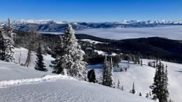
All Regions
Cloud cover will hinder avalanche activity from the warm temperatures. However, if the sun comes out, small and loose wet snow slides, roller balls and pinwheels will appear, but won’t pose a danger.
The overarching concern is weak snow plaguing our forecast area. Grains of unbonded sugary snow, aka. facets and depth hoar, can avalanche on slopes capped with a wind drift. Yesterday, after Ian and I put up the Taylor Fork weather station, we dug a snowpit and found layers of weak facets and talked about how a stiff wind slab would make unstable conditions (video). In Island Park, a rider tested that theory when he got a slope to crack and move a couple inches, but not avalanche.
Signs of instability are decreasing, but the occasional report reminds us that all is not well. It remains possible to trigger avalanches. Many slopes are stable, but some are not. Weak snow blankets our forecast area and recent wind-loading at mid-mountain and ridgetops will create instability. Pay attention to changing surface conditions, back off if you get collapsing or cracking, and do a stability test before entering avalanche terrain.
For today, the avalanche danger is rated MODERATE on all slopes in our forecast area.
If you venture out, please fill an observation form. It does not need to be technical. Did you see any avalanches? How much snow is on the ground? Was the wind moving snow? Simple observations are incredibly valuable. You can also contact us via email (mtavalanche@gmail.com), phone (406-587-6984), or Instagram (#gnfacobs).
Upcoming Avalanche Education and Events
Our education calendar is full of awareness lectures and field courses. Check it out: Events and Education Calendar.
Every weekend in Cooke City: Friday at The Antlers at 7 p.m., Free Avalanche Awareness and Current Conditions talk, and Saturday from 10 a.m.-2 p.m. at Round Lake Warming Hut, Free Rescue Practice.
We offer Avalanche Fundamentals with Field Session courses targeted towards non-motorized travelers in January and one geared towards motorized users. Sign up early before they fill up.
King & Queen 2024, 3 February 2024. Form a team or sign up individually to hike laps on the Bridger Bowl ridge to fundraise for the Friends of the Avalanche Center.
Loss in the Outdoors is a support group for those affected by loss and grief related to outdoor pursuits. Check out the link for more information.
Here’s a quick read, The Invisible Hands of Avalanche Work, an interview with GNFAC forecaster, Doug Chabot.