Good morning. This is Doug Chabot with the Gallatin National Forest Avalanche Forecast on Thursday, January 25th at 6:45 a.m. Today’s forecast is sponsored by Spark R&D and Mystery Ranch. This forecast does not apply to operating ski areas.
AVALANCHE WARNING
We are continuing a Backcountry Avalanche Warning for the Centennial Mountains in Island Park. New snow and wind-loaded snow is overloading an exceptionally weak snowpack, creating very dangerous avalanche conditions. Human-triggered avalanches are very likely. Avoid avalanche terrain and avalanche runout zones. The avalanche danger is rated HIGH on all slopes. Contact the Gallatin National Forest Avalanche Center for more detailed information.
This warning will expire or be updated by 6:00 a.m. on Friday, January 26th.
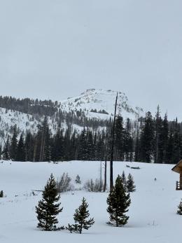
In the last 24 hours 1-2” fell in Cooke City, West Yellowstone and Island Park. Southwest wind is blowing at 10 mph with gusts of 30 mph and mountain temperatures are 20 F. Today will become cloudy with wind blowing 10-20 mph out of the SW and switching NW tonight. By morning the southern mountains will have 1-2” of new snow and a trace to 1” south of Bozeman to Big Sky.

Avalanche Warning
We issued an Avalanche Warning for the third day in a row in Island Park because it keeps snowing. An inch or two of new snow is keeping the snowpack very dangerous. Since Saturday, 1.5” of snow water equivalent fell, measuring a foot and a half of snow. Avalanches can be triggered from hundreds of feet away and getting caught could be deadly. Our advice is simple: don’t get into or underneath any avalanche terrain. The avalanche danger is rated HIGH on all slopes.
A large avalanche on Henderson Mountain in Cooke City was seen yesterday (observation and photos). It likely occurred the night before or yesterday morning and we are unsure of the trigger. No matter. This avalanche illustrates why we are worried: the snowpack is on edge, it is slow to adjust to even the smallest amount of snow, and remains very unstable for a long period of time. Read The Last Word at the end of the advisory for an explanation on these unusual conditions.
On Sunday, Alex and Dave triggered a slide at Lionhead (video) and a similar avalanche could occur today. Slopes that have added weight from previous wind-loading are extra susceptible to avalanching, just like the slide on Henderson Mountain. Last night, we were sent 4 photos of recent slides in Cooke City, even more evidence of the snowpack’s danger. I recommend staying off slopes steeper than 30 degrees and being extra careful traveling under slopes.
The avalanche danger is HIGH on previously wind-loaded slopes and CONSIDERABLE on all others.

The snowpack in the Bridger, Madison and Gallatin Ranges remains weak and unstable. Even days after a storm the danger remains elevated. An unusually weak snowpack is creating unusual avalanche conditions. Slopes can be triggered from far away as Dave discovered on Buck Ridge on Sunday (video) and others on Flanders Mountain and Hyalite Peak. And let’s not forget Saddle Peak, where a skier triggered a large avalanche far below the ridge. Dave and I turned around on the Throne in the northern Bridger Range because we were worried about triggering a slide far above us (video). The backcountry is dangerous and will remain so for a while. Karl Birkeland, avalanche scientist, wrote, “This snowpack is gonna take a LONG time to stabilize every time it gets loaded. Have patience. This snowpack is unlikely to get completely better until it's melted and heading down the rivers in the spring!” Not exactly what I wanted to hear, but likely true nonetheless. Read The Last Word at the end of the advisory for an explanation on these unusual conditions.
If you go into avalanche terrain it’s likely you’ll trigger a slide today. Consequently, the avalanche danger is rated CONSIDERABLE.
If you venture out, please fill an observation form. It does not need to be technical. Did you see any avalanches? How much snow is on the ground? Was the wind moving snow? Simple observations are incredibly valuable. You can also contact us via email (mtavalanche@gmail.com), phone (406-587-6984), or Instagram (#gnfacobs).
Upcoming Avalanche Education and Events
Our education calendar is full of awareness lectures and field courses. Check it out: Events and Education Calendar.
Every weekend in Cooke City: Friday at The Antlers at 7 p.m., Free Avalanche Awareness and Current Conditions talk, and Saturday from 10 a.m.-2 p.m. at Round Lake Warming Hut, Free Rescue Practice.
We offer Avalanche Fundamentals with Field Session courses targeted towards non-motorized travelers in January and one geared towards motorized users. Sign up early before they fill up.
King & Queen 2024, 3 February 2024. Form a team or sign up individually to hike laps on the Bridger Bowl ridge to fundraise for the Friends of the Avalanche Center.
Loss in the Outdoors is a support group for those affected by loss and grief related to outdoor pursuits. Check out the link for more information.
KING AND QUEEN OF THE RIDGE, FEBRUARY 3rd
Do you like to hike? Do you like to ski? Then the King & Queen of the Ridge is for you. Hike, ski and raise money for the Friends of the Avalanche Center in their 2nd biggest fundraiser of the year. Join the effort to promote and support avalanche safety and awareness! Fundraising prizes for the top 5 individuals who raise over $500. No racing is necessary to compete for the fundraising prizes. Info is HERE. Race participants for the February 4th event must register separately with Bridger Bowl HERE.
This year's snowpack is not to be trifled with.
Unusual weather leads to unusual avalanche conditions, and that is certainly the case this year. This year is unique in my 29 years of avalanche forecasting in southwest Montana. Large avalanches are being triggered from hundreds of feet away long after the most recent snowfall. Even a few inches of new snow is causing us to elevate the danger. This is not like other seasons, and it's making our entire forecasting team nervous. We are recalibrating our risk and notching back our travel plans due to a great deal of uncertainty about what it will take for things to become more stable.
Typically, the snowpack begins to adjust to new snow within a few days after a storm, avalanches and obvious signs of instability like whumpfing decrease, and we can start notching down the avalanche danger. This year is different. Our current snowpack is stabilizing at a rate that is agonizingly slow. The only real solution to our current snowpack situation is patience. With our current weak layers, every small storm is likely to raise the avalanche danger, and instability will lurk on many slopes long after the snow falls.