Good morning. This is Ian Hoyer with the Gallatin National Forest Avalanche Forecast on Saturday, March 2nd at 7:00 a.m. Today’s forecast is sponsored by Klim and Avalanche Alliance. This forecast does not apply to operating ski areas.
AVALANCHE WARNING
The Gallatin National Forest Avalanche Center is issuing a Backcountry Avalanche Warning for the Centennial Mountains in Island Park, ID. Heavy snowfall with intense wind-drifting have overloaded a very weak snowpack, creating very dangerous avalanche conditions. Human-triggered and natural avalanches are likely. Avoid avalanche terrain and avalanche runout zones. The avalanche danger is HIGH on all slopes. Contact the Gallatin National Forest Avalanche Center for more detailed information.
This warning will expire or be updated by 6:00 a.m. on Sunday, March 3rd.
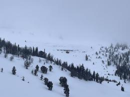
There are 6-10” of new snow around Island Park, West Yellowstone and Cooke City, much of which fell overnight. 2-6” fell around Bozeman and Big Sky as snowfall ended yesterday morning. Temperatures are in the 20s F this morning. Winds are 10-20 mph out of the southwest to southeast with 20-30 mph gusts, except near Island Park where it is blowing 30-45 mph out of the west with gusts up to 88 mph. Winds will remain strong today. Temperatures will rise into the high 20s and 30s F. Another 7-10” will fall today around Island Park, with 6-8” near West Yellowstone and Cooke City, and 2-4” around Bozeman and Big Sky.

Avalanche Warning
Both human triggered and natural avalanches are likely today. Heavy, dense new snow is overloading a weak snowpack. 8” of new snow may not seem like much, but it is between 2x and 4x as dense as our more typical snowfall (it contains 1.6” of snow water equivalent, 2.1” fell in the last 48 hours). The weight of this new snow will overload the weak layers in the upper snowpack that are 1.5-2.5 ft deep and may also wake up the weak layers near the base of the snowpack (video). Yesterday, we encountered deep wind drifts near the head of Yale Creek (observation). These drifts are magnifying the weight of the new snow, making conditions even more unstable. Extremely strong winds have created drifts at all elevations. Large avalanches are likely and really gigantic avalanches breaking at the bottom of the snowpack are also possible. Avoid all slopes steeper than 30 degrees and avoid crossing beneath them as well.
The avalanche danger is HIGH today.

New snow and wind on a weak snowpack means human triggered avalanches are likely today. More snow fell around West Yellowstone and Cooke City last night with more snow expected today, but the Bozeman and Big Sky areas were the big winners yesterday, so it balances out and you should expect all areas to have dangerous conditions. Avalanches could break beneath the new and wind drifted snow or on the weak layers deep in the snowpack. Smaller avalanches in the new snow could also step down to trigger deeper slides.
Riders in the northern Bridger’s yesterday noted fresh natural avalanches (observation) and riders near Lionhead were able to make small avalanches in the new snow on test slopes (observation).
Drifts that formed during yesterday’s apocalyptically strong winds have now been hidden underneath a fresh blanket of new snow drifting with more normal, but still strong winds. This will make wind loading patterns even harder to identify.
Give the new snow time to stabilize and wait to see how the deeper weak layers handle this loading event before getting onto steep slopes.
The avalanche danger is CONSIDERABLE.
If you get out please submit an observation. It does not need to be technical. Did you see any avalanches? How much snow is on the ground? Was the wind moving snow? Simple observations are incredibly valuable. You can also contact us by email (mtavalanche@gmail.com), phone (406-587-6984), or Instagram (#gnfacobs).
Upcoming Avalanche Education and Events
Our education calendar is full of awareness lectures and field courses. Check it out: Events and Education Calendar.
March 8-10: Bozeman Splitfest. Check the Bozeman Splitfest website for event details and avalanche education opportunities offered by the Friends of the Avalanche Center.
Every weekend in Cooke City: Friday at The Antlers at 7 p.m., Free Avalanche Awareness and Current Conditions talk, and Saturday from 10 a.m.-2 p.m. at Round Lake Warming Hut, Free Rescue Practice.
Loss in the Outdoors is a support group for those affected by loss and grief related to outdoor pursuits. Check out the link for more information.
Clear weather and temperature fluctuations can make a weak layer in the top few cm of the snowpack called near-surface faceting. There are 3 dominant types which are explained in Bruce Jamieson’s new video featuring Karl Birkeland, Doug Chabot, Ed Adams, Mike Cooperstein, Ethan Greene and Mark Staples.