Good morning. This is Ian Hoyer with the Gallatin National Forest Avalanche Forecast on Saturday, March 9th at 7:00 a.m. Today’s forecast is sponsored by Uphill Pursuits and Idaho State Snowmobile Association - Avalanche Fund. This forecast does not apply to operating ski areas.
There is no new snow. Mountain temperatures are in the teens F. Winds are generally 10-15 mph gusting up to 25 mph out of the west, but are a bit stronger in Bridger Range and gusting to 70 mph in Island Park. Temperatures will rise into the 30s F in most places and up into the 40s F in the Bridger Range. Winds will generally remain moderate and shift more southwest today. We’ve got another bluebird day in store. The next chance for snow is on Monday.

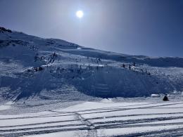
Dangerous avalanche conditions exist and large human triggered avalanches are likely. Snowfall earlier this week pushed the snowpack past its breaking point. Alex rode around the motorized zone yesterday and reported that it was “maybe the most widespread large activity I have ever seen” (observation).
Thursday’s snowmobile triggered slide on Henderson Mountain was even bigger than we initially reported, breaking over 2000 ft wide and all the way up to the ridgeline, generally 6-10 ft deep and 12-15 ft deep in the deepest section (aerial video). Two more very large slides were likely triggered by snowmobiles yesterday on different faces of Scotch Bonnet Mountain (details, details, Scotch Bonnet video). We expect more of the same today. Avoid riding on any slope steeper than 30 degrees and give them a wide berth as you pass beneath them as well.
The avalanche danger is rated CONSIDERABLE.

Triggering large avalanches is a very real and dangerous possibility today. The likelihood of triggering slides has marginally decreased over the last couple days without snowfall, but the potential size and consequences of triggering a slide have not. Close calls in Beehive Basin and on Saddle Peak yesterday drive home the seriousness of conditions right now.
Yesterday, skiers in Beehive Basin triggered an avalanche that broke 500 ft wide and up to 6 ft deep by dropping a section of cornice onto a slope (details and photos). This slide took out the skin track up the face they had just broken on the ascent. Slides breaking on these deeper weak layers are likely to be unsurvivable, regardless of any terrain considerations.
Somewhat smaller avalanches breaking in wind drifted snow could also have devastating consequences in the wrong spot. Two skiers, at different times yesterday, triggered avalanches on Saddle Peak (details and photos). The larger slide initially broke about a foot deep, but then triggered a secondary slab that broke 1-3 ft deep and 200 ft wide before running over the large main cliff band. Thankfully the skier was not caught and did not take this unsurvivable ride and no one happened to be beneath the cliffs as the debris came down from above.
If you are considering stepping out into steeper terrain, our recommendation is to ease into lower-consequence terrain and religiously follow safe travel protocols in case something goes wrong. To be crystal clear, skiing on Saddle Peak is the antithesis of these recommendations with large, steep slopes, and big cliffs, and other groups likely to be both above and below you.
The avalanche danger is rated MODERATE today.
If you venture out, please fill an observation form. It does not need to be technical. Did you see any avalanches? How much snow is on the ground? Was the wind moving snow? Simple observations are incredibly valuable. You can also contact us via email (mtavalanche@gmail.com), phone (406-587-6984), or Instagram (#gnfacobs).
Upcoming Avalanche Education and Events
Our education calendar is full of awareness lectures and field courses. Check it out: Events and Education Calendar.
THIS WEEKEND, March 8-10: Bozeman Splitfest. Check the Bozeman Splitfest website for event details and avalanche education opportunities offered by the Friends of the Avalanche Center.
Every weekend in Cooke City: Friday at The Antlers at 7 p.m., Free Avalanche Awareness and Current Conditions talk, and Saturday from 10 a.m.-2 p.m. at Round Lake Warming Hut, Free Rescue Practice.
Loss in the Outdoors is a support group for those affected by loss and grief related to outdoor pursuits. Check out the link for more information.
On Wednesday, an avalanche forecaster from the Wallowa Avalanche Center was caught and killed in an avalanche in NE Oregon (details). This tragic accident drives home the very real dangers of a life working and playing in the mountains. This is the third U.S. avalanche fatality this month (avalanche.org).