Good morning. This is Doug Chabot with avalanche and weather information from the Gallatin National Forest Avalanche Center on Friday, November 24th, at 6:30 a.m. This information is sponsored by World Boards and Mystery Ranch and will be updated as conditions change.
Since 5 a.m. yesterday, up to 1” fell in the northern ranges and 2-4” from Big Sky to West Yellowstone and Island Park. Cooke City and Hyalite got missed. Northeast to east wind is averaging 10-30 mph with gusts of almost 80 mph on Sawtelle Peak. Temperatures are in the single digits F. Today, mountain temperatures will rise into the teens under clearing skies with an east wind at 10-30 mph. Sunny skies and seasonal temperatures are forecasted through next week.

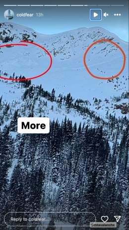
In the last 36 hours the mountains picked up 2-4” of snow, except Cooke City, which got nothing. Wind has been gusting out of the east and blew this new snow into drifts at all elevations. Snowfall amounts are still elevation dependent with dirt or sparse coverage in the valleys and 10-20+” near the ridgelines. This recent storm will make drifts which are our primary avalanche concern. These whales of snow, typically found in gullies, could be triggered by a skier, ice climber or hunter. A skier-triggered avalanche on Mt. Blackmore 12 days ago reminds us how a wind pillow can sometimes release a wider slide. Wind-loading will keep these gullies and pillows avalanche-prone. Cracks shooting out in front of your feet or skis are a warning to not go further.
Early season avalanches are serious because there is a high risk of getting physically beat up on rocks, as well as being buried. Everyone traveling in avalanche terrain needs a sturdy shovel, probe and avalanche transceiver. Only expose one person at a time to avalanche terrain so there is always a rescuer in case someone is buried.
Our crystal ball says: The snowpack at higher elevations will become weaker. Thin snow cover and cold air change snowflakes into weak crystals of angular facets. These grains feel and look like sugar. Once these facets get overburdened with new snow, they become unstable and can release large and deep avalanches later in the season.
If you venture out, please fill an observation form. It does not need to be technical. Did you see any avalanches? How much snow is on the ground? Was the wind moving snow? Simple observations are incredibly valuable. You can also contact us via email (mtavalanche@gmail.com), phone (406-587-6984), or Instagram (#gnfacobs).
In the last 36 hours the mountains picked up 2-4” of snow, except Cooke City, which got nothing. Wind has been gusting out of the east and blew this new snow into drifts at all elevations, our primary avalanche concern. These whales of snow, typically found in gullies, could be triggered by a skier, ice climber or hunter. Cracks shooting out in front of your feet or skis are a warning to not go further.
On November 15, Ian saw evidence that the 20” of snow at 8,800’ is weakening at our Sawtelle Weather Station. This will be the foundation of this season’s snowpack (observation and photos).
Upcoming Avalanche Education and Events
Our education calendar is full of awareness lectures and field courses. Check it out: Events and Education Calendar.
We are offering Avalanche Fundamentals with Field Session courses targeted towards non-motorized users in December and January, and one geared towards motorized users in January. Sign up early before they fill up.
We travel with a lot of electronics that could interfere with our avalanche transceiver, both as a victim and as a rescuer. Check out our article on Electronic Warfare to learn what to do.