Good morning. This is Dave Zinn with the Gallatin National Forest Avalanche Forecast on Monday, December 25th at 6:45 a.m. This information is sponsored by Santa Claus, Community Food Co-op, and Upper Yellowstone Snowmobile Club. This forecast does not apply to operating ski areas.
Mountain temperatures are in the single digits to teens F with 5-15 mph winds from the west to the north except in the Bridger Range, where they are 25-30 mph. There is no new snow. Today, temperatures will be in the 20s F with 5-15 mph winds from the west to the north. We may see a few flurries tomorrow.

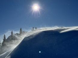
Winds in the Bridger Range are transporting the 6-8” of recent snow into stiff drifts likely to avalanche under the weight of human triggers today. Yesterday, my partner and I toured up the Ramp and arrived at the ridge just as these winds picked up. We found sensitive slabs of wind-drifted snow that cracked and avalanched readily (photo 1, photo 2, video). Today, hard, drum-like slabs will be more dangerous than what we found yesterday. Expect and avoid wind-loaded slopes at all elevations, as the winds are nearly as strong at mid-elevations as on the ridge (Mid-way Wx Station, Ridge Wx Station).
Persistent weak layers of sugary facets buried 1-2 feet deep make avalanches possible on all slopes, wind-loaded or not. Avoid terrain steeper than 30 degrees entirely if you observe signs of instability like recent avalanches, whumphs (collapsing), shooting cracks, and unstable test scores.
The danger in the Bridger Range is CONSIDERABLE.

This weekend, the mountains around Island Park, West Yellowstone and Big Sky received 5-8” of new snow, with 2-3” south of Bozeman and near Cooke City. Persistent weak layers buried 1-2 feet deep near the bottom of the snowpack are nearly universal across the advisory area and make human-triggered avalanches possible. Alex and Doug got confused by the calendar the last two days, celebrating Groundhog Day rather than Christmas, titling their videos from Island Park and Lionhead Ridge, “Still Weak and Unstable” and “It’s Not Better Yet.” Skiers in Cooke City and the Northern Gallatin Range have experienced whumphing collapses in the last two days and reported a recent avalanche north of Cooke City (observation Cooke, observation N. Gallatin). Our avalanche log has many red flags indicating instability associated with buried weak layers across the advisory area.
Avoid avalanches by traveling in terrain gentler than 30 degrees if signs of instability like recent slides, whumphs (collapsing), shooting cracks, and unstable test scores are present (learn more about the extended column test in this video).
Today, human-triggered avalanches large enough to bury or injure a person are possible, and avalanche danger is MODERATE.
If you venture out, please fill an observation form. It does not need to be technical. Did you see any avalanches? How much snow is on the ground? Was the wind moving snow? Simple observations are incredibly valuable. You can also contact us via email (mtavalanche@gmail.com), phone (406-587-6984), or Instagram (#gnfacobs).
Upcoming Avalanche Education and Events
Our education calendar is full of awareness lectures and field courses. Check it out: Events and Education Calendar.
Every weekend in Cooke City: Friday at The Antlers at 7pm, Free Avalanche Awareness and Current Conditions talk, and Saturday from 10am-2pm at Round Lake Warming Hut, Free Rescue Practice.
We offer Avalanche Fundamentals with Field Session courses targeted towards non-motorized travelers in January and one geared towards motorized users. Sign up early before they fill up.
Loss in the Outdoors is a support group for those affected by loss and grief related to outdoor pursuits. Check out the link for more information.
Feathery crystals of surface hoar blanket our advisory area. Bruce Jamieson and Simon Horton made a 3-part video series on how it forms and why it’s a problem.