Good morning. This is Dave Zinn with the Gallatin National Forest Avalanche Forecast on Tuesday, December 26th at 6:30 a.m. This information is sponsored by Klim and Cooke City Super 8/Bearclaw Bob’s. This forecast does not apply to operating ski areas.
Mountain temperatures are in the teens to 20s F this morning, except on the Madison Plateau, where it is -6 F. Winds are 5-15 mph from the west to northwest, and there is no new snow. Today, temperatures will be in the 20s F with 5-15 mph winds from the west to southwest. We will likely see snowflakes in the sky this afternoon into evening, but no measurable accumulation.

All Regions
Triggering a dangerous slab avalanche that breaks 1-2 feet deep is possible. The poor structure of the snowpack across the advisory area is fundamentally the same, with a strong slab of recent snow resting on top of a thick layer of weak, grainy facets. Winds, especially in the Bridger Range, drifted last weekend’s snow onto some slopes where avalanches could break more deeply.
If you are traveling in the mountains of our advisory area, there is likely a persistent weak layer under your feet or sled. Detect it without a snowpit by noticing that you sink quickly to the ground below when you step out of your skis or off your snowshoes, board, or sled. We have highlighted these weak layers as our primary concern in nearly all of this season’s field videos. Watch our videos from Lionhead, the Bridger Range, Island Park, Tepee Basin, and Cooke City for highlights within the last week. Recent observations are filled with signs of instability, including the snowpack collapsing with whumphs, poor test scores, and one recent natural avalanche north of Cooke City (details). Allow these indicators to direct you to lower-angle terrain. Only consider slopes steeper than 30 degrees after thoroughly evaluating the snowpack for instability and the terrain for features that increase the consequences of a slide.
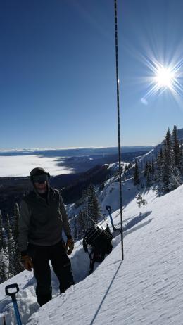
Slopes with recent drifts of wind-loaded snow are more prone to avalanches than those without. Winds, especially in the Bridger Range, built hard, drum-like slabs on some slopes at all elevations. Yesterday, during avalanche mitigation work, the Bridger Bowl Ski Patrol triggered slides with explosives that failed 2-3 feet deep on wind-loaded slopes. On Sunday, I toured north of Bridger Bowl and easily triggered small drifts (photo 1, photo 2).
Avoid specific slopes loaded by recently wind-drifted snow and travel in terrain less than 30 degrees if you observe signs of instability like recent slides, collapsing of the snowpack, shooting cracks, or unstable test scores (learn about the extended column test in this video).
The avalanche danger is MODERATE.
If you venture out, please fill an observation form. It does not need to be technical. Did you see any avalanches? How much snow is on the ground? Was the wind moving snow? Simple observations are incredibly valuable. You can also contact us via email (mtavalanche@gmail.com), phone (406-587-6984), or Instagram (#gnfacobs).
Upcoming Avalanche Education and Events
Our education calendar is full of awareness lectures and field courses. Check it out: Events and Education Calendar.
Every weekend in Cooke City: Friday at The Antlers at 7 p.m., Free Avalanche Awareness and Current Conditions talk, and Saturday from 10 a.m.-2 p.m. at Round Lake Warming Hut, Free Rescue Practice.
We offer Avalanche Fundamentals with Field Session courses targeted towards non-motorized travelers in January and one geared towards motorized users. Sign up early before they fill up.
Loss in the Outdoors is a support group for those affected by loss and grief related to outdoor pursuits. Check out the link for more information.
Feathery crystals of surface hoar blanket our advisory area. Bruce Jamieson and Simon Horton made a 3-part video series on how it forms and why it’s a problem.