Good morning. This is Dave Zinn with the Gallatin National Forest Avalanche Forecast on Tuesday, March 12th at 7:00 a.m. Today’s forecast is sponsored by Bridger Bowl, Cooke City Motorsports and Ride Rasmussen Style. This forecast does not apply to operating ski areas.
Mountain temperatures are in the teens and 20s F this morning, with 10-25 mph winds from the west to southwest. There is a trace of new snow near Big Sky, 1-3” near West Yellowstone and Cooke City, and 5” in Island Park. Today, high temperatures will be in the low 30s F across the advisory area, with low 40s F in the Bridger Range. Today’s storm will bring 2-3” in the Bridger Range by morning, 3-6” near Big Sky, south of Bozeman, West Yellowstone and Cooke City, and 7-10” in Island Park.
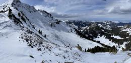
Dangerous avalanche conditions exist in the mountains south of Bozeman through Cooke City, Big Sky, West Yellowstone, and Island Park. Today's new and wind-drifted snow will keep the snowpack on edge. Enormous avalanches breaking 5-10 feet deep and hundreds to 1000s of feet wide on deeply buried persistent weak layers are possible, and they are almost certainly unsurvivable if they wrap you up in their grasp. Smaller avalanches within the new and wind-drifted snow are likely.
Recent human-triggered avalanches in Cooke City resulted in partial burials on Sheep Mountain (photos) and multiple close calls on Scotch Bonnet Mountain (details, details, Scotch Bonnet video) and Miller Mountain (video, photo). Last Thursday, a rider triggered a behemoth avalanche on Henderson Mountain that broke 2000 feet wide and over 10 feet deep in places (photos, video and details). Read about and look at photos of the long list of large human-triggered and natural avalanches on the avalanche activity log.
The frequency of avalanches in the mountains south of Bozeman through Island Park has not equaled Cooke City. However, the magnitude of the slides makes my stomach turn. Yesterday morning, groups reported a fresh avalanche on the north side of Mount Blackmore that ripped apart mature trees after breaking 8 feet deep and hundreds of feet wide (overview video and photos). Three avalanches at the head of Beehive Basin broke 3-5 feet deep this weekend, one of which wiped out the skier’s skin track and piled debris 10-15 feet deep (video, details, photos and details).
Execute a conservative travel plan that largely avoids slopes over 30 degrees. If you go onto steeper slopes, select smaller pitches free of terrain traps and at the lower angle end of the spectrum, and be prepared should something go wrong. The danger is CONSIDERABLE.
Human-triggered avalanches breaking within recent and wind-drifted snow are possible in the Bridger Range. Last week, two skier-triggered avalanches on Saddle Peak initiated on wind-loaded slopes and broke 1-2’ deep and up to 200’ wide (details and photos). Skiers in the northern Bridger range noted recent natural avalanches that occurred earlier last week (Bridgers photos). Slides do not need to be large to injure or kill backcountry travelers, especially when they are in high-consequence terrain like those on Saddle Peak.
Assess the snowpack for instability before considering terrain steeper than 30 degrees. Choose simple, low-consequence terrain and slopes without previous wind-loading. Carry rescue gear and only expose one person at a time to steep slopes. The avalanche danger is rated MODERATE.
If you venture out, please fill an observation form. It does not need to be technical. Did you see any avalanches? How much snow is on the ground? Was the wind moving snow? Simple observations are incredibly valuable. You can also contact us via email (mtavalanche@gmail.com), phone (406-587-6984), or Instagram (#gnfacobs).
Upcoming Avalanche Education and Events
Our education calendar is full of awareness lectures and field courses. Check it out: Events and Education Calendar.
Next weekend in Cooke City: Friday at The Antlers at 7 p.m., Free Avalanche Awareness and Current Conditions talk, and Saturday from 10 a.m.-2 p.m. at Round Lake Warming Hut, Free Rescue Practice.
Loss in the Outdoors is a support group for those affected by loss and grief related to outdoor pursuits. Check out the link for more information.
We are deeply saddened to share the loss of two avalanche professionals from the Pacific Northwest last week. Nick Burks, who was a forecaster for the Wallowa Avalanche Center died in an avalanche accident while skiing with a friend on Wednesday, March 6 (details). Matt Primomo, who was an avalanche forecaster for the Northwest Avalanche Center, died in a non-avalanche related accident on Thursday, March 7. Our thoughts are with our colleagues, their friends, families, and the communities which these people were a major part of.


