Good morning. This is Doug Chabot with the Gallatin National Forest Avalanche Forecast on Thursday, December 21st at 7:00 a.m. This information is sponsored by Alpine Orthopedics & Sports Medicine and Knoff Group Real Estate. This forecast does not apply to operating ski areas.
At 5 a.m. there is no new snow and mountain temperatures are in the mid 20’s F with west to southwest wind averaging 15-25 mph. Under mostly clear skies, temperatures will rise into the mid to upper 30s F with southwest wind at 10-20 mph. No new snow is forecast until Friday night through Saturday when a small storm passes.

The snowpack in Cooke City continues to show more instability than other mountain ranges in our advisory area. Yesterday, Dave and his partner were “surprised by the abundant signs of instability nine days after the last measurable snow…My partner and I felt that triggering an avalanche would be likely if we ventured into avalanche terrain. I am worried, and we are avoiding steep slopes.” His video from yesterday and Alex’s video from Sunday, outline their worry. It is still dangerous in the backcountry with whumpfing, cracking, and poor test scores being seen day after day.
The snowpack in Cooke City remains unstable and the danger is rated CONSIDERABLE.

From Bozeman to Big Sky to West Yellowstone and Island Park, the snowpack is weak on all slopes and unstable on a few. Snow on the ground changes with time, and the longer we go without new snow, the weaker it becomes. On slopes with a cohesive slab perched on top of this weaker snow (i.e. wind-load), we will get collapses (whumpfing), sometimes cracking and occasionally avalanches. On Sunday, Ian found a small slide up Buck Ridge that was triggered by sledders using the slope to test stability, which was a good idea (video).
With time stability is slowly improving. Our snowpit tests take more force to break layers and avalanche activity is decreasing. However, over the last few days, collapsing in Lionhead and whumpfs and cracking in Bacon Rind are signs of lingering instability.
I do not trust most slopes in our advisory area until I dig and test to determine if a slab and weak layer combination exists (video). It is still possible to trigger avalanches and the danger is rated MODERATE.
If you venture out, please fill an observation form. It does not need to be technical. Did you see any avalanches? How much snow is on the ground? Was the wind moving snow? Simple observations are incredibly valuable. You can also contact us via email (mtavalanche@gmail.com), phone (406-587-6984), or Instagram (#gnfacobs).
Upcoming Avalanche Education and Events
Our education calendar is full of awareness lectures and field courses. Check it out: Events and Education Calendar.
We offer Avalanche Fundamentals with Field Session courses targeted towards non-motorized travelers in January and one geared towards motorized users. Sign up early before they fill up.
Loss in the Outdoors is a support group for those affected by loss and grief related to outdoor pursuits. Check out the link for more information.
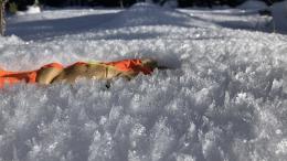
Feathery crystals of surface hoar blanket our advisory area. Bruce Jamieson and Simon Horton made a 3-part video series on how it forms and why it’s a problem.