Good morning. This is Dave Zinn with the Gallatin National Forest Avalanche Forecast on Wednesday, December 20th at 6:20 a.m. This information is sponsored by the Yellowstone Club Community Foundation and Alpine Yamaha in Livingston. This forecast does not apply to operating ski areas.
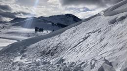
Mountain temperatures are in the 20s F this morning with 5-15 mph winds from the west to southwest. The Centennial Mountain Range received 1” of new snow, with nothing elsewhere. Today, high temperatures will be in the 30s to low 40s F with 5-15 mph winds from the west to southwest. The mountains around Cooke City, Big Sky and West Yellowstone will get a trace of new snow, with 1-2” in Island Park.

All Regions
Trust in a snowpack with a weak structure comes slowly. Persistent weak layers underlying a slab of snow from last week’s storm make human-triggered avalanches possible. Avalanches can break 1-2 feet deep and be large enough to bury or injure backcountry travelers.
Ian and his partner rode at Buck Ridge yesterday and were still able to trigger small slabs of snow immediately adjacent to an avalanche that riders triggered intentionally several days ago on a short, wind-loaded slope. This is clear evidence that some terrain remains unstable (video). Doug and his partner skied north of Bridger Bowl and said, “Even though it’s getting better, I don’t necessarily trust this on all slopes. So, you’re going to want to dig to find out what is happening in the snow… before you drop in and commit” (video). Skiers at Lionhead Ridge on Monday noted less collapsing than a week before but still observed noticeable signs of instability, including a whumph that propagated 50’ (observation). Last weekend, a skier remotely triggered an avalanche at Lionhead Ridge that broke downhill of him on a steep rollover (video). Additionally, Alex triggered collapsing in Cooke City (video), groups in Beehive Basin witnessed cracking, heard whumphs, and got unstable test scores (details), and two groups triggered collapses and turned back from their objectives in the Bridger Range (details1, details2). Look at the long list of documented instabilities on the weather and avalanche log for a more complete picture.
As I mentioned in my video from the Throne on Monday, we have two options for safer backcountry travel. Either continue avoiding avalanche terrain or dig, test, and turn back to lower-angle slopes if you observe any signs of instability. Follow the principles of safe travel by carrying rescue gear and never exposing more than one person at a time to steeper slopes.
The avalanche danger is MODERATE.
If you venture out, please fill an observation form. It does not need to be technical. Did you see any avalanches? How much snow is on the ground? Was the wind moving snow? Simple observations are incredibly valuable. You can also contact us via email (mtavalanche@gmail.com), phone (406-587-6984), or Instagram (#gnfacobs).
Upcoming Avalanche Education and Events
Our education calendar is full of awareness lectures and field courses. Check it out: Events and Education Calendar.
We offer Avalanche Fundamentals with Field Session courses targeted towards non-motorized travelers in January and one geared towards motorized users. Sign up early before they fill up.
Loss in the Outdoors is a support group for those affected by loss and grief related to outdoor pursuits. Check out the link for more information.
Listen to GNFAC Forecaster Dave Zinn on the Hoary Marmot Podcast for some extracurricular avalanche talk (link to episode).