Good morning. This is Ian Hoyer with the Gallatin National Forest Avalanche Forecast on Friday, December 22nd at 7:00 a.m. This information is sponsored by Basecamp Gallatin and Yamaha and Montana State Parks. This forecast does not apply to operating ski areas.
There is no new snow this morning. Temperatures are in the 20s and low 30s F. Winds are 15-20 mph out of the southwest and west with 20-40 mph gusts (up to 70 mph gusts in Island Park). High temperatures today will be in the 30s and low 40s F. Winds will remain moderate and southwesterly today. Snowfall will begin overnight with a trace to a couple inches accumulating by tomorrow morning.

Human triggered avalanches are likely today in Cooke City. It’s been a week and a half since the last snowfall, but the snowpack remains unstable. It is unusual for the danger to remain elevated for so long without new snow. This is a reflection that conditions are unusual. The snowpack structure is remarkably poor. Signs of instability remain widespread and we do not trust the snowpack (see Dave’s recent videos 1, 2). Don’t get complacent. Take heed and continue to avoid avalanche terrain. If you choose to ride steep slopes, expect to trigger avalanches. The avalanche danger is CONSIDERABLE.

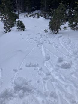
Weak snow is widespread but stability is slowly improving. The last reported avalanches were on Sunday, with a skier triggered slide at Lionhead (observation) and a snowmobile triggered slide on Buck Ridge (video). Fewer slopes are showing the propensity to avalanche (Bridgers video). On many slopes slabs are breaking down and the whole snowpack is weakening, which is bad news for stability once it starts snowing again (maybe tonight?), but for now means avalanches are becoming less likely. Dig before riding steep slopes to make sure you haven’t found one of the lingering areas of instability with a substantial slab over the weak snow at the bottom of the snowpack. Also, remember that the snowpack is still thin and highly variable, so give yourself a big margin of error in both your snowpack assessment and terrain choices.
Human triggered avalanches are possible and the avalanche danger is MODERATE.
Expect snowfall beginning tonight to bring changing avalanche conditions this weekend.
If you venture out, please fill an observation form. It does not need to be technical. Did you see any avalanches? How much snow is on the ground? Was the wind moving snow? Simple observations are incredibly valuable. You can also contact us via email (mtavalanche@gmail.com), phone (406-587-6984), or Instagram (#gnfacobs).
Upcoming Avalanche Education and Events
Our education calendar is full of awareness lectures and field courses. Check it out: Events and Education Calendar.
We offer Avalanche Fundamentals with Field Session courses targeted towards non-motorized travelers in January and one geared towards motorized users. Sign up early before they fill up.
Loss in the Outdoors is a support group for those affected by loss and grief related to outdoor pursuits. Check out the link for more information
Feathery crystals of surface hoar blanket our advisory area. Bruce Jamieson and Simon Horton made a 3-part video series on how it forms and why it’s a problem.