Snow Observations List
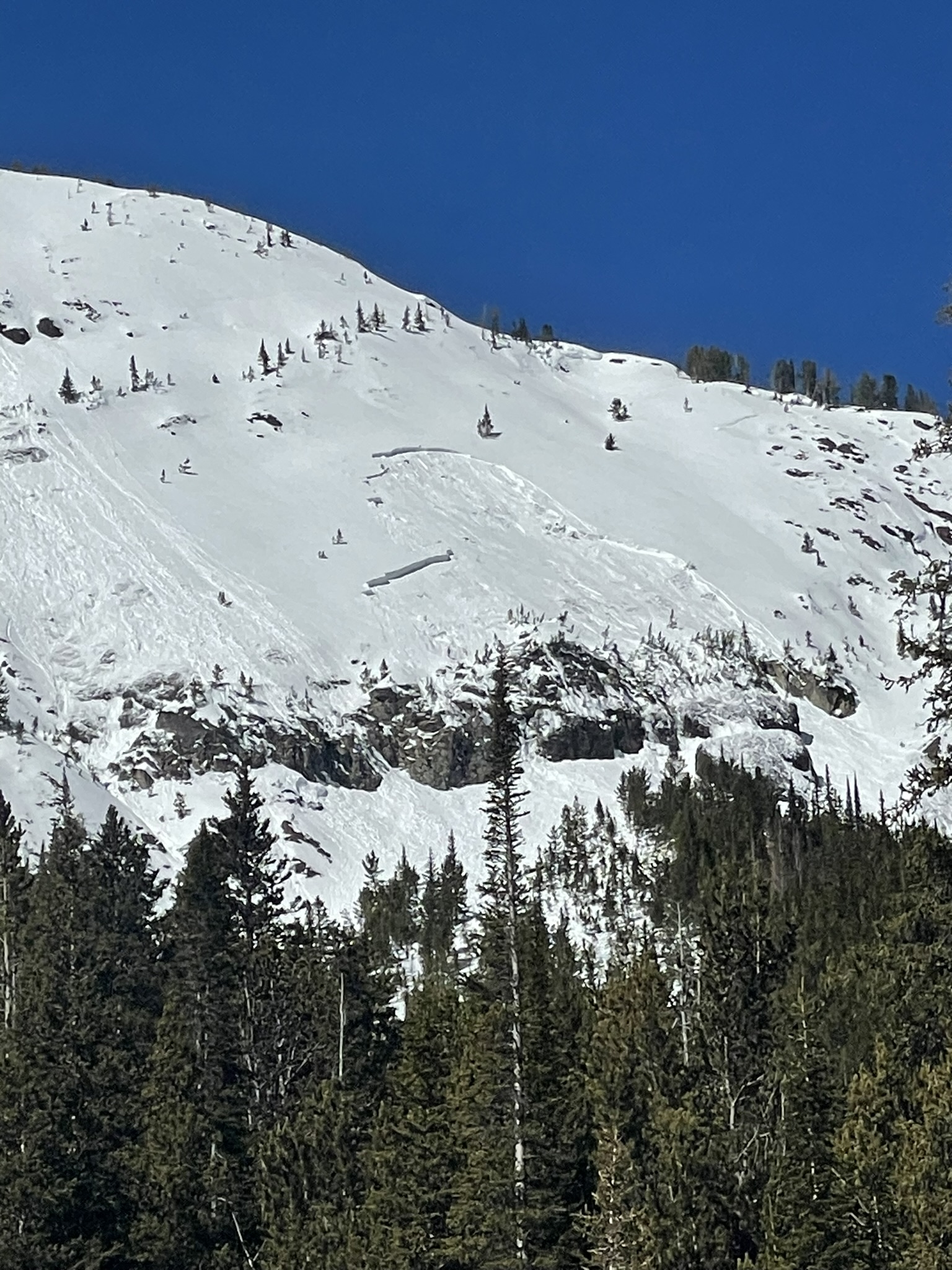
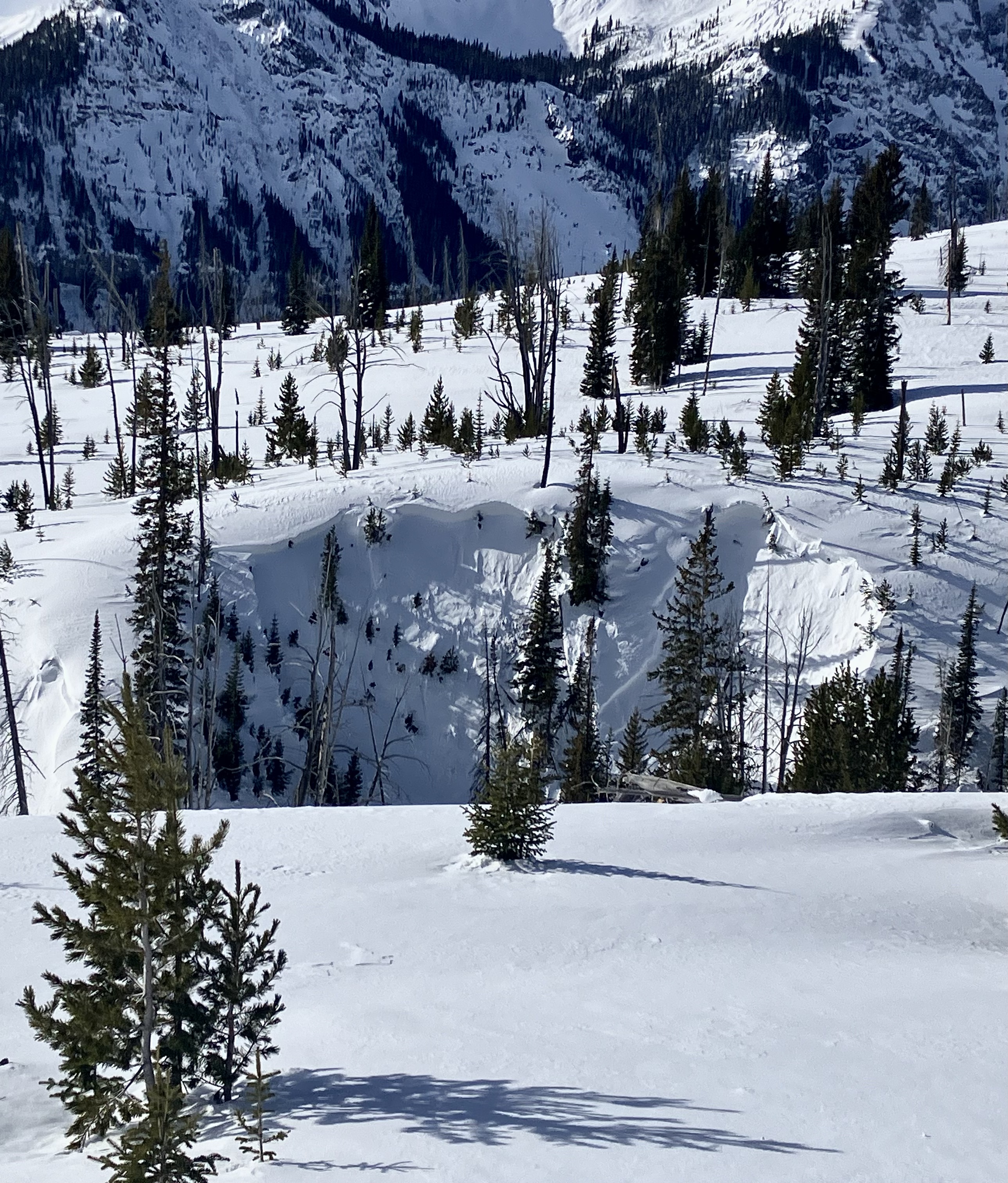
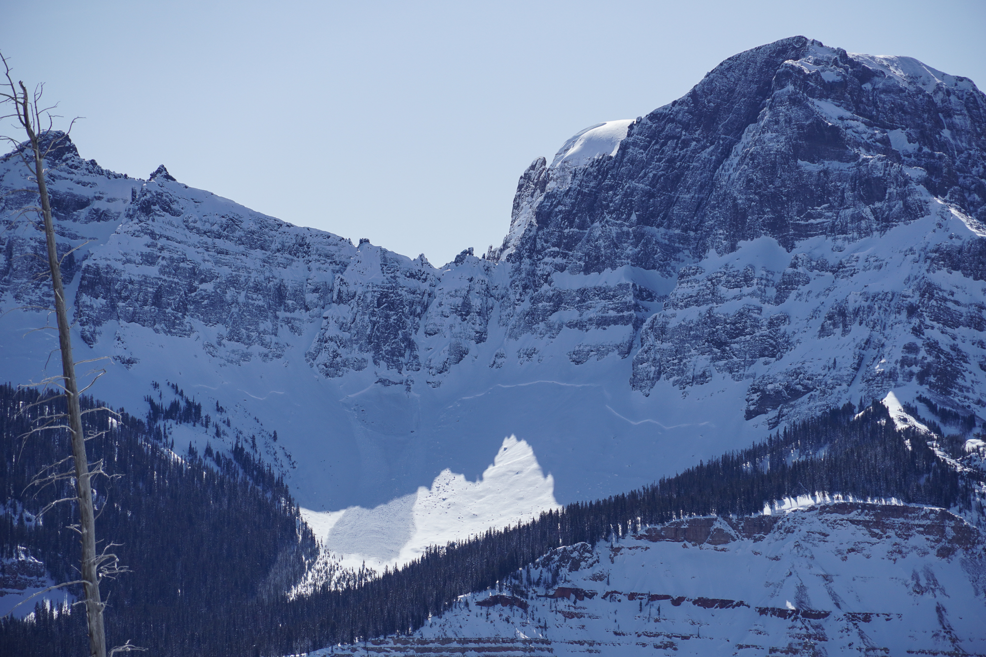
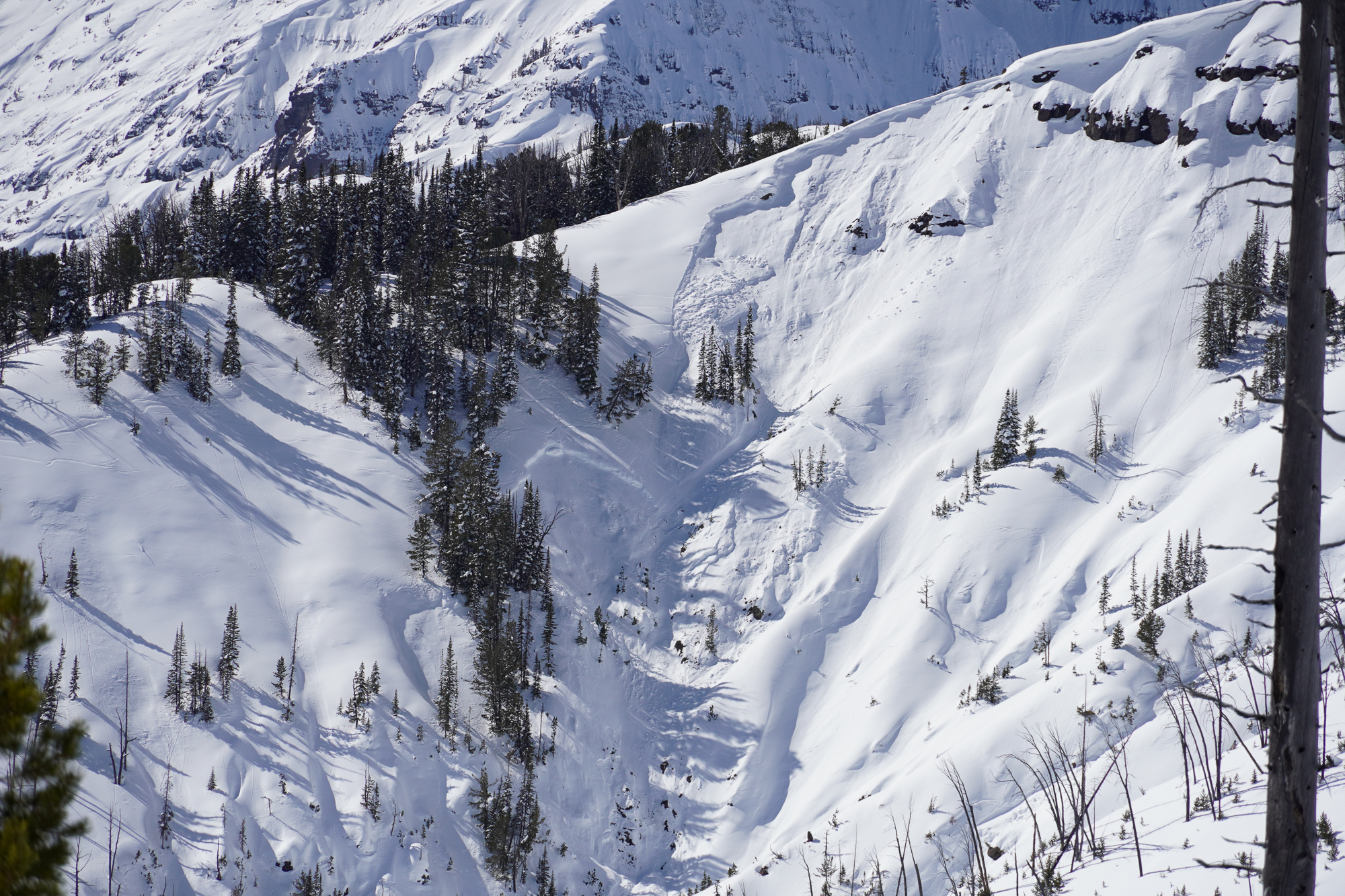
Toured out into Lower Hayden today to look around. Lots of wet loose avalanches on all aspects by noon. And by the time I came back down the hill, the Fin had slid. It likely happened sometime between 10:30 and 1:30 today. It doesn’t look super deep, but it’s hard to say for sure. I’d guess around 2 feet deep.
Full Snow Observation Report
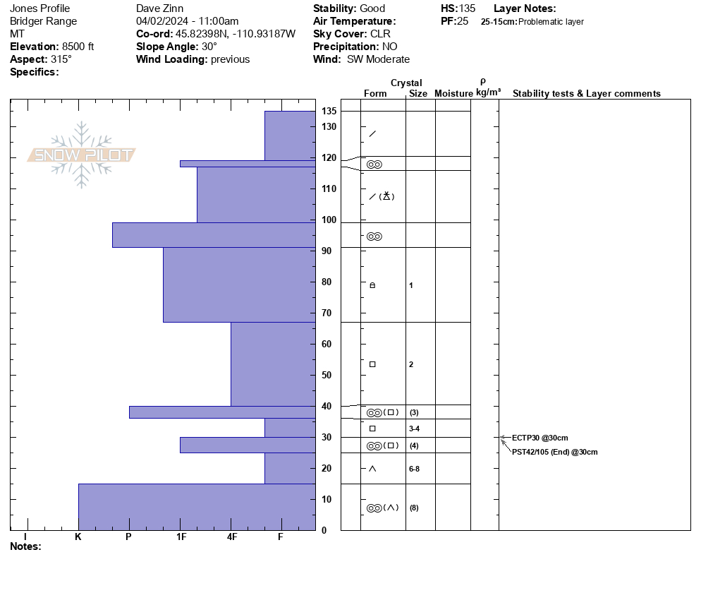
We toured down the west side of the Bridger Range on the edge of Truman Gulch and found predictably weak snow on an upper-elevation NW-facing slope. Conditions were variable and transitioned to a thick crust as we moved on to a lower elevation, west-facing slope. By the time we came down the Ramp, the snow was getting wet, we saw roller balls, and we avoided steep, sun-exposed terrain.
We dug below NW Passage. It was a 135 cm deep snowpack, dry throughout, with Fist plus hard facets and depth hoar making up the foundation (ECTP30, PST 42/100 end at 30 cm from the ground.
Full Snow Observation ReportMODERATE rising to CONSIDERABLE seemed correct.

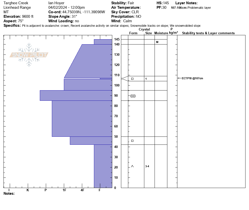
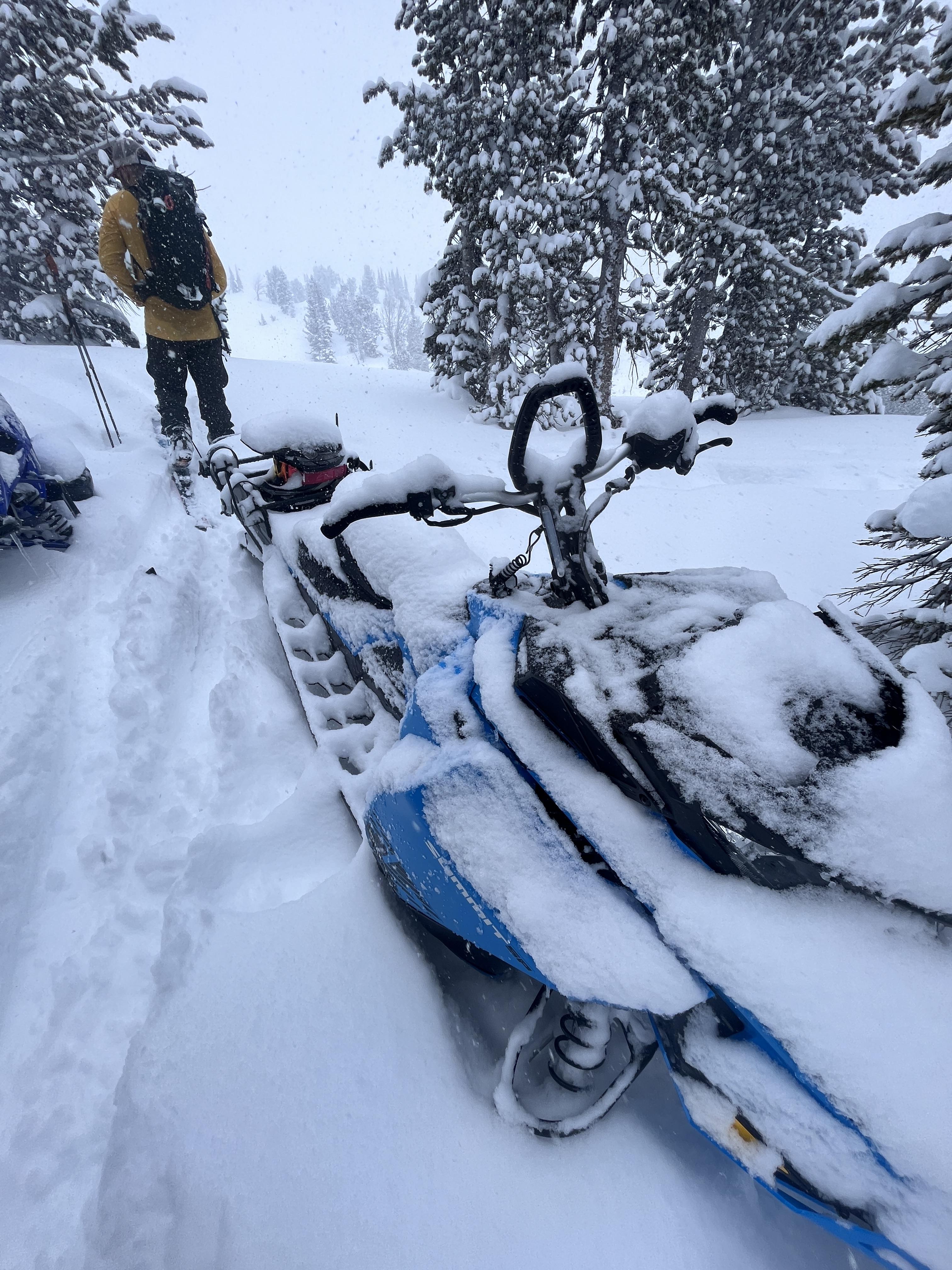
We rode from the Buttermilk trailhead up Denny Creek to Lionhead Ridge, along Lionhead Ridge through Watkins Creek and to the motorized boundary at the head of Targhee Creek.
There was a ~1" crust at the surface when we left the trailhead, with dry snow beneath. We saw our first wet loose avalanche of the day running around 11 am. By 12:30 there were dozens and many rollerballs. None of them ran particularly far or picked up too much volume. The snow surface was moist on sunny slopes by late morning, but not more than a few inches down.
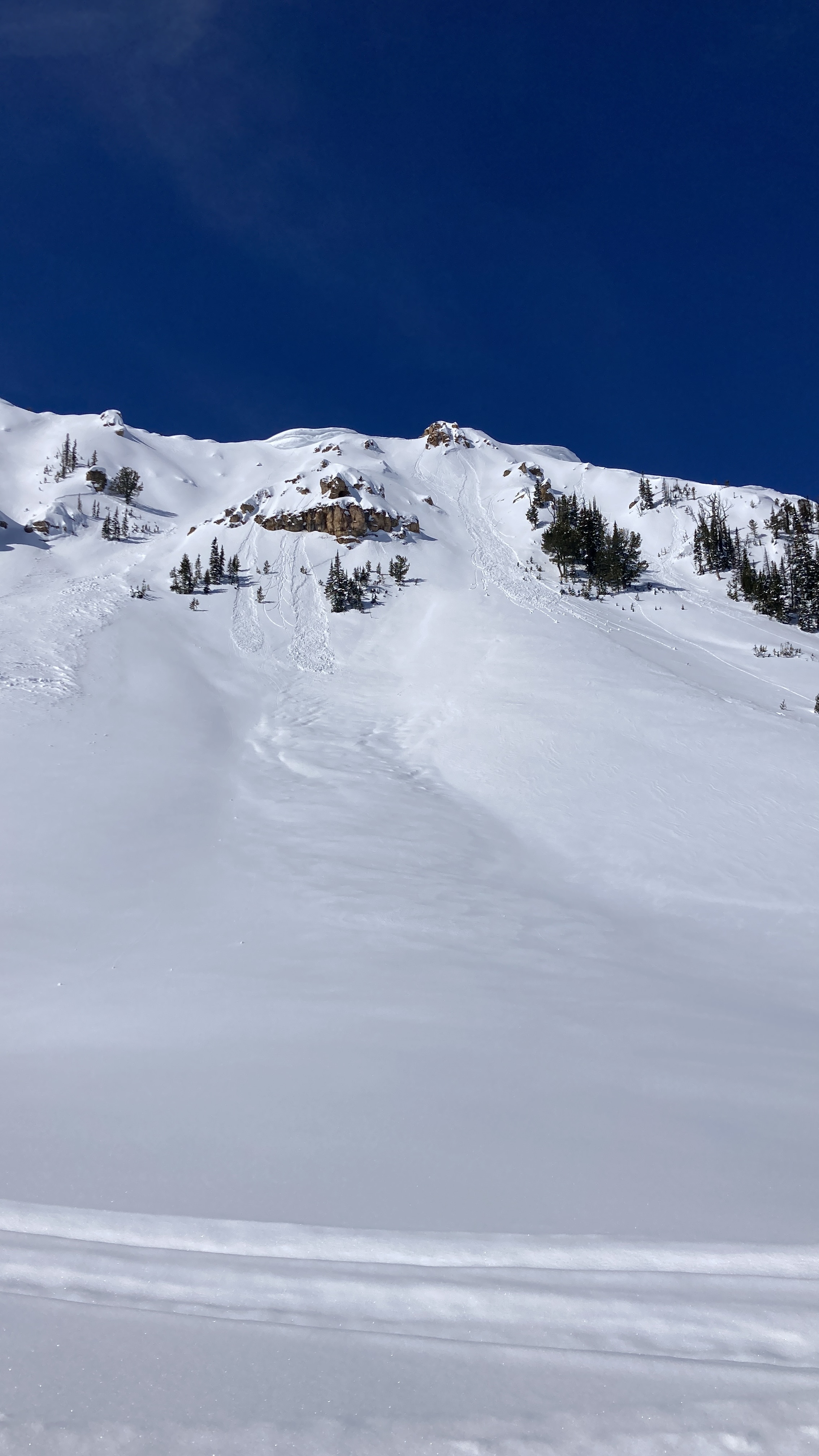
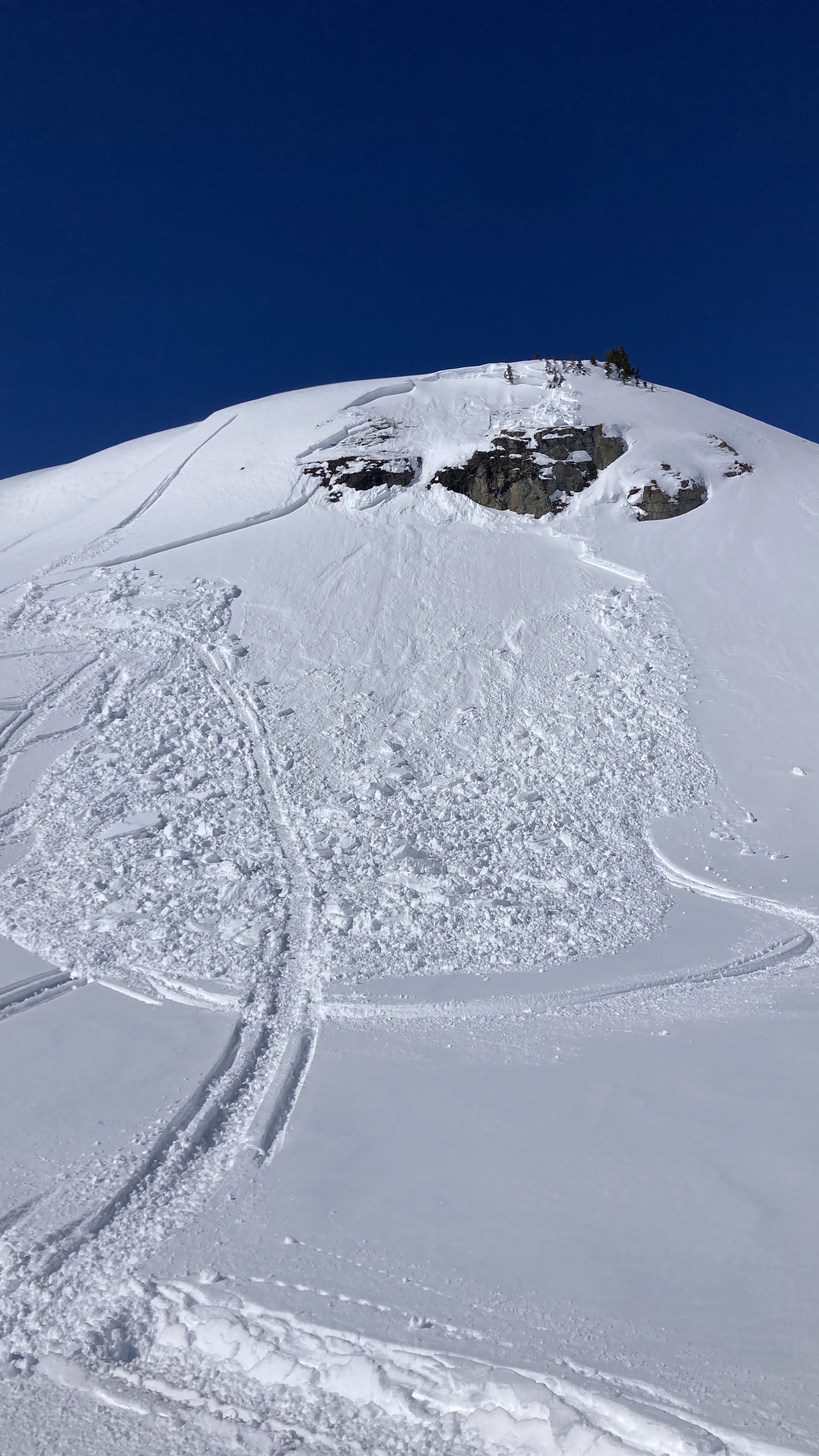
We saw one small slab avalanche that occurred since this weekend's snow. It appears to have been triggered by a snowmobile yesterday (4/1/24). It broke 10" to 2 ft deep, 50 ft wide, and ran ~50 vertical feet. It broke on a thin layer of facets beneath the new snow. Digging in the crown, dry facets at the ground were along still present and weak (fist hardness).
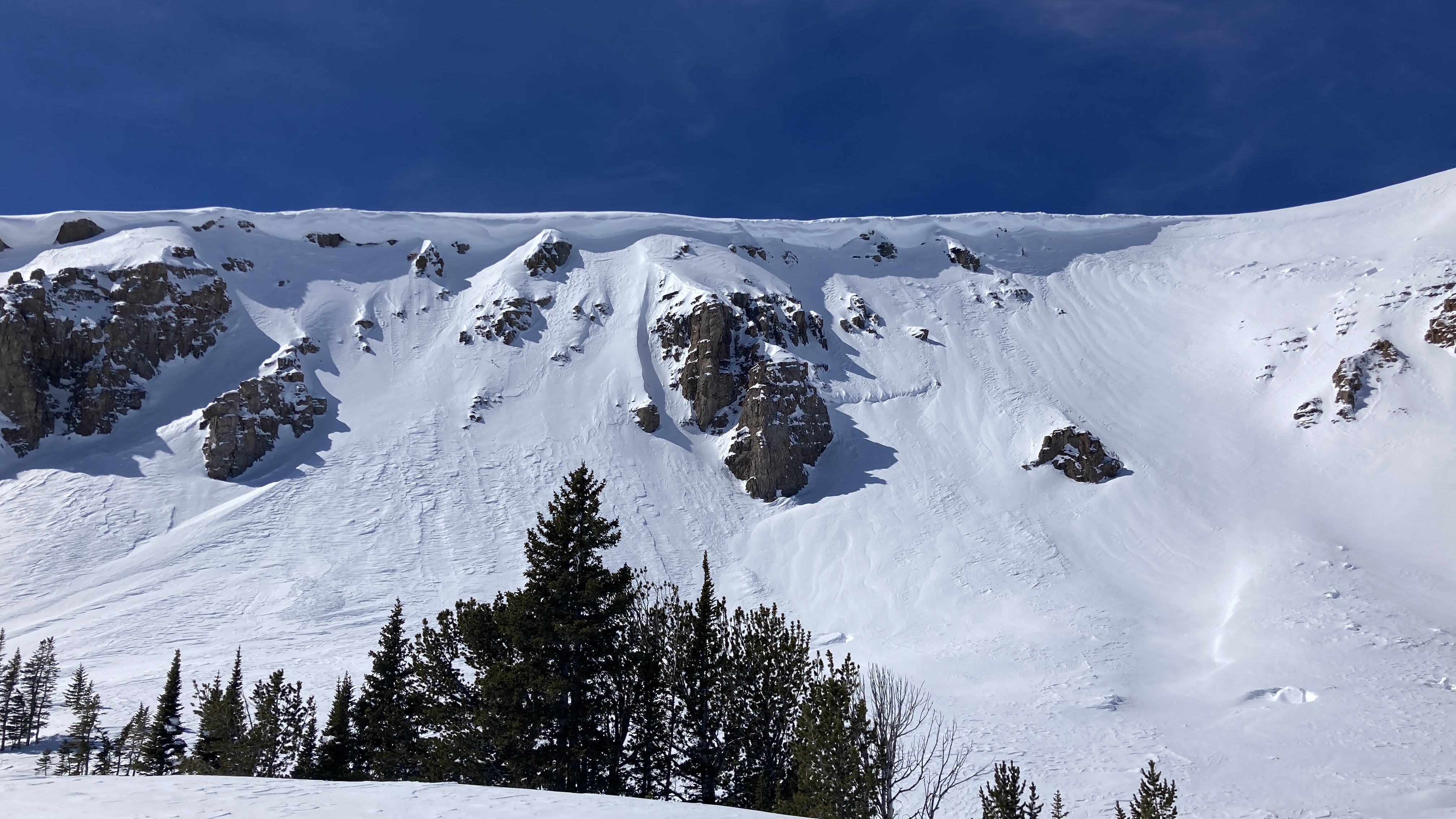
Signs of older avalanches were visible beneath the new snow, including one slide that broke in early March. No cracking or collapsing were observed today.
Full Snow Observation ReportMOD rising to CON seemed totally reasonable.

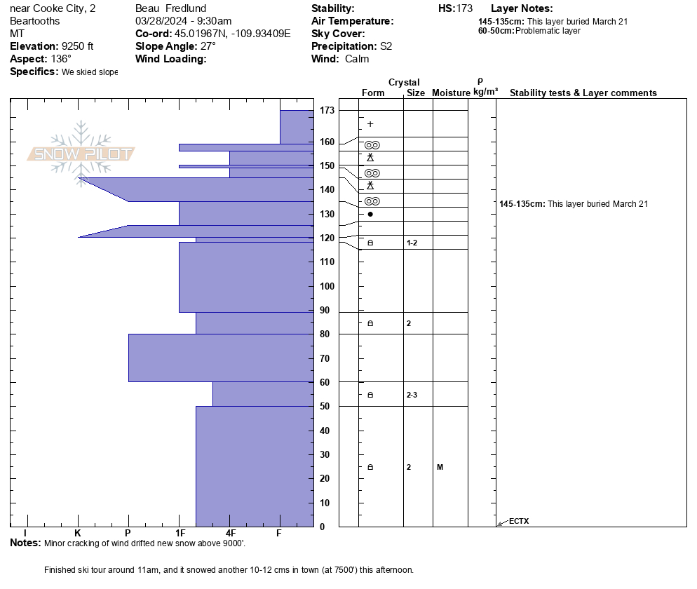
From email: "Snowpit from this morning: SE aspect, 9250'.
It snowed all day in Cooke (S2), mild temps, light westerly winds."
Full Snow Observation Report
Today, we skied near the wilderness boundary north of Round Lake. On a wind-loaded test slope at the top of our second ski run, we were able to get recent drifts to crack, but not avalanche. Slightly further down on a steep roll the second skier in our group triggered a small wind slab avalanche. This avalanche was 15-20' wide, 8" deep, and ran for about 30-40 vertical feet. The skier easily skied away from the slide and was not caught.
Winds remained mostly calm but increased by the end of the day. Snowfall through the day was enough to partially cover our morning tracks and we found 2" of snow on our snowmobiles at the end of the day.
Full Snow Observation Report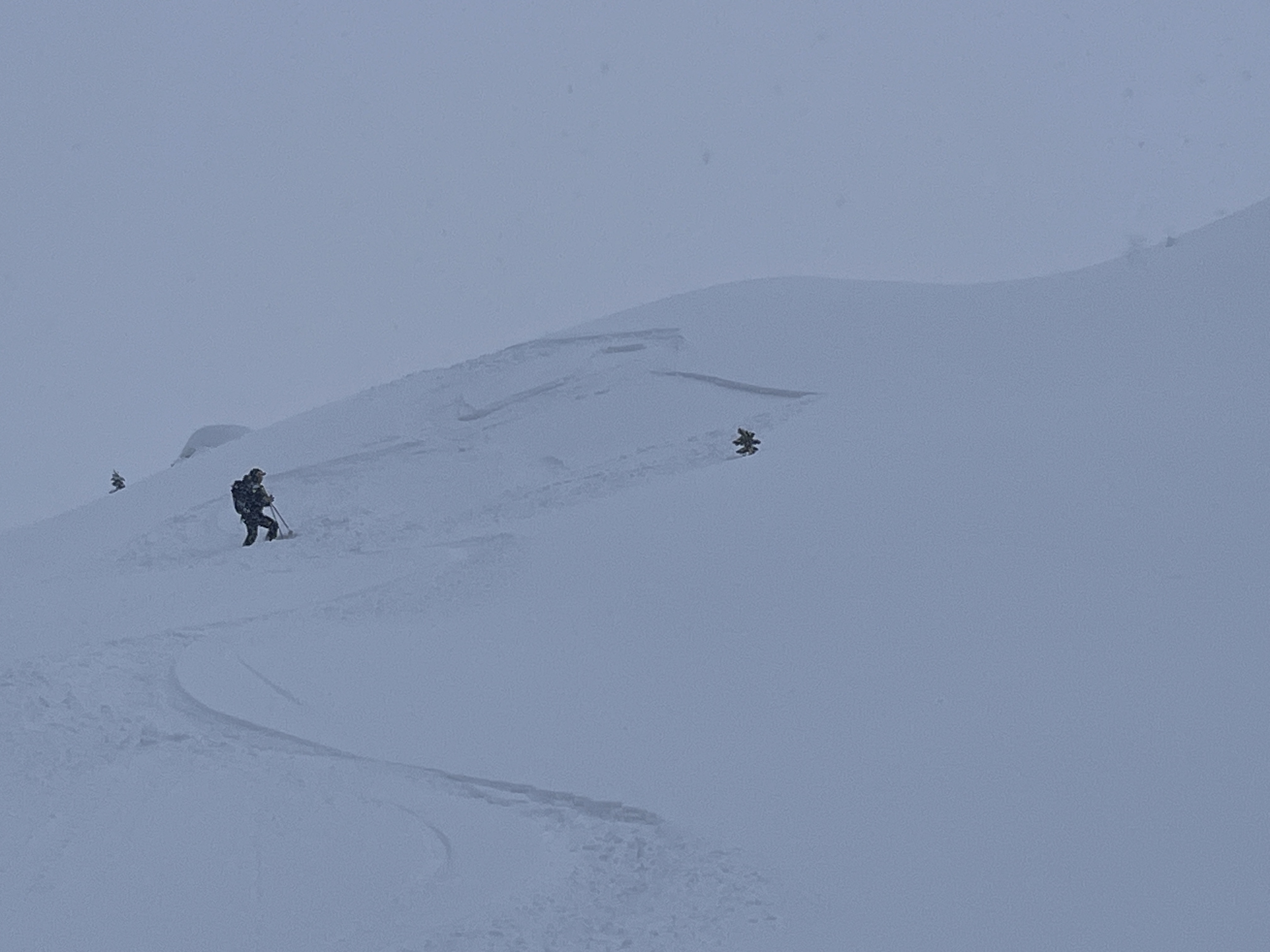

Today, we rode north of Cooke City through Abundance Basin around Scotch Bonnet ending at the East Henderson bench. We found anywhere from 4-12" of new snow that fell in the last 24-48 hours. Strong winds have transported this new snow into thick drifts even in more sheltered terrain. We did not see any recent notable avalanches but saw many crowns and debris piles from two weeks ago.
On the East Henderson bench, we dug a snowpit and found 235cm (almost 8') of snow. We found moist faceted snow 6' below the surface near the bottom of the snowpack. At the top of our snowpit was 12" of new snow above a stiff crust. Our stability test showed ECTN15 results on this interface.
Snow continued off and on through the day with little to no accumulation. Many slopes had signs of either wind-loading or had been scoured by recent wind resulting in thinner areas.
Full Snow Observation Report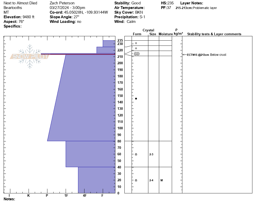

Today there were strong winds loading snow onto the Northeast face off of Pine Martin Ridge, just North of Ram Pasture. When we got a better view of the slope, we noticed there had been a natural wind-slab avalanche (left), possibly triggered by a cornice fall. While transitioning, we saw a small part of the same cornice break off and trigger a similar wind slab avalanche (right).
Full Snow Observation Report
Triggered this small windslab while skinning near a steeprollover at the top of an East facing slope above Zimmer Creek. Crown was ~20 ft wide and ran a similar distance. 2"-10" at the deepest.
Full Snow Observation Report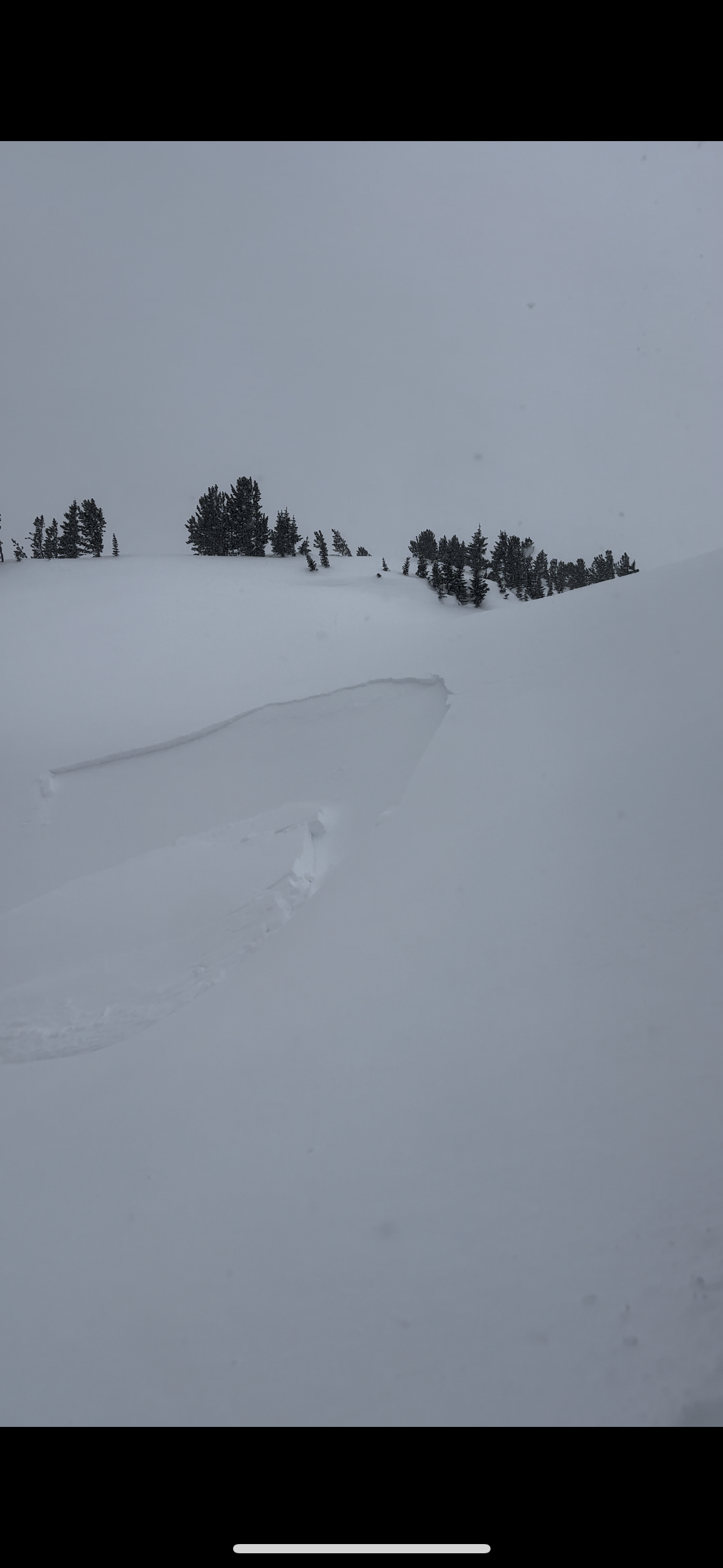
Spent the last few days traveling around the Cooke City Area. New to the area so this is just some general notes/obs of things we saw that seemed interesting:
- weak basal facets/depth hoar widespread across all aspects and elevations travelled
- no cracking or collapsing noted
- anywhere from 1-5" of new snow in the last few days. Surface conditions quite a mixed bag and tricky to predict what would be crusted or not I think due to how the sun has popped out at random times and locations in between snow squalls.
- pits were dug in 2 locations (see images) -
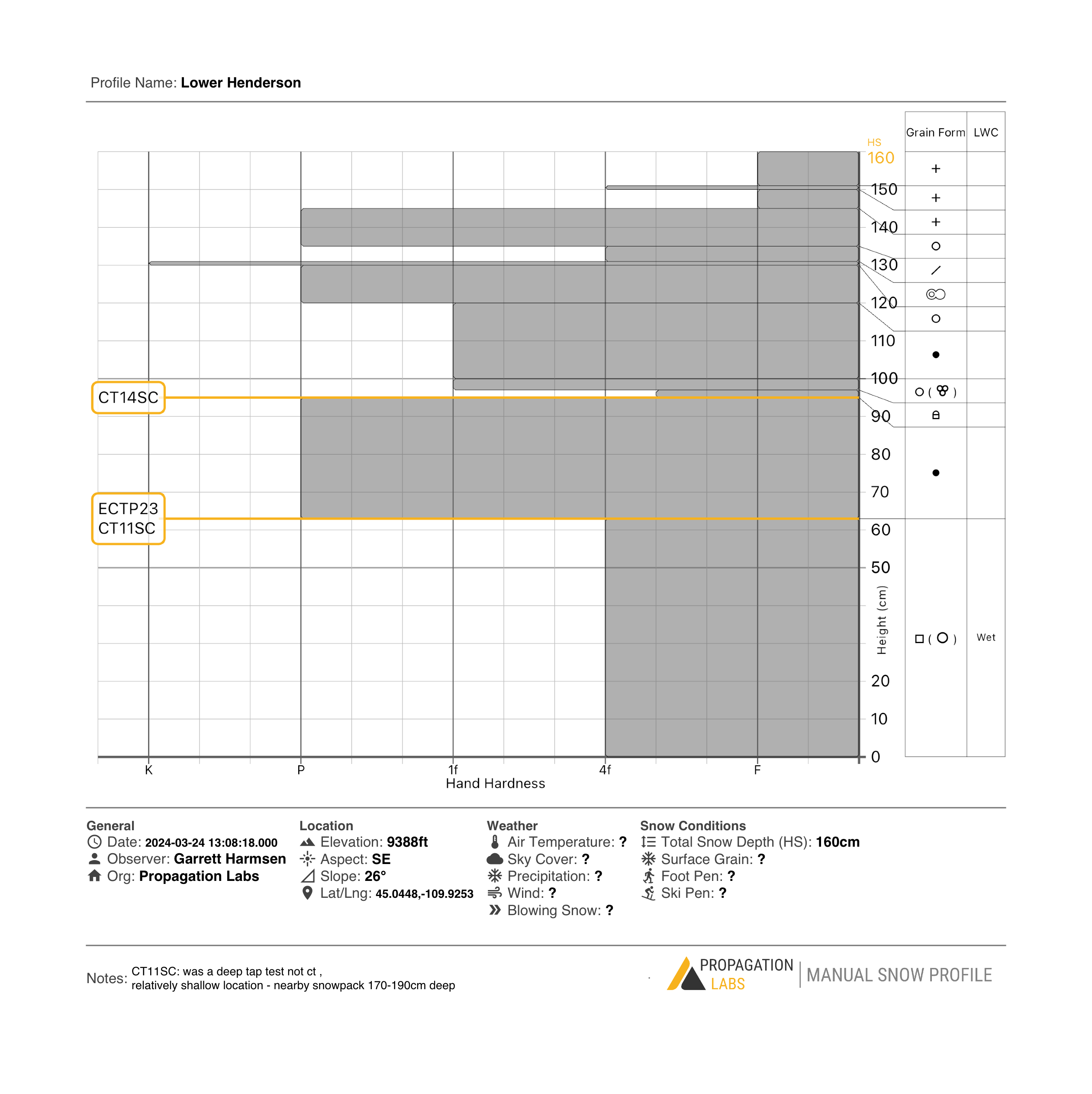
- S aspect on Henderson, many clean CT (Q1/SC) results and ECTP results on both a mid pack facets and basal depth hoar, even though depth hoar was wet (could make a snowball). These test results were repeatable in 2 pits dug nearby each other in same location representing both shallow (~160cm) and deep (~200cm) spots. Video of this pit linked.
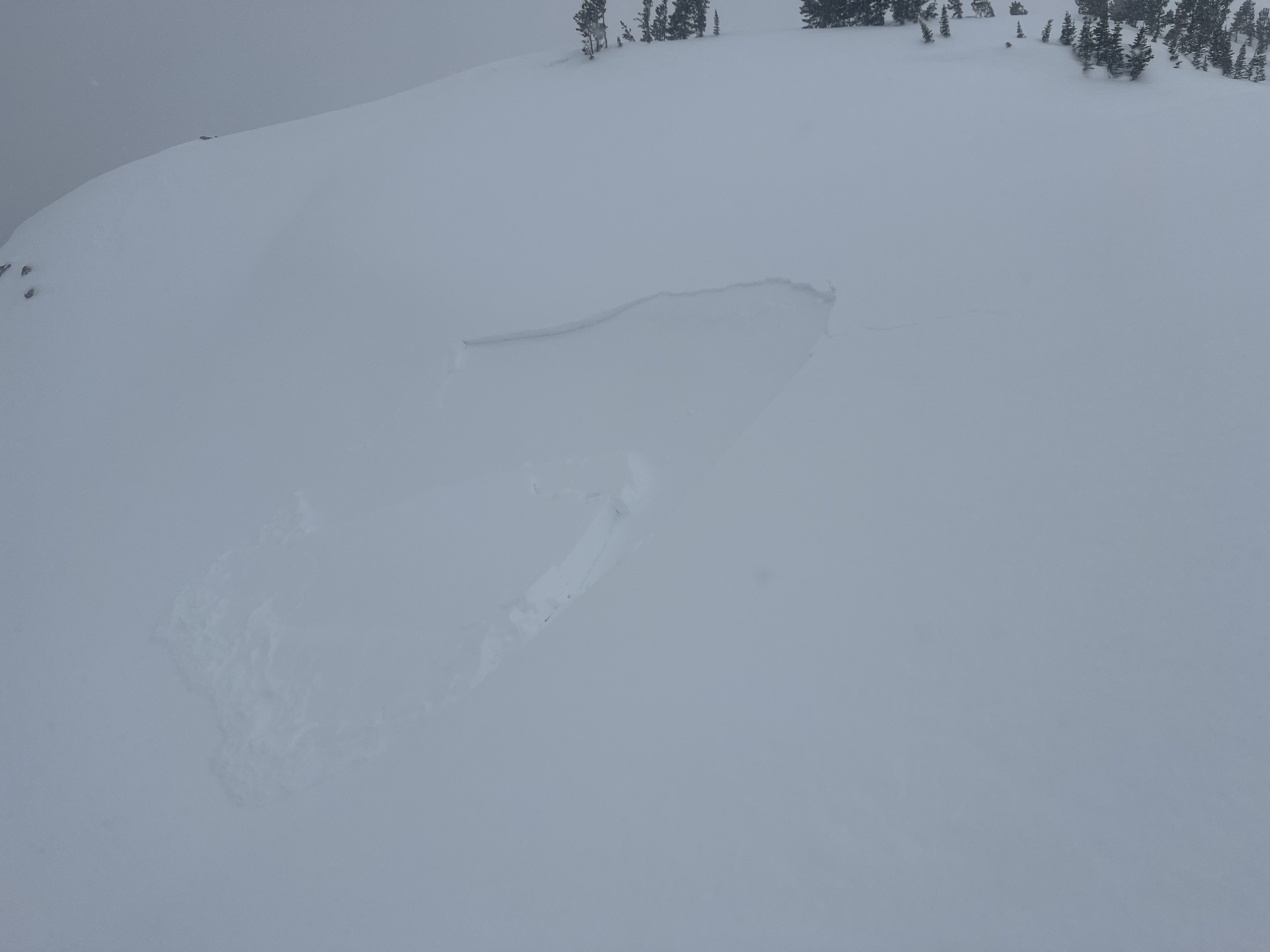
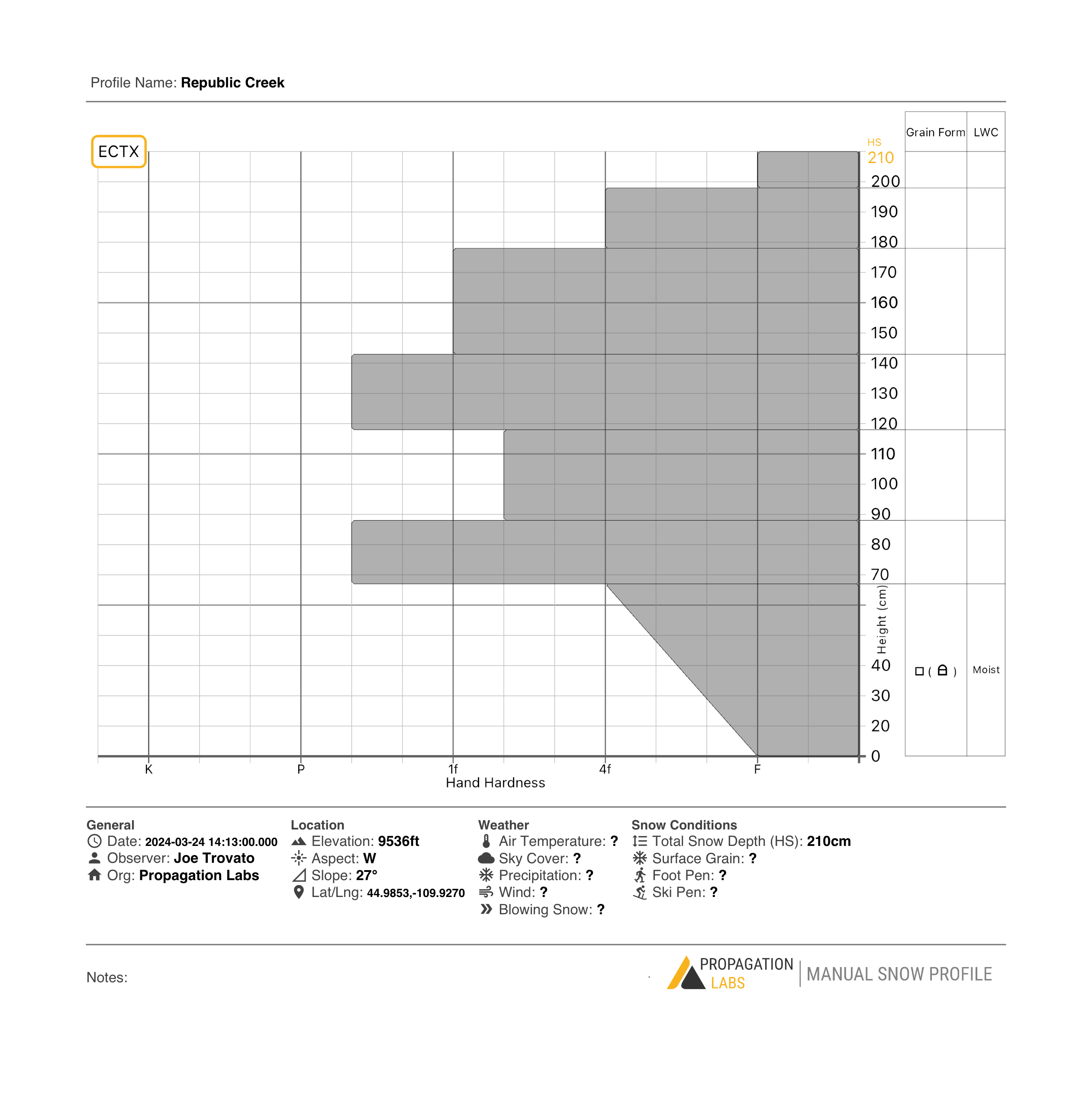
- W Aspect Republic Crk/Woody Ridge - same basal facets/depth hoar noted, but not reactive to ECT (ECTX result), even when top half of snowpack was removed. This is near the collapse ob from another party the other day so points to the spatial variability - no result in our pit but a reactive collapse nearby from another party noted.
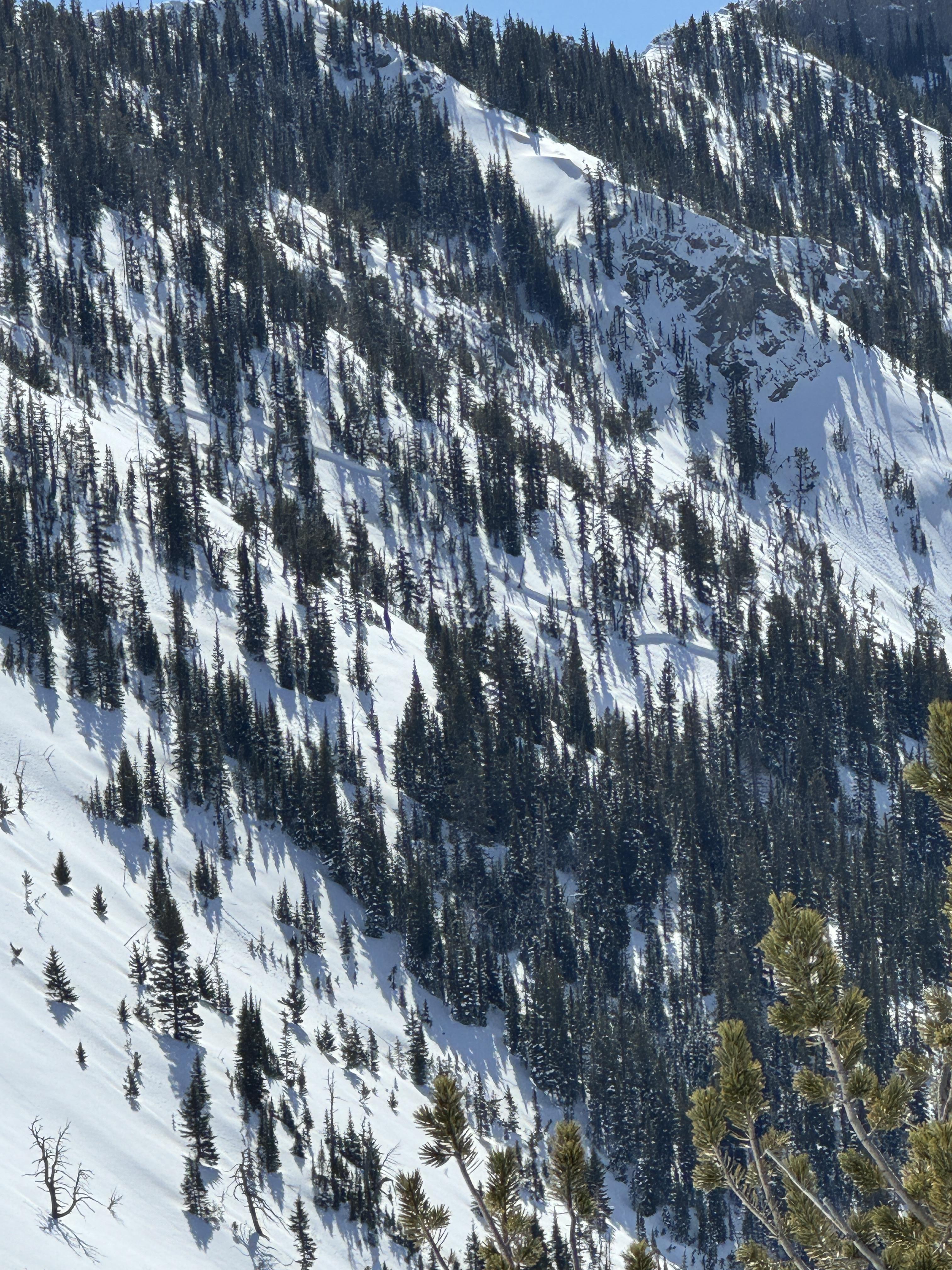
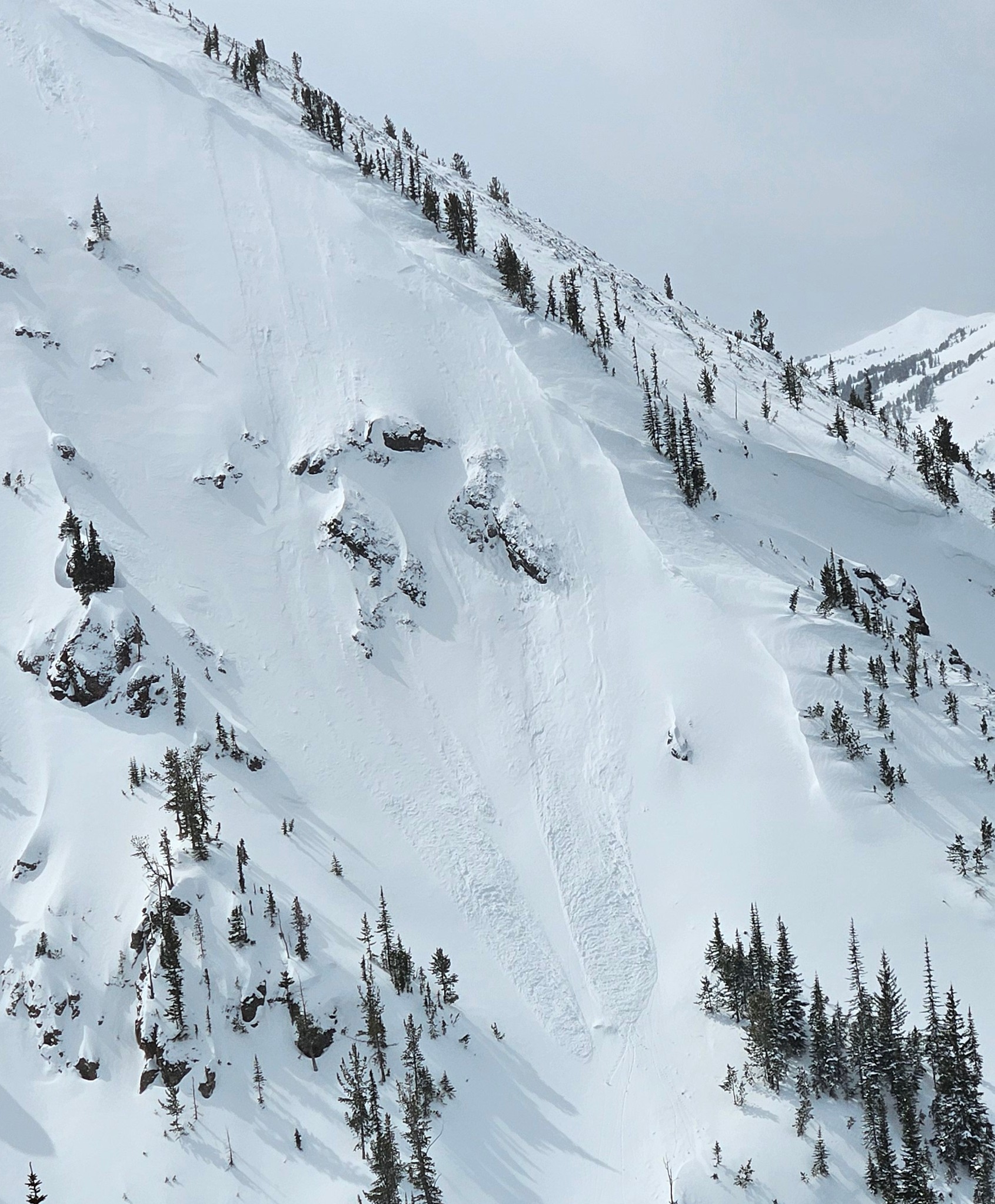
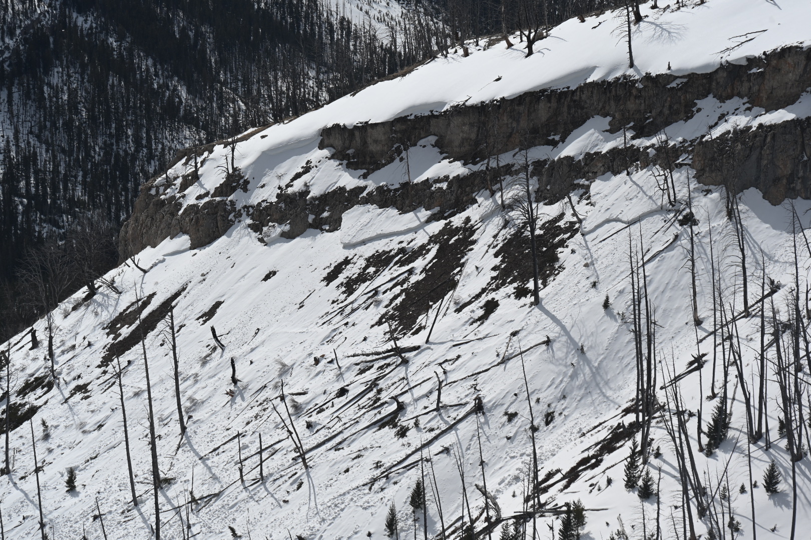
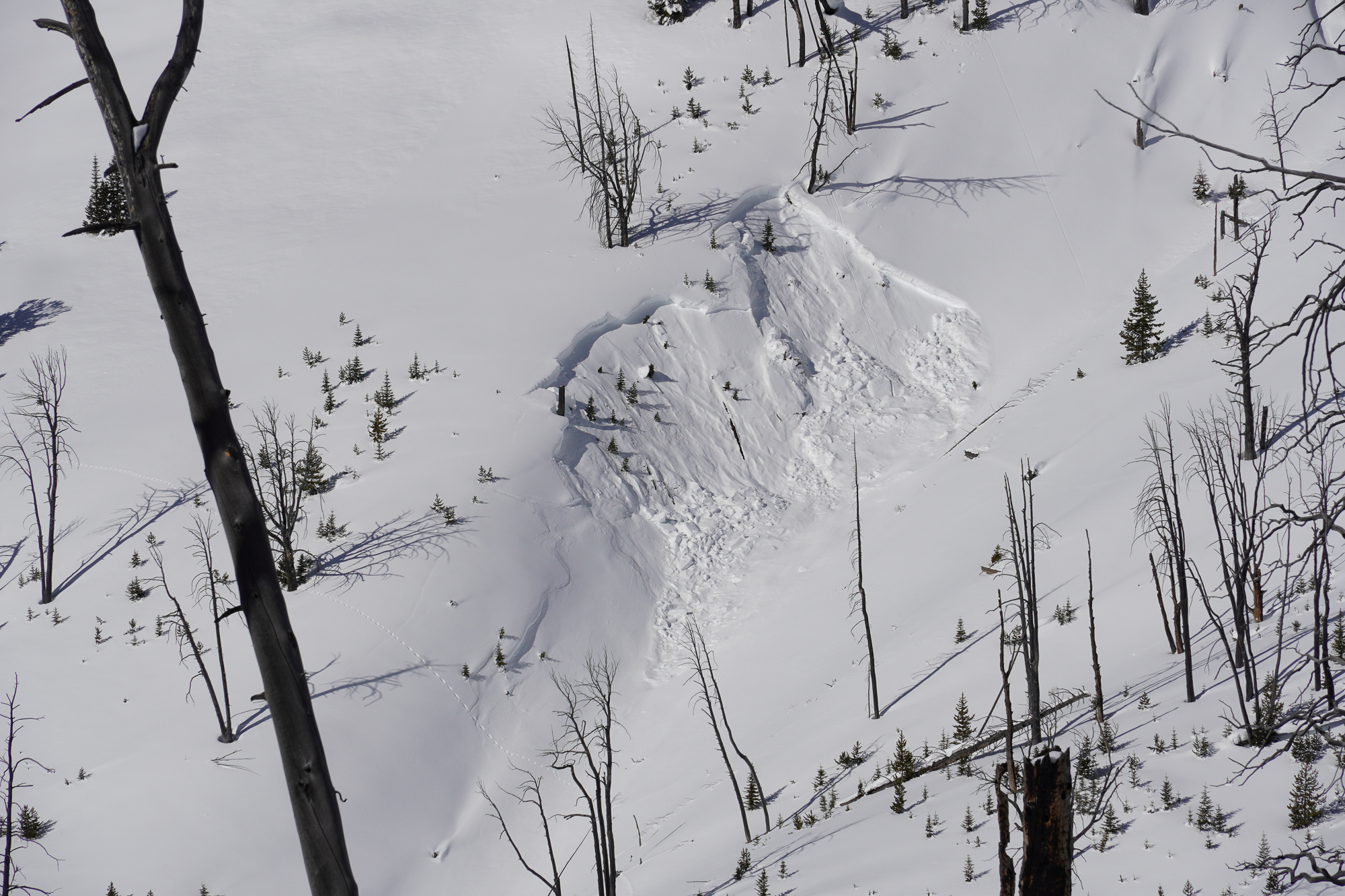
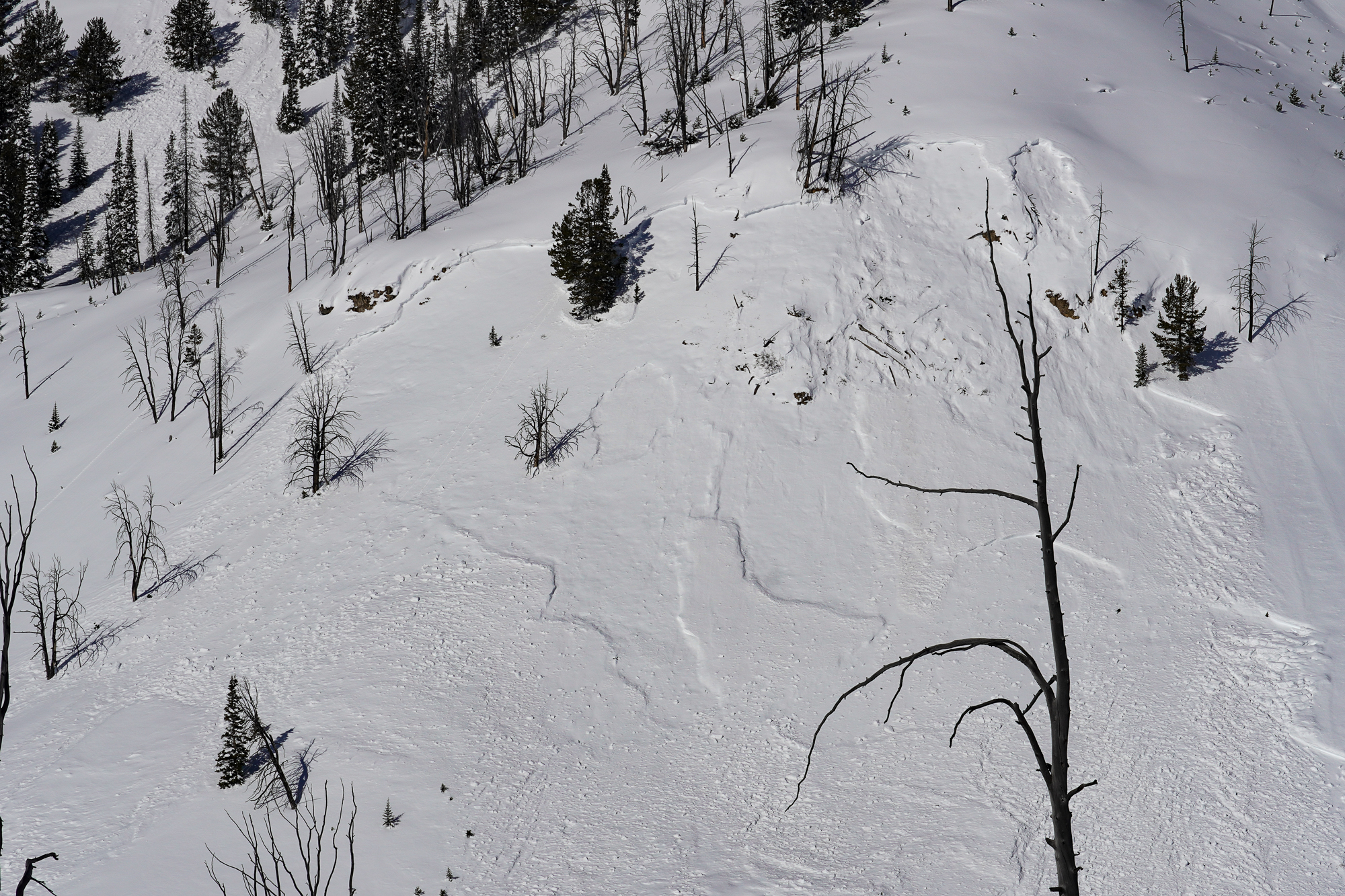
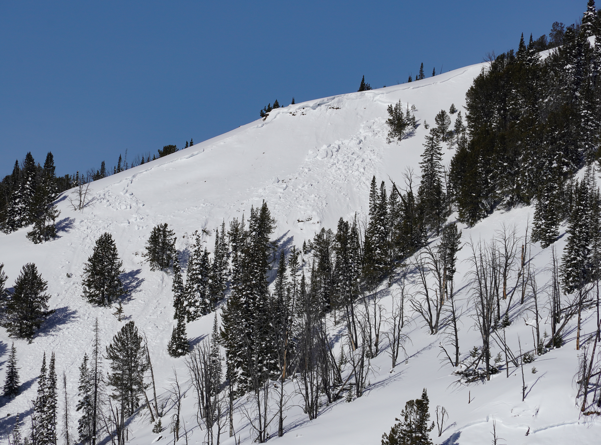
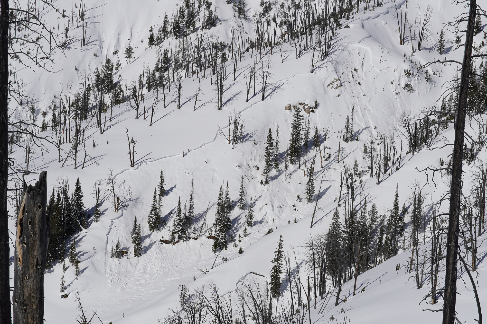
- Widespread crowns visible from previous cycle almost everywhere you could imagine, especially on easterly aspects. Don't think we saw anything that hadn't been reported, but must have been a very impressive cycle. One photo attached is of a shallow SE aspect slide seen in Pilot Crk drainage. I thought interesting because of how shallow the snowpack seemed there.

Collapse with shooting cracks approx 50 feet out
1 skiers boot broke through the crust layer during transitioning and sank to the waist causing collapse of about 2” according to standing skiers feeling of drop
elevation: 9940
Republic side of woody ridge
Full Snow Observation ReportFrom email: "New snow: 10-15cms.
No collapsing, no cracking, no fresh avalanche activity to report.
Snowpit attached from a SE aspect at 9100'. HS: 113. ECTP18 @ 78."
Full Snow Observation Report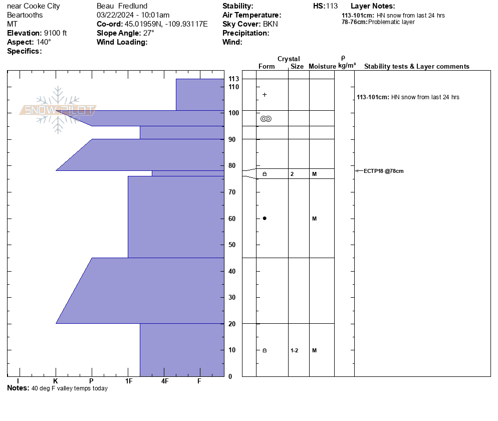
We rode to the Wilderness boundary near Astral Lake and skied a small loop through to Green Lake. We then rode across to Lulu and Daisy Passes to look for avalanches. We saw several wet loose slides on south faces. We saw no new deep slab avalanches since Alex was there last week. After a late start due to some sled issues, we dug one pit looking for new upper level weak layers. ECTNs on hardness changes. We did not note any new persistent weak layers.
While it remains possible to trigger very large avalanches on persistent weak layers near the base of the snow pack, it is clearly becoming less likely. Unfortunately, if you triggered one, it would be no less deadly.
Full Snow Observation ReportThe danger seems to have dropped to MODERATE. Very large avalanches remain possible but they are becoming less likely.

We were skinning in the valley to the East of Woody Ridge near the North end and observed a wet slide occur naturally due to a point release, moving about 500 ft downslope. While that was occurring it remotely triggered a dry slab avalanche approx. 50-100 ft adjacent on the same slope and elevation. The crown appeared to be 3 ft deep, possibly thicker, but we were viewing from afar so hard to tell. 9500 ft elevation, East aspect. 12:02 PM March 17, 2024. Air temp approx. 30F clear skies all day.
Full Snow Observation Report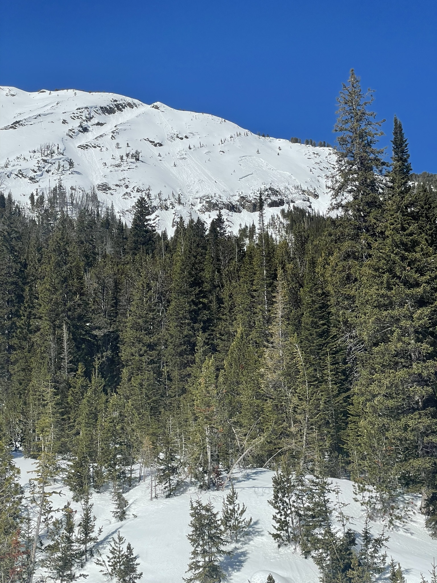
Just got out from a hot few days at the Woody Creek Cabin. A highlight of the trip was watching a natural avalanche come off the unsupported northly end of the Climax slide path on Sunday the 17th. We believe it was remotely triggered by a wet loose point release which occurred a second before and ran immediately adjacent to the slab avalanche (see photo). Our best estimate for size is R2-D2, approximately 1.5m deep, and based on Google Earth measurements 75-100m wide, running about 200m. This occurred just before noon as the path received direct sunlight.
We also saw numerous roller balls and D1-1.5 loose wet avalanches in the Climax Path. The largest of which ran about 250 m, likely a D1.5 as it didn't have the mass for a D2 despite the distance.
We travelled in the trees on the east side of the valley, and gave run-outs a large berth. We skied moist snow on south aspects in Olie's Woods.
Full Snow Observation Report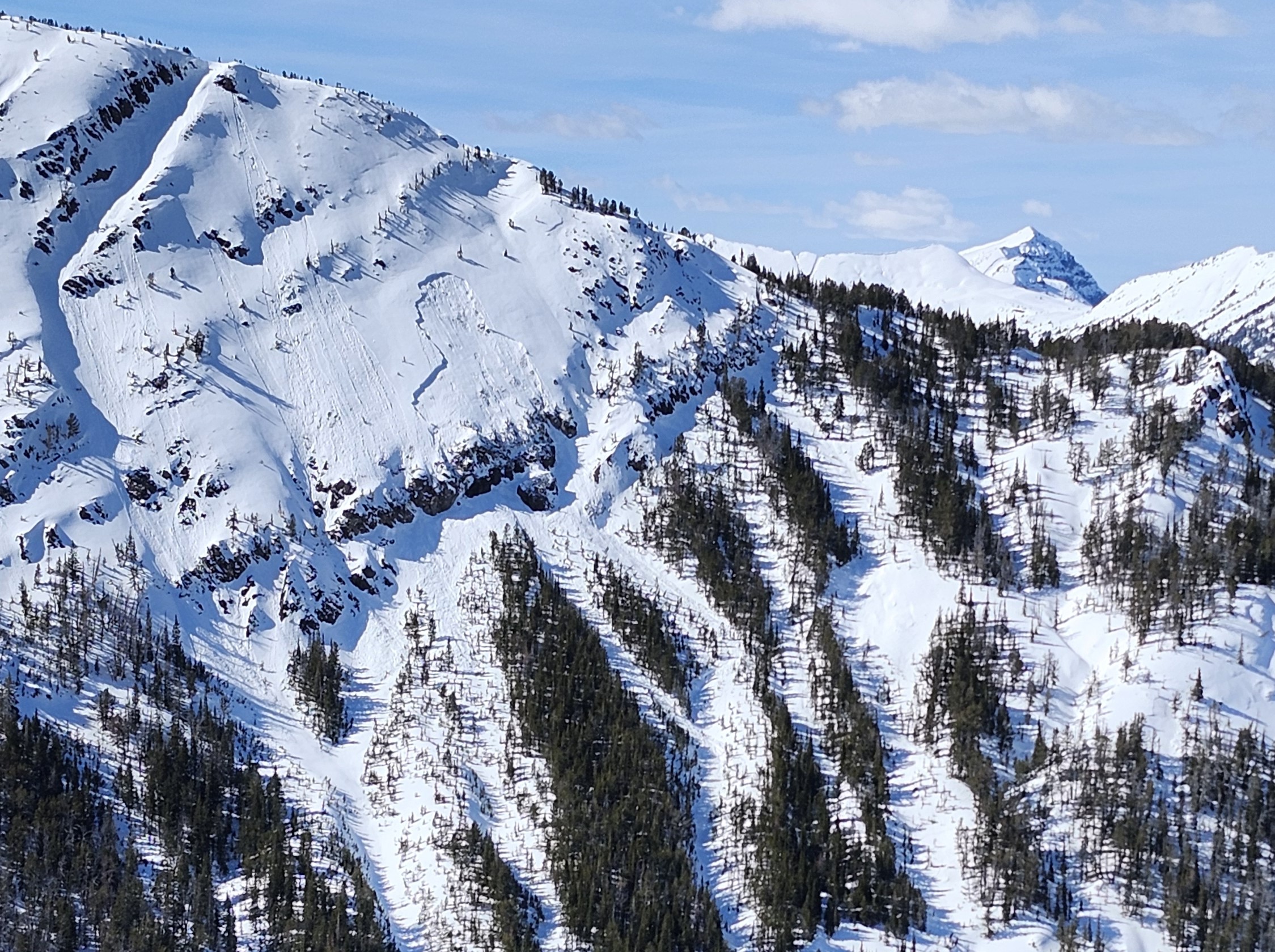
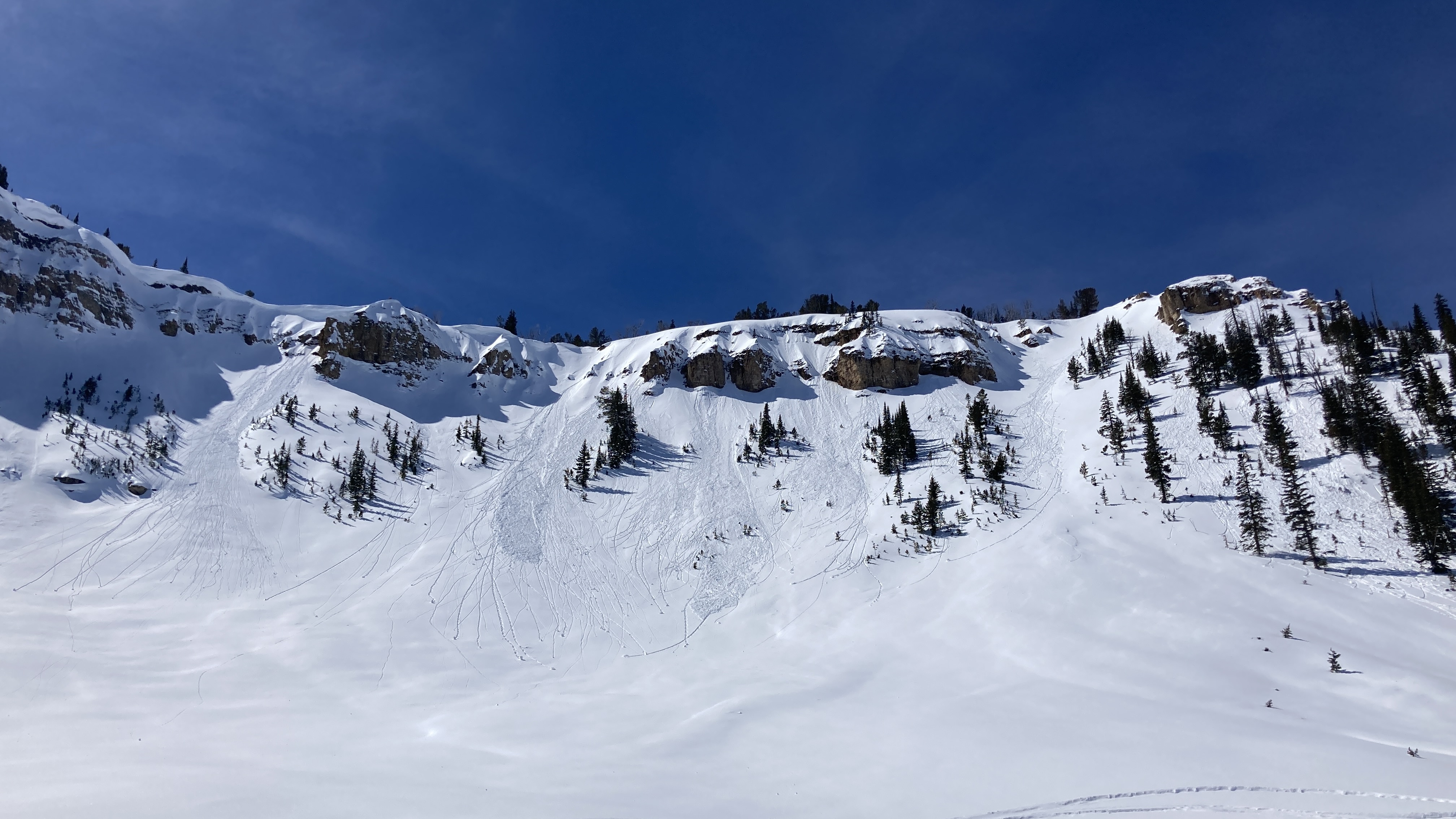
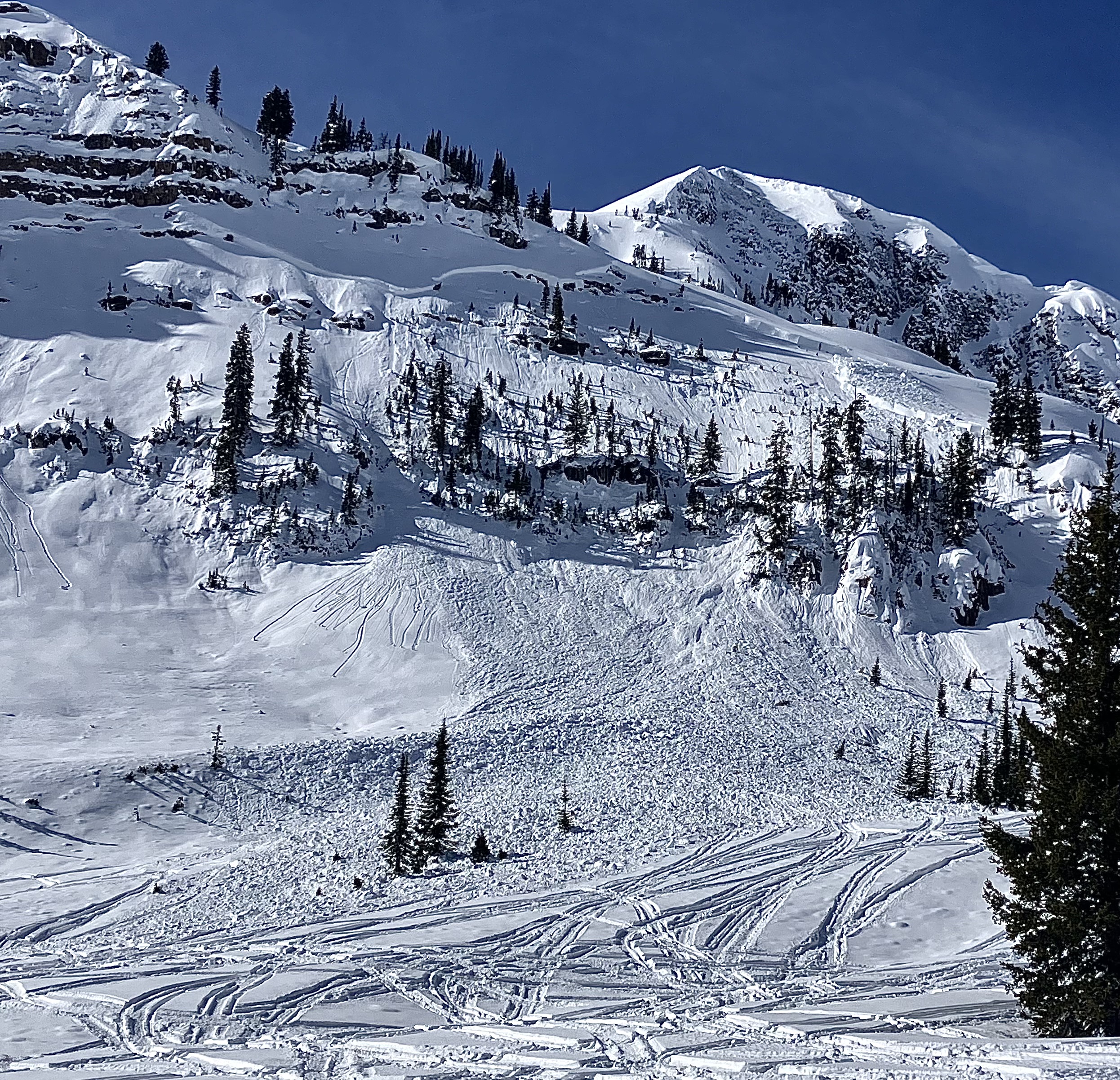
We rode over Daisy Pass and out to the pass between Wolverine and Abundance. Low on Daisy Road along the steep creek walls we saw three recent 2'+ deep avalanches. each 70-100' wide. HS-R4-D2-O. One looked within the last day or two and the other two were maybe 3-4 days old. Triggers unknown, there were various ages of sled/snowbike tracks nearby. We saw older crowns (4-7 days old) on east and north Miller Mtn.
Between Miller and Wolverine there was a recent large avalanche that I would guess was triggered yesterday. 3-6' deep, 250-300' wide. HS-R4-D2.5-O. Video and photos attached. Given the recent human triggered and natural avalanches, we expect dangerous conditions will continue to start the week.
Partly sunny skies, light to moderate winds with some stronger gusts and snow transport at ridgelines. Snow surface had a thick crust on any slopes that were not fully shaded yesterday. Rode back to town at noon and snow surface was still mostly frozen. Cloud cover increased through the day.
Full Snow Observation Report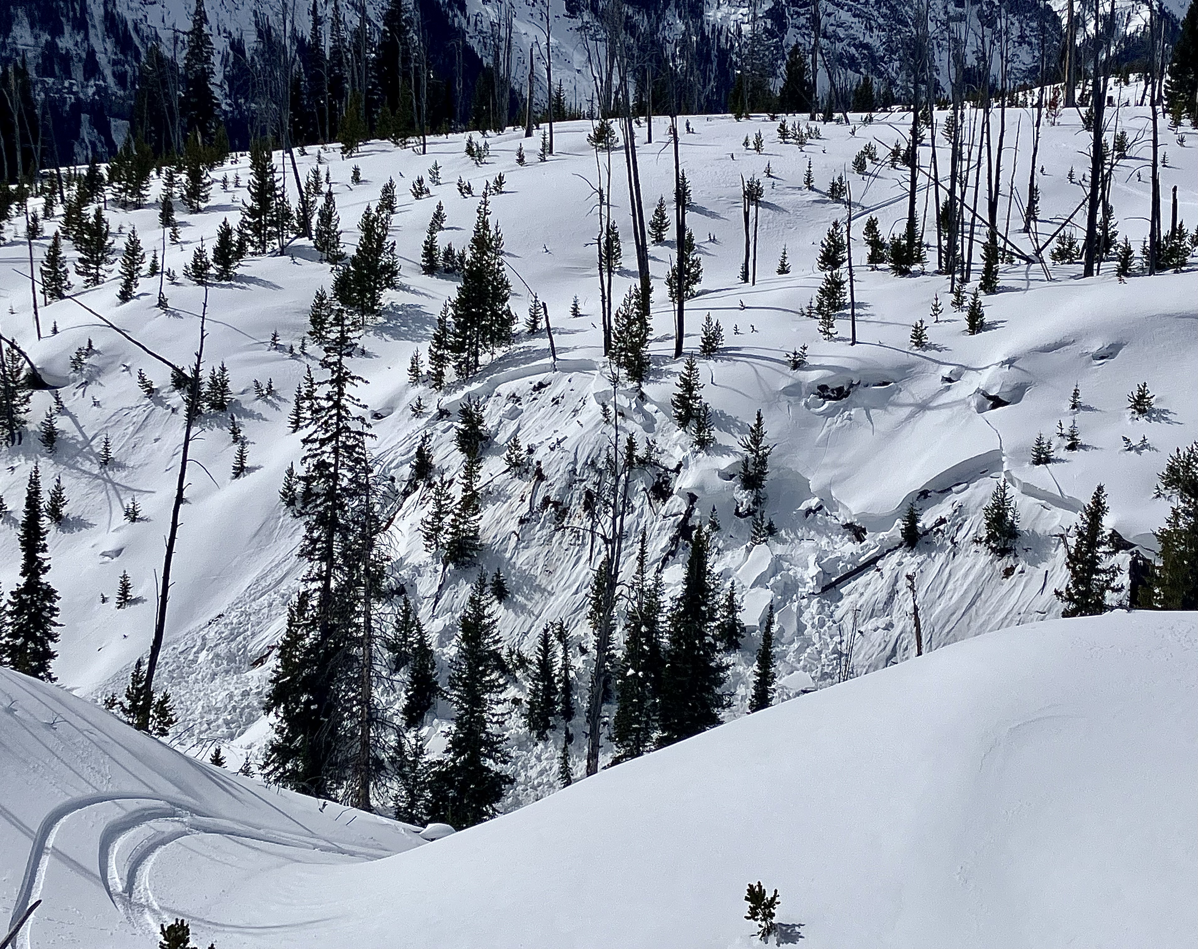

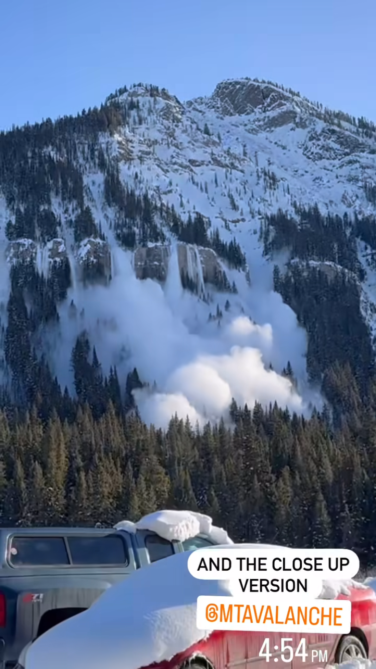
A natural avalanche was witnessed on the north side of Republic Mtn. on 3/9 at 4:54pm. It appeared to break around 3 feet deep.
Full Snow Observation Report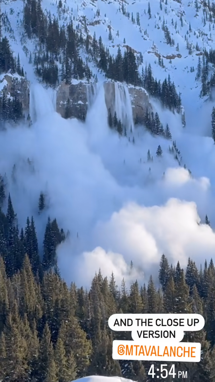
Saw a couple avalanches today in the Woody Creek Cabin area
First was in Woody Creek, right by the waterfall. D2, crown was up to 5 feet deep. NE facing
The other was on the backside of High Hayden, in Pilot Creek. This one ran probably 1000 feet. SE facing
Full Snow Observation Report