Advisory Archive
At 5 a.m. mountain temperatures at 9,000 feet are in the mid-thirties with ridgetop winds blowing 20-30 mph out of the west under cloudy skies. Today will…rain. There, I said it, the dreaded “r” word. And maybe even thunder. Freezing levels will drop to 6,000 feet tonight and rain will turn to snow. By morning I expect 2-4 inches. The weekend should be cold and snowy, so put away your shorts and flip-flops and find your ice scraper; I’m guessing you’ll need it.
Yesterday high temperatures were in the 40s F and this morning low temperatures hovered around freezing. Winds were blowing 5-10 mph and gusting to 15 mph from the WSW. Today will have warmer temperatures than yesterday with highs reaching 50 degrees F or higher. Winds will blow 10-15 from the W but increase some this afternoon and shift to the SW. There will be plenty of sunshine today and a few clouds. More clouds will arrive late this afternoon and deliver a trace of precipitation by tomorrow morning.
This morning temperatures in most areas were at or slightly above freezing following high temperatures yesterday in the high 40s/low 50s F. Winds were averaging 10 mph from the W with gusts of 15-20 mph. Clouds will keep today a bit cooler than yesterday with high temperatures in the low to mid 40s F. Winds should ease a bit as cloud cover increases this afternoon when a few rain drops or snowflakes may fall.

Yesterday high temperatures reached the 50s F in some places with very little wind. This morning temperatures were in the high 20s to low 30s F. Winds averaged 5-10 mph from the W and NW with gusts of 15 mph. Today will have sunshine, above average temperatures, and very light winds. High temperatures today will be in the 40s F and possibly 50s F in some areas.
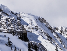
Wow – Spring is unpredictable! Last night a surprise storm dropped 2-3 feet of heavy dense snow over the mountains of southwest Montana. It looks like another 1-2 feet will fall over the next few days. The storm riding should be absolutely amazing! April Fools.
Actually - temperatures will be around 10 degrees above average today and conditions will be mostly dry. This morning, the mercury is sitting in the upper 20s F under clear skies and winds are calm. Today, temperatures will warm into the mid-40s F under partly cloudy skies and winds will stay light out of the west. There is a chance for an afternoon shower in the mountains around Big Sky, West Yellowstone and Cooke City. There is also potential for lightning this afternoon as the atmosphere grows increasingly unstable.
This morning there is no new snow to report. At 4 a.m. temperatures are in the upper twenties F and winds are blowing 10-20 mph out of the WNW with ridgetop gusts reaching into the 30s. Today will be perfect for Easter activates – skies will be partly cloudy and temperatures will warm into the low to mid-forties F. Winds will continue to blow 10-20 out of the WNW. No precipitation is expected over the next 24 hours.
Over the past 24 hours the mountains picked up 1-3 inches of high density snow above 8,000 ft. This morning temperatures are in the twenties F and winds are blowing 10-20 out of the WNW. A northwest flow aloft will keep skies cloudy this morning producing a slight chance of mountain snow and valley rain. Conditions will dry out this afternoon as a weak ridge of high pressure builds over the area. Today, temperatures will warm into the mid-30s to low 40s F and winds will remain light out of the WNW.
Yesterday high temperatures were in the 40s F and cooled to around 30 degrees F by this morning. Winds were blowing 5-10 mph from the WSW with gusts of 15-20 mph. Today should be mostly cloudy with snow falling this afternoon. Temperatures today will reach the high 30s F and winds shouldn’t change much. By tomorrow morning the mountains near Big Sky will get 2-3 inches of snow and all other areas will get 1-2 inches.
Yesterday many places had high temperatures in the high 30s to low 40s F with light winds. Temperatures dropped to the mid to low 20s F overnight and winds were blowing 5-10 mph gusting to 15 mph from the W and SW this morning. Today’s weather will be similar to yesterday’s with warm temperatures, light winds, and mostly sunny skies. Some snow will fall Friday afternoon followed by a brief period of slightly cooler temperatures.

Yesterday, under partly cloudy skies, mountain temperatures rose into the mid-thirties with light west to southwest winds. Overnight temperatures dropped to 20 degrees, but these will quickly rise into the 40s today under sunny skies. Ridgetop winds will remain light at 5-15 mph out of the west to southwest. Tonight, clear skies will help drive the temperature down to below freezing. No new snow is expected in the coming days, just a strong warming trend.