Good morning. This is Doug Chabot with early season weather and avalanche information from the Gallatin National Forest Avalanche Center on Monday, November 20th at 7:30 a.m. This information is sponsored by The Friends of the Avalanche Center and Community Food Co-op. We will update this bulletin on Wednesday and begin issuing daily avalanche advisories and danger ratings this Friday.
There’s been no new snow since Friday night, just wind. Mountain temperatures this morning are in the mid-20s in the north and high teens in the south. Southwest winds picked up overnight and are blowing steady at 35 mph with gusts near 55 mph. As the day progresses skies will become cloudy and winds will decrease and shift northerly. Later today and tonight the mountains will get a little snow and possibly rain in the valleys. By morning I expect 1-2” in the north and 2-4” in the southern mountains. Tuesday looks to be dry and uneventful.

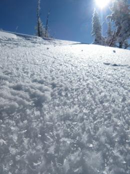
My primary avalanche concern for the next couple days is fresh wind slabs cracking and avalanching. Skiers in the Bridger Range, up Hyalite, near Big Sky and on Ramshorn Peak in the southern Gallatin all reported winds blowing snow over the weekend (photo). A few wind slabs cracked as skiers slid by. Winds became strong and gusty last night further thickening wind slabs and increasing their chance of being triggered.
In all our ranges, except Cooke City, there are a few slopes with weaker, faceted snow near the ground. Snowpacks thinner than 3’ deep at higher elevations are where this layer is prominent. Eric found it in Beehive Basin on Saturday, and although he could not get this layer to break in his stability test, he is still cautious. His video, titled “Could be Worse”, explains his concern and optimism. Yesterday at Big Sky Ski Area the patrol was able to trigger avalanches with explosives at the ground on heavily wind-loaded slopes (photo). We pay close attention to early season avalanche control at ski areas since their snowpack resembles the backcountry. The avalanches at Big Sky are warnings that some slopes have weak, unstable snow.
Outside Cooke City there is a 4-5’ deep snowpack that is mostly stable (snowpit profile) with the exception being wind-loaded slopes. These mountains have lots of snow and recent wind. Wind-loaded slopes are the most dangerous and on Friday snowmobilers saw a natural avalanche cover their tracks on Mt. Abundance (photo).
If you get out and have any avalanche or snowpack observations to share, drop a line via our website, email (mtavalanche@gmail.com), phone (406-587-6984), or Instagram (#gnfacobs).
Upcoming Avalanche Education and Events
BOZEMAN
Nov. 28, Avalanche Awareness, 6-7:30 p.m. at Play it Again Sports
Nov. 29, 30 and Dec. 2, 3 or 9, Introduction to Avalanches w/ Field Day, Info and Register Here
Dec. 6, Avalanche Awareness, 6-7:30 p.m. at REI Bozeman
Dec. 7, Avalanche Awareness and Beacon Practice, 6-8 p.m. at Beall Park, Bozeman
Dec. 13, Avalanche Awareness, 6:30-8 p.m. at Gallatin Valley Snowmobile Association, 4-Corners
Jan. 12 and 13, Companion Rescue Clinic, Info and Register
Jan. 17, 18 and 20 or 21, Introduction to Avalanches w/ Field Day, Info and Register Here
Jan. 24, 25 and 27, Advanced Avalanche Workshop w. Field Day, Info and Register Here
Feb. 9 and 10, Companion Rescue Clinic, Info and Register
HELENA
7 December, Avalanche Awareness, 6-7:30 p.m. at Basecamp, Helena
WEST YELLOWSTONE
Dec. 14 and 15, Snowmobiler Introduction to Avalanches with Field Course, Info and Register Here
COOKE CITY
24 and 25 November, Current Conditions and Avalanche Rescue, 6:30-7:30 p.m. Friday and anytime between 10-2 on Saturday.
Here’s a new video series from BCA outlining how to use an avalanche transceiver to perform an effective rescue.