Good Morning. This is Doug Chabot with the Gallatin National Forest Avalanche Advisory issued on Wednesday, January 24th at 7:00 a.m. Today’s advisory is sponsored by Yellowstone Arctic Yamaha and Yamaha Motor Corp in partnership with the Friends of the Avalanche Center. This advisory does not apply to operating ski areas.
Yesterday, 1-2 inches of snow fell in the southern mountains. Under partly cloudy skies temperatures are near 20F in the north and 10F in the southern areas. Strong wind from the southwest is blowing at the ridgetops and mid-elevations. Speeds are averaging 25-35 mph with gusts of 50 mph in Hyalite. Today will be partly cloudy and breezy and the next chance of snow is tomorrow.

Eric and I rode into Lionhead yesterday to check on snow stability and were pleased at the strengthening that’s been taking place (video) since Alex’s visit on Saturday during the avalanche warning (video). The snowpack is getting stronger and we saw no recent avalanches nor collapses, and our snowpits revealed 5’ of snow depth with improving stability test scores. However, this area has a poor snow structure (weak layers underlying denser slabs) and it’s possible to trigger an avalanche 2-4’ deep on weak, sugary facets near the ground, which is why Eric and I gave runout zones a wide berth. Additionally, it snowed 3’ since Friday and strong southwest winds are currently loading slopes that could avalanche naturally. For today, the avalanche danger is CONSIDERABLE on wind-loaded slopes and MODERATE on all other terrain.
Throughout our advisory area southwest winds are blowing strong at all elevations, not just the ridgelines and loading will occur in gullies and other fetches mid-slope. Yesterday, drifts were reported to be 1-2’ thick and today they’ll be even meatier and easily triggered. Over the weekend we had two skiers caught in the Bridger Range when they triggered wind-loaded slopes, one on Naya Nuki after a failed ski cut resulted in an 800’ ride, and another smaller avalanche on the Throne (photo). Wind-loaded slopes were also triggered in Taylor Fork (photo) and natural avalanches were seen outside Cooke City (photo, photo).
In addition to wind slabs, weak, sugary snow 1-2’ off the ground is a concern. This layer broke in one of my snowpits in Taylor Fork on Sunday (video), but not in others. The spatial variability between weak and strong slopes in close proximity to one another can be confusing. This is why we recommend digging and testing before getting into avalanche terrain.
For today, strong wind is creating a CONSIDERABLE avalanche danger on wind-loaded slopes. All other slopes have a MODERATE avalanche danger.
If you get out and have any avalanche or snowpack observations to share, drop a line via our website, email (mtavalanche@gmail.com), phone (406-587-6984), or Instagram (#gnfacobs).
AVALANCHE FATALITY REPORT: Reas Peak, Centennial Range, 20 January
On the afternoon of Saturday, January 20, four snow bikers (motorized) were riding southeast of Reas Peak (9,298’) in the Centennial Range in Idaho. The group was riding along a trail near a creek bed below 500-700’ high slopes that were greater than 35 degrees steepness. Two bikers rode up 15’ from the bottom of the slope when it released, catching and burying one. The group had rescue gear and located the victim quickly. The victim’s head was 6’ from the surface and CPR was initiated but unsuccessful. The avalanche was estimated to be 600’ wide, up to 2.5’ deep, and 2-300’ slope distance. It is classified SS-AMu-R2-D2-O. Photo of crown, burial location, Google Earth; news article.
A full report will be posted later today.
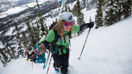
King and Queen of the Ridge
King and Queen of the Ridge, Saturday, February 3rd. A Hike and Ski/Ride-a-Thon fundraising event to support the Friends of the Gallatin National Forest Avalanche Center. Sign up and start collecting pledges HERE.
Upcoming Avalanche Education and Events
BOZEMAN
Feb. 6th, Sidecountry specific avalanche awareness for family and friends. 6-8 p.m. @ Beall Park
Feb. 7th, Woman’s specific avalanche awareness, 6-7:30 p.m. @ REI in Bozeman
Feb. 7th, Avalanche awareness, 6-7:00 p.m. @ Roskie Hall MSU
Feb. 9 and 10, Companion Rescue Clinic, Info and Register
March 2nd, Avalanche Awareness, 6-7:00 p.m. Bozeman Split Fest
March 7th, Avalanche Awareness, 6-7:30 p.m. @ REI
DILLON
Feb. 24th and 25th, Snowmobile intro to avalanches w/ field course. More info: https://msuextension.org/conference/.
WEST YELLOWSTONE
Feb. 3rd, Avalanche Awareness, 7-8 p.m. at West Yellowstone Holiday Inn Conference Center
Feb. 10th, Avalanche Awareness, 7-8 p.m. at West Yellowstone Holiday Inn Conference Center
COOKE CITY
Every Friday and Saturday, Current Conditions Update and Avalanche Rescue, Friday 6:30-7:30 p.m. at The Antler's Lodge in January. Saturday anytime between 10-2 @ Round Lake.
King and Queen of the Ridge, Saturday, February 3rd. A Hike and Ski/Ride-a-Thon fundraising event to support the Friends of the Gallatin National Forest Avalanche Center. Sign up and start collecting pledges HERE.