Good Morning. This is Alex Marienthal with the Gallatin National Forest Avalanche Advisory issued on Monday, March 5th at 7:00 a.m. Today’s advisory is sponsored by Montana Ale Works and the Yellowstone Club Community Foundation. This advisory does not apply to operating ski areas.
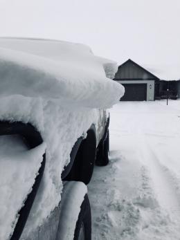
Since yesterday morning the mountains near West Yellowstone and Cooke City got 2-4” of new snow. Elsewhere got 4-6” with 14” of low density snow at Big Sky and 11” in the Bridger Range. Temperatures this morning are single digits to low teens F and will be in the teens today. Overnight, wind was northwest-west at 15-25 mph with gusts of 30-40 mph. Moderate west-northwest wind will continue today. Light snow showers in the mountains through tonight will total 3-5” of low density snow by morning.
Yesterday a cold northwest flow brought 6-14” of low density powder to the mountains near Bozeman and Big Sky, and 2-4” near West Yellowstone and Cooke City. Even where deepest, this snow equals a light .4-.6” of snow water equivalent (SWE). Eric was at Mt. Ellis yesterday and found 10” of powder was easily triggered into dry loose avalanches on steeper slopes (video). Skiers in Hyalite reported soft slabs easily cracked on lower angle terrain, and ski patrols triggered lightweight slabs of new snow. Today, dry loose avalanches and soft slabs of new snow are possible to trigger. These slides won’t be huge, but carry enough force to push a person over cliffs, into trees or other hazards.
The primary avalanche problem to avoid today is drifts of snow 1-3’ deep that formed from strong west-northwest wind. These wind slabs are easy to trigger and could avalanche naturally. They are largest near ridgelines and possible on cross-loaded terrain, convex rolls, below cliffs and along edges of gullies. Avoid steep, wind loaded slopes today.
Wind and snow have formed massive cornices this season. They can easily break under the weight of a person, and new snow and wind loading could break them naturally. Avoid slopes below cornices and keep a far distance back along ridgelines (photo, illustration).
Below the new snow, the snowpack is generally stable and deeper avalanches are unlikely. Doug and I were at Bacon Rind yesterday and found new snow and wind loading the only concern (video). In isolated areas, avalanches breaking in older snow are possible. This weekend, a skier triggered a small slide near Hebgen Lake that broke into snow from last week (photo, photo), and a skier in Hyalite reported a couple large collapses on wind affected terrain. It is always essential to carefully assess the snowpack and practice safe travel habits in avalanche terrain.
Today, strong wind and new snow formed slabs that are easy to trigger and avalanche danger is CONSIDERABLE on wind loaded slopes. Danger is MODERATE on non-wind loaded slopes.
If you get out and have any avalanche or snowpack observations to share, drop a line via our website, email (mtavalanche@gmail.com), phone (406-587-6984), or Instagram (#gnfacobs).
Upcoming Avalanche Education and Events
BOZEMAN
March 7th, Avalanche Awareness, 6-7:30 p.m. @ REI
LIVINGSTON
March 20, Beer for a Cause Night at Katabatic Brewing, 4-8p.m. A dollar from every pint will be donated to The Friends of the Avalanche Center.
COOKE CITY
March 10th, Upper Yellowstone Snowmobile Club Annual Hog Roast, Cooke City, festivities from 7am – 7pm. Schedule Here.
Friday and Saturday, Current Conditions Update and Avalanche Rescue, Friday 6:30-7:30 p.m. at The Soda Butte Lodge. Saturday anytime between 10-2 @ Round Lake.
The snowpack is generally stable below recent snow. Continue the search for instability. Don’t let preconceived notions of stability overshadow evidence of instability. Check out this blog from the F.A.C. about confirmation bias.


