Good Morning. This is Eric Knoff with the Gallatin National Forest Avalanche Advisory issued on Friday, March 16th at 7:00 a.m. Today’s advisory is sponsored by Montana Ale Works and Gallatin County Search and Rescue. This advisory does not apply to operating ski areas.
Over the past 24 hours the Bridger Range picked up 8” of new snow. The Gallatin and Madison Ranges received 4-5” while the mountains around West Yellowstone and Cooke City squeezed out 1-2”. This morning temperatures are in the teens F under partly cloudy skies and winds are blowing 5-20 mph out of the SW. Today, skies will remain partly to mostly cloudy and no new snow is expected. Temps will warm into the 20’s to low 30’s and winds will remain light to moderate out of the SW. Snow moves back into the area tonight. The southern ranges could see 1-2” by tomorrow morning while the northern areas will remain dry. Snow intensifies tomorrow and the mountains could see 6-10” by Sunday.

Yesterday turned out to be snowier than expected. The Bridger Range received 8-10” of new snow, totaling 1.25” of SWE. The Madison and Gallatin Ranges received 5-6” of new snow, putting storm totals at 0.7-1” of SWE. The new snow bonded well to the old snow surface at the beginning of the storm, but became increasingly unstable as it accumulated throughout the day. The Big Sky Ski Patrol reported the formation of touchy soft slabs, mainly in wind loaded terrain. Bridger Bowl Ski Patrol also reported sensitive conditions, which caused them to close the Ridge at 1:30 pm.
Clear and calm conditions overnight have allowed the new snow a chance to stabilize. Although conditions won’t be as active today, wind slabs that formed yesterday will still be possible to trigger. Wind slabs exist mainly in leeward terrain favored by southwest winds. Dry loose avalanches will also be possible in steep terrain. Today it will be important to assess snowpack and terrain carefully before jumping onto avalanche prone slopes.
An additional problem could be the formation of wet loose avalanches. If temperatures rise above freezing and/or the sun comes out, the new snow will lose strength quickly, making wet loose avalanches possible on steeper slopes (photo, photo). Roller balls and small point releases are obvious clues that surface layers are destabilizing. If these signs of instability are observed, it’s time to move away from steep terrain or seek shadier aspects.
Today, the dry snow avalanche hazard is rated MODERATE since wind slabs and dry loose avalanches will be possible to trigger. The wet snow danger will start out LOW, but could rise to MODERATE by this afternoon.

The mountains around Cooke City and West Yellowstone only picked up 2-3” out of the last storm system. The new snow boned well to the old snow surface and did little to increase the avalanche hazard. Yesterday, Alex rode in the Lionhead area near West Yellowstone and found stable conditions (video). This is consistent with what I found in Cooke City a few days ago (video).
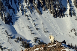
Although the snowpack is generally stable, there will be a few avalanche problems to look out for. If the sun comes out, small wet loose avalanches will be possible on steep, sun exposed slopes. Given the light amount of new snow, these won’t be large, but something to keep an eye out for. Cornices are also potential hazard. These monsters can fail naturally or from the weight of a single person. Watch for and avoid large cornices above and below the ridgelines (photo, photo).
Today, natural and human triggered avalanches are unlikely and avalanche danger is rated LOW.
If you get out and have any avalanche or snowpack observations to share, drop a line via our website, email (mtavalanche@gmail.com), phone (406-587-6984), or Instagram (#gnfacobs).
Upcoming Avalanche Education and Events
LIVINGSTON
March 20, Beer for a Cause Night at Katabatic Brewing, 4-8p.m. A dollar from every pint will be donated to The Friends of the Avalanche Center.
Alex and Eric wrote up a one-page accident report on the avalanche that caught a snowmobiler on Kirkwood Ridge in the southern Madison Range on March 7th that is worth looking at: accident report, video.