Good Morning. This is Eric Knoff with early season avalanche and weather information from the Gallatin National Forest Avalanche Center on Saturday, November 17th. This bulletin is sponsored by The Friends of the Avalanche Center and Yellowstone Arctic Yamaha and will be updated as conditions change.
Since yesterday morning the mountains near Bozeman and Big Sky picked up 5-7” of new snow while the mountains around West Yellowstone and Cooke City received 2-3”. During the storm winds blew 20-35 mph out of the W-NW, but decreased overnight and are currently blowing 5-10 mph out of the N-NE. The exception is the Bridger Range which has ridgetop winds blowing 10-15 mph from the due east. Temps this morning range from the single digits in the north to low teens in the south. Today, skies will be partly cloudy, winds will blow 5-15 mph out of the N-NE, and temps will warm into the upper teens to low 20s F. A building ridge of high pressure will produce nice weather through the weekend.

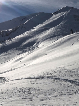
Winter has returned and so has the increased potential for triggering avalanches. The mountains around Bozeman and Big Sky were favored by the recent storm and will be the most likely to produce unstable conditions. The mountains around West Yellowstone and Cooke City didn’t pick up as much snow, but could still produce isolated areas of instability. The most suspect slopes across the advisory area will be those with wind drifted snow (photo, photo).
Winds decreased overnight, but blew hard during the onset of the storm. Upper elevation slopes leeward to west-northwest winds will be likely areas to encounter fresh wind slabs. In the Bridger Range, winds shifted to the east which could produce isolated areas of wind drifted snow on the west side of the ridge. Wind slabs won’t be exceptionally large, but will be touchy to human triggers. Even small slides can have severe consequences, especially when associated with terrain traps such as gullies, trees, or rock bands. This problem can be mitigated by making conservative terrain selections and assessing the snowpack carefully.
Dry loose avalanches will be another problem to look out for on steep slopes. On sunny aspects, the new snow was deposited on a thin ice crust that formed prior to the storm. This crust will make a smooth surface for the new slide. These slides won’t entrain a large volume of snow, but could pack enough punch to knock you over or push you into unfavorable terrain. Fortunately, avalanche activity will stay confined to new and wind-blown snow as the underlying snowpack is generally stable (video).
Check out new hyperlinks to the Weather and Avalanche Log and a new Menu item <Avalanches and SnowPits> with information on avalanche activity and incidents.
If you get outside send us an observation via our website, email (mtavalanche@gmail.com), phone (406-587-6984), or Instagram (#gnfacobs).
Upcoming Avalanche Education and Events
Our education calendar is full of awareness lectures and field courses. Check it out: Events and Education Calendar.
November 26, MSU Snow and Avalanche Workshop, 5-9pm at MSU SUB Ballroom A
November 29, 30 and Dec 1, 2or 8, Intro to Avalanche w/ Field Day, more info here
Every Friday and Saturday in Cooke City starting November 23 and 24, Free Rescue training and Snowpack update, exact locations TBD
Practice with your rescue gear, and test your partner’s skills. Put fresh batteries in your beacon and check your shovel and probe for any damage, and replace them if needed.