Good Morning. This is Doug Chabot with the Gallatin National Forest Avalanche Forecast issued on Wednesday, December 5th at 6:45 a.m. This forecast is sponsored by Spark R&D and Bridger Bowl, and does not apply to operating ski areas.
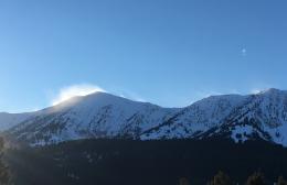
There’s no new snow to report, just clear skies and pre-dawn temperatures from zero to 10F. Winds are blowing westerly at 20-30 mph around Bozeman and Big Sky and 10-15 mph near West Yellowstone and Cooke City. Today will be sunny and mountain temperatures will rise into the high teens before plummeting to near -10F tonight. Brrr. Better plug in the car.

Yesterday’s wind was perfect for moving snow at all elevations and aspects. It loaded snow onto slopes at a fast rate and avalanched both naturally and from skiers. The slides were confined to the new windblown snow, 12-18” thick at its deepest, but enough to bury a person or push them into deadly terrain. We received a few reports, all with pictures, that are detailed on our avalanche activity page. A recap:
- Alex made a short video of wind-loading in the Bridger Range which is worth watching.
- Skiers triggered a wind slab in Beehive Basin (report).
- Skiers triggered wind slabs in Maid of the Mist Cirque in Hyalite (report).
- Natural avalanches were seen in Divide Basin in Hyalite (report).
Winds are decreasing but drifting will still occur. There are many wind-loaded slopes and gullies that are ripe to be triggered by a passing skier, sledder or post-holing ice-climber. Extra caution is advised for all ice climbers attending the Bozeman Ice Festival. The steep gullies up Hyalite need to be crossed and ascended with caution. Turn around at the first sign of cracking. For today, the avalanche danger is rated CONSIDERABLE on all wind-loaded slopes and MODERATE on all others.

The Lionhead area has weak snow on the ground (faceted, sugary grains) that is a source of concern. I don’t trust that it will unconditionally support the new snow and wind-loading from the last 7 days. Alex visited last week and found a very weak snow structure (video). For today, the avalanche danger is rated MODERATE since it is possible to trigger avalanches, especially near the ridgelines where the snow is deepest.
The southern Madison, southern Gallatin and mountains outside Cooke City received wind-loading yesterday that is the primary concern today. Recently formed wind slabs could be triggered by a skier or snowmobiler. Because the snowpack around Cooke City is generally strong, I do not expect avalanches to break on deeper, older layers.
Eric and I rode into Taylor Fork yesterday and didn’t hit any rocks or get the sleds stuck. We were pleasantly surprised to find 2.5 feet of supportable snow. Our stability test showed a concern at the interface between the old snow (facets and an ice-crust) and newer snow that fell in the last 7 days. His video outlines both the snowpack’s strength and weakness. For today the avalanche danger is rated MODERATE on wind-loaded slopes and LOW on all others.
Eric will issue the next advisory tomorrow morning by 7:30 a.m. If you get out and have any avalanche or snowpack observations to share, contact us via our website, email (mtavalanche@gmail.com), phone (406-587-6984), or Instagram (#gnfacobs).
Upcoming Avalanche Education and Events
Our education calendar is full of awareness lectures and field courses. Check it out: Events and Education Calendar.
BOZEMAN
TONIGHT, December 5, 1-hr Avalanche Awareness, 6-7 p.m. at REI, Bozeman.
December 6, 1-hr Avalanche Awareness and Beacon Practice, 6:30-8 p.m. at Story Mill Park.
December 7 and 9, Beacon Park for the Bozeman Ice Fest, Grotto Falls parking lot, Hyalite Canyon, 10 a.m. to 2 p.m.
December 11 and 12, Snowmobile Intro to Avalanches w/Field, Holiday Inn, West Yellowstone; more info here.
December 12, 1-hr Avalanche Awareness for Snowmobilers, 6-7 p.m. at Yellowstone Motorsports, Bozeman.
December 13, 1-hr Avalanche Awareness, 6-7 p.m. at Play It Again Sports, Bozeman.
HELENA
December 12, 1-hr Avalanche Awareness, 6-7 p.m. at The Basecamp, Helena.
COOKE CITY
Every Friday and Saturday, Rescue Training and Snowpack Update. Friday 6:30-7:30 p.m. at the Soda Butte Lodge. Saturday anytime between 10-2 @ Round Lake.
Check out our new “Avalanches and Snowpits” menu item where we list all the reported avalanche activity.