Good Morning. This is Alex Marienthal with the Gallatin National Forest Avalanche Forecast issued on Monday, December 10th at 7:00 a.m. Today’s forecast is sponsored by Yellowstone Arctic Yamaha and The Friends of The Avalanche Center. This forecast does not apply to operating ski areas.
This morning the mountains have no new snow. Temperatures are mid-20s to 30 F at ridgetops and low teens F at lower elevations. Wind overnight was west to southwest at 10-20 mph with gusts of 30-35 mph. Today, wind will be southwest at 10-15 mph with gusts of 20-30 mph and temperatures will be mid-20s to low 30s F. Increasing cloud cover through the day will be followed by snow showers overnight with 2-4” possible by morning. More snow is expected Tuesday night and Wednesday.

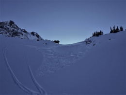
Doug rode in the mountains near Cooke City yesterday and dug multiple snowpits. He found 2.5 to 4 feet of stable snow (video, photo), and saw a couple small avalanches from last week (photo, photo). The snowpack near Bozeman and Big Sky is similarly deep and generally stable (videos and snowpits). Near West Yellowstone the snowpack is 1-2 feet deep, sugary and weak (video). Avalanche activity last week was confined to small slides of new and wind-drifted snow (Avalanche Activity), and the mountains have not had new snow or wind-loading since last Tuesday.
Isolated areas of unstable snow are possible where small slabs of wind-drifted snow formed on top of weak, low density snow (photo). Ice climbers triggered a small wind slab in Hyalite on Friday (photo), and yesterday skiers out-of-bounds near Bridger found an 8” wind slab that collapsed and propagated with eleven taps in their stability tests (unstable test result) (video). Be cautious of wind loaded slopes and assess terrain for consequences of being caught in even a small slide. A lack of recent snow and wind, and a generally stable snowpack make avalanches unlikely to be triggered today, and avalanche danger is rated LOW.
Check out our recent videos and snowpit profiles on our website for a snapshot of the snowpack structure across our advisory area.
If you get out and have any avalanche or snowpack observations to share, contact us via our website, email (mtavalanche@gmail.com), phone (406-587-6984), or Instagram (#gnfacobs).
Upcoming Avalanche Education and Events
Our education calendar is full of awareness lectures and field courses. Check it out: Events and Education Calendar.
West Yellowstone
Today! December 10 and 11, Snowmobile Intro to Avalanches w/Field, Holiday Inn, West Yellowstone; more info here.
BOZEMAN
December 12, 1-hr Avalanche Awareness for Snowmobilers, 6-7 p.m. at Yellowstone Motorsports, Bozeman.
December 13, 1-hr Avalanche Awareness, 6-7 p.m. at Play It Again Sports, Bozeman.
HELENA
December 12, 1-hr Avalanche Awareness, 6-7 p.m. at The Basecamp, Helena.
COOKE CITY
Every Friday and Saturday, Rescue Training and Snowpack Update. Friday 6:30-7:30 p.m. at the Soda Butte Lodge. Saturday anytime between 10-2 @ Round Lake.
Check out our new “Avalanches and Snowpits” menu item where we list all the reported avalanche activity.