Good Morning. This is Alex Marienthal with the Gallatin National Forest Avalanche Forecast on Sunday, December 29th at 7:00 a.m. Today’s forecast is sponsored by Grizzly Outfitters and World Boards. This forecast does not apply to operating ski areas.
Early yesterday morning the Bridger Range got 4” of near zero percent (0.5%) density snow. Elsewhere received no new snow. Yesterday wind was light out of the north-northwest. Overnight, wind shifted south-southwest at 5-10 mph with gusts over 20 mph. This morning temperatures are single digits below and above zero F. Today, under partly cloudy skies temperatures will be in the teens F and wind will be west-southwest at 5-15 mph. A few scattered snowflakes are possible, but no measurable snowfall is expected until early Wednesday.

In the mountains near Cooke City human triggered and natural avalanches were reported each of the last four weekends (Dec 7, Dec 13, Dec 14, Dec 14, Dec 22, Dec 27). These avalanches broke deep and wide on buried weak layers. They show a poor snowpack structure exists, and large, deadly avalanches are possible to trigger. See recent photos and videos on the regional page to see what is possible if you hit the wrong spot on a steep slope.
For the last couple weeks snowfall and wind have added minimal load to the snowpack. This allowed the snowpack to gain stability which means there are no warning signs like natural avalanches or collapsing. Multiple riders can make tracks on a slope before someone hits a weaker spot and triggers a large avalanche. Do not let tracks fool you into thinking a slope is safe. Carefully evaluate the snowpack and consequences of a slide before riding on steep slopes. Avalanche danger is MODERATE.
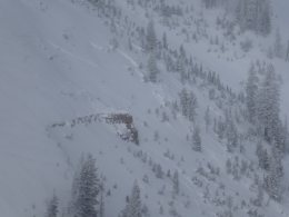
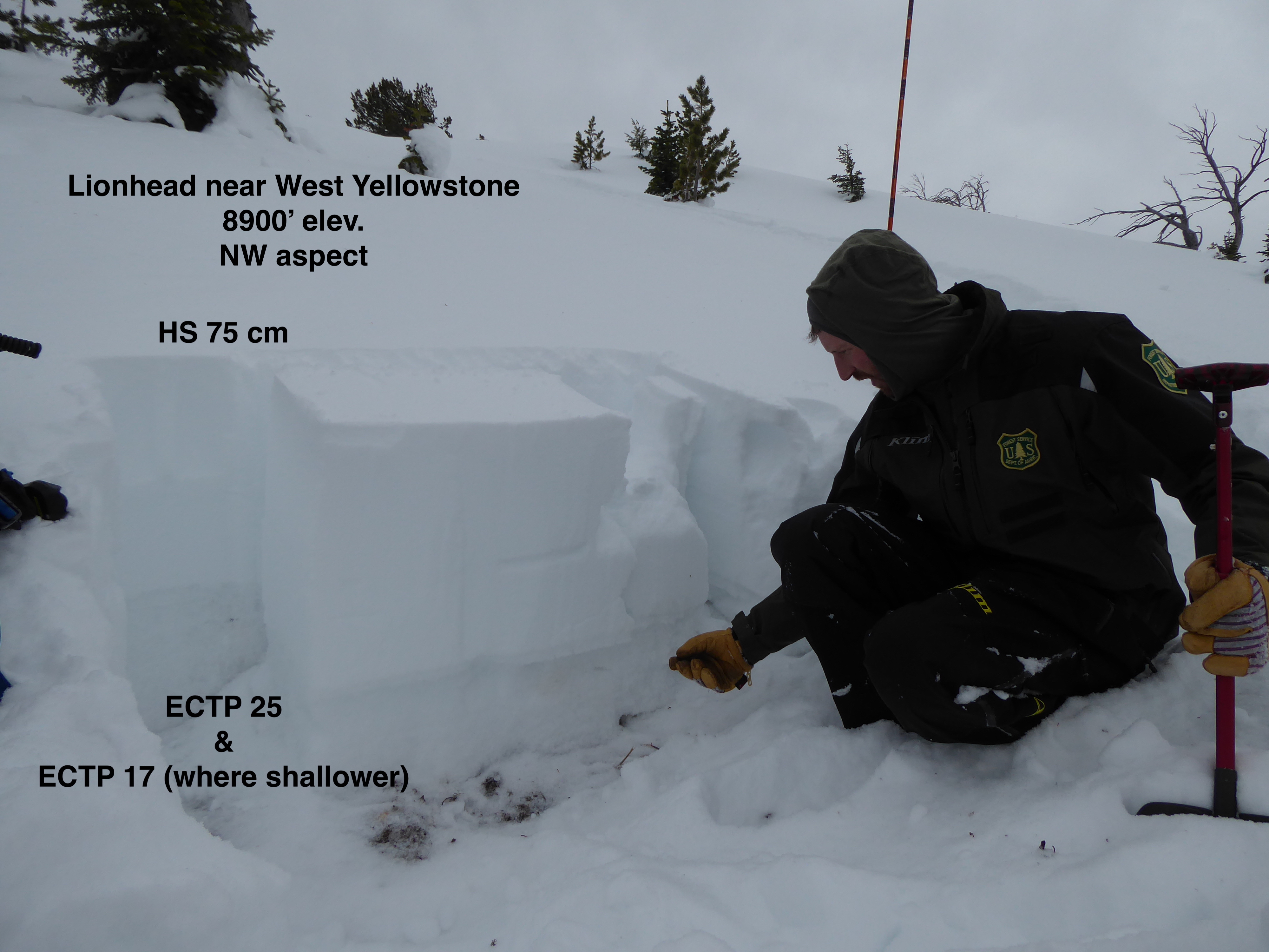
Near Big Sky and West Yellowstone the snowpack is supported by layers of sugary, weak snow that make large avalanches possible to trigger (video, photo). The snowpack has adjusted to the weight of previous snowfall, but a weak layer could collapse and release an avalanche across an entire slope if a person hits the wrong spot (video). Either avoid avalanche terrain, or carefully evaluate the snowpack and terrain before riding steep slopes. Your homework is to review media on our regional pages to see what the unstable snowpack looks like and where you are most likely to find it (Lionhead page, N. Madison page). Today buried weak layers make avalanches possible to trigger and avalanche danger is MODERATE.

In the mountains near Bozeman potential avalanches are confined to fresh drifts of snow. Otherwise the snowpack is generally stable and deeper avalanches are not likely. Light to moderate winds formed fresh drifts with yesterday’s low density snow. These drifts are probably shallow and present minimal hazard, but should be carefully evaluated. Look for cracking under your skis as a sign fresh drifts are unstable. Avoid slopes where fresh drifts appear large or where slides could push you into hazards like trees or cliffs. Avalanche danger is LOW.
Upcoming Avalanche Education and Events
Our education calendar is full of awareness lectures and field courses. Check it out and plan to attend one or two: Events and Education Calendar.
COOKE CITY
Every Friday and Saturday, Snowpack Update and Rescue Training. Friday, 6:30-7:30 p.m. at the Soda Butte Lodge. Saturday anytime between 10-2 @ Round Lake.
WEST YELLOWSTONE
January 4, 1-hr Avalanche Awareness, 7-8 p.m. at West Yellowstone Holiday Inn.
January 25, 1-hr Avalanche Awareness, 7-8 p.m. at West Yellowstone Holiday Inn.
BOZEMAN
January 7, Women's Specific Avalanche Awareness + Beacons, 6-8 p.m. at Story Mill.
January 8, 1-hr Avalanche Awareness, 6-7 p.m. at REI.
January 10 & 11, Companion Rescue Clinic, 6-8 p.m. on the 10th at REI and 10-2 p.m. on the 11th at History Rock. More info and Register Here.
January 15 and 16, Introduction to Avalanche w/ Field Course, evenings of January 15 & 16 plus one field day either January 18, 19 or 25. Snowmobile specific field day offered January 25. More info and Register Here.
The Lionhead Weather Station is up and running! You can access the data here.