Good Morning. This is Ian Hoyer with the Gallatin National Forest Avalanche Forecast on Saturday, February 8th at 7:15 a.m. Today’s forecast is sponsored by Montana State Parks and Cooke City Motorsports. This forecast does not apply to operating ski areas.
This morning there are 6” of new snow in Cooke City and 2-3” across the rest of the advisory area. Southwest and west winds are 10-30 mph with gusts of 30-50 mph overnight. Temperatures this morning are in the 20s F. A cold front today will bring snowfall, strong winds, and temperatures dropping though the day. Expect 6-8” by tomorrow morning near Bozeman, Big Sky and Cooke City and 2-4” near West Yellowstone.

Both natural and human triggered avalanches are likely today. The snowfall rate backed off yesterday, which allowed us to drop the avalanche warning, but conditions remain very dangerous. Strong winds overnight continued to load many slopes, keeping them at their breaking point. More snow and strong winds are on tap today. We could see periods of heavy snowfall accompanying the cold front passage.
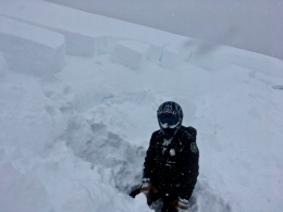
Yesterday, Alex saw three natural avalanches on mid-elevation slopes north of Bridger Bowl (details). These avalanches broke 3 ft deep beneath the new snow. Since this storm began on Wednesday, avalanches have been breaking deep, running long distances, and breaking trees (details).
The widespread weak layers near the ground have just gotten a very large load and haven’t had time to adjust. Avalanches may break 10 or more feet deep (video). There is nothing manageable about these deep slab avalanches. If you trigger one, it most likely won’t have a good outcome.
This is not the day to push it. Keep off of and out from under any steep slope. With heavy snowfall at low elevations, expect avalanches in unusual places. Watch out for gullies and road cuts that you normally don’t think twice about. With so much fresh snow, even a small slope could avalanche deep enough to bury someone. Don’t let your guard down. Be on alert from the minute you leave the car this morning until you get back to it at the end of the day.
The danger is rated HIGH on windloaded slopes, CONSIDERABLE on all other slopes.

Cooke City has less storm snow than the rest of the advisory area, but with another 6” this morning it is starting to catch up and strong wind gusts have built deep drifts. With continued snowfall and strong winds today, human triggered avalanches are likely. Avalanches can break in wind drifts or on weak layers near the ground. The combination of poor visibility, strong winds, new snow, and weak layers deep in the snowpack should keep you on your toes and off of steep slopes. For today, the avalanche danger is rated CONSIDERABLE.
If you get out, please send us your observations no matter how brief. You can fill out an observation form, email us (mtavalanche@gmail.com), leave a VM at 406-587-6984, or Instagram (#gnfacobs).
Upcoming Avalanche Education and Events
Our education calendar is full of awareness lectures and field courses. Check it out and plan to attend one or two: Events and Education Calendar.
COOKE CITY
Every Friday and Saturday, Snowpack Update and Rescue Training. Friday, 6:30-7:30 p.m. at the Soda Butte Lodge. Saturday anytime between 10-2 @ Round Lake.
BOZEMAN
February 10, 1-hr Avalanche Awareness. 5:30 p.m. at Gallatin Valley YMCA.
WEST YELLOWSTONE
TONIGHT! February 8, 1-hr Avalanche Awareness, 7-8 p.m. at West Yellowstone Holiday Inn.
Make it a daily habit to check out our Weather and Avalanche Log. It’s a great way to get a quick snapshot of what’s been happening in the backcountry.