Good Morning. This is Ian Hoyer with the Gallatin National Forest Avalanche Forecast on Valentine’s Day, Friday, February 14th at 7:15 a.m. Today’s forecast is sponsored by our Valentines, Leila, Nina, Amy and Allyson. This forecast does not apply to operating ski areas.
Last night winds picked up with gusts of 30-60 mph out of the south and west. These strong and gusty winds will continue today as a cold front passes through. Temperatures are in the teens to mid-20s F. and will stay fairly constant through the day under mostly cloudy skies. There is no new snow this morning. Periods of snowfall today will leave 1-2 inches by this afternoon and 2-4 inches by tomorrow morning.

All Regions
Strong winds and plenty of soft snow available for transport have created fresh wind drifts. These drifts can break several feet deep with the weight of a skier or rider today. Watch out for these drifts near ridgelines, in cross-loaded gullies, and downwind of tree islands. Steer clear of these drifts to avoid getting surprised by a slide. If you feel the snow stiffening under your feet or see cracks shooting out in front of your skis/sled, you’ve found one of these potentially dangerous drifts. Stop. Reevaluate. And then move to a less wind affected slope.
Larger, deeper avalanches also remain possible on weak layers near the ground. Yesterday, a snowmobiler triggered a slide on a small slope near Buck Ridge completely burying his snowmobile while he luckily stayed on top (photo). The debris piled up 12-15 ft deep in a creek drainage. On Wednesday, skiers on Garnet Mountain triggered two avalanches that broke up to 4 ft deep on the weak, faceted, snow at the ground (photo). These slides were triggered from a thin area 15 ft away on slightly lower angled terrain.
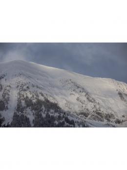
Over the last two days I covered a lot of ground riding near Cooke City and only saw evidence of one avalanche that broke last weekend (video). This fits with reports we’ve gotten from around the region (there have only been a few slides reported since last Sunday) and makes me cautiously optimistic about the snowpack. As we get further out from the last storm, it’s becoming less likely that you’ll trigger a deeper avalanche. However, the handful of recent slides demonstrate that the possibility is still out there.
Good travel practices remain key: always ride with a partner, only expose one person at a time to steep slopes, and always carry rescue gear (beacon, shovel, and probe). Tilt the odds in your favor by avoiding freshly windloaded slopes and staying away from thin areas that are likely triggering spots.
The avalanche danger is MODERATE today across our forecast area.
If you get out, please send us your observations no matter how brief. You can fill out an observation form, email us (mtavalanche@gmail.com), leave a VM at 406-587-6984, or Instagram (#gnfacobs).
Upcoming Avalanche Education and Events
Our education calendar is full of awareness lectures and field courses. Check it out and plan to attend one or two: Events and Education Calendar.
COOKE CITY
Every Friday and Saturday, Snowpack Update and Rescue Training. Friday, 6:30-7:30 p.m. at the Soda Butte Lodge. Saturday anytime between 10-2 @ Round Lake.
BOZEMAN
March 4, 1-hr Avalanche Awareness. 6-7 p.m. at REI.
WEST YELLOWSTONE
February 22, 1-hr Avalanche Awareness. 7-8 p.m. at West Yellowstone Holiday Inn.
Is ski cutting a tool you use to manage avalanche hazard? This video by Bruce Jamieson lays out ways to reduce the risk and also why you might want to think twice before ski cutting in the backcountry, especially with the snowpack we have this year where deep slab avalanches are a possibility.