Good Morning. This is Dave Zinn with the Gallatin National Forest Avalanche Forecast on Monday, March 15th at 7:15 a.m. Today’s forecast is sponsored by Gallatin County Search and Rescue and the Montana Backcountry Alliance. This forecast does not apply to operating ski areas.
This morning winds are from the west to southwest at 5-10 mph, mountain temperatures are in the upper 20s F and there is no new snow. Today, temperatures will climb into the upper 30s to lower 40s F, winds will be 5-10 from the west shifting to the north, clouds will increase, and by morning Cooke City will get 1-2” of new snow with a trace through the remainder of the advisory area.

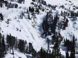
Several isolated avalanche concerns remain in the mountains around Bozeman, Big Sky, and West Yellowstone. Small wind-slabs or drifts of snow can avalanche under the weight of a skier or rider. Yesterday, my partner and I saw these in the Northern Bridger Range, skiers noted them around Beehive Peak, and the Big Sky Ski Patrol triggered a slab that broke up to 18” deep during avalanche mitigation work. These avalanches are likely too small to bury someone but would be dangerous in extreme or technical terrain.
Water in the snowpack on slopes getting baked by the sun on warm days causes the snow to lose cohesion and slide downhill. If you sink deeper than mid-boot level into wet or slushy snow, move to a shadier aspect, a higher elevation, or call it a day. As I outlined in my video from the Northern Bridgers yesterday and Ian showed in Specimen creek last week, these are often aspect and elevation-driven events. Increasing cloud cover will minimize this danger today.
Finally, I had a stability test fail near the ground yesterday (snowpit profile) and Doug had a massive slab fall in his lap in Tepee Basin last week. Large avalanches failing on weak snow near the ground are unlikely but we cannot put these deeply buried weak layers out of our mind. Assess the snowpack and rigorously follow standard safe travel practices.
Human-triggered avalanches are unlikely and the danger is rated LOW.
Generally, safe avalanche conditions exist in Cooke City. If you are considering more adventurous terrain selection, keep a few things in mind. Small slab avalanches (photo, photo, video) and loose, wet snow avalanches if it warms up and stays sunny (photo) can have severe consequences in steep terrain. Skiers and riders have encountered both of these isolated issues within the last week. Large cornices have collapsed recently. A group climbing a couloir on Abiathar was nearly hit by vehicle-sized chunks “raining down” on them (details). Skiers also observed a recent cornice collapse on Mount Fox. Avalanches are unlikely today and the danger is rated LOW.
If you get out, please send us your observations no matter how brief. You can submit them via our website, email (mtavalanche@gmail.com), phone (406-587-6984), or Instagram (#gnfacobs).
Upcoming Avalanche Education and Events
See our education calendar for an up-to-date list of all local classes. Here are a few select upcoming events and opportunities to check out:
March 20, 5:30 p.m., Snowpack Update for Bozeman Splitfest, online Link to Join HERE
March 24, 6 p.m., Free 1-Hour Avalanche Awareness, online Link to Join HERE
March 29, 6 p.m., Free 1-Hour Avalanche Awareness, online Link to Join HERE
The University of Nevada, Reno School of Medicine and Montana State University are doing a brief survey to learn if and how the use of the winter backcountry has changed due to the coronavirus pandemic. The 5-minute survey is HERE.