Good Morning. This is Doug Chabot with the Gallatin National Forest Avalanche Forecast on Wednesday, March 31st at 7:00 a.m. Today’s forecast is sponsored by Bridger Bowl and Blitz Motorsports and Yamaha. This forecast does not apply to operating ski areas.
Under clear skies temperatures are in the single digits F and wind is blowing westerly at 10-30 mph, except in the Bridger Range where it is 30-50 mph. Early yesterday morning the Bridger Range got 3” of low density snow. Today will be sunny, wind will remain westerly and taper off to 10-20 mph. Daytime temperatures will reach the high 30s and fall into the 20s tonight. Clear skies and warming temperatures are the dominant weather heading into Easter weekend.

All Regions
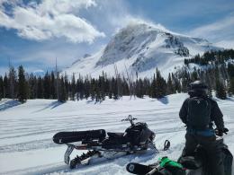
The snowpack throughout our advisory area is a mixed bag of conditions: powdery or windblown up high, mashed potatoes down low. The chances of triggering an avalanche is decreasing without a load of new snow or active wind-loading, but it still remains possible. There was natural avalanche activity on wind-loaded slopes Sunday and Monday. Winds hit 100 mph Sunday night and felled trees which Ian and Dave had to lumberjack through to get into Taylor Fork yesterday. They found recent avalanches in Sunlight Basin (photo) and Sage (photo), and caution us that we can still trigger wind slabs (video).
Deeper in the snowpack are sugary facets (depth hoar) near the ground. Over the weekend a skier triggered an 8-10’ deep avalanche on this layer on Mt Blackmore (photos and details), and another deep slide was seen in Flanders Creek (photo) and MacAtee Basin (photo and details). This layer has been a non-stop worry since November and these slides illustrate that being worried is still warranted.
The sun will be strong today, but wind and cool temperatures will temper wet avalanches from getting big. On sunny slopes expect small, loose, wet slides in the top few inches of the snowpack.
Being outside on a beautiful day will feel wonderful, but has no bearing on snowpack stability. Wind-loaded slopes can still be triggered. Before you commit to avalanche terrain dig down a couple feet and confirm there is not an unstable layer underfoot. Overall, triggering slides remains possible and if you are extra unlucky, they could break deep. Today the avalanche danger is rated MODERATE on all slopes.
If you get out, please send us your observations no matter how brief. You can submit them via our website, email (mtavalanche@gmail.com), phone (406-587-6984), or Instagram (#gnfacobs).
Upcoming Avalanche Education and Events
See our education calendar for an up-to-date list of all local classes. Here are a few select upcoming events and opportunities to check out:
April 5, 6:30 p.m., Forecaster Chat with Alex Marienthal, hosted by Uphill Pursuits, “Spring Snowpack and Forecasting Tools”. Link to Join.
This French video of a skier triggered avalanche, burial and rescue is unbelievable and worth 5 minutes of your time. Multiple GoPro cameras caught the action and you’ll watch a successful partner rescue unfold. The takeaway is simple: practice. There’s no shortcut to being a honed partner.