Good Morning. This is Ian Hoyer with the Gallatin National Forest Avalanche Forecast on Saturday, December 18th at 7:00 a.m. This information is sponsored by Uphill Pursuits and World Boards. This forecast does not apply to operating ski areas.
Bridger Bowl will be closed to uphill travel at dark on Sunday (12/19). Please stay off the hill after Sunday as they prepare to open Tuesday (12/21). Thank you.
The Southern Madison Range squeezed out 2” of snow as the storm finished up yesterday morning while the rest of the area remained dry. Winds are 15-20 mph out of the southwest to northwest with gusts of 30-50 mph. Temperatures are in the single digits to teens F this morning and will rise into the teens and 20s F. Moderate westerly winds will continue today with strong gusts. Skies will be partly sunny in the north and increasingly cloudy as you go south. A few snow showers are possible tonight with more substantial snowfall returning Sunday night.

The primary avalanche concern today is triggering a slide in a wind drift of recent snow. With multiple rounds of strong winds and snowfall over the last week, avalanches could break anywhere from 6 inches to 4 ft deep and may even break on slopes that haven’t been wind-loaded.
This week, skiers and snowmobilers have triggered avalanches across the advisory area from the Bridger Range (photos and details) down to near West Yellowstone (Bacon Rind photo, Taylor Fork video). Now that snowfall has ended, triggering slides has become somewhat less likely, but remains a possibility.
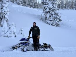
Yesterday, Alex was at Two Top south of West Yellowstone (while outside of the advisory area it is near Lionhead and has a similar snowpack). He found a snowpack that appeared to have handled the 3 ft of new snow well, but was still cautious of deeper drifts (video).
You are less likely to see obvious signs of instability today, so if you’re planning on riding steeper slopes, dig to evaluate how well the new snow has bonded to the old and also look for deeper weak layers.
Skiers or riders triggering avalanches is possible today and the avalanche danger is MODERATE.
Near Cooke City, you could trigger an avalanche 1-3 ft deep in wind-drifted snow from the last week. On Wednesday, snowmobilers triggered a 75-100 ft wide slab near Goose lake (details). Watch out for wind-loaded slopes and either avoid them or dig to make sure that the drifts are well bonded. Avalanches are unlikely on non-windloaded slopes.
The avalanche danger is MODERATE on wind-loaded slopes and LOW on all others.
If you get out, please send us your observations no matter how brief. You can submit them via our website, email (mtavalanche@gmail.com), phone (406-587-6984), or Instagram (#gnfacobs).
Upcoming Education Opportunities:
Get your avalanche brain ready for the season at one of the many classes listed on our education calendar, and list of upcoming events below. Don’t delay preparing and inspecting your avalanche gear. Get some tips from Dave Zinn in this Pre-Season gear check video.
Every Saturday near Cooke City, 10a.m.-3p.m. FREE snowpack update and transceiver/rescue training. Stop by for 20 minutes or more at the Round Lake Warming Hut.
Friends of GNFAC Powder Blast Fundraiser
The Friends of the Avalanche Center are hosting the Virtual Powder Blast fundraiser. With only $2,000 left to go, help us reach the $65,000 goal. Your donations support free and low-cost avalanche education, beacon checkers at trailheads, beacon parks, weather stations, and GNFAC programs!
Sadly, yesterday two teenagers died in an avalanche outside of Driggs, Idaho in the Big Hole Mountains. Details so far are sparse, but initial reports are that they were both skiing and snowmobiling (Link to news story).