Good morning. This is Doug Chabot with the Gallatin National Forest Avalanche Forecast on Wednesday, January 19th at 7:00 a.m. This information is sponsored by Beartooth Powder Guides, Montana Backcountry Alliance and Werner Wealth Management (Advisors with DA Davidson). This forecast does not apply to operating ski areas.
Bozeman got more snow (4+”) than the mountains. At 6 a.m. the mountains from Bozeman to Big Sky and West Yellowstone have a trace to 2” of snow while in the last 24 hours Cooke City received 3”. Wind is west to northwest at 10-15 mph with gusts of 30 mph. Temperatures are in the mid teens F. The storm will drop another inch or two in the mountains before ending this morning. Wind will be westerly at 10-20 mph and temperatures won’t warm much. Another round of snow is expected Thursday night.

All Regions
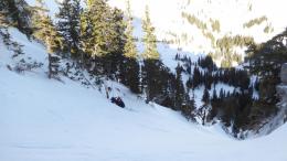
A few inches of new snow is not enough weight to adversely affect the stability of the snowpack. Wind at the ridgeline may create thin pockets of drifted snow, but these won’t be deep or widespread. Yesterday, Ian and his partner toured up Flanders drainage in Hyalite. They dug a snowpit on a slope adjacent to where they were planning to ski and got unstable test results, which is not what they were expecting (video). He said, “I’d much rather get surprised in my snowpit than surprised by an avalanche.” This is why we dig, even when avalanches are unlikely. Knowing what’s under our feet is critical information.
South of Big Sky to West Yellowstone and Cooke City, the snowpack is stable but we just buried a new weak layer, a future problem. Feathery crystals of surface hoar that formed during clear nights (photo) are now 1-3” under the snow surface. Alex is in Cooke City and confirmed they are now buried and preserved (photo, video). Yesterday, I found them under the surface in Lionhead near West Yellowstone (video). Their distribution is widespread at most elevations and aspects in the southern mountains. This specific weak layer is resistant to strengthening and can remain a problem for a month or more. I expect avalanches on this layer once we get more snow, but not today.
The basics of avalanche safety never get old, they keep us trained and focused. Carry rescue gear, practice with it, only expose one person at a time on a slope and dig and test before committing to avalanche terrain. Today the avalanche danger is rated LOW on all slopes in the forecast area since avalanches are unlikely.
If you get out, please send us your observations no matter how brief. You can submit them via our website, email (mtavalanche@gmail.com), phone (406-587-6984), or Instagram (#gnfacobs).
Upcoming Education Opportunities
The West Yellowstone Beacon Park is up and running! Stop by to check it out and practice with your rescue gear.
See our education calendar for an up-to-date list of all local classes. Here are a few select upcoming events and opportunities to check out:
January 20 + Field Day. Our popular Avalanche Fundamentals with Field Course is perfect as a refresher or an introduction to avalanches. We are introducing a new format with four pre-recorded lectures to watch at your convenience, a live question and answer session, and a choice of a snowmobile or ski/ board-based field day occurring the following two weekends.
Every Saturday near Cooke City, 10 a.m.-3 p.m. FREE snowpack update and transceiver/rescue training. Stop by for 20 minutes or more at the Round Lake Warming Hut.
The Bozeman Daily Chronicle ran a story on a-day-in-the-life of an avalanche forecaster that highlighted Dave Zinn.