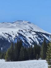
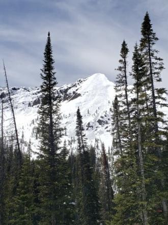
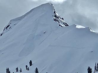
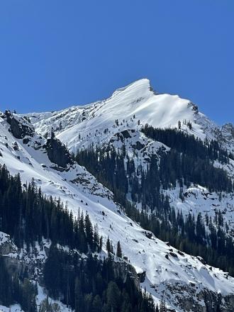
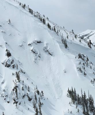
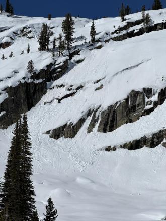
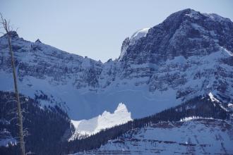
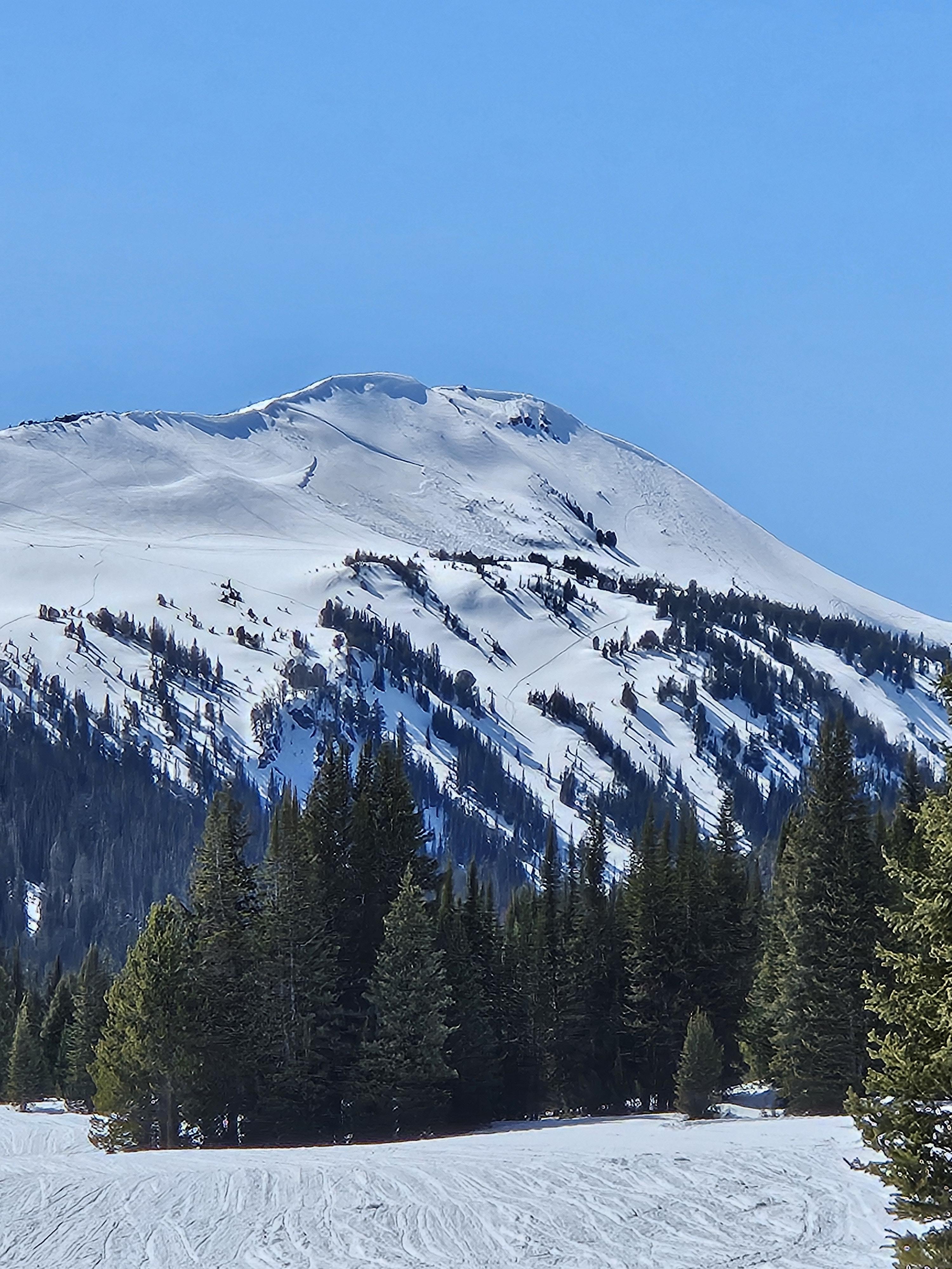
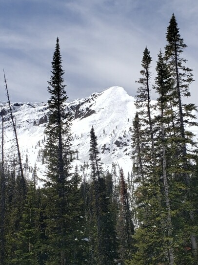
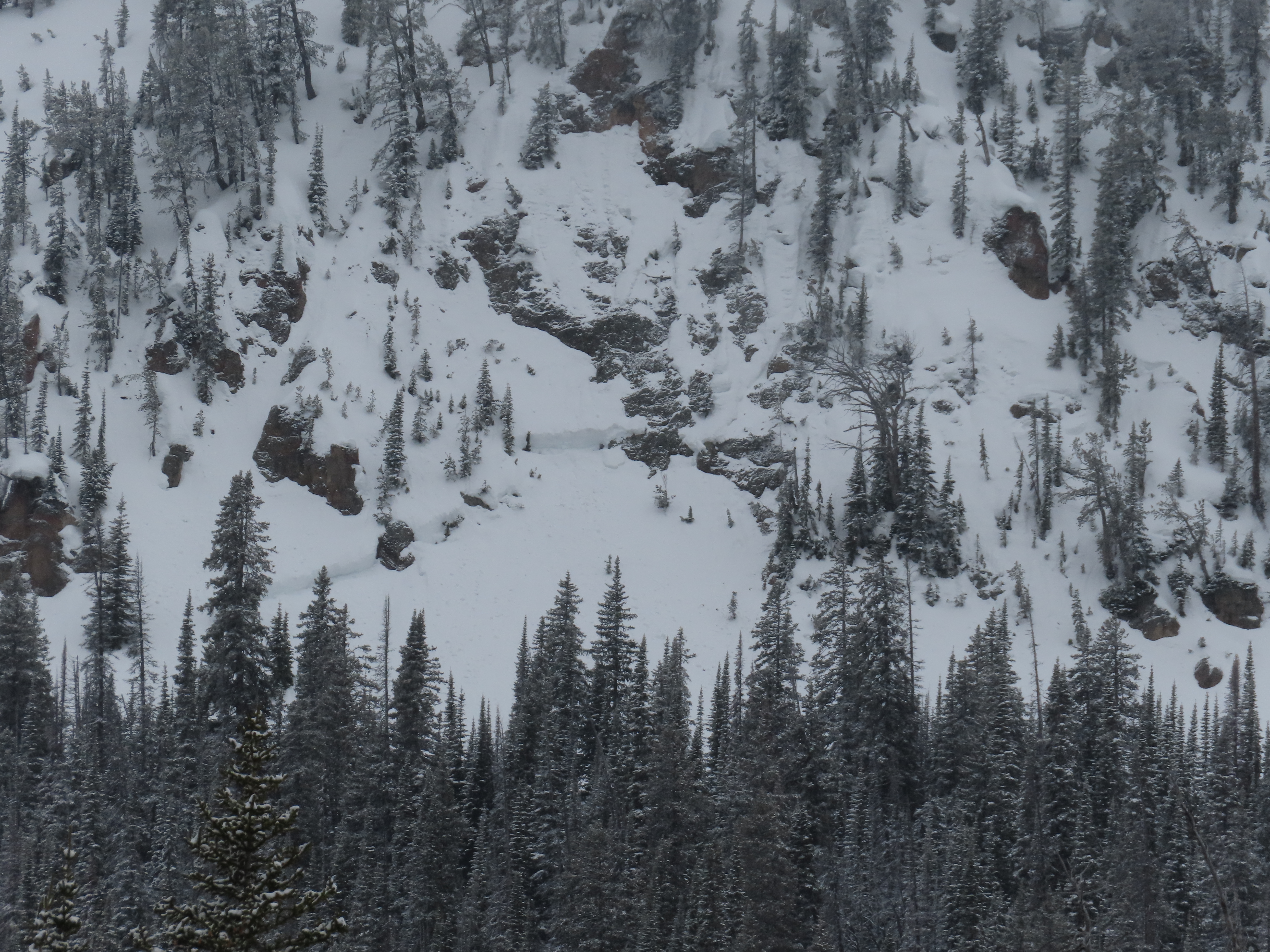
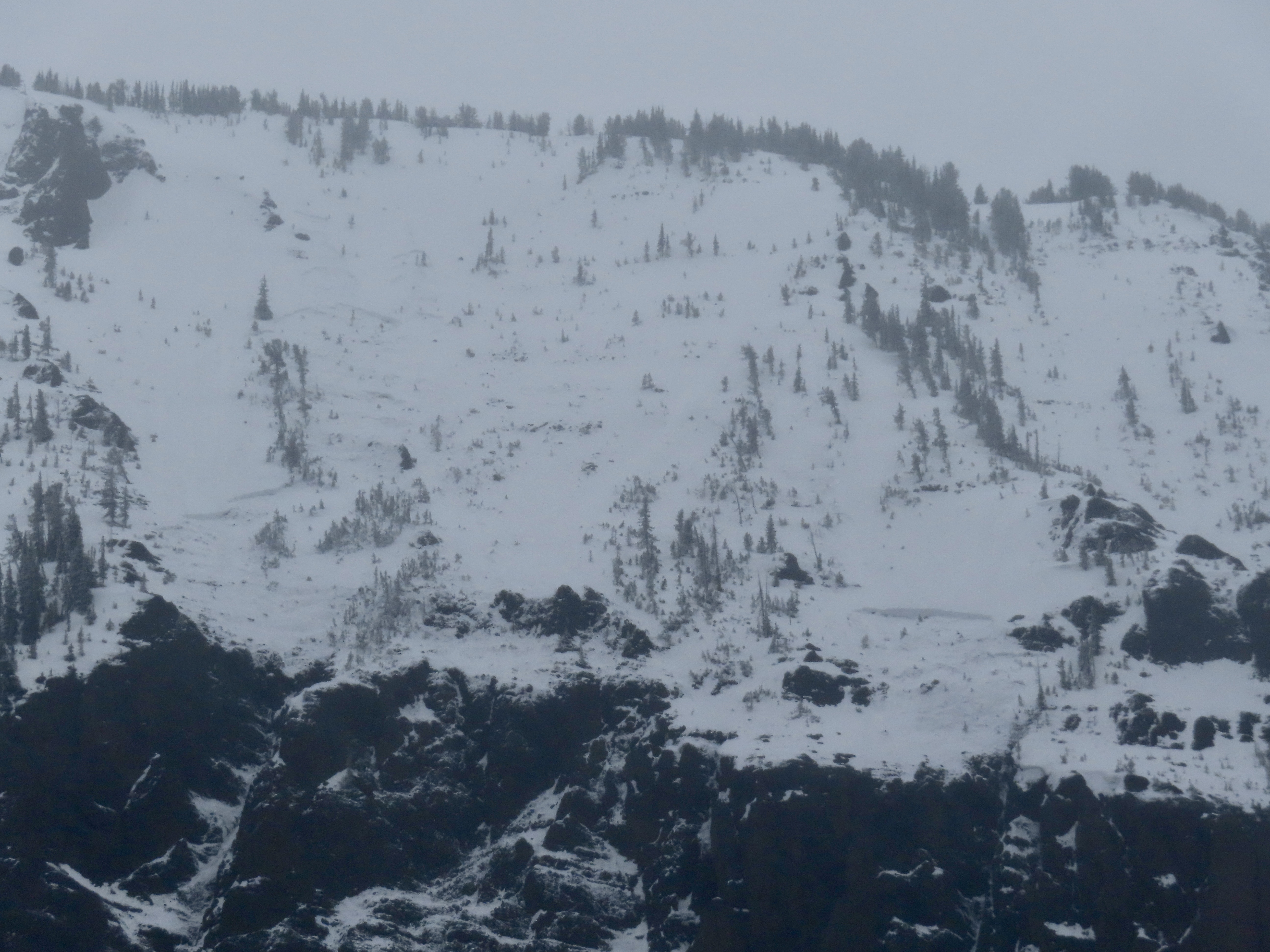
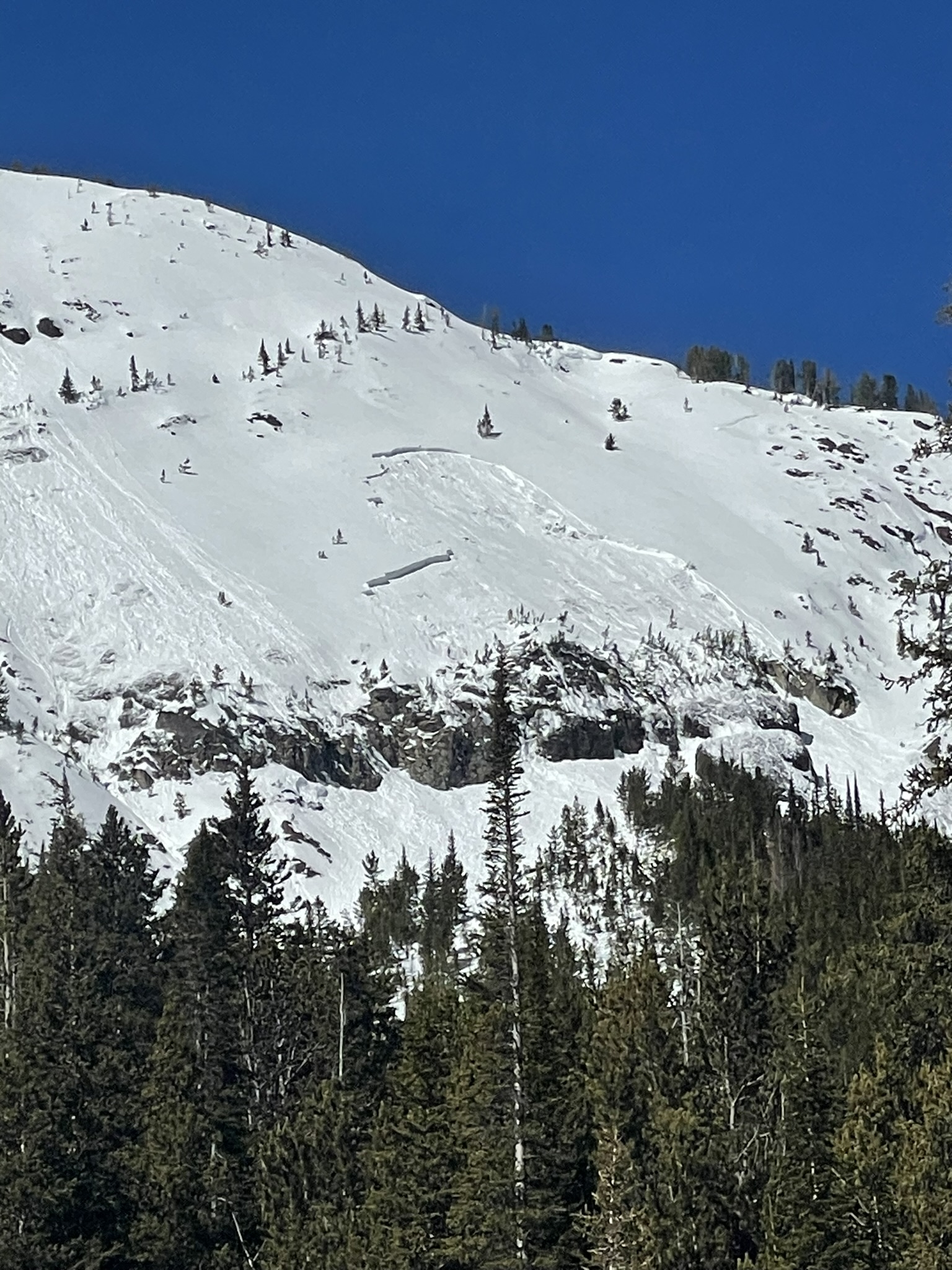
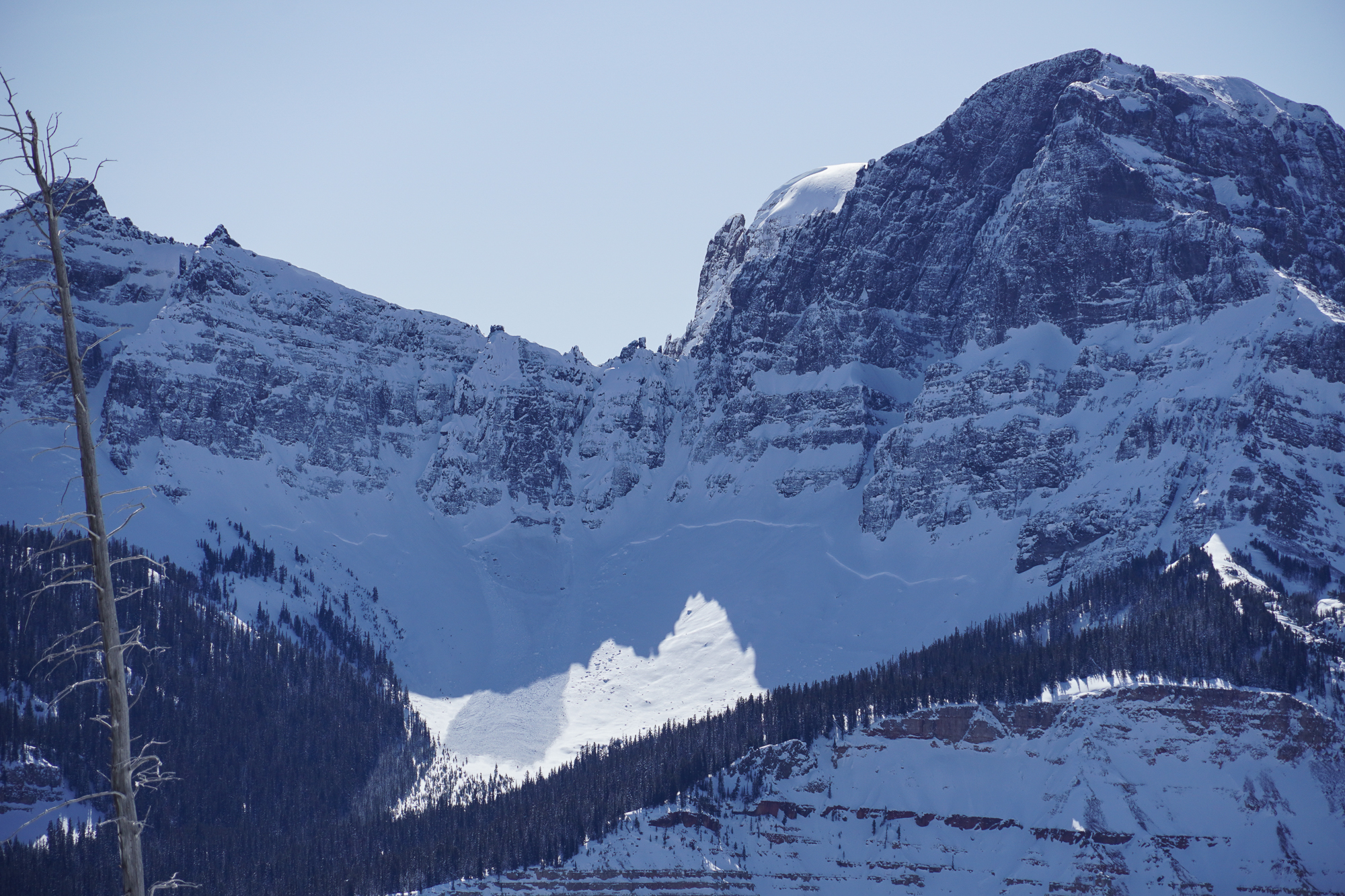
From obs 5/12/24: "Saw a few slides that look like they propagated across the layer of new snow from the last storm (as opposed to the characteristic spring wet snow point releases). The largest was the previously reported one from Sheep... We also saw a similar slide on a N/NW aspect of Mt Zimmer (pictured). Hard to say from a distance when these broke, but the one on Mt Zimmer looked the most recent." Photo: A. Kautzer
Trip Planning for Cooke City Area

Primary Problem: None
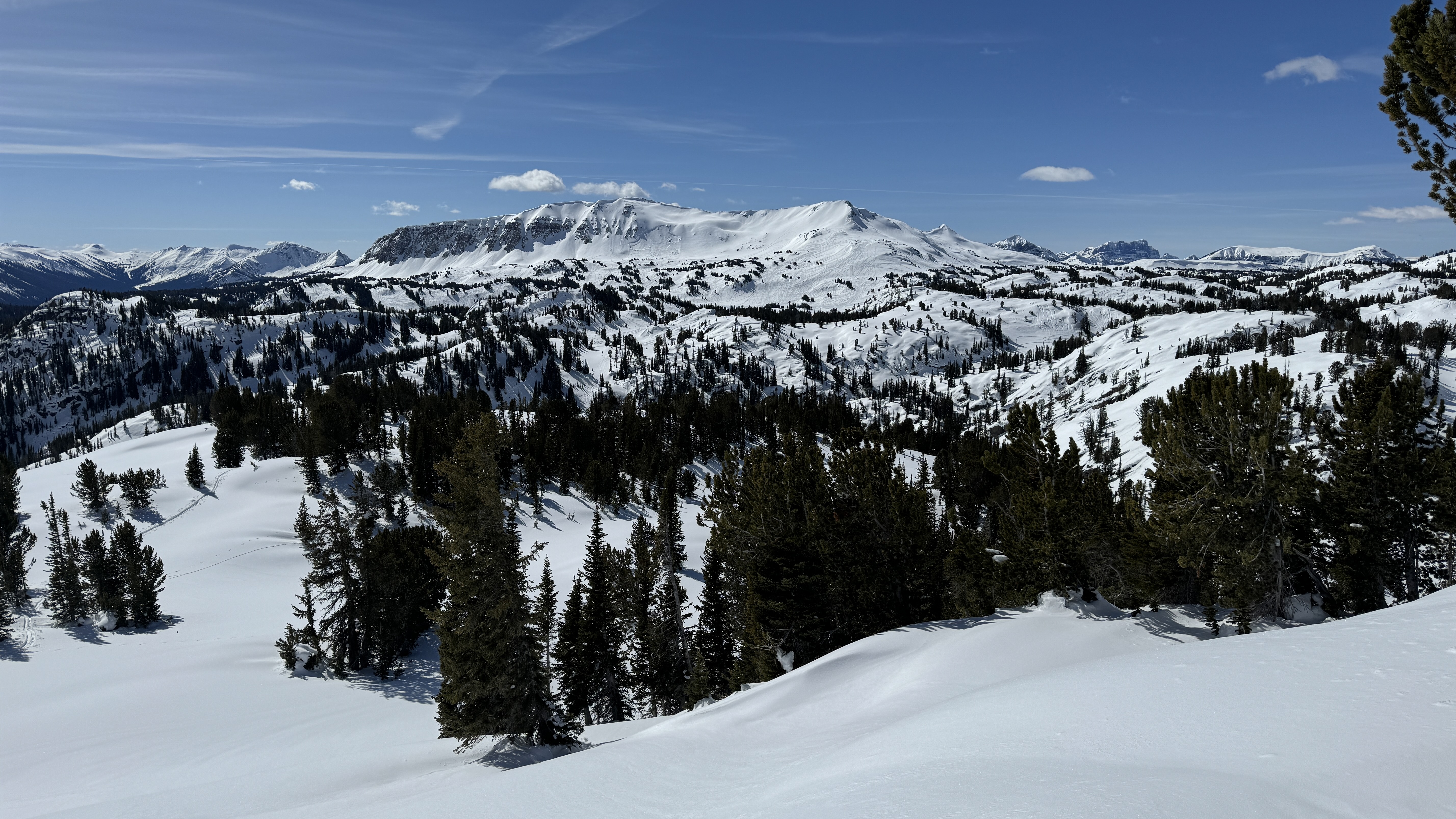
Bottom Line: Spring weather can be highly variable and create a mix of avalanche problems to watch out for. Snow conditions and snow stability can change drastically from day to day or hour to hour. Anticipate rapid change and plan accordingly. Plenty of snowfall over the winter with more spring snow to come makes avalanches possible into summer.Past 5 Days
Fri Apr 19

None
None
Mon Apr 22
None
None
Fri Apr 26
None
None
Mon Apr 29
None
None
Thu May 2
None
None
Relevant Avalanche Activity
Cooke City
Fisher Mtn.
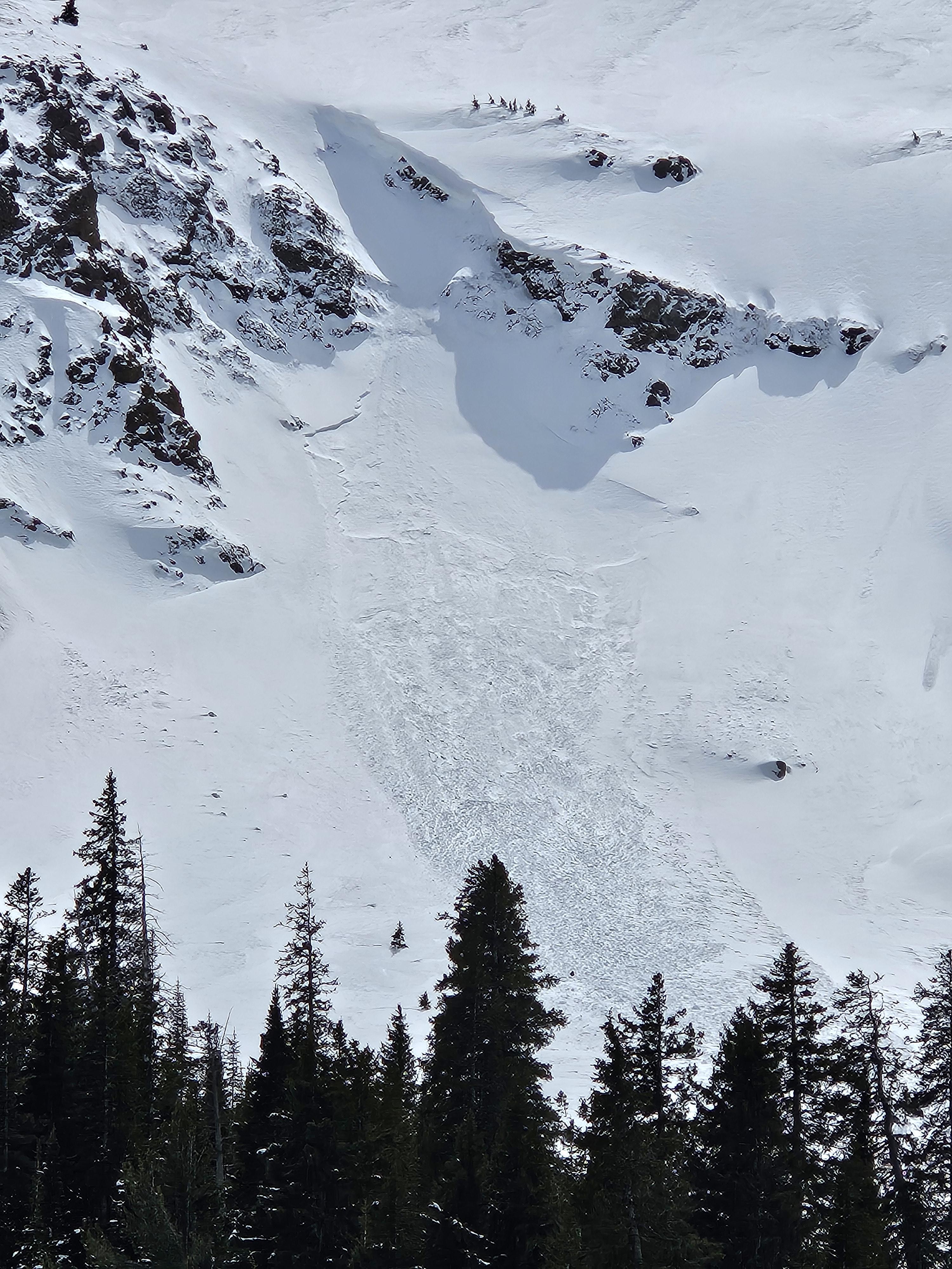
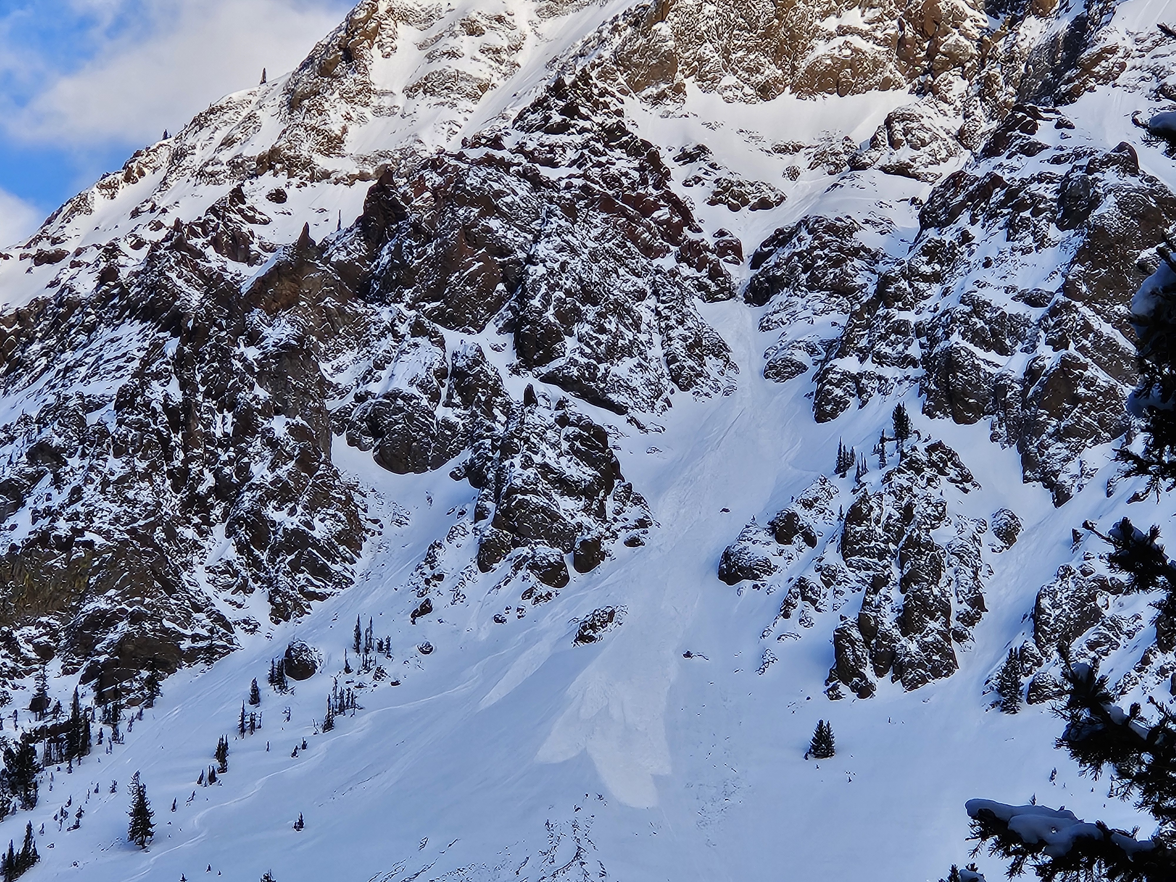
Natural avalanche on Fisher mtn
Fisher Mtn.
SS-NC-R2-D2
Elevation: 10,000
Aspect: E
Coordinates: 45.0661, -109.9590
Caught: 0 ; Buried: 0
More Avalanche Details
SS-NC-R2-D2
Elevation: 10,000
Aspect: E
Coordinates: 45.0661, -109.9590
Caught: 0 ; Buried: 0
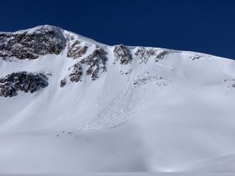
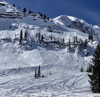
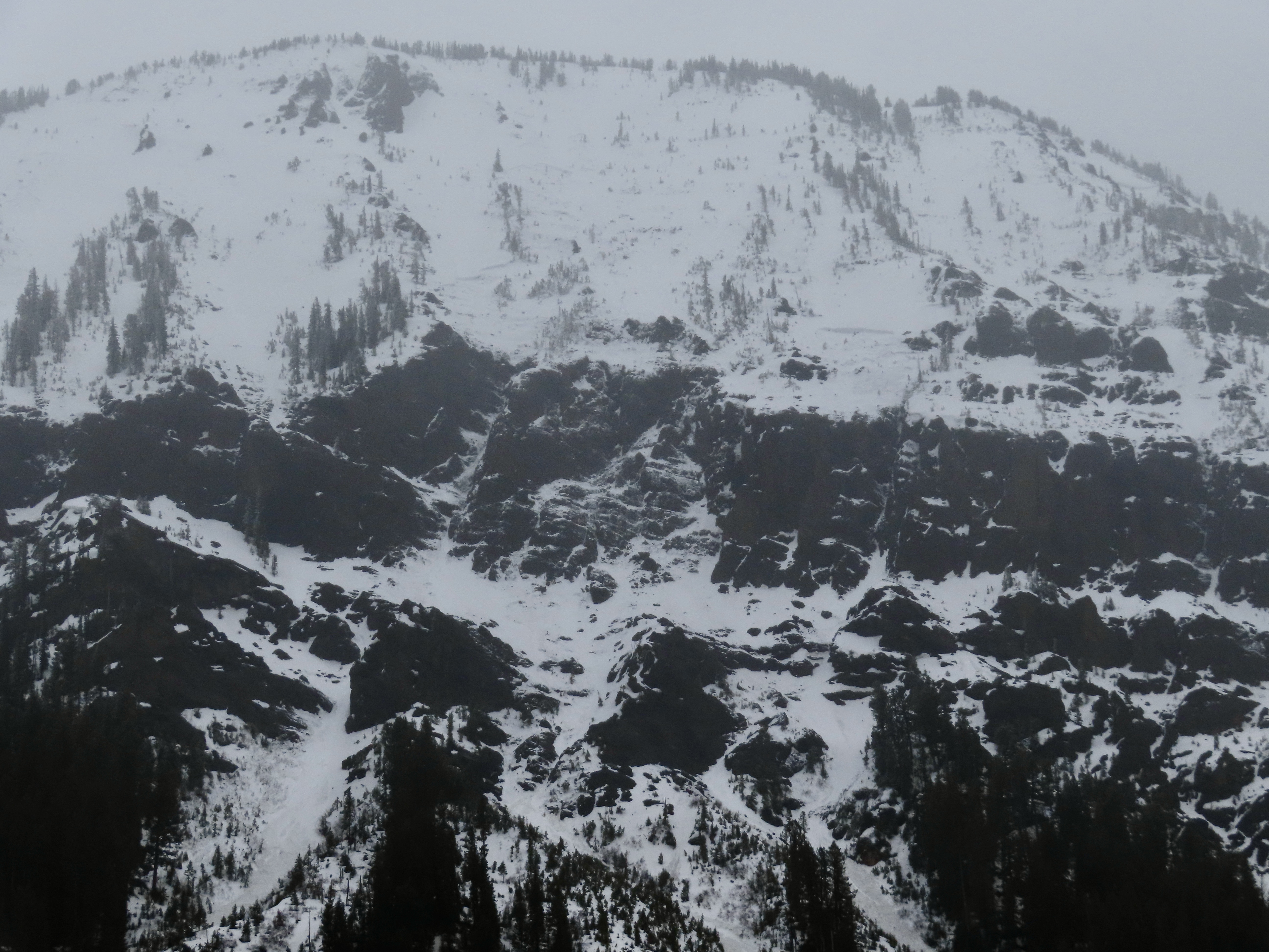
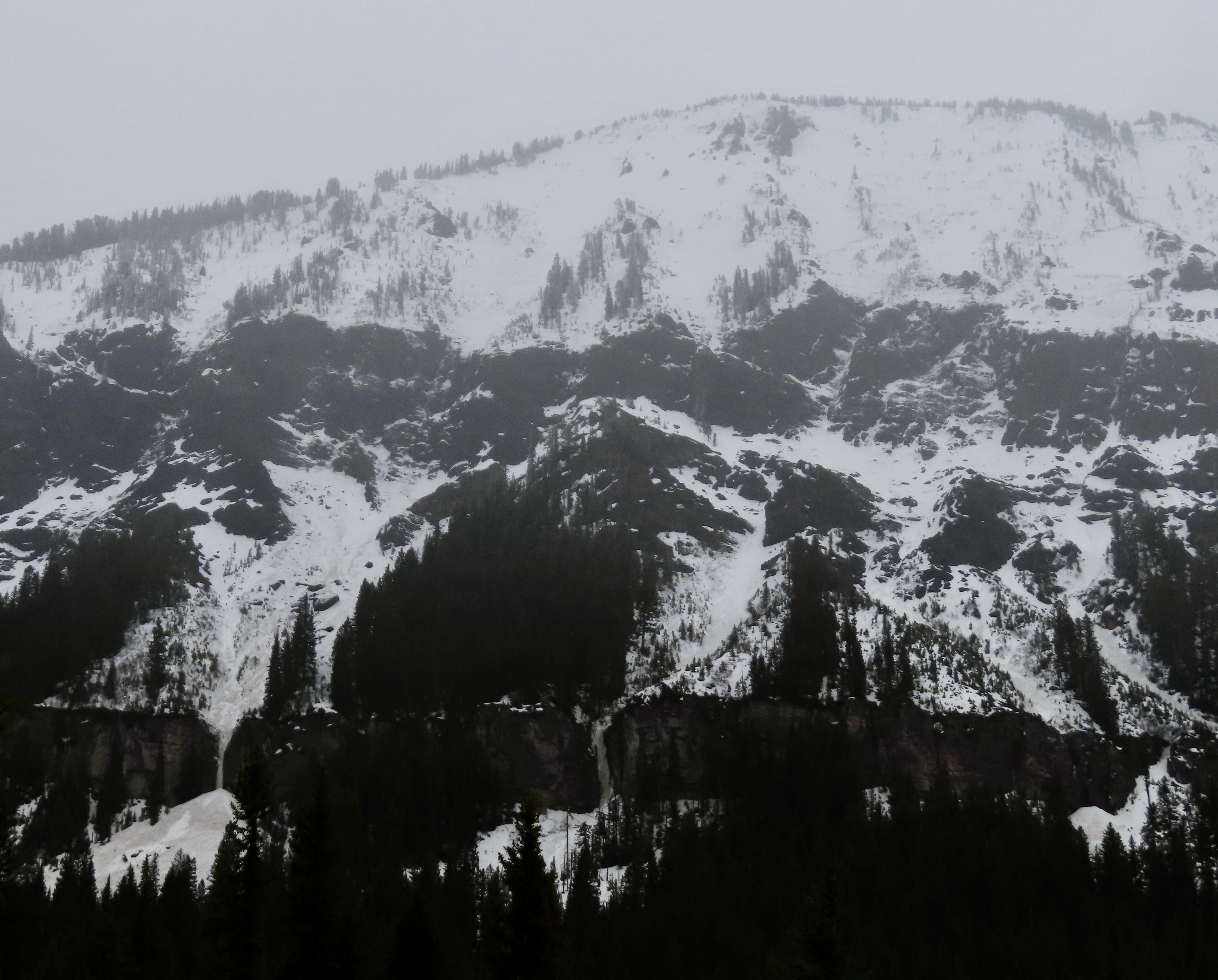
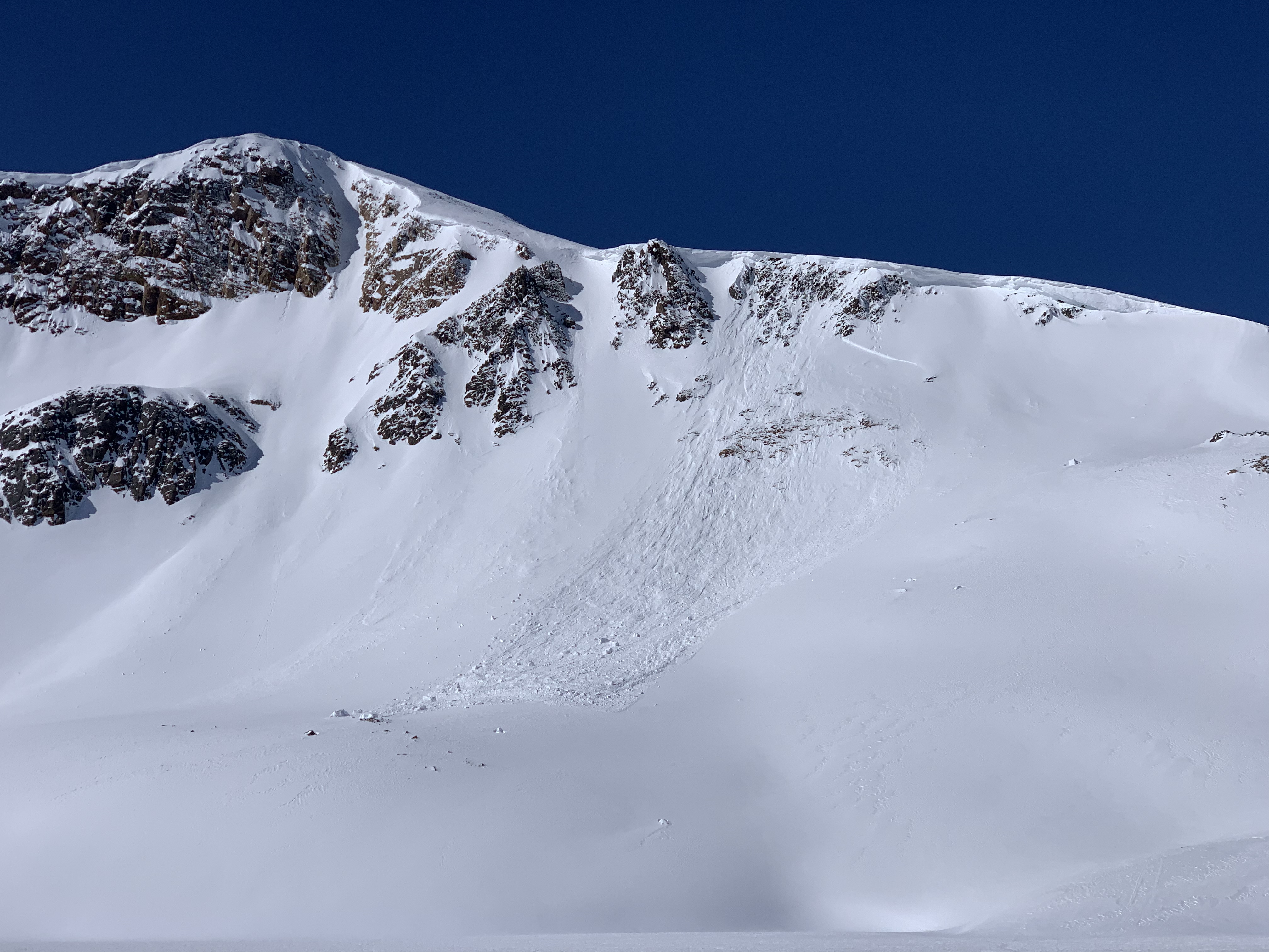
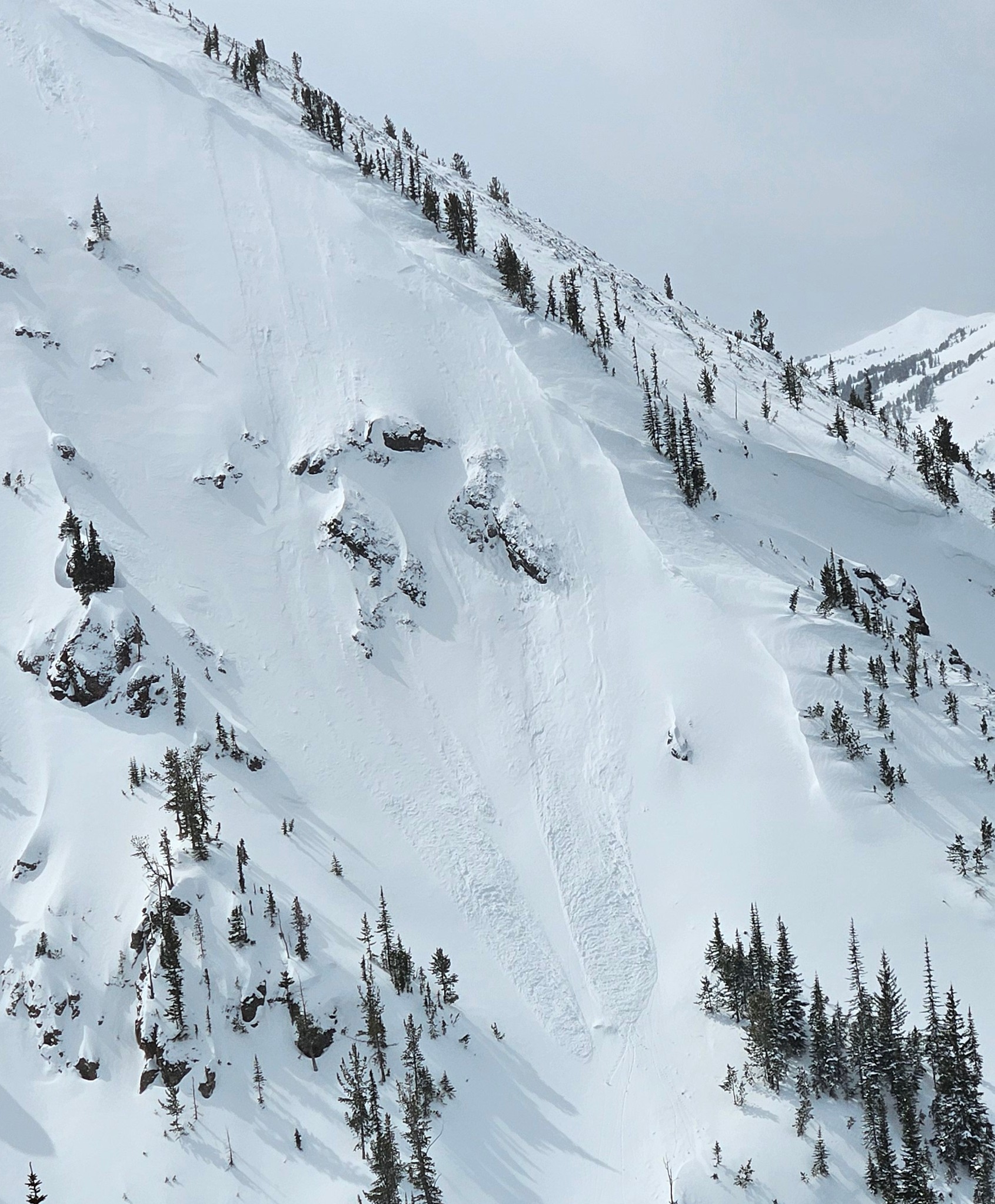
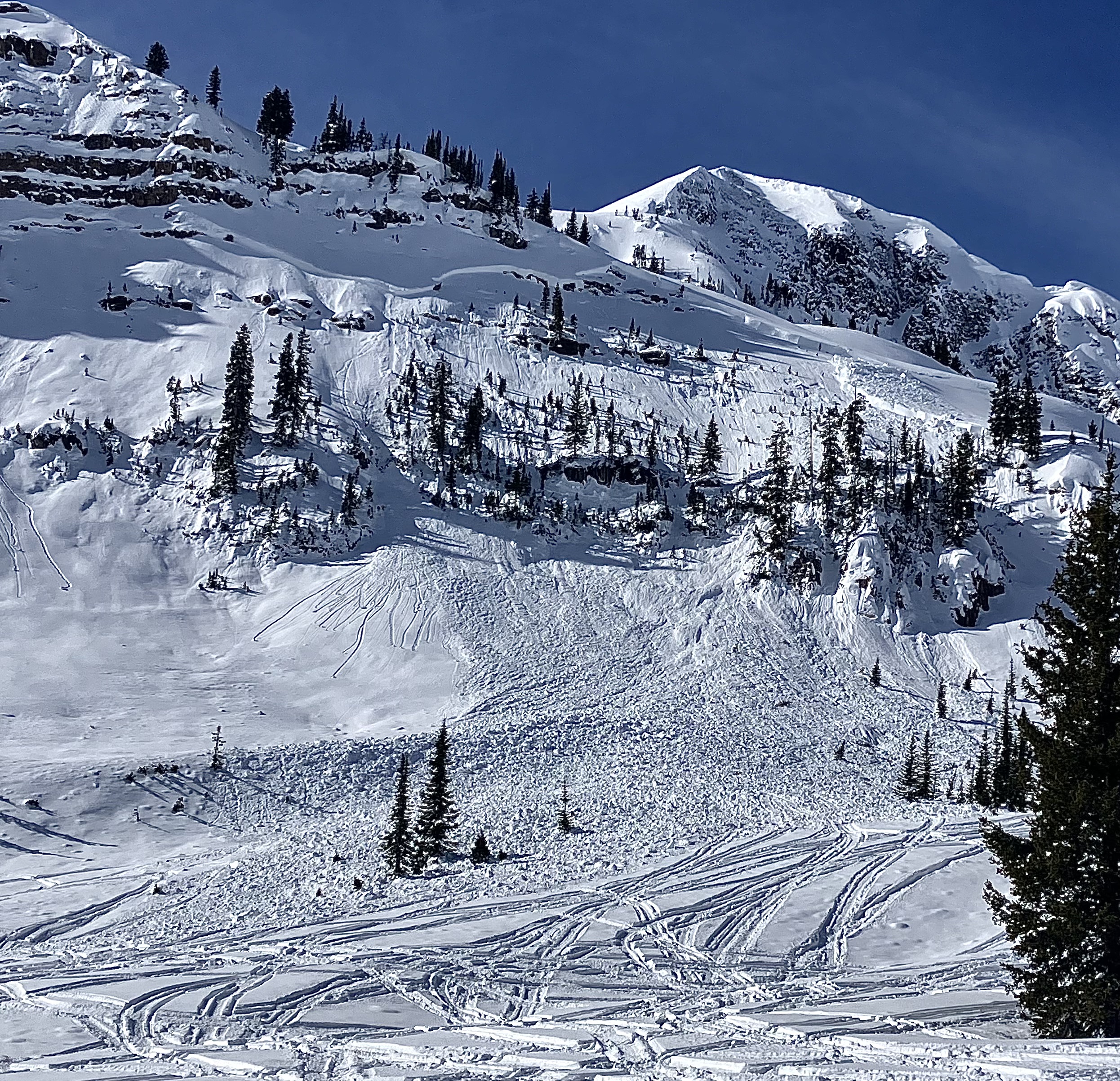
From email 5/11/24: “Hey Guys, here are a few photos from the weekend. The sheep Mountain Avalanche was Snowmobile triggered on Friday and the fisher peak avalanche happened today. Maybe cornice drop?”
More Avalanche Details
Cooke City
Sheep Mountain
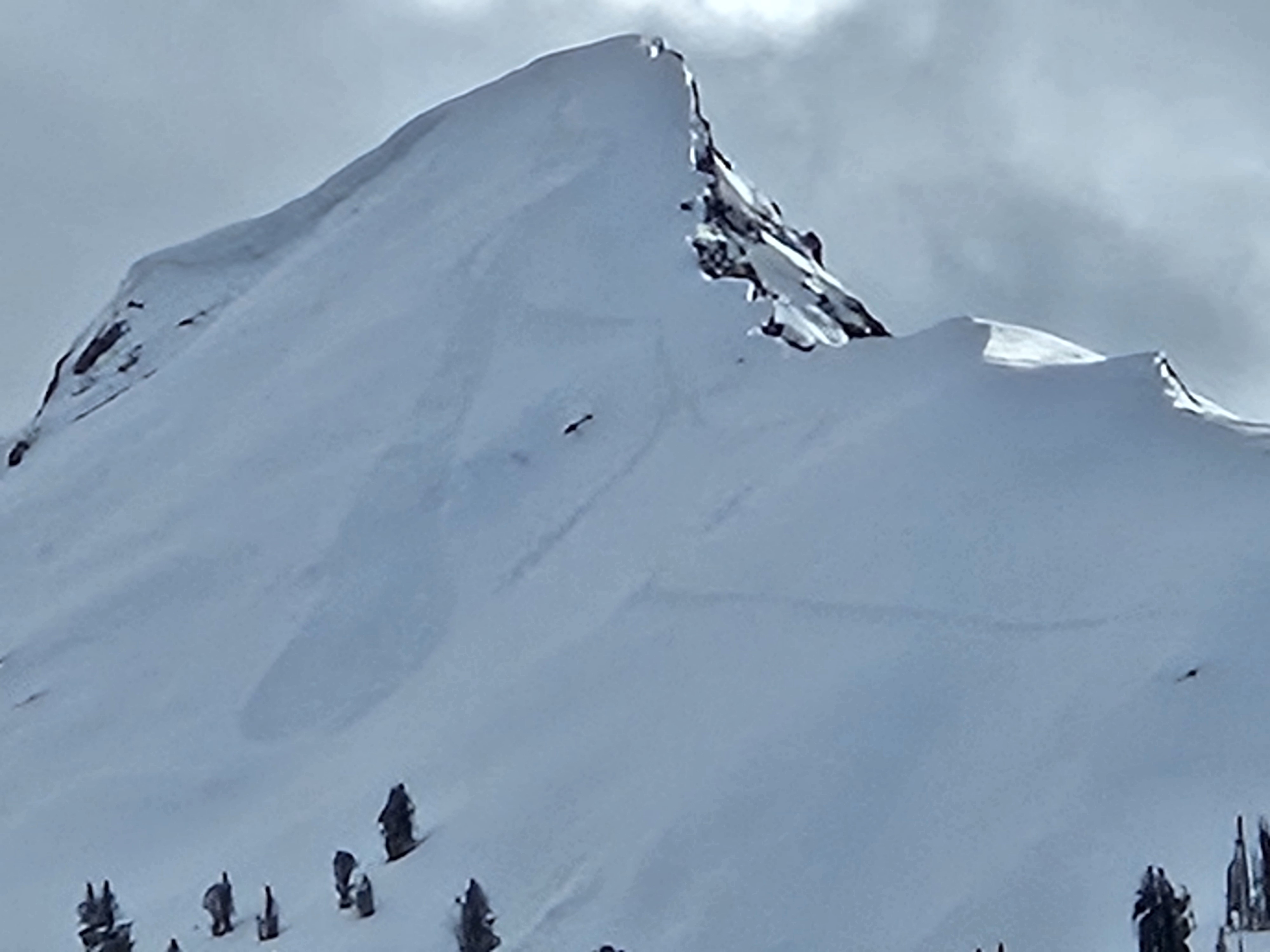
Snowmobile triggered slide on Sheep
Sheep Mountain
SS-AM-R3-D2
Elevation: 9,500
Aspect: NE
Coordinates: 45.0722, -109.9280
Caught: 0 ; Buried: 0
More Avalanche Details
SS-AM-R3-D2
Elevation: 9,500
Aspect: NE
Coordinates: 45.0722, -109.9280
Caught: 0 ; Buried: 0
From email 5/11/24: “Hey Guys, here are a few photos from the weekend. The sheep Mountain Avalanche was Snowmobile triggered on Friday and the fisher peak avalanche happened today. Maybe cornice drop?”
More Avalanche Details
Cooke City
Round Lake
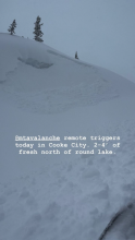
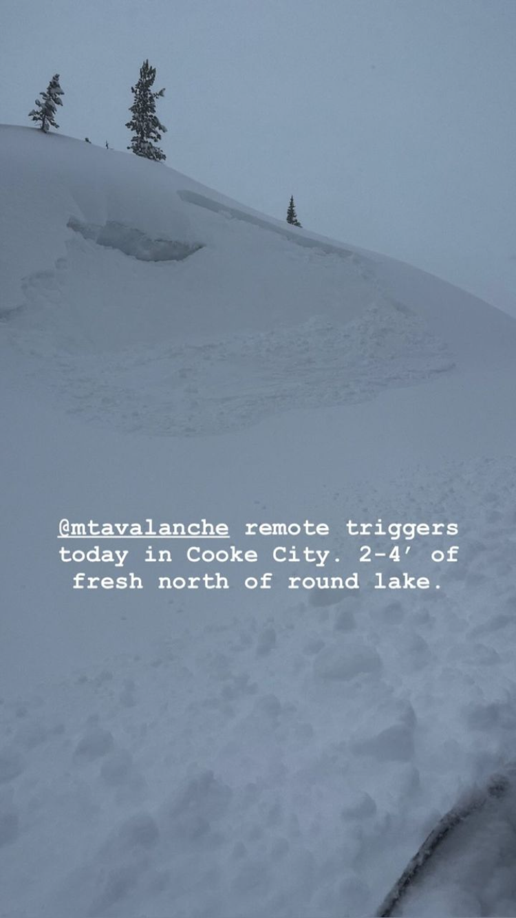
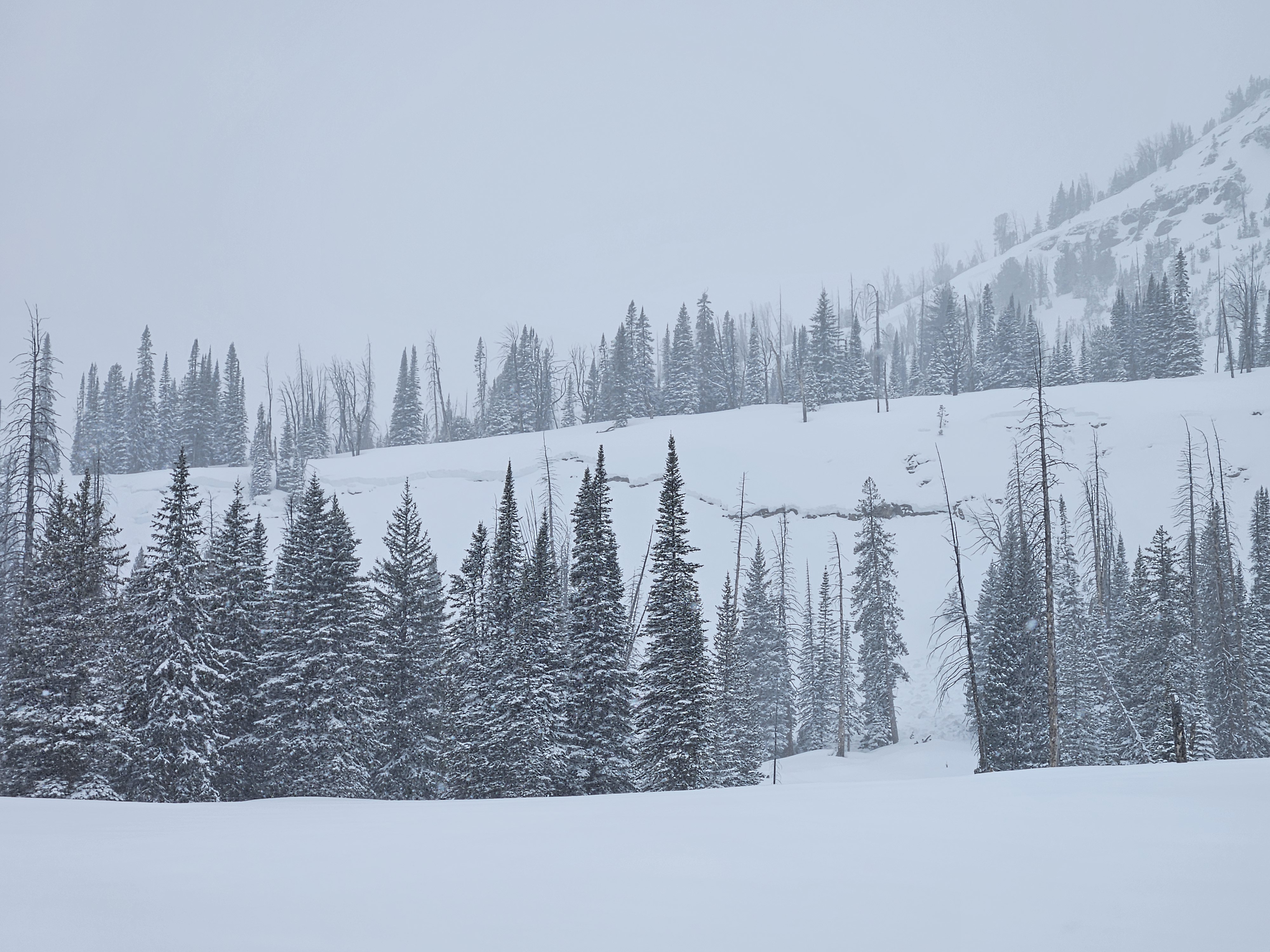
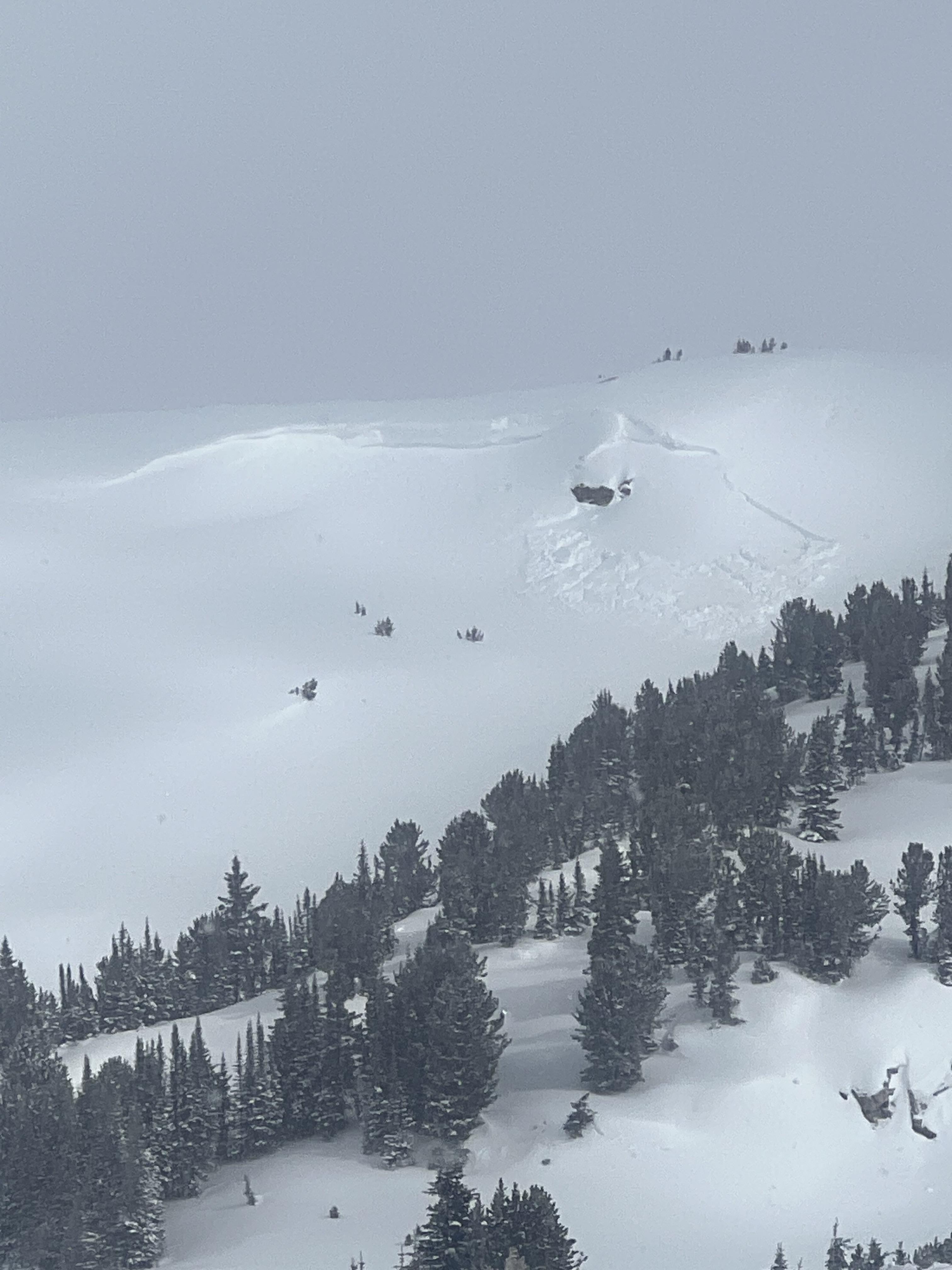
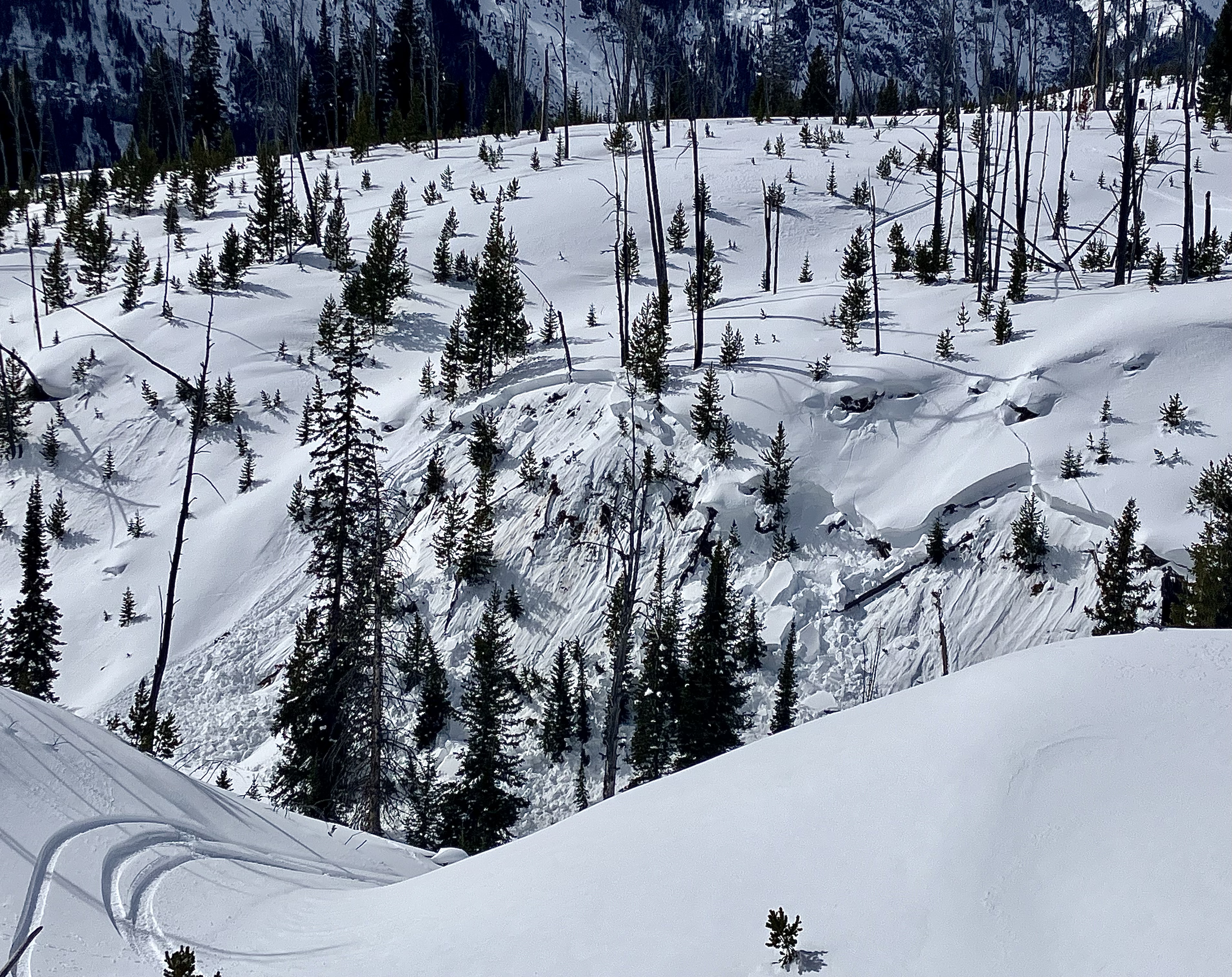
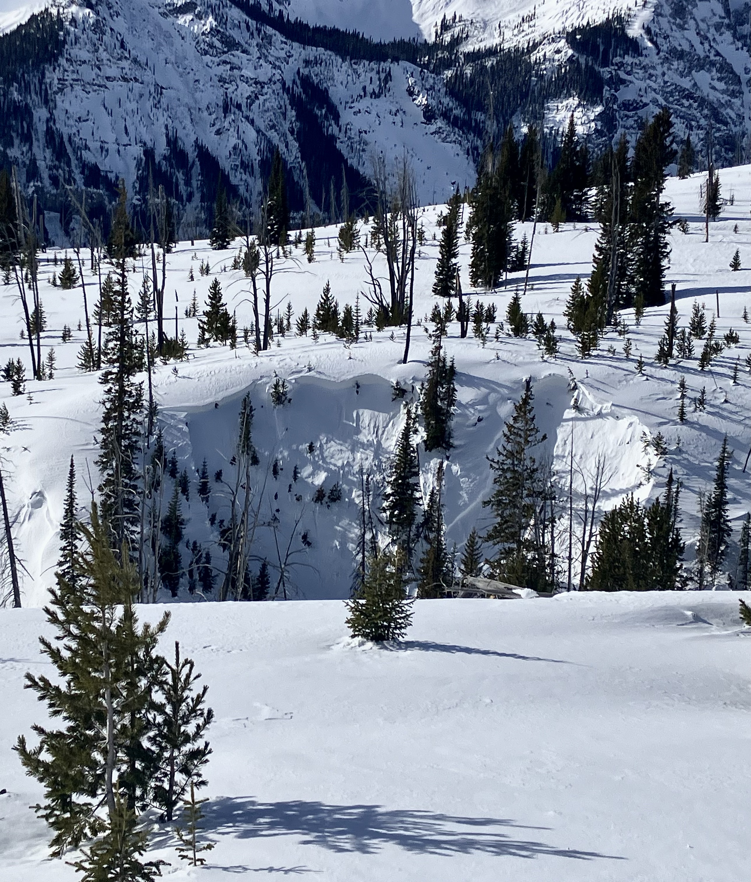
Remote triggered storm slab near Cooke
Round Lake
SS-AMr-R2-D1
Elevation: 9,000
Coordinates: 45.0745, -109.9070
Caught: 0 ; Buried: 0
More Avalanche Details
SS-AMr-R2-D1
Elevation: 9,000
Coordinates: 45.0745, -109.9070
Caught: 0 ; Buried: 0
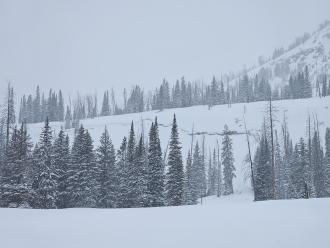
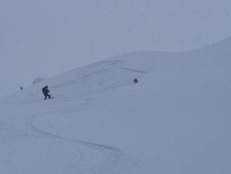
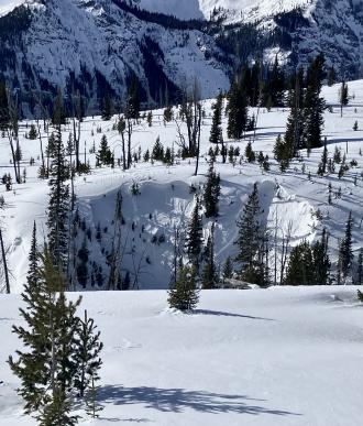
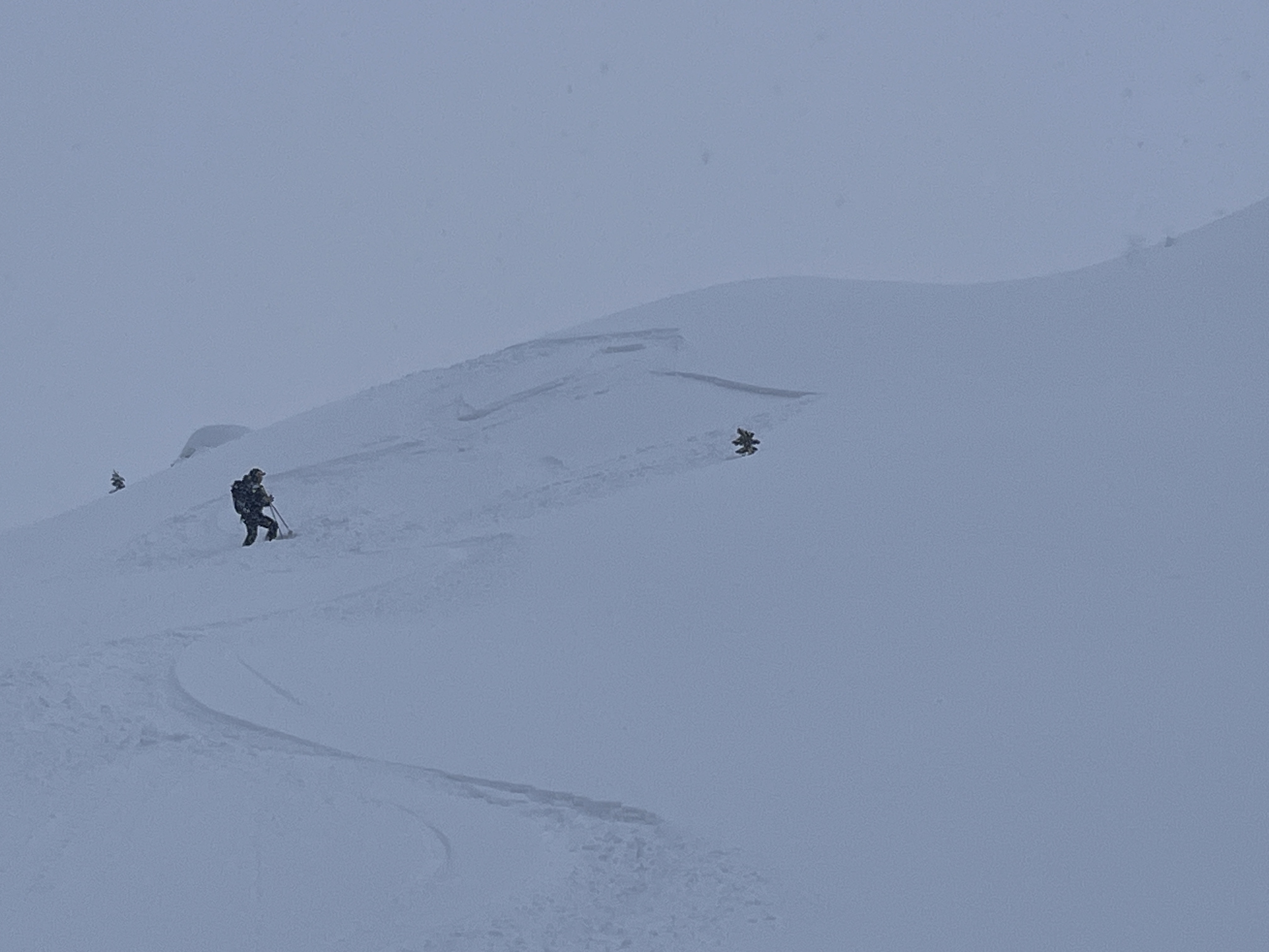
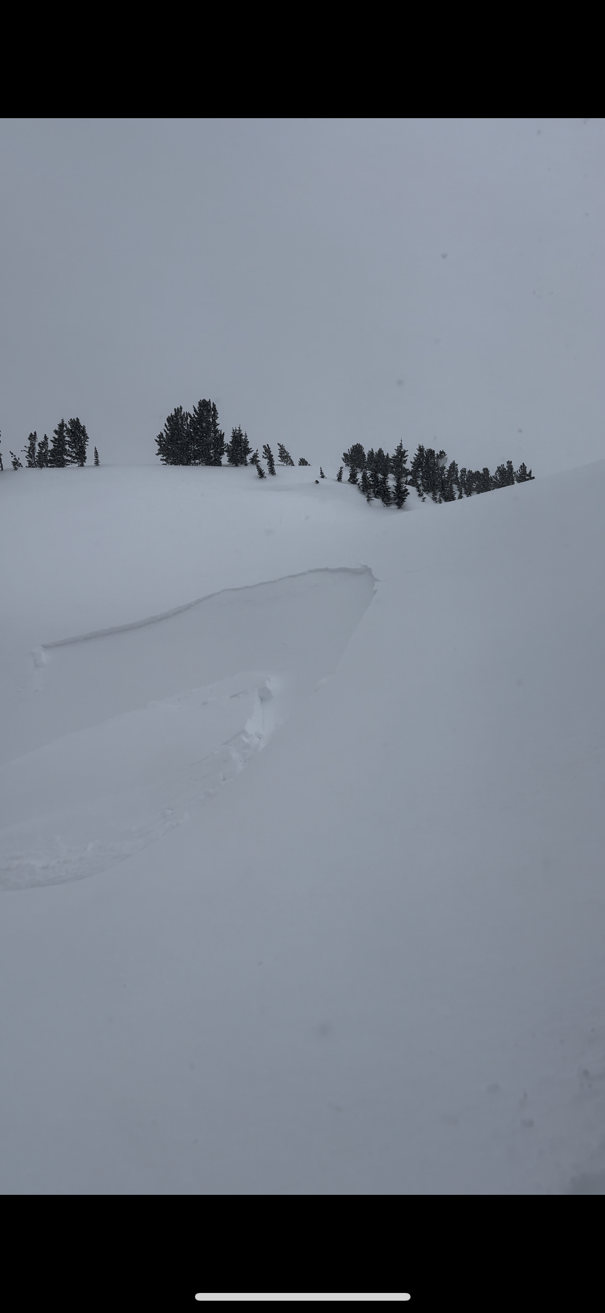
From IG story 5/8/24: "@mtavalanche remote triggers today in Cooke City. 2-4' of fresh north of round lake."
More Avalanche Details
Relevant Photos
Displaying 1 - 40
-

-

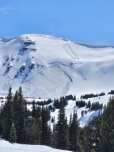
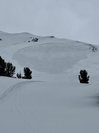
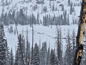
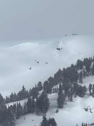
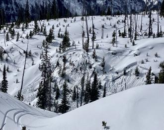
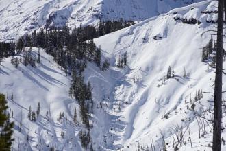
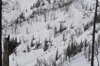
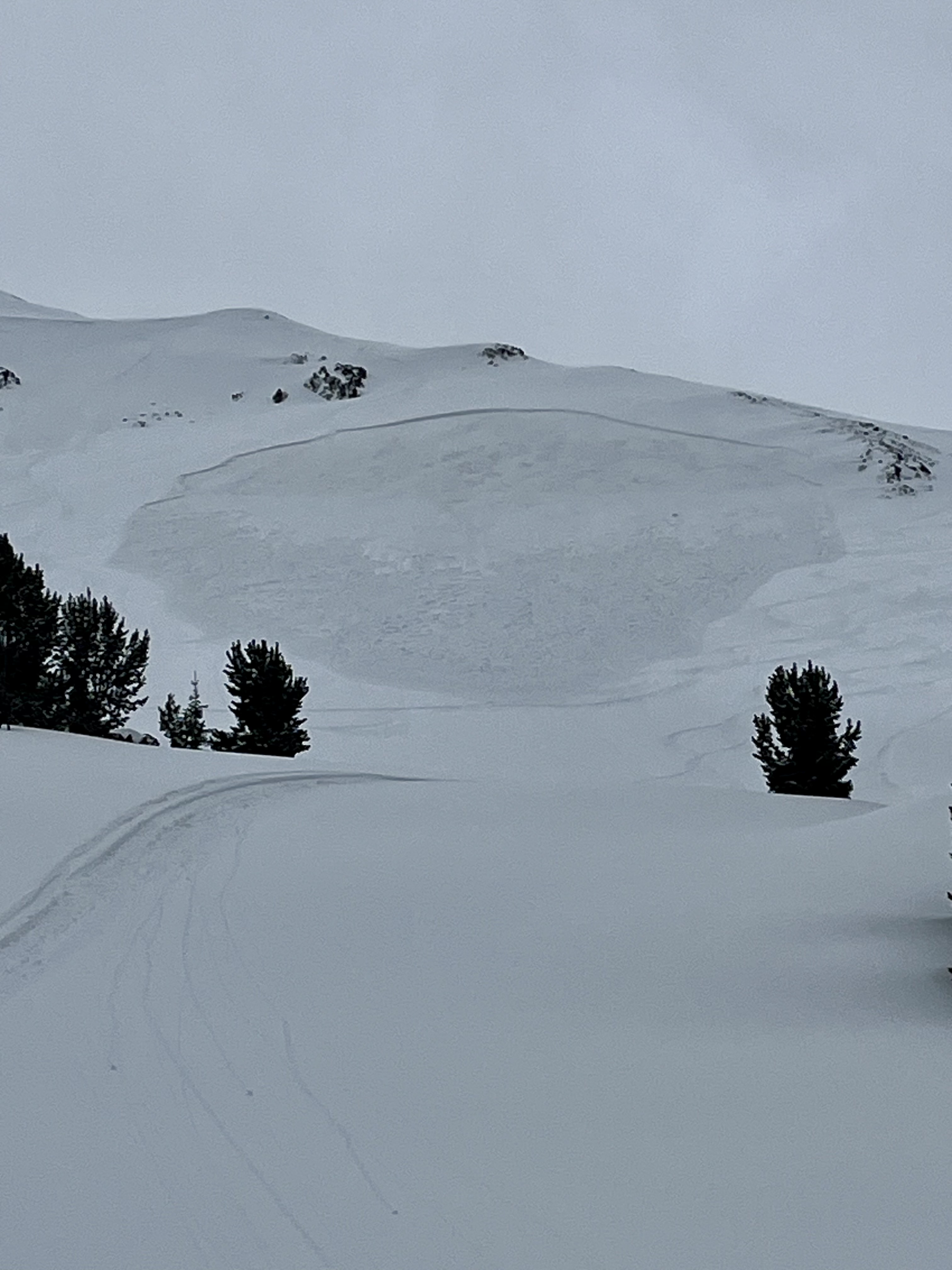
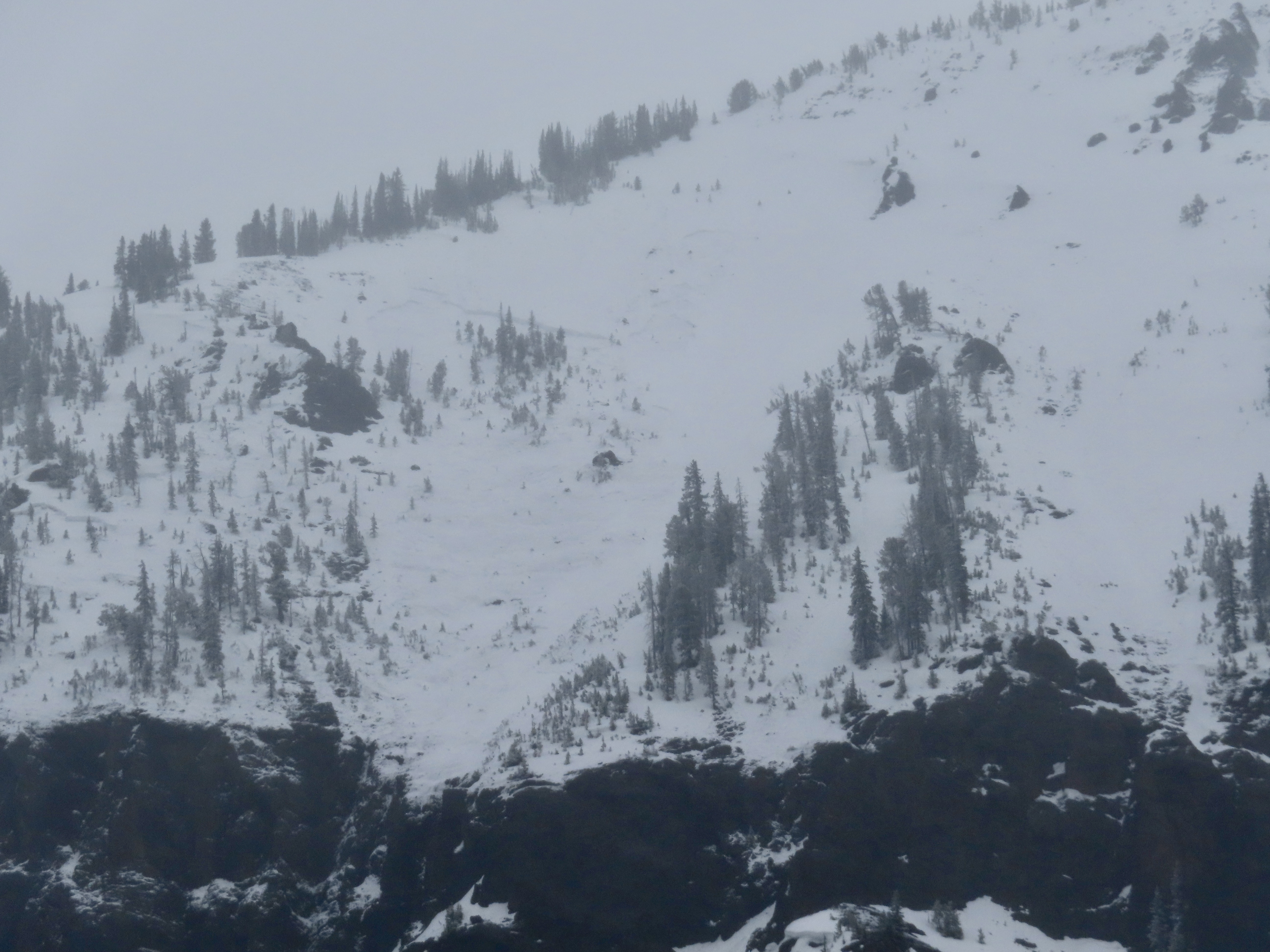
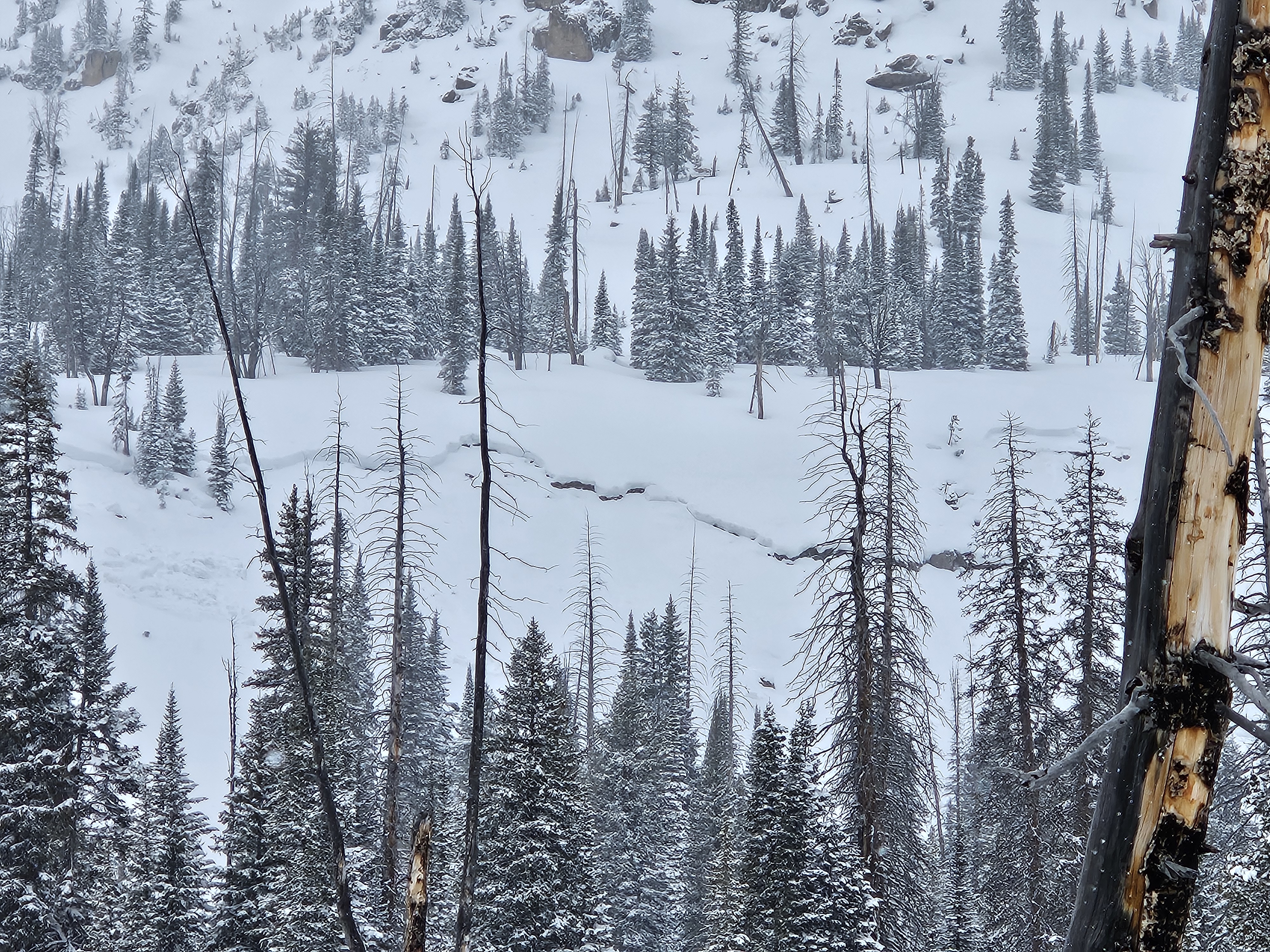
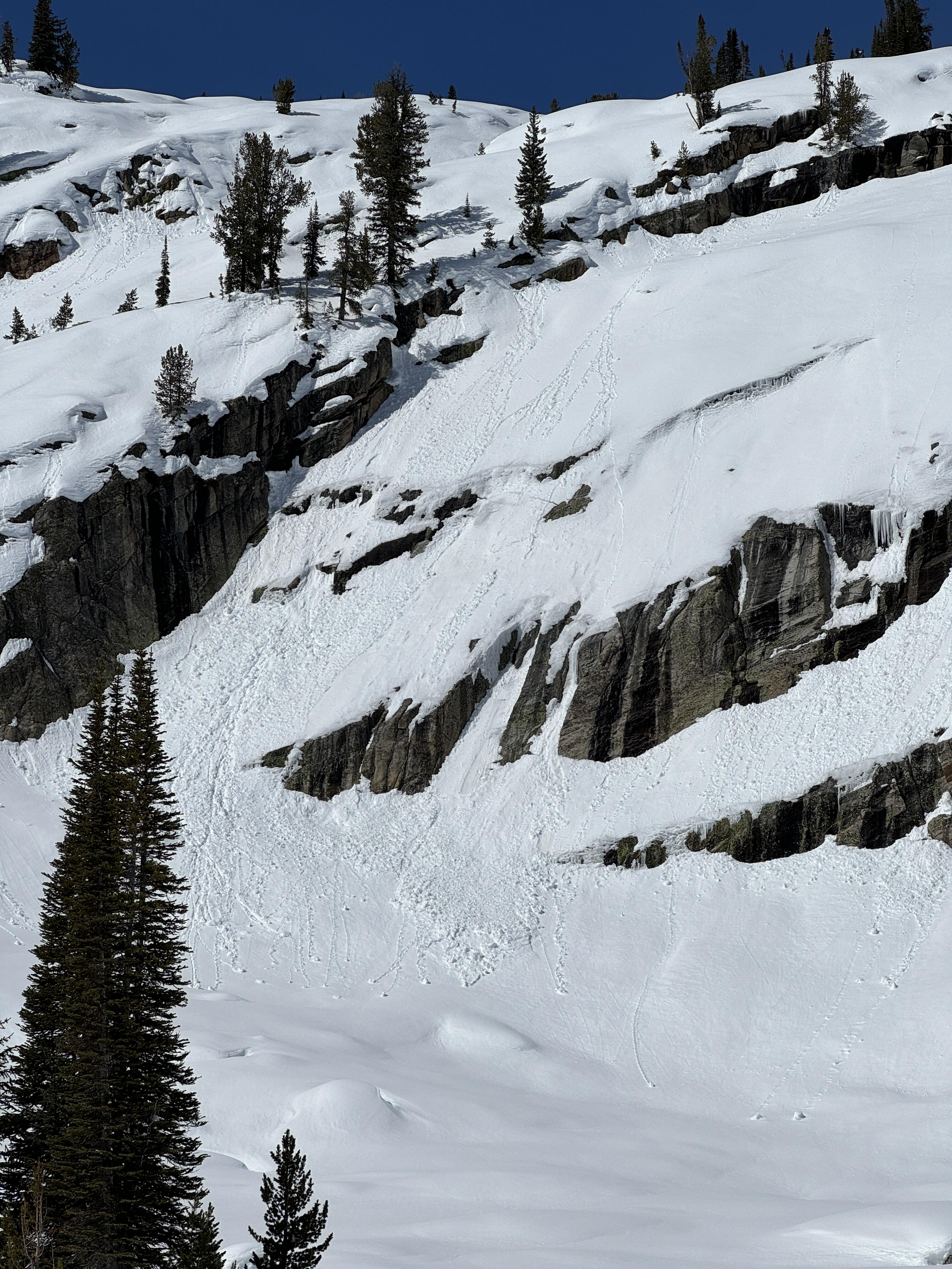
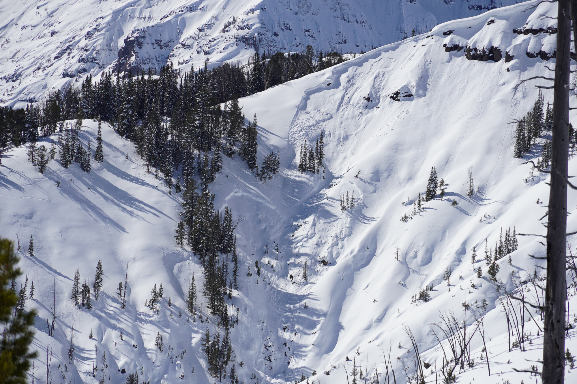
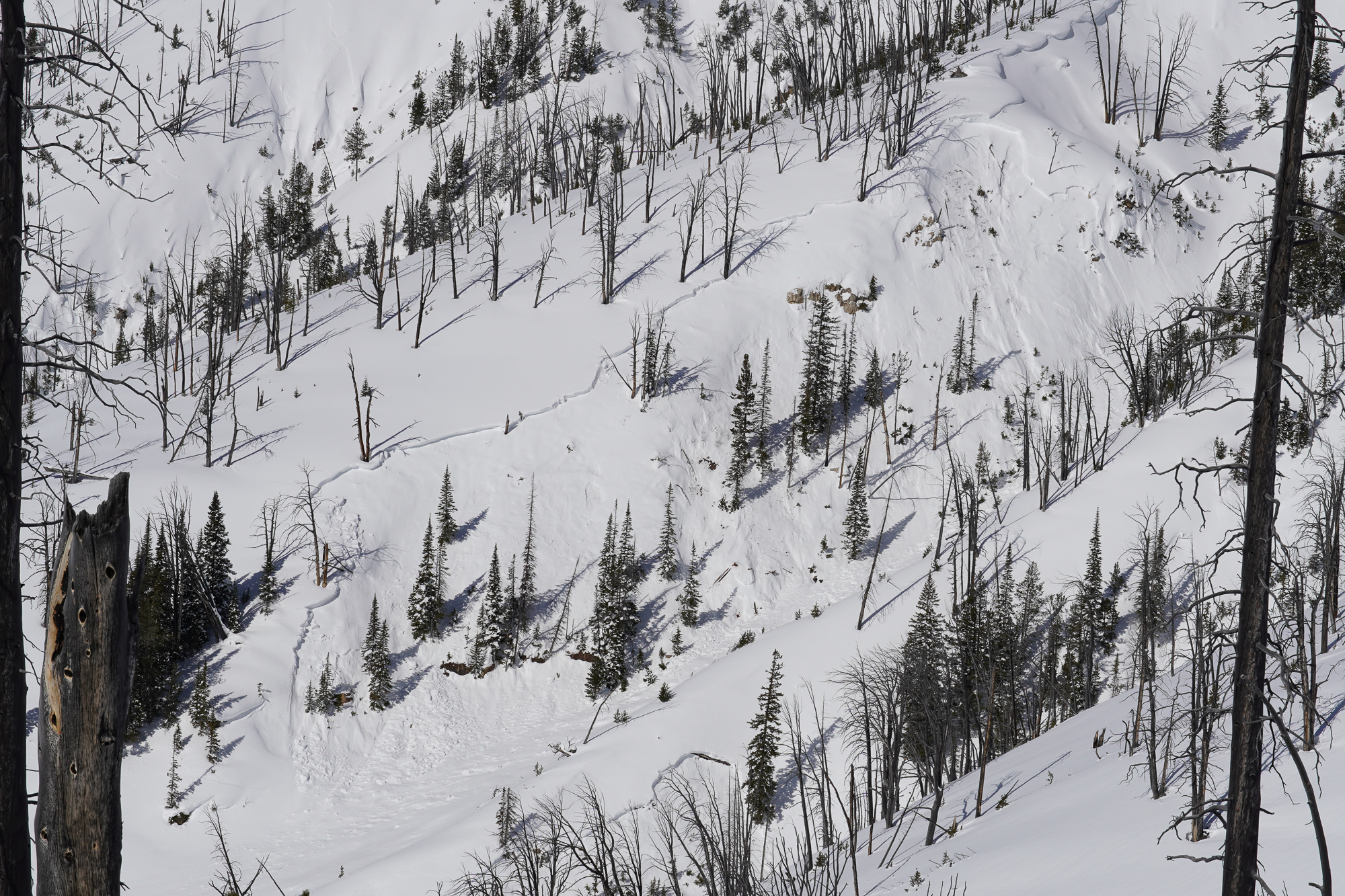
From obs 5/12/24: "Saw a few slides that look like they propagated across the layer of new snow from the last storm (as opposed to the characteristic spring wet snow point releases). The largest was the previously reported one from Sheep. On the way out we saw a smaller slide farther south along the same ridge that looked like it broke on the new snow interface, both NE aspects (pictured)." Photo: A. Kautzer
-

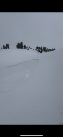
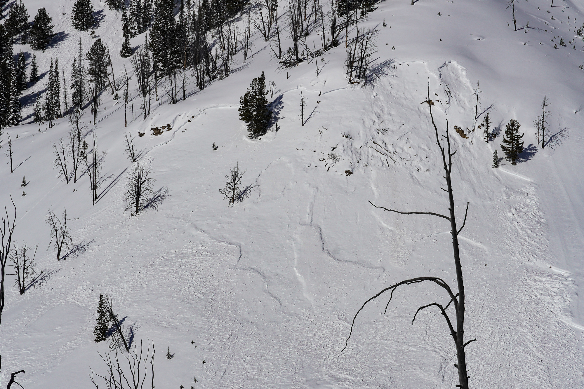
From email 5/11/24: “Hey Guys, here are a few photos from the weekend. The sheep Mountain Avalanche was Snowmobile triggered on Friday…”
-

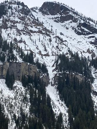
From email 5/11/24: “Hey Guys, here are a few photos from the weekend. … the fisher peak avalanche happened today. Maybe cornice drop?”
-

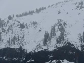
From IG story 5/8/24: "@mtavalanche remote triggers today in Cooke City. 2-4' of fresh north of round lake."
-
On 5/4/24 Skiers triggered large wet loose slides on the Fin near Cooke City
-

From obs 5/2/24: "Wind load on old crust, probably from Wednesday."
-
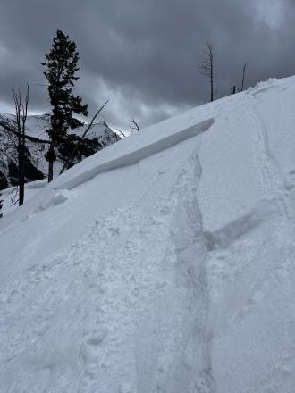
From email 5/1/24: "Hi crew. I triggered a soft slab avalanche on the North side of Sheep Mountain today. D1.5 200’ wide ran 200’. Crown was 6-12’’ deep. I was able to ride out of it and anchor in a safe spot.
It broke on our 7th lap and we had seen no signs of instability prior to the avalanche but wind loading was occurring and obvious. The avalanche broke and on a dirty crust that formed during a rain event last week."
-

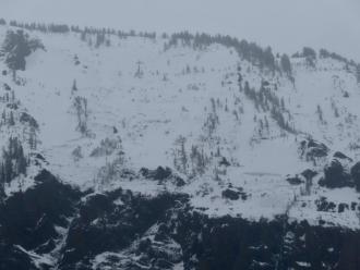
Photos of what appears like a wet slab possibly from Friday (4/26) when the precip. started after the first night or two of poor freeze (Henderson Bench). Photo GNFAC
-
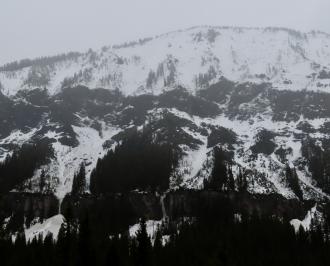
Photos of what appear like wet slabs possibly from Friday (4/26) when the precip. started after the first night or two of poor freeze (North side of Republic near Cooke City). Photo GNFAC
-
On 4/26/24 large natural wet slabs were seen running on Wall Mountain near Silver Gate. An observer from Beartooth Powder Guides sent us a video of them happening at 3pm while it was 43 degrees F. I also noted a similar large crown on the north side of Republic Mtn. that probably also happened this afternoon. Photo: GNFAC
-
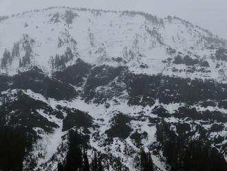
On 4/26/24 large natural wet slabs were seen running on Wall Mountain near Silver Gate. An observer from Beartooth Powder Guides sent us a video of them happening at 3pm while it was 43 degrees F. I also noted a similar large crown on the north side of Republic Mtn. that probably also happened this afternoon.
-
On 4/26/24 large natural wet slabs were seen running on Wall Mountain near Silver Gate. An observer from Beartooth Powder Guides sent us a video of them happening at 3pm while it was 43 degrees F. I also noted a similar large crown on the north side of Republic Mtn. that probably also happened this afternoon. Photo: GNFAC
-
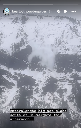
From IG on 04/26/2024 Photo: Beartooth Powder Guides
-

A skier triggered this sluff in a steep chute east of Republic Mountain. Photo: B
-
Skiers triggered a small sluff in steep terrain while skiing on the Fin near Republic Mountain. Photo: B.
-
Riders saw this wet slab avalanche on the SE shoulder of Mount Abundance. The avalanche likely happened a few days ago during prolonged above-freezing temperatures. Photo: R.
-
Riders saw this wet slab avalanche on the SE shoulder of Mount Abundance. The avalanche likely happened a few days ago during prolonged above-freezing temperatures. Photo: R.
-
From obs: "Natural cornice failure and small slab on Iceberg Peak’s NE face. We skied by the day prior and judging by what the wind did to our tracks overnight, this looked like it happened in the morning." Photo A. Joy
-
A snowboarder saw this natural avalanche on the Fin from Cooke City. He estimated it happened between 10:30-1:30 and broke 2' deep. Photo: N. Mattes
-
We triggered this small avalanche on a steep windloaded rollover on an otherwise mellow slope. This avalanche was 15-20' wide, 8" deep, and ran for about 30-40 vertical feet. The skier easily skied away from the slide and was not caught. Photo: GNFAC
-
From obs: "skiing north of cooke city today observed this Small windslab on a South facing slope ~9800 ft." G. Roe
-
Skiers triggered this small windslab while skinning near a steeprollover at the top of an East facing slope above Zimmer Creek. Crown was ~20 ft wide and ran a similar distance. 2"-10" at the deepest. Photo: G. Roe
-
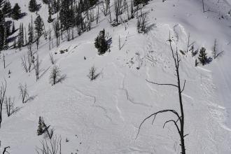
Skiers south of Cooke City saw a recent likely cornice-triggered avalanche on a northeast face. During their tour, they saw a small part of the same cornice fall off and trigger another small avalanche. Photo: B. Daley
-
A snowboarder intentionally triggered a wind-slab avalanche on Town Hill in Cooke City that broke 6-10” deep and approximately 30’ wide. It ran about 40 vertical feet. Photo: R. Youngbar
-

On the east side of Woody Ridge, skiers watched a wet, loose snow avalanche trigger a dry slab avalanche on March 17. photo: N Iltis
-
On the east side of Woody Ridge, skiers watched a wet, loose snow avalanche trigger a dry slab avalanche on March 17. photo: N Iltis
-
We saw no new deep slab avalanches in Cooke City since Alex was there last week. Unfortunately, if you triggered one, it would be no less deadly. This was a large deep slab avalanche on Sheep Mountain. Photo: GNFAC
-
Wet loose snow avalanche Astral Lake. Photo: GNFAC
-
A wet loose snow avalanche on Crown Butte. Photo: GNFAC
-
On 3/10/24 Between Miller and Wolverine there was a recent large avalanche that I would guess was triggered yesterday. 3-6' deep, 250-300' wide. Photo: GNFAC
-
On 3/10/24 Low on Daisy Road along the steep creek walls we saw three recent 2' deep avalanches. each 70-100' wide. HS-R4-D2-O. This one looked within the last day or two and the other two were maybe 3-4 days old. Triggers unknown, there were various ages of sled/snowbike tracks nearby. Photo: GNFAC
-
On 3/10/24 Low on Daisy Road along the steep creek walls we saw three recent 2'+ deep avalanches. each 70-100' wide. HS-R4-D2-O. This one maybe 3-4 days old. Triggers unknown, there were various ages of sled/snowbike tracks nearby. Photo: GNFAC
-
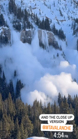
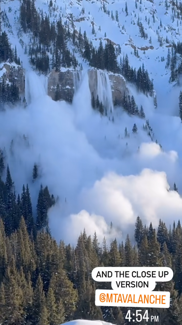
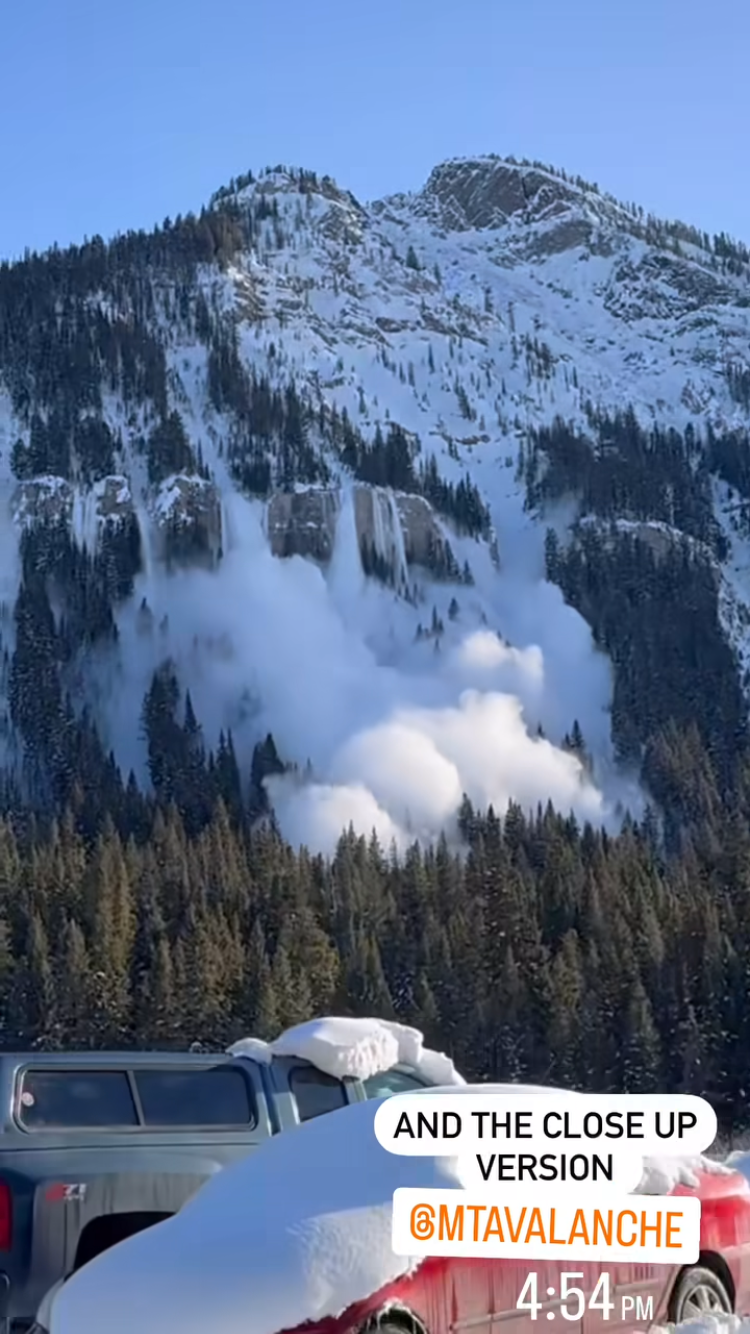
A natural avalanche was witnessed on the north side of Republic Mtn. on 3/9 at 4:54pm. It appeared to break around 3 feet deep. Photo: screenshot from IG, M. Simone
-
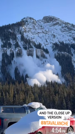
A natural avalanche was witnessed on the north side of Republic Mtn. on 3/9 at 4:54pm. It appeared to break around 3 feet deep. Photo: screenshot from IG, M. Simone
-
E aspect, 9100' Photo: B. Fredlund
-
N aspect, 9600' Photo: B. Fredlund
-
E aspect, 8800' Photo: B. Fredlund
-
SE aspect, 8800' Photo: B. Fredlund


Videos- Cooke City Area
WebCams
Soda Butte Lodge, looking West
Soda Butte Lodge, looking East

Weather Stations- Cooke City Area
Weather Forecast Cooke City Area
Extended Forecast for2 Miles NNE Cooke City MT
Overnight

Low: 37 °F
Rain/Snow
LikelyTuesday
High: 47 °F
Rain/Snow
Likely then
ShowersTuesday Night
Low: 30 °F
Chance
Rain/Snow
then Mostly
CloudyWednesday
High: 50 °F
Slight Chance
Snow then
Chance
ShowersWednesday Night
Low: 32 °F
Slight Chance
Rain then
Partly CloudyThursday
High: 53 °F
Partly Sunny
then Chance
ShowersThursday Night
Low: 34 °F
Chance
Showers then
Mostly ClearFriday
High: 55 °F
Sunny then
Chance
ShowersFriday Night
Low: 28 °F
Chance
Rain/Snow
then Slight
Chance Snow
Showers
The Last Word
We began daily forecasts on December 7. 130 daily forecasts and 464 reported avalanches later, we wrapped up our daily forecasting season on April 14th. Read our SEASON SUMMARY to look back at the 2023-24 avalanche forecasting season.
Thank you to everyone that sent in observations, read the advisories, took an avalanche class, or donated money, time or gear. Our success is directly related to support from the community and the Forest Service. Have a safe spring and summer!