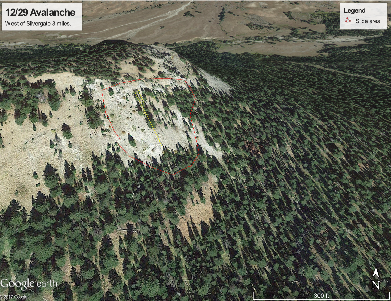
Google Earth view of Warm Creek Avalanche. Map shows approximate area of avalanche which caught two skiers and partially buried one.
From e-mail: "On 12/29 we parked about 2 miles west of Silvergate and skied a mile west on the road and turned north to the ridge just NE of Baronette pk. We were aware of high avalanche danger but somehow got complacent on our surroundings and ended up getting caught in this slide. The crown was 2-3 feet high and propagated well into the timber on the "Thanksgiving crust"
The slope angle was 33-36 degrees. We were traversing just below a cliff band when it broke taking both of us over a small ledge. I hung on to a aspen tree for awhile before getting pushed into a spruce tree and hung up. My partner hit several trees and was carried down 150-200 feet and partly buried but could get himself out. We both were scratched up a bit but skied out."
The slide broke 2-3' deep and 200' wide on a south facing slope around 8,500'. Photo: Anon