Good Morning. This is Doug Chabot with the Gallatin National Forest Avalanche Advisory issued on Wednesday, December 20th at 7:15 a.m. Today’s advisory is sponsored by World Boards and Spark R&D. This advisory does not apply to operating ski areas.
In the last 24 hours the mountains around Cooke City have 12” of new snow, the southern ranges and West Yellowstone have 5-6”, and Big Sky and the Bridger Range are showing 1-2”. Ridgetop winds are strong out of the southwest with speeds averaging 20-35 mph and gusts of 60 mph. Mountain temperatures are near 20F. After a pre-dawn lull, snowfall will begin this morning and drop 3-4” in all ranges with winds decreasing and snowfall ending later this afternoon.

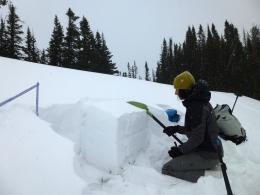
The mountains around Cooke City have gotten at least 1’ of new snow measuring 1.1” of snow water equivalent (SWE). Additionally, it’s very windy and snow will continue. On Sunday, I found a weak layer of faceted (sugary) snow on all aspects and elevations (photo, video). It is now buried 12-18” deep and is our main layer of concern. It will create avalanches today. An inch of SWE in 24 hours is a high rate of loading and is creating dangerous avalanche conditions. More snow and wind will not help. Cracking or collapsing on low-angled slopes or road cuts is a warning sign to not venture into or underneath avalanche terrain. Be cautious today as the avalanche danger is rated HIGH on all wind-loaded slopes and CONSIDERABLE everywhere else.

Carrot Basin in the southern Madison Range and the mountains outside West Yellowstone have received 6” of new snow (.5” SWE) and strong winds out of the southwest. The snowpack is thin, weak and unstable and will be taxed with this storm. On Friday, Eric found the top 6” of the snowpack to be weak and faceted and sitting on an ice crust, making a recipe for avalanches when it snows…like today. Wind-loaded slopes may avalanche naturally, but even on slopes without a wind-load you could trigger a slide since snowfall and winds are not abating. For today, the avalanche danger is rated CONSIDERABLE on all slopes.

The mountains around Big Sky and Bozeman have strong southwest winds and 1-2” of new snow. Wind slabs avalanched on Monday, but were stubborn yesterday. Weak, faceted snow can be found 4-6” under the surface on some slopes (W. side of the Bridger Range; in Hyalite) but not on others (video). Yesterday, three of us went to Mount Ellis and did not find this layer. In fact, we found a stable 3’ deep snowpack which was a bit surprising since this area tends to be shallower and weaker than other areas (snowpit profile, video). For today, the avalanche danger is rated MODERATE, but could rise to CONSIDERABLE on wind-loaded slopes with the approaching storm.
If you get out and have any avalanche or snowpack observations to share, drop a line via our website, email (mtavalanche@gmail.com), phone (406-587-6984), or Instagram (#gnfacobs).
Upcoming Avalanche Education and Events
BOZEMAN
TOMORROW, Dec. 21, Avalanche Awareness, 6-7:30 P.m. at Play It Again Sports, Bozeman
Jan. 12 and 13, Companion Rescue Clinic, Info and Register
Jan. 17, 18 and 20 or 21, Introduction to Avalanches w/ Field Day, Info and Register Here
Jan. 24, 25 and 27, Advanced Avalanche Workshop w. Field Day, Info and Register Here
Feb. 9 and 10, Companion Rescue Clinic, Info and Register
WEST YELLOWSTONE
Today and tomorrow, Snowmobiler Introduction to Avalanches with Field Course, Info and Register Here
Jan. 6, Avalanche Awareness, 7-8 p.m. at West Yellowstone Holiday Inn Conference Center
COOKE CITY
22 and 23 December, Weekly Current Conditions and Avalanche Rescue, 6:30-7:30 p.m. Friday @ the Super 8, and anytime between 10-2 on Saturday @ Lulu Pass road.
Check out Chabot’s article, Being Prepared that was just published in the Chronicle’s CARVE magazine this weekend. In essence, preparation decreases the chance for negative outcomes.