Photos
|
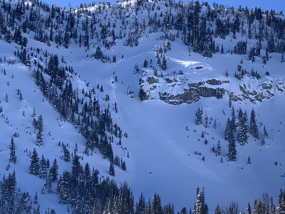
Bridger Range, 2020-02-07 We saw this avalanche on the afternoon of 2/7/2020. It looks to have broken in the storm snow about 3 feet deep. North of Bridger Bowl on an East aspect at 7,900'. It probably occurred within the last 24-36 hrs. Photo: GNFAC Link to Avalanche Details |
|
Northern Madison, 2020-02-06 We triggered this avalanche in the second Yellow Mule off Buck Ridge on 2/6/2020 It is on a small roll/cornice "in the flats". It broke within the current 2-3' storm snow. Photo: GNFAC Link to Avalanche Details |
|
Northern Madison, 2020-02-06 A snowmobiler triggered this avalanche in the second Yellow Mule off Buck Ridge on 2/6/2020 It is on a small roll/cornice "in the flats". It broke within the current 2-3' storm snow. Photo: GNFAC Link to Avalanche Details |
|
Northern Madison, 2020-02-06 We saw this natural crown that broke within the current 2-3' storm on a small terrain feature. It is in the second Yellow Mule off Buck Ridge on 2/6/2020. Photo: GNFAC Link to Avalanche Details |
|
Southern Madison, 2020-02-05 This small natural avalanche was seen in Teepee basin on Tuesday, 2/4. Photo: A. Wheeler Link to Avalanche Details |
|
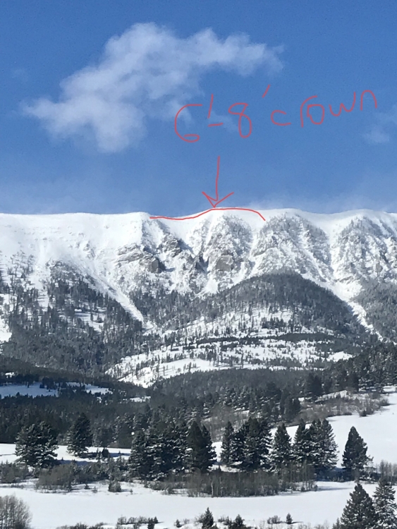
Bridger Range, 2020-02-05 "I took this photo from the highway today just before noon 2/4/20. Looked pretty fresh and not blown in much and the winds were howling.
Largest part of the crown looked 6-8' tall right in the center. It connected across a pretty low angle shoulder to pull out the northern bowl." Photo: R. Griffen
Link to Avalanche Details
|
|
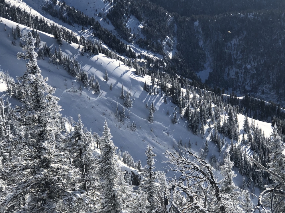
Bridger Range, 2020-02-04 "Saw this looking south from top of the ramp into Jones creek. Looks to be just new snow but couldn’t see the whole crown or the slide path." Photo: Andrew Dombroski Link to Avalanche Details |
|
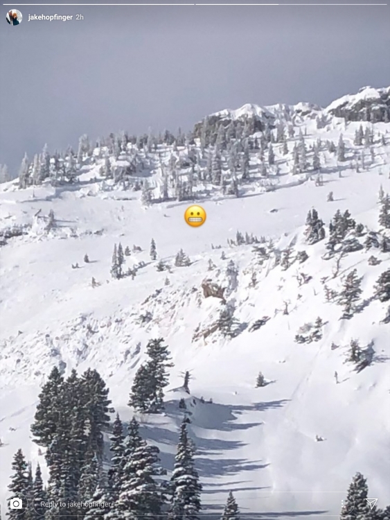
Bridger Range, 2020-02-04 This avalanche was seen on Tuesday, Feb 4 and likely released on Monday from the wind loading. Photo: @jakehopfinger Link to Avalanche Details |
|
Bridger Range, 2020-02-04 This avalanche was seen on Tuesday, Feb 4 and likely released on Monday from the wind loading. Photo: @jakehopfinger Link to Avalanche Details |
|
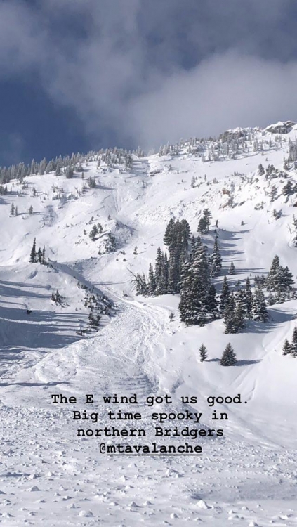
Bridger Range, 2020-02-04 "I saw two crowns from the ridge at 1430 today (2/4). One on the lower heavily wind loaded shoulder and one up high in the middle of the path. Not sure if they connected, or were separate. R3-D2.5. 2-4’ deep. The higher one was partially drifted in. My guess is ran yesterday with east winds or early today." Photo: GNFAC Link to Avalanche Details |
|
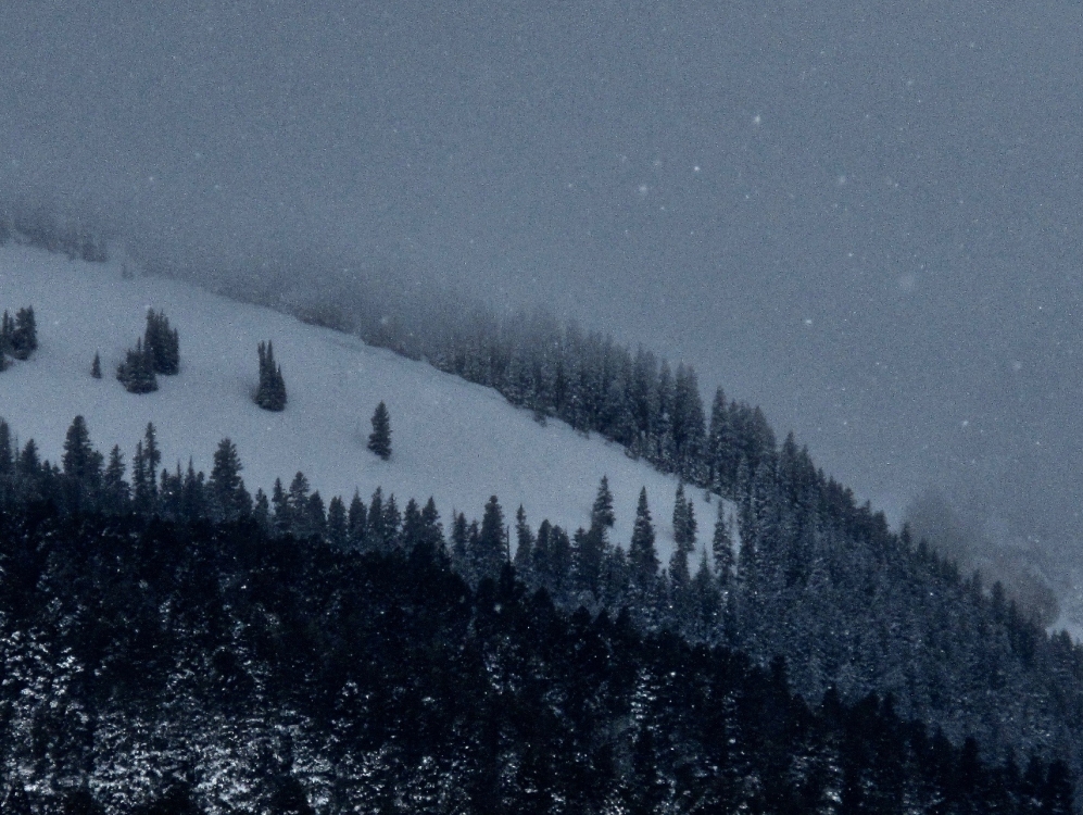
Northern Madison, 2020-02-04 East facing slope seen from Big Sky meadow after Sunday’s storm. Photo: Don Mattusch Link to Avalanche Details |
|
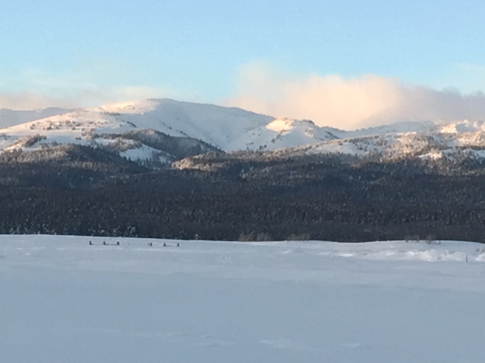
Island Park, 2020-02-04 I took out my binoculars from our cabin on the west shore of Island Park Reservoir and noticed this huge slide in the bowl south of Reas peak. Started at the little tree band below the ridge, takes out 1/3 of the bowl, and runs into the Blue Creek terrain trap. I assume this is a natural avalanche as I don’t see tracks (hard to see in this light). Photo: M Elstad
Link to Avalanche Details
|
|
Island Park, 2020-02-04 I took out my binoculars from our cabin on the west shore of Island Park Reservoir and noticed this huge slide in the bowl south of Reas peak. Started at the little tree band below the ridge, takes out 1/3 of the bowl, and runs into the Blue Creek terrain trap. I assume this is a natural as I don’t see tracks (hard to see in this light). Photo: M Elstad
Link to Avalanche Details
|

|
Cooke City, 2020-02-04 The Nose of Town Hill avalanched on Feb. 1 due to the strong SWerly winds and looked to be triggered by a cornice fall (estimated 2-3' crown, about 75-100' wide). Photo: B Fredlund Link to Avalanche Details |

|
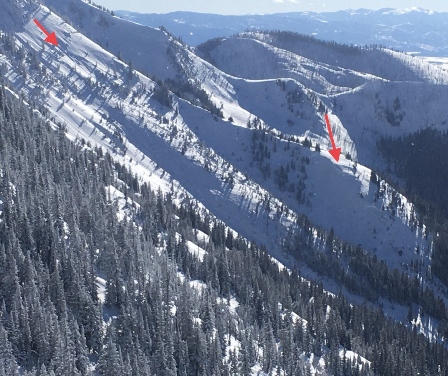
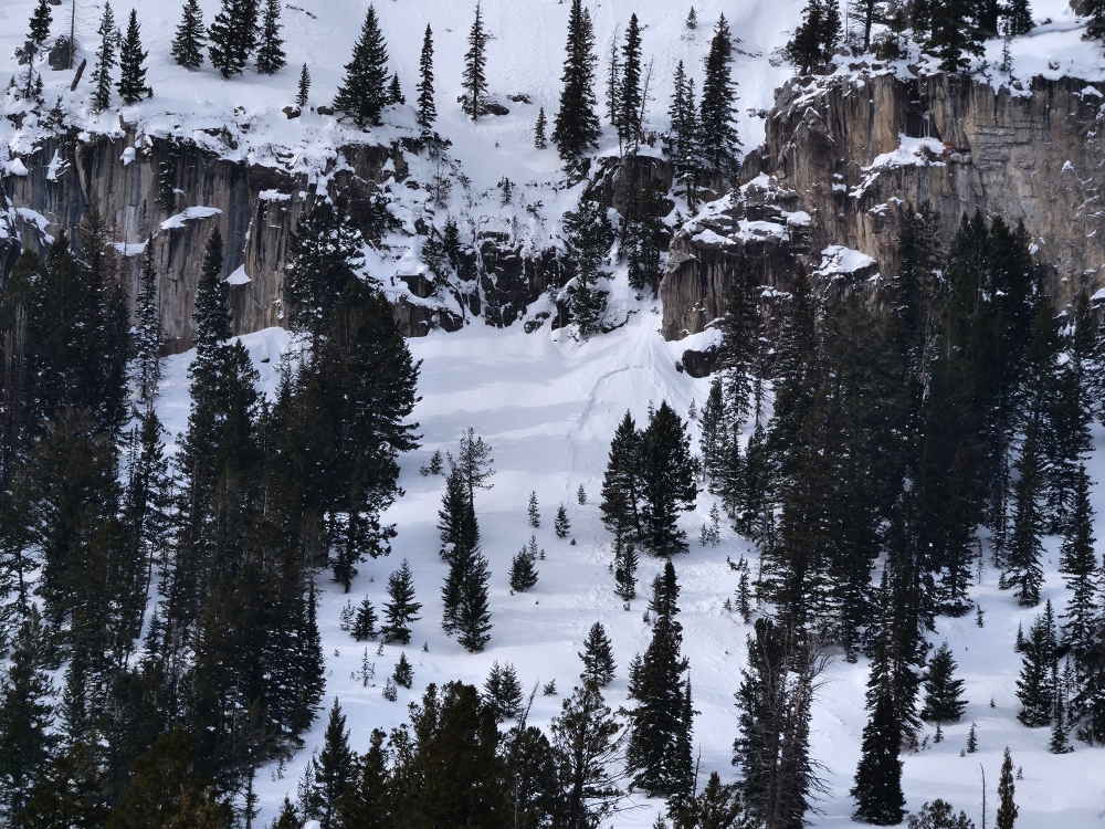
Bridger Range, 2020-02-03 Saw this today while skiing. This crown is on a northeast aspect at about 8600 feet. Crown height 6-8 feet. It is mid path in the Great One. It seems to have naturally avalanched on Sunday during the storm, without a cornice trigger, after the wind event. All I can get here is that the slope was overloaded from storm snow, on top of a recently overgrown hard slab. Looks like it initiated higher up and pulled out much deeper below. Definitely a large hard slab avalanche. HS-N-R3-D3.5. Debris made it to the trees in the historic path. Otherwise, northeast aspects are loaded above 8500 feet, and I saw about 14 inches of new at 8000 feet. No loading during the day today. Photo: T. Woodward Link to Avalanche Details |
|
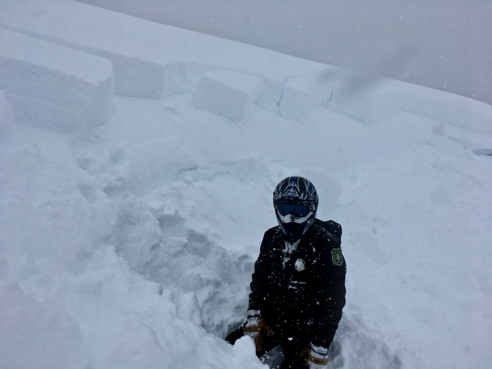
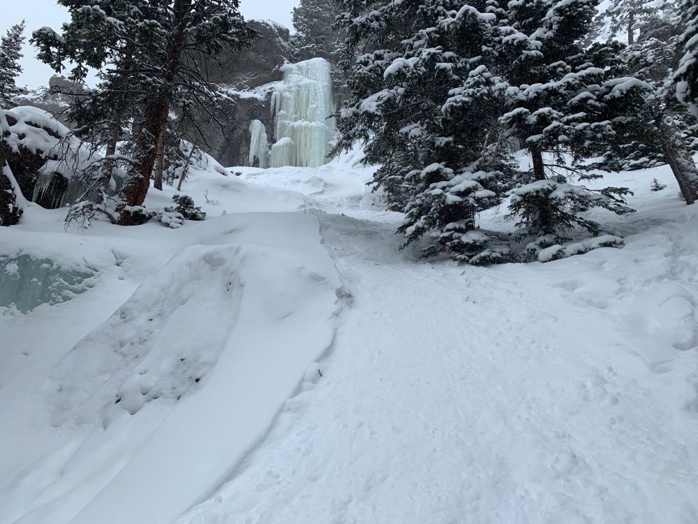
Northern Gallatin, 2020-02-03 Climber caused icefall that triggered a small avalanche. Thankfully, the bed surface was ice just a few inches down and the belayer was just outside the path. Minor entrainment Photo: Anonymous |
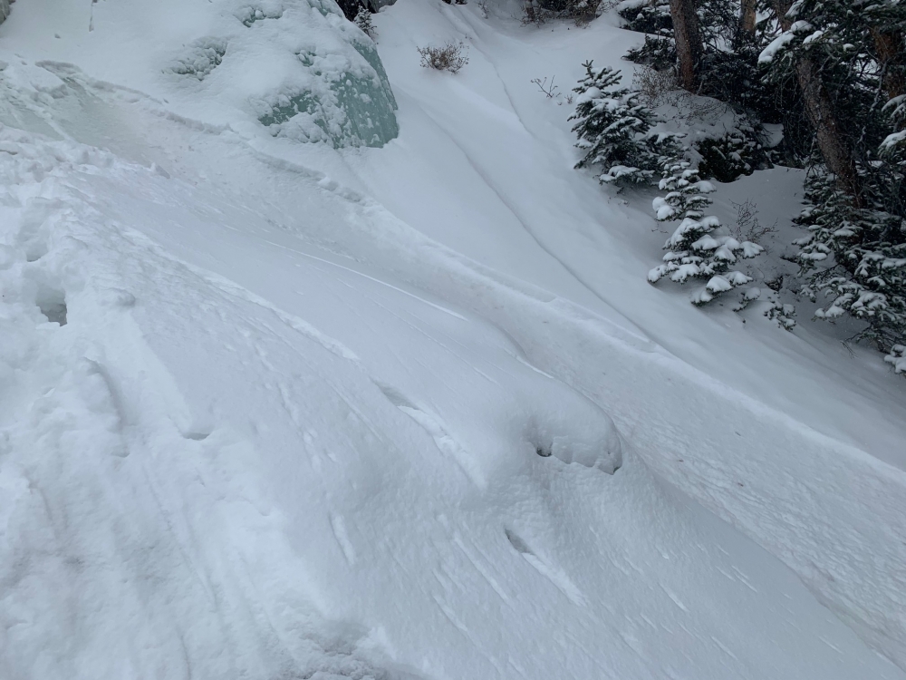
|
Northern Gallatin, 2020-02-03 Climber caused icefall that triggered a small avalanche. Thankfully, the bed surface was ice just a few inches down and the belayer was just outside the path. Minor entrainment Photo: Anonymous |
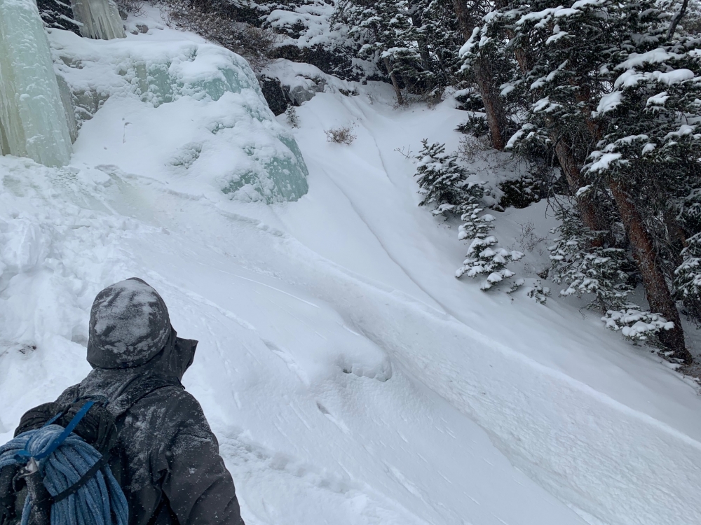
|
Northern Gallatin, 2020-02-03 Climber caused icefall that triggered a small avalanche. Thankfully, the bed surface was ice just a few inches down and the belayer was just outside the path. Minor entrainment Photo: Anonymous |
|
Cooke City, 2020-02-03 SEerly aspect around 8600'. A thinner, smaller storm slab, triggered by dry loose from above. Photo: B. Fredlund Link to Avalanche Details |
|
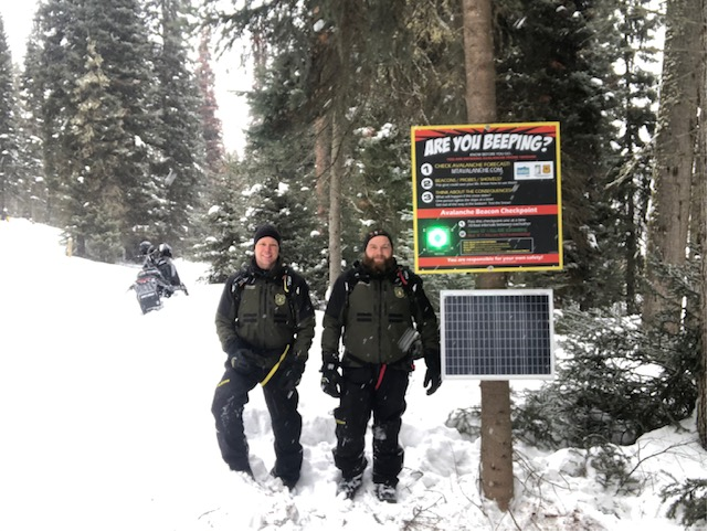
Lionhead Range, 2020-02-03 Hebgen/West Yellowstone snow rangers and Montana State Parks installed this beacon checker at the trail into Lionhead Ridge. It is a great asset to promote avalanche awareness in our area. Photo: J. Norlander |