Photos
|
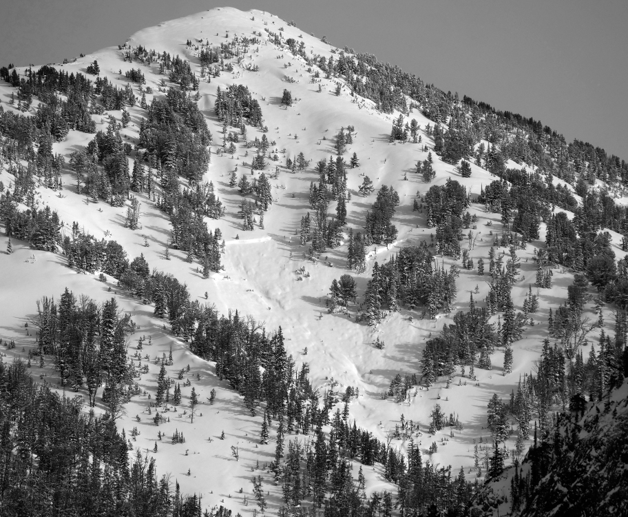
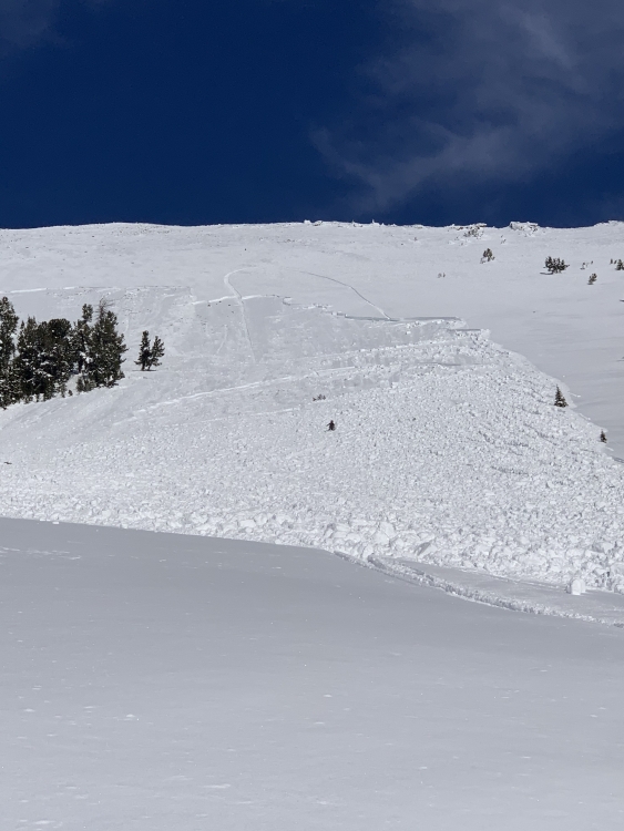
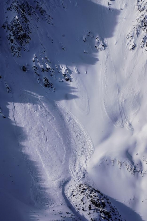
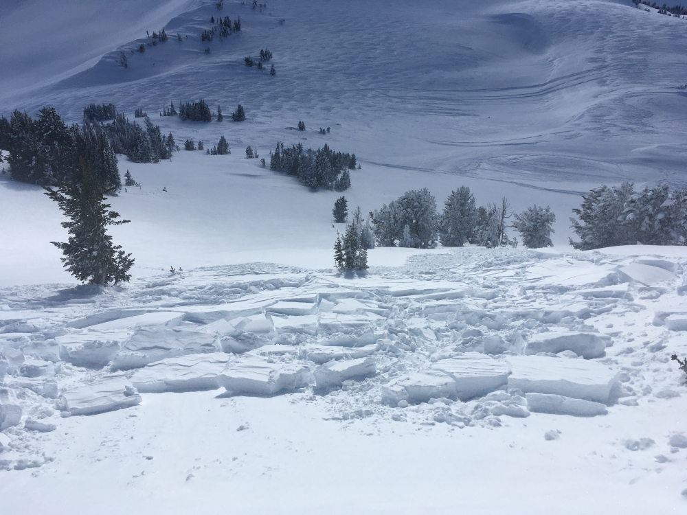
Cooke City, 2020-02-03 SWerly aspect around 9500'. Deep slab, mid-slope. I'd estimate that crown to be about 4-6' deep. Photo: B. Fredlund Link to Avalanche Details |
|
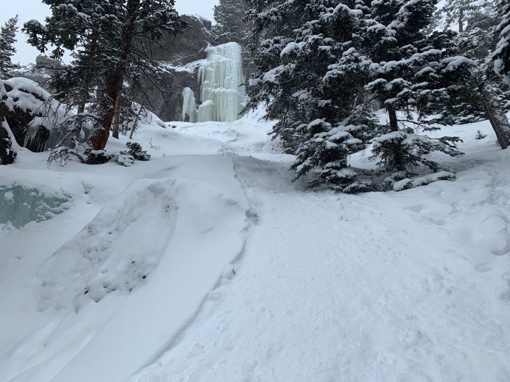
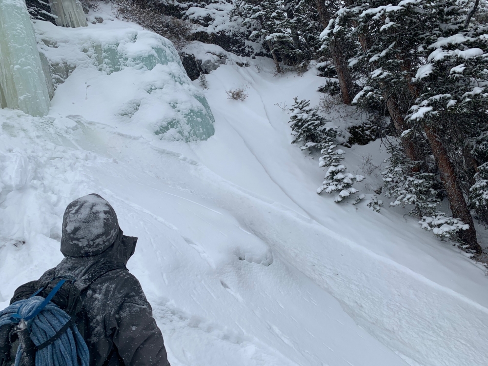
Northern Gallatin, 2020-02-03 From an observation: "Climber caused icefall that triggered small avalanche. Thankfully, the bed surface was ice just a few inches down and belayer was just outside the path. Minor entrainment." Photo: Joe Vogel Link to Avalanche Details |
|
Northern Gallatin, 2020-02-03 From an observation: "Climber caused icefall that triggered small avalanche. Thankfully, the bed surface was ice just a few inches down and belayer was just outside the path. Minor entrainment." Photo: Joe Vogel Link to Avalanche Details |
|
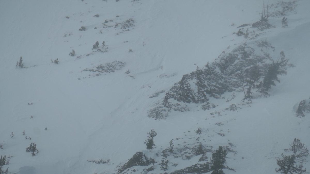
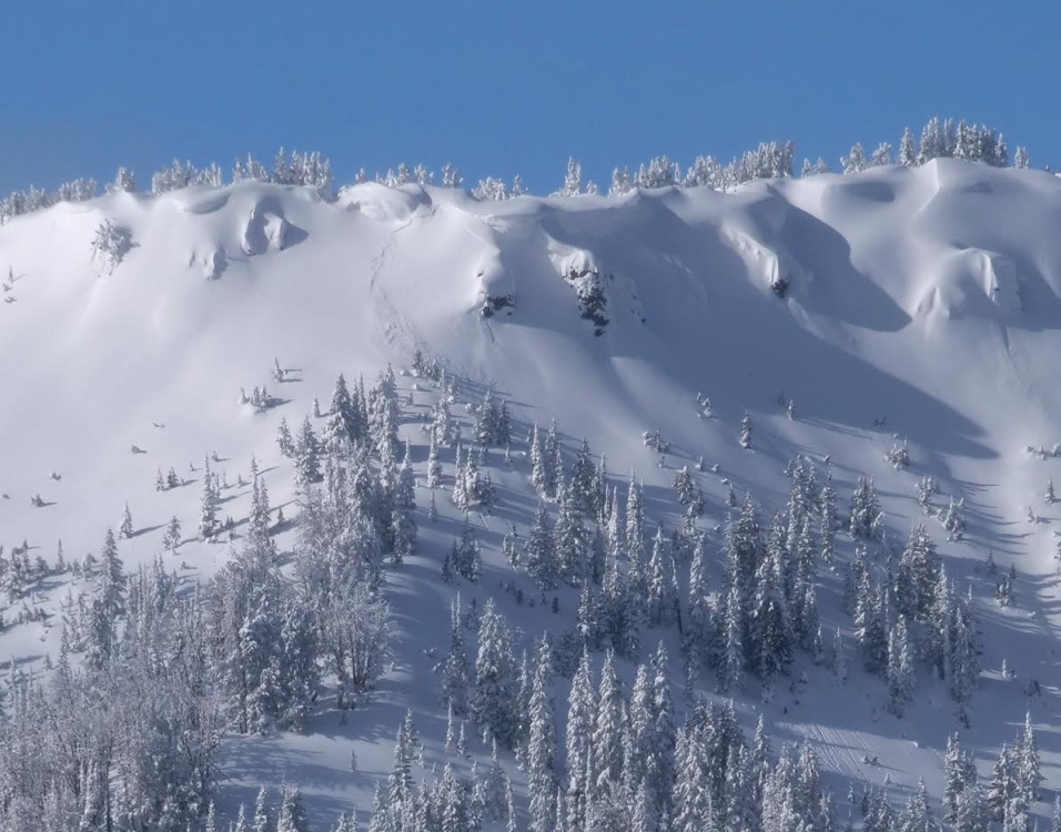
Cooke City, 2020-02-02 Winds Friday night transported snow creating fresh drifts that avalanched naturally over the weekend. This one on the east side of Woody Ridge appears to be 2-3' deep and 50' wide. Photo: GNFAC Link to Avalanche Details |
|
Southern Madison, 2020-02-02 From riders involved: "Yesterday we were the ones in the big sky avalanche. There was no markings on the spot we were climbing. Further down the mountains there were climbs at the same angles of this slope. Thankfully the rider was above the slide when it started and managed to stay on top. Rider walked down the debris and we found the sled lower down in the trees. No injuries." Photo: Anonymous Link to Avalanche Details |
|
Southern Madison, 2020-02-02 From obs. form: "[slope] Was marked up previously. We parked out near the bottom and a few guys not in our group start climbing. So we watch them climb. It breaks out. Guy ditches the sled and manages to stay up top. Sled goes down with the slide. Then the snow breaks in 2 other spots creating more slides." Photo: C. Carlson Link to Avalanche Details |
|
Northern Madison, 2020-02-01 From BSSP: " Also saw a large slide on one of the far ridges of Cedar that was not there yesterday and appears to be cornice triggered." Link to Avalanche Details |
|
Out of Advisory Area, 2020-01-31 These slides are in the Absarokas, outside of our advisory area. From email (1/30/2020): "We went for a tour up Arrastra Creek in the Absarokas and were not the least bit surprised to find recent avalanche activity, shoot cracks and unstable results. We stayed out of avalanche terrain but still got a good look at a lot of new-ish crowns. All of the slides appeared to be 1-2 days old and ran naturally. Most looked like wind slabs that broke on thin rocky terrain and under cornice failures. Some stepped down to the depth hoar, which easily makes up 70% of the snowpack out there. All slides were on eastern aspects."
|
|
Northern Gallatin, 2020-01-31 From an observation: "We were up on the ridge off Palace Butte and saw this recent natural released slide. Crown was big in spots. Must have happened sometime over night or in the morning (1/29 or 1/30) perhaps from the recent wind loading. East, southeast facing, on the peak north of MT Bole." Photo: A. Schrier Link to Avalanche Details |
|
Cooke City, 2020-01-31 From email (1/30/2020): "2 natural avalanches that ran last night, just west of Cooke City. Both slides were on easterly aspects around 9500'." Link to Avalanche Details |
|
Cooke City, 2020-01-31 From email (1/30/2020): "2 natural avalanches that ran last night, just west of Cooke City. Both slides were on easterly aspects around 9500'." Link to Avalanche Details |
|
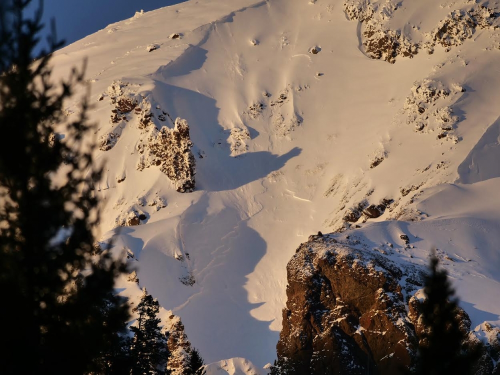
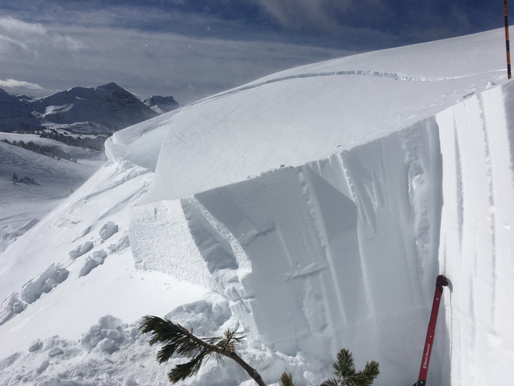
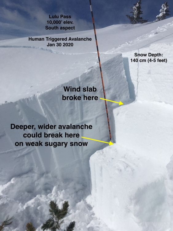
Cooke City, 2020-01-30 We triggered this avalanche of wind-drifted snow as we approached very carefully from a low angle slope above, on 1/30/2020. This is near Lulu Pass outside Cooke City on a south facing slope at 10,000'. It broke within recently drifted snow, but these slabs could be enough weight to break deeper and wider on sugary layers deep in the snowpack. Photo: GNFAC Link to Avalanche Details |
|
Cooke City, 2020-01-30 We triggered this avalanche of wind-drifted snow as we approached very carefully from a low angle slope above, on 1/30/2020. Triggered from where Alex is standing. Near Lulu Pass outside Cooke City on a south facing slope at 10,000'. It broke within recently drifted snow, but these slabs could be enough weight to break deeper and wider on sugary layers deep in the snowpack. Photo: L. Browning Link to Avalanche Details |
|
Cooke City, 2020-01-30 We triggered an avalanche of wind-drifted snow as we approached very carefully from a low angle slope above, on 1/30/2020. It broke within recently drifted snow, but these slides could be enough weight to break deeper and wider on sugary layers deep in the snowpack. Photo: GNFAC Link to Avalanche Details |
|
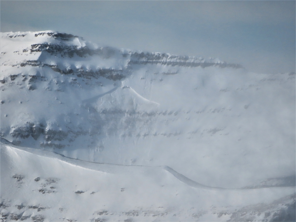
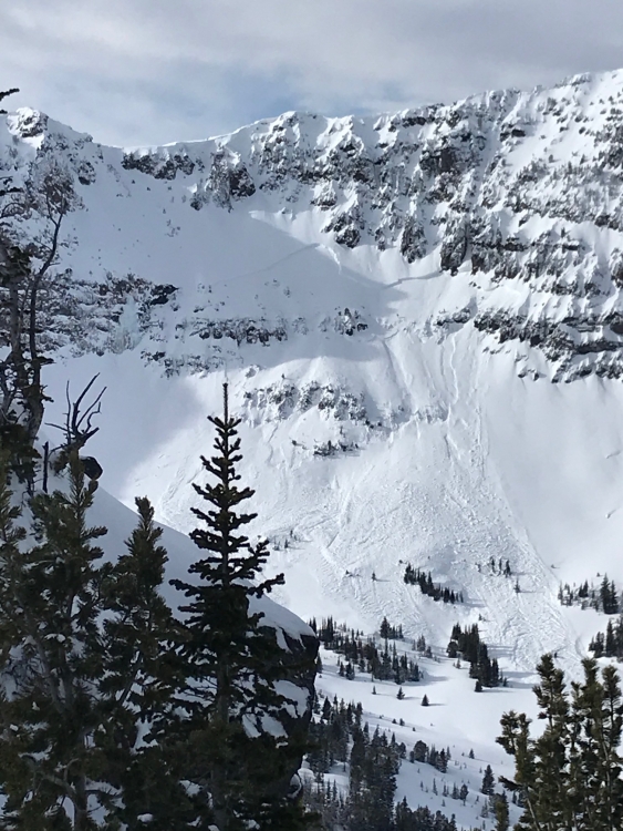
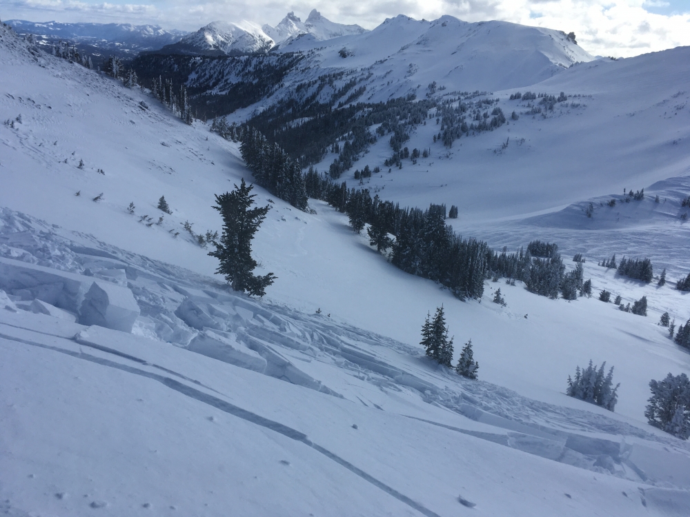
Bridger Range, 2020-01-29 Avalanche crown visible near the top of Naya Nuki Peak in the Northern Bridgers. Estimated max crown depth of 10 ft, approximately 200 ft wide. Photo taken Jan 29th, 2020. Several inches of snow were on the debris, avalanche likely occurred on Monday, Jan 27th. Photo: E. Otto Link to Avalanche Details |
|
Northern Gallatin, 2020-01-29 Snow picked up at Mt. Blackmore with calm to light winds. Someone up there before us pulled out a small wind loaded pocket on the face leaving the basin. Photo: S Jonas Link to Avalanche Details |