Photos
|
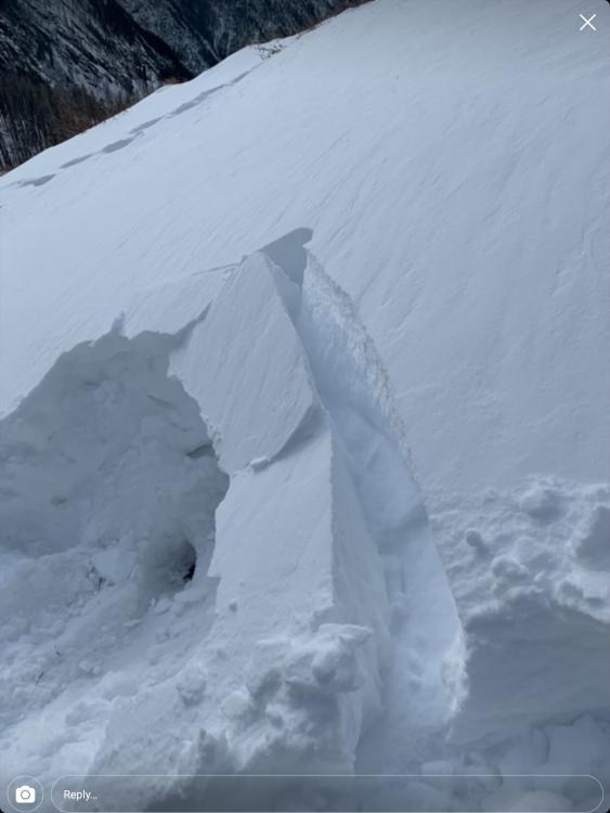
Bridger Range, 2021-12-16 On 12/16/21 A skier in a group of three triggered and was caught in this avalanche near The Apron at Bridger Bowl. The ski area is closed and backcountry conditions exist. Nobody was injured. Link to Avalanche Details |

|
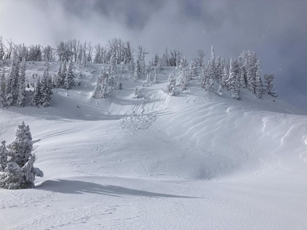
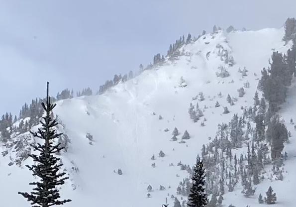
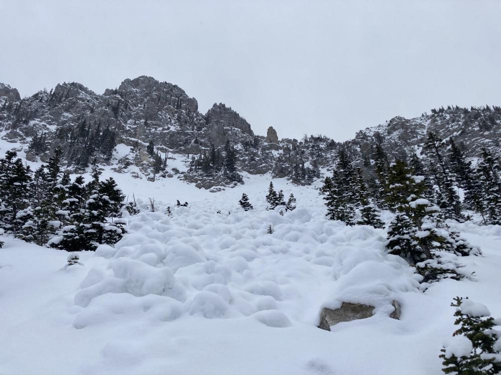
Southern Madison, 2021-12-15 Natural avalanche in Taylor Fork that broke 100ft wide, 2-3 ft deep, beneath the recent storm snow. Appears to have failed towards the end of the storm (likely 12/15/21). Photo: GNFAC Link to Avalanche Details |
|
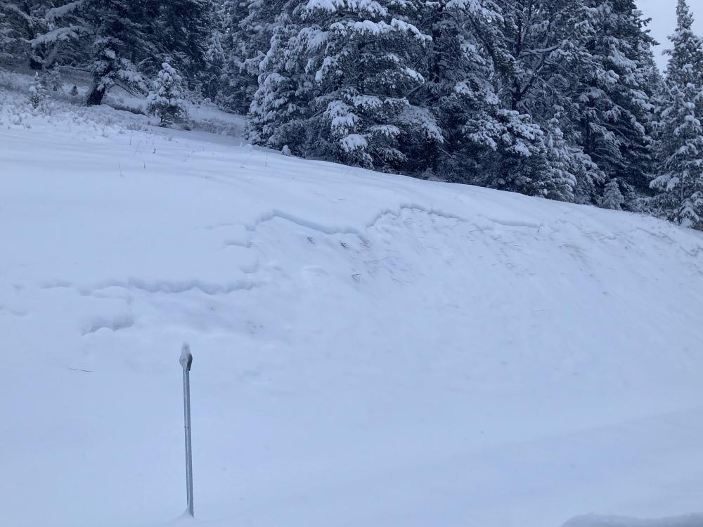
Southern Madison, 2021-12-15 This avalanche was remotely triggered by snowmobilers from over 100 ft away on 12/15. It broke beneath the recent storm snow, 1-2 ft deep. Photo: GNFAC Link to Avalanche Details |
|
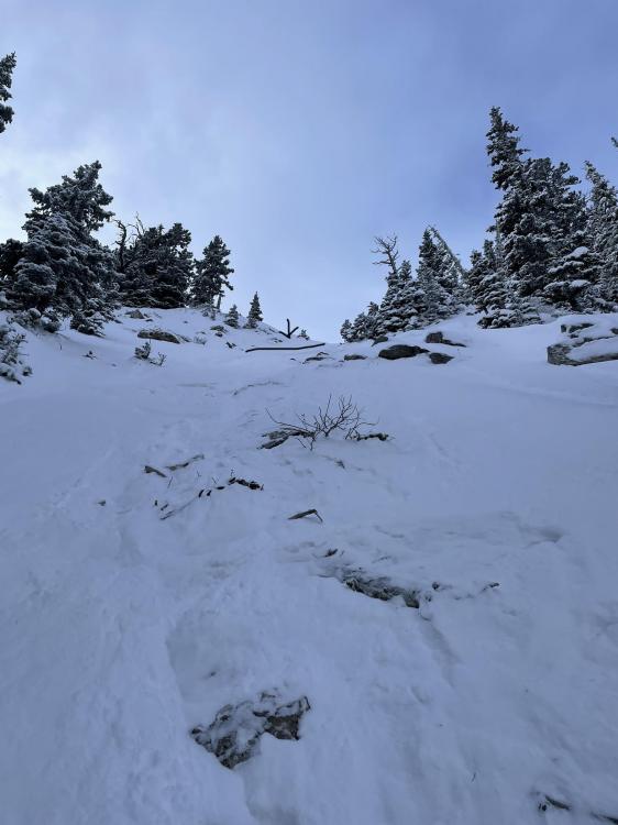
Northern Gallatin, 2021-12-15 Skiers up the East Fork of Hyalite Creek observed this small avalanche on a road cut. Photo: S. Reinsel |

|
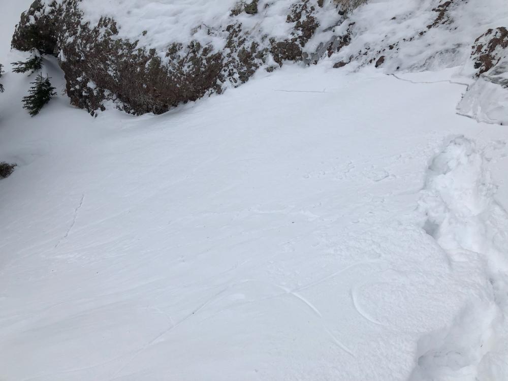
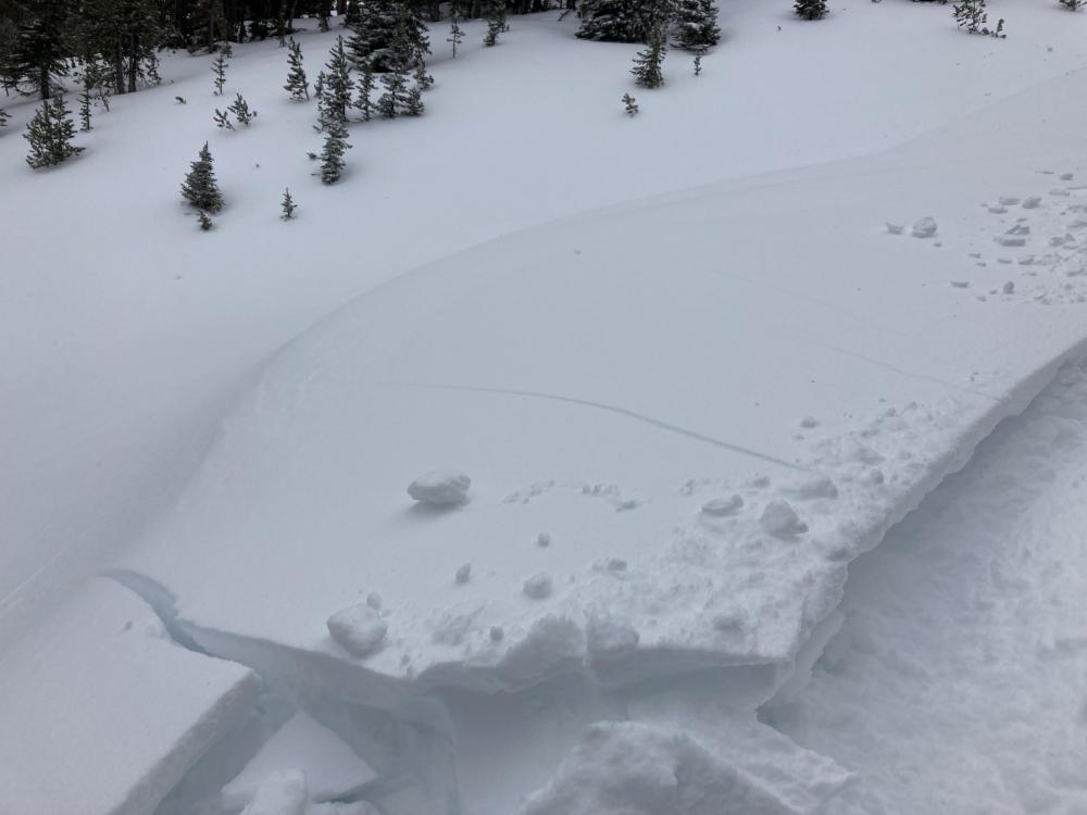
Southern Madison, 2021-12-15 A skier in the Southern Madison Range remotely triggered this avalanche in the Bacon Rind area from a flat bench above the slope. It broke over 50-75' away where the slope got steeper. Human-triggered avalanches are likely. Avoid steep terrain until the snowpack stabilizes. Photo: Anonymous Link to Avalanche Details |
|
Northern Gallatin, 2021-12-13 From IG 12/12/21: @montanamountainmedicine Link to Avalanche Details |

|
Southern Madison, 2021-12-12 From obs: 12/12/21: "Heavy wind loading from gusty SW winds and recent snowfall. Made for some touchy conditions. This was at 9100’ between Sage and Sunlight basins." Photo: JR Mooney |
|
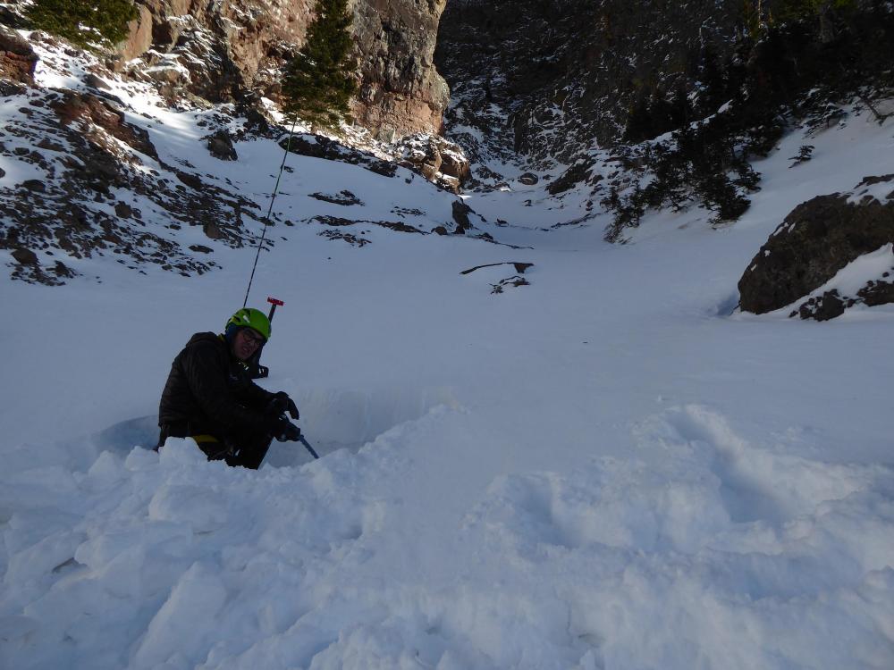
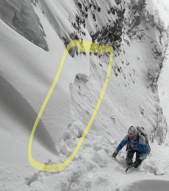
Northern Gallatin, 2021-12-12 From obs: 12/12/21: "Shooting cracks and whoomphing in wind loaded areas. An approximately 15x30ft wind slab cracked along the base of a rock band and settled at the base of P2 on high fidelity. Was triggered while traversing along the rock band to gain the second pitch, 1-2 inches of facets on the ground. Wind slab of 6-36in in the gullies." Photo: M. Hearley Link to Avalanche Details |
|
Lionhead Range, 2021-12-12 At Lionhead Ridge, strong winds are drifting snow into unstable slabs. On steep rollovers, we observed shooting cracks and one large collapse, or "whumph." With more wind and snow in the forecast, expect conditions to get more dangerous before they improve. Photo: GNFAC Link to Avalanche Details |
|
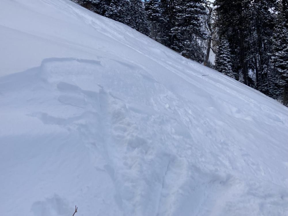
Bridger Range, 2021-12-10 In the Bridger Range on December 10, 2021 2-3" of low density new snow was drifted into small soft slabs that were easy to trigger. Photo: GNFAC Link to Avalanche Details |

|
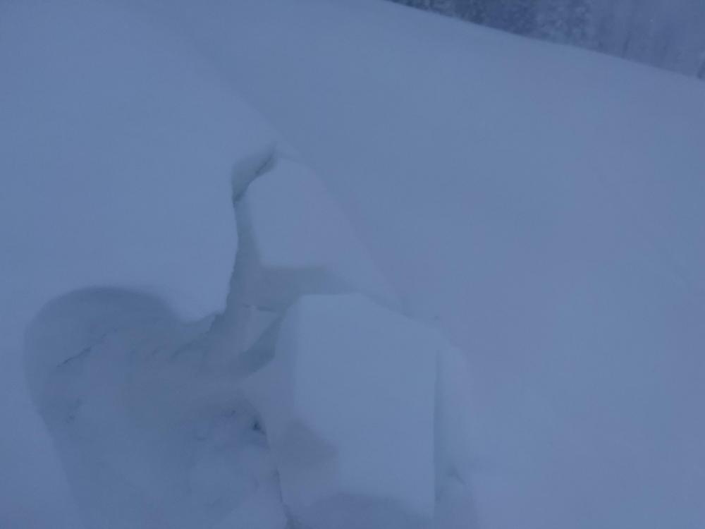
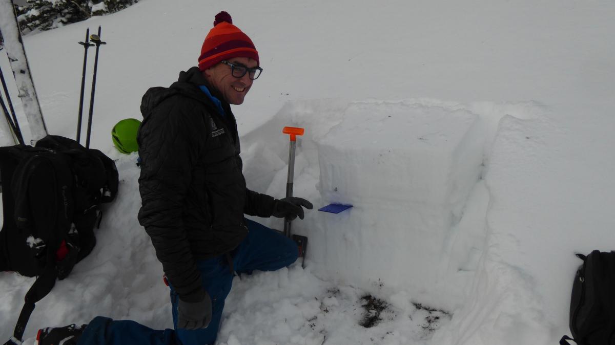
Northern Gallatin, 2021-12-10 This pit was dug in Hyalite Canyon near Twin Falls. It showed 2 mm facets (sugar snow) underlying the snowpack. This layer did not break in stability tests, but anticipate these grains will get weaker with time. Photo: GNFAC |

|
Northern Gallatin, 2021-12-09 For the Bozeman Ice Fest we investigated the Silken Falls and Avalanche Gulch gulleys. They were wind-loaded and had weak snow mid-pack that was unreactive. Avalanches in these gulleys would be deadly, so be extra vigilant in your assessment before crossing. Photo: GNFAC |
|
Bridger Range, 2021-12-08 We found 80 cm (2+ feet) of snow on a NE facing slope at 8,000 feet outside Bridger Bowl's Boundaries. The snow was supportable with a weak layer at the blue card. Faceted, weak, sugary snow is the layer of concern, but it was not that bad...yet. We'll be watching to see if it gets weaker. Photo: GNFAC |
|
Out of Advisory Area, 2021-12-08 Monday night's new snow formed wind slabs from the strong wind on Tuesday. We are finding these throughout southwest Montana. Photo: D. Britt |
|
Cooke City, 2021-12-07 New snow was blown into thick drifts that can be triggered by skiers or riders. Cracking like this is a sign that drifts are unstable and could slide on steeper slopes. Photo: GNFAC |
|
Cooke City, 2021-12-07 This small natural wind slab was observed north of Cooke City on 12/7/21. Photo: GNFAC Link to Avalanche Details |
|
Bridger Range, 2021-12-06 "Wet slide from [around 12/1/21]. When it was so damn warm. Velma's and Peter's point runout...." Photo: S. Cottom Link to Avalanche Details |

|
Southern Madison, 2021-12-06 From obs (12/5/21): "Went poking around in the Taylor Hilgard today looking for snow. As expected, found a thin and faceted snowpack at lower elevations. Snowpack improved considerably above 8500', often .5-1m. I dug a quick pit to the ground on a N-NE facing slope at around 9300'. Pit measuded 1.1m, and to my surprise consisted of a relatively compacted and consolidated snowpack, almost entirely 4f hardness. I was expecting to find layers of facets near the base of the snowpack, and between crusts in the middle, but did not." Photo: L. Heine |
|
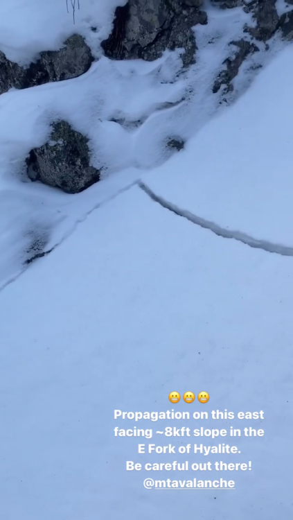
Northern Gallatin, 2021-12-06 This post and picture was on the FB ice climbers page. This is from Comet Alley, a steep gully off the East Fork Road: Today we found that this gully has some significant loading. We triggered a few wind slab slides on the approach. We managed to get a quick lap on the route and got out before it got loaded more. TBH with more unconsolidated snow I’d reconsider going there. Link to Avalanche Details |