Photos
|
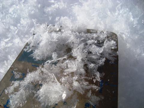
Southern Madison, 2011-12-13 Potato chip sized crystals of surface hoar at Bacon Rind in the southern Madison Range. We found this from the highway to 9,000 feet. Photo GNFAC |
|
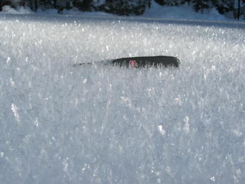
Northern Gallatin, 2011-12-13 Surface Hoar is being found in many locations throughout southwest Montana. This picture was taken up Hyalite. If it does not melt or get blown over before the next snowstorm, it can produce avalanches when buried. Photo: W. Shoutis |
|
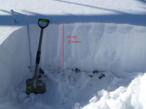
Northern Gallatin, 2011-12-11 The snowpack on Mt Ellis consists of a variety of faceted layers. Some are more dense than others, but the fact is if this slope gets a load it will likely produce avalanches. Photo: GNFAC |
|
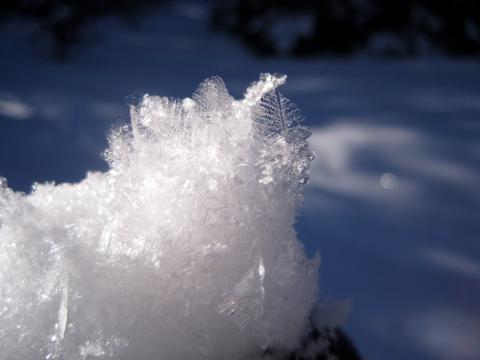
Northern Gallatin, 2011-12-11 Surface hoar has been found in many areas in the northern Gallatin Range. Photo: Alex Marienthal |
|
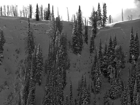
Cooke City, 2011-12-09 This natural avalanche occured near Cooke City on a NE facing slope near 9100 ft. This avalanche shows three things: 1)Cornices near the ridgetop indicate wind loading. 2)Weak facets near the ground have no problem fracturing across tree covered slopes. 3)If avalanches are occurring naturally, then they can surely be triggered by a skier or rider. Photo: B. Fredlund |
|
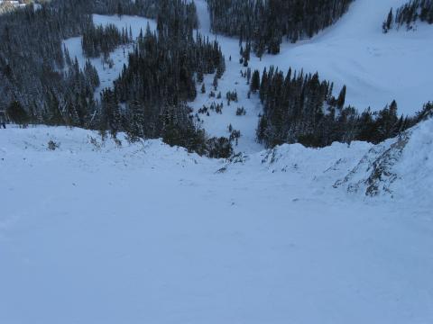
Northern Madison, 2011-12-09 This is the track and runout from an avalanche triggered by the Moonlight Basin Ski Patrol on a heavily wind loaded slope. Being caught in an early season slide is serious and likely to cause serious trauma. Photo: GNFAC |
|
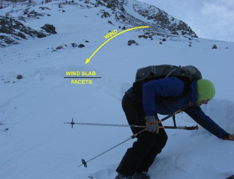
Northern Madison, 2011-12-09 This avalanche was triggered by explosives by the Moonlight Basin Ski Patrol; however, this slope was heavily wind loaded and could have easily been triggered by a skier or rider. The snowpack is thin and weak with very large facets sitting under a fresh wind slab. This is a classic recipe for an avalanche. See a snowpit from the adjacent slope at: http://bit.ly/tL6j78 Also, see a video: http://bit.ly/vyZgut Photo: GNFAC
|

|
Cooke City, 2011-12-07 A skier noted significant cracking above 9,500 feet on Mt. Republic yesterday. This hard slab of windblown snow cracked 30+ feet on a <30 degree slope. Cracking is Bull's-eye data that the snow is unstable. Photo: Beau Fredlund |
|
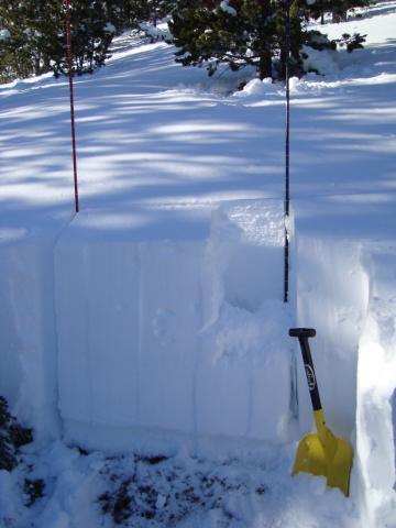
Northern Gallatin, 2011-12-06 This three foot deep snowpack was breaking near the ground on facets. ECTP22,Q1 was our test score. The pit was at 9,330 feet on a southeast facnig slope. We were not excited to find the weak snow propagating fractures and we stuck to terrain that was not exposed to avalanches. Photo: GNFAC |
|
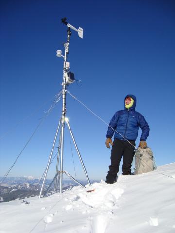
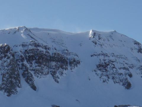
Northern Gallatin, 2011-12-06 Mark Staples checked out the weather station today which has been broken since it got hit with 100 mph winds over a month ago. It'll require another trip later in the season to repair. Situated at a little over 10,000 feet near Flanders peak we got a great view of the surrounding mountains. The Bridger Range is in the far distance. Photo: GNFAC |
|
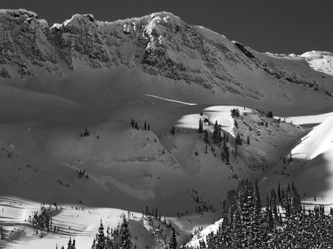
Cooke City, 2011-12-05 A recent, natural slide on a wind-loaded, south-southwest facing slope on Sheep Mountain outside Cooke City. Photo: B. Zavora |
|
Cooke City, 2011-12-05 Photo of a natural slab avalanche that ran in the last 24 hrs outside Cooke City up Sheep Creek. It was a northeasterly aspect around 9400’ and as you can see it’s thin- maybe a foot deep, and around 70’ wide. A couple of other natural sluffs were noted, N and S aspects, short running, new snow, from the last 24 hrs as well. Photo: Beau Fredlund
|
|
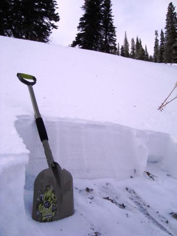
Lionhead Range, 2011-12-04 This east facing slope at 8100 feet is comprised of facets. Nine days ago it was stronger, but the cold temperatures turned the snow crystals into large grains of unbonded snow. Here is a snowpit of this picture (http://www.mtavalanche.com/images/11/ski-hill-lionhead-0?size=_original) and here is a video of Eric Knoff explaining the snow structure (http://www.youtube.com/watch?v=dDwWL8vMDyY). Photo GNFAC. |
|
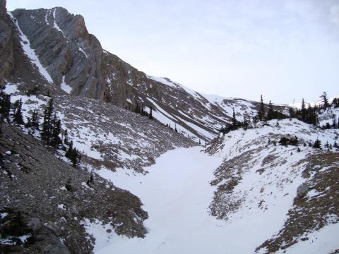
Bridger Range, 2011-11-29 Thin and irregular snowcover will make stability assessment complicated when this terrain gets covered with more snow. Some areas are covered with weak facets, others are strong wind drifts and some are bare dirt. Photo: GNFAC |
|
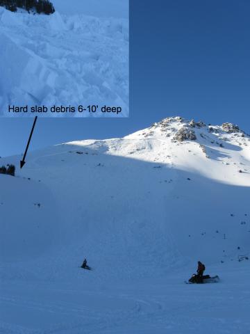
Cooke City, 2011-11-27 This avalanche occurred on Saturday, Nov 26. It was triggered by a snowmobiler who was fortunately able to out run the avalanche. This slope was heavily wind loaded and the avalanche broke 3 feet deep. A relatively flat area near the left side of the photograph caused the debris to pile up very deeply. Aspect 160 deg. Elev. 9715. Watch a video of our investigation here:http://www.youtube.com/watch?v=7Z3cgH7eya0 Photo: GNFAC |
|
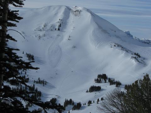
Cooke City, 2011-11-27 This avalanche occurred recently on Fisher Peak near Lulu Pass outside of Cooke City. This slope has a thinner and weaker snowpack than other slopes and also had a heavy load of wind blown snow. Here's our snowpit of the flank: http://www.mtavalanche.com/images/11/fisher-peak?size=_original Photo: GNFAC |
|
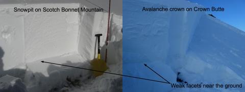
Cooke City, 2011-11-27 The photo on the right is from a snowmobile triggered avalanche on Crown Butte on 11-26. The photo on the left shows a nearly identical snowpack on nearby Scotch Bonnet Mtn the same day where a stability test broke on facets near the ground (ECTP 17). A similar layer of facets produced the human triggered avalanche on Crown Butte. Slopes with recent avalanches are clear evidence that similar slopes with a similar snowpack structure are prime places to trigger more avalanches. Photo: GNFAC |
|
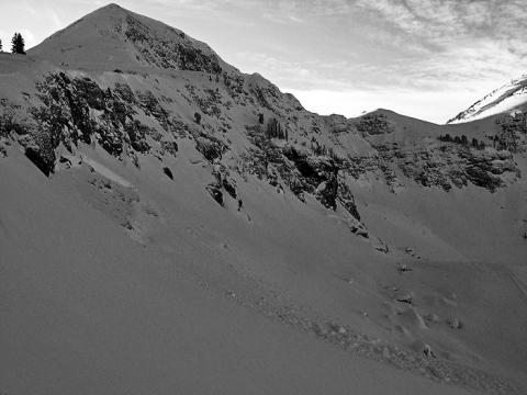
Cooke City, 2011-11-27 A deeper snowpack and facets near the ground are producing both natural and human triggered avalanches near Cooke City. This slide occurred on a NE facing slope near Sunset Peak. Photo: Beau Fredlund |
|
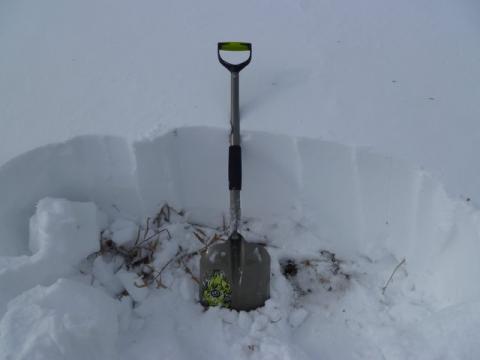
Southern Madison, 2011-11-25 A shallow but stronger snowpack was found in Bacon Rind in the southern Madison Range as well as the Lionhead Area near West Yellowstone. |
|
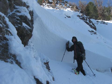
Northern Gallatin, 2011-11-22 Strong winds have loaded some slopes past their breaking point. This crown is from a natural avalnache that occurred on a slope near Mt. Blackmore. Weak facets near the ground are struggling to support heavy loads. Photo GNFAC |
