|
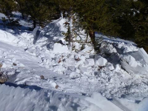
Bridger Range, 2012-03-11 A large cornice, well below treeline on the Baldy Trail, broke free as skiers toured past. The cornice was dripping with water, a strong sign that it's losing internal strength. Although this was low consequence terrain, it illustrates the problems we'll encounter at higher elevations with warmer, spring weather. Photo: C. Kautz
|

|
Northern Madison, 2012-03-10 This avalanche in the second yellowmule off Buck Ridge was likely triggered by a snowmobiler today. It was on a steep wind-loaded slope (northeast facing) and the avalanche propagated a few hundred feet wide. A layer of small faceted crystals was the likely culprit. This layer is on many slopes. Photo: TJ Krob
|
|
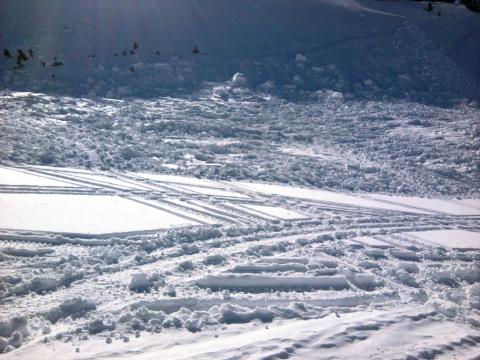
Northern Madison, 2012-03-10 The hard, wind slab debris hit a steep transition and did not travel far. This slide was likely triggered by a snowmobiler. Photo: TJ Krob
|

|
Cooke City, 2012-03-09 Snow Rangers in the Cooke City area observed many natural slides that occurred over the past few days. This slide occurred on a heavily wind loaded slope and probably failed on a layer of near surface facets formed in the middle of
February. Photo Adam Norlander
|

|
Northern Madison, 2012-03-09 This slide occurred on Fan Mountain near Big Sky. A natural cornice drop was likley the trigger. Photo MW
|

|
Northern Gallatin, 2012-03-09 This slide was triggered by a cornice dropping onto a thinner, more faced part of the slope. The slope was heavily wind loaded. Photo: J. Barkhausen
|

|
Northern Gallatin, 2012-03-09 A large natural slide was observed near the Maid of the Mist up Hyalite Canyon. This slide occurred on a heavily wind loaded slope and was likely triggered by a natural cornice drop. It's hard to say what layer this slide failed on, but there is a good chance it was the near surface facet layer formed in the middle of February. Photo Andrew Newman
|

|
Northern Madison, 2012-03-08 This avalanche occurred either Tuesday (3/6) night or early Wednesday (3/7) morning. The main avalanche broke near the ground about 5 feet deep. it was likely triggered by a small wind slab that broke in the rocks above. This is a NE facing slope at about 10,000 ft. Photo: GNFAC
|
|
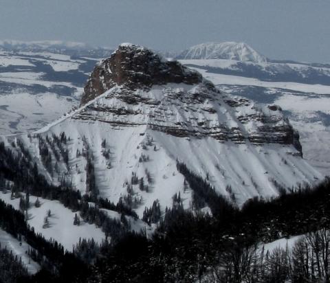
Northern Madison, 2012-03-08 This feature is just west of the Sphinx and is known as the Helmet. It is a NE facing slope at about 9000ft. this photo was included to demostrate the widespread nature of recent avalanche activity. Photo: GNFAC
|
|
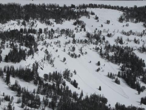
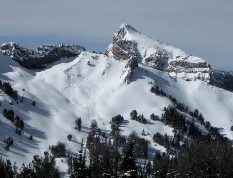
Northern Madison, 2012-03-08 It was unclear if these avalanches were naturally or human triggered. They are on a SSW facing slope at about 9000 ft. The snowpack was very thin in this area but loaded by storms on the weekend of March 3/4 and another storm March 6. The crowns were about 1ft in size and total snowpack depth wasn't more than 2 ft. Photo: GNFAC
|
|
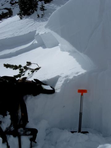
Northern Madison, 2012-03-08 This natural avalanche occured sometime Wednesday. It broke 3 feet deep on a NE facing slope at 9830 ft. Photo: GNFAC
|
|
Northern Madison, 2012-03-08 This is part of the crown to a natural avalanche. See the full slide at http://www.mtavalanche.com/images/12/mcatee-avalanche and crown profile at http://www.mtavalanche.com/images/12/mcatee-wilderness-boundary-snowpit?size=_original Total snowpack depth is 150 cm and the avalanche broke on a layer of 1.5mm facets at 66cm above the ground. It was about 3 ft deep. Photo GNFAC
|

|
Northern Madison, 2012-03-04 The avalanche on the left was snowmobiler triggered (close-up below) as was the larger slide on the right. Photo: YC Ski Patrol
|

|
Northern Madison, 2012-03-04 A snowmobioler triggered this avalanche midday. His exit tracks are on the right. Wind-loaded slopes are where the greatest chances of triggering slides are. Photo: YC Ski Patrol.
|

|
Northern Madison, 2012-03-04 These natural avalanches released sometime in the last two days. The ridgeline is the far westerly ridge off of Cedar Mountain. Photo: YC Ski Patrol
|

|
Bridger Range, 2012-03-04 These raised foot prints on the hike to Saddle Peak are evidence of serious wind scouring. There's no need for an anemometer when you see these; the winds have been ripping and loading leeward slopes. Photo: GNFAC
|

|
Northern Madison, 2012-03-01 From an email: "Normal day of riding. Overall stable except for this windloaded spot. Snowmobiler was sidehilling and broke the windslab. Noone caught and the guy that set it off was wearing an airbag. In muddy basin of buck ridge main headwall on 2/29. North northeast facing slope." Photo: J. Volpe
|

|
Cooke City, 2012-03-01 This snowpit was dug about 300 yards away from the avalanche fatality that occured one week ago: same aspect and elevation. The facets are still reactive and propagating, but it is taking more and more force to get them to break. This weak layer is persistent. Photo: GNFAC
|

|
Cooke City, 2012-02-28 A recent slab avalanche in Upper Republic Creek on an easterly aspect. Photo: B. Fredlund
|

|
Southern Madison, 2012-02-27 At the ridgetopp near Hebgen Lake, about a few hundred feet above our snowpit where we got ECTP20, Eric got a large collapse and cracks. In this zone the near surface facets about 1.5 feet under the surface are propagating fractures. Photo: GNFAC
|