Photos

|
Bridger Range, 2012-02-27 A large natural slide occurred on Saddle Peak Saturday night (2-25). This slide propagated across the ridge that many consider to be the safest route down. Photo: R. Elliott |

|
Bridger Range, 2012-02-26 Saddle Peak slid naturally sometime before sunrise today (Feb 26). Photo: K. Birkeland |

|
Bridger Range, 2012-02-25 When the avalanche broke in Wolverine, other slopes adjacent to it fractured as well. This one was about 100ft South of the main fracture. Photo: S. Schmidt |

|
Bridger Range, 2012-02-25 Crown face of the avalanche in Wolverine Bowl. Photo: S. Schmidt |
|
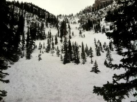
Bridger Range, 2012-02-25 This slide occurred in Wolverine Bowl north of Bridger Bowl. It was a natural avalanche sometime before dawn on 24 Feb and broke on facets near the ground. Heavy snow and strong winds have put a tremendous amount of stress on a very weak snowpack producing natural and human triggered avalanches in the Bridger Range. Photo Graham Turnage |
|
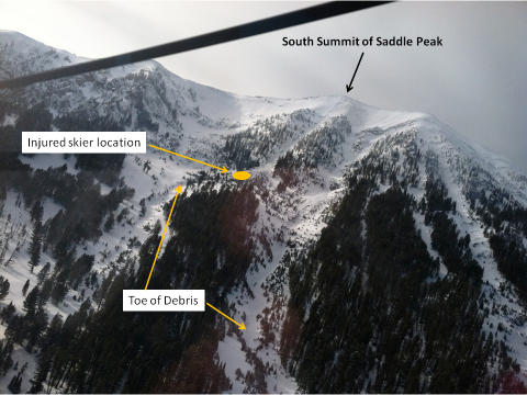
Bridger Range, 2012-02-25 This is the view of the south summit of Saddle Peak. The skier was flushed doen the left hand gully. She sustained a broken arm and leg injuries and was only partially buried. Photo: T. Thesing |
|
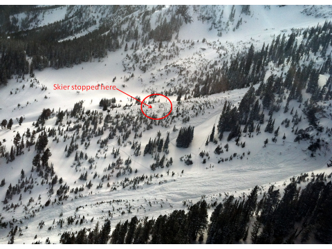
Bridger Range, 2012-02-25 The skier who took a ride off the south peak of Saddle fortunately ended up on the surface. She was injured and rescued by a search and rescue helicopter. Photo Todd Thesing |
|
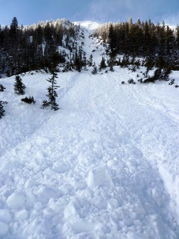
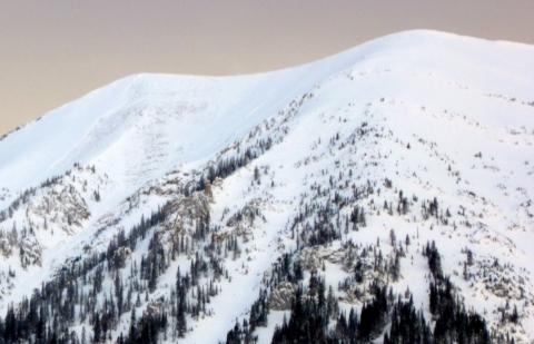
Bridger Range, 2012-02-24 The skier who triggered this slide took the ride of a lifetime - nearly 1,500 vertical feet. Fortunately they escaped with non life threatening injuries. The slide was triggered near the ridgeline and the skier came to rest near where this photo was taken. Photo GNFAC |
|
Bridger Range, 2012-02-24 Heavy snow and strong winds over the past few days have created dangerous avalanche conditions in the Brdiger Range. The second skier on this slope triggered the slide. The avalanche failed on facets near the ground and ran nearly 2000 vertical feet. Photo GNFAC |

|
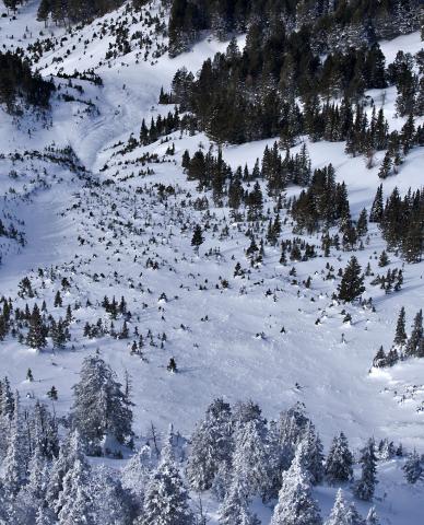
Cooke City, 2012-02-24 This natural avalanche on the west face of Woody Ridge broke 4-6' feet deep and likley ran on facets at the ground. This slide ran over 1,000 vertical feet. Photo B. Fredlund |
|
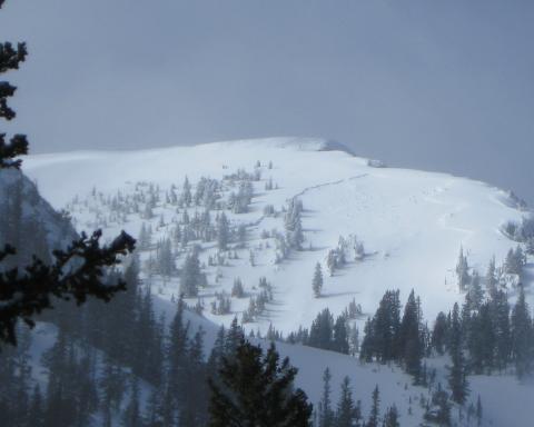
Bridger Range, 2012-02-24 This avalanche was intentionally triggered by a skier (not the photograher) on the west side of the Bridger Range opposite to Bridger Bowl in an area known as St. Lawrence which is part of Truman Gulch. Photo: P. Clayton |
|
Bridger Range, 2012-02-24 This avalanche happened sometime on Feb. 24 just south of Hardscrabble Peak. Many other avalanches were seen, but many had been filled in by yesterday's snow and recent winds. Photo: GNFAC |

|
Bridger Range, 2012-02-24 Photo: S. Schmidt |

|
Bridger Range, 2012-02-24 This avalanche was skier triggered. The black line indicates where it broke. The red line is incorrect: she came down the next gully to the left. Photo: GNFAC |

|
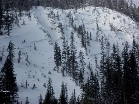
Northern Madison, 2012-02-24 This avalanche initially broke 20 inches deep then produced an avalnche 4-6 ft deep. Although this avalanche was intentionally triggered at a ski area, it represents a likely scenario in the backcountry. Photo: MLB Ski Patrol |
|
Bridger Range, 2012-02-24 This natural avalanche occurred just above the summer trailhead for Sacajawea Peak in the norther Bridger Range. Photo: D. Pogge |

|
Northern Madison, 2012-02-24 This avalanche broke 18 inches deep and 75 feet wide on a layer of near surface facets that formed 1-2 weeks ago. It occurred on an E aspect around 9200 ft. It was triggered from low angle terrain about 30 feet away from the crown. Remotely triggered avalanches are a clear sign of very unstable conditions. Photo: M. Young |
|
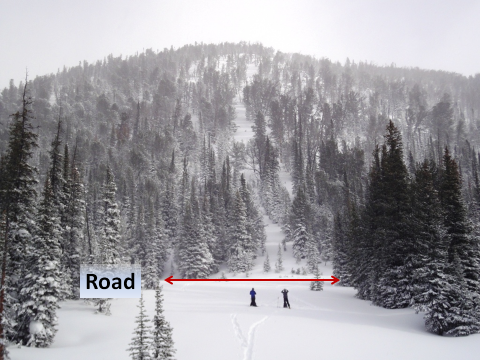
Cooke City, 2012-02-23 The avalanche path is more obvious from a distance, but not from the road. Daisy Pass is up to the road to the left of the picture. Due to a reloading of the slope and a HIGH avalanche danger we were unable to hike up and investigate the snowpack. We are unsure if this slide was a natural or human triggered. The crown was likely at the top of the slope (estimated to be 600 feet vertical), but we could not confirm this. Photo: GNFAC |
|
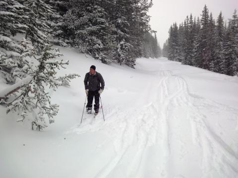
Cooke City, 2012-02-23 The victim was buried on the road where the skier is standing. The avalanche hit him as he turned his sled around. He was buried under approx 4 feet of snow. Photo: GNFAC |
|
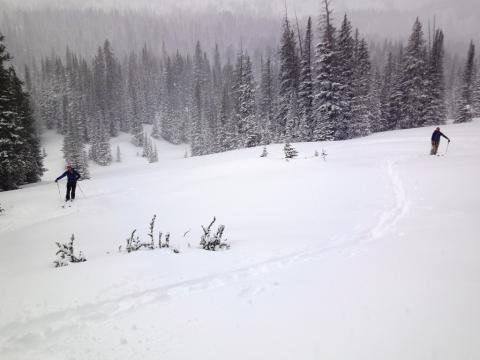
Cooke City, 2012-02-23 This photo is looking below the road. The two skiers are in the spots where the snowmobilers were partially buried (arm was sticking out of the snow for each). Photo: GNFAC |
